I first identified the list of mountains in South Africa with at least 1000m topographic prominence in 2020. I had realised my planned trip to Nepal wouldn’t be happening due to Covid travel restrictions, and had also realised that I would need to take some leave soon if I was going to use all my leave before it expired. So I booked a trip to Cape Town – a city I had only once visited, 17 years earlier. My main goals were to climb Du Toits Peak, South Africa’s most prominent mountain, and hike in the Hex Mountains. On looking up peaks in the Hex, I found that two have over 1000m prominence – and so does Table Mountain.
I was soon digging online and managed to pull the satellite data of around 8 million summits on the planet, basically anything with at least 30m prominence. I imported the list into Excel cut anything with less than 1000m prominence, and sorted by longitude and latitude to eliminate anything outside of SA. I soon had a list of 22 peaks. On my first Cape trip I managed to bag three of them – Du Toits, Matroosberg and Table Mountain. I then realised that satellite data often understates summit heights, and after reviewing anything on the list with at least 850m prominence, I found that both Simonsberg and Compassberg also had more than 1000m prominence.
I visited the Cape twice in 2021, managing to get up 5 peaks in September and doing a road trip to get my first Eastern Cape peak and 3 more Western Cape Peaks in December. This meant I was halfway through the list. 2022 saw a dramatic slowing of my progress, in no small part due to international travel being back, thus facilitating my Mauritius trip in June and my Nepal trip in November. Simonsberg and Marakele were my only progress on this list for the year – although Marakele had been one of the biggest question marks on the list due to access concerns.
During this time I had kept my eye on the MCSA Eastern Province meet sheet due to the two remaining peaks I have in the province, Cockscomb and Groot Winterberg. Cockscomb is the 6th most prominent mountain in South Africa, with 1244m topographic prominence according to Peak Bagger, 1291m according to Peakvisor, and 1280m according to my list. The complication with this peak is that one has to cross multiple farms to access it – if you aren’t an MCSA member, it is practically impossible to gain access. Luckily for me, I am an MCSA member – but with almost no information available online, the best bet was to join an MCSA Eastern Section team. I would not recommend attempting this peak unless you are an experienced hiker with a good head for heights – there are plenty of tricky and dangerous spots. Navigation is also tricky. For those looking to arrange access outside of an MCSA organised group – you will need to chat to Eastern Province Section, there is a form you have to complete to apply for access, which requires sufficient advanced notice, details on the plans etc.
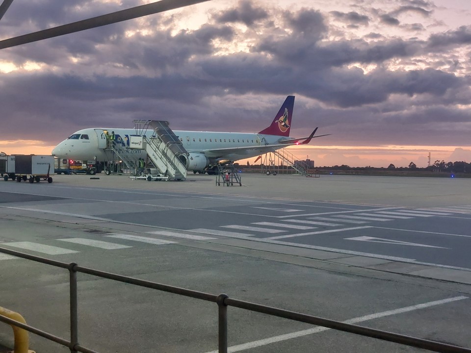
On Friday afternoon I found myself at OR Tambo waiting to board a flight to PE. My last visit to PE had been in 2007 for Wargames World Championships, where I ended up having a 100% win rate against non-SA players, including beating Dave Hanley who was ranked 2nd in the world at the time in the first round, and ironically a 0% win rate vs SA players. I beat two British players and a Netherlands player. I finished far out of contention for a medal, but that win in round one remains one of my favourite wargaming memories.
Flying on an Airlink Embraer E190, with my usual emergency exit window seat – we had a fairly turbulent fight. Coming into land, something about the air-pressure caused a significant headache as we descended. I have been on at least 65 flights and have never had this before, apparently the steep descent into PE does sometimes cause this problem.
Judy picked me up from the airport and we proceeded to Gaye and Steve’s house. Gaye had made a lovely supper, but having taken my mother and Archie to a late lunch, and having had some food on the flight – I wasn’t particularly hungry. This was a shame as Gaye’s meal was better than the previous ones I had!
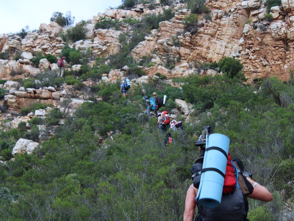
In the morning we were off. Judy, Gaye and Myself met the others just off the main road, and we drove in convoy to the start of the hike. We had a team of 15 that signed up, dropping to 14 by the day of the hike with Steve pulling out. Apparently there had been a waiting list for the hike. Unlike Drakensberg regulations where a group larger than 12 isn’t allowed outside of the Giants Cup Trail, being private land, no such rule applies. The limit was decided by Angela and Roland, the meet leaders.

Judy did a great job of summing up the team in her poem about the hike, which is as follows:
Oh Cockscomb, you’re such a beautiful sight
From near and far, a wondrous delight.
Climbers and swirling mist can’t leave you alone
And you generously offer your cave to be home.
BUT, summiting is treacherous, one has to be brave
A mere slip of a foot means a fall to the grave.
Thanks Angela & Roland for expertly leading our team,
Climbing Cockscomb Mountain was a bucket list dream.
From early Saturday morning to post Monday lunch
We enjoyed the climb with a terrific bunch.
Spectacular sunsets following perfect weather
Braais and even a talent show thrown in for good measure.
Gaye, gentle soul having Jonathan and Judy to stay
Helping with hand and footholds and finding the way.
Jonathan, we so enjoyed your stories and rapping galore
You’re a wealth of information… please share some more.
Serge, the way you cope is an utter inspiration
You have more than enough guts to drive a WHOLE nation.
Helene, YOU are a superwoman forever on the go
I wonder if you even know the meaning of slow.
Lyndi you’re a musician, singer and even songwriter
And your infectious energy makes those around you feel lighter.
Luke, you’re agile and fast and climb like a klipspringer
Your high energy levels will make you a winner.
Lesley, I enjoyed your conversations and inquiring mind
You’re a rock-solid person of the finest kind.
Pops Pieter, Mom Rut, Decklin and sweet little Sharma
You’re an exceptionally great family full of good karma.
So, to Cockscomb and new found friends I must say
I loved this adventure and hope for another someday.
– Judy Woodgate

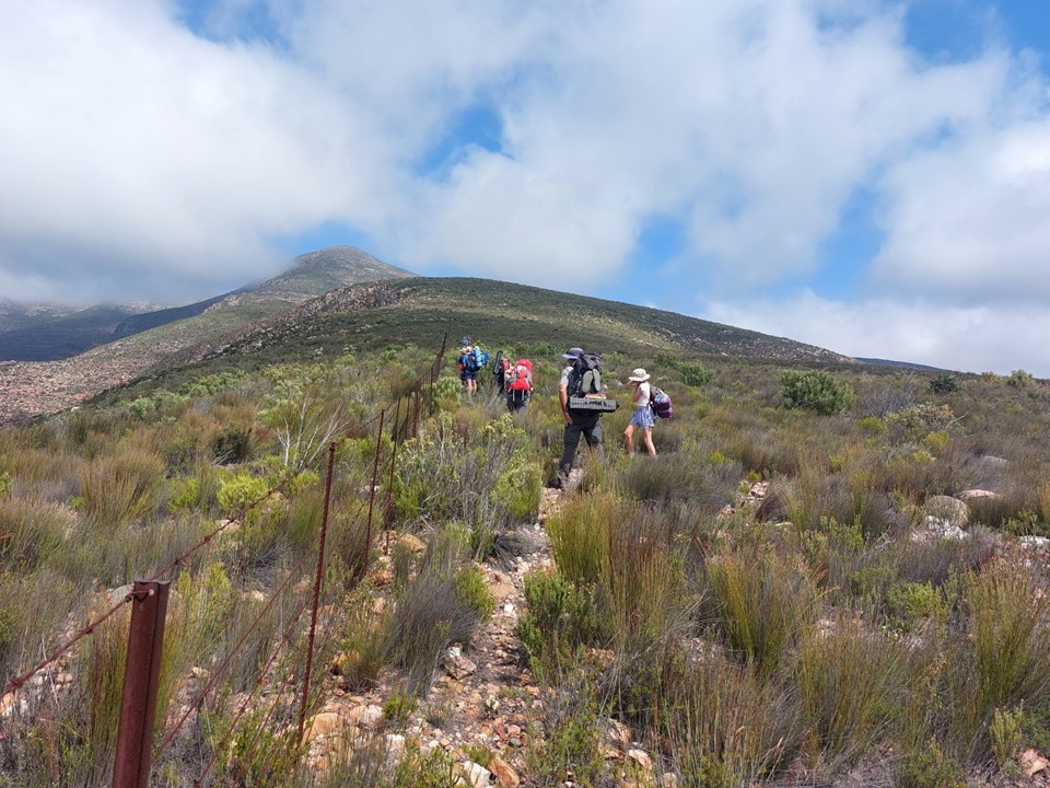
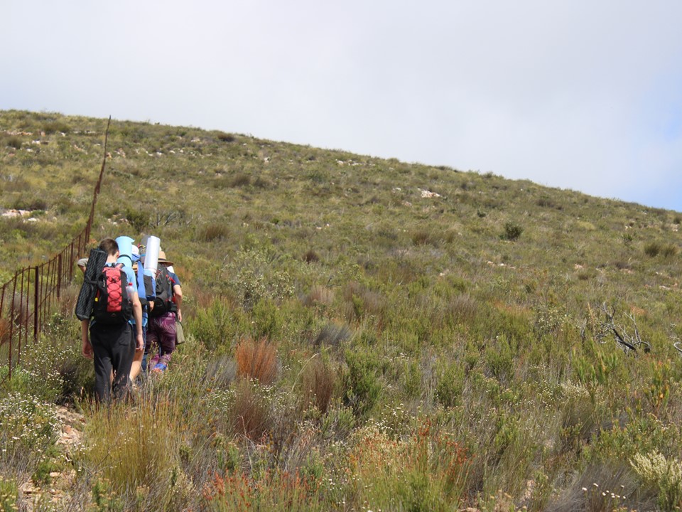
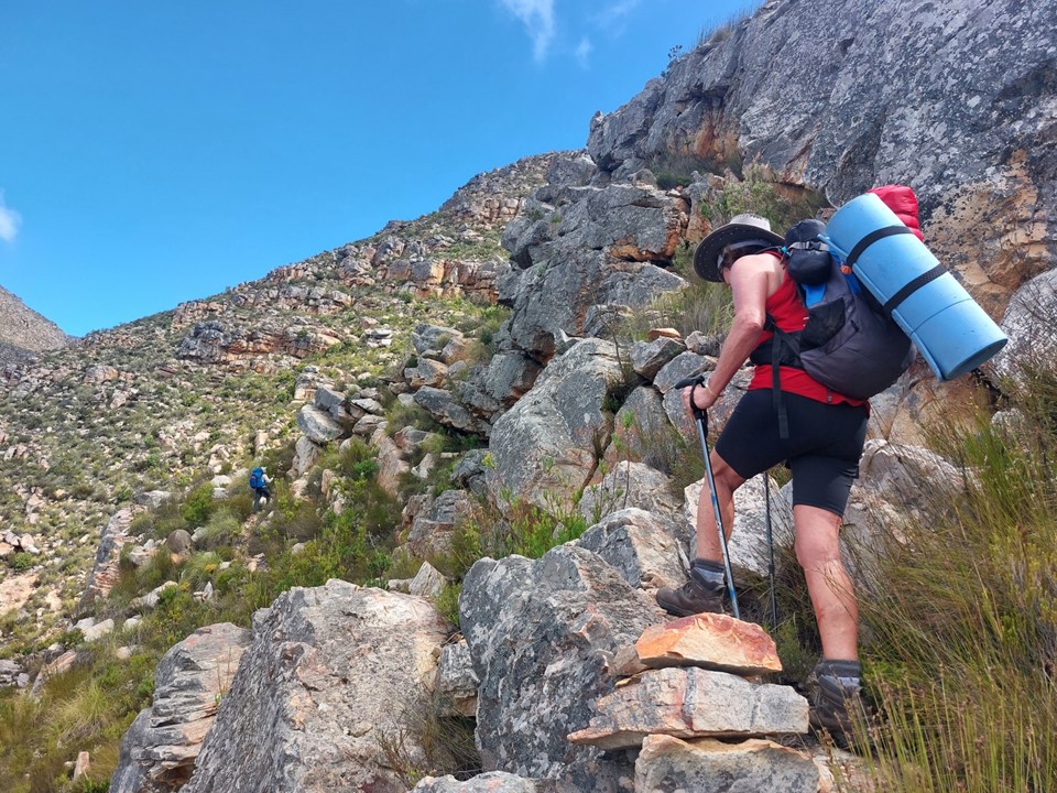
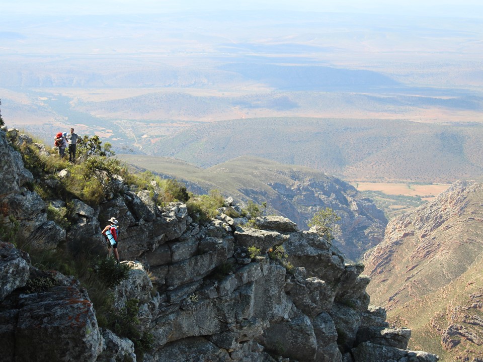
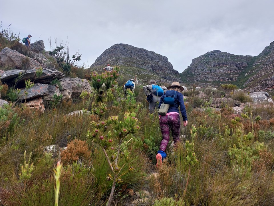
We started up the road, and then abruptly turned into the bush. One of those routes where one could find themself lost very quickly if they don’t know the way.
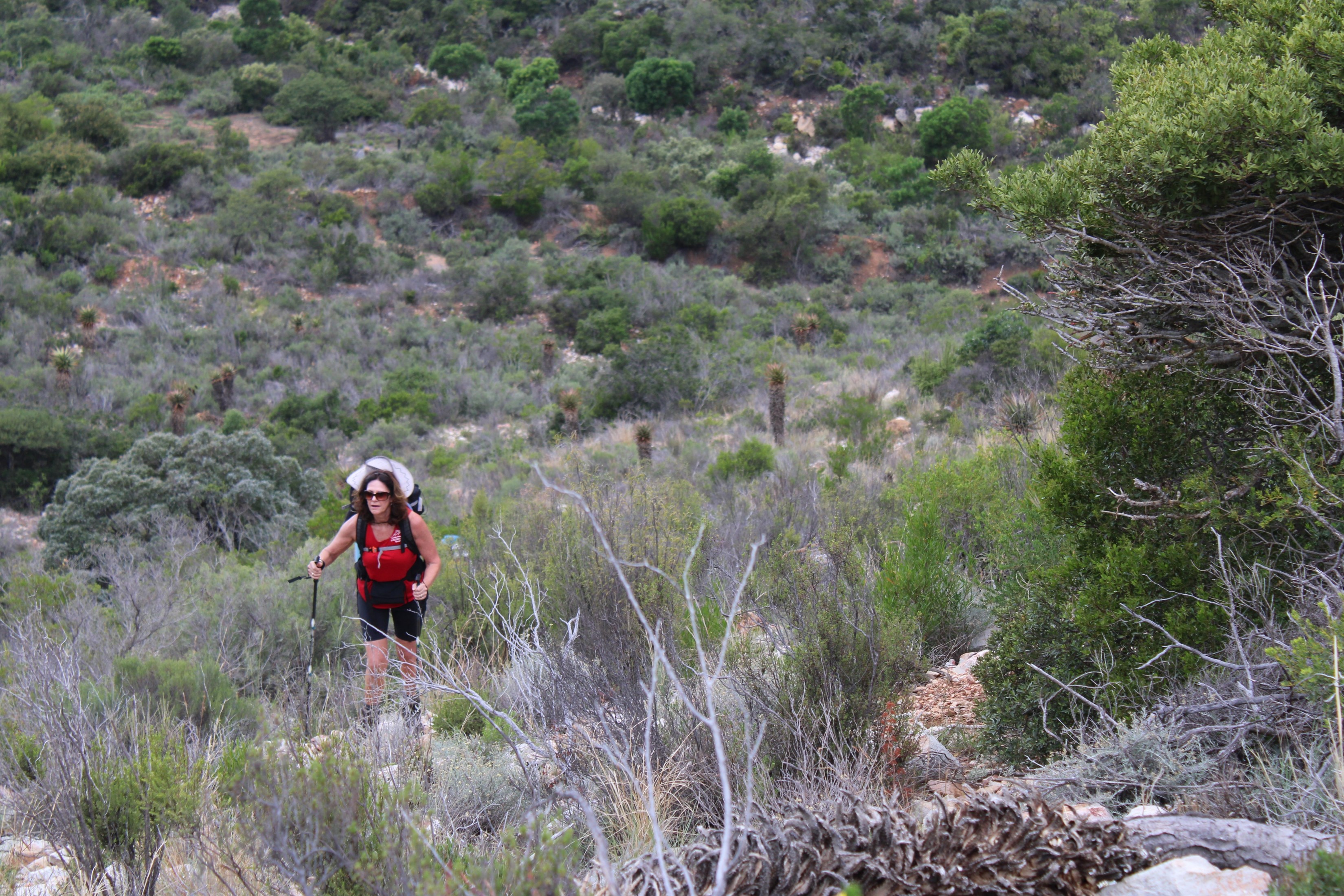
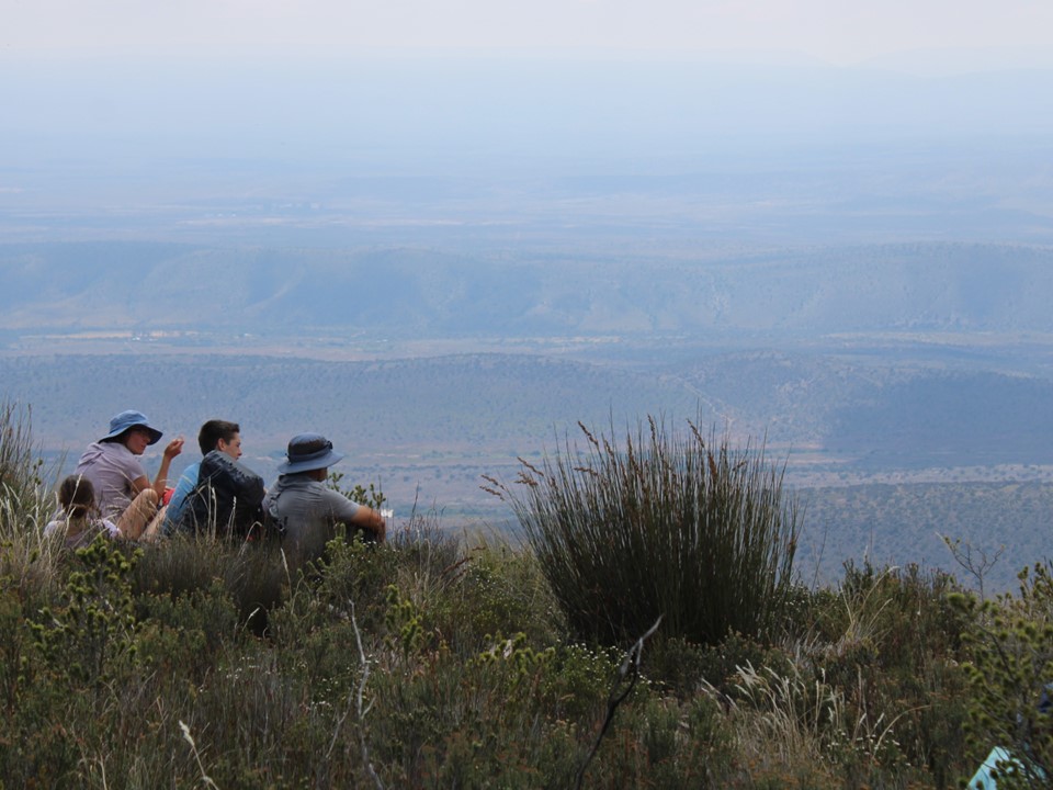
The first 1km of the hike includes about 200m elevation gain and is on loose gravel with plenty of vegetation. It was cloudy, but very hot. I was drenched in sweat by the time we stopped at the first gate 1km in.
We waited for everyone to catch up at this spot. I knew nothing about the route due to the lack of available information. As we waited for others to join, the joke was that we could reach the cave early enough to climb the peak on day one, then again on day two and a third time before heading home on day three.
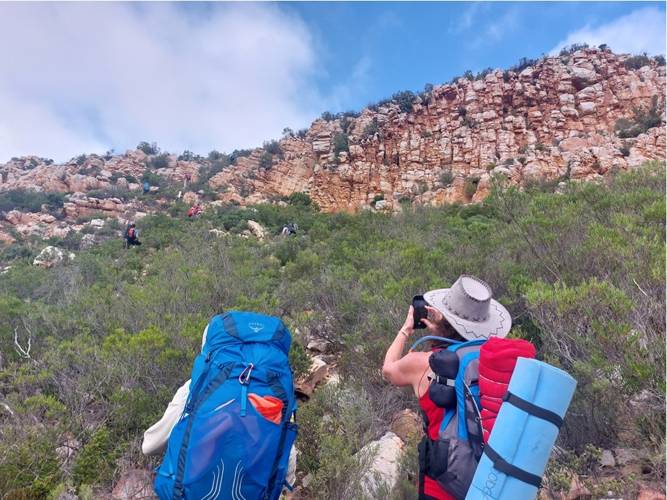
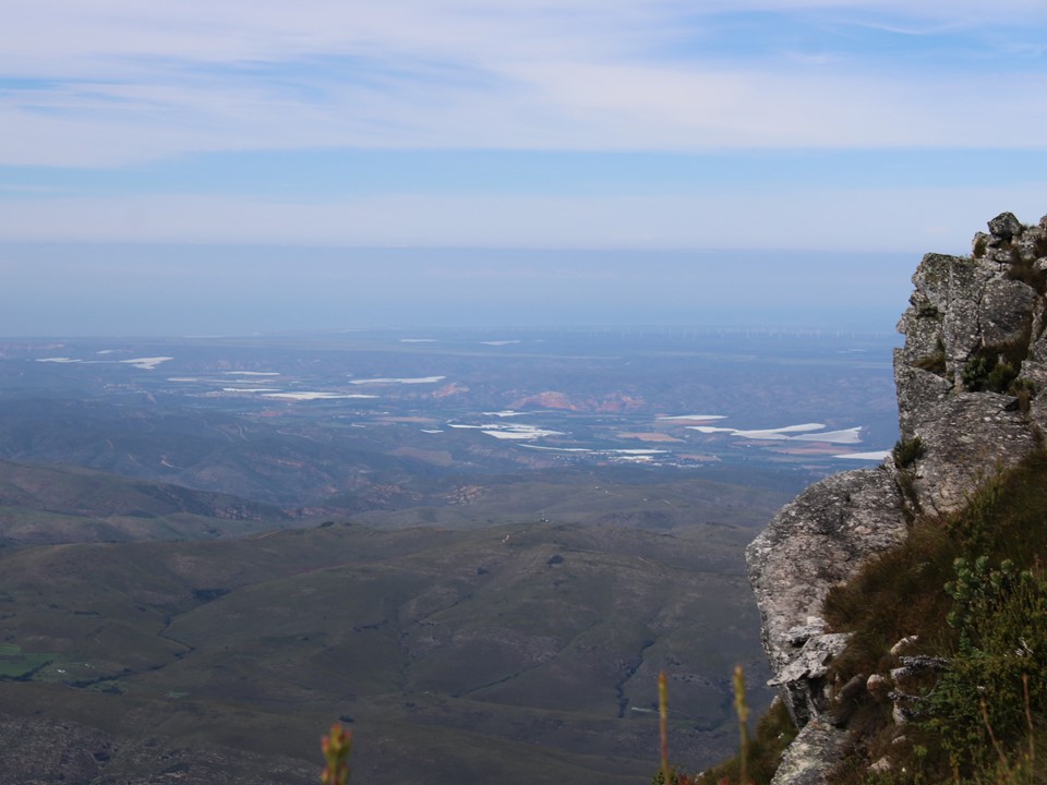
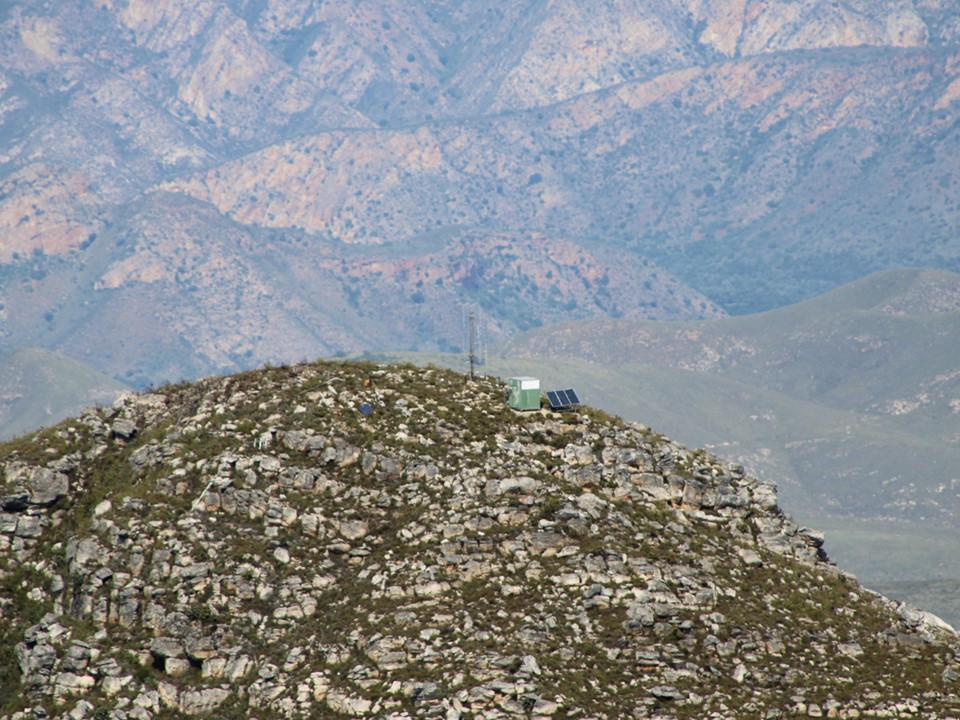
We proceeded a bit further before another break. I had recently bought a new camera to replace my old bridge camera that had decided to stop working at 5087m on Nangkartshang in Nepal in November 2022 – and decided to test its zoom capabilities. The following two photos are taken from the same spot, one without zoom and one with maximum zoom.
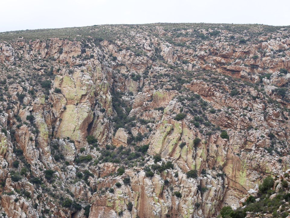
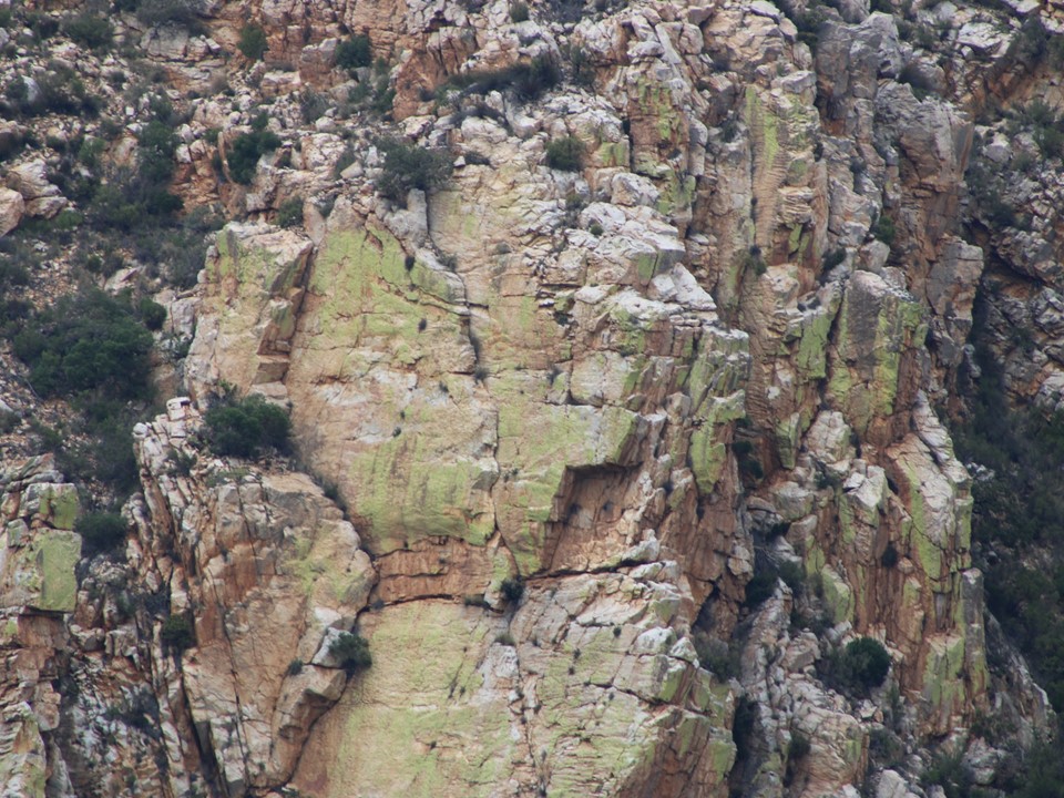
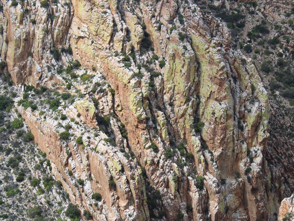
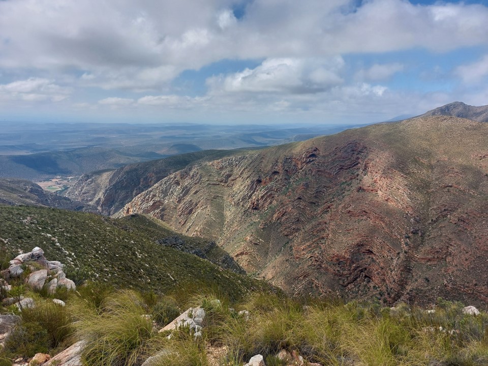
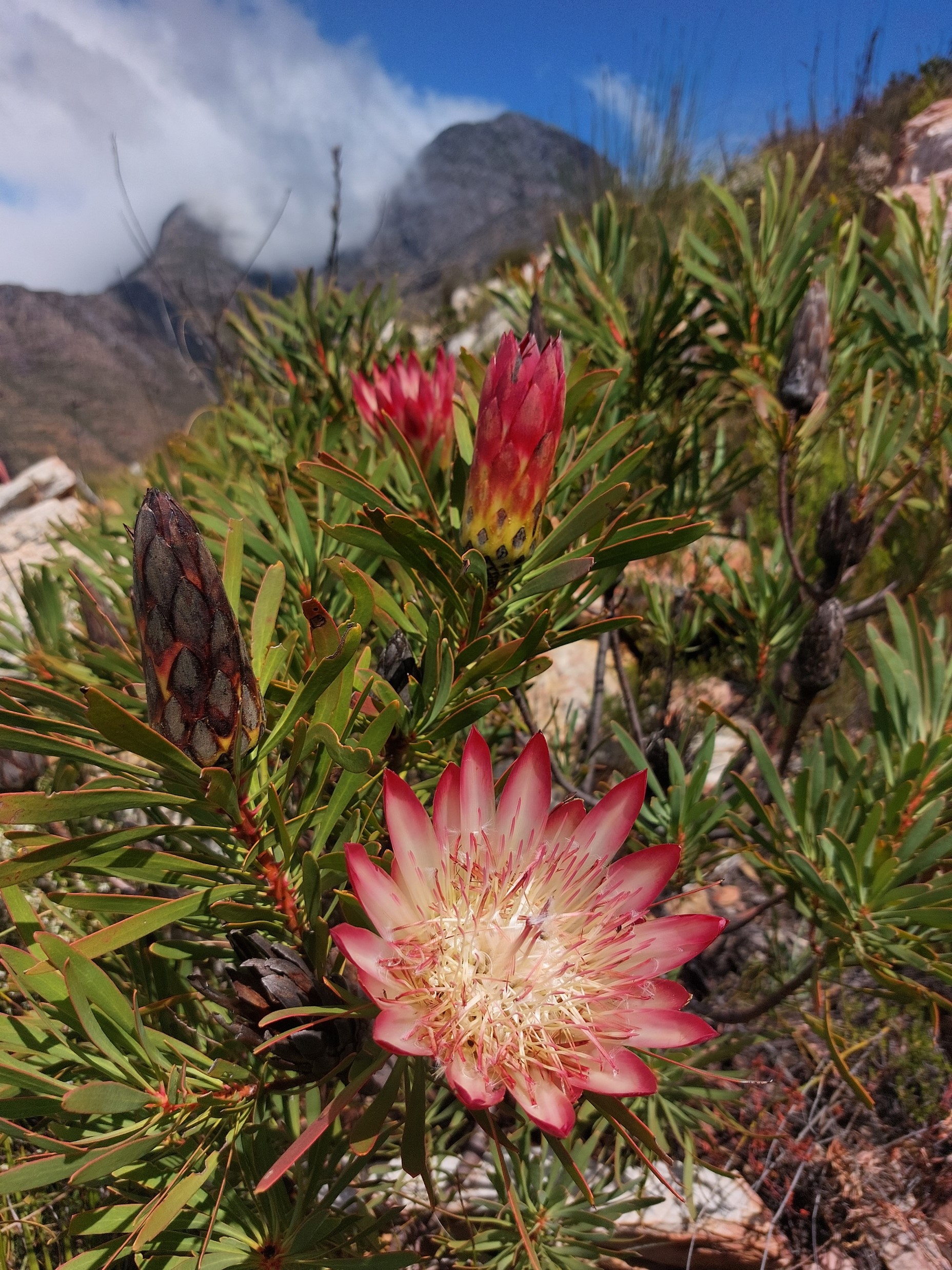
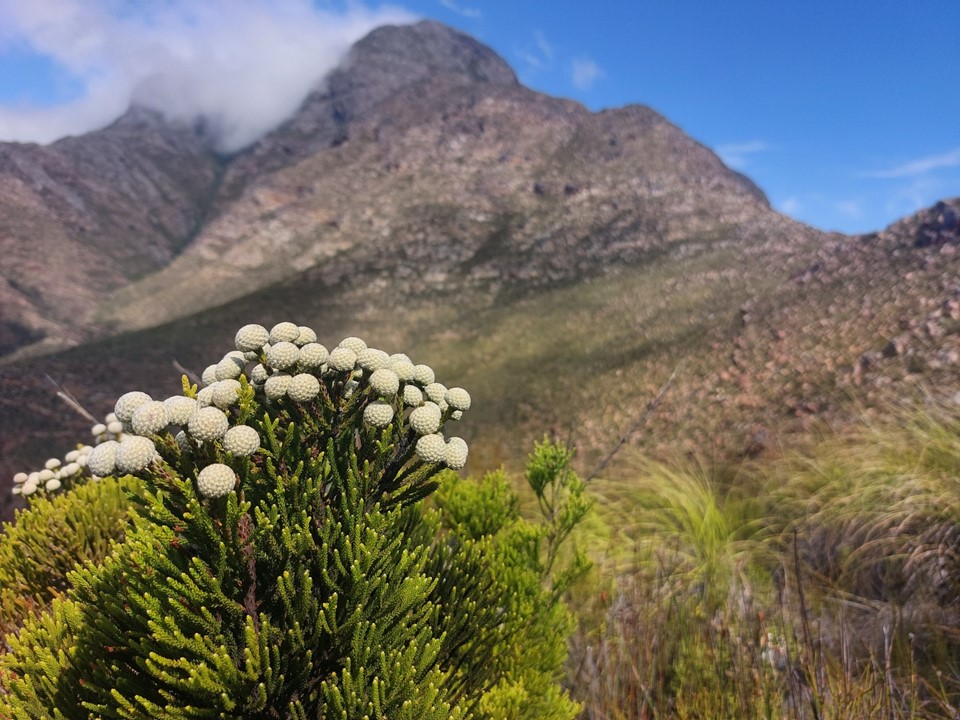
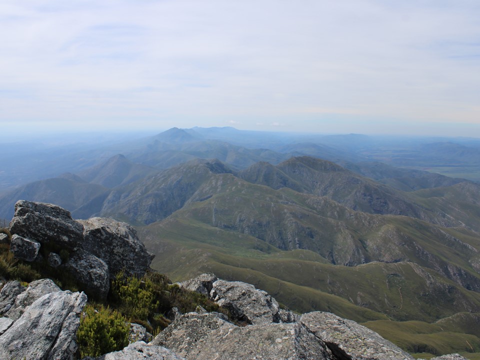
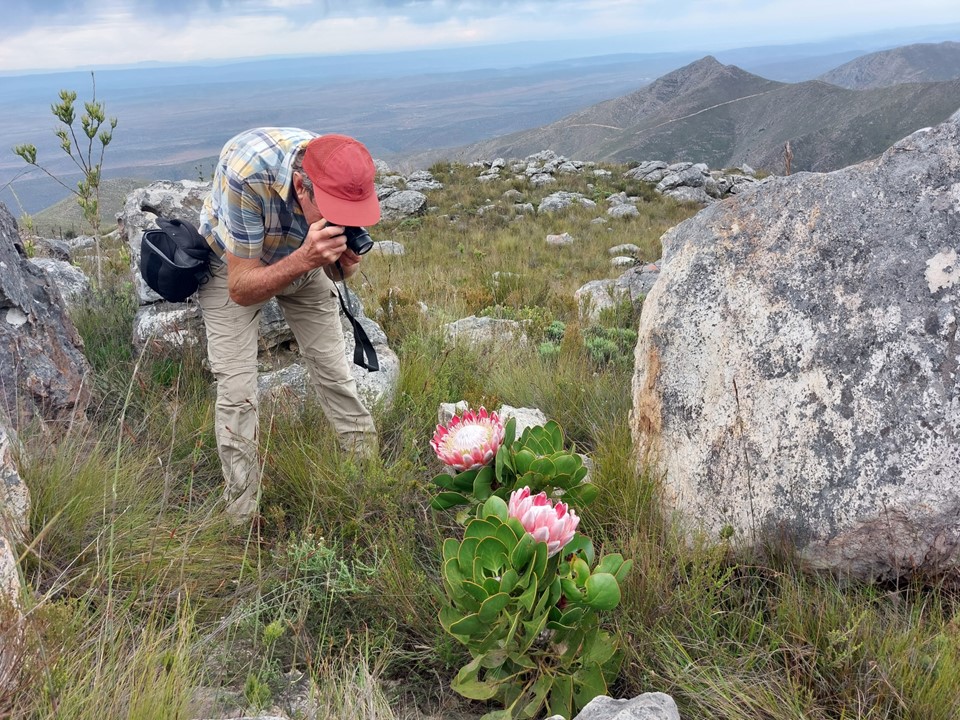
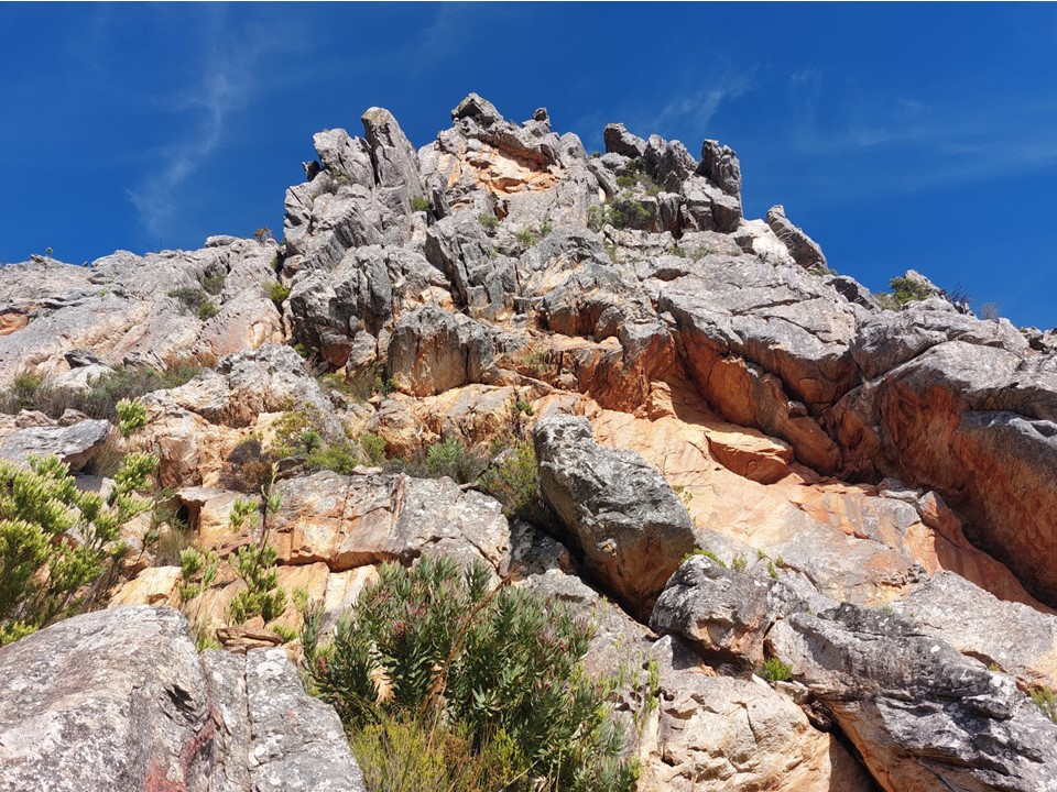
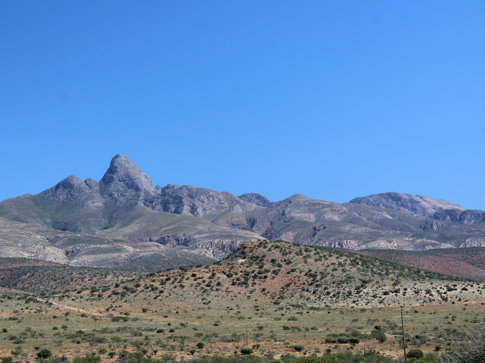
As always, I enjoy the chaos of the Cape Fold Mountains. This happens to be a really good region of them, with the rock ranging from lime green to red to white.
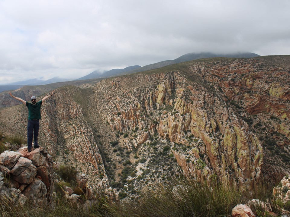
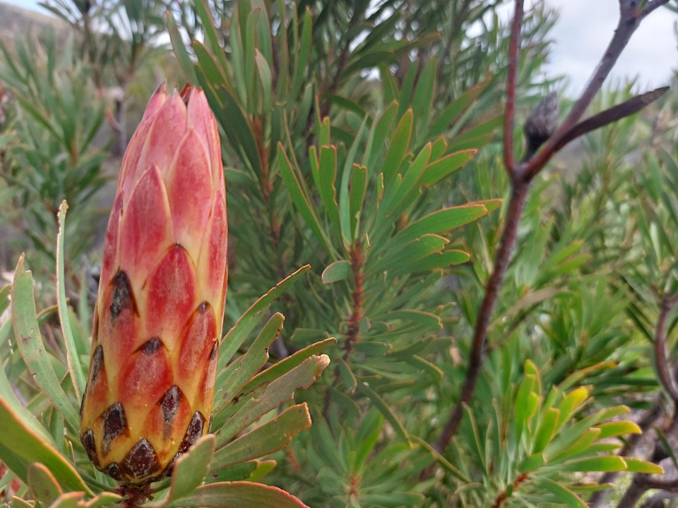
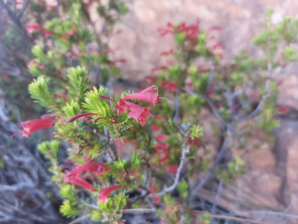
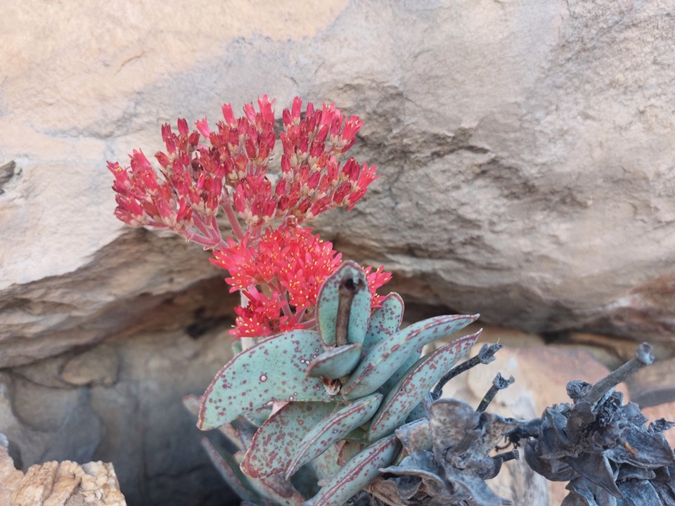
The flowers were out in full force, which is always a great sight to see. The peak however was hiding in the cloud. With this range forming a barrier for moisture coming in from the sea, I imagine the summit is misty for a significant portion of the year.

The peak did eventually show itself for about half an hour, before disappearing back into the cloud. The summit is very rocky, and I quickly realised this summit would not be a trivial one. Good – I hadn’t come all this way for some easy stroll up a random peak with nothing but statistical significance.

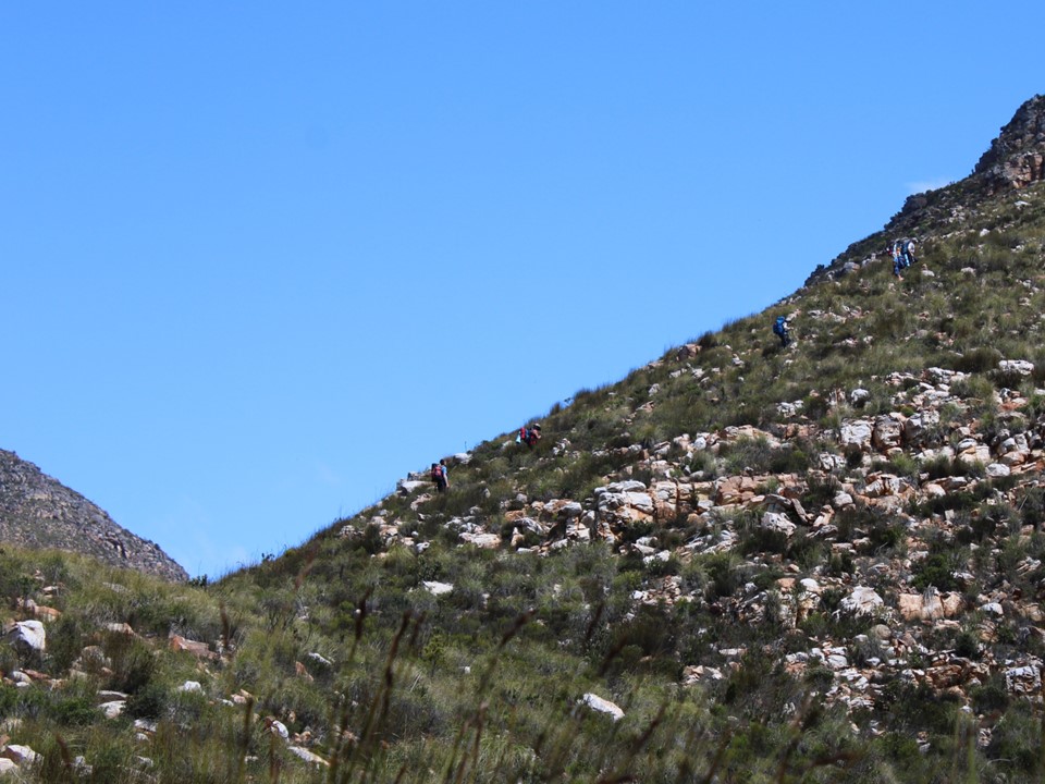
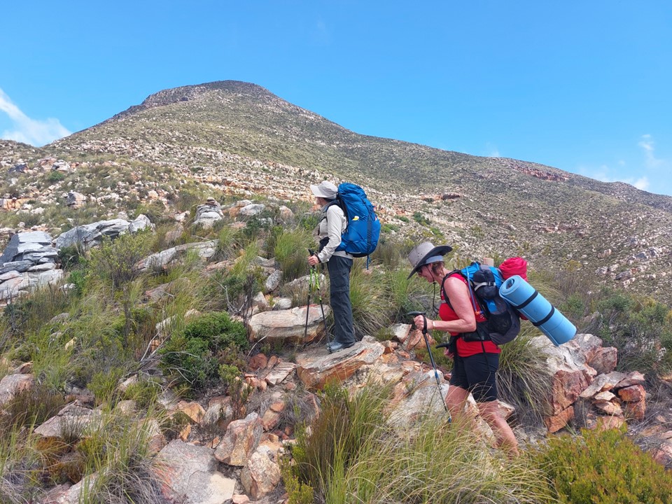
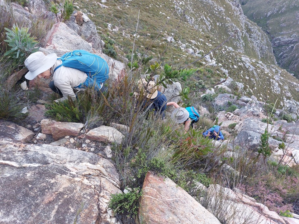
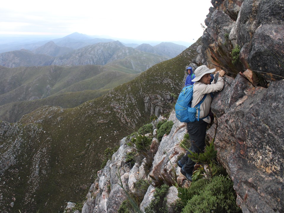
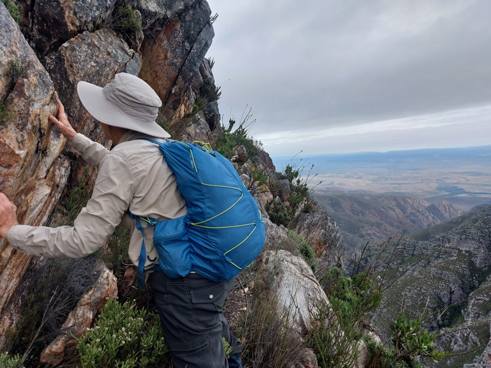
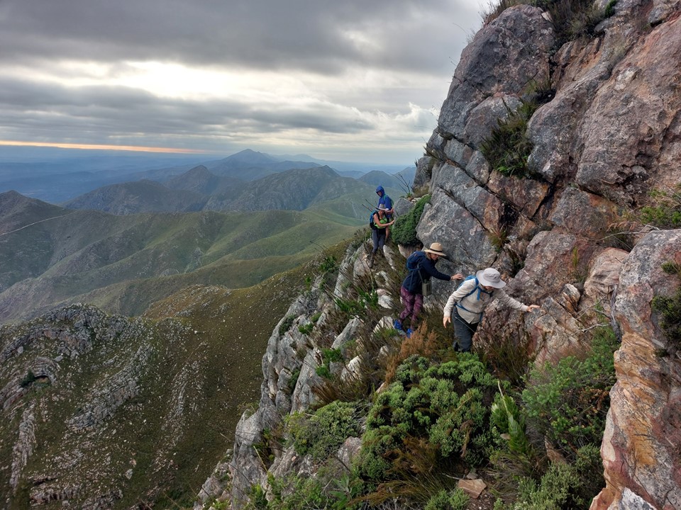
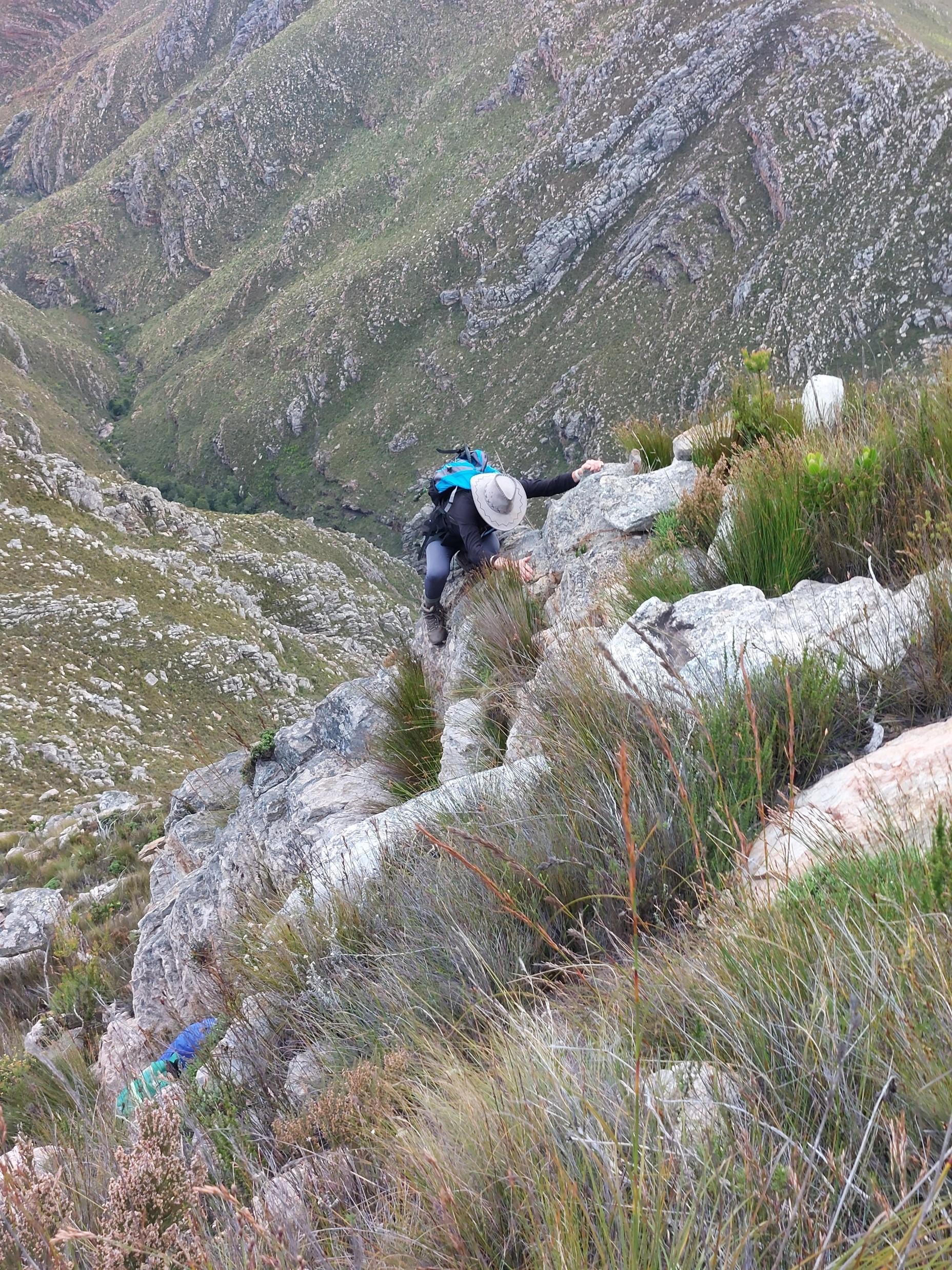
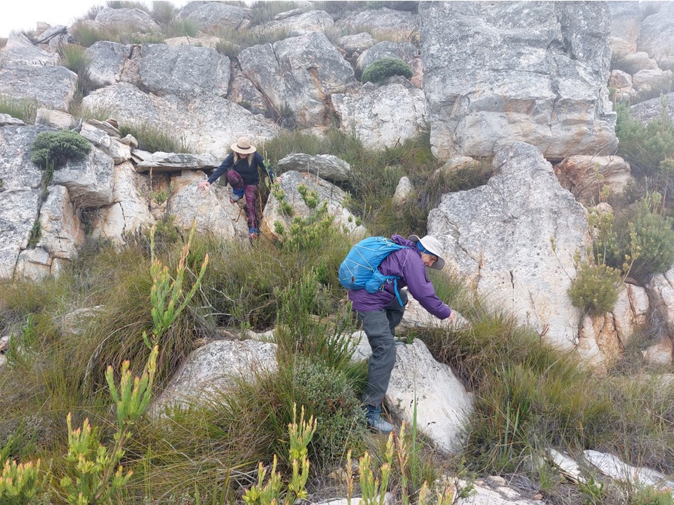
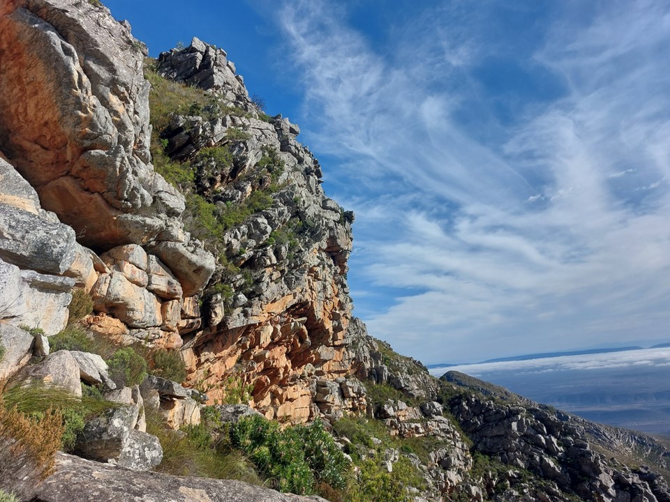
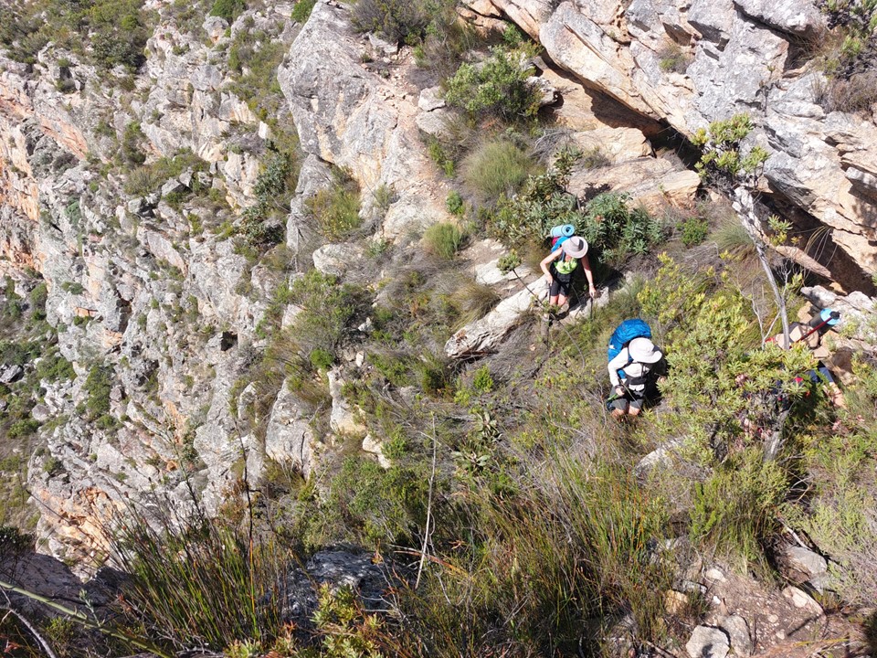
As we neared Tokoloshe Cave, the ground suddenly started getting more exposed. As is often the case in the Cape Fold Mountains, one has to walk on narrow exposed ledges where a fall could be serious. As Andrew would call it – the DFU Zone (Don’t Mess Up Zone).


The cave has a few paintings. As the late Meridy Pfoetenhauer once told me – when in a rock art site, always look around for rocks that have been used as tools. I don’t know if the bright red rock on the floor had been used to make paint, but it certainly looks like it.

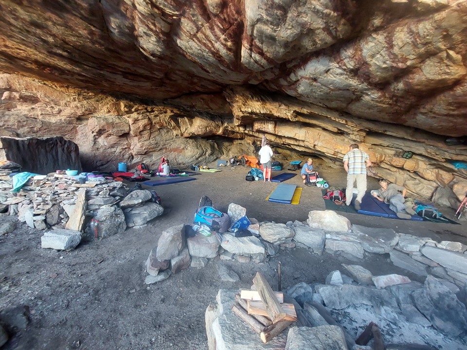
The team had lunch in the cave, while waiting for the others to catch up. In hindsight this was only 500m from T’Numqoua Cave, our home for the weekend.


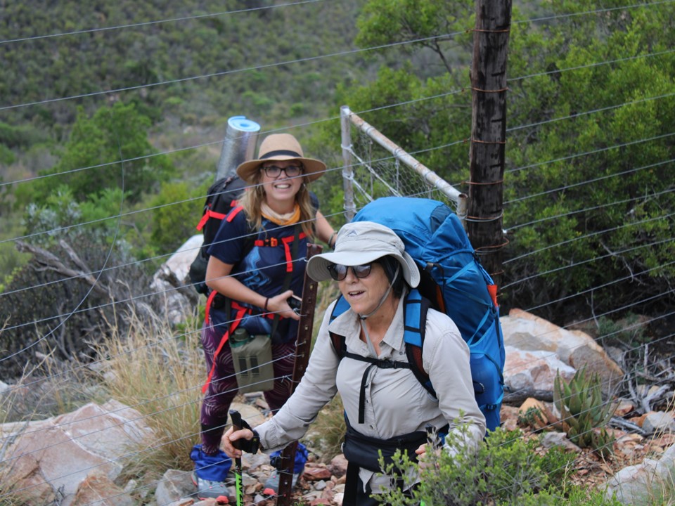
T’Numqoua Cave, meaning Mountain of Mist, is a large cave capable of comfortably sleeping 20, and possibly even 30 at a push. The primary problem is access to water – the nearest reliable stream is about 1km away, with a drip collection system installed in the cave being limited by the capacity of the tanks. A large team in the cave for two days could easily deplete those reserves quickly – so responsibly a team limit of around 15 makes sense for this. The cave itself is on MCSA property and staying here without permission from the club would be trespassing.

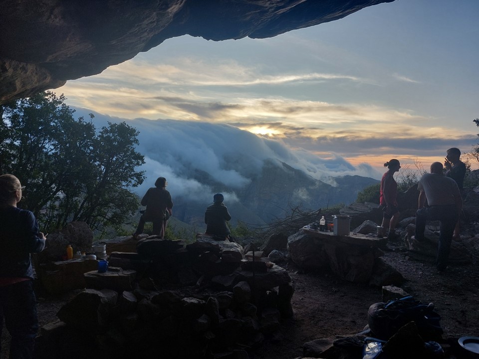
We watched the clouds as they rolled over the ridge. I remember learning about how warm moist coastal air and dry inland air don’t mix, which is the reason for the existence of the Karoo. This phenomenon was very clearly visible from the cave. These visuals explained high school geography better than the best teacher possibly could.
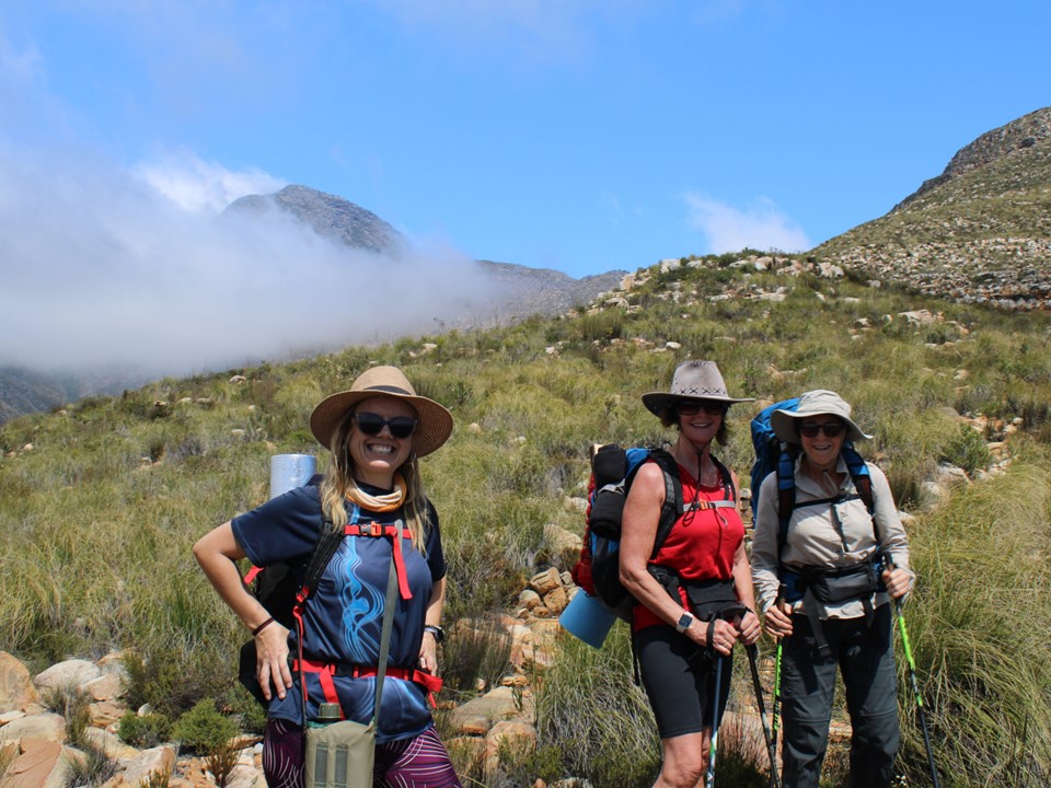
After some discussion, Judy, Gaye, Lyndi, Luke and I agreed that we would start up the peak at 6am the next morning. The others would be starting at 8am. I knew I wanted a view without mist, and that it was possible that that window could be limited to 30 minutes for the entire day, if even that much – so I was prepared to sit on the summit for as long as necessary to see this.
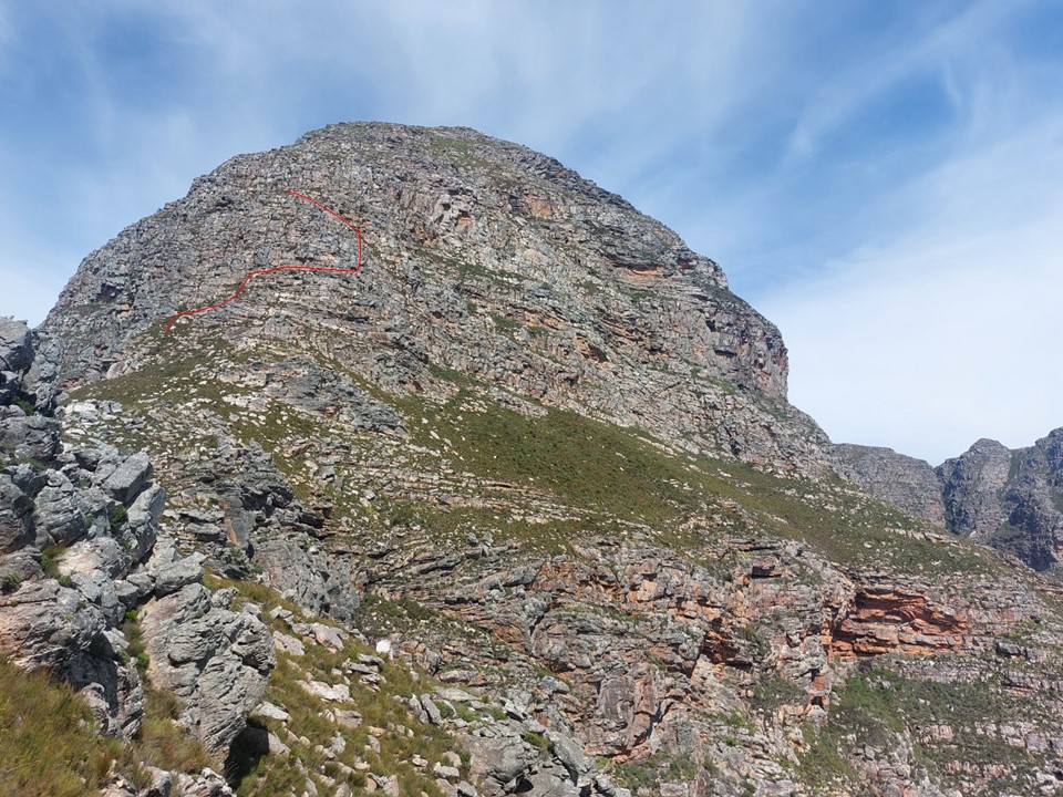
The line up the peak isn’t obvious from below, although there is a trail and cairns – so it is possible to figure out. The following is the approximate line. It will not be entirely accurate and only gives a rough idea.
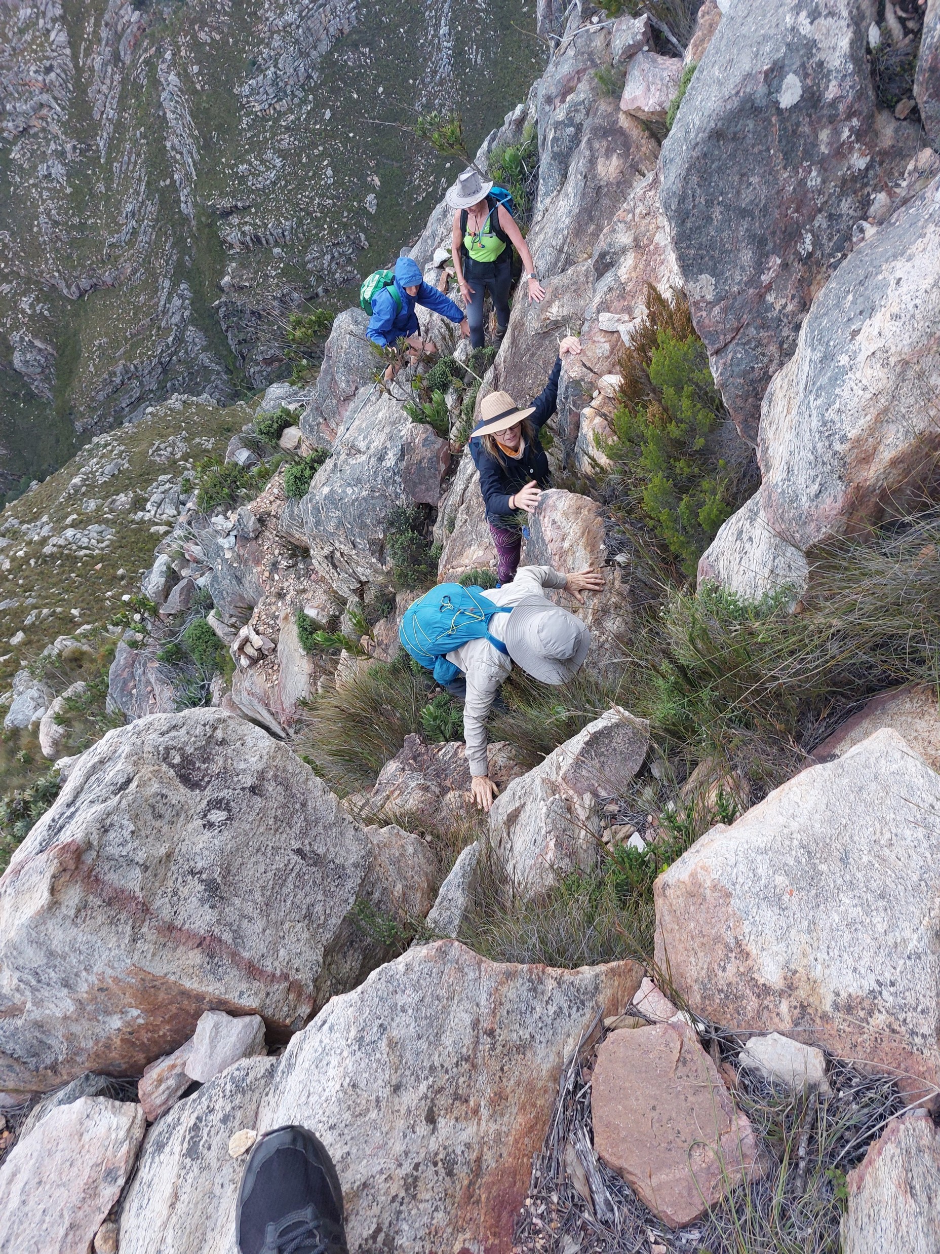
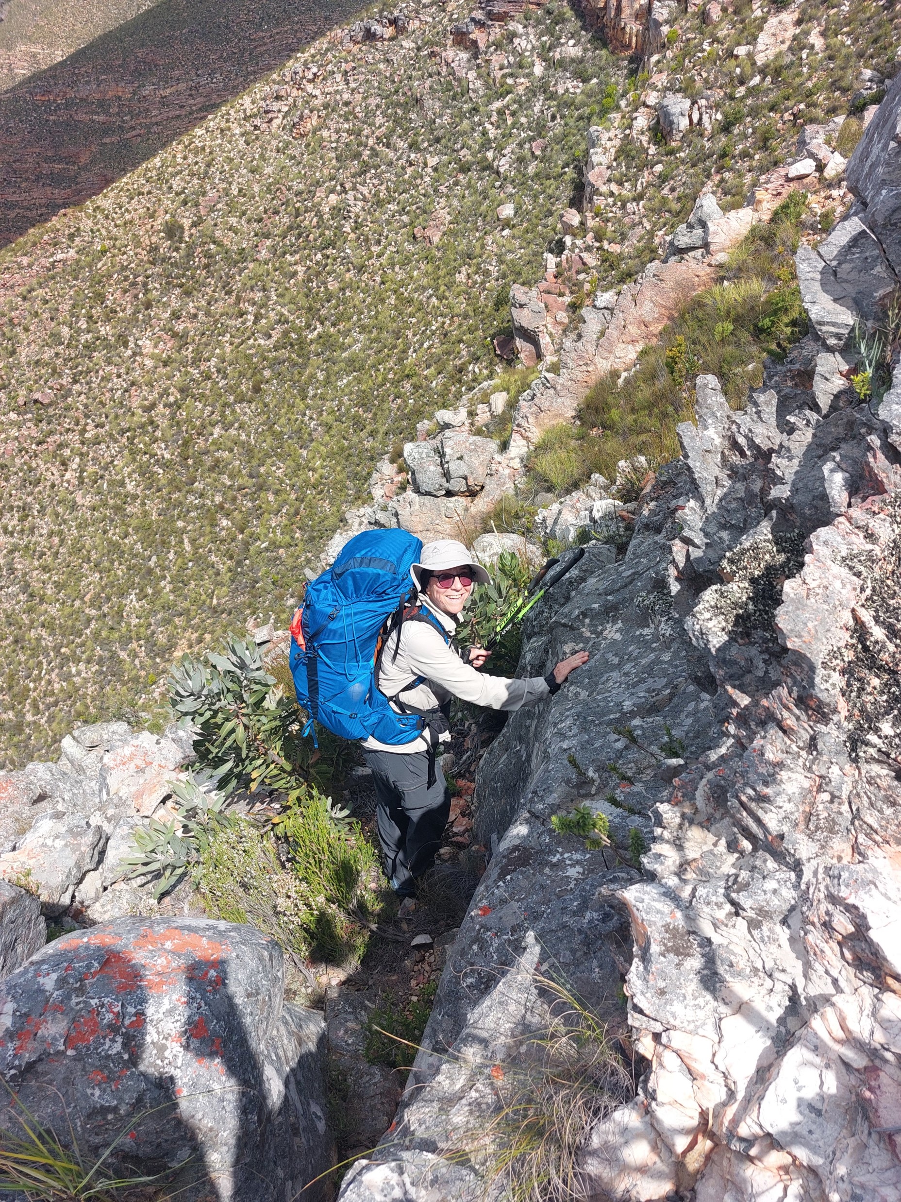
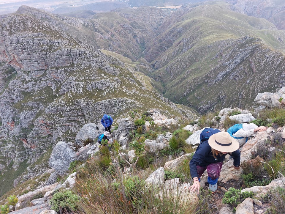
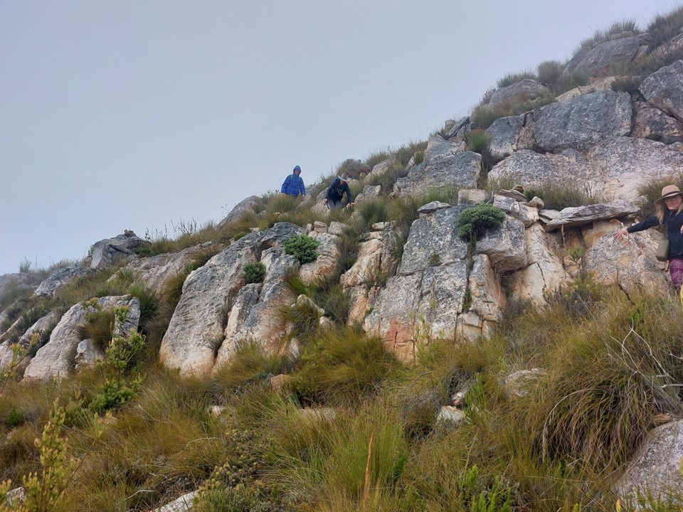
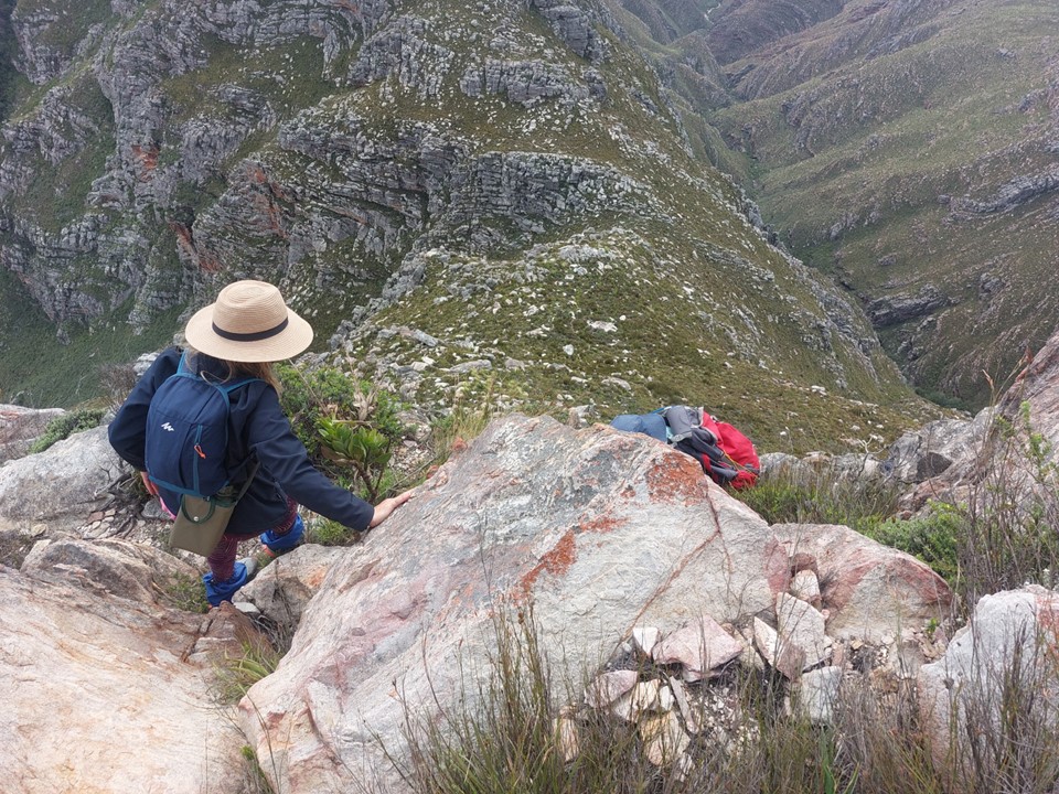
The scrambles start fairly close to the saddle, and the exposure is notable.
You soon reach the infamous ledge. Of the sketchy bits of the route, this part didn’t bother me much as I was always able to keep one full foot in contact with the ground – it never felt like I might actually fall. There were parts higher up where I was less confident, though.

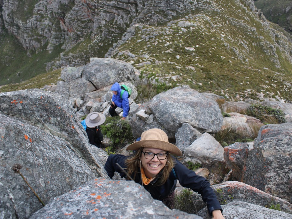
Watching Gaye on this terrain – I wondered how strong she must have been in her youth. Aside from being very fit and strong, she is also very competent on rough terrain like this, a proper mountain goat.


As we got to the top of the exposed scrambles, the mist came in. I had been aware that this as likely, so I was prepared for the possibility of seeing no view from the top. Interestingly the mist always seemed to hover above the ground – presumably because of the air types not mixing. This provided an eerie feeling of being in a bubble.


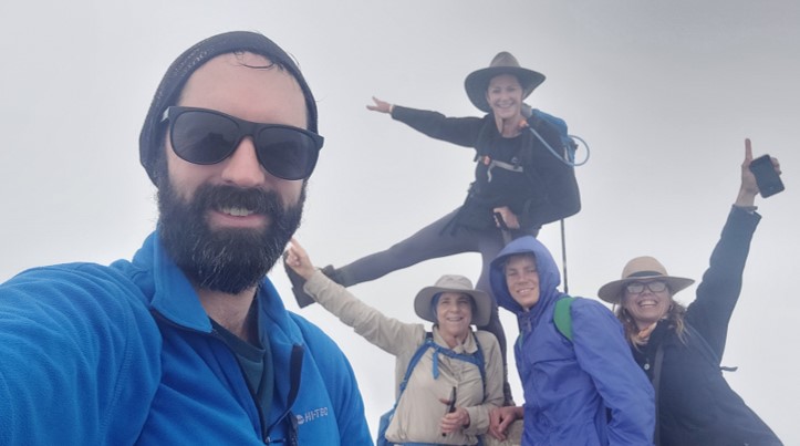
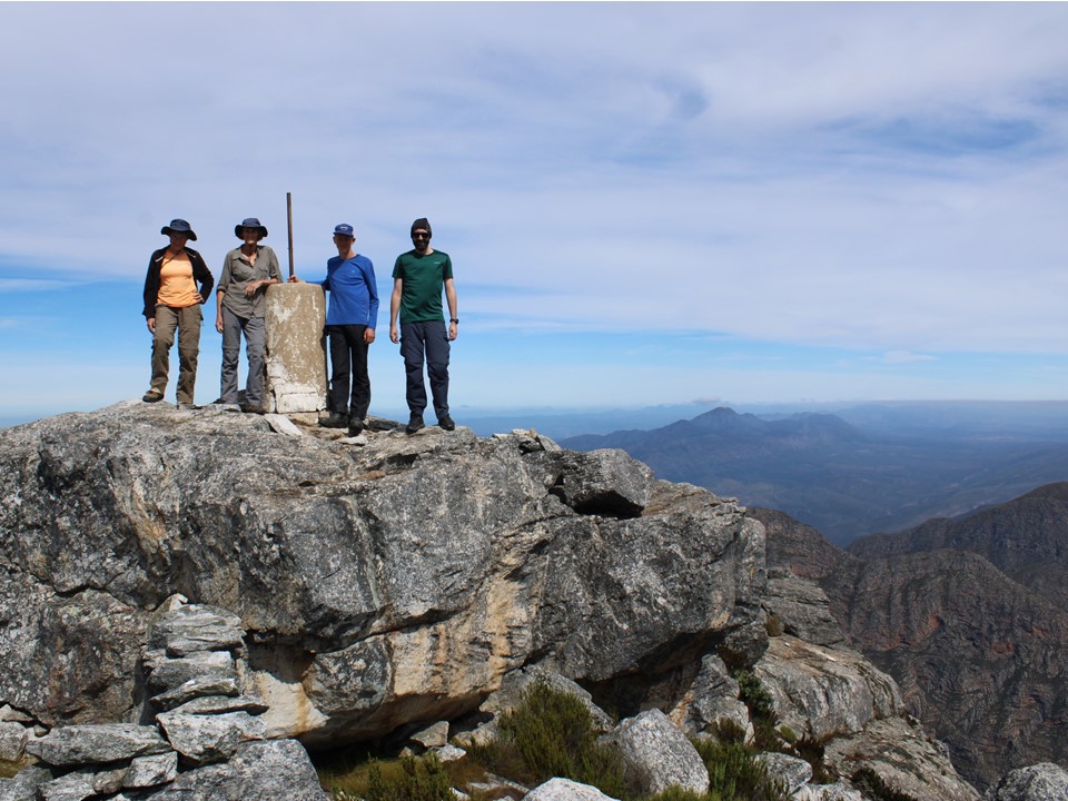
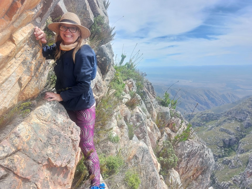
L-R: myself, Judy (top), Gaye, Luke and Lyndi.
With very little to see on top, we sat and ate some snacks and discussed various philosophical topics.
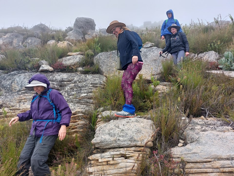
It was getting a bit windy, and there was no sign of it clearing – so we started back down.
When Angela, Roland and Helene passed us, Luke decided to join them and head back to the top.
Then the mist started clearing just as we hit the top of the sketchy section. Lyndi and I agreed to turn back and head back up as well, while Gaye and Judy continued down.

Lyndi found a nice spot out of the wind about 80m below the top and decided to wait there. I “ran” (by that I mean walked as fast as I could up very steep ground) to the summit.
Getting back to the top in perfect weather – I was happy that I turned back. Angela laughed, I could have slept in and had the better view. The way I see it – I got to do the top section twice, I do laps of stairs with a pack at home, this was far more enjoyable training!


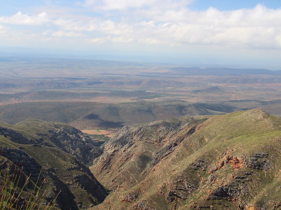
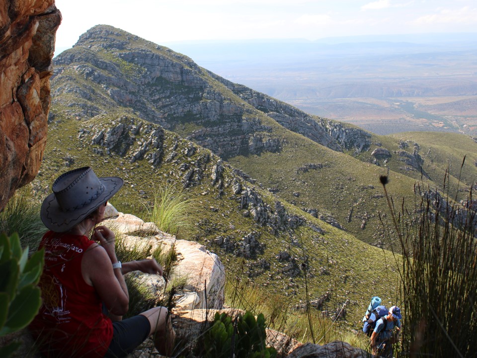
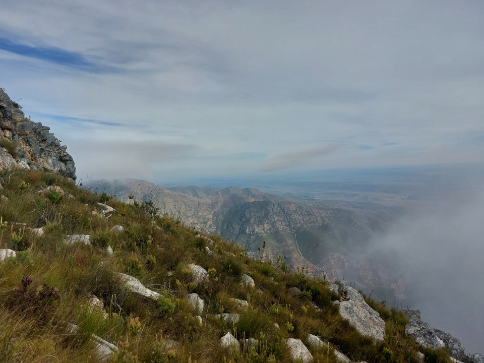
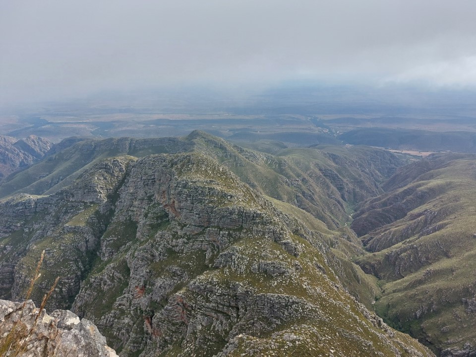
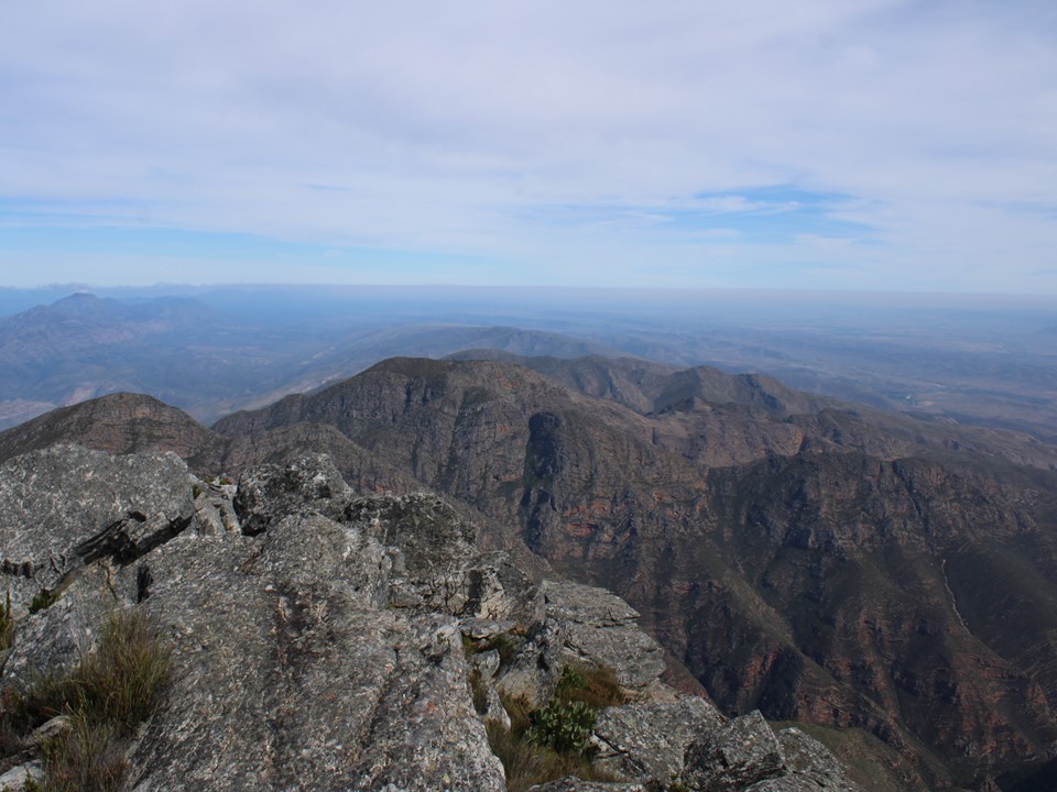
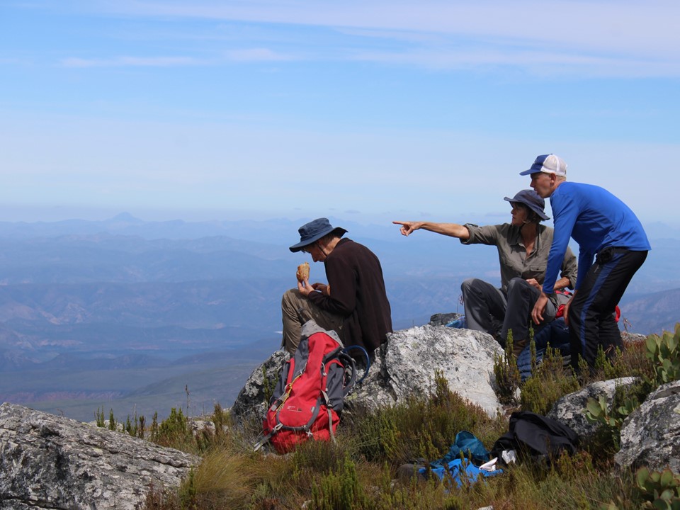
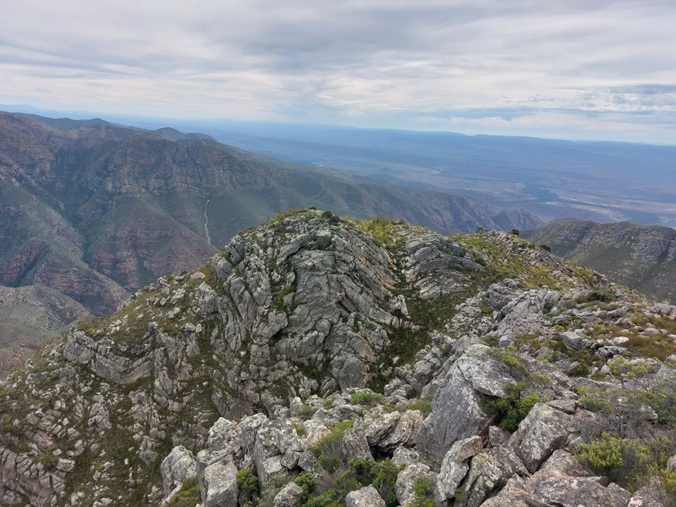
The views from the top were great, although as I had guessed, the best views were in the direction we had seen before the mist settled, so the others hadn’t missed the best part.

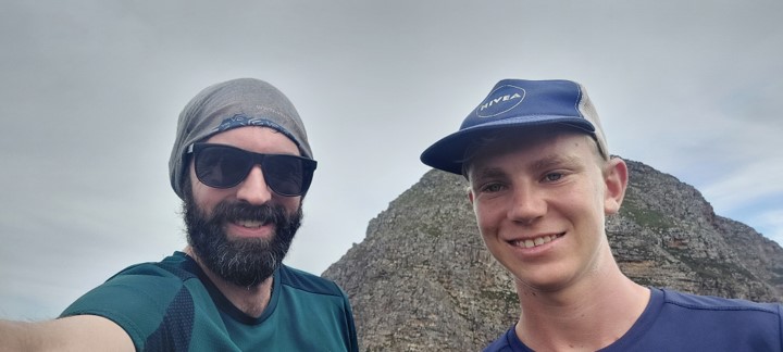
L-R Helene, Angela, Luke and myself. Roland took the photo.
We stayed on top for a while. Such a beautiful clear day! And thus my run of standing on 1000+m prominence summits in perfect weather continues!

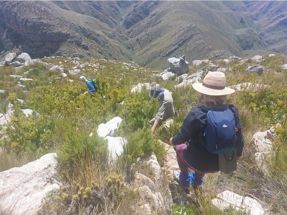
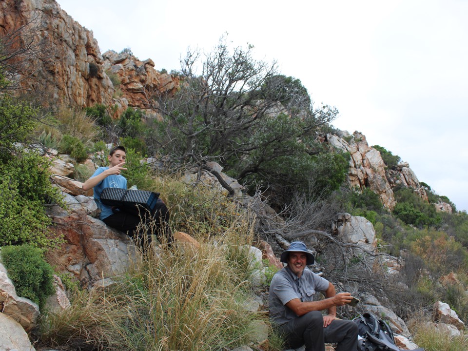
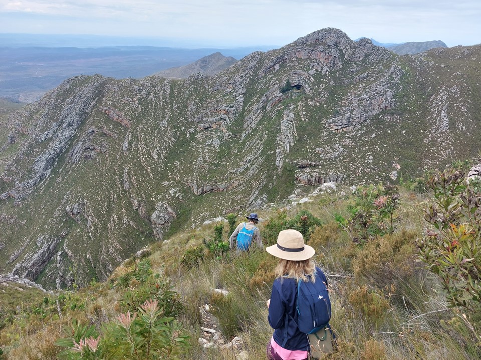
Luke wanted to explore the ridge above the cave, so I decided to join him. He is busy doing matric at present and is a strong runner and very competent on ground like this. He practically ran up the peak. With about 100m prominent and a height of 1400m, it isn’t a mountain summit by my definition – but still a great view point. Luke decided to collect firewood up there as well, just to add a bit of a challenge – or maybe to ensure no shortage of firewood.
We continued along to explore the ridge before dropping back down and joining Angela, Roland, Gaye and Lyndi for a walk to explore the valley and other ridge.


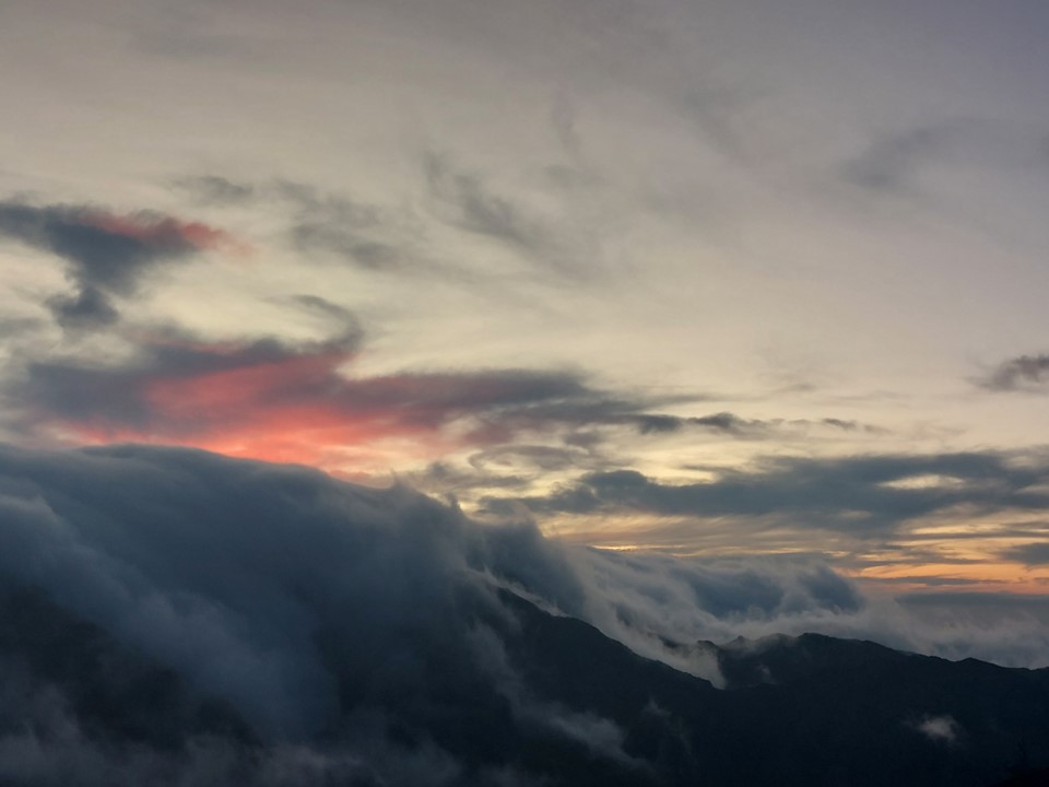
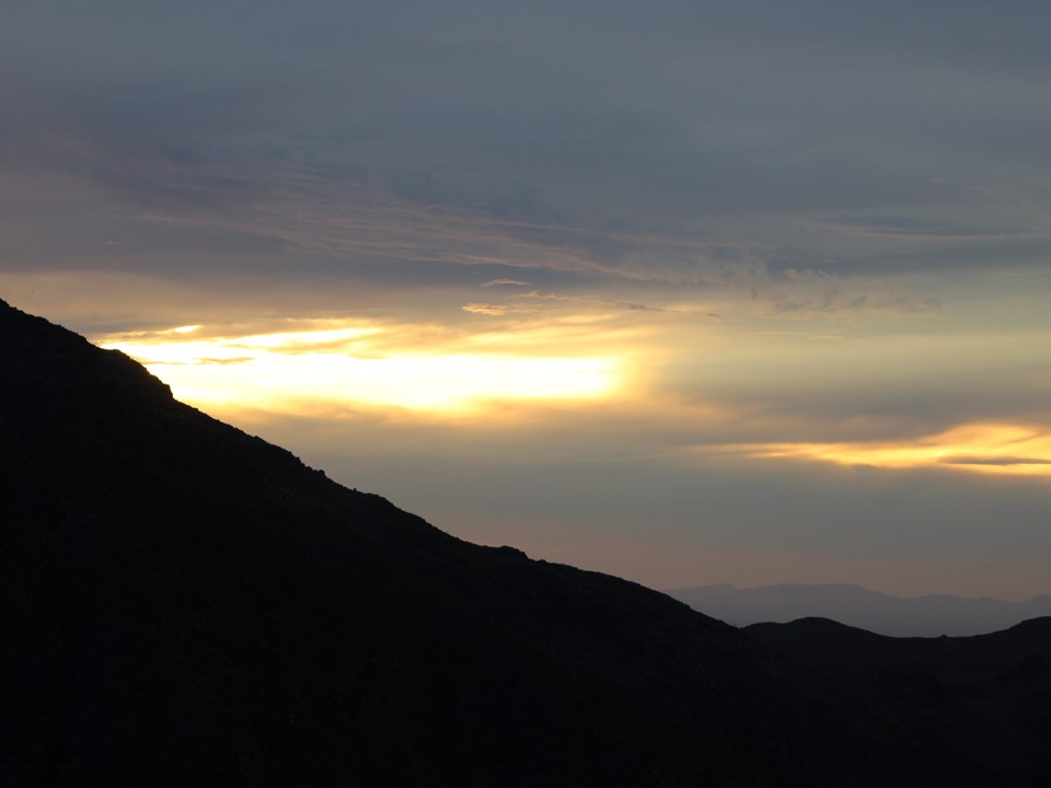
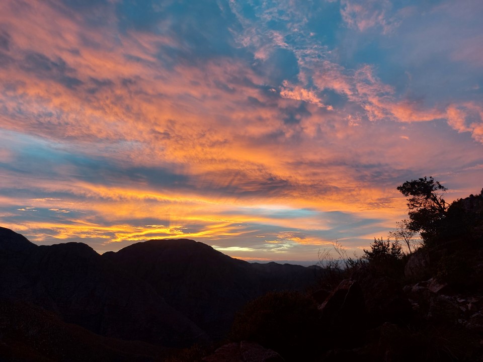
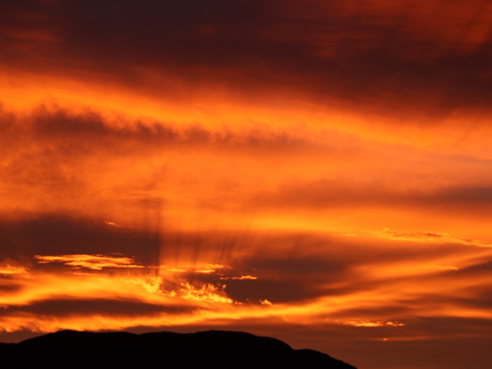
The day ended with an exceptional sunset. These photos have not been edited in any way, this is directly off the camera.
We got a late start to the walk back to the car. At just over 5km, it was always going to be reasonably easy.


With everyone safely back at the car, arriving between midday and 1PM, the hike was a success. Thanks to Angela and Roland for organising and leading it, thanks to Gaye for the accommodation, thanks to Judy for transport and thanks to everyone else in the group who made this a great long weekend!
We stopped on the road back from the peak to get some photos of this monstrous peak. The drive back to PE went largely without incident, and I was soon back at Gaye’s house.
I got a 5:15am taxi to the airport, had breakfast at the airport and soon found myself on a flight back home – emergency exit window seat as usual. Overall a great weekend with a lovely group of people!

Hi Jonathan
I thoroughly enjoyed reading your account of the Cockscomb hike. You’ve captured its essence in your descriptions and photos. Wonderful to experience it again through your eyes.
I’m now an avid follower of your blog. Look forward to being taken on more of your explorations.
Best wishes
Lesley