“I can say with a fairly high level of certainty that Hilton Pass is not a pass that will ever form part of my list of bagged passes” – me, 31 August 2011
Hilton Pass has been a bit of a Drakensberg mystery for a while. I had read an old account of a team hiking up the gully and ending up benighted halfway up. There had been speculation as to whether or not there was a side gully worth trying as well.
When I read up on the pass in Bill Barnes’ book, Giants Castle: A Personal History, I found that the original pass was in fact not the gully shown on the map, but rather one gully further north. I had largely written off Hilton Pass as something I would never do, so I wasn’t too bothered by this at first.
In June 2017, I set off with the intention of coming down Hilton Pass (the map marked pass, not the Barnes’ pass), but due to wind and ice, we opted not to use it.
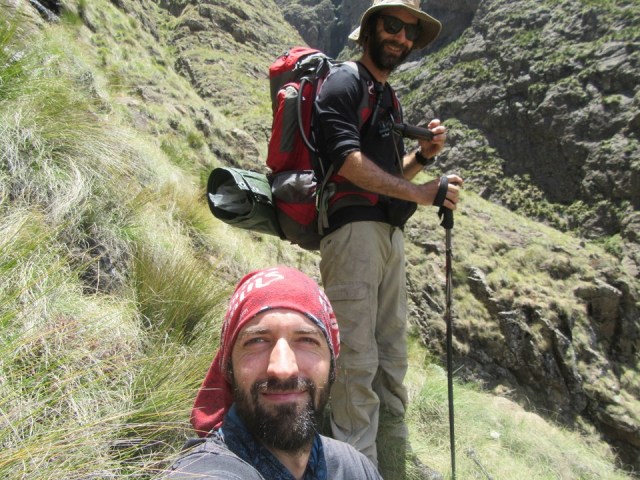
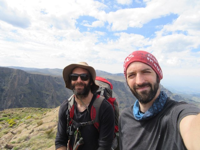
As time passed on, Hilton Pass became my only Geoseries map marked pass remaining in the Central KZN Drakensberg. One of the key problems with a pass like this is that you have to have a strong teammate for it. The route is difficult, even dangerous – so when Graeme was up for it, I knew we had a good shot of pulling this off.
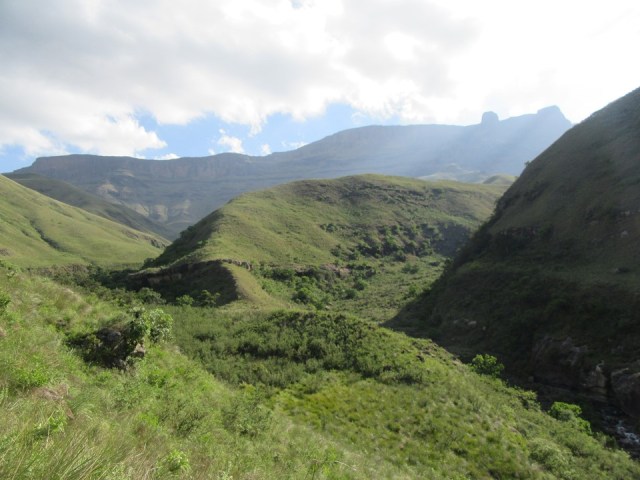
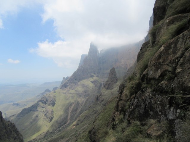
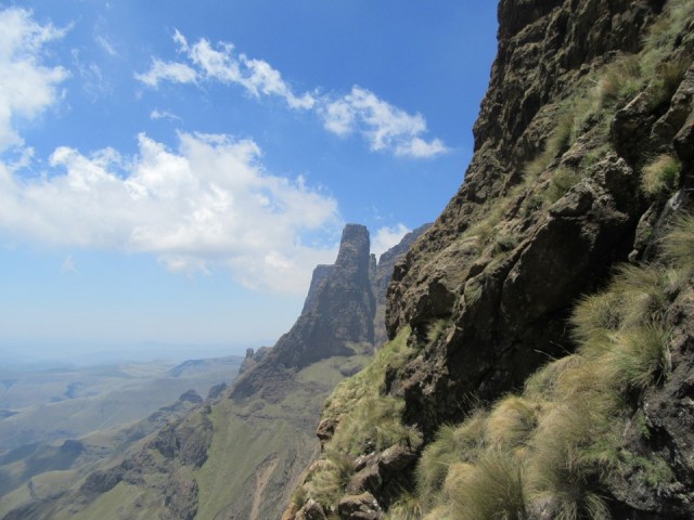
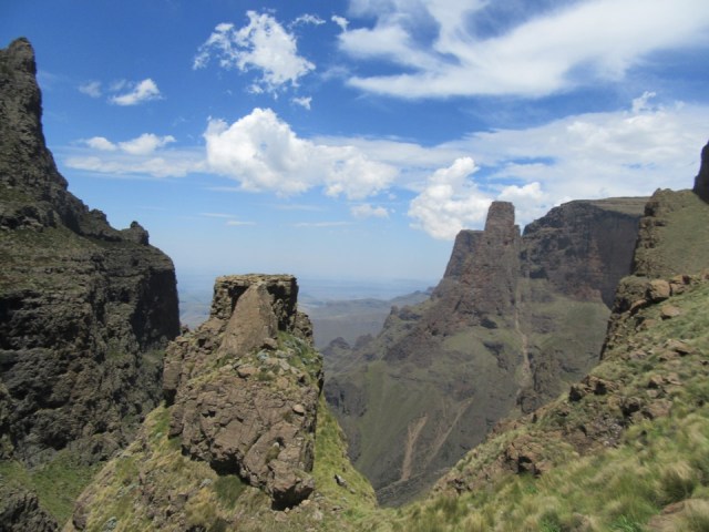
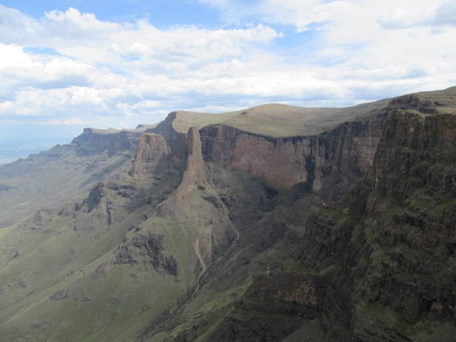
For many years I have nicknamed the valley between the Red Wall and Injisuthi Buttresses the “Magic Valley”. The reason for this is simple: it is surrounded by very striking peaks and includes one of the highest single drop waterfalls on earth – thus setting a very high expectation on what the views would be like. Spoiler alert: it did not disappoint!
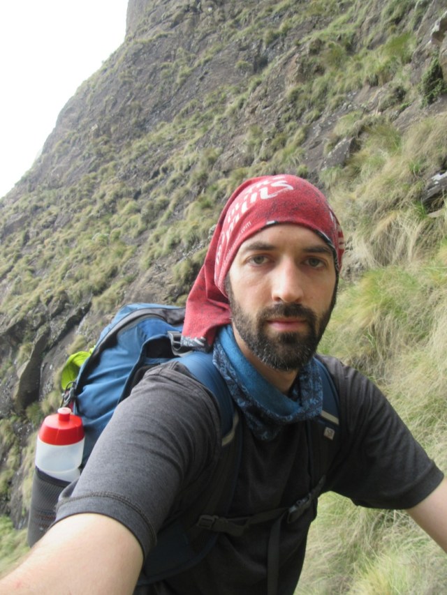
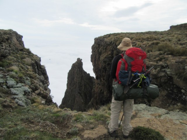
Graeme and I set out from Injisuthi Camp on Friday afternoon, around 2:40PM. The goal for day 1 was Lower Injisuthi Cave. Surprisingly it had not been booked, so I had booked it a few days earlier.
The route is popular with families taking their children for a first night out in a cave, so the route is fairly easy. 8km after leaving the car, you find yourself in the large but not that well sheltered cave.
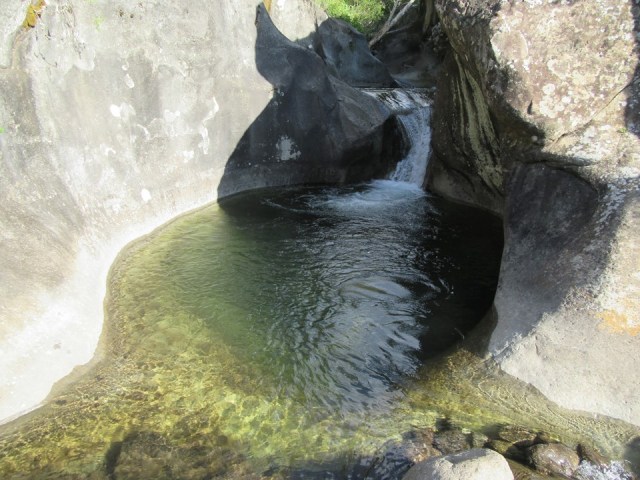
There are a few deep rock pools just before the cave, so after having a look at the cave, we went back to sit and chill next to the river.
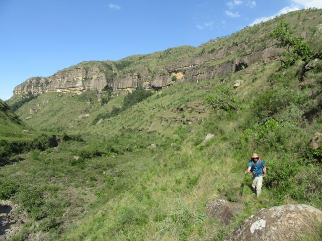
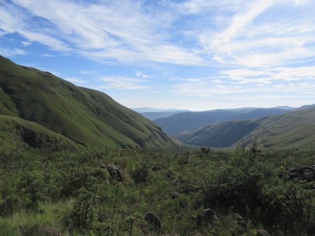
We were up at first light and walking by sunrise on Saturday. The views up the valley were a good start!

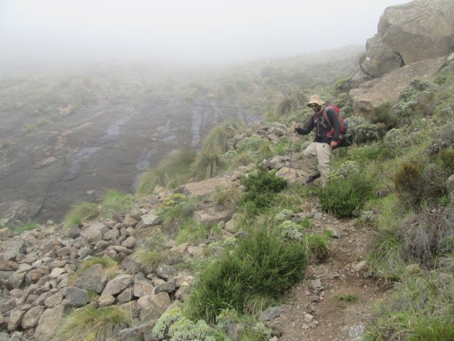
It was a hot and humid morning, but at least the weather was clear. I knew we needed good visibility for navigation and dry conditions for the exposed middle of the pass.

We passed a few dead pine trees along the way. Good to see the fruits of the Pine Busters team! Pines are alien invasives in the Drakensberg and do a lot of long term damage. The team has been working on a volunteer basis for years to try and eradicate them.


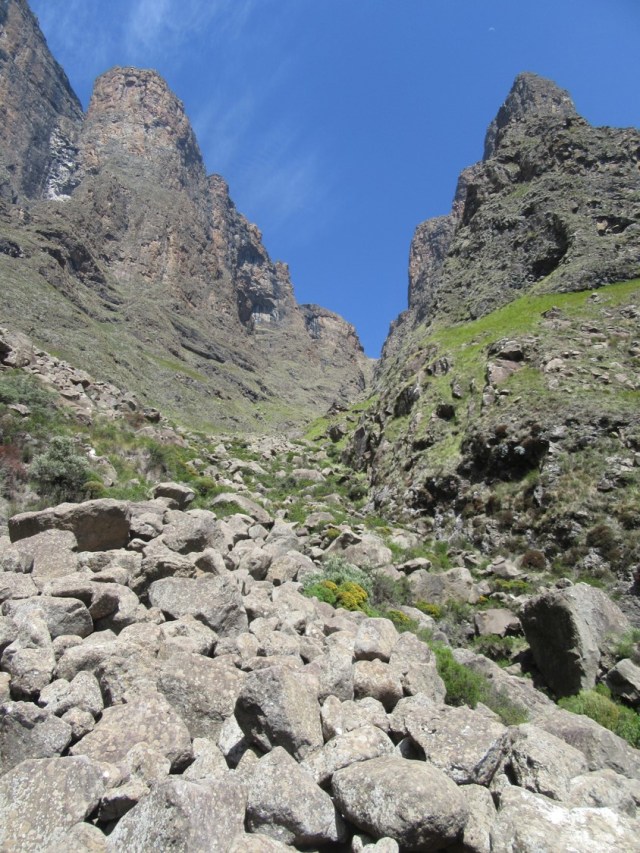
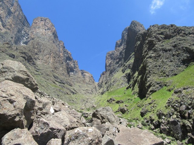
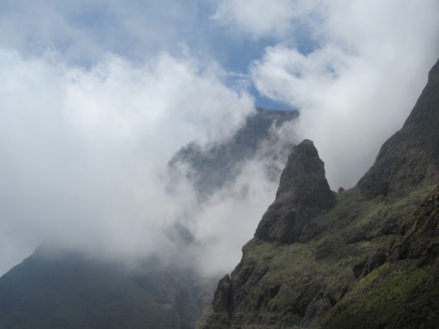
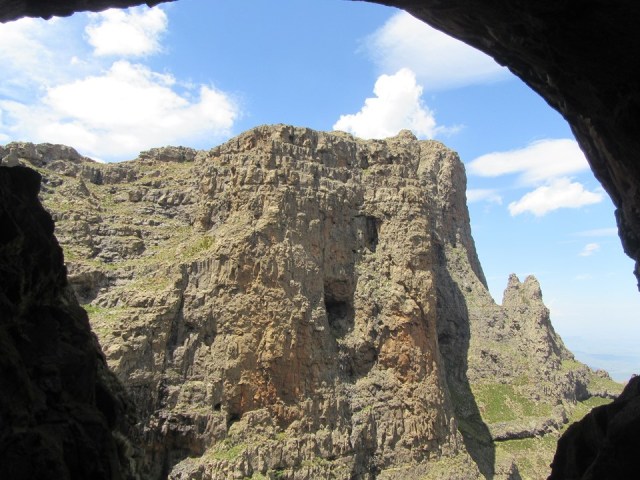
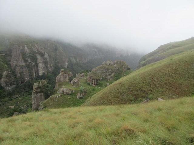
As we got up the valley, the sides began to close in around us, with the Injisuthi Triplets to our left and the Injisuthi Buttresses to our right. Magic indeed!
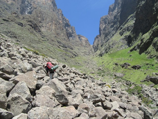
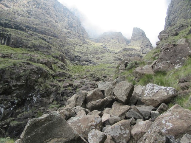
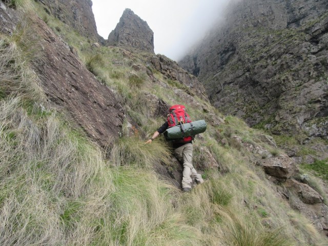
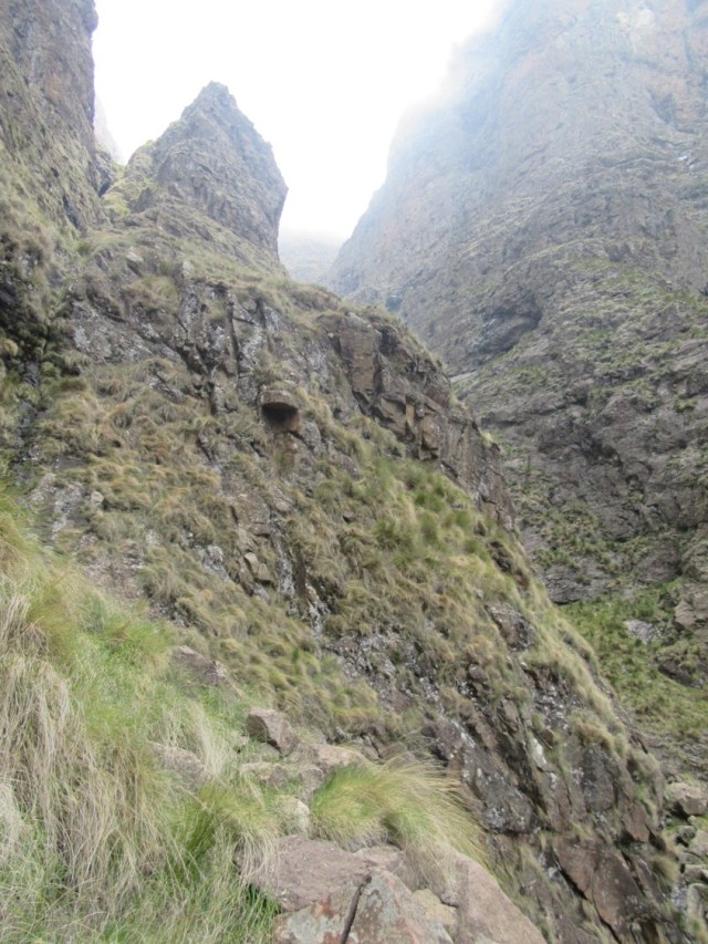
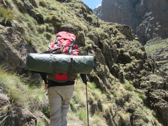
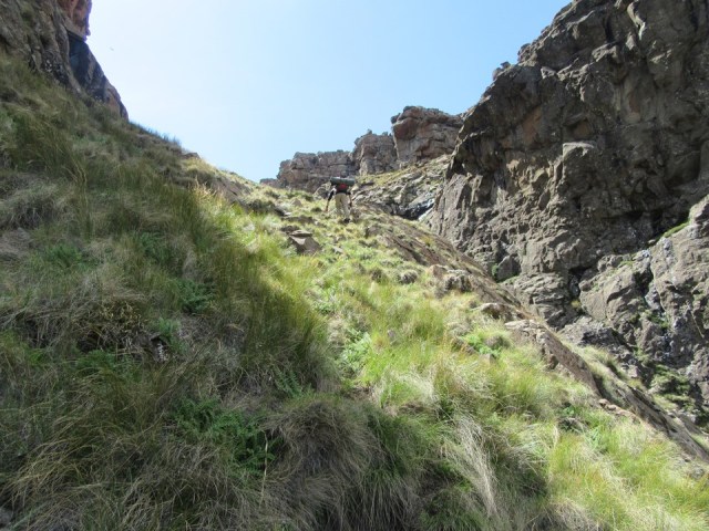
The pass started with a choice between scrambling out of the river and following a steep grassy side-slope, or pushing through thick overgrowth. That was an easy choice, we took the side slope.
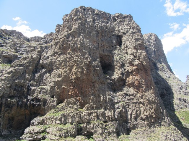
This deposited us in the rocky base of the pass proper.
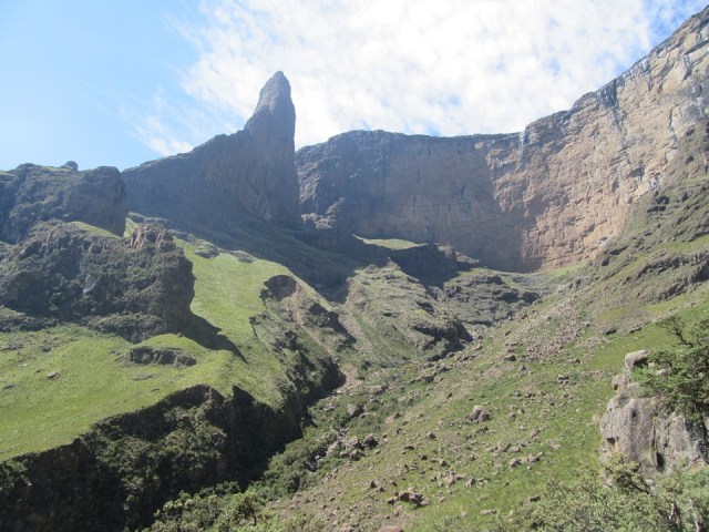
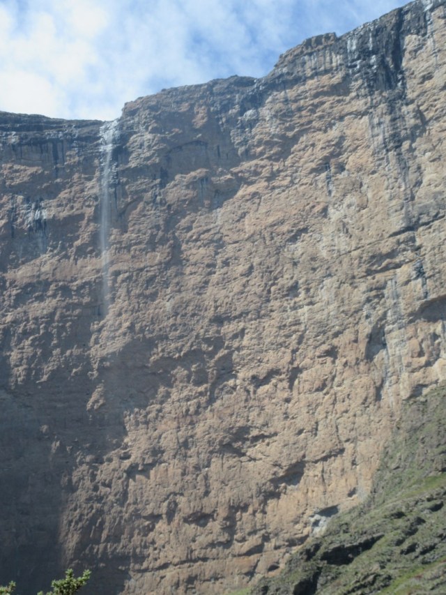
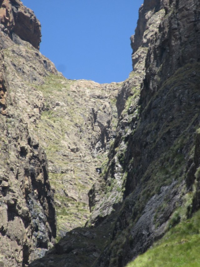
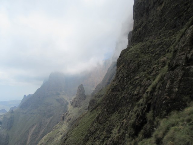
Red Wall Falls, at 409m, is the 2nd highest single drop waterfall in Africa, and one of the highest single drop waterfalls on earth. Notably it is overhanging the entire way, which is rather unusual. Due to the wind, it was hard to spot beyond the first 20m or so. It wasn’t windy in the valley, but the changing amount of waterfall we could see told us it would be windy on top.
We planned to follow the gully for as long as possible. I knew from the top that there was a pillar we wanted to pass above. From there up, you are home free. I saw a line that went up directly below this, which we wanted to try. Then we found a trail!
Tony M had mentioned that a trail was forming when they used the route. I was surprised to find a reasonably good trail this far down, just above where we left the river.
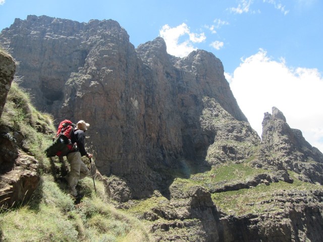
While the faint trail was handy, it still lead straight to some fairly exposed scrambling – making me question who the trail had been formed by.
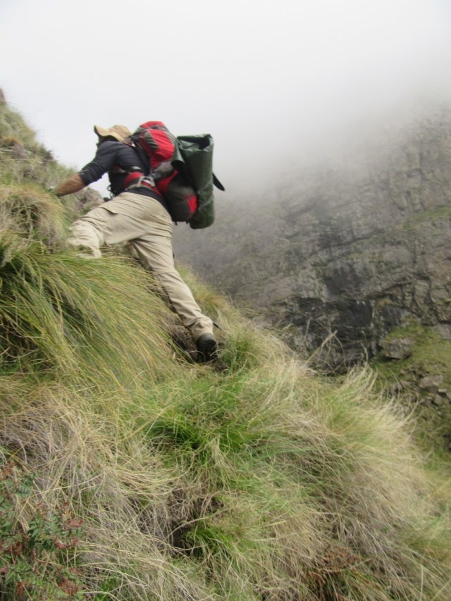
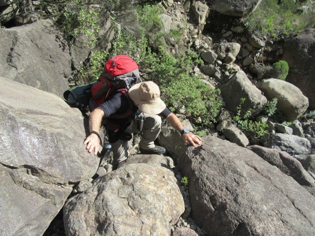
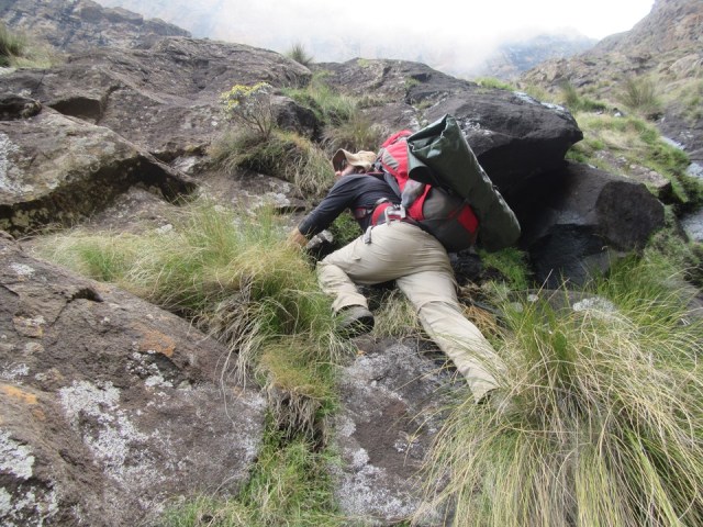
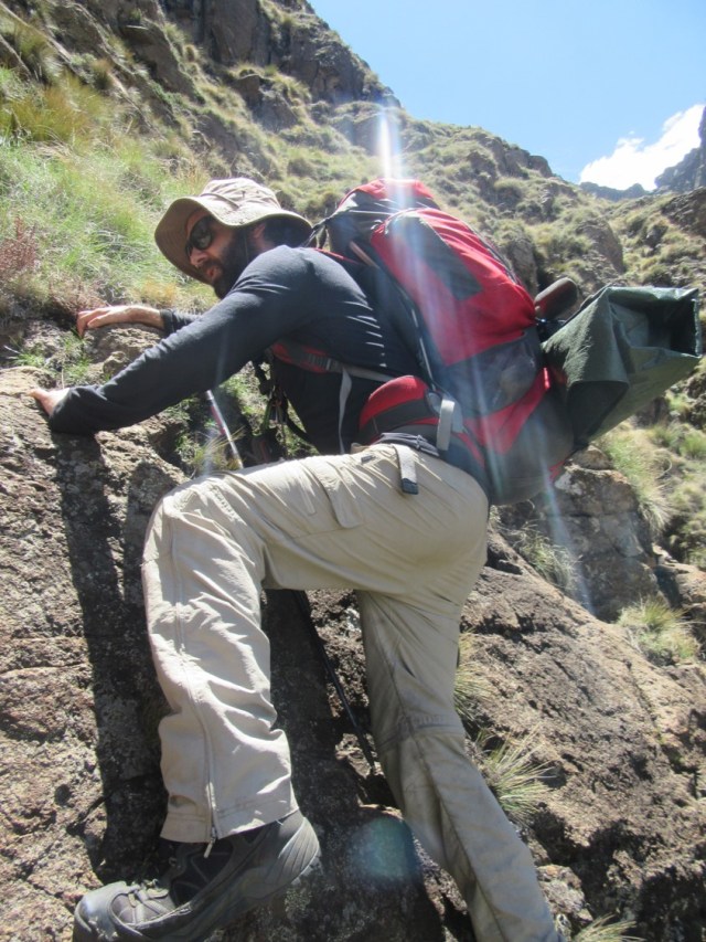
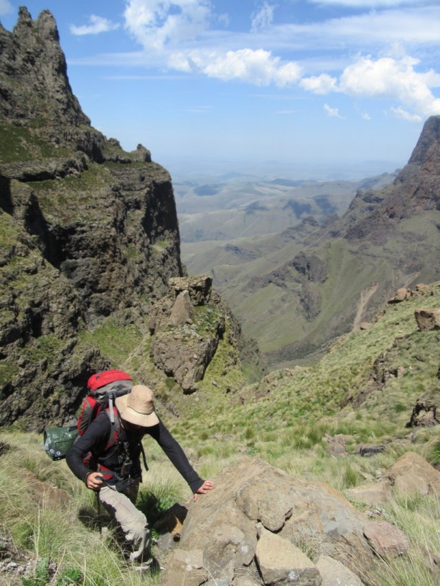
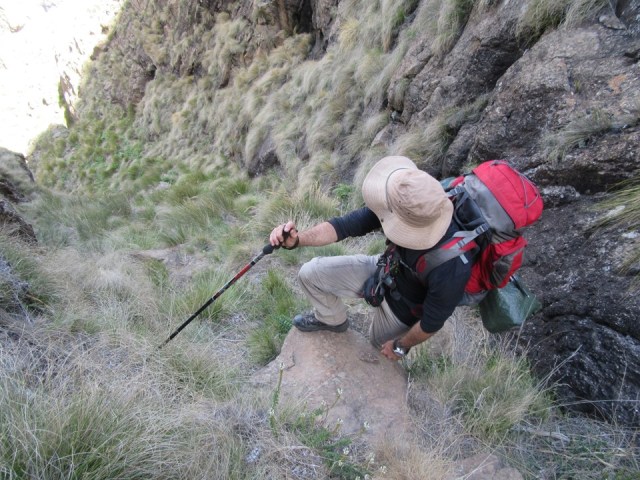
The first proper scramble was interesting. Graeme went up with his pack on, and then hauled mine up. I get very nervous on these exposed scrambles. The fact that a minor slip or broken rock could be fatal is always a factor in ones mind!
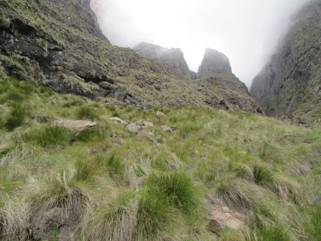
We were briefly in some mist, but it cleared soon enough.
The second scramble proved harder and scarier. Graeme decided to go up with his pack on. Seeing as he was happy (well, willing anyway) to go up unroped, I asked him to set up a top rope for me. There were some proper climbing moves on this bit, and the exposure was severe.
Once we were above it, we were both relieved. We were still on the trail, and we knew we were above the worst of the exposure.

The next section was steep, but it was nice to be back out of the DFU zone. (for those unfamiliar with the reference – the DFU Zone is the “don’t-stuff-up zone” – basically anywhere where a mistake could be severe or fatal).
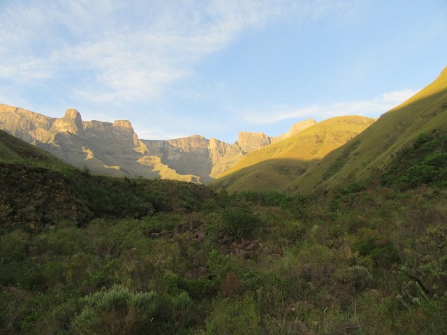
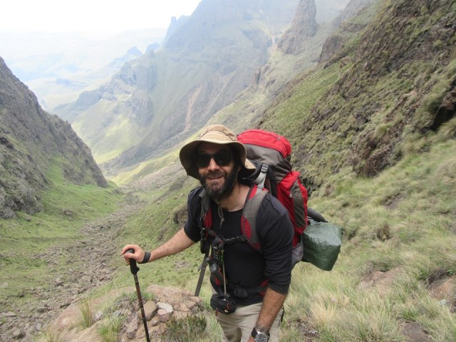
Being above the worst of the pass, we started stopping to enjoy the view a bit more. We had given ourselves a full day to get up. At 5AM we were walking, and we knew we had daylight till 7PM, 14 hours of daylight the day before the summer solstice, what more could you ask for! Now that we were on track to be up by 2PM, we decided we could take in the sights a bit more.
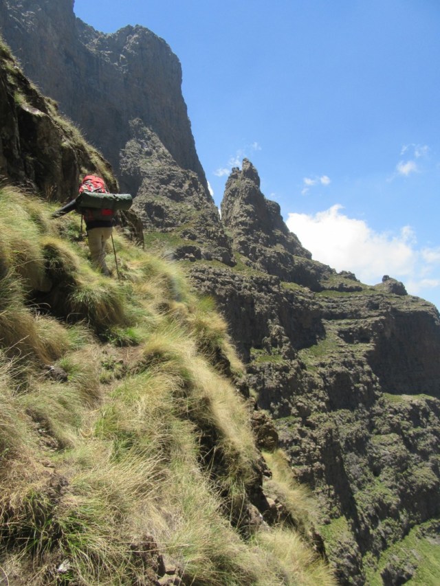
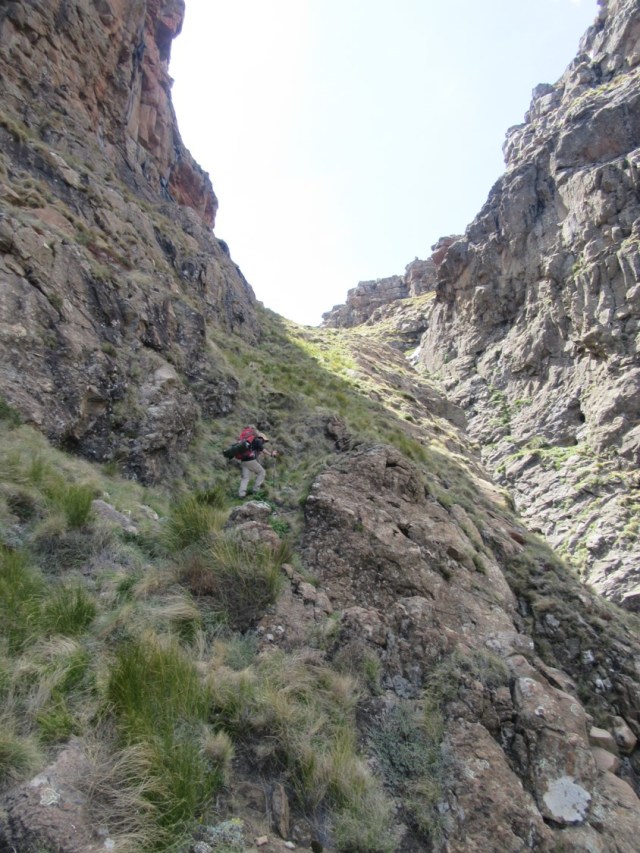
The next section was very exposed, but the trail negated a lot of the risk of falling.
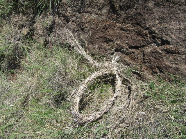
We found some rope on the trail – which told us who is using the route and why. There are some phenomenally strong hikers out there. Coming up this pass with a light pack was hard, coming down it with a heavy bag tied to your back must be insanely scary!
When we reached the next scramble, we recognised it from Tony’s writeup. At least this one was easy, short and above a ledge – so a serious fall was unlikely.
We soon found ourselves above the gully I had talked about aiming for. From below it looked doable, from above it looked insanely steep. In retrospect I am really not sure if it would be easier or harder than the line we used, and I don’t really want to go back to find out!

The next section was steep, but no worse than any number of Drakensberg passes.
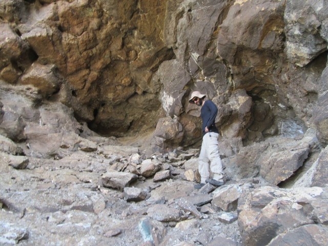
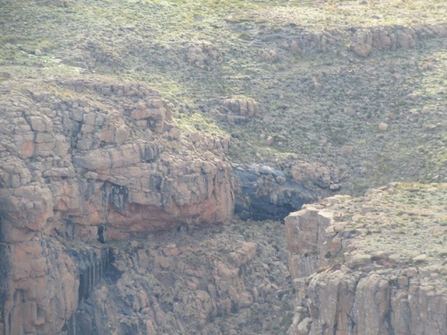
We saw a large cave above us, which we scrambled up to. Turns out to be very sheltered, but only sleeps 2, and they would be very close in it. There was a bit of a wall, so it has clearly been used before.
As it turned out, to get up the pass from the cave, we had to drop over 50m back to where we had set off for it. Every possible ledge was far too exposed to try traversing on.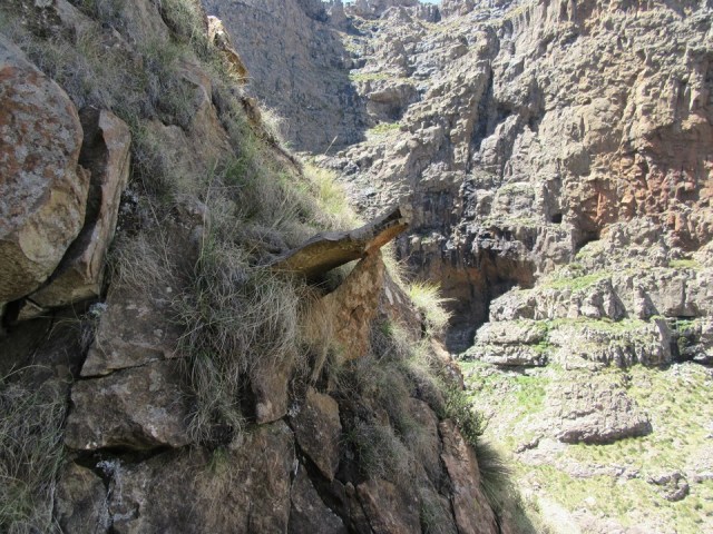
When we found ourselves back on the trail, we discovered we had to ascend a steep grassy gully. Compared to everything else on the pass, this was trivial. It would have been the hardest section of most Drakensberg passes.
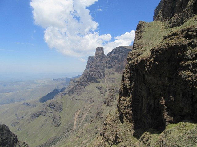
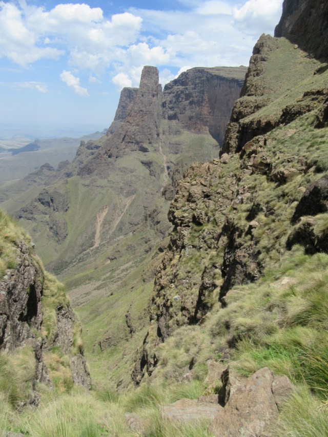
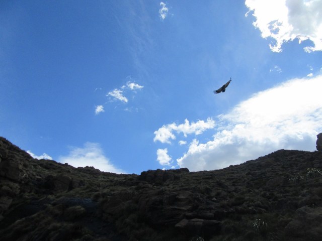
As we prepared to top out, a vulture flew right above our heads. As we were discussing how cool that was, another one did the same. After this had happened roughly 7 times, we assume it was over, and I got my camera out to get a photo of the view – just as another went by. In total, we saw 10, all at very close range. In the three photos that follow, note that I haven’t used any zoom or cropping.

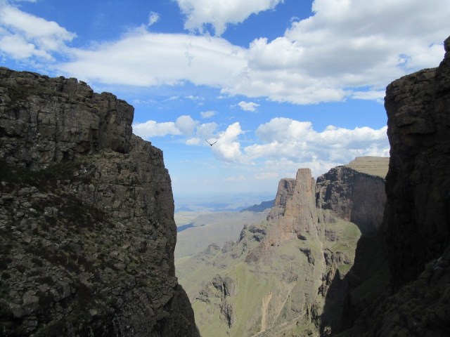
Once up, we went up The Greater Injisuthi Buttress. On the way up we got a good look at the Barnes Variation Hilton Pass. Based on what we saw, it definitely goes – although won’t be easy.
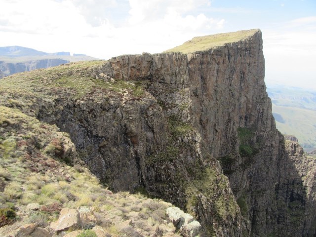
It was great to see the view from the summit on this occasion. I had only done the peak once before, and that was in thick mist. The peak is far out of the way, so while I had always hoped to go back in good weather, I wasn’t certain I ever would. We proceeded from there to the summit of Lesser Injisuthi Buttress.

We reached the cave at the top of the pass where we spent the night. We spent some time building a wall for some shelter from the wind. The rock quality is so bad that a surprising number of the rocks simply crumbled when moved.
There was a good spot to collect water right at the entrance of the cave, which was handy.


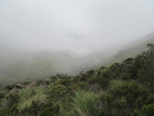
A thunderstorm rolled in during the night. It is one thing to be caught in a thunderstorm, it is another thing to actually be in the thick grey mist of the cloud itself. We found our gear got wet very quickly, and it was exceptionally dark. By far the thickest mist I have ever been in.
The storm eventually cleared and the stars came out. Luckily the storm passed without incident.
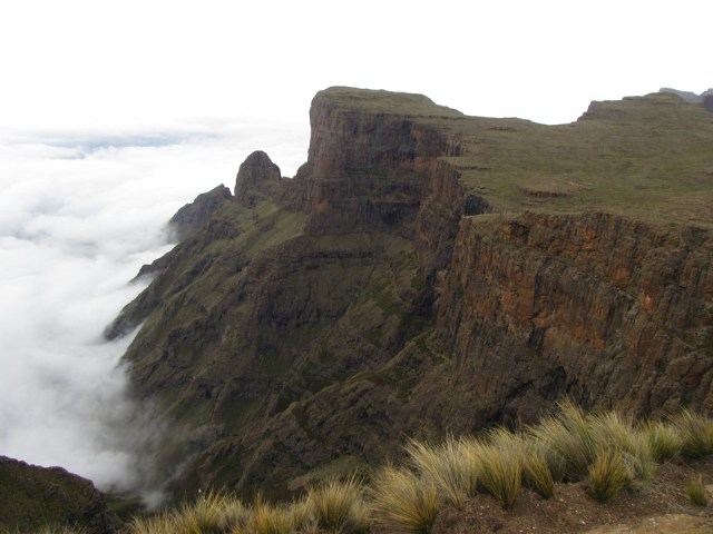
We woke up to cloud in the valleys, knowing this meant we would be descending into mist.
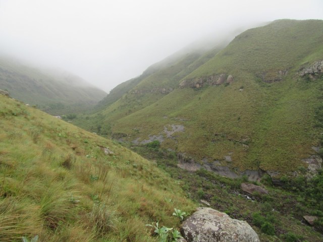
We filled up our bottles at the river behind the pass, and then took the scenic route to the top of Leslies Pass. We had hoped to go down Apes Pass, and walked towards it, but with the amount of mist, this seemed like a bad idea. For one thing, confirming we had the correct gully by sight would be tricky, we would also miss the views – but most importantly, the steep grass and boulder hopping could be tricky or even dangerous if the conditions were wet.
So Leslies Pass it was. The pass was in its usual eroded state, making parts quiet slippery.

From the bottom of the pass, we managed to follow the trail to Marble Baths Cave most of the way. We did lose it on occasion, but nothing serious. The vegetation was very wet, which didn’t help.
We reached the car in good time, with the walkout proving uneventful.
Overall a very successful weekend.
My thoughts on Hilton Pass: the views are exceptional, some of the best I have ever seen. For an experienced team who are competent on rock and have a good head for heights, it is definitely doable (although not very safe). For any team that isn’t entirely made up of experienced hikers/climbers – I would suggest that you rather stay clear of this one. It is also a route I would not consider descending without ropes, and for ascent, ropes come in handy.

Great read Jonathan. The locals on those paths are inspirational, i remember one of them once passing us down one of those passes in semi formal wear (including shiney school shoes) and massive hessian bags on his back, left us in his dust… You two did well !
Hi Jonathon, great read, and superb photos. Please see my email to MCSA KZN google groups 24 April 2020