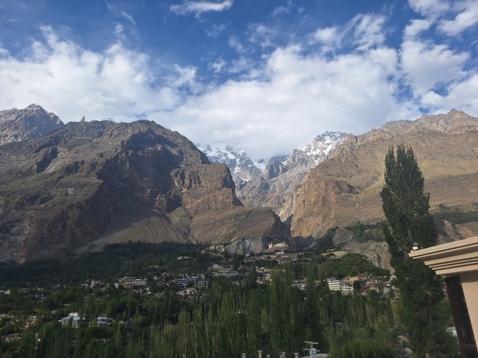
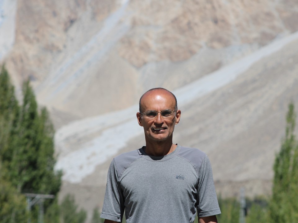
We made our way from from Minapin to Karimabad. For a desert town, it was remarkably green.
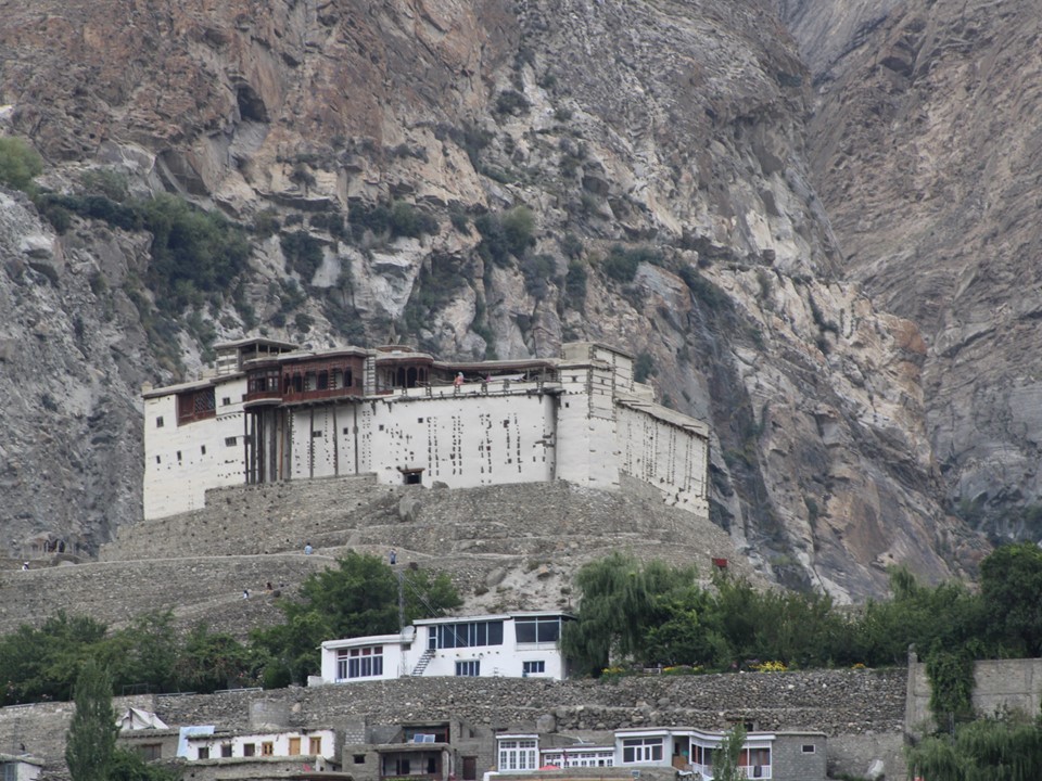
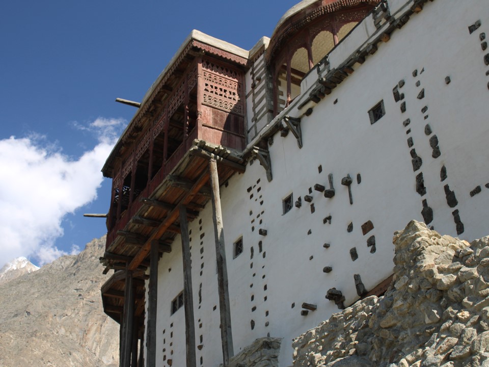
The Hunza Princely State was established around 1200AD and acceded to Pakistan on 3 November 1947. The fort commands great views over the town.
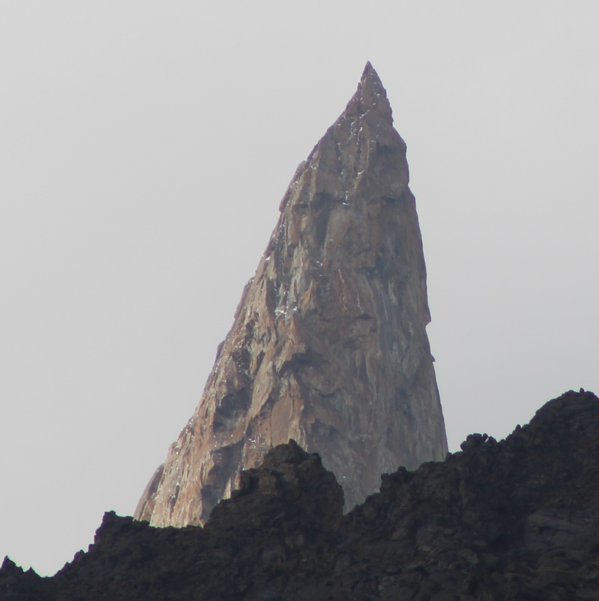
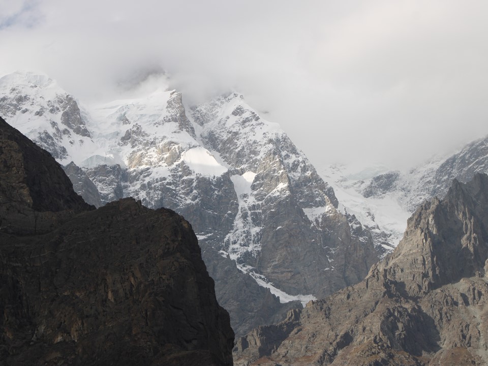
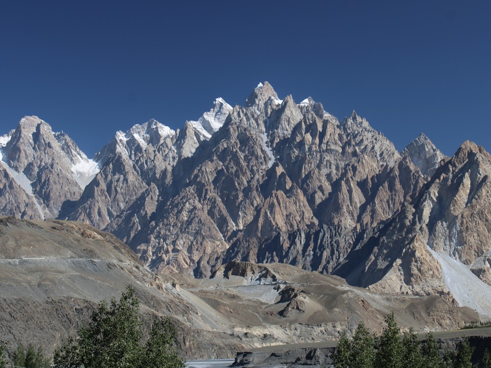
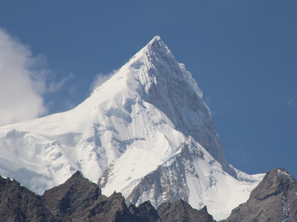
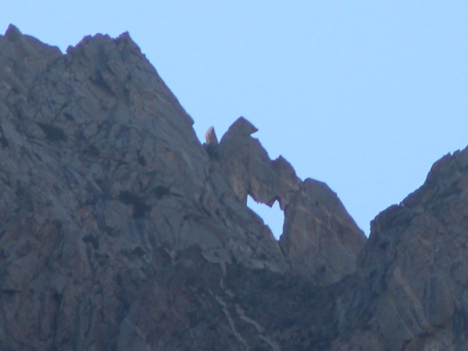
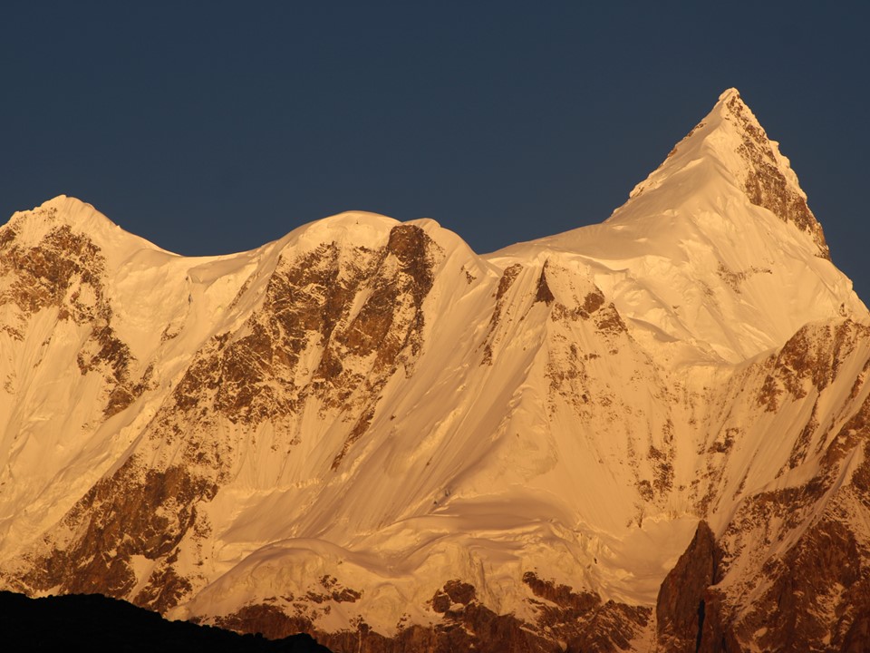
When we arrived, the mountains were still hidden in the clouds. One summit was visible, though – the impressive 6000m (the exact height is unsurveyed) Lady Finger. This granite tower has seen multiple ascents and has even been paraglided off.
Momin had been talking about the local walnut cake, so after putting our bags in our rooms, we took a walk through the town to try it.
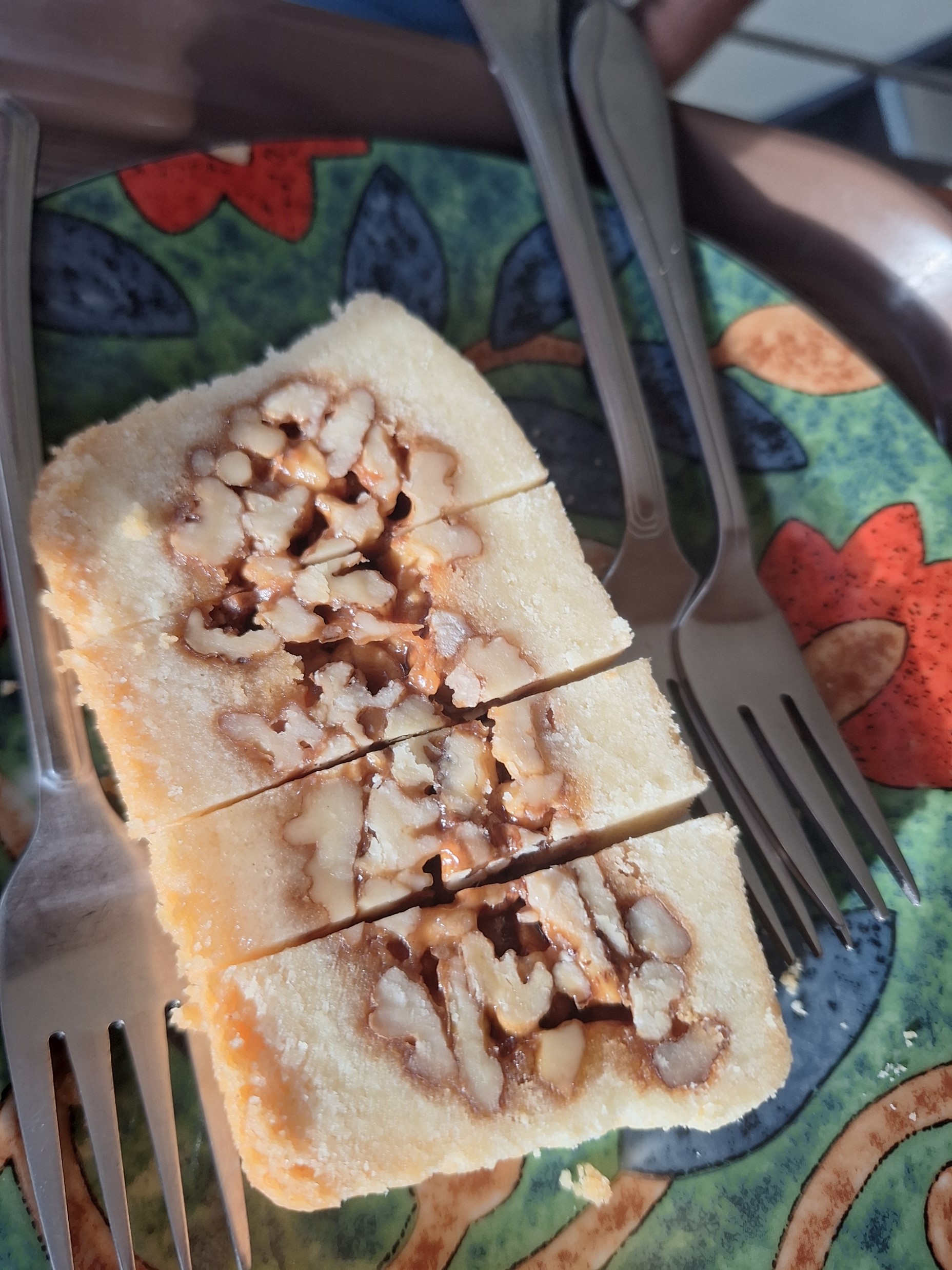
It tastes a lot like a pecan tart with an almost shortbread crust. Definitely worth trying if you happen to be in the region.
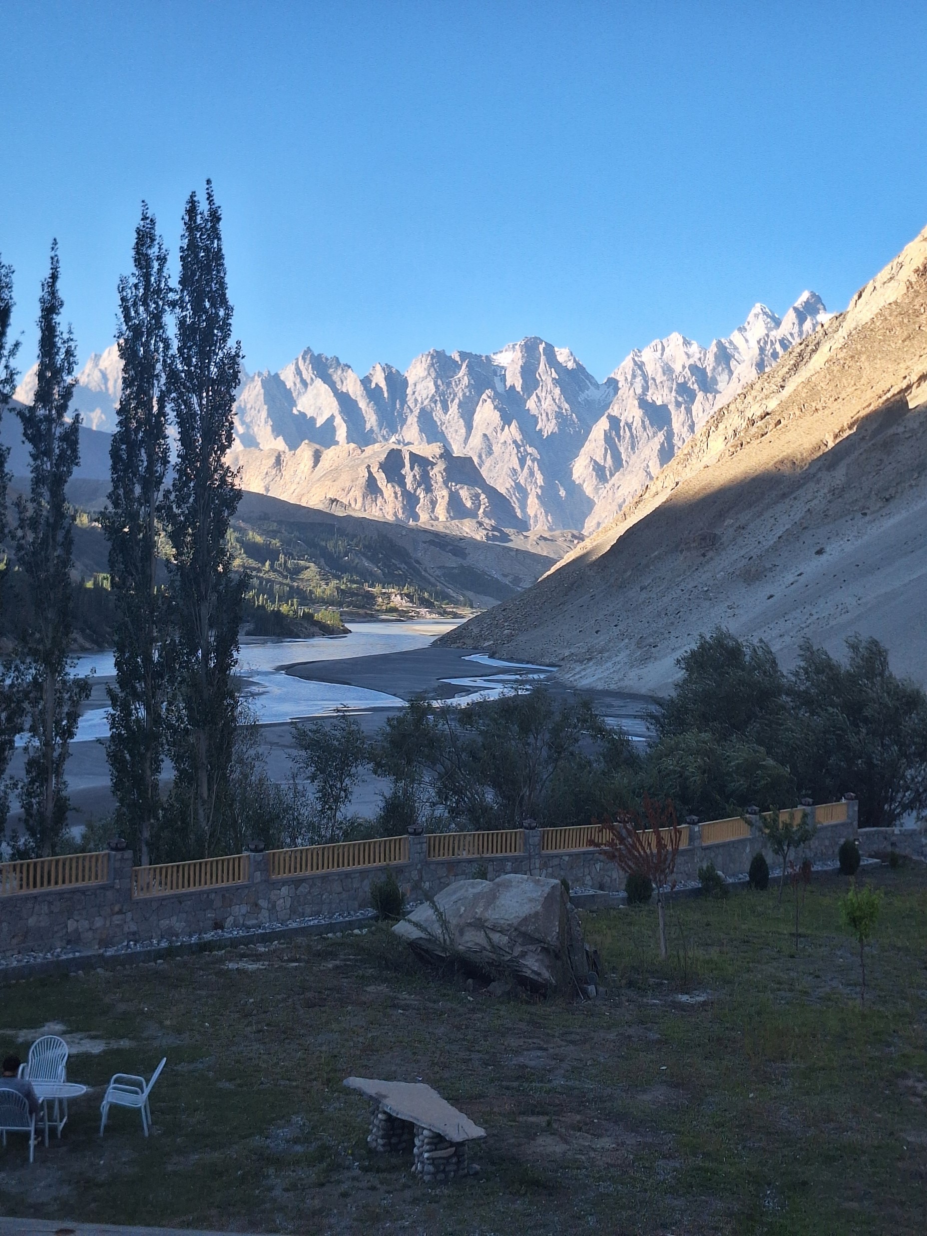
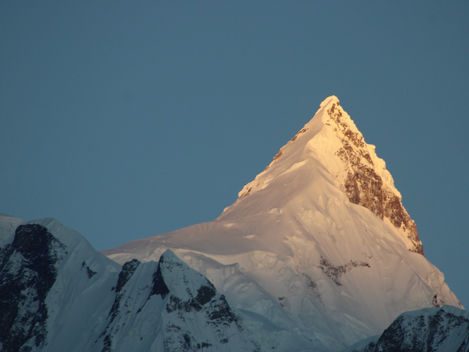
The town itself is surrounded by substantial mountains – most notably Ultar 7388m, which I recognise as the 69th highest mountain. Notably Lady Finger is found on its slopes. For context of how impressive the region is – our hotel was less than 10km away from the summit of Ultar, which was approximately 5000m vertically above us.
I enjoyed our walk through the town. Momin had a chat with a local police officer, who I noticed wasn’t even carrying a gun – not something I’ve seen many times before. We stopped for supper, and bought some Hunza Valley fig jam at one of the shops – we had eaten this on the Rakaposhi Basecamp hike, and both Moiez and I wanted to get some to bring home.
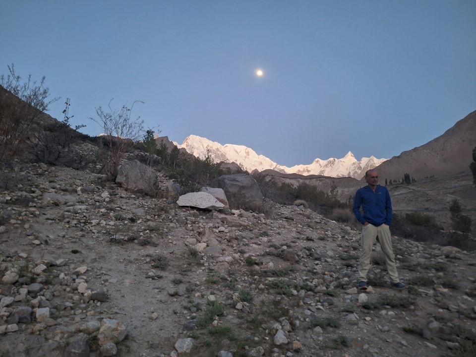
Around 4am the following morning I was woken by something. It was around full moon, and I could see light coming in from outside, so I went to my window to take a look. There was Ultar, glowing in the moonlight. Naturally I went outside to see the many mountains that surround this town – the views were incredible! Sadly none of my attempts at photos were any good.
After going back to bed, I was up again soon, this time for sunrise.
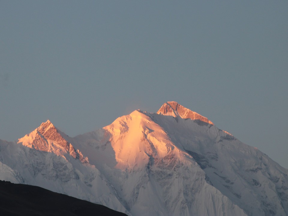
Above: Rakaposhi 7788m, 26th highest mountain.
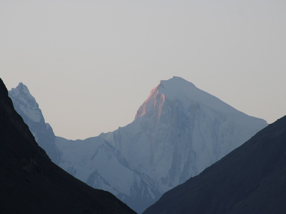
Above: Spantik 7027m, 165th highest mountain.
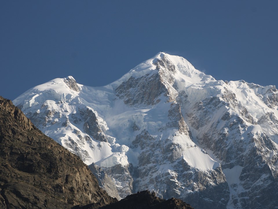
Above: Ultar 7388m, 69th highest mountain.
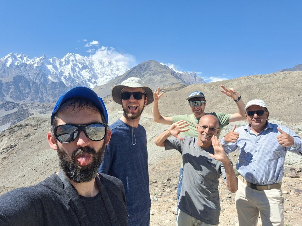
After breakfast we set off for Baltit Fort. Being interested in history, and especially military history, I was looking forward to this.
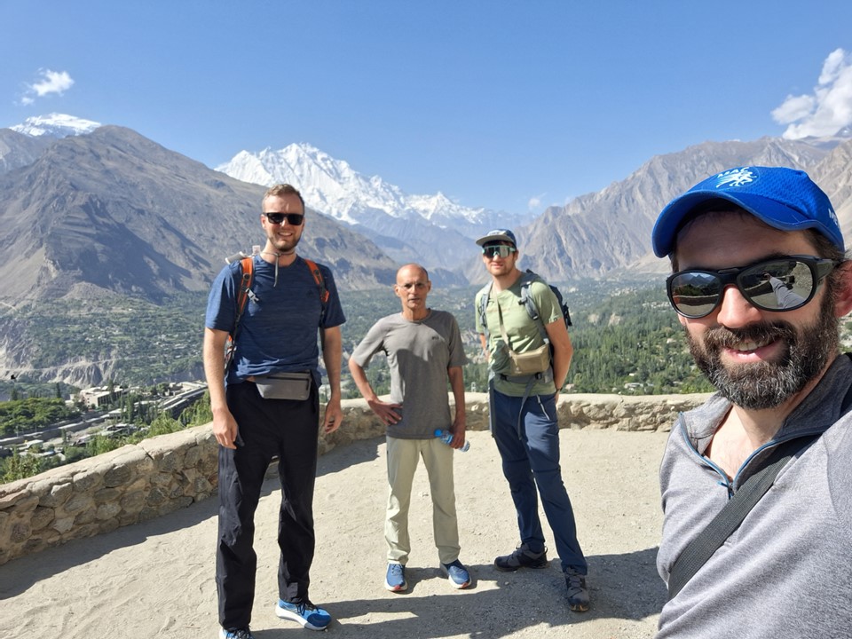
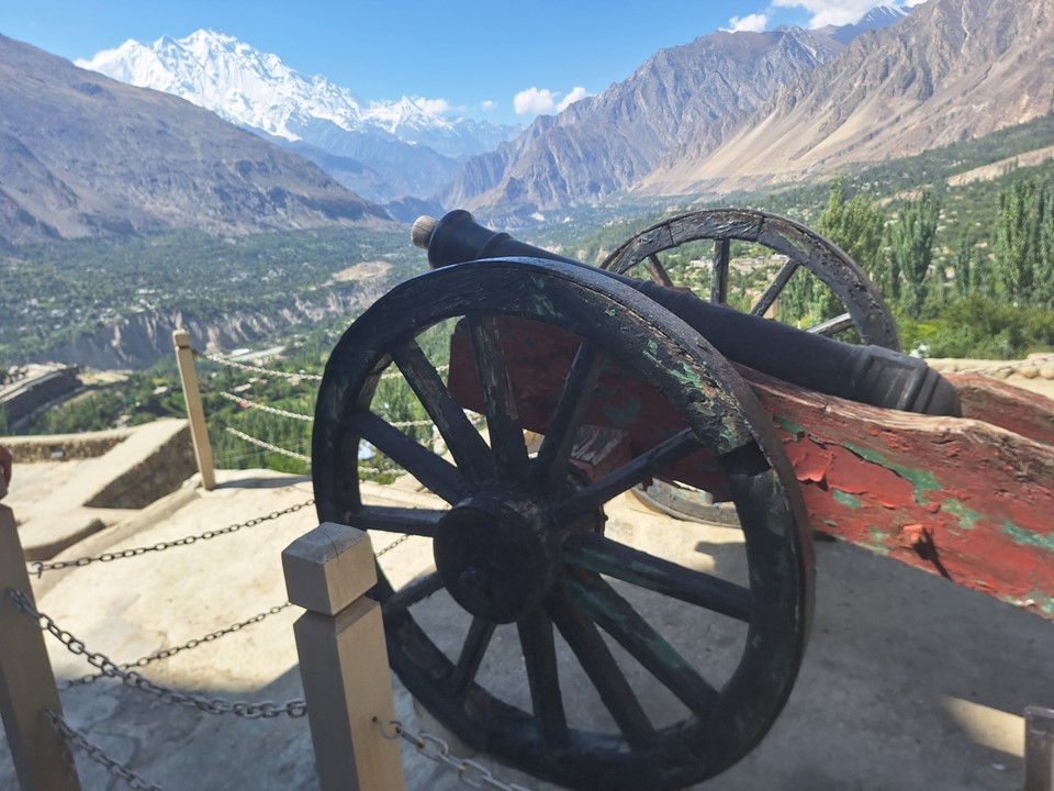
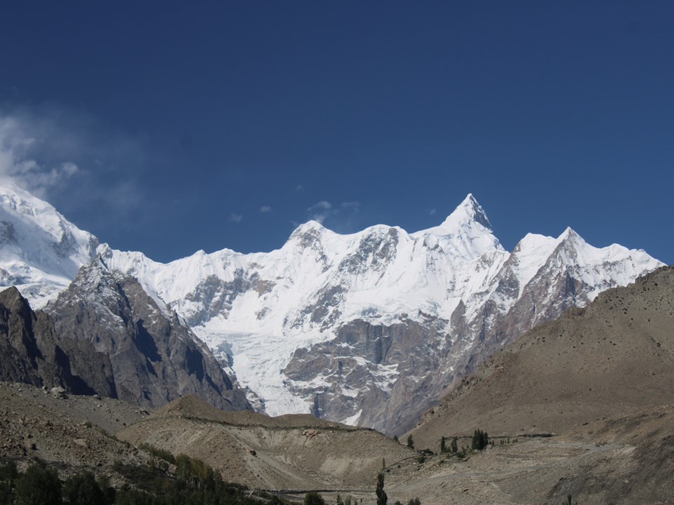
The views from the fort were great, this angle of Lady Finger was particularly interesting.

The tour of the fort covered some local military history. We visited the dungeon, the grain store etc. It can get very hot in Karimabad, so the walls were exceptionally thick for added insulation. There isn’t much to see, but if you are in the area, it is worth a visit.
The aspect of this day I found most interesting, however, was the irrigation system the town uses. Rather than trying to explain it, here’s a video:
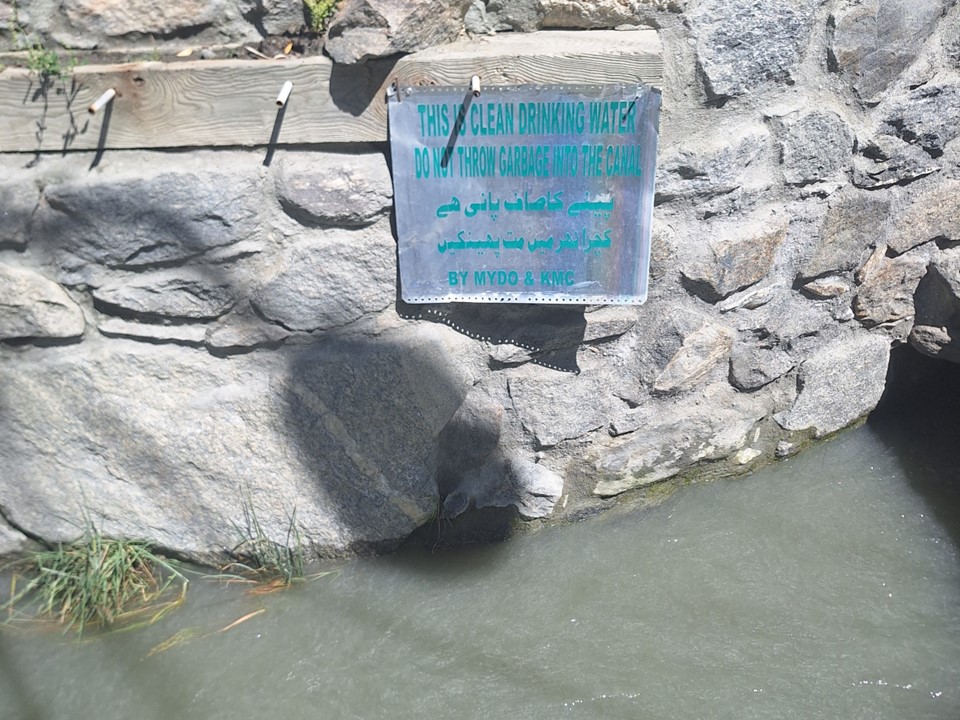
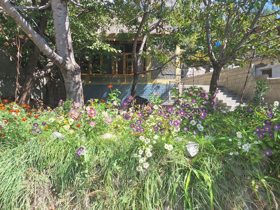
I was very impressed how green the town was!
We proceeded from there to our accommodation for the night, having been up since around 4am, I decided to take an afternoon nap.
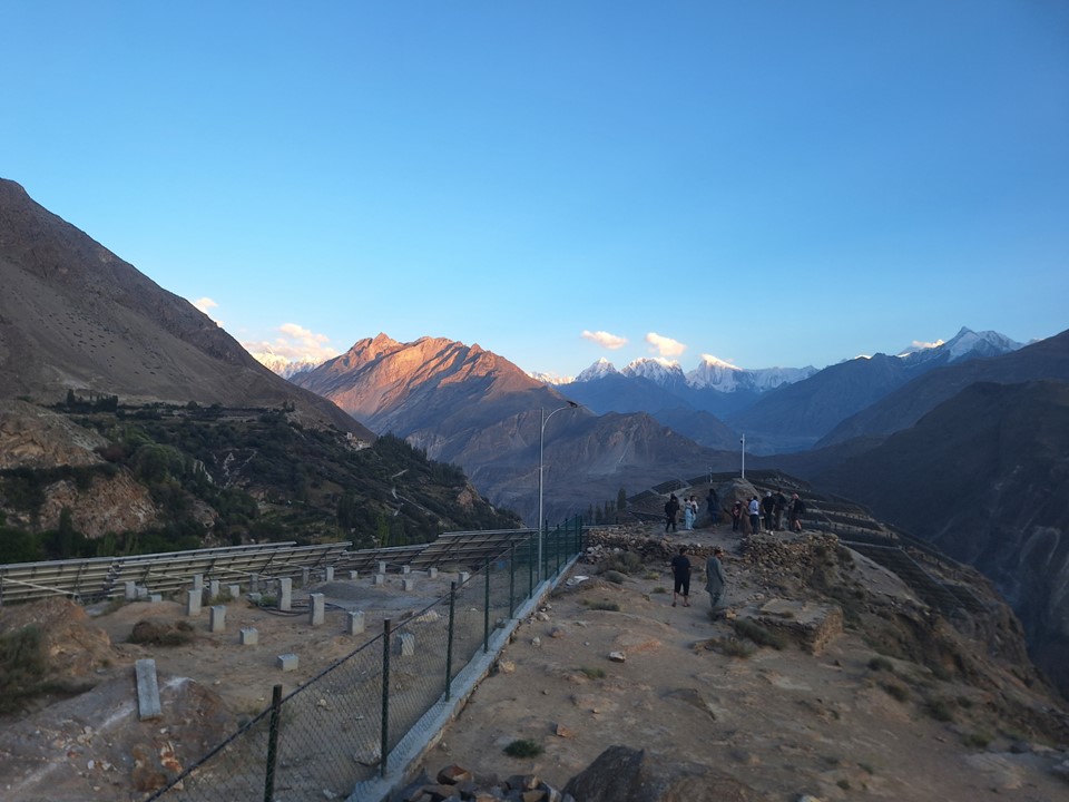
We watched the sunset from the lookout point just below the hotel. The views in this region are exceptional!
The following morning we set off north once more – this would be our last day traveling north.
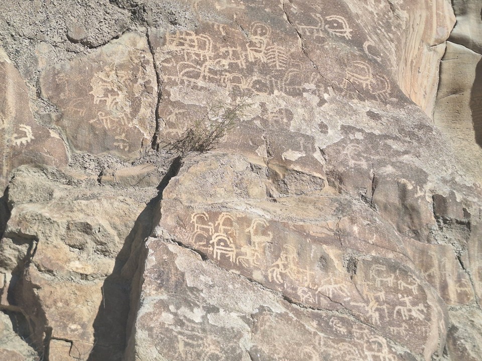
We stopped to see some more petroglyphs along the way.
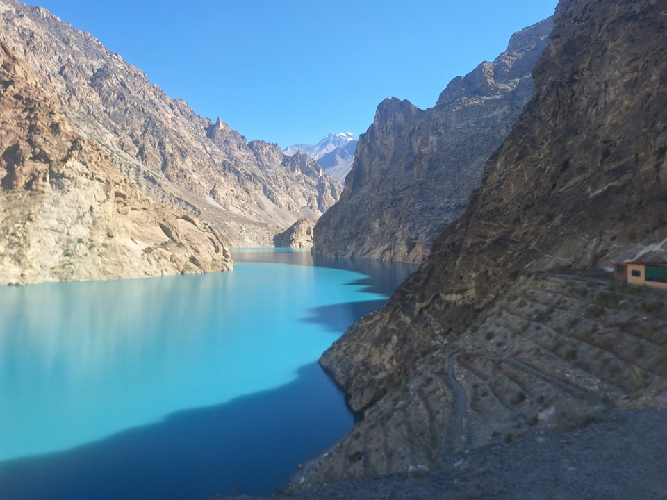
We also stopped at Attabad Lake – a lake that formed due to a landslide in 2010.
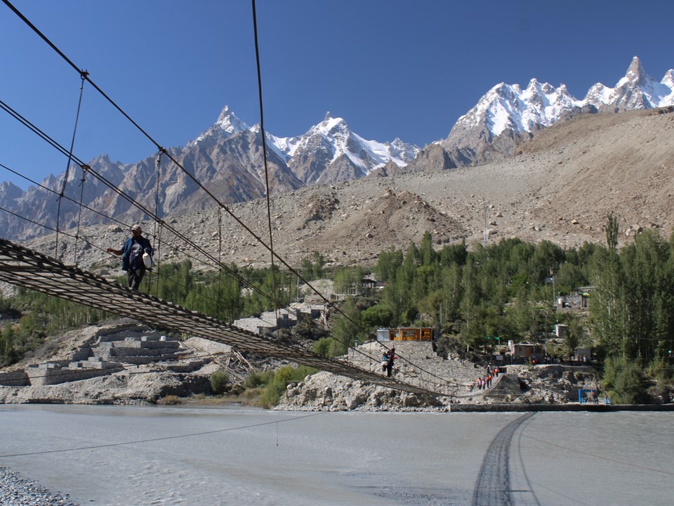
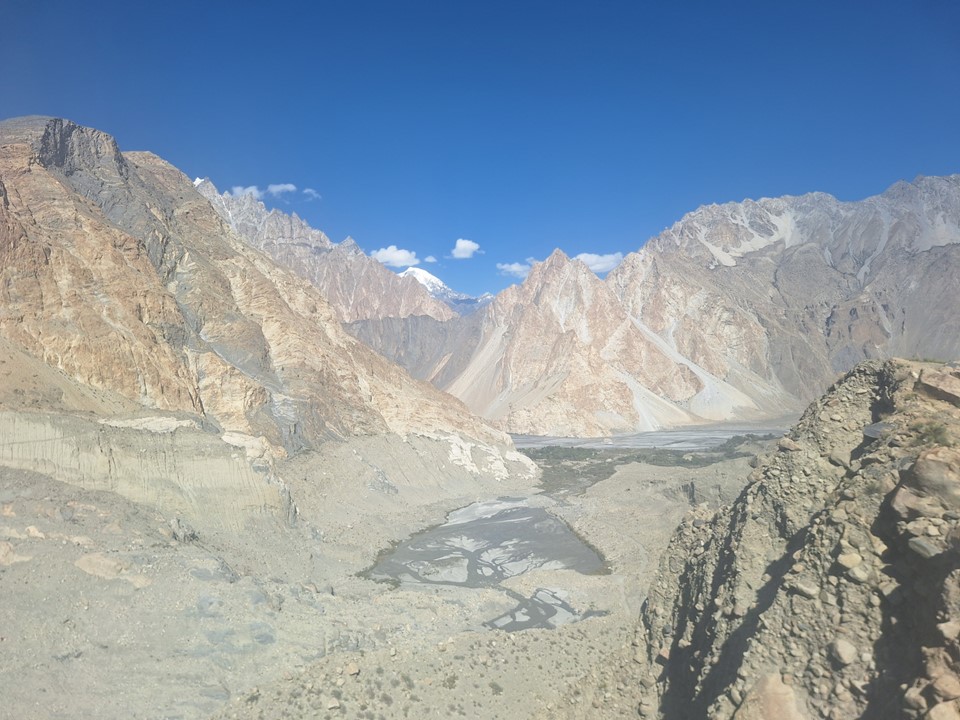
We continued along to a great viewpoint of the Passu Cones, the iconic rock formations usually seen in photos of the Karakoram Highway.
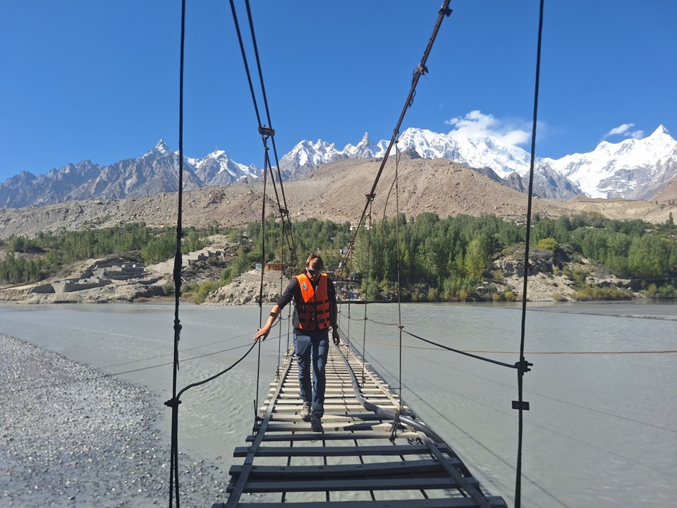
For reasons I’m still not entirely sure of, we then walked across the Hussaini Suspension Bridge and back. It wasn’t particularly high, but the planks are at an awkward distance apart – too close to do one at a time, but too far to skip every second one. I opted to film it – my GoPro hadn’t come out of my pack all trip, so this was a good excuse to use it – but the video is reasonably boring and won’t be shared here.

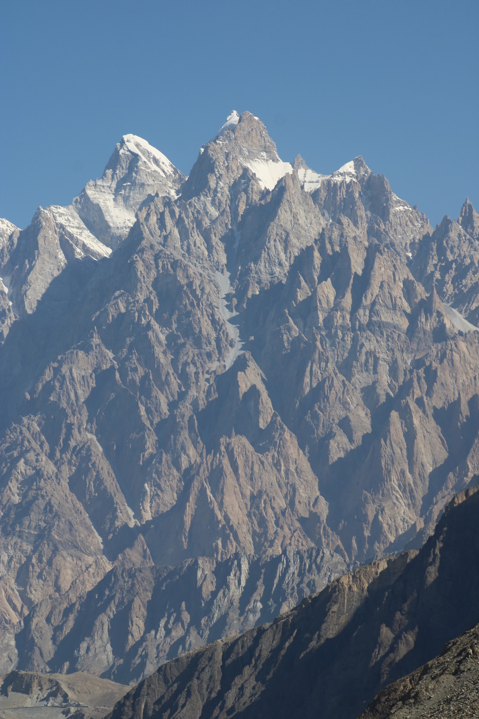
It was at this location, however, that I saw a sight that immediately captured my imagination. I often comment that the most beautiful mountains are usually 6000ers. Very few 7000ers or 8000ers look particularly interesting. Yes, there’s K2, G4 and Pumori – there will always be some exceptions, but even a 7000er as beautiful as Rakaposhi won’t compete with the likes of Ama Dablam or Cholatse. However, standing at 7611m was the 38th highest mountain on the planet, Shispare – one of the most beautiful mountains I’ve ever seen, and unquestionably the most beautiful peak I would see on this trip.
Shispare has had a few ascents, albeit not many. Being so far north, the glacier starts surprisingly far down the mountain. The mountain is both enormous and has a distinct pointy summit.
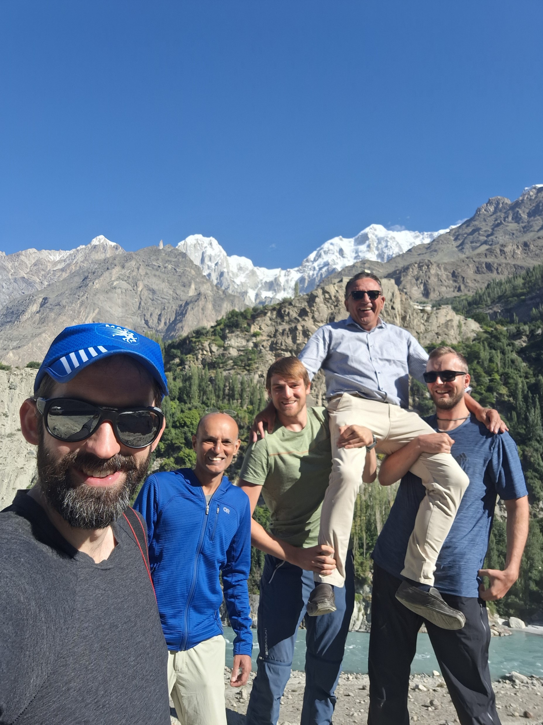
We continued up the valley. It was crazy to look at the map and realise we were right by the Afghan border, and actually surprisingly close to Tajikistan. Some groups continue right to the China Border, although we didn’t have time to go that far – which was about two hours further, so four hours round trip.

We had yak burgers at a place by the side of the road. I had tried yak burgers in Nepal previously and wasn’t impressed – but these were actually really good.
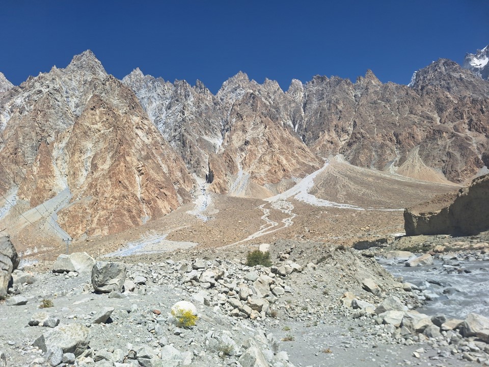

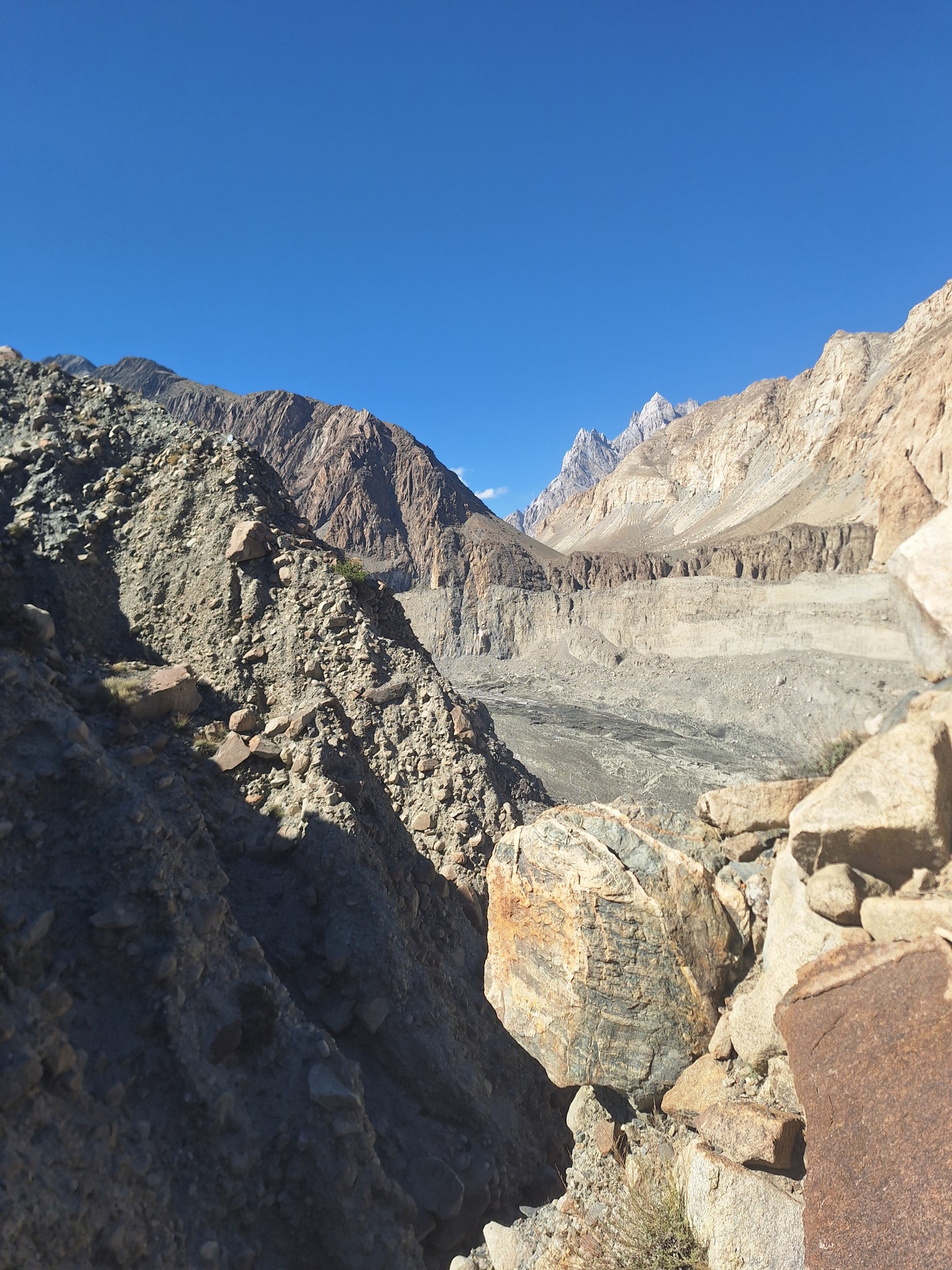
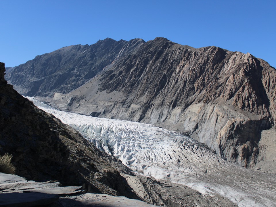
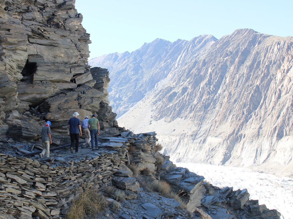
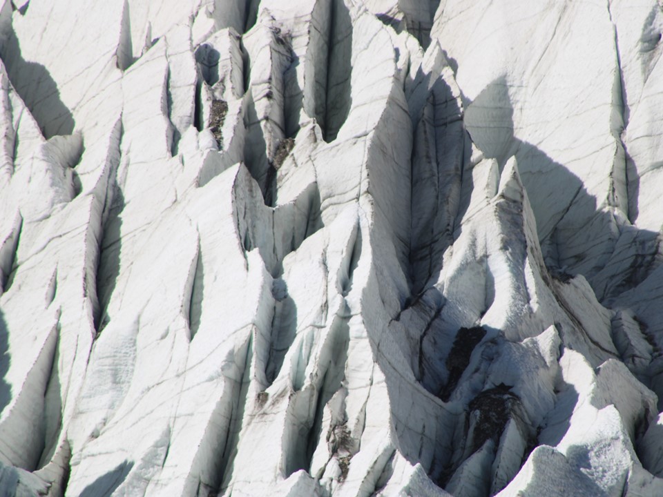
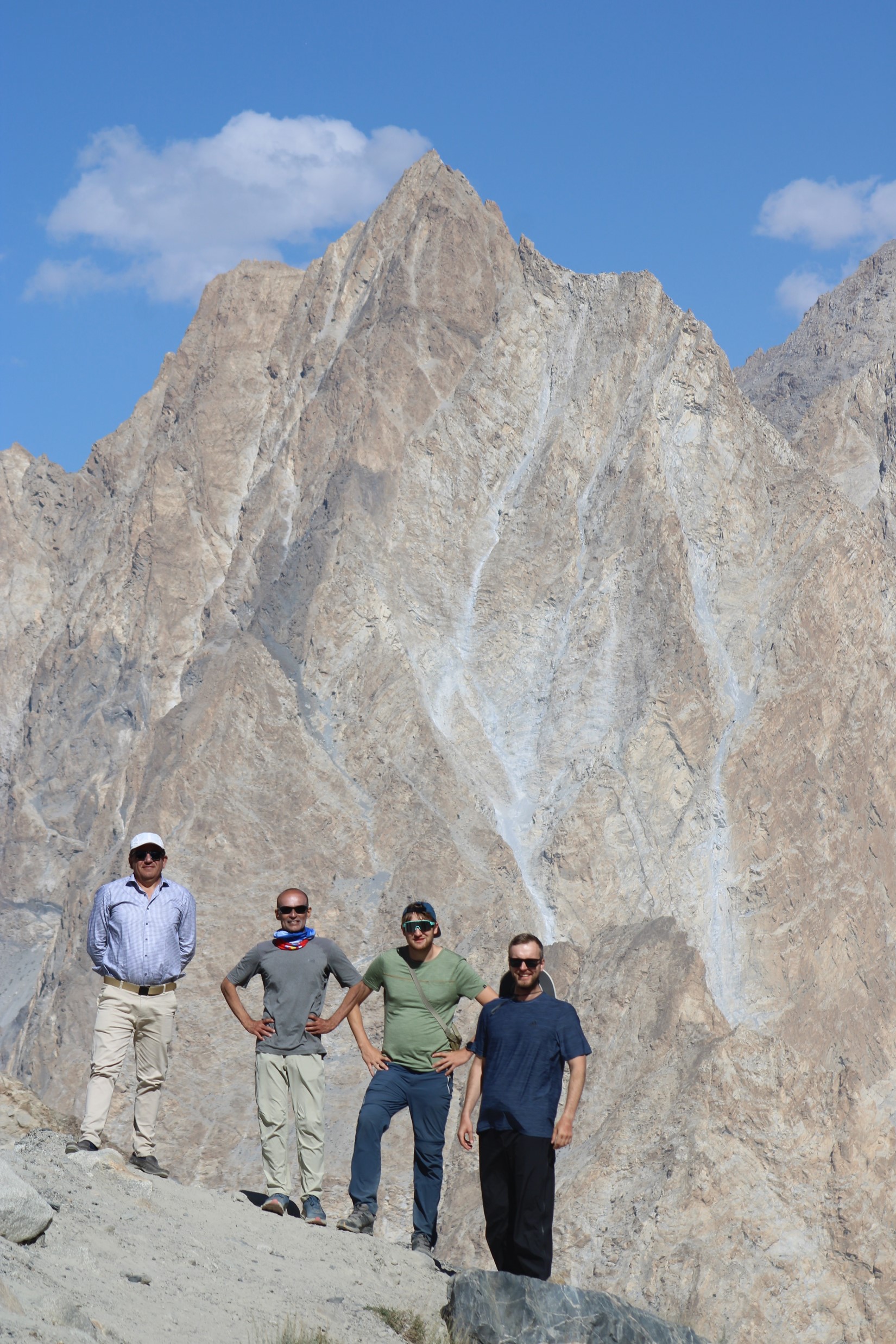
Having reached the northern end of our trip, we turned back south and made our way towards the Passu Glacier – our final hike for the trip. It was trivial in terms of difficulty, but was strange to see a glacier at such low elevation and so close to a highway.
We made our way from there back to our accommodation for the night. Sitting outside looking at the Passu Cones – I knew I was going to miss this place.
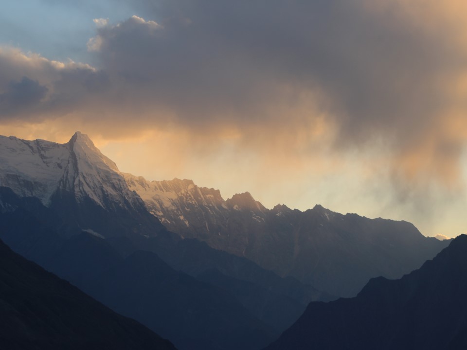
The following day we were up early – we had to drive most of the way back to Islamabad, but there was something I really wanted first: a sunrise photo of Shispare. Without realising that it would require a 20 minute drive in the wrong direction, we all agreed to start even earlier and head there for the sunrise. While we waited for the sun to show itself, I couldn’t help but feel guilty about the entire team having to wait around so I could get one last photo. Then the sun came up and my regret melted away.
I have since had the above photo printed on an A1 canvas and it is hanging in my lounge at the time of writing this. What a special mountain!
Moiez also had a photo he wanted – the iconic “look to your left” with Nanga Parbat in the background. We were pressed for time, so I had my large lens in place, and as soon as we got to the spot, I ran as far as I could to set up the shot. If I had more time, I’d actually use my smaller lens – Nanga is so big that I struggled to get Moiez and the mountain into the photo!

While Nanga Parbat’s scale is lost when viewed from Fairy Meadows, it is not lost from this far back – the size of the mountain is excessive. No photo will ever capture the scale, nor will a memory do it justice.
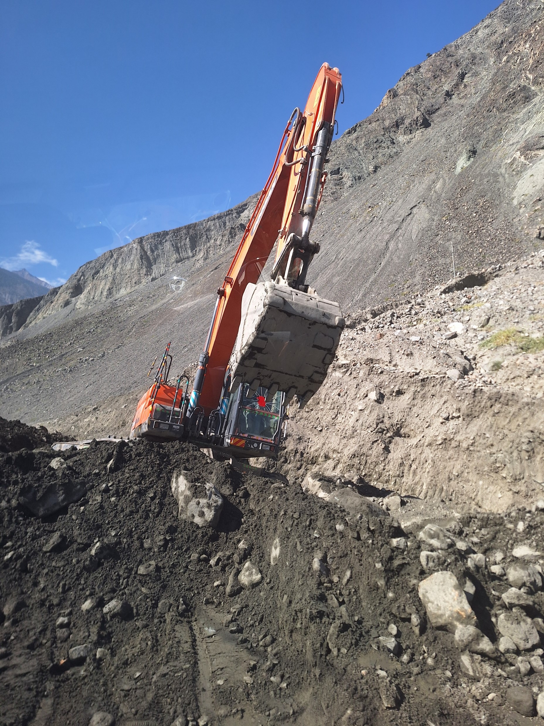
The reason we were so pressed for time was that the landslide we had encountered earlier on the trip was still being cleared. The road was open from 8 to 10 and then 12 to 2 – and if we arrived after 10am, we would have to wait for two hours before it reopened. Naturally if I knew this I would not have asked for the Shispare detour, but we got to the obstruction at 9:57, so we made it through before it was closed in any case.
As we made our way over Babusar Pass once more, it was sad to bid farewell to Gilgit-Baltistan, but I know I’ll be back some day. From the top of the pass I could see my mountain once again – maybe some day I’ll manage to get access and return to ascend that pointy peak that somehow isn’t even a 5000er.
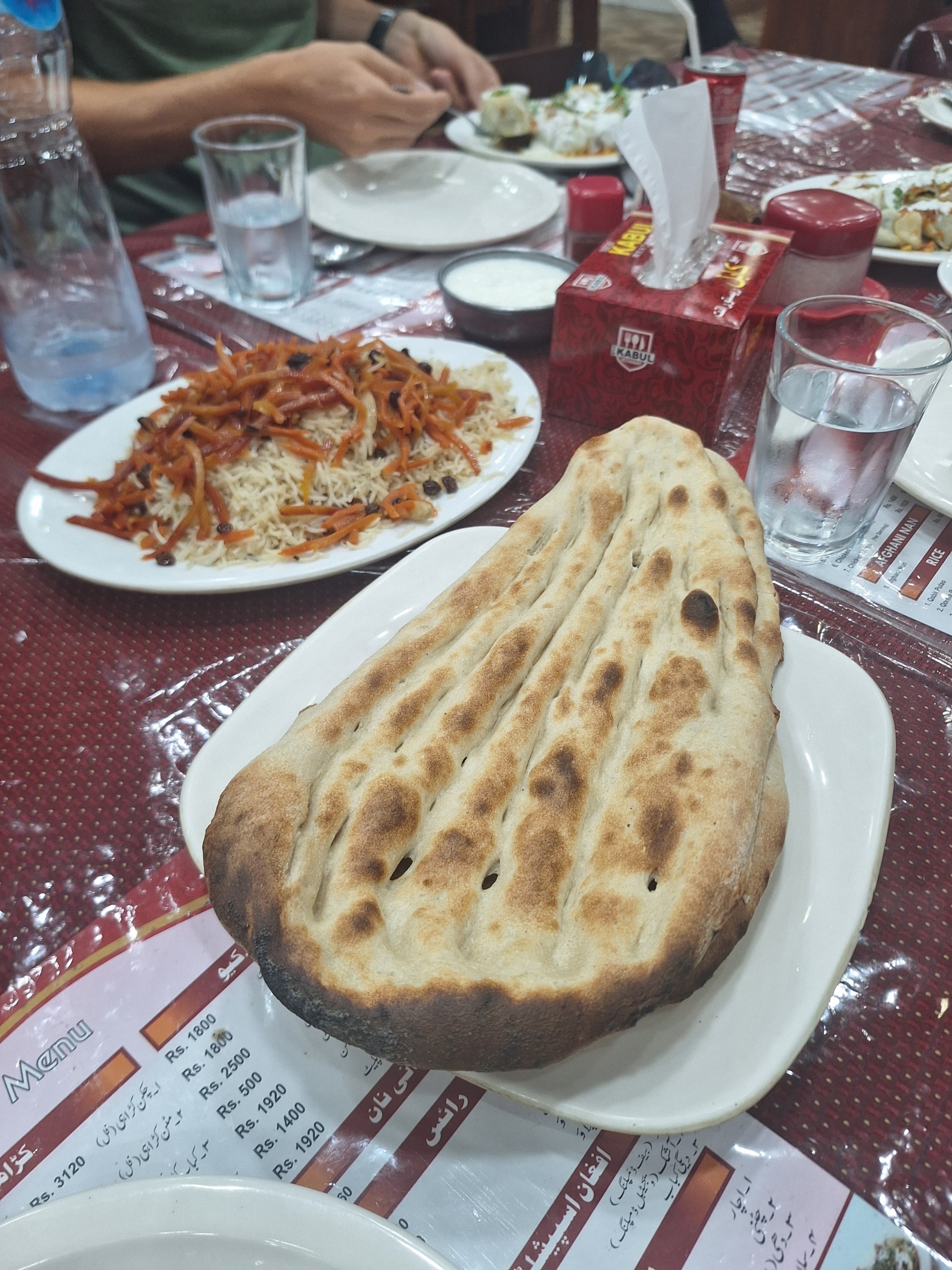
Our final day of travel back was largely uneventful. We went for Afghan food, which was really good, before heading back to our rooms.
My flight was at 3am, so I said farewell to everyone and tried to get some sleep. Moiez had a slightly later flight, so we went to the airport together.
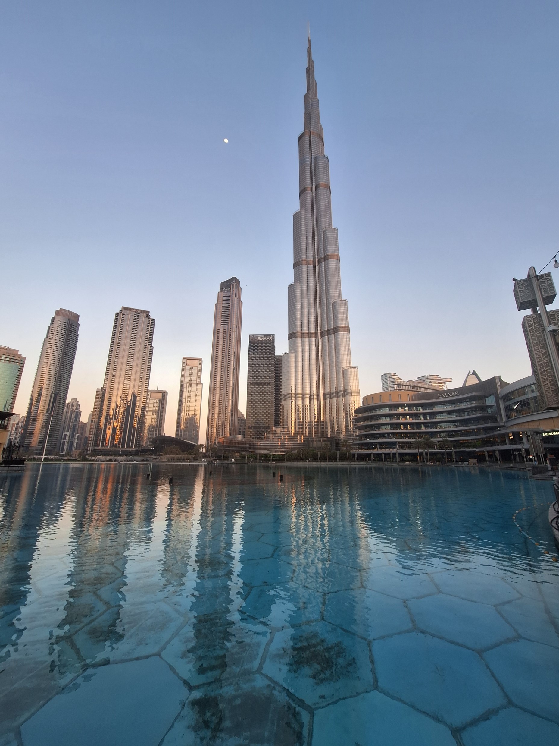
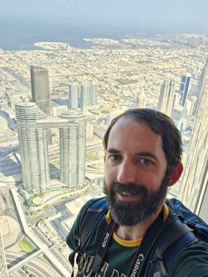
I had an 8 hour layover in Dubai on the way back, so I caught a taxi to the Burj Khalifa. I spent some time enjoying the view from the 125th floor, which is 456m up. I didn’t really have anything else I wanted to do in Dubai – everything is very expensive there, and I had already taken photos and seen all the classic highlights of the city.
While I was waiting to head back down, I had a friendly chat with the elevator operator, who proceeded to give me a voucher for a free coffee at the bottom.
I walked around the mall below the tower for a bit, I was hoping to find some new running shoes – but alas, no such luck with the shoes I was looking for. I had an overpriced ice cream that wasn’t as good as I had hoped. I really wanted a proper local shawarma, and while I could find food from basically any other country – even Bulgaria – I couldn’t find proper local food. I probably should have made an effort to get to some run down shoddy looking place where actual locals eat, but it was too hot and I decided to make my way back to the airport.
I had plenty of time, so I opted to use the train to get back. The flight home went well, and soon I was back in my own bed, ready for work the next morning.
My thoughts on Pakistan:
- Firstly with regards to safety – at no point on this trip did I feel unsafe. There were armed soldiers with large guns all over the place, but they were always polite and had a smile on their faces. Even the airport officials were friendly and welcoming.
- The people – Pakistan has a reputation for friendly and welcoming people, and my experience was that this is in fact true. When we encountered other hikers on routes, they would often be invited to join for tea even though they weren’t part of the group. Strangers were always friendly too.
- The food – I didn’t get as adventurous with food as I probably should have. The best meal of the trip was actually the Afghan food in Islamabad on the last night. In general, the food I had was very similar to the kinds of curries I would have in KwaZulu Natal, so it is the type of food I know and enjoy. The food was generally great.
- Our tour company – Hunza Guides was great. They were organised, they communicated well, and when there was an unexpected medical issue with our initial guide, they found another high quality guide at short notice. Just a note, though, the prices quoted on their website are for very large groups and the dates on the website are hypothetical. You can customise the trip as required, change dates etc, but unless you are traveling as a large group, the price will be higher than what is quoted on the website.
- The tour – most of the tour was great, although some parts were a bit arbitrary, such as the market in Rawalpindi and the Hussaini Suspension Bridge. Overall it was a great trip, though. We had a significant variety of scenery, varied accommodation and it was well paced.
- Our guide – Momin was great, his knowledge of history, culture and the local mountains was phenomenal. I’d absolutely recommend him.
- Highlight of the trip – definitely Rakaphoshi Basecamp.
Another question people will likely ask is whether they should go to Nepal or Pakistan. Naturally the ideal answer is both. But if that isn’t an option, these are my thoughts:
- Cost: my Three Passes Circuit Trek (unguided) in 2022 and my 2024 Pakistan trip (fully guided) cost about the same, so Pakistan is the cheaper of the two.
- Crowds: Pakistan was a lot less crowded than the busier routes I did in Nepal, but this isn’t necessarily a fair comparison – Rakaposhi Basecamp isn’t a particularly popular route, and I basically had Cho La Pass in Nepal to myself, so it really depends where one goes in each country.
- The scale of the mountains in Pakistan is generally larger – you stand at 2000m and look at a peak like Rakaposhi at 7788m, but contrast to seeing Everest at 8848m from around 3600m outside Namche. Then again – you can see Annapurna II at 7937 from below 1000m in Pokhara, so it once again depends on where one is heading.
- Terrain: Nepal is prettier, with plenty of greenery lower down, in addition to more animals and monasteries, which make for great photos. This region of Pakistan is generally desert.
- Glaciers: in Nepal you’ll rarely see a glacier below 5000m, but in Pakistan they go below 3000m.
- Culture and history: both have great culture, but Pakistan has the longer recorded history – especially with the old Silk Road.
- Food: I’m going to give this one to Pakistan. I enjoy the food of Nepal, especially the curried vegetables included with dal bhat, but overall Pakistan is more to my personal preferences.
- Access: you can see many of the highest mountains in Pakistan from a road (not counting K2 and the likes), whereas one has to hike a fair distance in Nepal to see most of the major peaks. Pakistan also has considerably better quality roads.
- Overall it is hard to pick a winner – one could argue I haven’t seen enough of either country to pick a fair winner. I need to visit the Boltoro and see the monsters that are K2, Broad Peak and the Gasherbrums – not to mention the legendary Trango Towers. This tour was very different to, say, the Three Passes Circuit in the Everest Region – with considerably less hiking, no time at altitude and much easier access, so a direct comparison isn’t really fair. But if I had to decide between redoing the Three Passes Circuit or this tour, I’d head back to the Everest Region.

Very interesting read. Thank you. Re water, I spent a year in Morocco way back and one of the side bar trips was to a small fertile valley in the Atlas Mountains, where similarly an intricate, centuries old system of aqueducts was in daily use. This bread basket supplied a significant number of communities.