If you ask ten people who are knowledgeable about the greater ranges what their favourite 8000er is, most will give you the same answer: K2. But if they had to provide a second answer, Nanga Parbat would likely be the most common response.
I first learned about the existence of Nanga Parbat in my early hiking days. I came across Messner’s book Naked Mountain, which remains one of my favourite mountaineering books, and covers the first ascent of the Rupal Face of Nanga Parbat in 1970, the highest mountain face on the planet. Many years later, I would read Steve House’s Beyond The Mountain, about the second ascent of the Rupal Face of Nanga Parbat – in 2007. These two books document the only successful ascents this face has ever seen. Needless to say, I knew I had to see this mighty mountain.
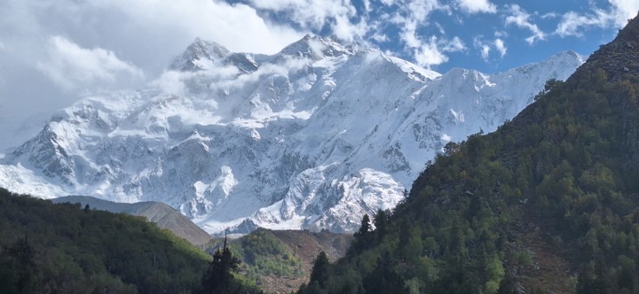
At 8126m, Nanga Parbat is the ninth highest mountain on earth. This name means “the naked mountain”, referencing how many avalanches occur on its flanks. I personally prefer one of its other local names – Diamer, which means “the king of mountains”.
Nanga Parbat is often referred to as The Killer Mountain, mostly due to the fact that 31 people died trying to climb it, before Hermann Buhl stood alone on its summit on 3 July 1953. It was the first 8000er to be summitted by a solo climber, and also the first without bottled oxygen. To say that Hermann Buhl was a mountaineering legend is an understatement!
The likely reason for so many fatalities on this mountain prior to the first ascent is that Nanga Parbat is a bit of an anomaly – unlike the other 8000ers that are very remote and surrounded by other large mountains, Nanga stands far away from the main range and is not surrounded by large mountains. It is possibly the easiest 8000er to reach. Conversely, it rises very steeply from the surrounding terrain, with the elevation differential on the south (Rupal Face) side being the largest elevation differential anywhere on the planet over a 25km distance, at approximately 7000m.

So in early September 2024, I found myself boarding an Emirates Airbus A380 to Dubai, and then on to Islamabad – the capital of Pakistan. I had wanted to fly on an A380 for many years, and by picking a slightly less efficient flight, I was able to finally tick this box. Considering the reputation for an A380 to barely feel turbulence, it was actually one of the most turbulent flights I’ve ever been on. Nonetheless, we safely arrived in Dubai, and after three hours, I was on a B777 to Islamabad.

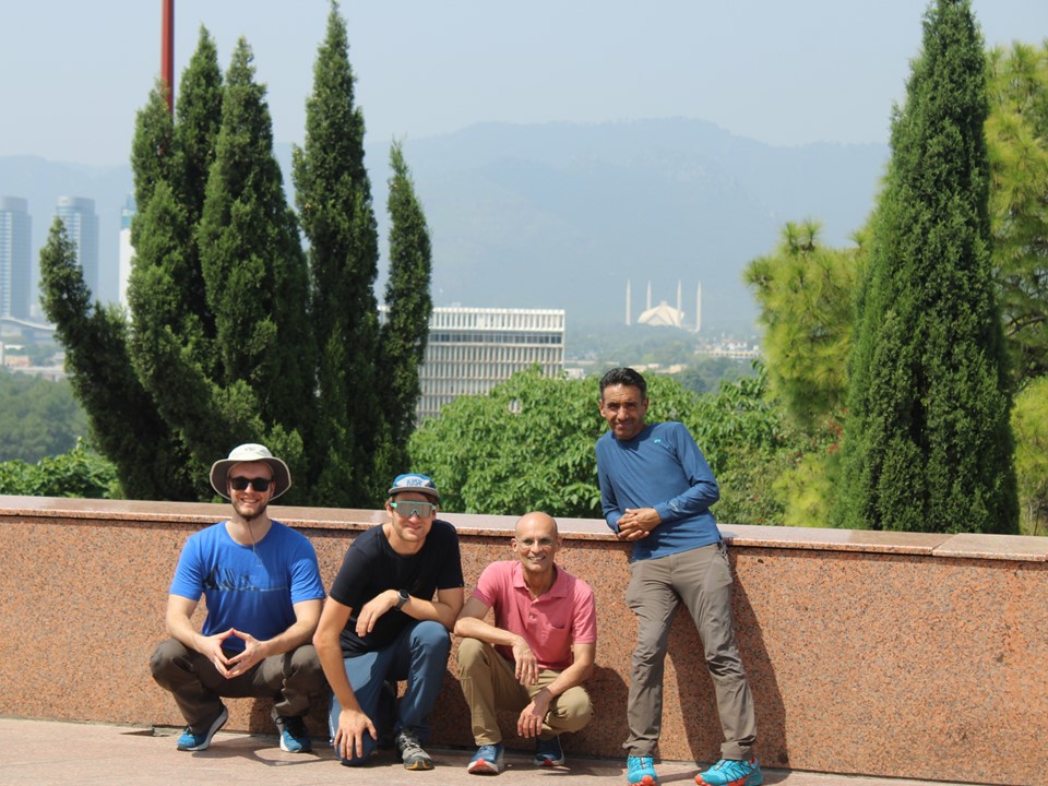
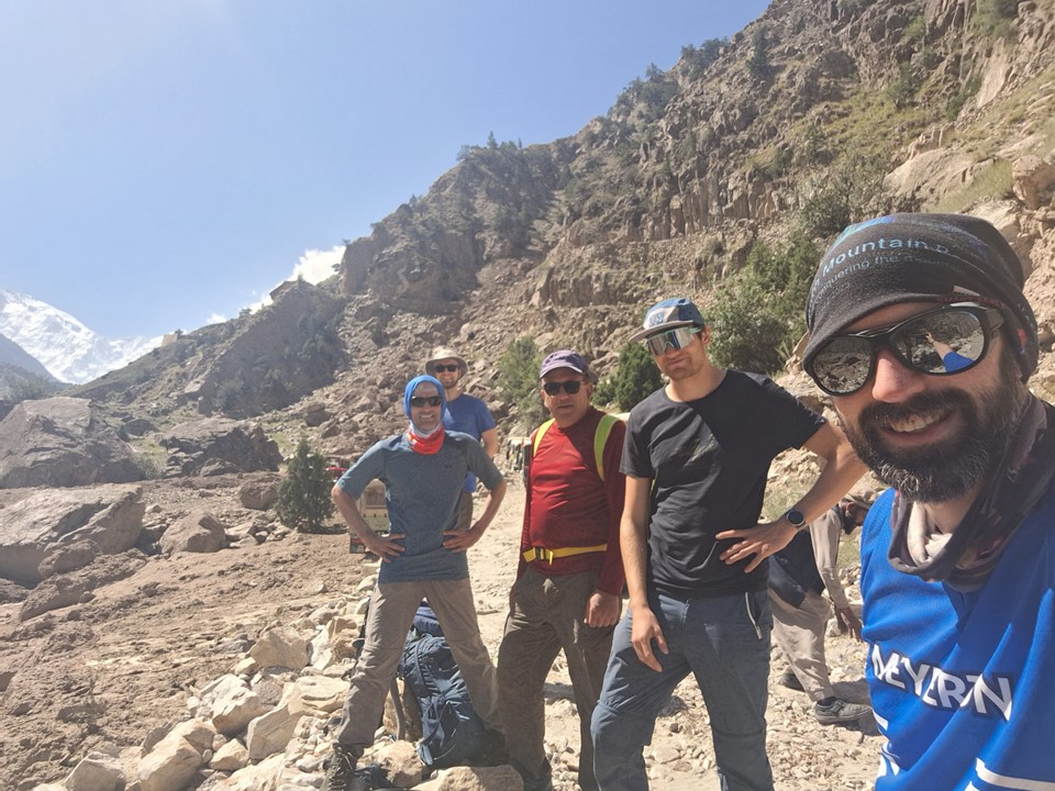
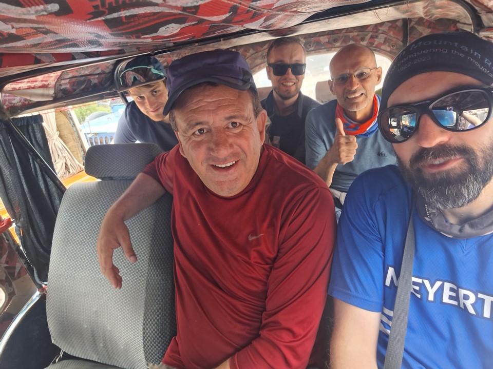
L-R: myself, Moiez, Murtaza, Julian and Sven, outside Faisal Mosque in Islamabad.
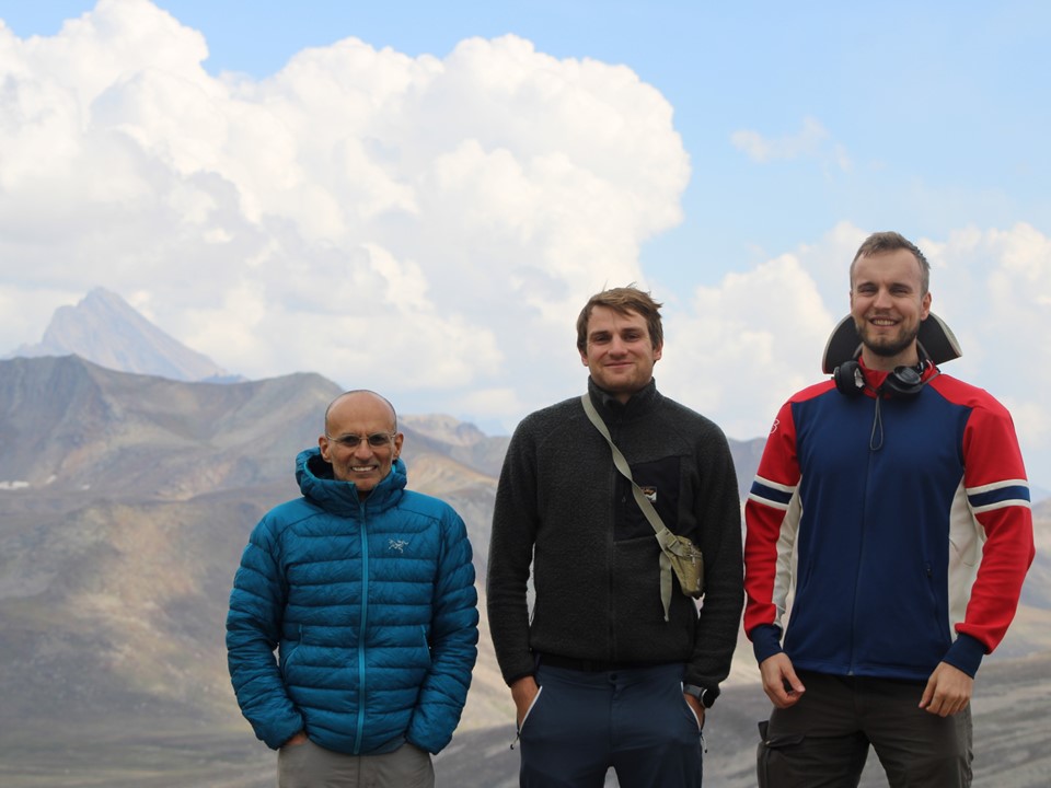
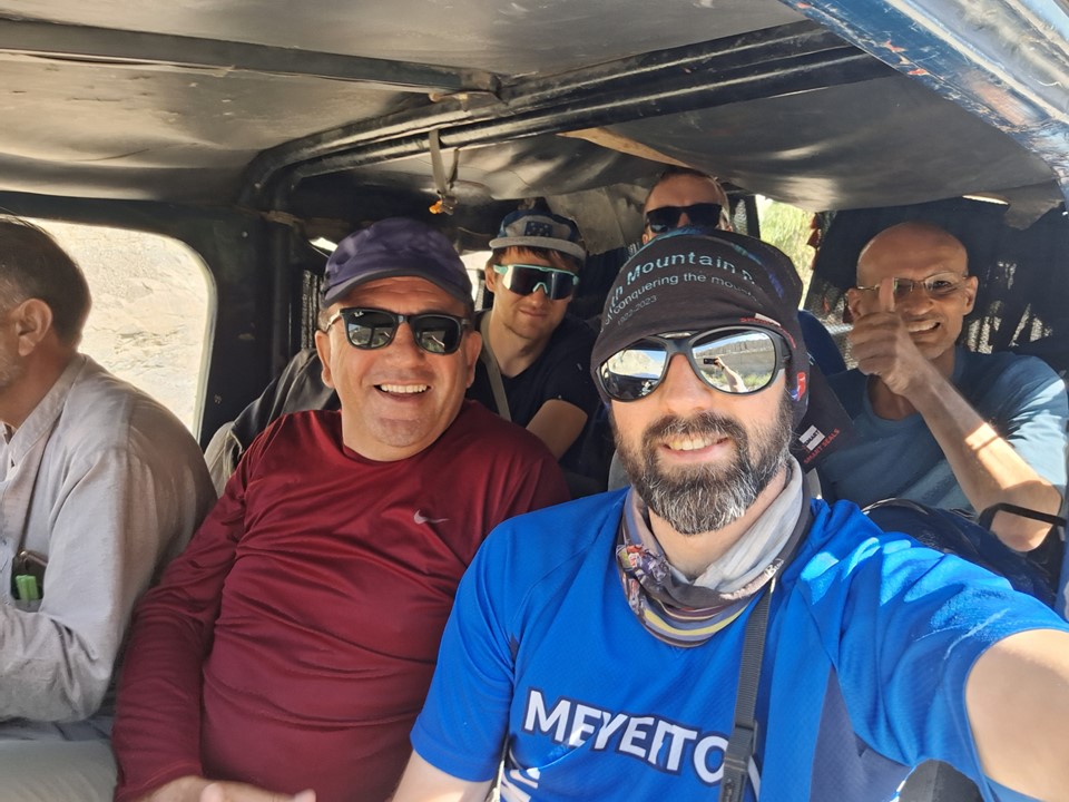
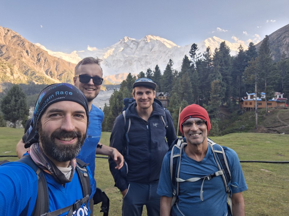
My flight times had made sleep difficult, and arriving in Islamabad, all I wanted was a shower and a nap. Murtaza, our guide from the company Hunza Guides, met me at the airport, and we proceeded to our hotel. Unfortunately my room wasn’t ready – but Julian and Sven allowed me to use the shower in their room. I was the last of our team of four to arrive, so I met the others over breakfast. I wasn’t very hungry, and wasn’t generally in the best mood, but I could tell immediately that I would get on with the team.
Julian and Sven have been friends for many years, both coming from Germany. Moiez lives in America, but is originally from Pakistan – it was his first time back after 25 years. We had all signed up for the same tour, but had not been in contact before arriving in Islamabad.
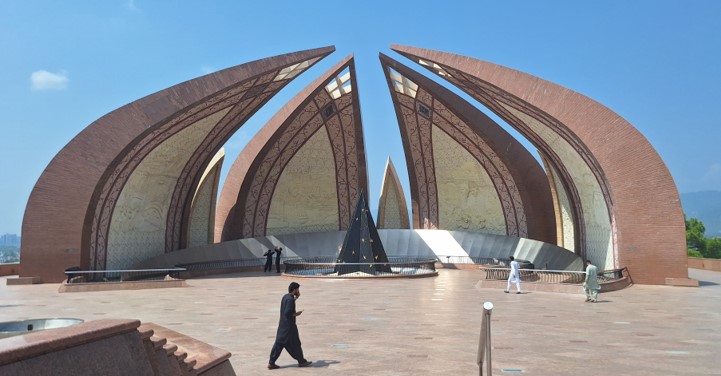
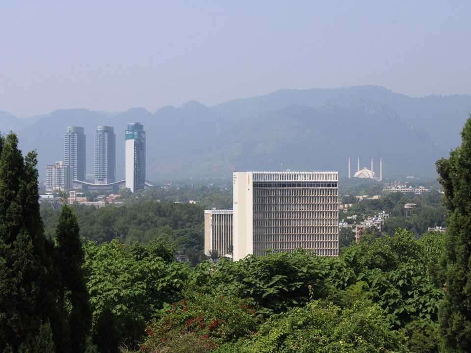
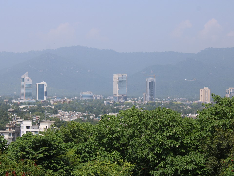
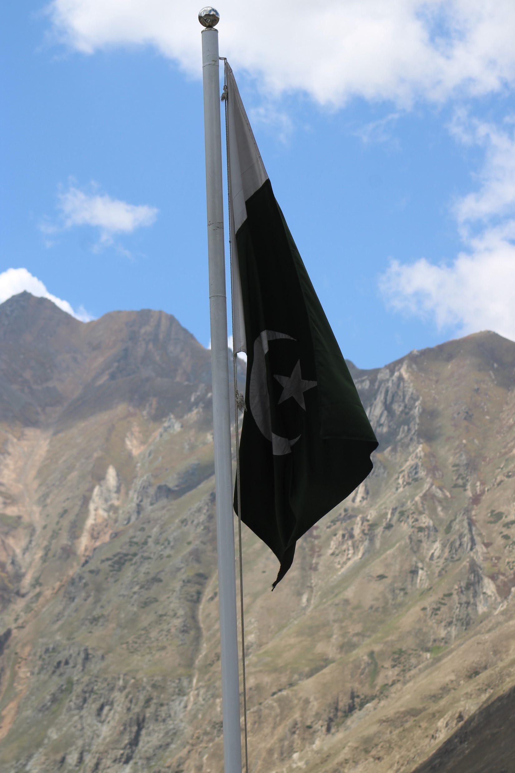
After getting a shower – and somehow losing my sunglasses – we went off on a tour around Islamabad. We started by visiting Faisal Mosque, then the Pakistan Monument and a walk around the Rawalpindi market. We had lunch at a place in Rawalpindi – as someone who has lived in KZN for many years, Pakistani food feels very familiar to me.
We arrived back at the hotel, and I got a nap before we went out for some Afghan food. I was not feeling particularly hungry – still exhausted from not getting any sleep the previous night, and aware that we had an early start in the morning. I actually can’t remember what I ate.
During the night we had all received a text that unfortunately Murtaza had been admitted to hospital. Momin would take his place. Murtaza did fortunately recover reasonably quickly, although we would not see him again – we have remained in contact over whatsapp, though.
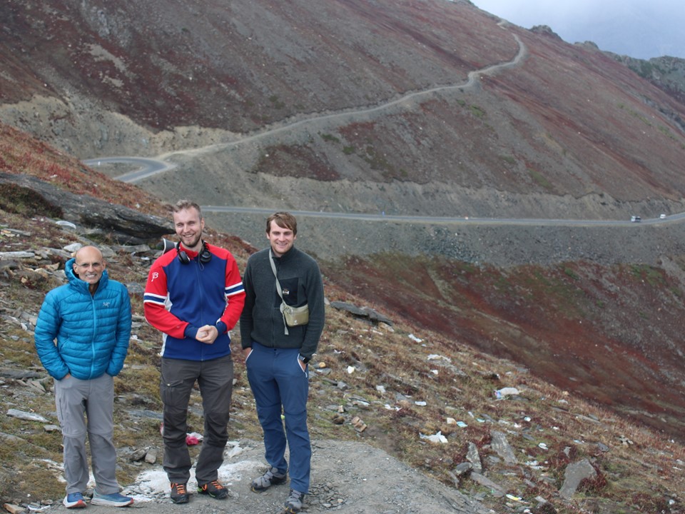
After a long drive through some interesting terrain, we stopped for lunch at the bottom of Babusar Pass. Unlike my previous trips, I hadn’t acclimatised at all before this one. At about 4150m, Babusar Pass would be our highest elevation for the trip, so I was curious how I would find this without any acclimatisation. We would be driving, not hiking, so I wasn’t too worried.
Babusar Pass is a tar road the entire way. Near the top one crosses the river that is the border of the Administrative Region of Gilgit Baltistan, the region of Pakistan where our two week trip would take place. They say on a clear day one can see Nanga Parbat from a spot on this pass, although we didn’t see it on the way out or the way back.

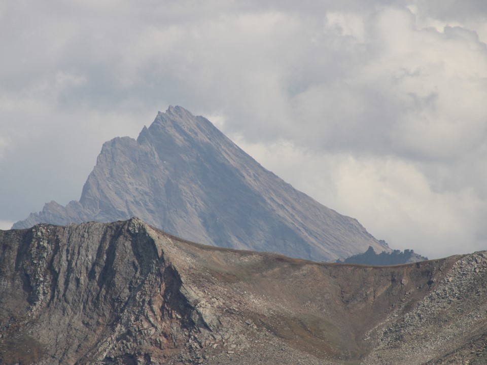
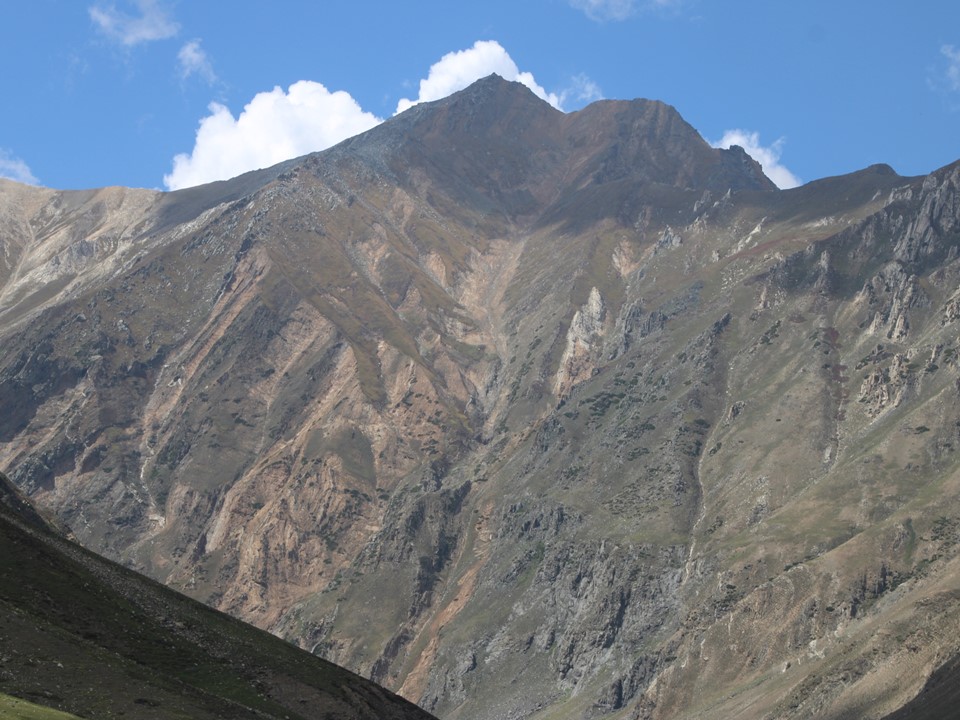
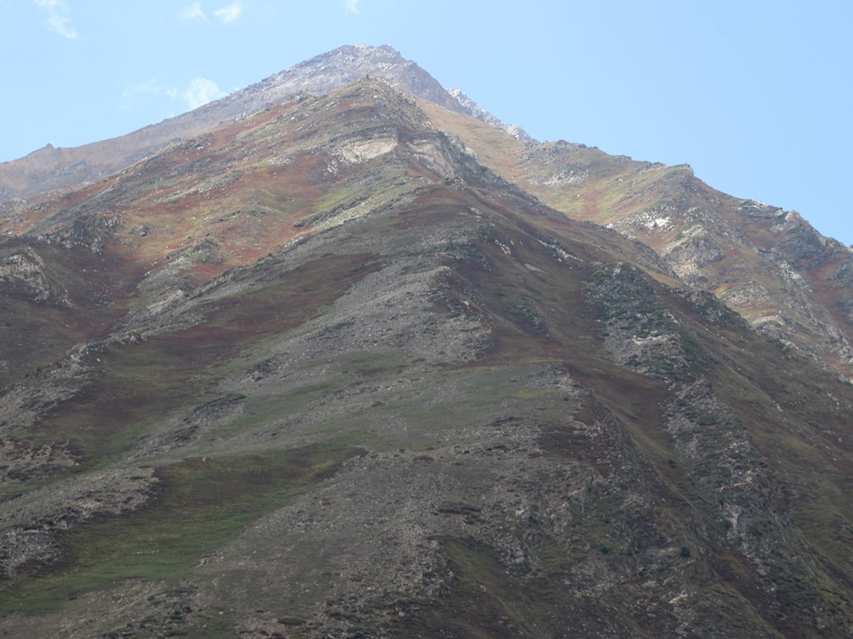
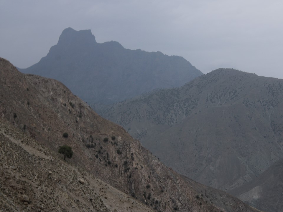
From the top of the pass, there was a really impressive peak visible in the distance. Momin confirmed that it is nothing of note – in Pakistan anything under 7000m is considered a hill. He jokingly called it “Jonathan’s Hill” – naturally there’s a temptation to return and climb it. Based on some research subsequent to the trip, I have found it is approximately 4850m, with over 500m topographic prominence, and thus a mountain by most definitions. I can’t find a name for it, or any indication as to whether or not it has been climbed. It is in the disputed region of Kashmir, so access could be tricky – but given infinite time and resources, I would absolutely return to Pakistan and climb it.
Incidentally, outside Momin’s home town of Shimshar there’s a hill called “Sonja’s Hill”, which was named after a hiker who visited the region and wanted to climb this hill. The name is officially recorded on local maps, although history seems to have forgotten who this Sonja actually was. Notably “Ghaznavid Hill” would be more fitting for this one, especially since this peak did once fall into the boundaries of the Ghaznavid Empire.
The drive down the north side of Babusar Pass was steep, and included a lot of police officers pulling over cars to ensure their brakes aren’t overheating. Apparently a lot of drivers have died on this pass due to brake failure, so this measure makes sense.
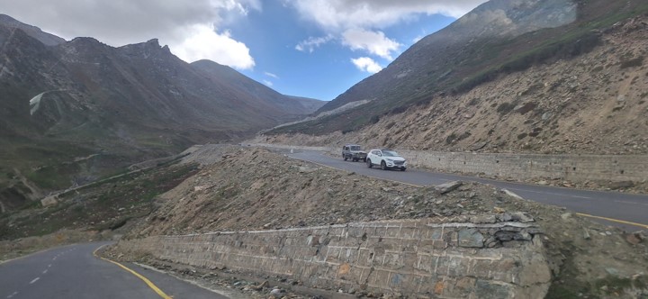
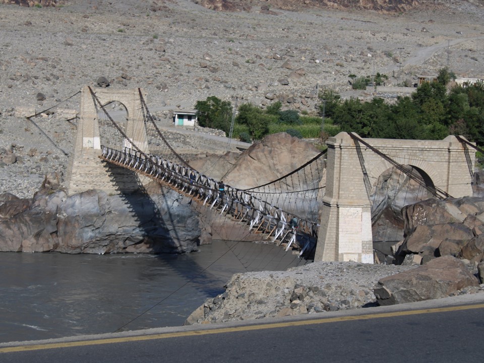
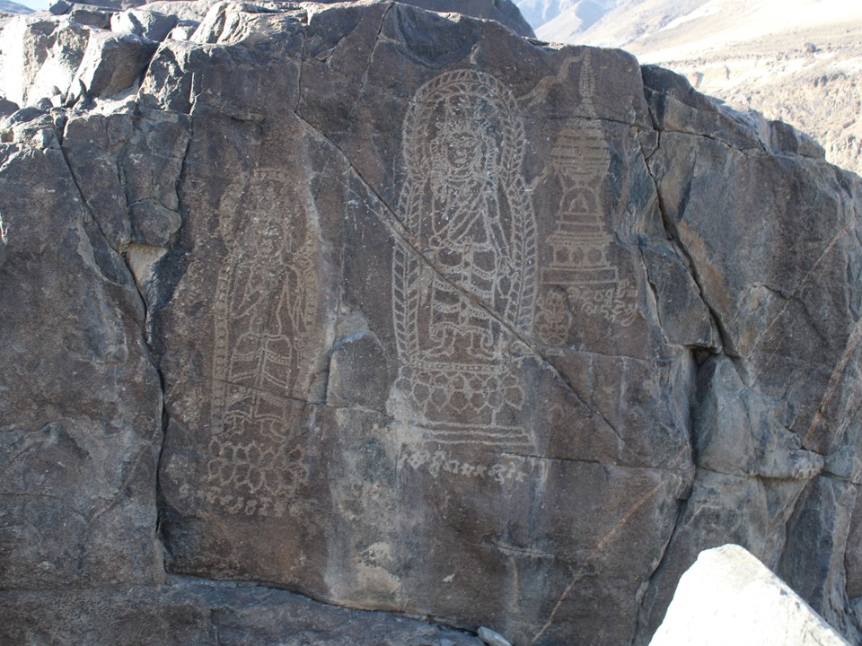
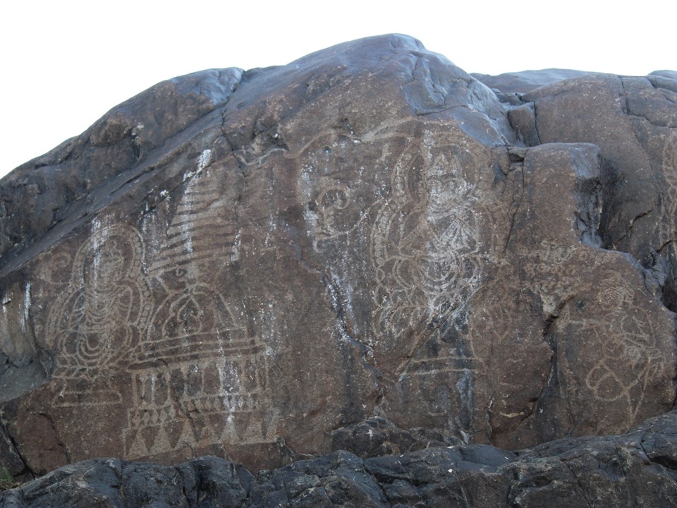
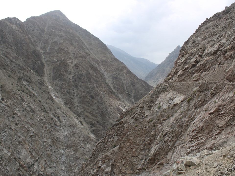
We soon found ourselves back at around 1000m in elevation on the Karakorum Highway, aka the KKH. This massive ridge that drops off so steeply on both sides is really something. It was also great to see the legendary Indus River, home to some of the oldest signs of humans organising into formal society. We were now also on the old Silk Road – we even saw some rock carvings dating back around 2000 years. The amount of history in this part of the world is notable.
We spent the night in Chilas, a small town on the Indus River. It was very hot and the mosquitoes were rather annoying. We walked around a bit, and ended up playing uno for a bit. Incidentally the uno cards wouldn’t come out again for the rest of the trip.
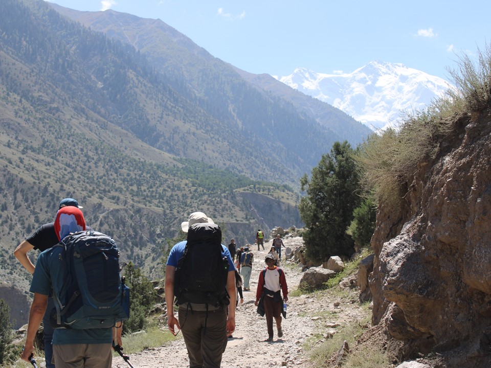
The following morning we set off on the KKH for Rakhoit Bridge, from where we would start up to Fairy Meadows and Nanga Parbat Basecamp.
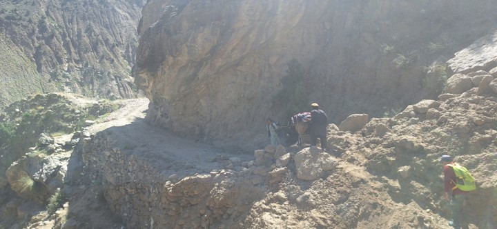
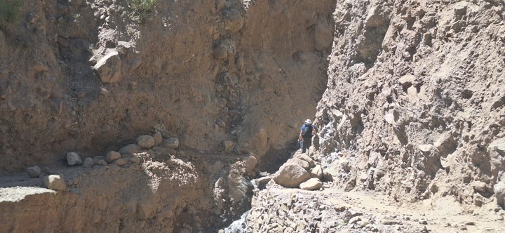
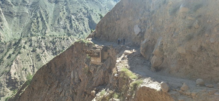
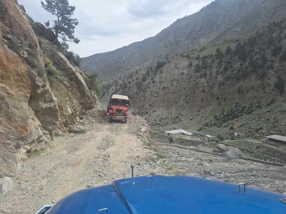
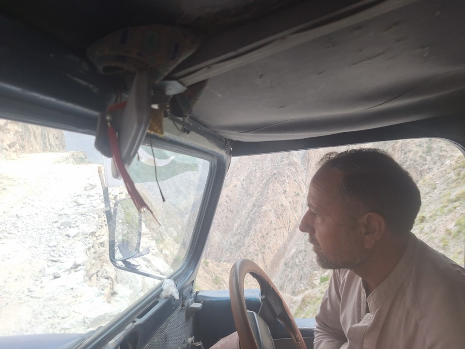
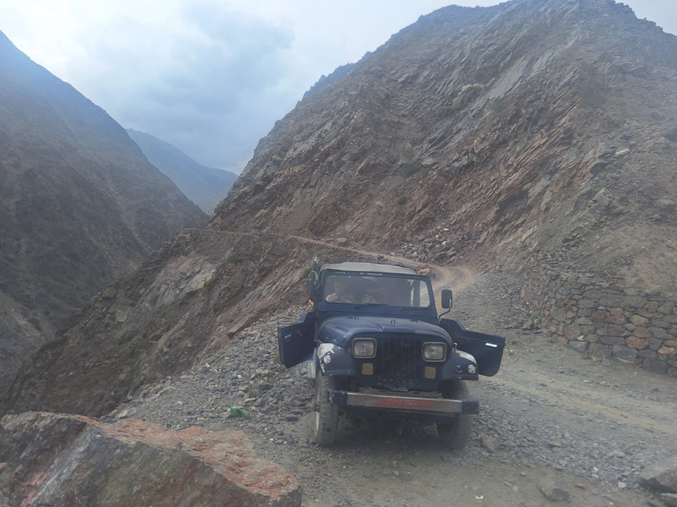
We got a jeep from Rakhoit Bridge, the road to Fairy Meadows is rather sketchy in places. The following video is from the way down.
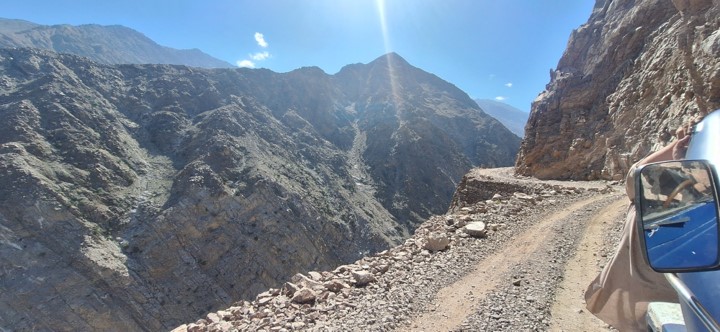

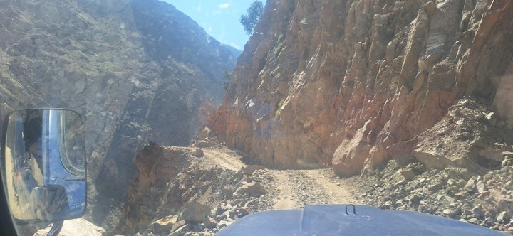
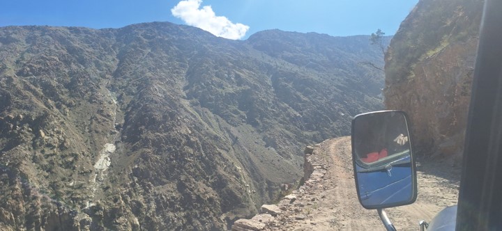
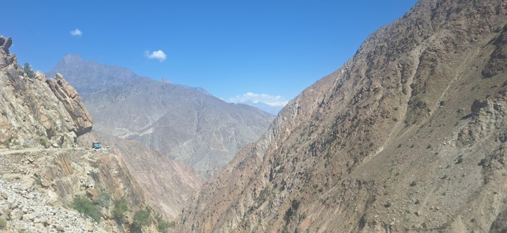
To be honest – the road does feel dangerous. The reality is that any incident that would result in going off the road would almost certainly be fatal. Conversely, these drivers drive up and down this road many times a day for years. In clear weather where a landslide isn’t a risk, the odds of a serious incident are low.
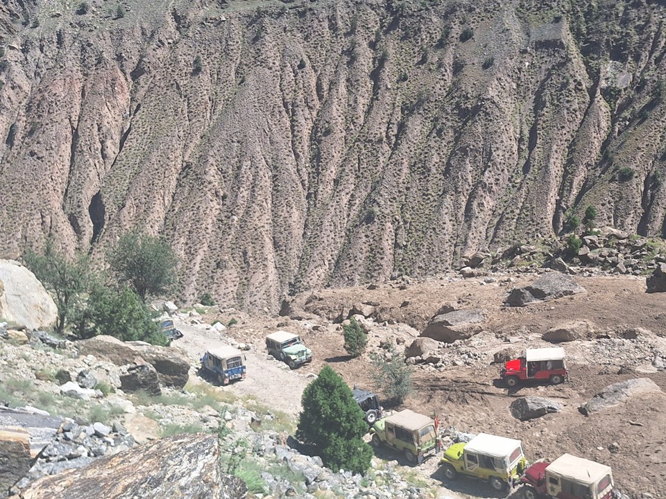
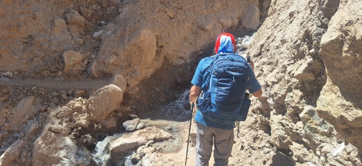
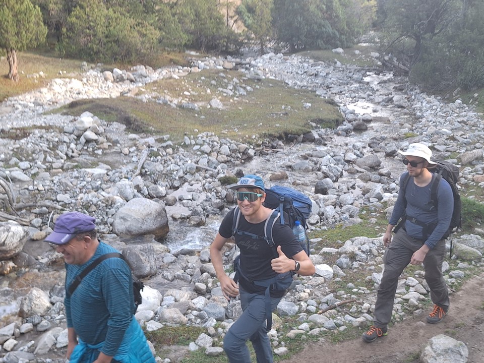
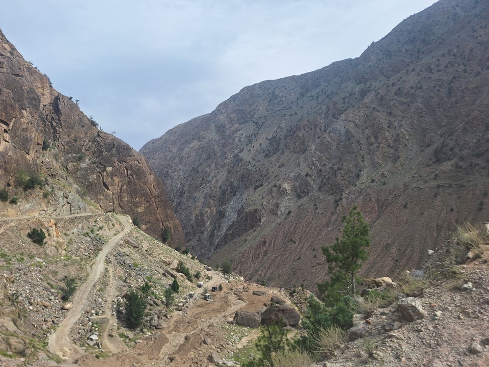
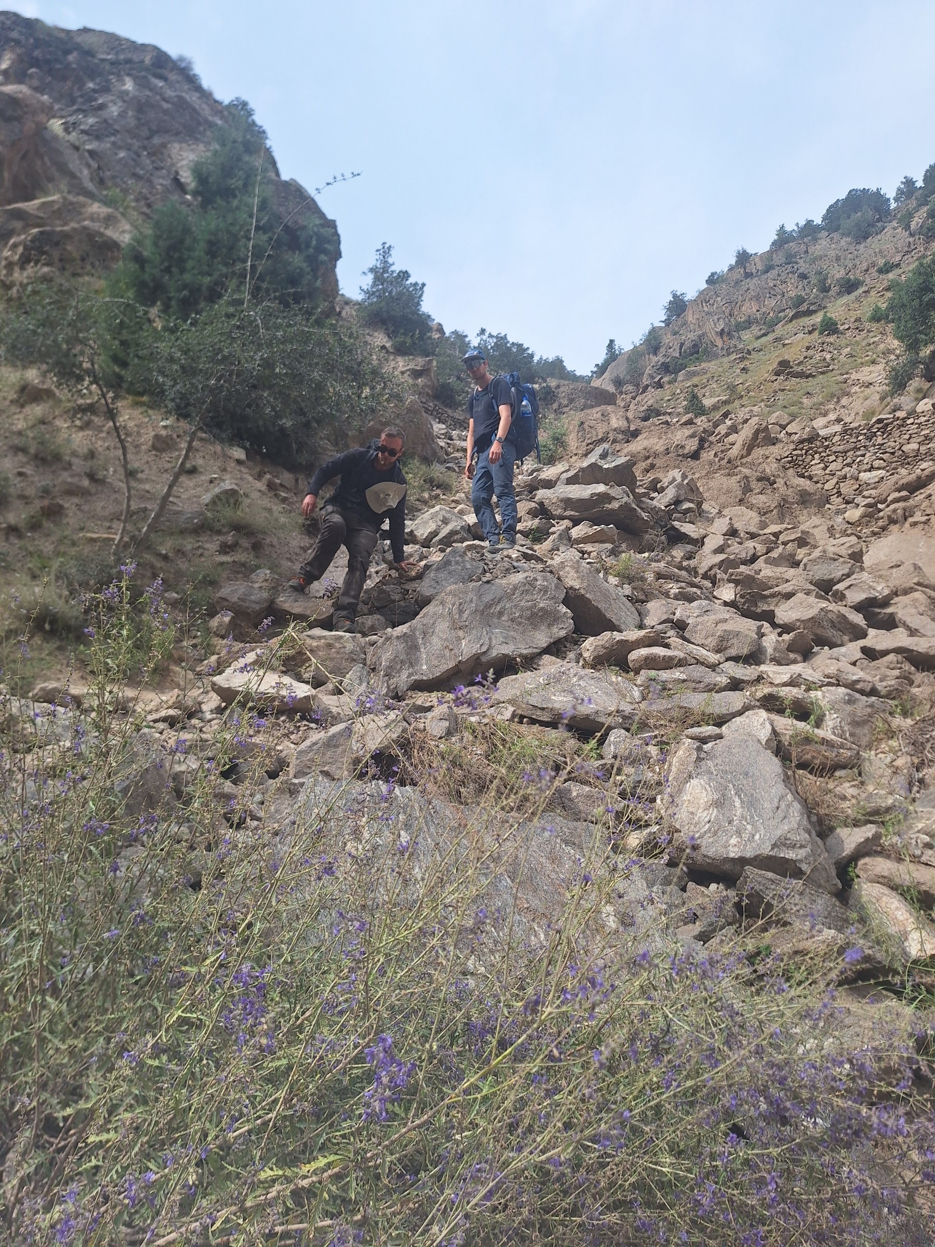
A few days before we arrived there had been a large storm. This had caused multiple landslides high up on the road, and meant that we had to walk roughly two kilometres on the road. People were working hard to get the road opened again, but a large bridge had been taken out, so it will be some time before the road is fully reopened. I was actually happy to walk a bit after having been in transit for the past two days.
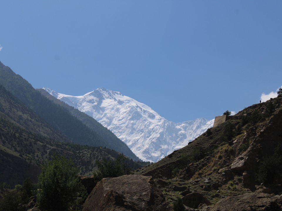
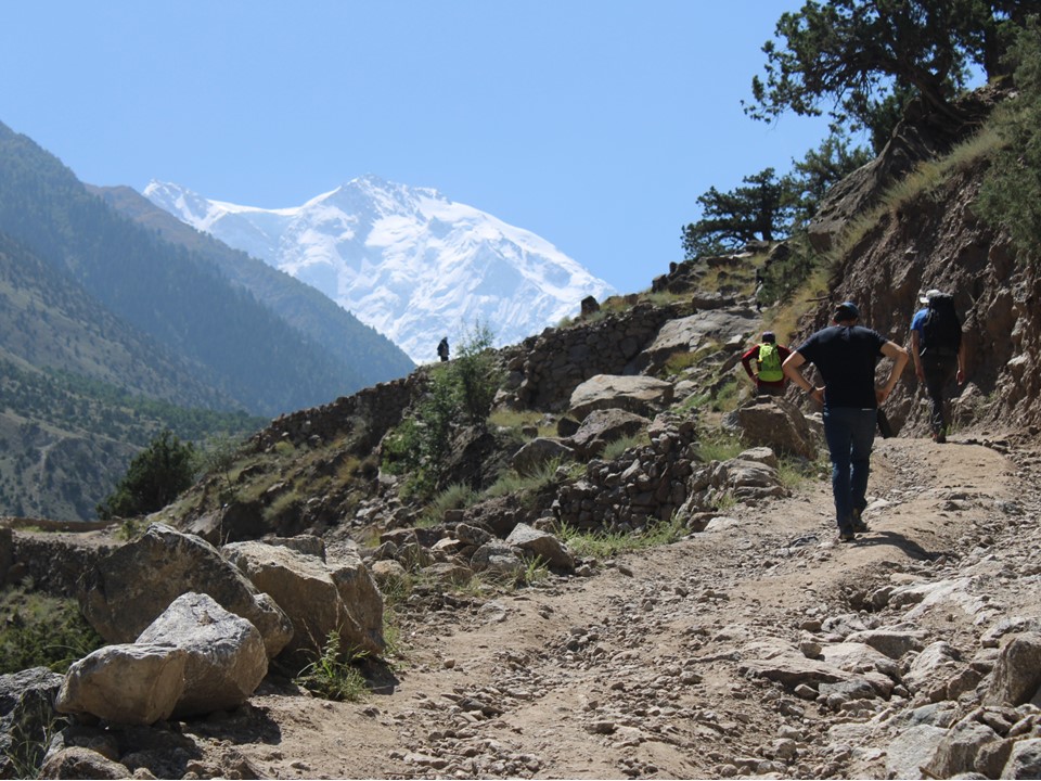
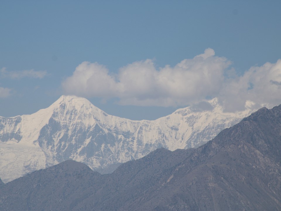
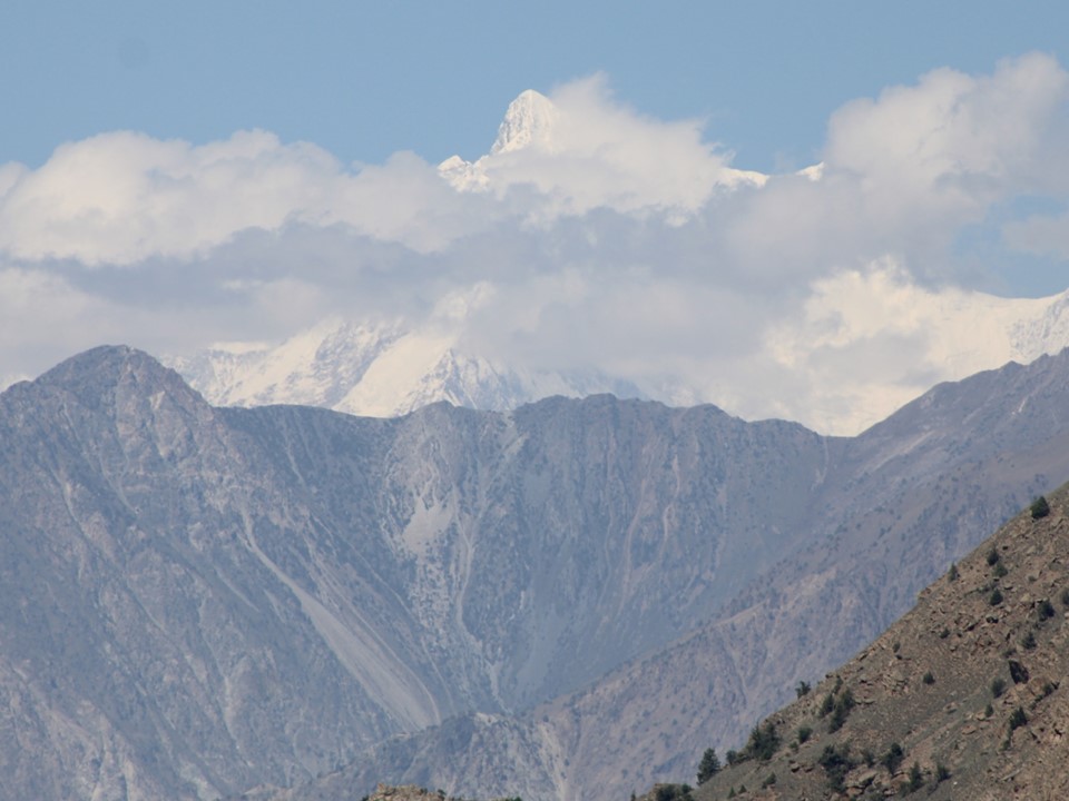
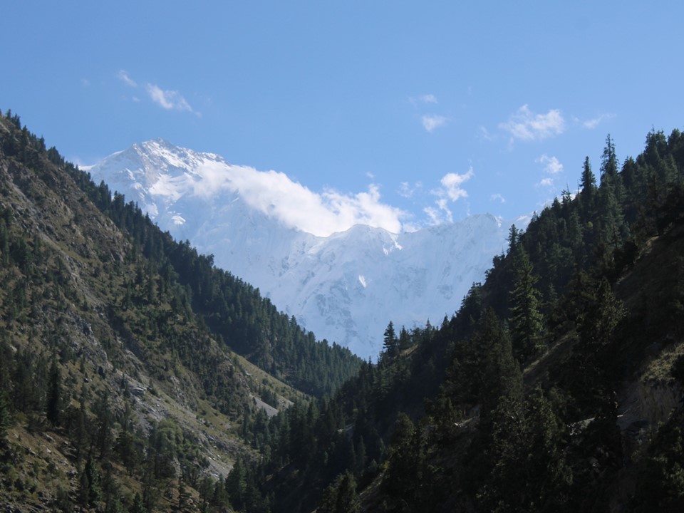
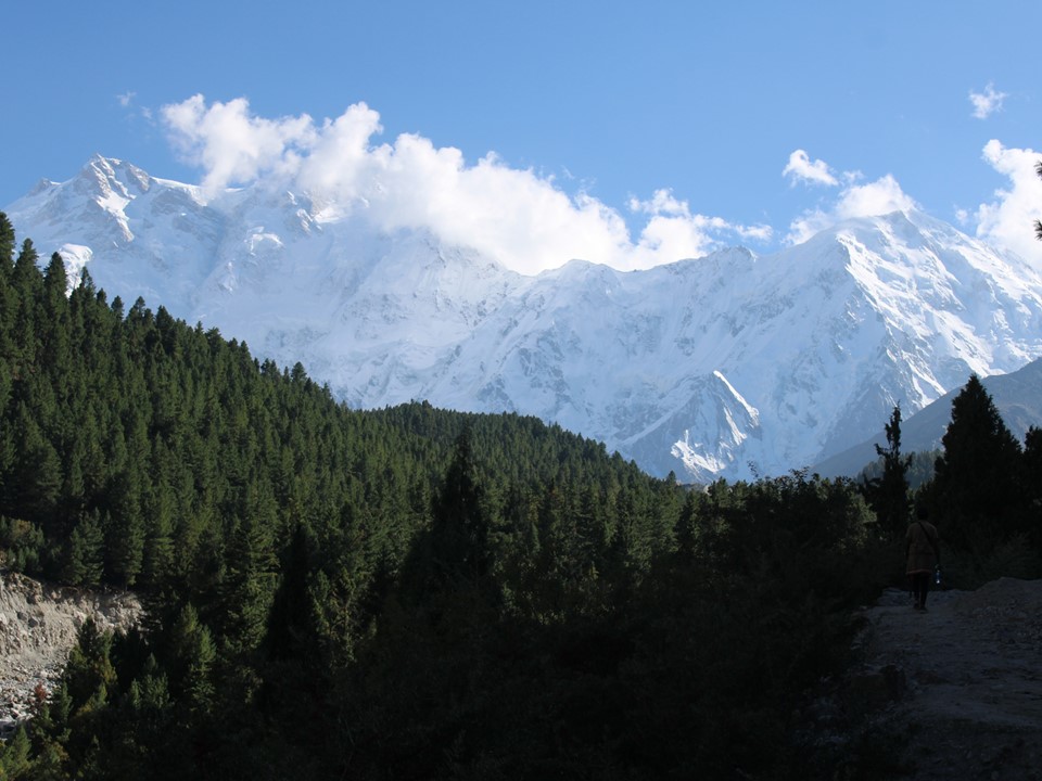
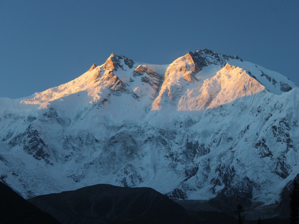
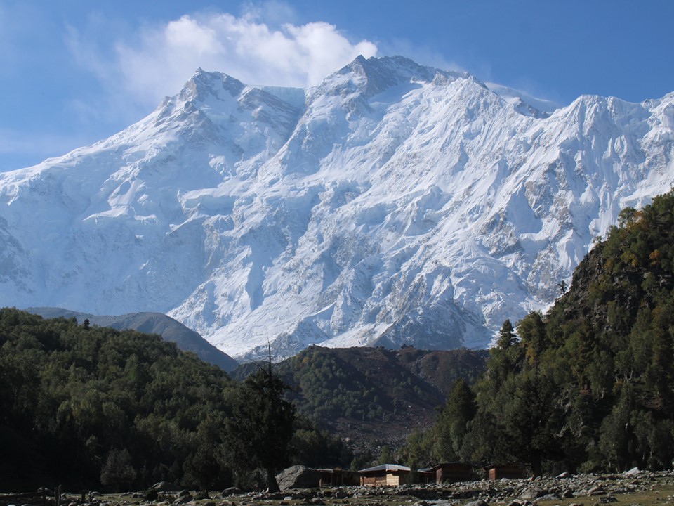
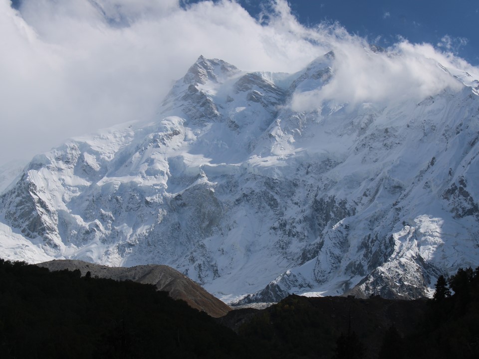
We also got our first view of Nanga Parbat on this section. We were around 2200m in elevation, meaning the summit was almost 6000m vertically above us. Strangely the size of this was hard to comprehend. I don’t think the human brain processes such large height differentials very well. Or perhaps I’m just spoiled after having seen so many of the largest mountain faces!
Julian was not feeling well, and sent his pack up with a porter. As it turns out, he wouldn’t see his pack again till Fairy Meadows.
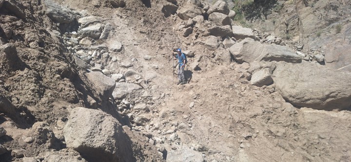
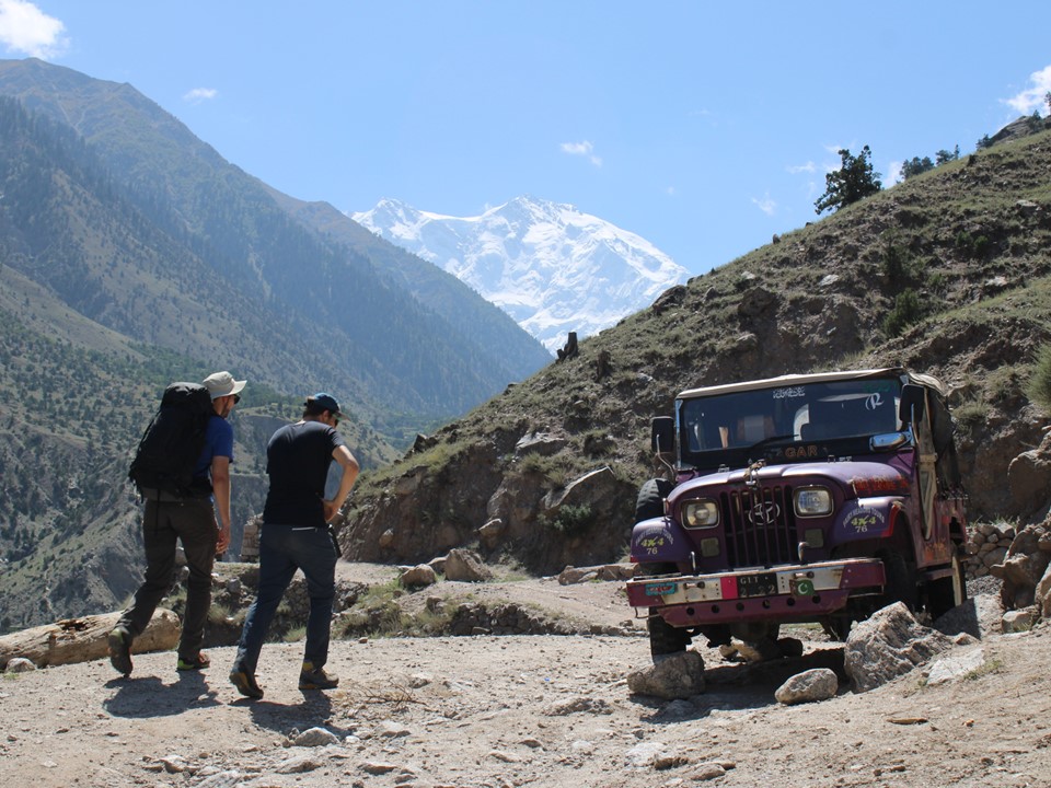
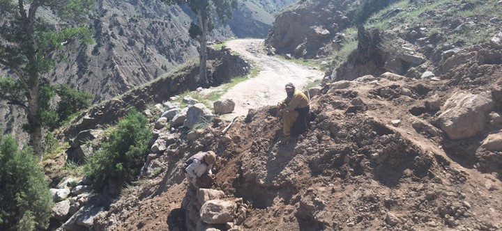
We were soon above the obstructions, and managed to get a different jeep for the final section of the road. A number of jeeps were caught above the damaged sections, and porters had been carrying fuel up to them to keep the roads going while the route is being repaired.
We stopped for lunch at the end of the road. Julian was feeling even worse, so Momin arranged a horse to take him up to Fairy Meadows.
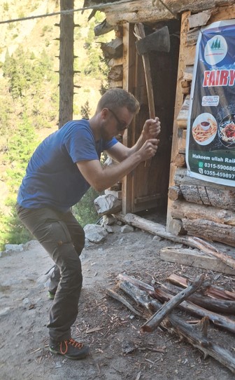
We stopped at a place on the way up, with a contact of Kamran Akmal, although he confirmed that he was not the former Pakistani wicket-keeper. Sven channeled his inner lumberjack while we enjoyed something to drink.
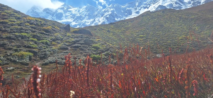
What I had not expected was the lower regions of the mountain being a desert. Now that we were higher up, we were in the magic world of pine forests that Buhl described as the most beautiful place on earth.
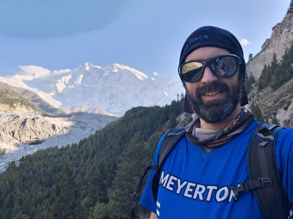
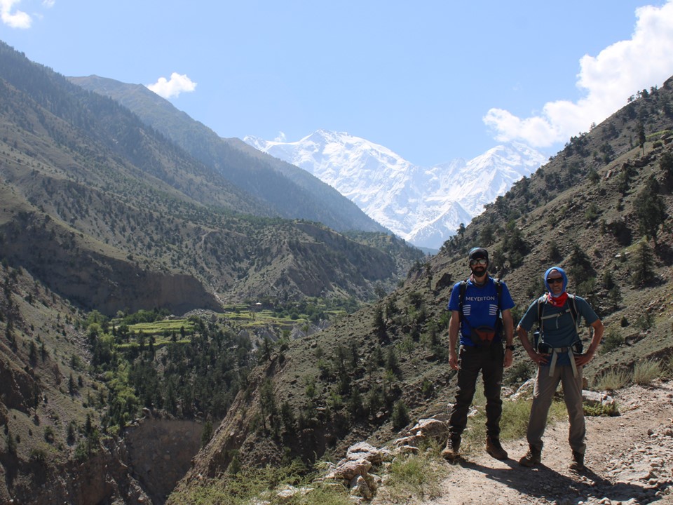
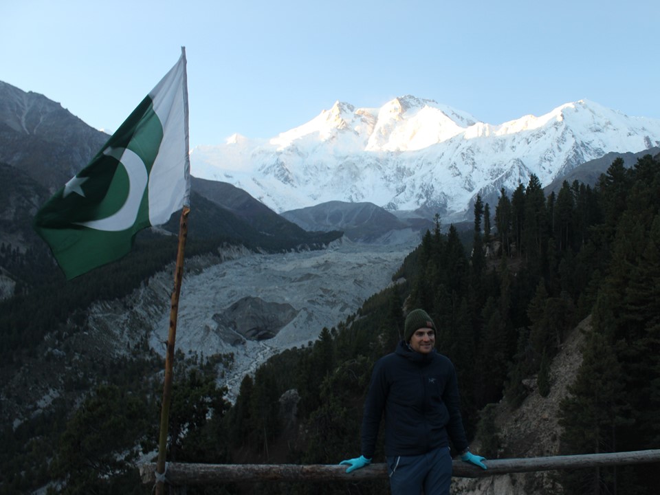
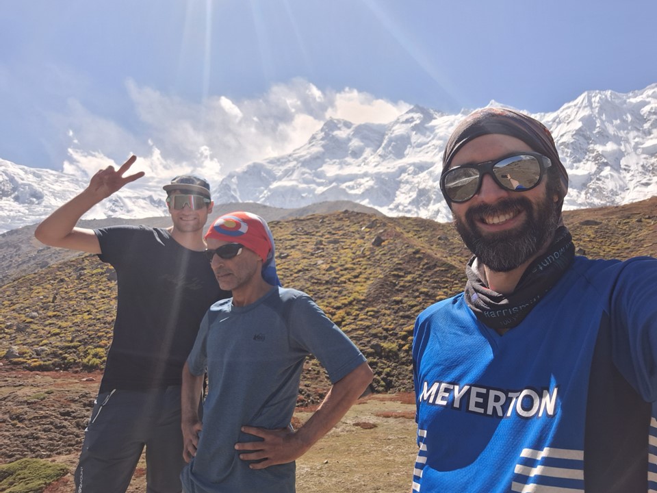
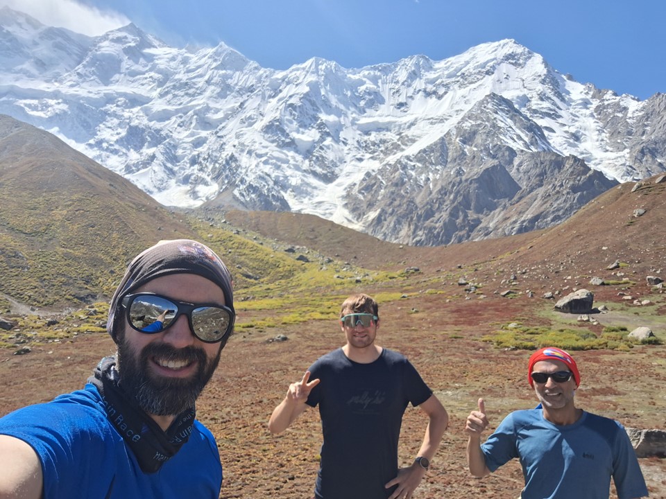
My running club has a tradition where one gets a photo of themself wearing a club shirt while hiking or running in order to add the country to the list of countries visited by club members. I took this opportunity to add Pakistan to the list, with a selfie showing the legendary mountain in the background.
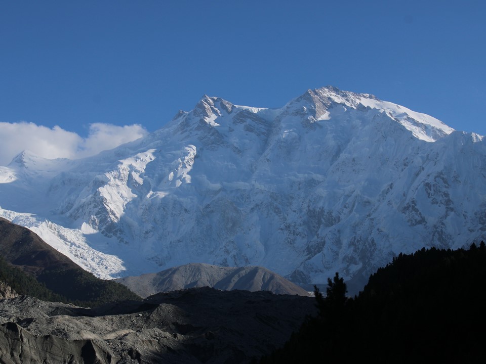
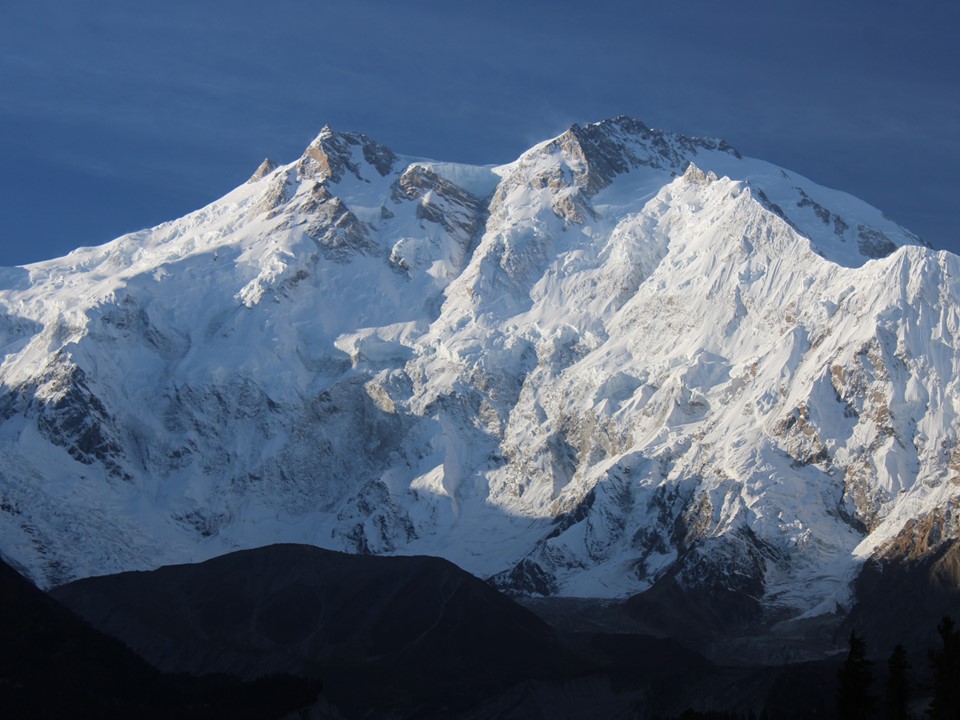
We eventually found ourselves at the legendary Fairy Meadows. It was a beautiful clear afternoon. We made our way to our rooms before heading to the famous reflection pool for some sunset photos of the mountain.

The reflection pool is much smaller than I had expected, and unfortunately the additional accommodation kind of ruins the traditional photos of the peak.
We were up early to enjoy the sunrise. Having taken hundreds of sunrise photos, I know the best mountain photos are often taken shortly after sunrise. I had always planned to get a photo of Nanga printed on an A1 canvas, and the winning photo actually ended up being one taken later in the day, but I have never regretted watching a mountain sunrise.


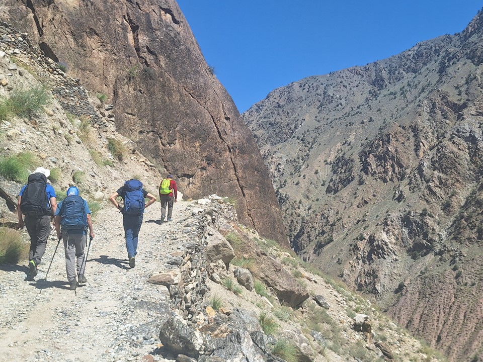
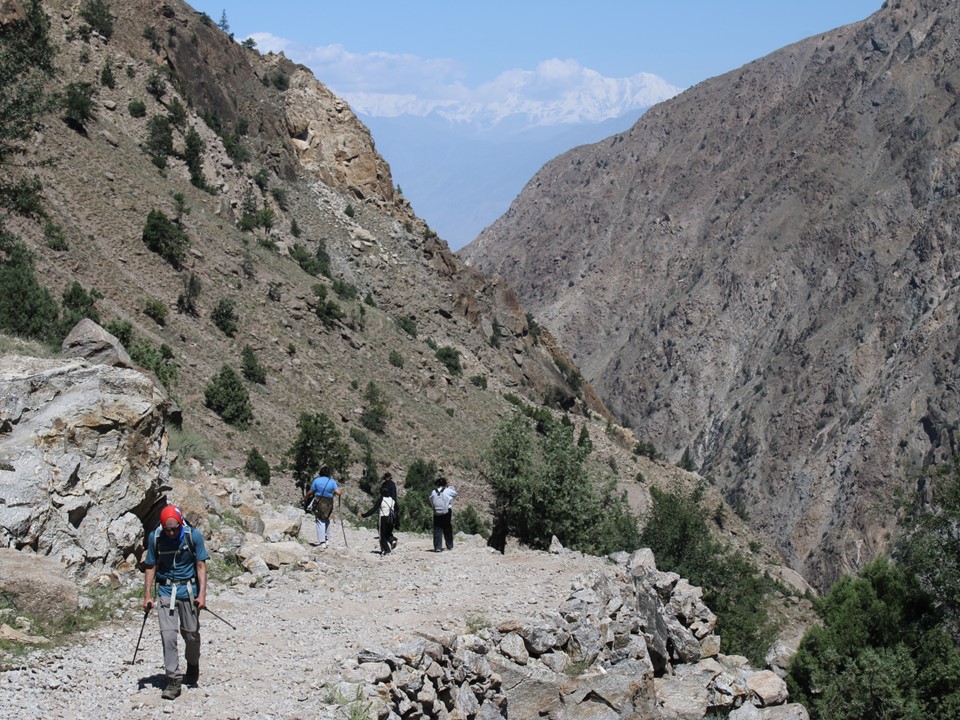
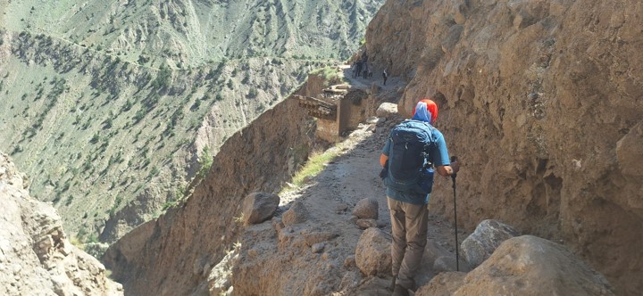
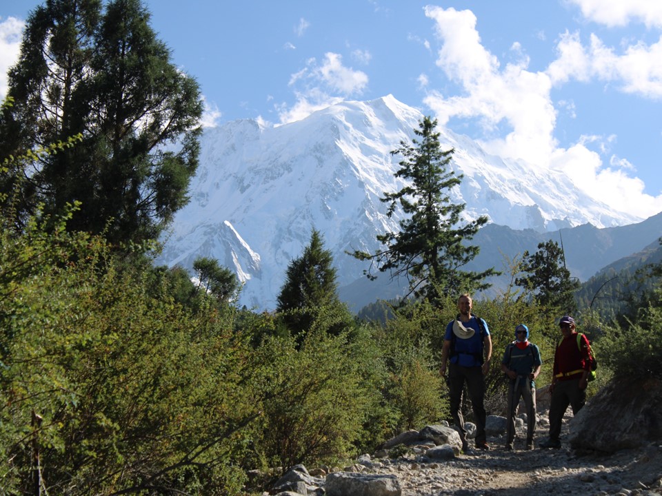
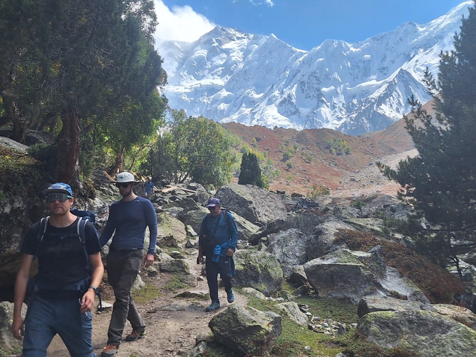
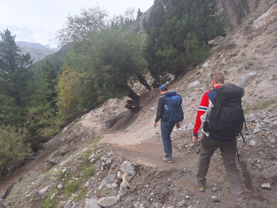
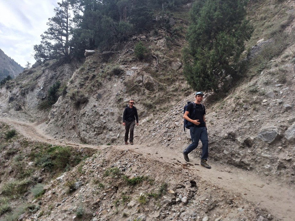
After breakfast we set off. It was a beautiful clear day, and we seemed to be the first team to start hiking – meaning we largely had the trails to ourselves. Not that many people seemed to be hiking on this particular day.
Julian was feeling much better, but Sven was not feeling too well. I admittedly wasn’t feeling 100% either, although I didn’t anticipate any major issues for the day.
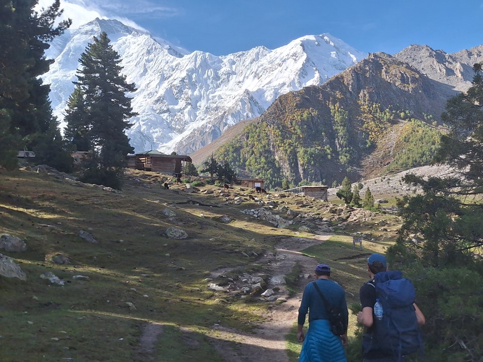
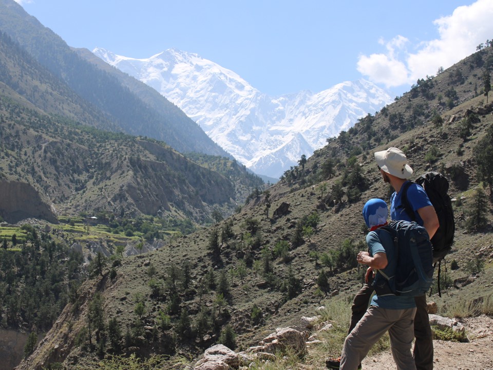
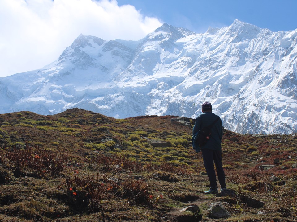
As you get closer, the size of the mountain truly starts to hit you.
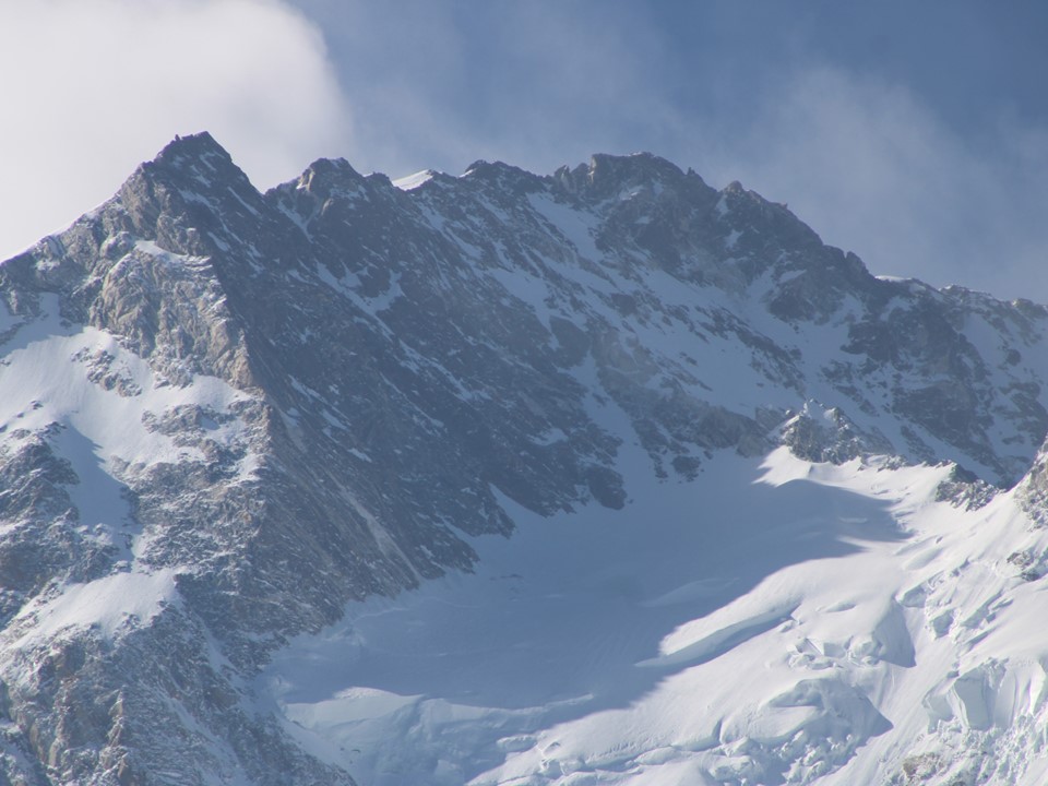
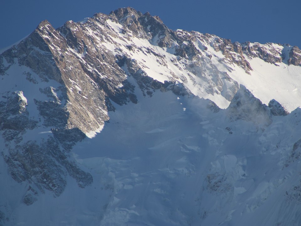
I studied the Silver Saddle – the massive gap between the east summit and the main summit, which had taken considerable time for Buhl to cross. I seem to recall someone having died on that section of an early attempt at the mountain, although I’d have to brush up on my history for detail.
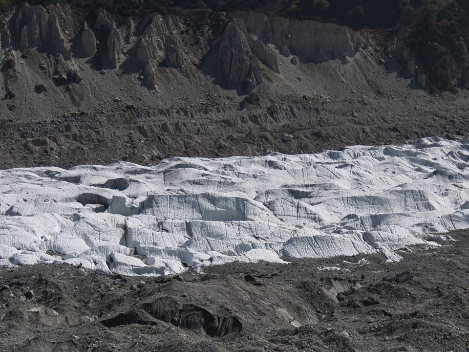
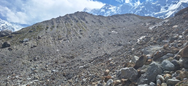
We soon found ourselves walking out onto the glacier. Or at least the rocky section next to the glacier. The best views are before this section, but we were shooting for the spot where Buhl and team had pitched basecamp back in 1953.
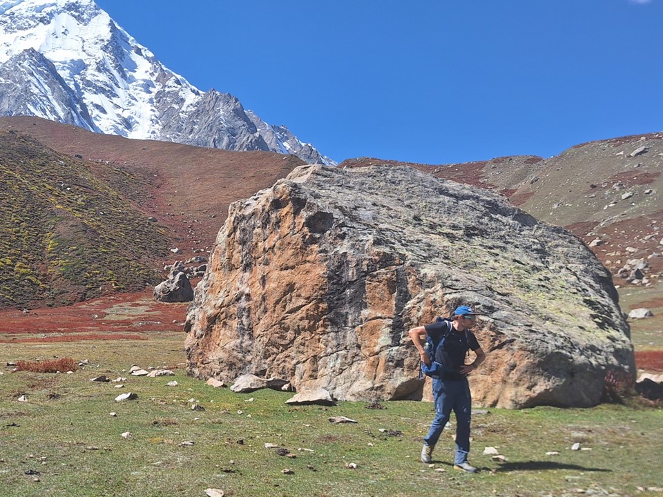
Not far from basecamp we found a really cool rock. Naturally we climbed it. I’m going to hazard a guess that most visitors to the region do this.

Sven wasn’t feeling well, so he waited here while the rest of us continued up the last ridge.
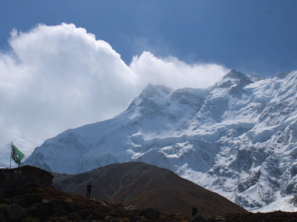
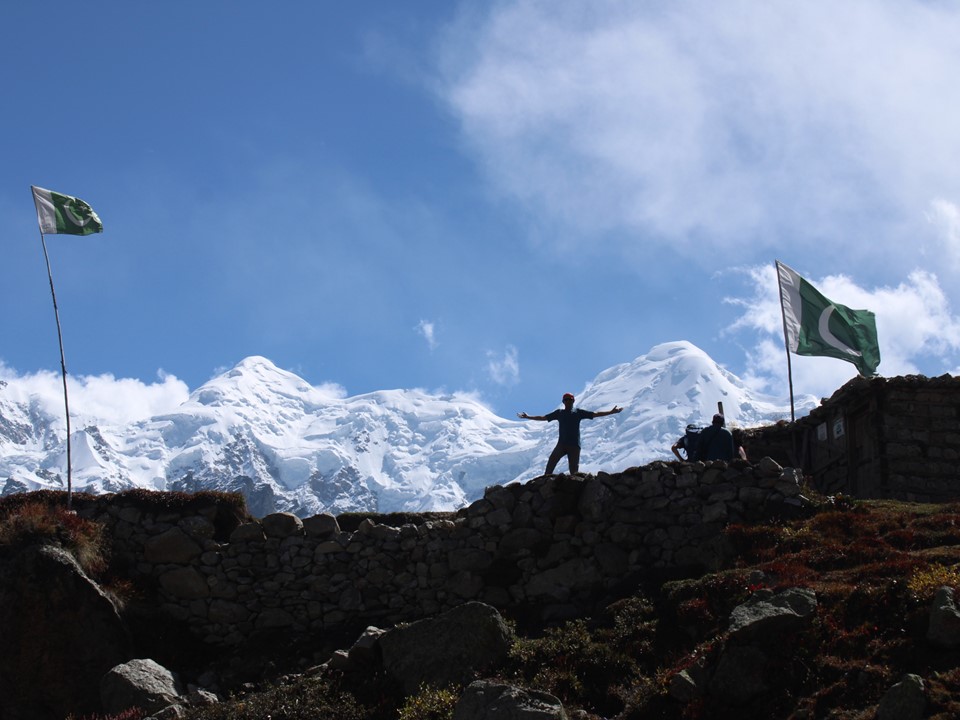
We considered continuing up the ridge to the viewpoint above basecamp, but I wasn’t feeling 100% and we ended up stopping at the old basecamp. Nanga Parbat is usually climbed by the Kinshofer Route on the Diamer Face – only two teams have successfully climbed the Rakhoit Face, so there’s not much at basecamp. The building found here is apparently a tea shop that is open during busier seasons.
As a kid, I had learned the tune of the German National Anthem after seeing Schumacher win most F1 races that I had watched. Seeing as Nanga Parbat is known as the German Mountain, I attempted to whistle while Julian sang the anthem.
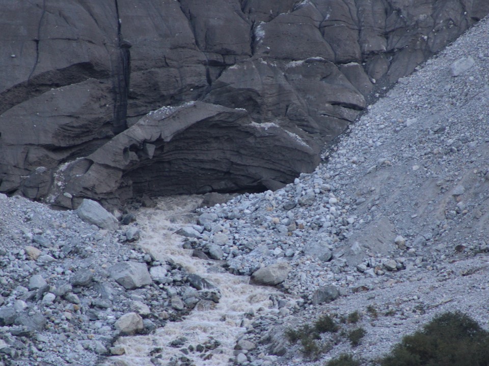
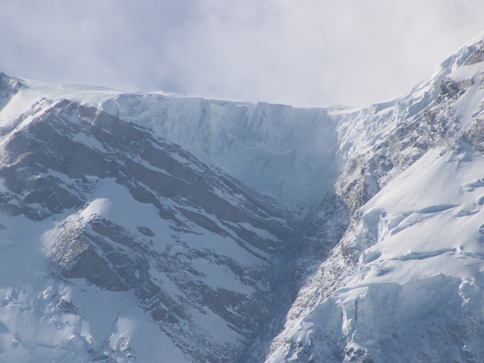
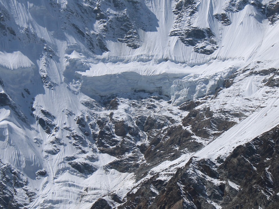
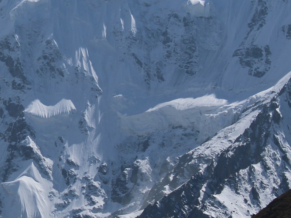
We made our way back down, by this point lunch was sounding good. In 45 days spent in Nepal, I had not seen a single avalanche. Nanga Parbat is famous for avalanches, and as we hiked down, I heard a shout of avalanche. Naturally we were far away from it and in no danger, but it was amazing to watch. The sound takes a while to reach you, but is also very loud.
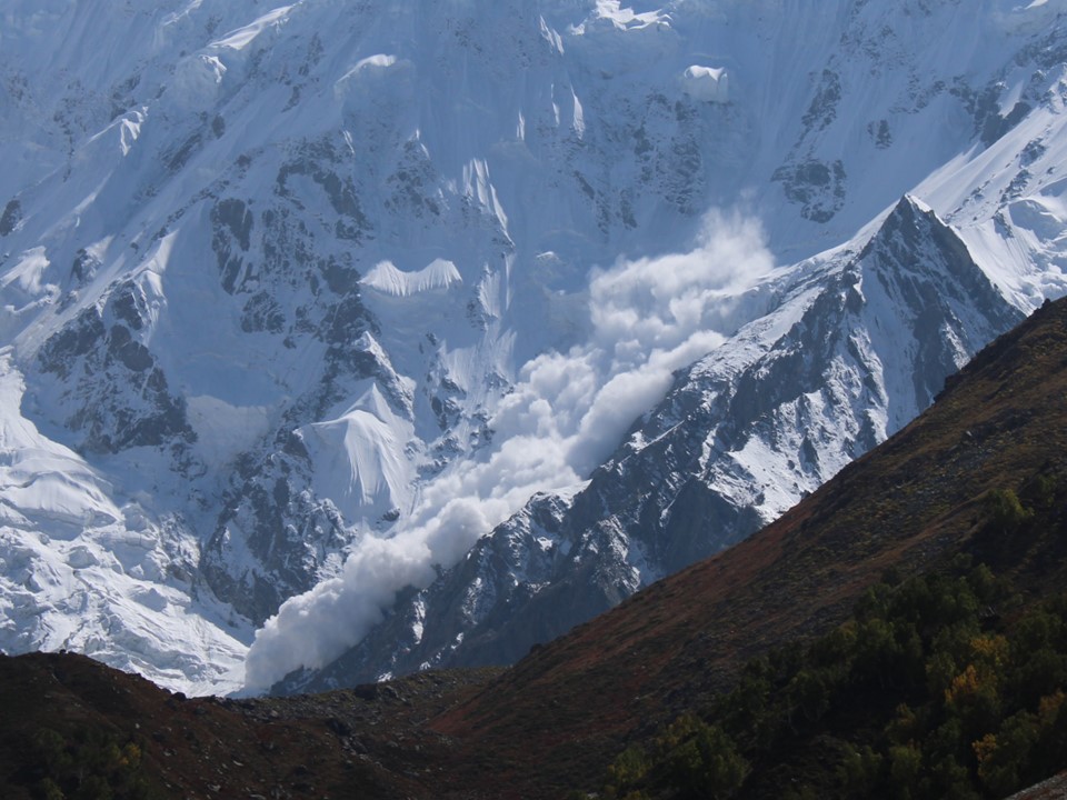
Having noticed the massive serac in this region and noting that the avalanche risk there was high, I had actually taken a photo of this spot before the avalanche. The following photos are before and after:
We continued to make our way down. Momin had commented that we’d have lunch at 1:30pm, and as I sat down for lunch, my watch said 1:29
After lunch we made our way back to Fairy Meadows. The clouds rolled in that afternoon, and wouldn’t clear for the next five days.
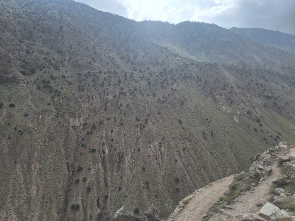
The hike back down proved uneventful. I tried to capture the beauty of the lower section above the Indus River, but it is one of those things you have to be there to experience.
Overall, Nanga Parbat Basecamp (Rakhoit Face) was a great hike, definitely worth the effort. I wouldn’t travel all that way just to do this hike, but as part of a general visit of the region, it was really good. Naturally I may return to the mountain at some point to attempt the Around Nanga Parbat hike – I like hikes like this as you spend more time learning the mountain. With this hike, I have now seen 8 out of the 10 highest mountains on earth – just K2 and Kangchenjunga to go.

Great writeup! Looking forward to subsequent parts.