It’s a surprisingly well kept secret globally that South Africa is an exceptional hiking destination. While venues such as Table Mountain are generally well known, there are hundreds of amazing venues across the country to chose from. So the first question a reader may ask is “why would you drive for five hours to hike up some obscure hills between Otse and Gaborone?”
Let’s backtrack a bit. Botswana is widely regarded for its beauty, specifically with regards to wildlife, and especially around the Okavango Delta. Anyone familiar with Botswana will know that the Okavango Delta and Gaborone are at opposite ends of the country. Anyone familiar with me will also know that I enjoy animals, but rarely travel to see them specifically.
Botswana is not known for hiking or mountains (or lack thereof). I did a bit of research to try and find the summit with the most topographic prominence – which turns out to be a 1380m hill in the east of the country with about 411m, I was unable to find a name for this peak.
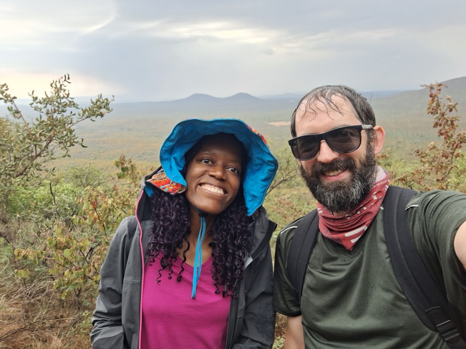
So after all that the question remains – why did we drive all that way for a few hills? Well, because they’re there. I have liked ticking off countries where I can, and especially their capitals and high points. In Botswana’s case, I knew I could do both the capital and the high point in a weekend, so naturally it became a goal of mine. Albeit a minor goal that I sat on for years. And when I met Anita on a hike in March this year, and found the same objective was on her to-do list, it made sense to go ahead and do this.
We set off from Jo’burg at 5am for the long drive to the Skilpadshek Border Post, which is called Pioneer Gate in Botswana. The drive there was largely uneventful, and unlike the other borders I’ve crossed on foot or in a vehicle, the SA/Botswana border in this region is a straight line between two points, so you aren’t even entirely sure when you’ve crossed it between the different border posts.
After struggling to find where to get our passports stamped on the SA side, and eventually finding a very unfriendly officer who stamped us out the country, we found ourselves on the Botswana side, where we received a friendly welcome. I always forget to learn the greetings in the local language, but Anita knew how to greet people, and thus we got a warm reception. After paying the exorbitant vehicle import tax, we were soon driving through Lobatse – making Botswana my 14th country visited.
I had been warned that Botswana police aren’t very friendly, so I stayed well within the speed limit and obeyed every street sign very carefully, much to the annoyance of locals – I think I almost caused a few accidents due to this! We eventually got to the town of Otse and proceeded to park at the Police College just outside town. We would soon realise that we could have driven around the college and parked much closer, but being a peak with almost no available information online, we were happy with a safe place to park.
We explained to the police what we were doing, and they told us to be careful, carry lots of water and be safe. An officer even came running after us, took my phone number and gave me his, telling us to call him if we had an emergency and to send him a message when we were safely back down. Those comments about unfriendly police were starting to sound unwarranted (pun intended).
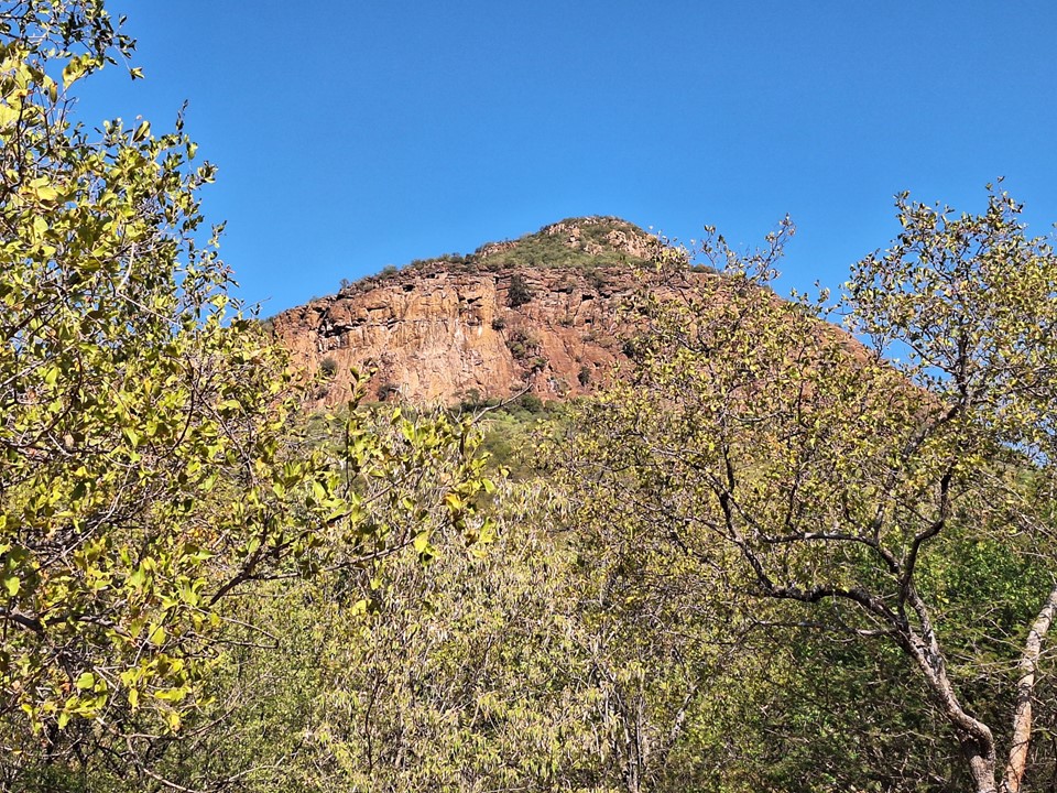
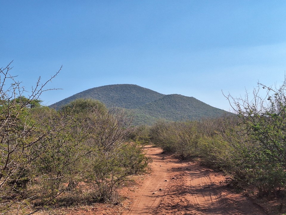
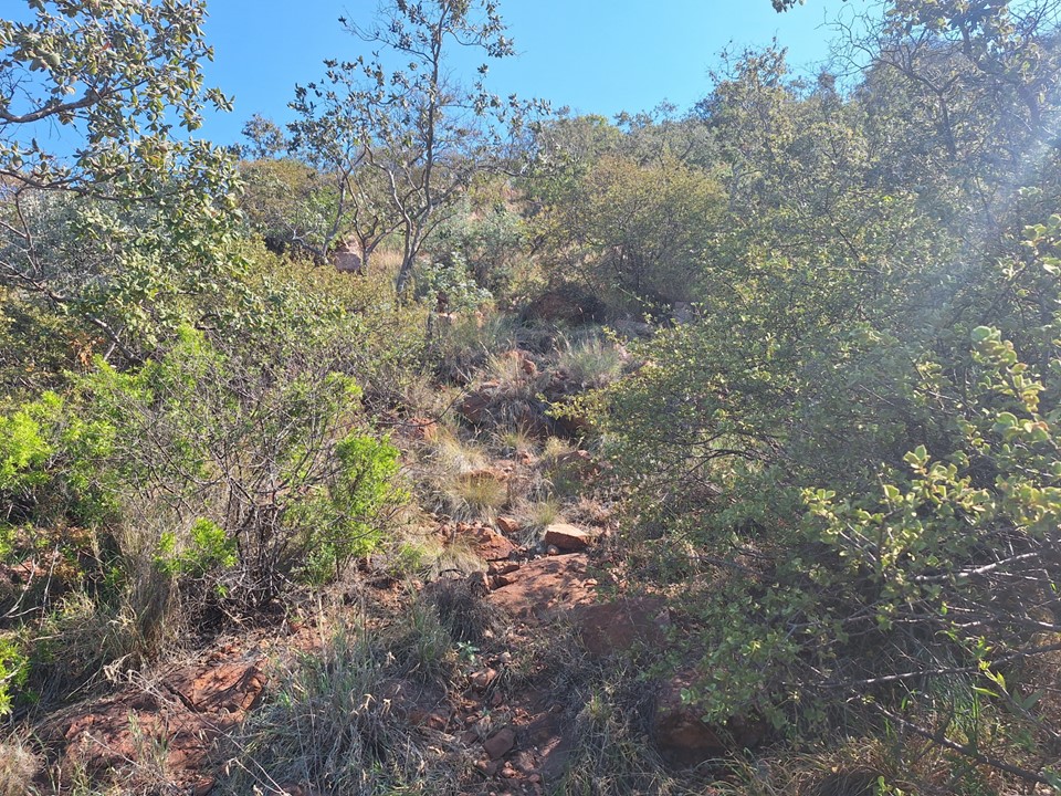
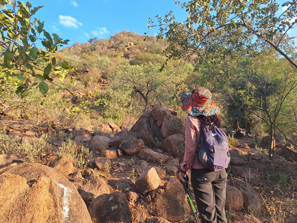
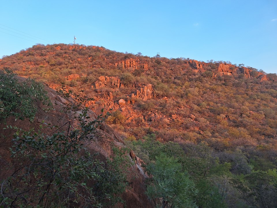
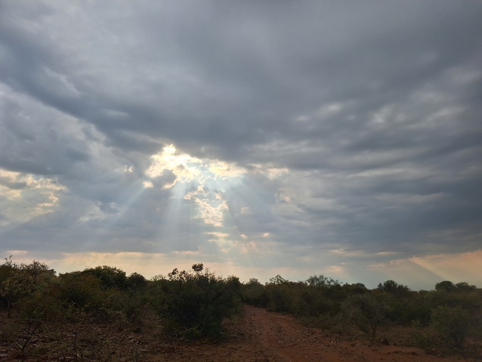
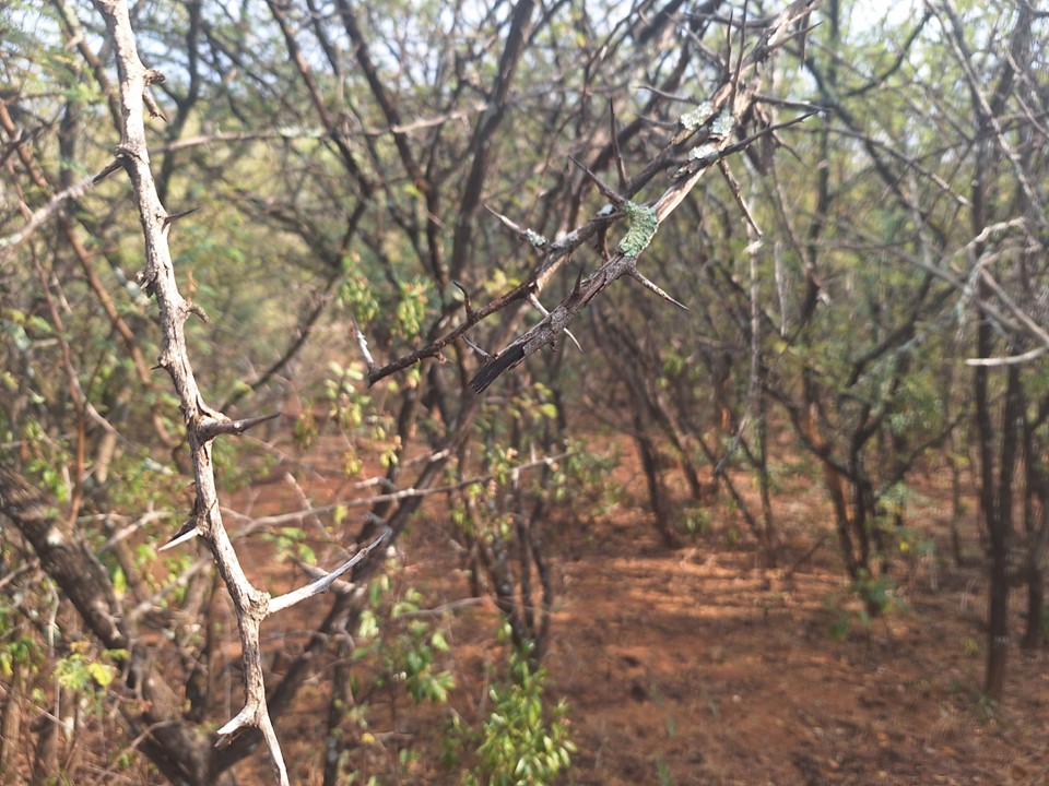
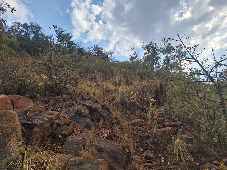
There’s a really interesting front-summit on Otse Hill with some reasonably substantial cliffs. We were happy to be on a dirt road as the overgrowth looked very dense. We knew there were no trails to the top, and with the few online writeups talking about how bad the overgrowth was, we were getting worried.
After walking 4km on dirt roads, an old Opel/Mazda (I don’t recall which) drove past us. We walked past a dry riverbed and considered walking up it, but decided not to. We also saw a turnoff dirt road, but it was like walking on the beach, so we decided to hold our road a bit longer.

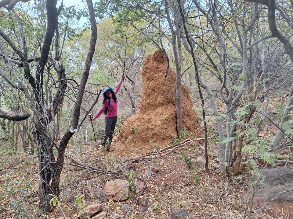
We soon found ourselves on cattle trails into the bush. With a lot of ducking – cattle aren’t eating or clearing anything much above their head height – we were making progress. We crossed the dry riverbed from earlier a few times, and considered walking up it, but decided to stick to the cattle trail.
We soon found the parking lot where the car from earlier had gone – so it turns out we could have just taken that road. Good to know for the way down. We continued along.
When we realised that the large group from that car that included some older individuals was moving faster than us, we realised that there was a nearby clear trail that we could use. So we followed them. Out of respect, we didn’t take any photos of them and didn’t disturb them – they seemed to be partaking in some form of ritual or ceremony.
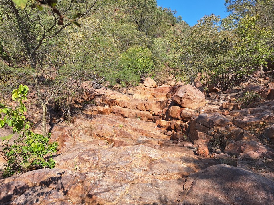
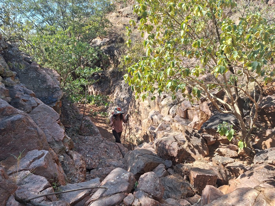
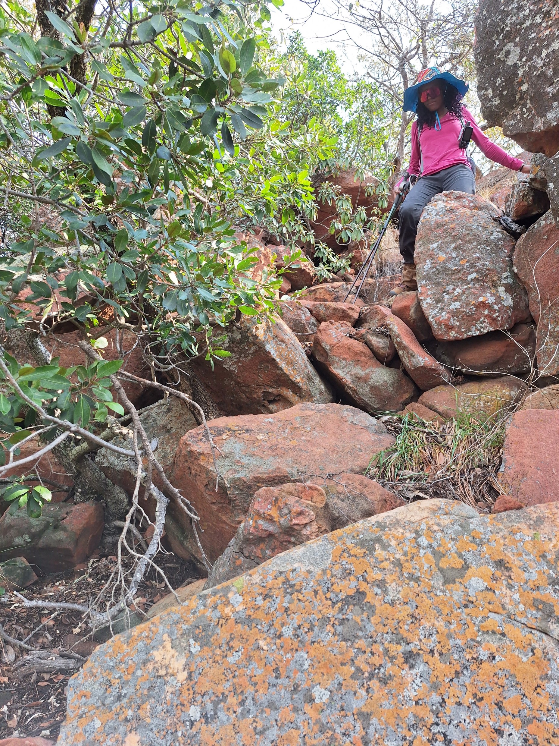
The dry riverbed soon narrowed and became more rocky. We followed this for some time, even finding some stagnant water – which obviously isn’t drinkable. Scenery was actually much better than we had anticipated. We stopped for lunch on some rocks in the shade.
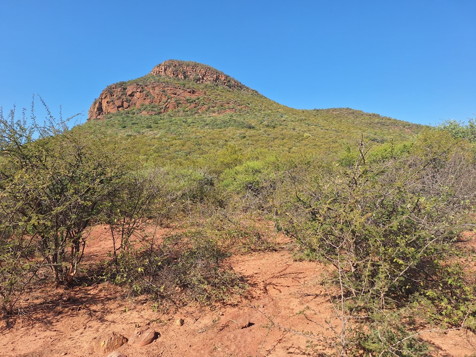
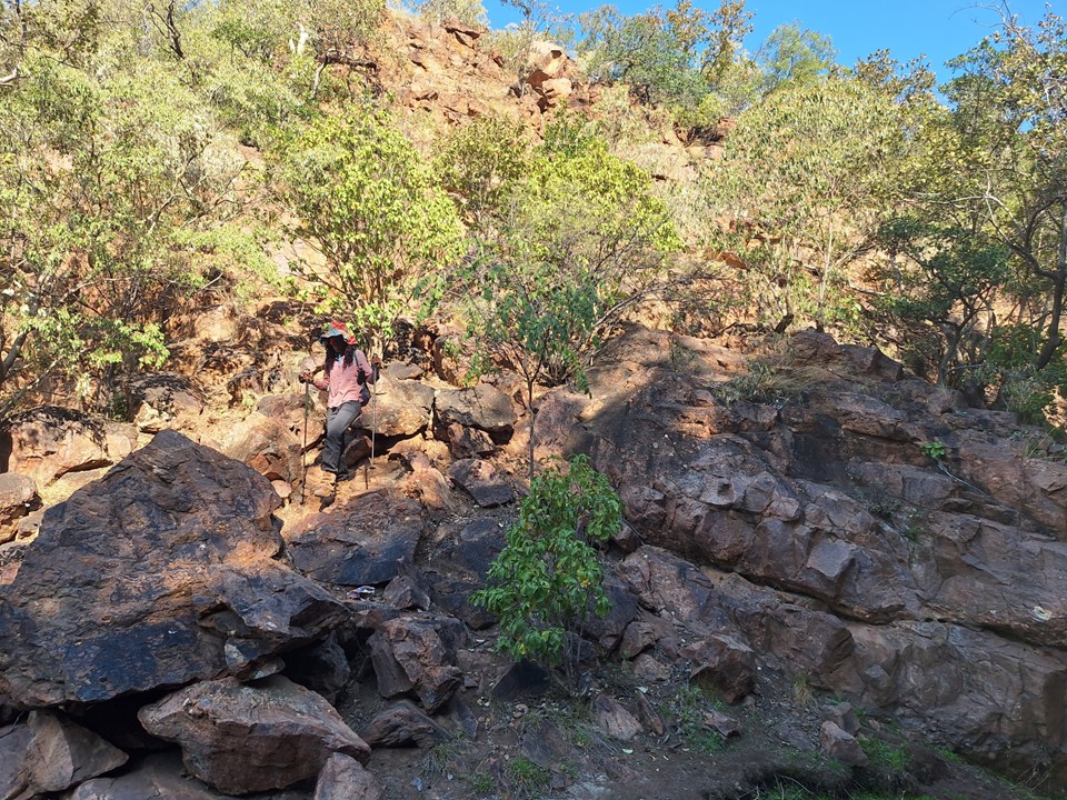
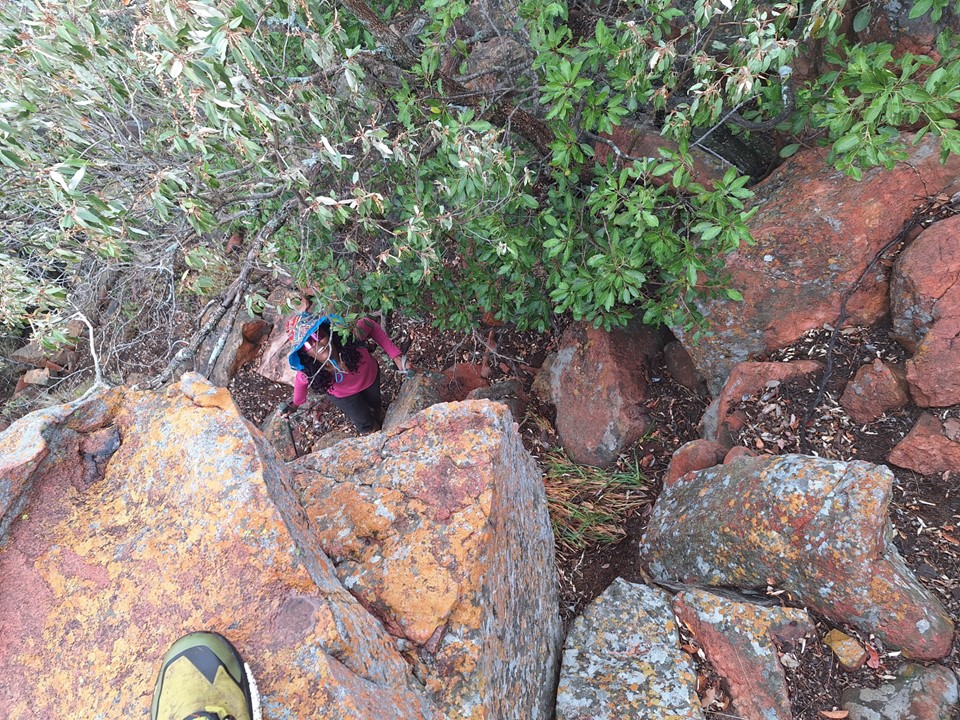
Eventually we had to leave the riverbed, but there were rocky lines up the slopes, so with careful navigation one can actually avoid most of the vegetation.
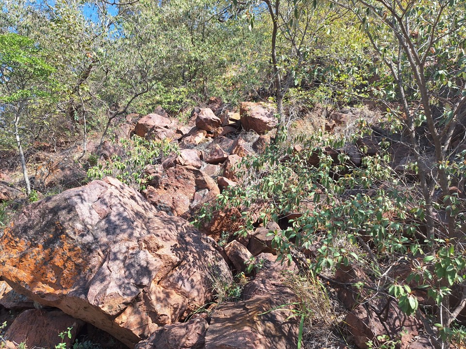
While we only had to put on about 400m in elevation from where we parked, about 270m of it was in the final 1km. The vegetation wasn’t dense enough to provide much shade either.


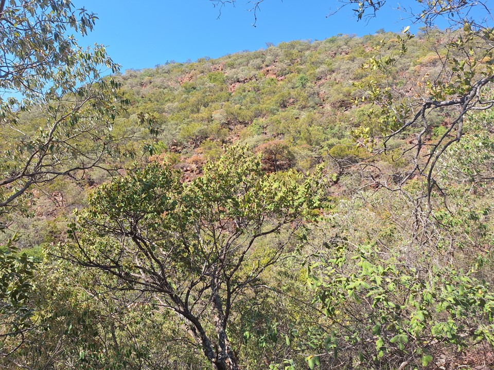
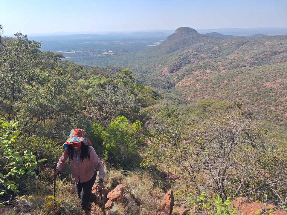
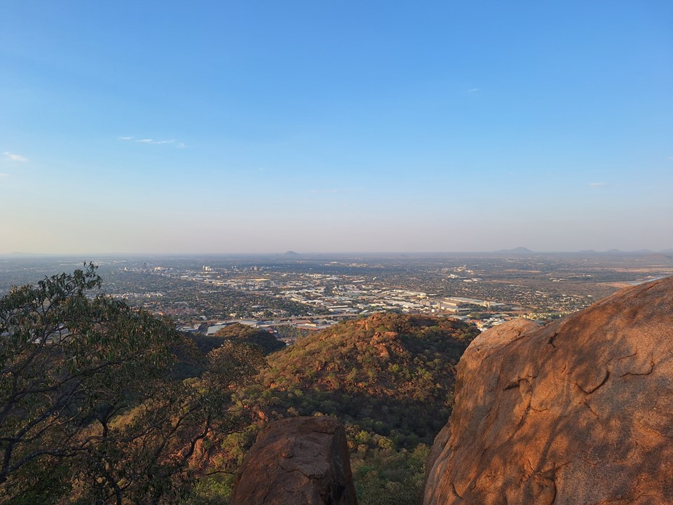
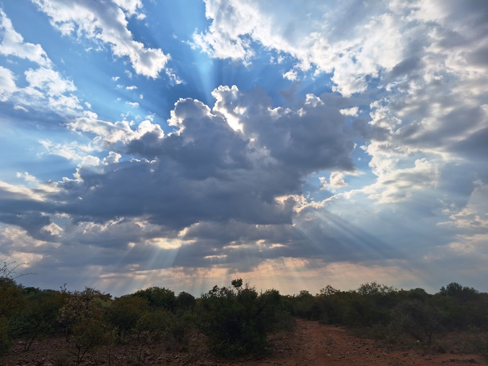
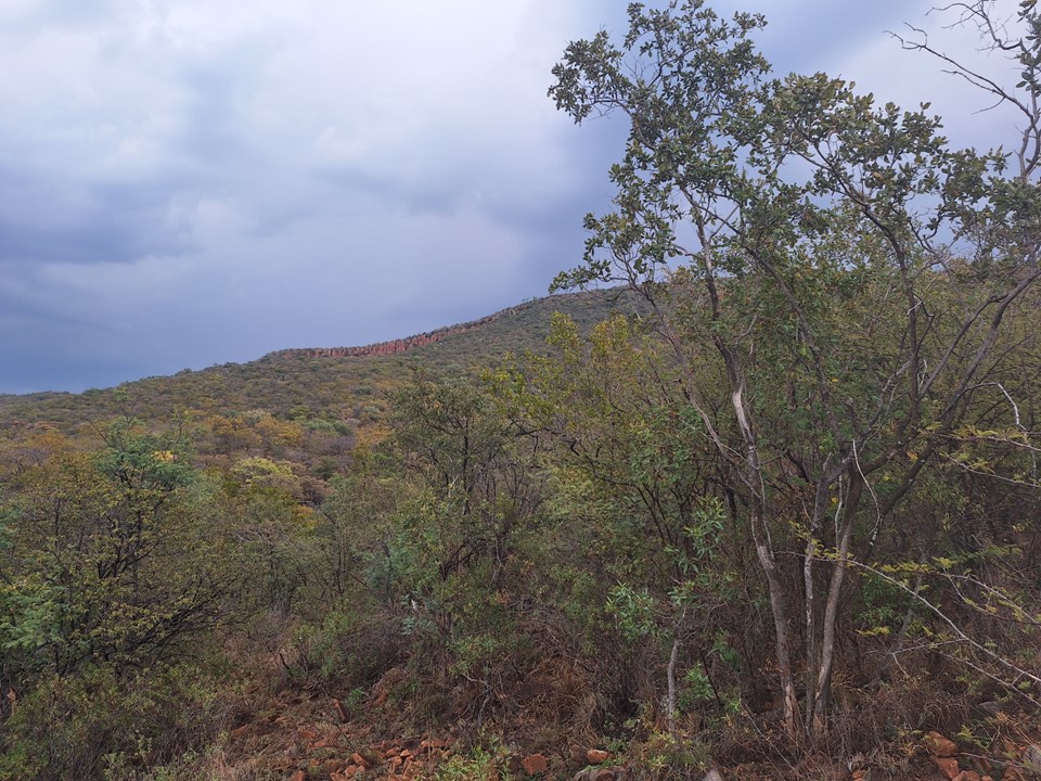
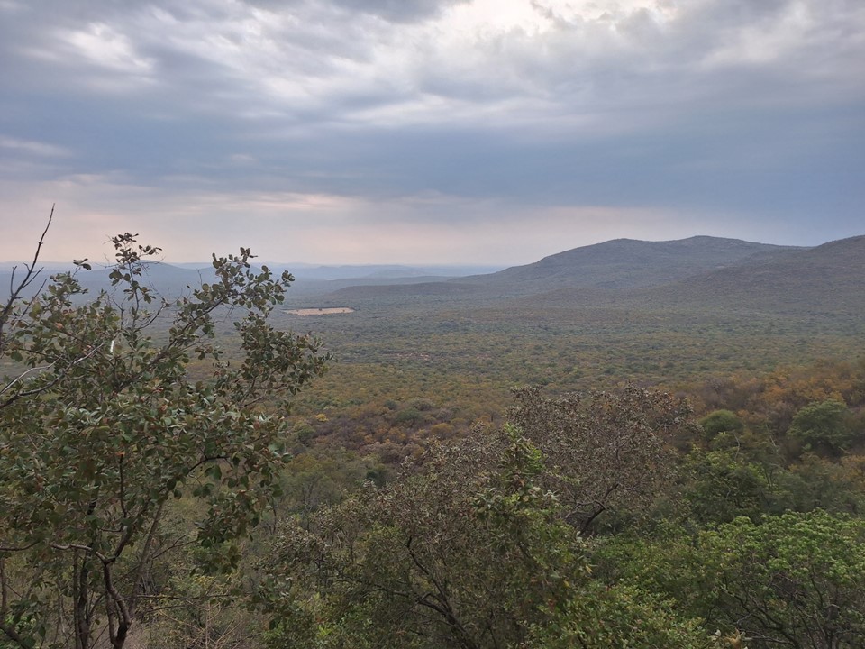
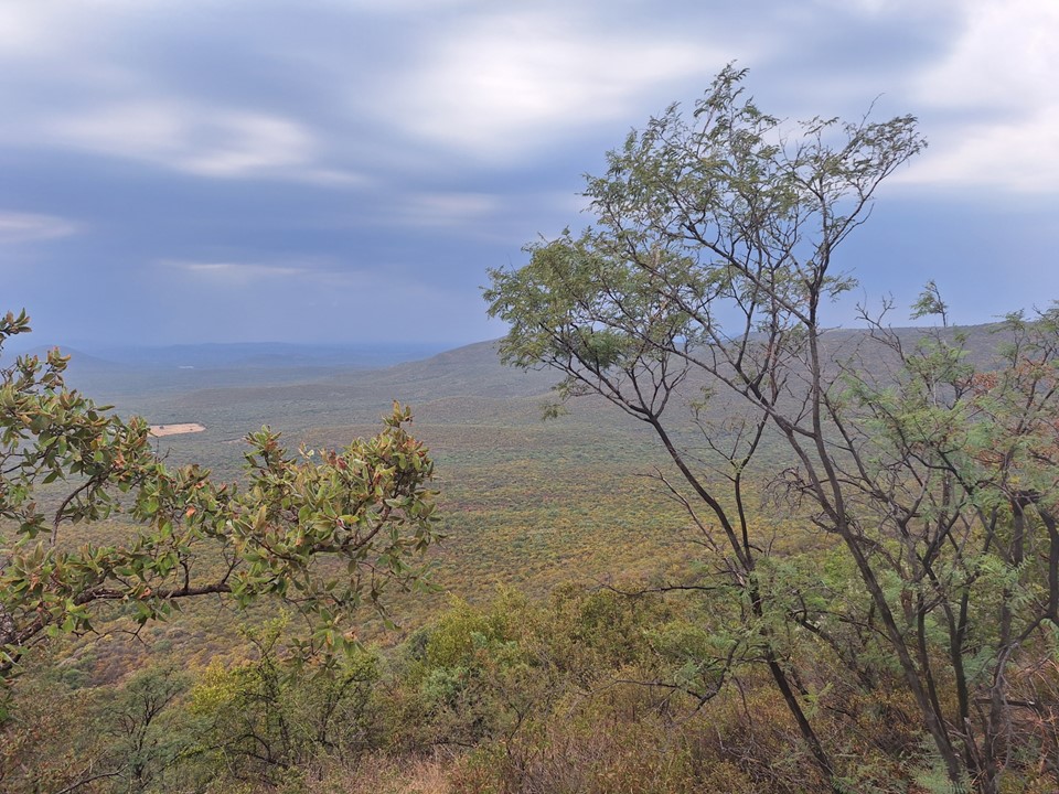
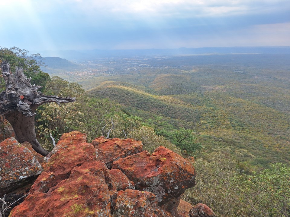
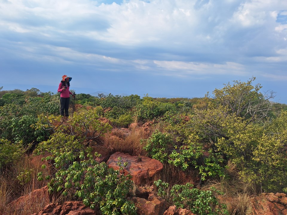
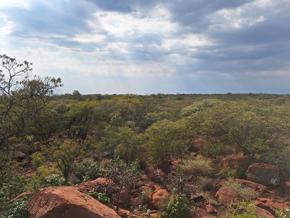
As we got higher, the views down below became more interesting. Don’t get me wrong, this isn’t in the same league as the Drakensberg, or even Magaliesberg, but it was better than expected.
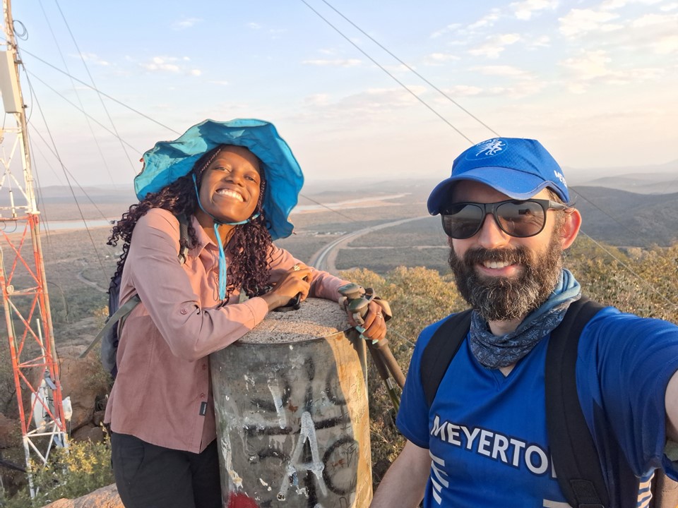
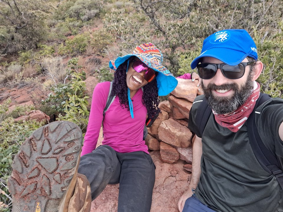
Eventually the ground started leveling out, and soon we found ourselves moving towards a trig beacon.
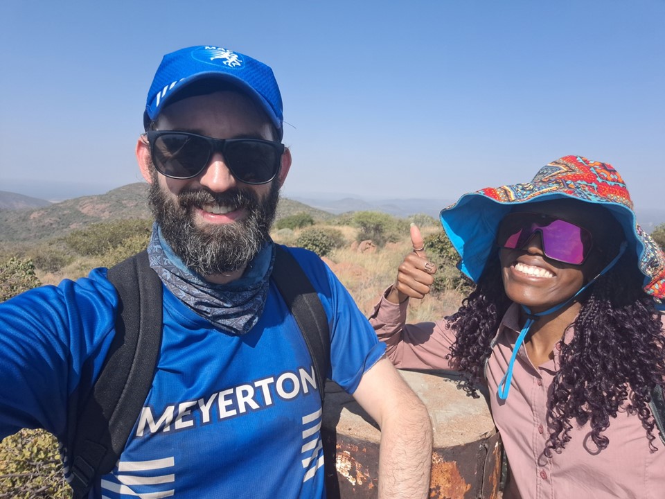
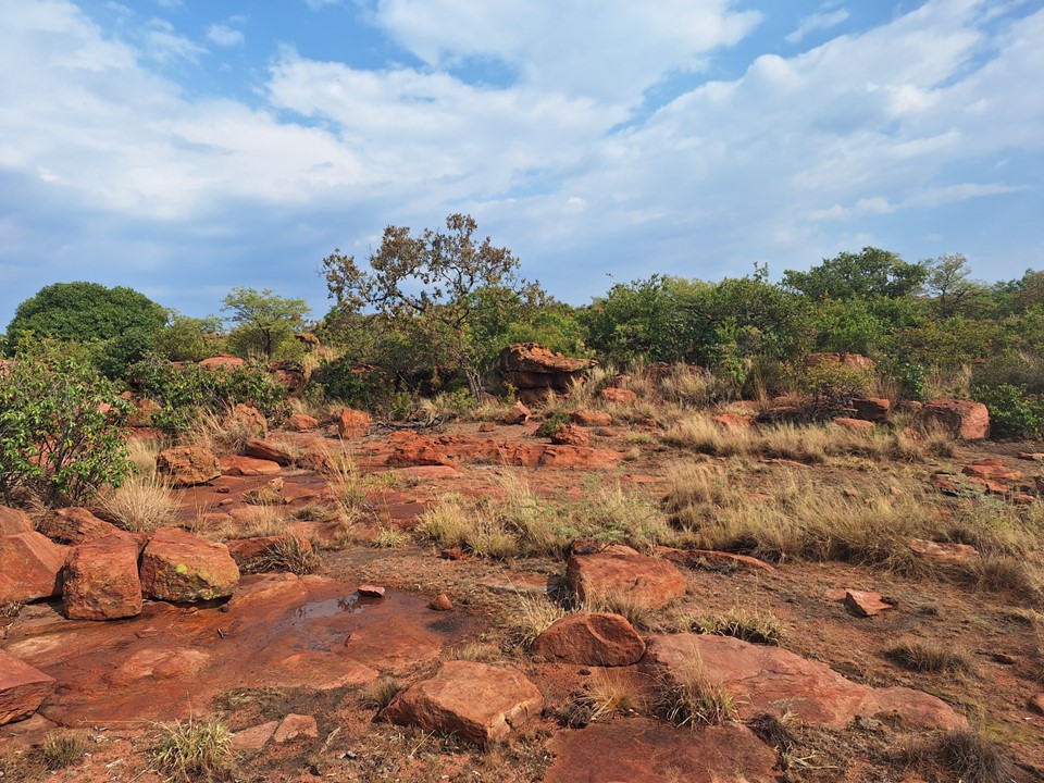
Officially 1490m, we got readings between 1484m and 1486m between our two GPS devices and our watches. This was consistent with what others have reported, and with SRTM data reflecting the summit at 1486m. I had initially dismissed the SRTM height as it usually under-estimates more pointy summits. But when actually on the summit, I realised that it is a fairly large summit and thus the SRTM data should have it about right.
The reason this matters is that Monalanong Hill is officially surveyed as being slightly lower than Otse Hill, but the SRTM data and a few hiking GPS devices have all suggested that it is slightly higher. Monalanong Hill is a massive plateau, so odds are the SRTM data was about right for its height – but I had dismissed this as it was a few metres different and Otse looked more pointy on maps than it actually is in real life. Having stood on the summit, I was immediately fairly certain that Monalanong Hill would in fact be higher.
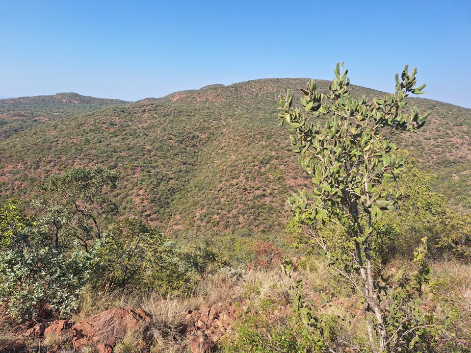
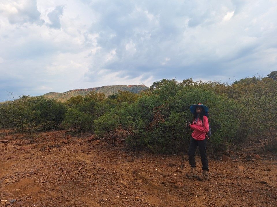
The view from the top was good, and we could see Monalanong Hill in the distance – being one of three large flat summits north of there. We had hoped to do both peaks in a day, but Otse Hill had been much further than anticipated due to parking at the Police College.

Armed with better route knowledge accumulated on the way up, we followed a rocky line back down to the river, and then followed the riverbed till we found the trail the local group had used to reach the rocky part of the riverbed.


Once we reached the spot where the cars had been parked earlier, we followed the dirt road back to the fence, and walked around the Police College back to the car. We messaged the officer to say we were down safely and thanking him for looking out for us.
Our original plan had to been to try to do Otse Hill, Monalanong Hill and Kgale Hill in a day. But Otse Hill had taken us five hours to get up, so we proceeded to Gaborone. Trying to figure out where to start for Kgale Hill was tricky, so we ended up going to the local shops to buy some food and ask for directions. After some vague directions, we found ourselves trying to find where to park.
A couple who were hiking up at the same time told us where to park and showed us the trail head. There’s a steep route and an easy route, so we decided to go up the steep route, while they went up the easy route.
With arrows painted on the rock, it was reasonably easy to find the way up.
It’s always sad to see graffiti on a summit like this.

We met up with them again on the summit. They have lived in Moshi and climbed Kilimanjaro multiple times. They have also been to Everest Basecamp and done the Inca Trail – so they have traveled a fair amount. They are teachers in Gaborone, and head up Kgale Hill frequently for training. They had been up Otse Hill before, but not Monalanong Hill, so they couldn’t provide much useful information for the following day.
We hiked down the easier route with them, enjoying the sunset on the way down.

Kgale Hill is a very easy hike, but it provides great views of Gaborone, and it was lovely meeting others on the route.
We had been told that the best place to eat in the area was at Manong Game Reserve, so we went to our accommodation in Gaborone to check in, drop off our things and clean up a bit. I had a lamb korma and Anita had a kudu burger. The food was very good.
We left Gaborone early the next morning to head to Monalanong Hill. We started by Google Maps trying to take us through a fence. A local got our attention and told us how to get around it. Having flashbacks to my 2022 Lesotho road trip with a flat tyre and severe hail damage, I very slowly drove on the dirt road. I had been worried about where I could turn my car around if we couldn’t go further, as well as where I could park without blocking the road – when suddenly a bit of a clearing appeared. I did a five-point turn and parked my car facing the way out with both wheels entirely off the road.

When I turned my GPS on, it turned out the track I found online had started at this exact same spot – the last time the track would prove useful on this hike. But looking at the skies, I had another concern.
I am usually very particular about carrying a raincoat – even in Jo’burg in winter I always carry a raincoat if I’m going to be more than 30 minutes from my car (unless I’m running). Somehow I had forgotten my raincoat at home – and despite it being the dry season in a country where it doesn’t rain much and that was experiencing a drought – there was a thunderstorm moving in.
I wasn’t too worried about getting wet, but red rocks have high iron content, and being out in a thunderstorm surrounded by red rock seemed like a very bad idea. We waiting in the car for almost an hour, got through the iconic thunderstorm pattern of heavy rain, clear but lightning, then more rain.
The skies were clearing, so we decided to go for it.
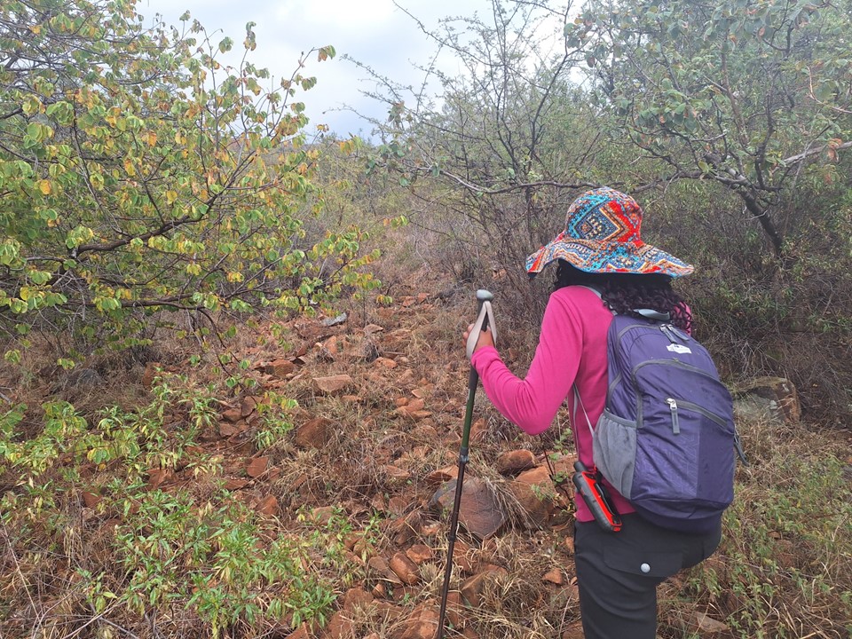
We found a dirt road that the GPS track I had downloaded didn’t use, so I kept the track open, but our line up would prove to be entirely different to theirs – with us taking a much more direct line. After about 250m, we realised that Anita’s trekking poles were in the car, so we went back to get them. In hindsight this was a good call – trekking poles are incredibly useful when trying to make your way through thick thorny vegetation.
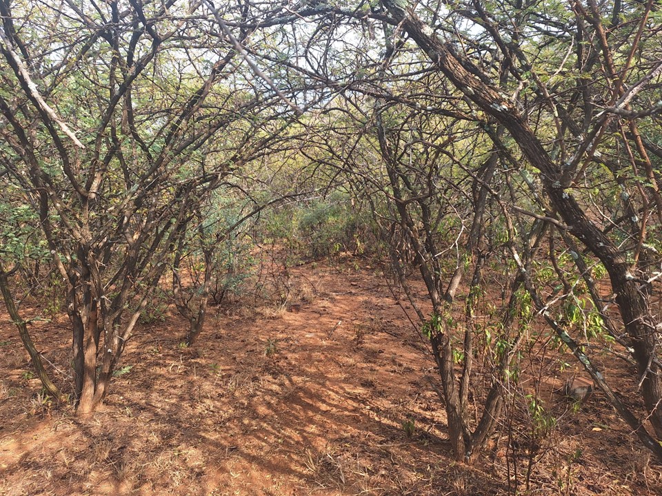
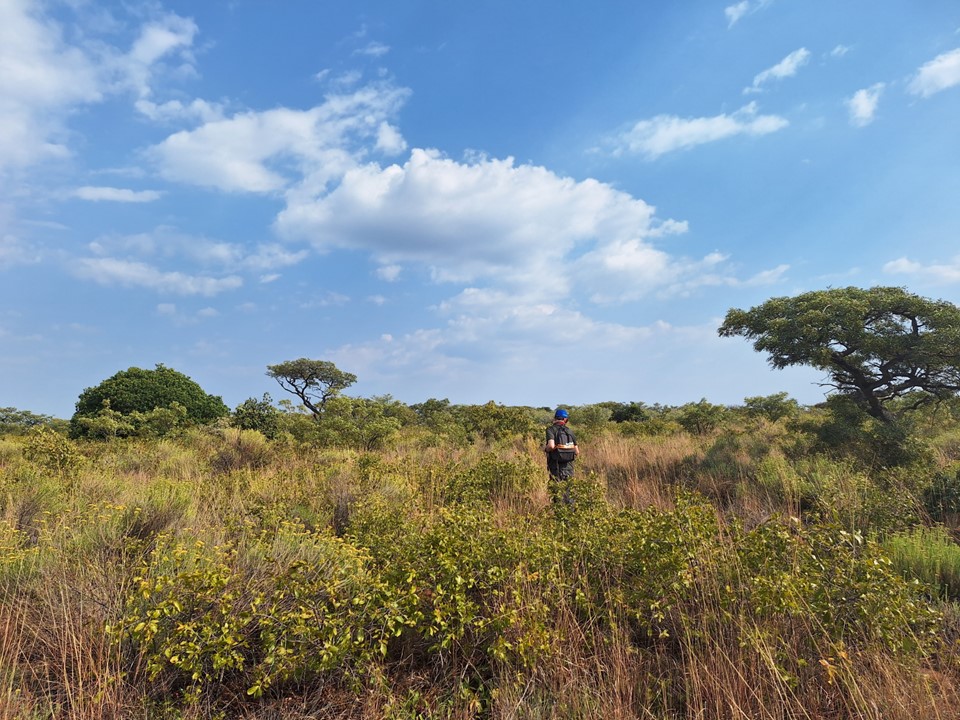
The road soon ended and we once again found ourselves on cattle trails. Without these, hiking through this region may require a machete or similar tools.
This hike was definitely worse than Otse Hill for vegetation. But unlike Otse Hill, you start putting on elevation early and it never gets as steep. That being said, both would be very easy with a well maintained trail, the only real difficulty was vegetation and route finding.
We occasionally found clearings, and used them as much as we could, but there weren’t many of them.
Then we started hearing thunder again. There was no shelter, and we weren’t that far below the top, so we discussed whether or not it was safe to continue, but agreed that we’d be caught in the worst of the storm if we went back anyway, so we may as well continue.
When it started raining, we sat under the densest vegetation we could find – which admittedly wasn’t very helpful – and sat while the storm passed over. It rained for about 20 minutes, but was soon gone. I didn’t get too wet. It also wasn’t cold enough that getting wet would be a major problem.
As we got higher up the slopes, the views below reminded me a bit of the hike to the Mulu Pinnacles in Borneo, where you also look down on a flat vegetated plain, albeit a much less dramatic one.
We also found more rock higher up, which made avoiding vegetation much easier.

We eventually reached the main face, which looked a lot more impressive from below. We easily found a scramble up through it, and were soon on the summit plateau.
The summit is heavily vegetated, and I soon realised that we were still 700m as the crow flies from the summit high point I had on my GPS. I also noted that we were already at 1484m, so it was fairly obvious that our GPS devices would be agreeing with other readings and the SRTM data that Monalanong Hill is in fact the highest summit in Botswana.

The first rocky outcrop we went up was 1493m on our devices. But as is often the case on flat summits, everything else looks higher. We kept going towards the theoretical summit. We also knew there was a summit cairn up here somewhere, but finding anything in the thick overgrowth is really difficult. I also now understand why the survey came up with a lower height – the actual high point is hidden in deep vegetation, so seeing it from another peak to get accurate trigonometrical data would be very difficult. The lack of a trig beacon on the summit, unless we missed it, does also make me wonder how it was surveyed.

Nonetheless, after going up two more summits that read 1493m, we finally found the summit cairn, and scrambled up the rocks to get another reading of 1493m. Anita got 1494m on this summit, so we’ll agree with whoever built it for the sake of simplicity – in reality it doesn’t really matter which one is very slightly higher than the rest. The fact that we had the consensus summit was good enough for us.
With that tagged, we made our way back to the gap in the cliffs we used on the way up.
We didn’t find a better way through the top sections, but once we were below a lower cliff, we dropped into the riverbed and followed that down till we hit the network of cattle trails.
We eventually hit the road just in time for a third thunderstorm. One can’t complain about it raining when there’s a drought – Botswana needed the rain far more than I needed to remain dry. It also made for a more interesting story.
Monalanong Hill had taken four hours, much longer than anticipated. We proceeded to drive back to the main road, back to Lobatse and back into SA at Skilpadshek. It started raining somewhere around Zeerust, and didn’t stop till I got back home.
All things considered, it was a rather epic weekend! If someone wanted advice one which to do – Kgale Hill was by far the best, while Otse Hill was definitely more interesting than Monalanong Hill. But Monalanong Hill was almost certainly the highest, albeit not by much. I’m not going to pretend that these hills were anything particularly impressive – and unless you’re into country high point tagging, they aren’t really worth the driving all that way to get them. But if you’re in Gaborone with some time to spare, they are worth a detour.
Exploration is about seeing new places and discovering more of the planet we live on. While these peaks won’t make any top-100 peaks list – it was a very memorable trip. I’ll remember how friendly the people were, the animals we saw on the way, new places I had never heard of. Overall it was a great way to spend a weekend!
