When I first looked over the list of summits in South Africa with at least 1000m topographic prominence, my reaction was that the list was not worth attempting due to how remote some of the peaks were – in particular, Groot Winterberg in the Eastern Cape. With no major roads nearby, no information available online and no idea who to ask about this remote peak, the prospect of gaining access to actually climb it seemed like it would be a lot of work.
After some digging, I found an old writeup from an MCSA team from PE that had summitted the peak a few years back. It referenced some rock climbing being required – which made me even more curious. The few photos provided proved entirely unhelpful – and based on Google Earth, it looked like a simple hike up a not particularly interesting peak.
In March I had successfully summited the most prominent mountain in the Eastern Cape, which happens to also be one of the more difficult 1000+m prominence peaks – Cockscomb. The meet leader had mentioned that Richard would be leading a hikeup Groot Winterberg later in the year. I immediately asked for contact details and dropped him a message.
Five months later I found myself on a flight to PE for the second time this year. It was only my fourth time in the Friendly City, always great to go back! Margo picked me up at the airport and I stayed in her spare room for the night.
Friday morning we were joined by Gaye – who I knew from Cockscomb – and Lizelle. We drove to Grahamstown and proceeded to switch vehicles to Richard’s Mahindra. It was a car full of highly qualified people – with a medical doctor, a physicist and Lizelle’s masters in computational psychiatry, I was comparatively uneducated with only an honours degree.
The farm is a mission to gain access to, thanks Richard for arranging this! Please don’t try to access this one without obtaining the necessary permission first. The road was also reasonably rough – not 4×4 territory, but high clearance and decent power are required.
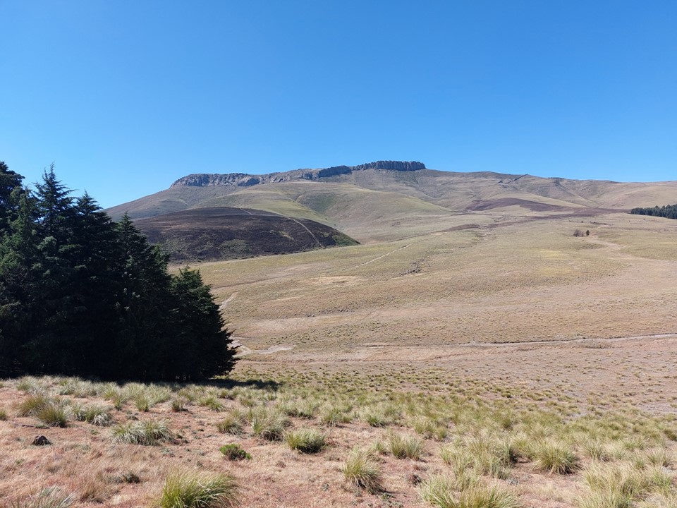
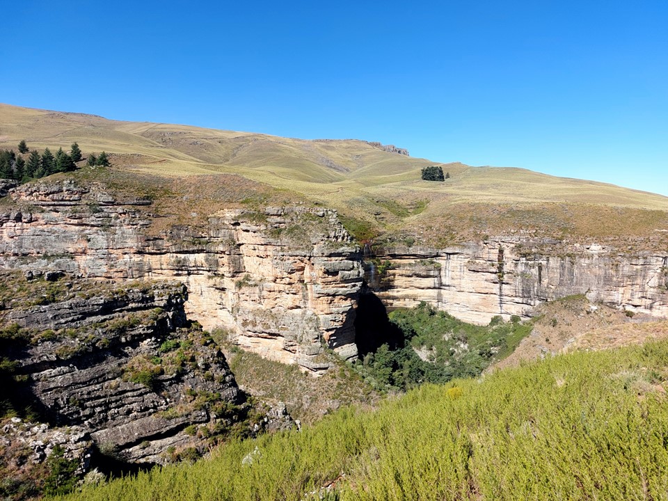
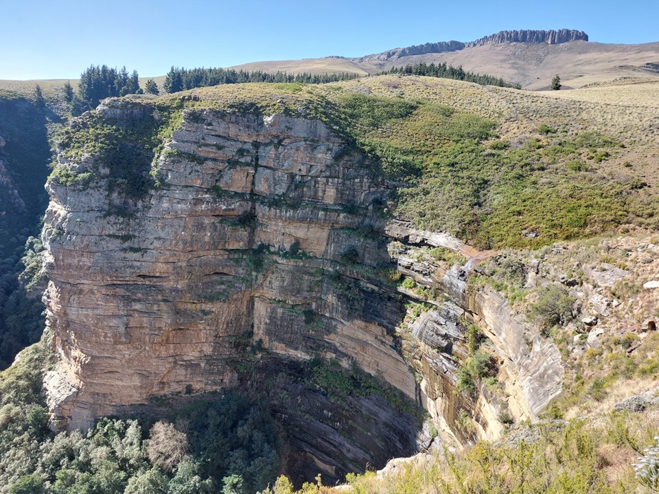
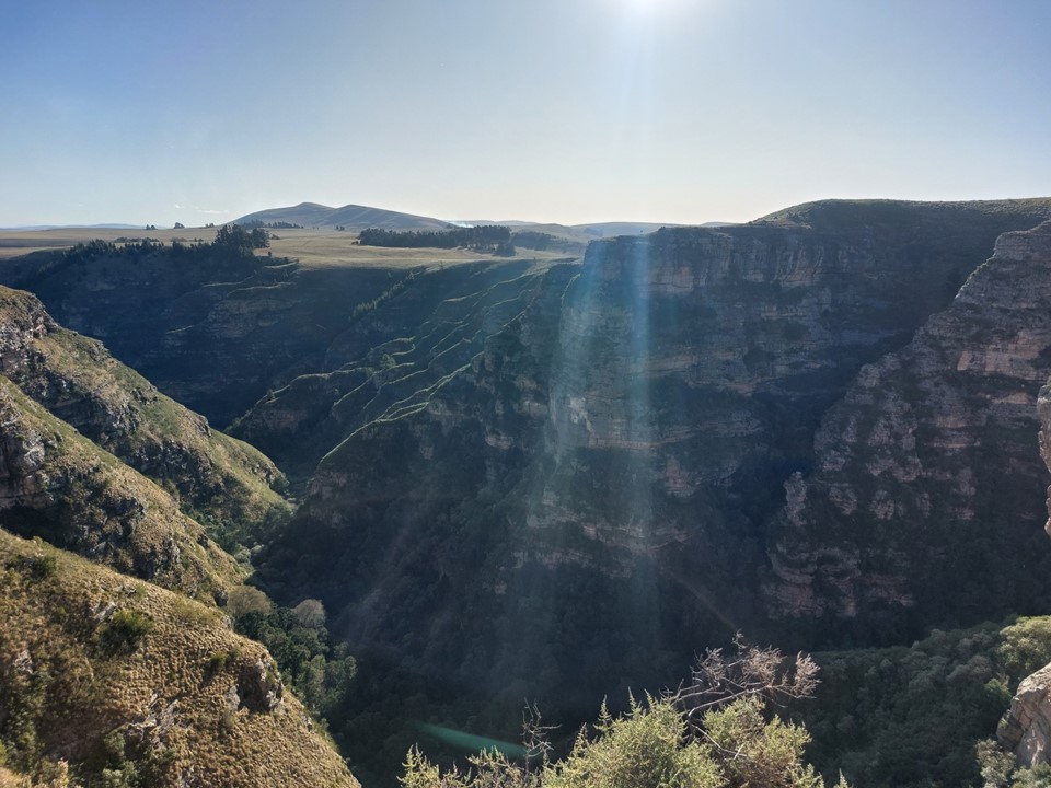
My first impression of the mountain was as I had suspected – relatively small and nothing of particular interest. Lizelle wanted to explore the nearby gorge, with some climbing gear. The others wanted to set everything up in the old farmhouse that would be our home for the weekend, so the two of us set off to do some exploring.
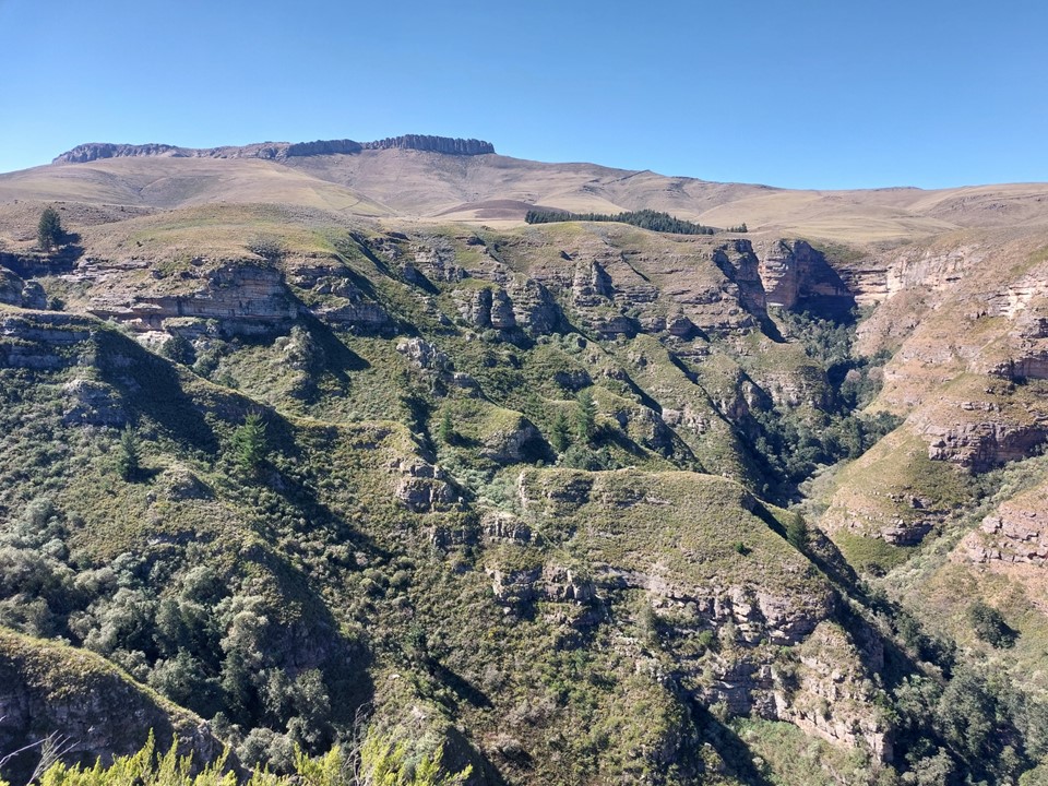
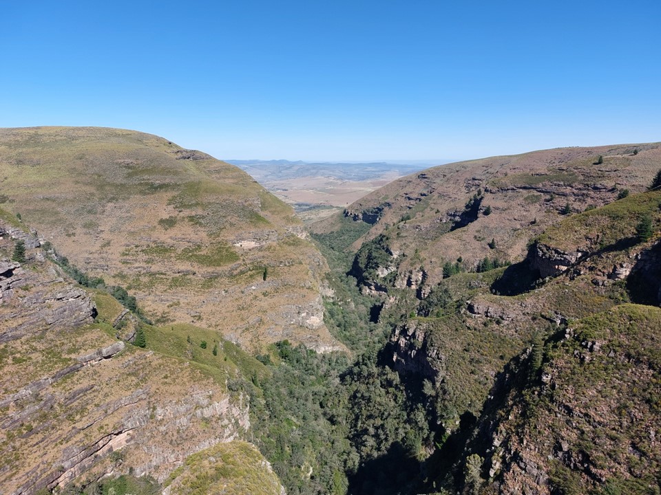
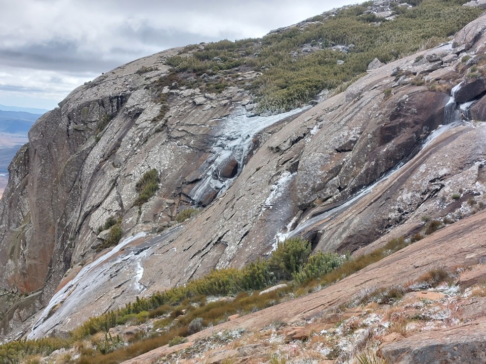
My impression of the area changed very quickly when I saw this gorge. I made the obligatory joke that it was “gorge-ous” – credit to Lizelle for not throwing something at me after such a bad joke.
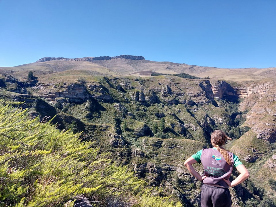
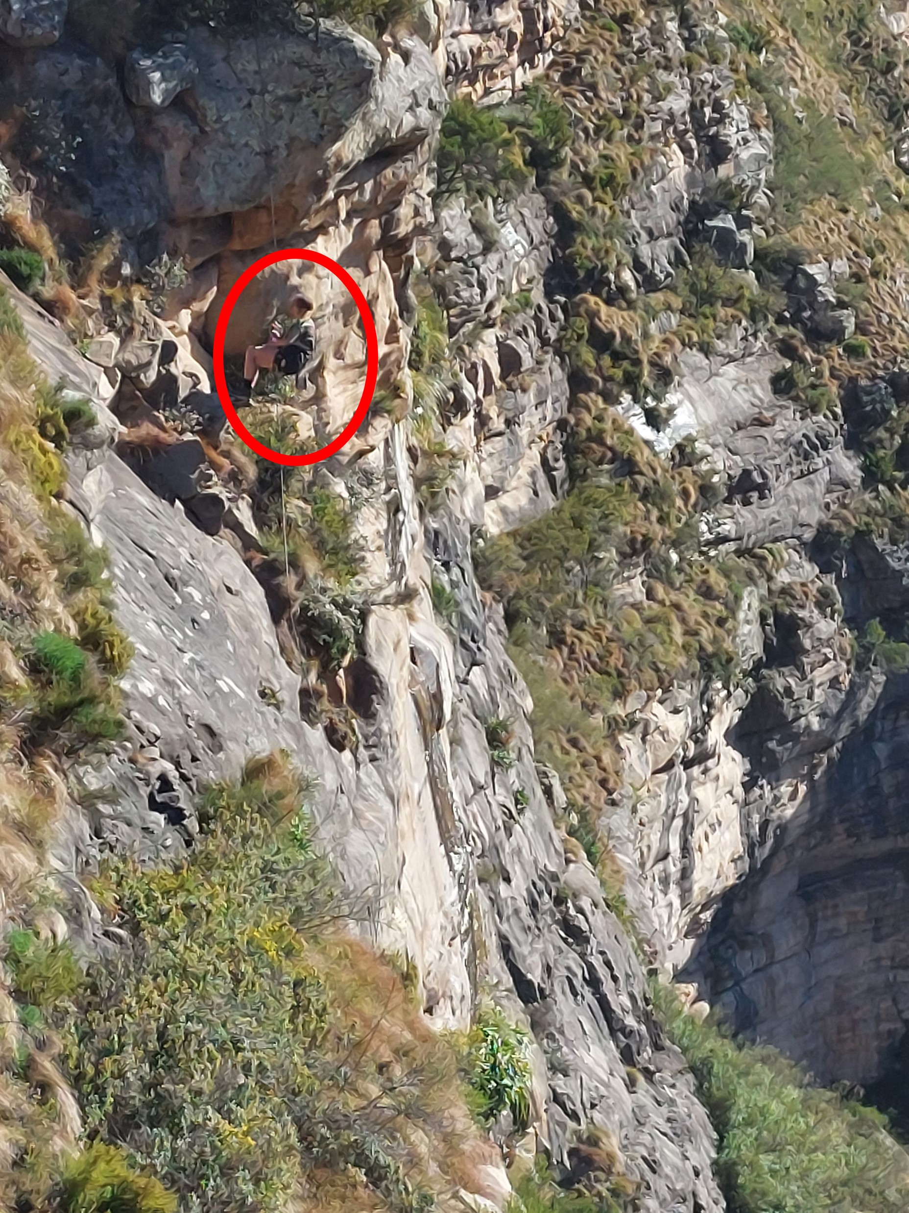
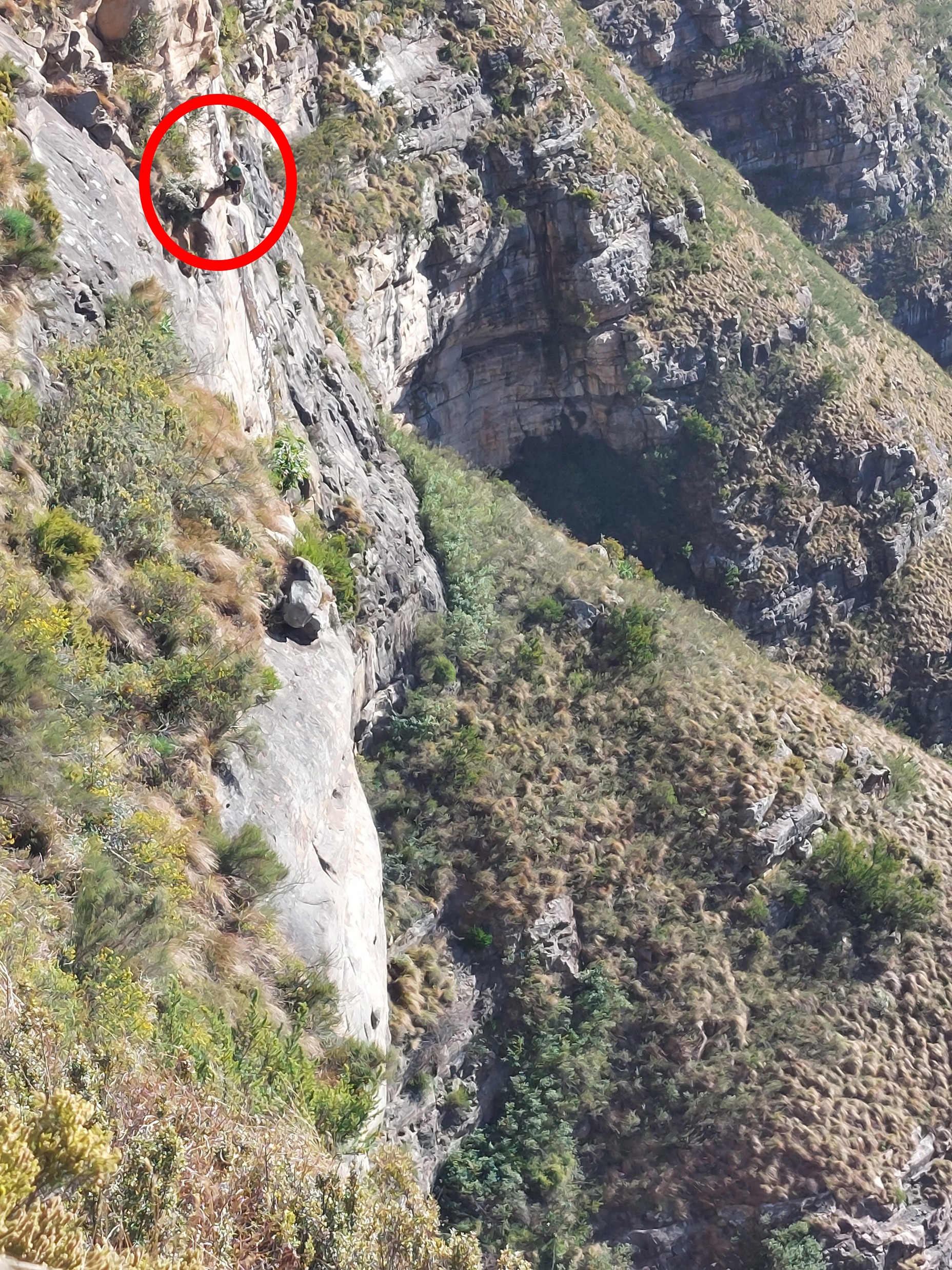
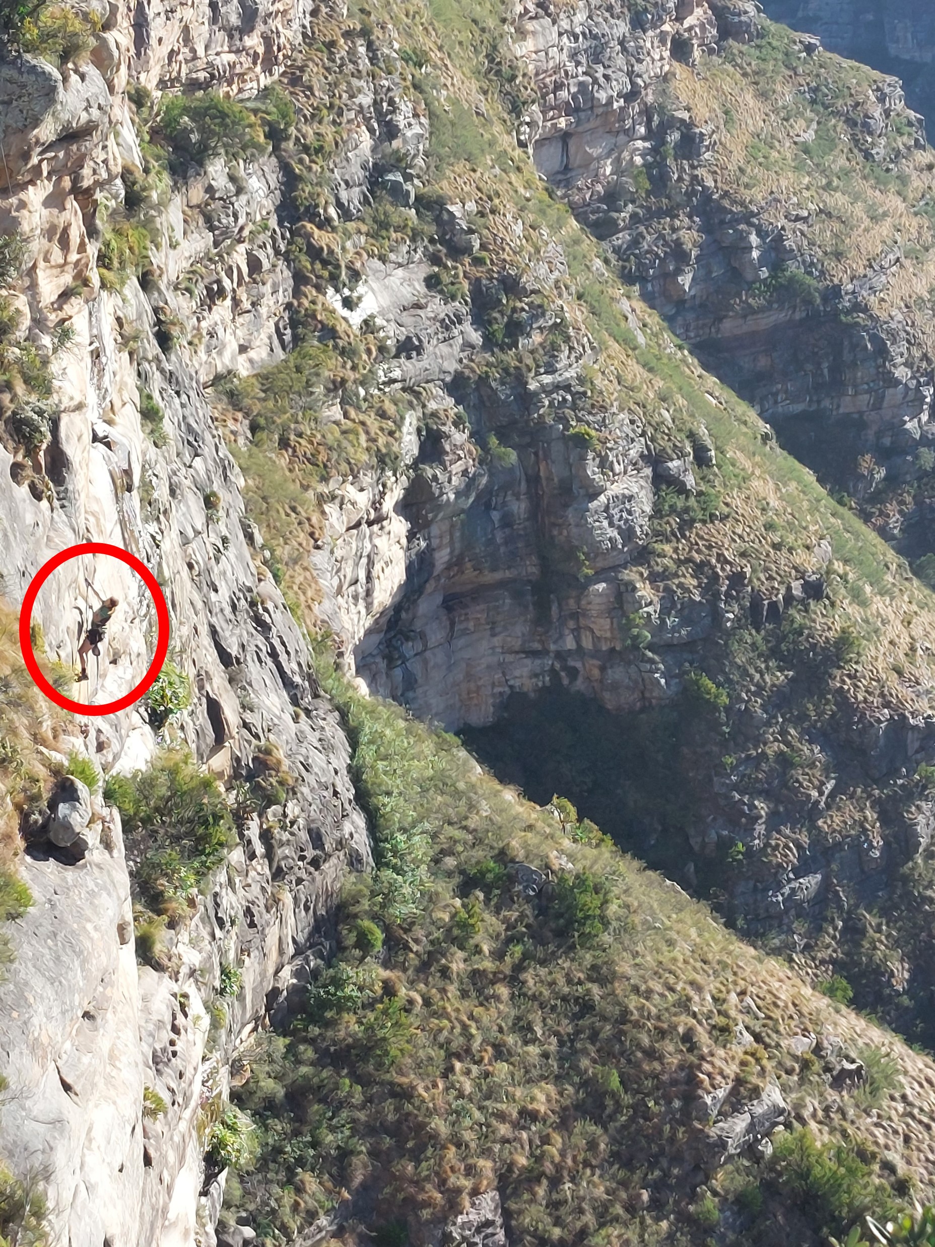
The side we were on was clearly rather overgrown and would be unpleasant to descend into. Lizelle wanted to explore the region around the waterfall, so we took a walk around the gorge to the top of the falls. With a gusty wind blowing, finding the falls was not difficult due to the spray of water being blown back up.
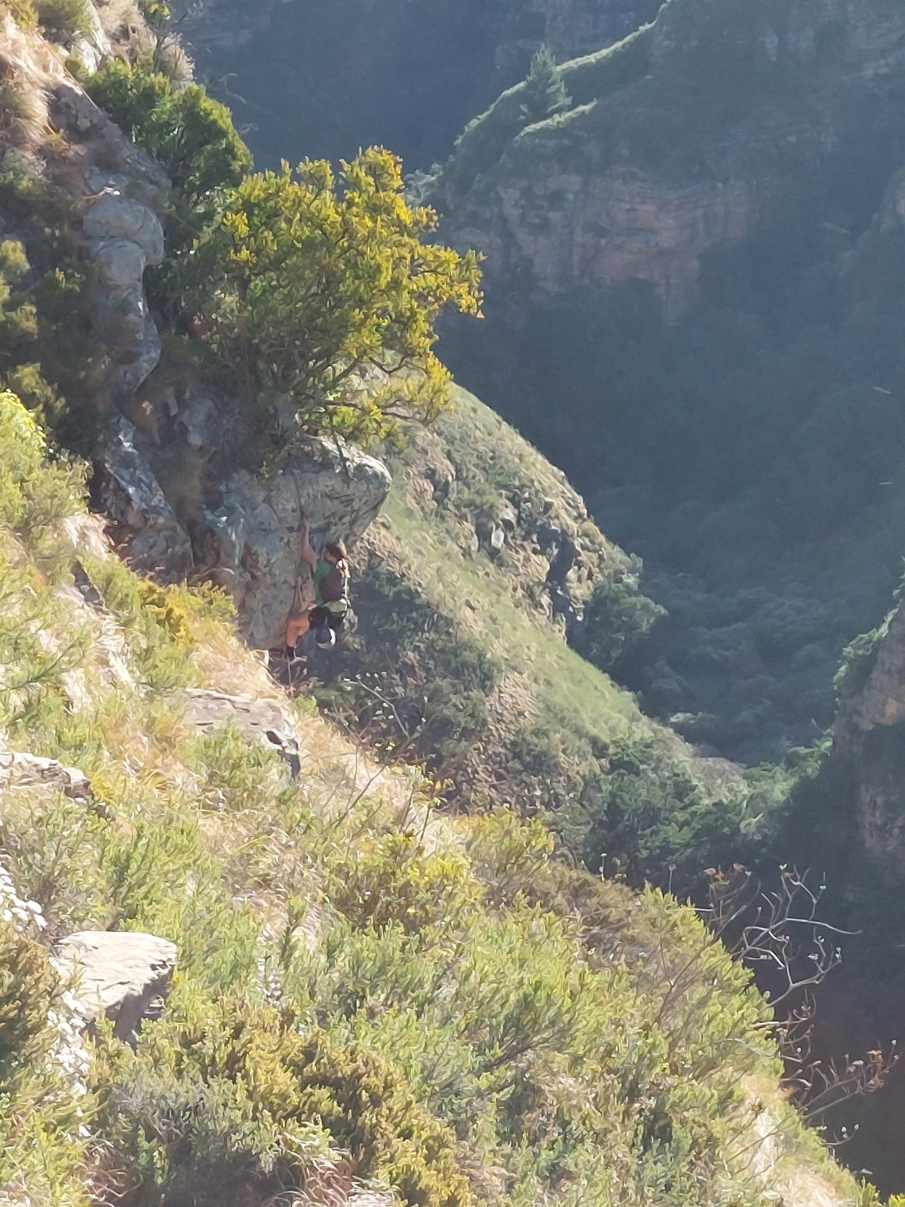
We knew Lizelle’s rope wouldn’t be long enough to get the entire way down the cliff, but she was mostly interested in abseiling in and jumaring back out, so this wasn’t an issue. I wasn’t particularly interested in doing this, so I tried to get a few photos. A shame I didn’t have my DSLR – I could have got some great shots of this.


After coiling the ropes, we made our way back to the farmhouse.
The weather forecast for Saturday had been really bad, so much so that there was concern the hike may have to be cancelled. So when it was only a bit cloudy on Saturday morning, and reasonably warm outside, I was happy that this should be easy enough.

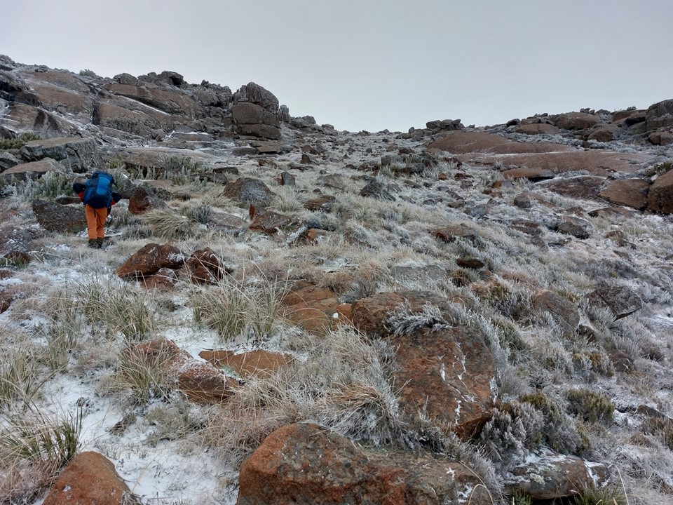
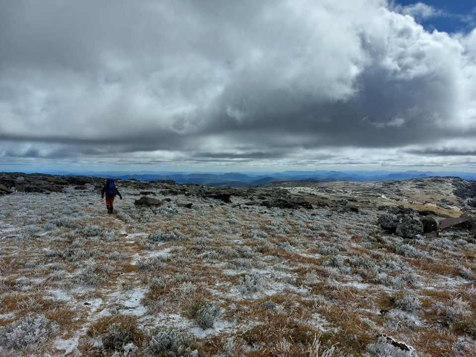
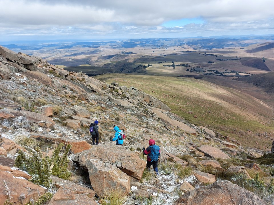
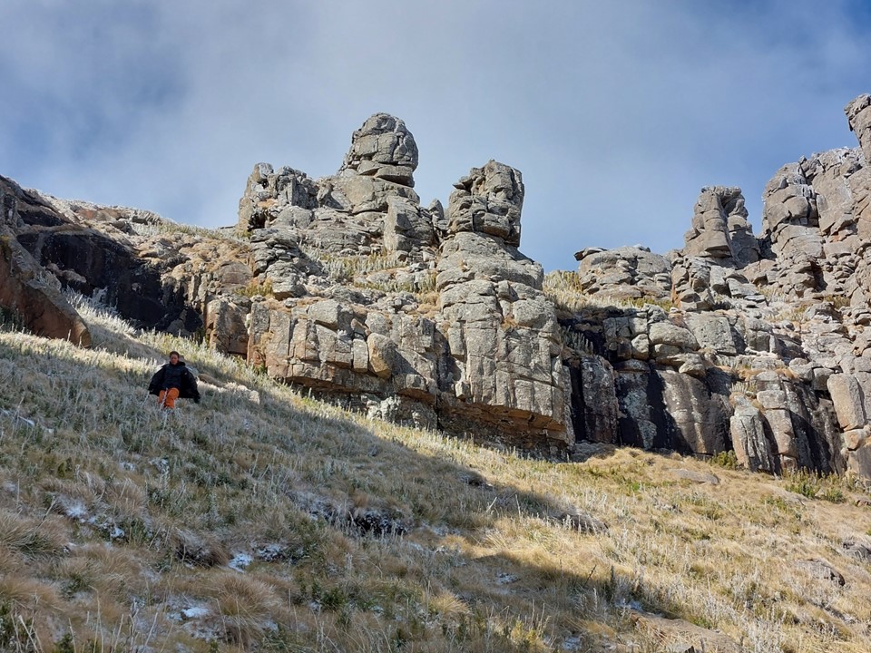
It had snowed overnight, although it was a light dusting. The others planned to start hiking around 9, but Lizelle wanted to explore the cliffs at the top, so we set out earlier. Carrying some of the gear would be good training as well – I expected it would be an easy peak to tick off. I grabbed my down jacket and gloves just in case, but it didn’t feel like I needed them.
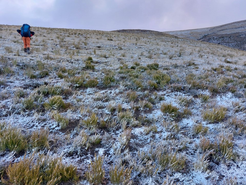

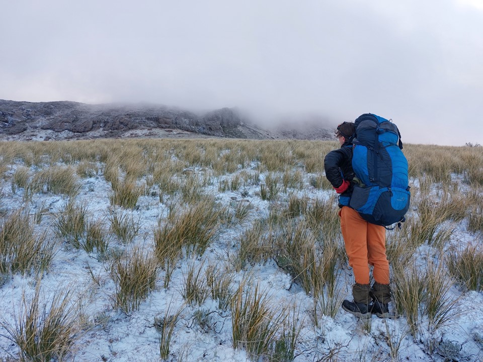
The lower section was trivial in difficulty, a very gentle uphill. We soon found ourselves in some light snow. As we got higher, the temperature dropped rapidly. I had taken my gloves off a few times to take photos, but was now starting to suffer the consequences as my hand were starting to lose feeling.
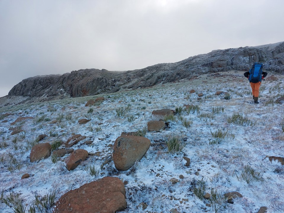
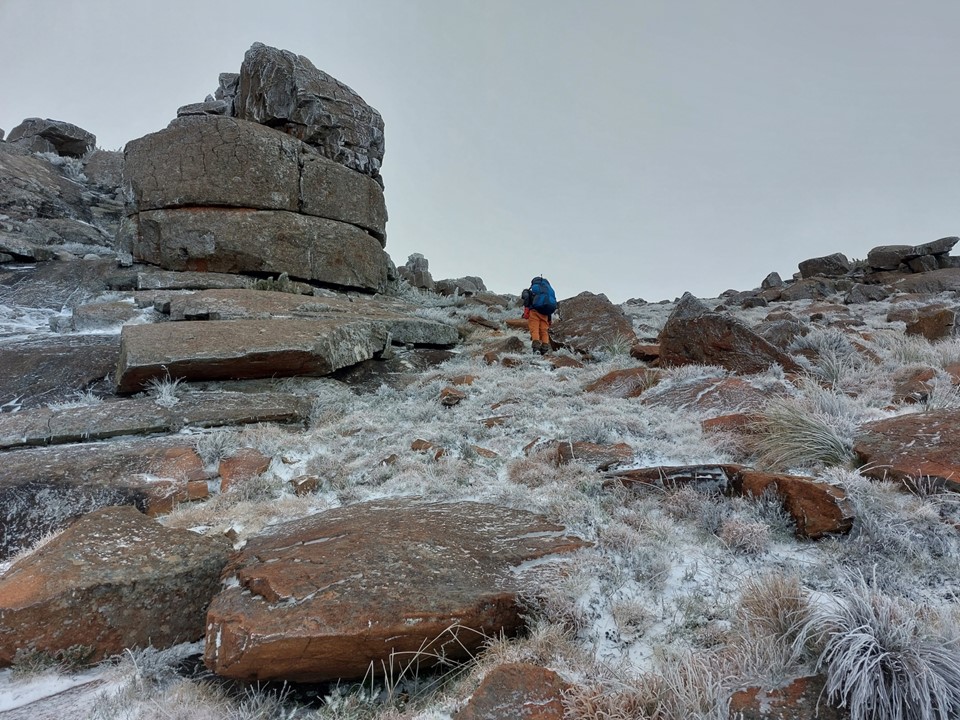
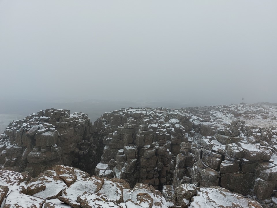
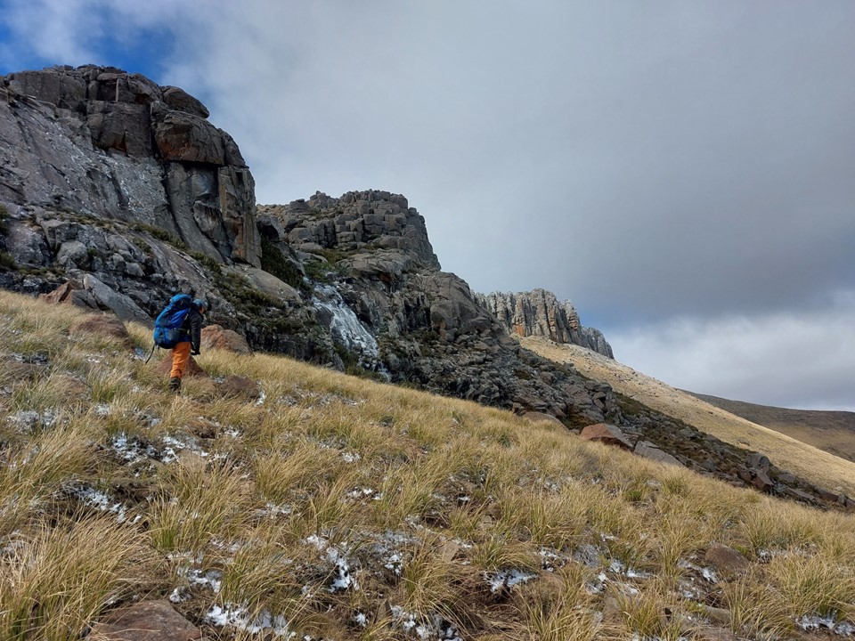
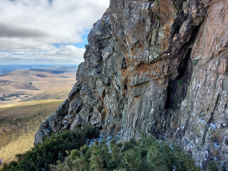
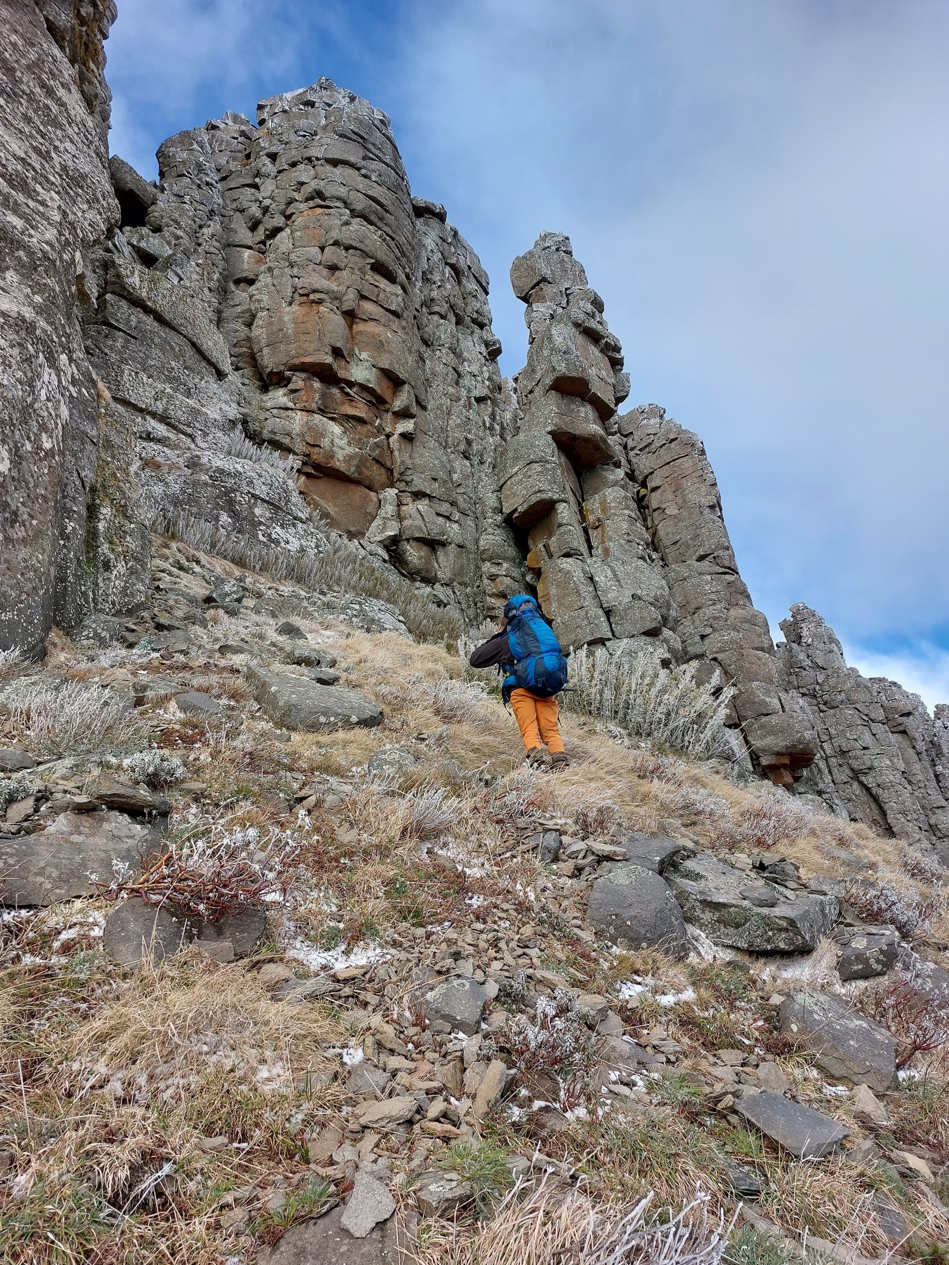
We soon reached the cliff band. It looked straightforward from below, and if dry, any number of scrambles would have been easy. But in these conditions, we decided to look for an easier gap to the north, which we soon found.
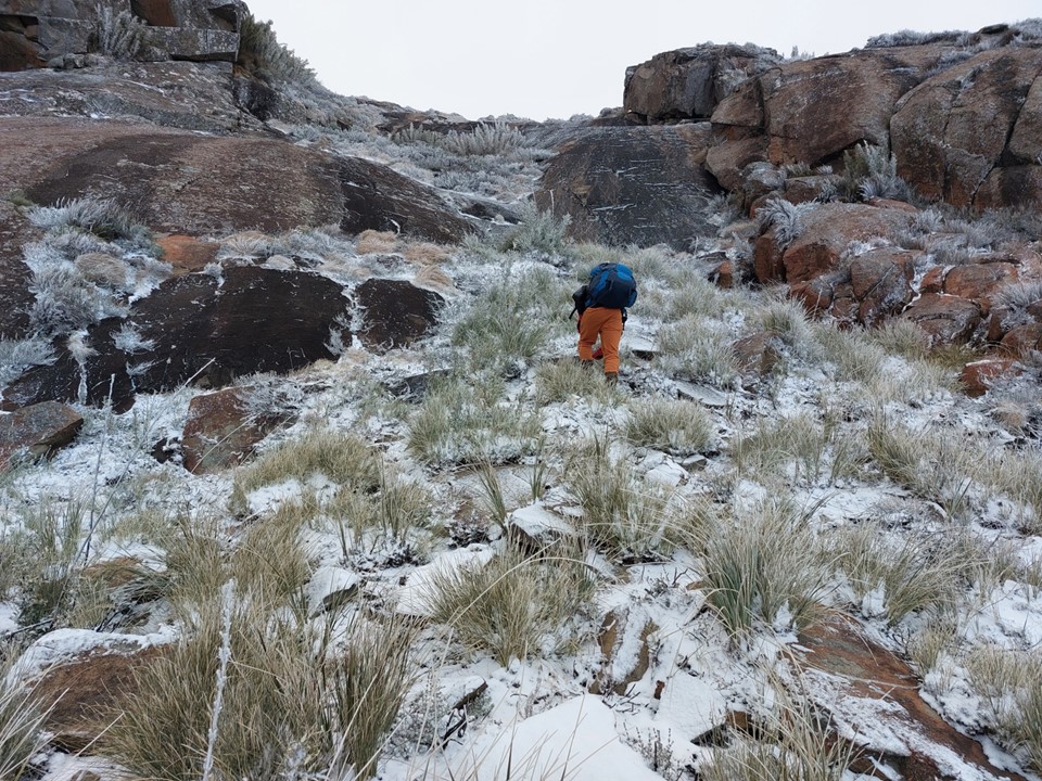
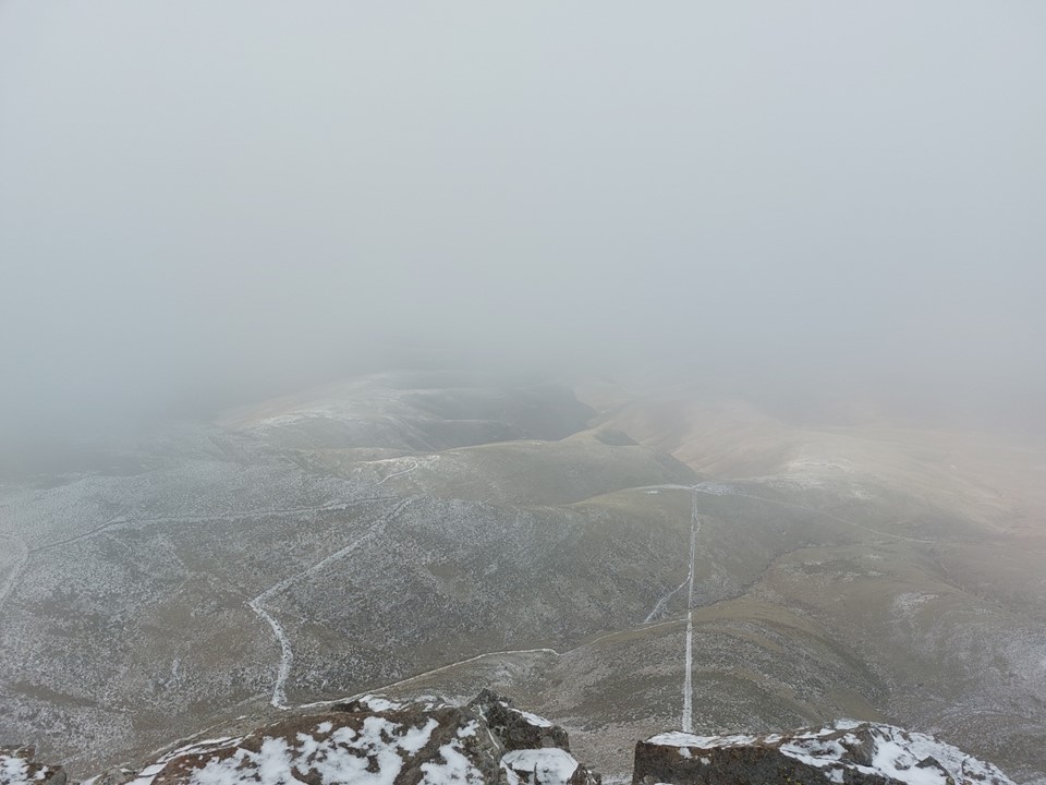
With a short easy scramble and some cliff-dodging, we soon found ourselves on the summit plateau. The icy wind was howling – and I was well aware of the extent to which I had underestimated the mountain! I had been jokingly calling it “La Montaña Grande de Invierno” (Spanish for Big Winter Mountain) – and the mountain was clearly enjoying the payback!
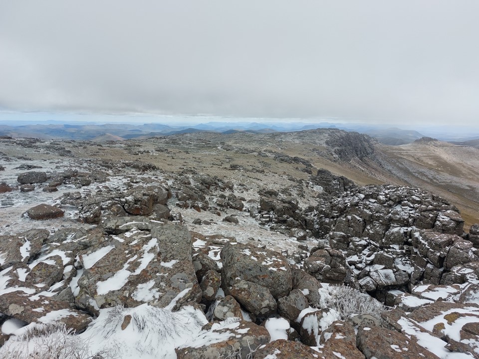
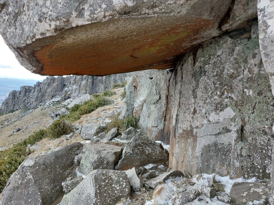
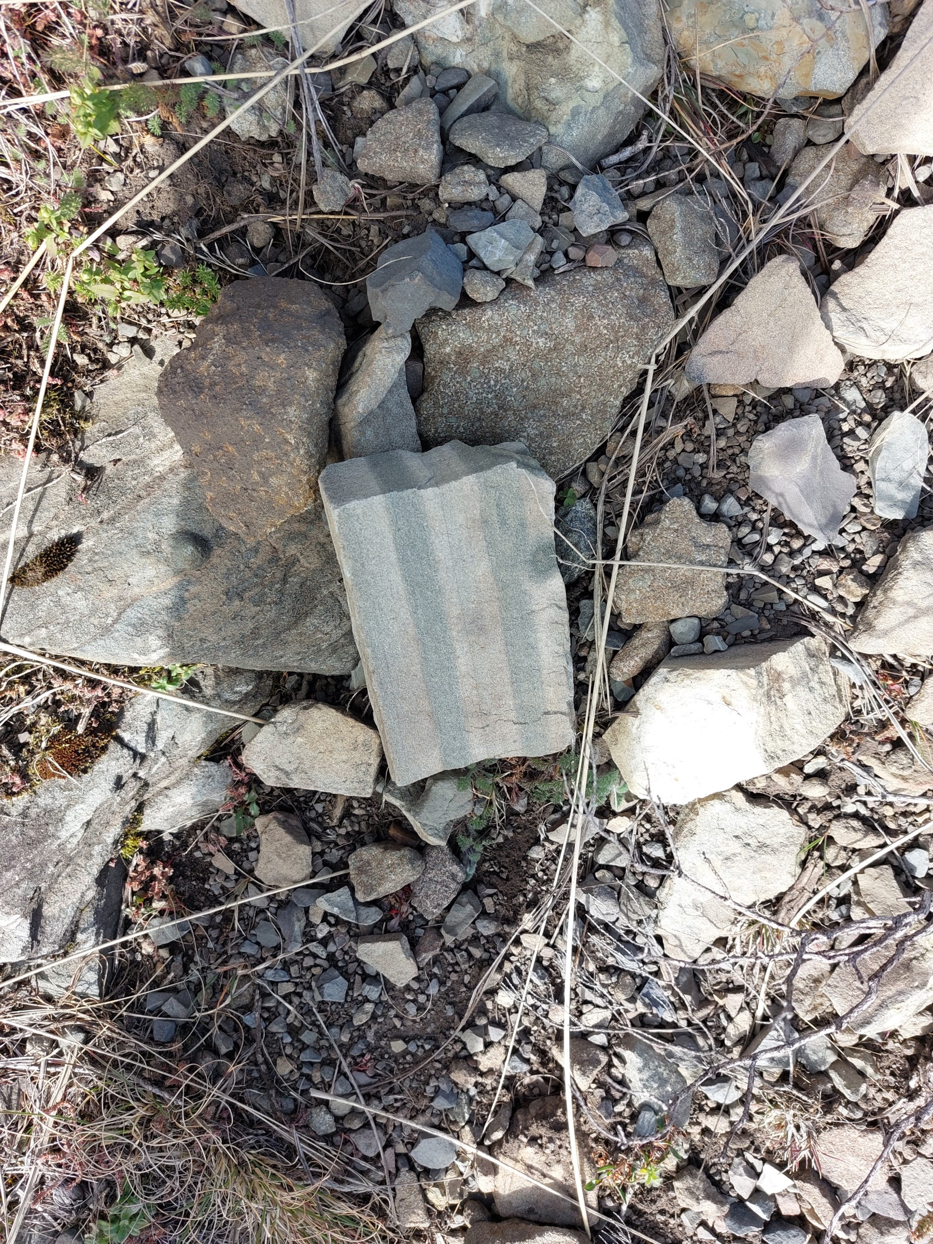
One factor I always enjoy when wind and snow come together is how the rocks shape is highlighted by the snow – almost as if they have been dry-brushed. In a way, they have been.
We found a spot out of the wind and stopped for something to eat and drink. My bottle’s nozzle was frozen shut, so I had to remove the top to drink – not the end of the world, but a sign of how cold the day was. My hands and feet had started to go numb, so I pulled my two spare buffs out my pack and put them on under my gloves, and Lizelle had a spare pair of socks she loaned me – so I was now in three pairs of socks under my trail shoes. Memories of Didima Pass in 2018 came to mind – but I knew I would resolve it soon enough and thus would not have to deal with numb toes for the next few months!
The small snack and extra clothing definitely helped. Interestingly – I didn’t have thermals on and my legs only had a single layer on them, yet they were fine. It was just my face, hands and feet that were cold.
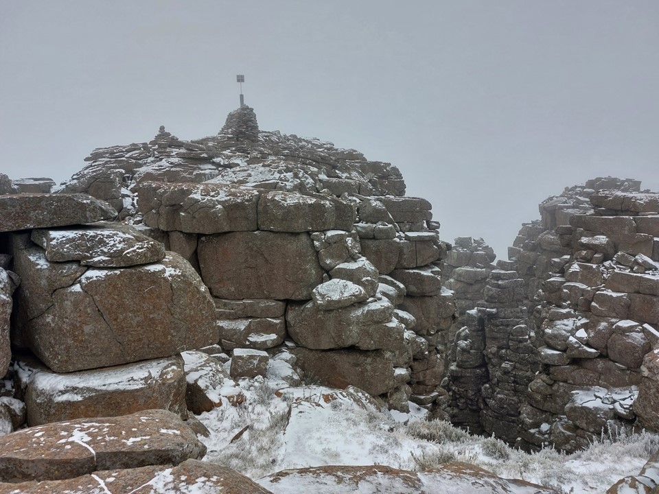
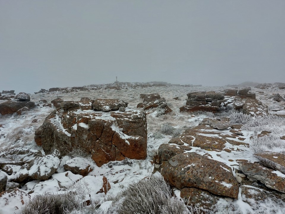
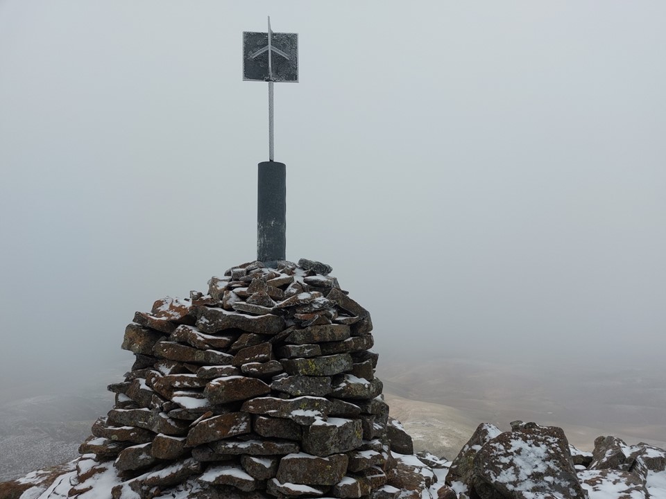
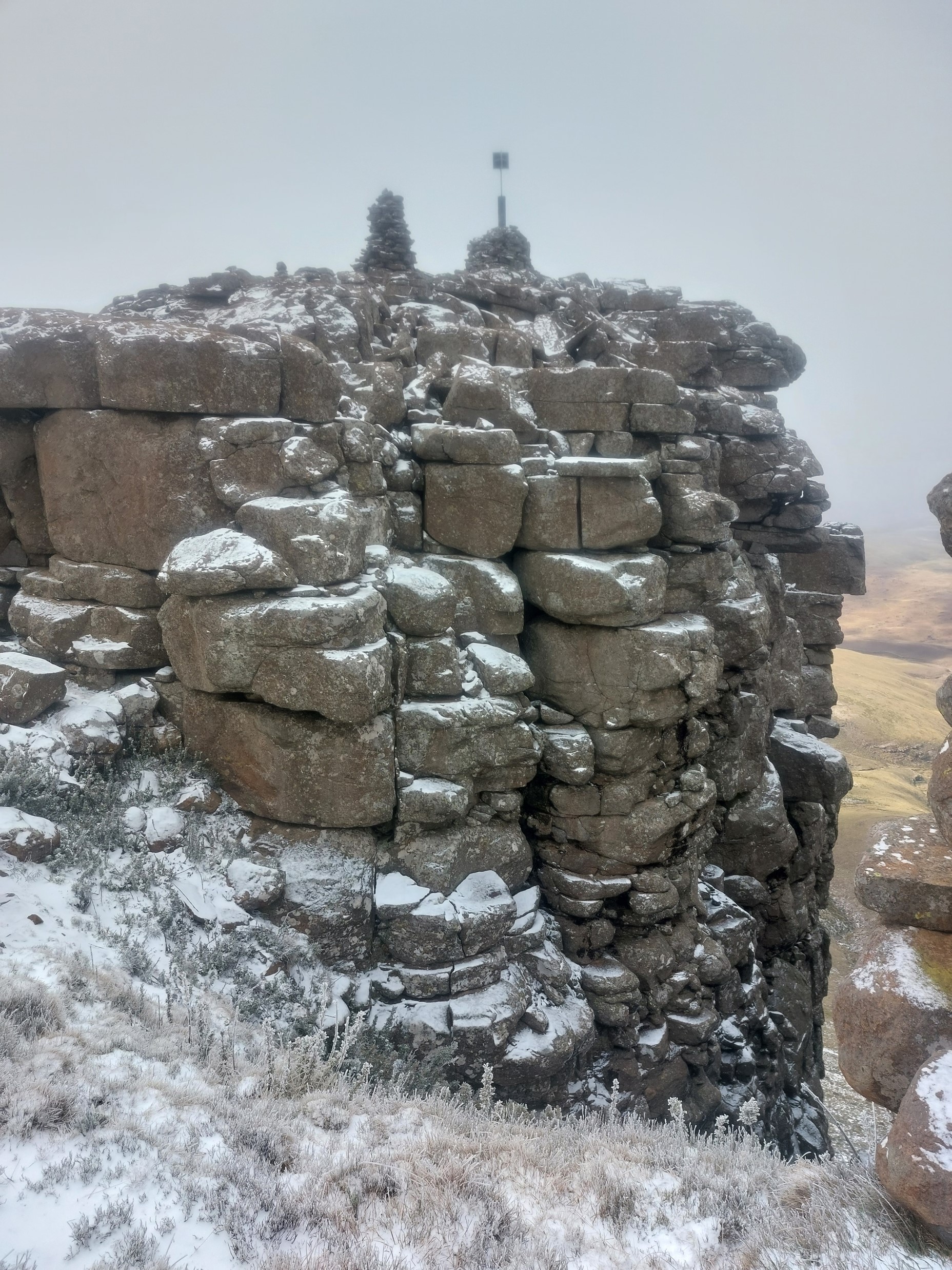
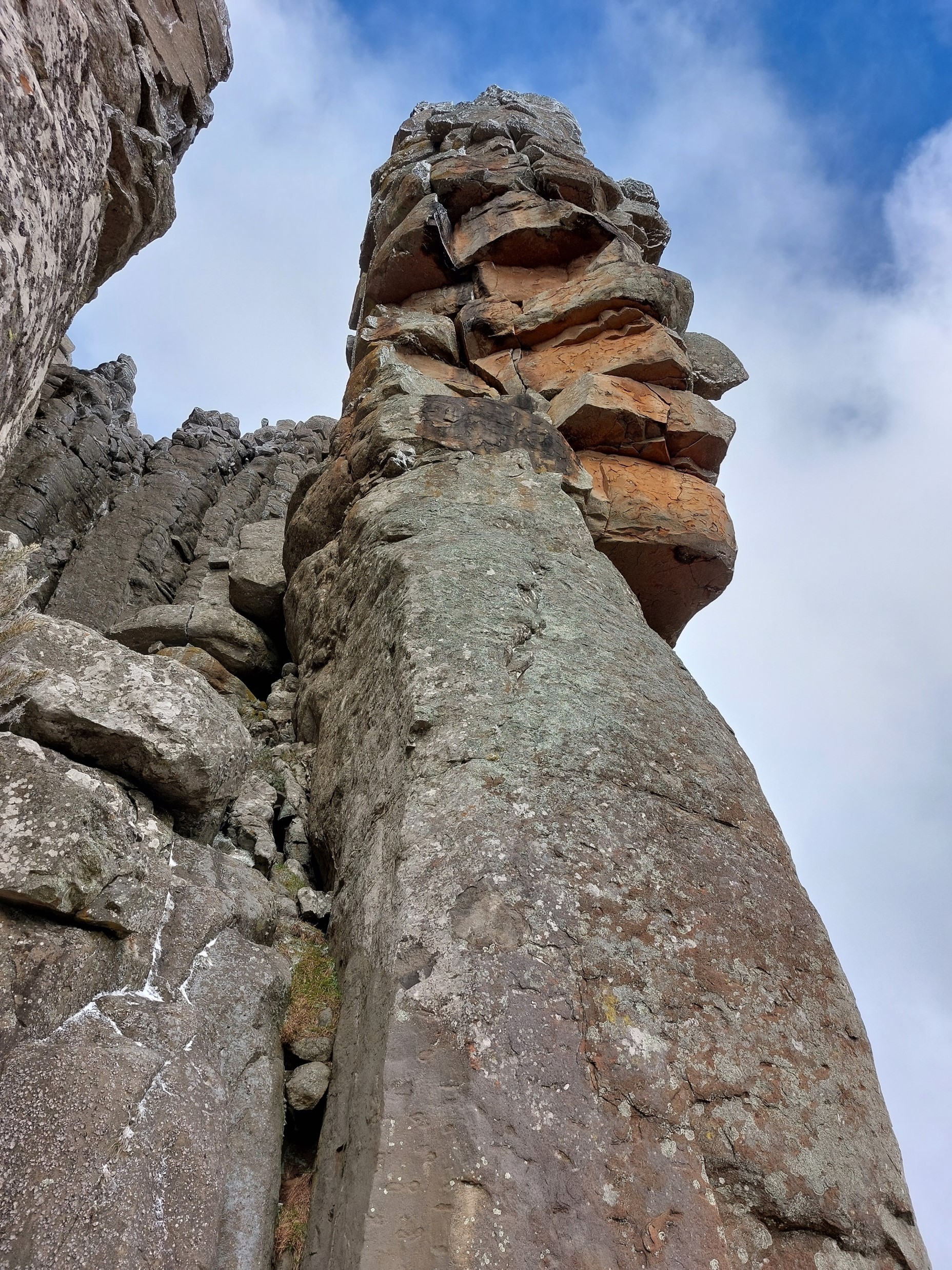
When I first saw the summit beacon, it looked like we could simply walk out onto it. As we got closer, I realised the summit was on a separate tower of rock. There was a lower summit beacon that one could hike to, but it clearly wasn’t the high point (we did later walk to it as well). I imagine this had something to do with surveying summits on the other side of the mountain where the main summit wouldn’t be visible. These days topographical surveys are usually done with advanced GPS devices, so trig beacons are largely a thing of the past.
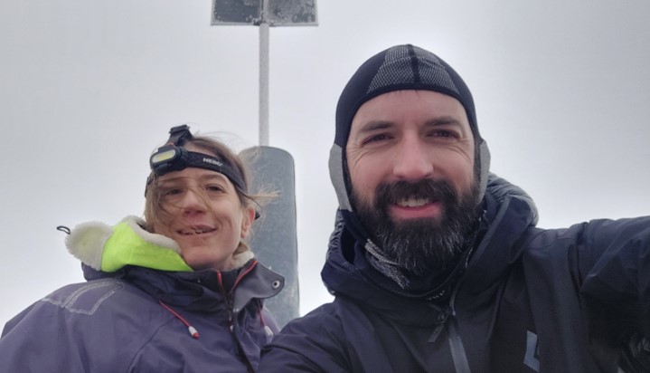
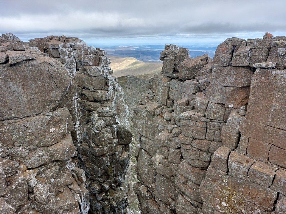
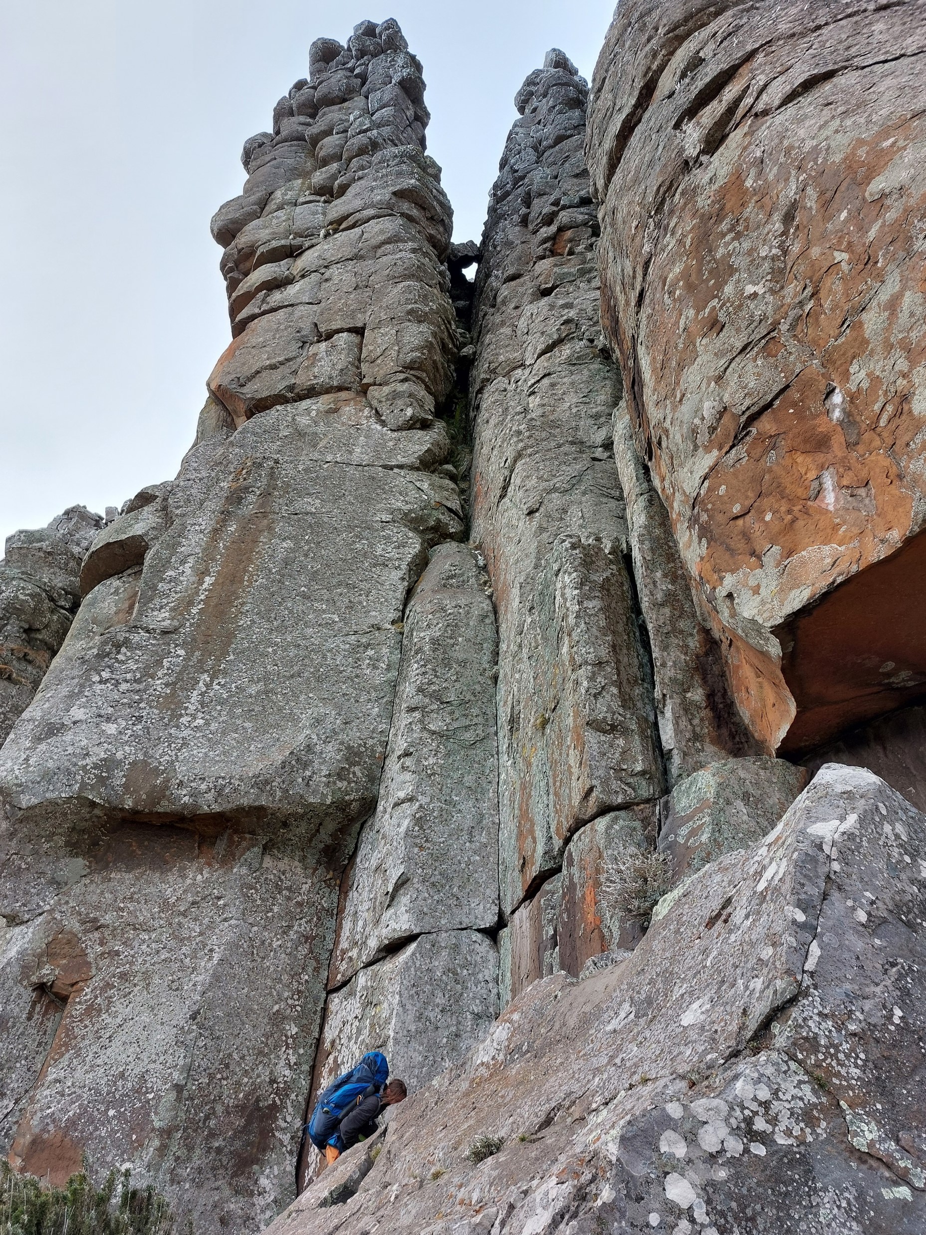
To access the summit, one drops down a gully, turns up a side gully, completes a series of large blocky scramble moves to reach an awkward move. I would say the awkward move would have been fine if there wasn’t snow – but it is actually fairly tricky. Lizelle made it look easy – clearly yoga helps with this kind of thing – but I knew, even if I could get up without a rope, there was no way I was down-climbing it without one.

Luckily Lizelle enjoys setting up anchors, and was happy to belay me up. The holds are very good, but its a very off-balance move, and if you can’t get into the right position, it becomes a case of pulling through an overhang. I eventually got up, and soon we were on the summit.
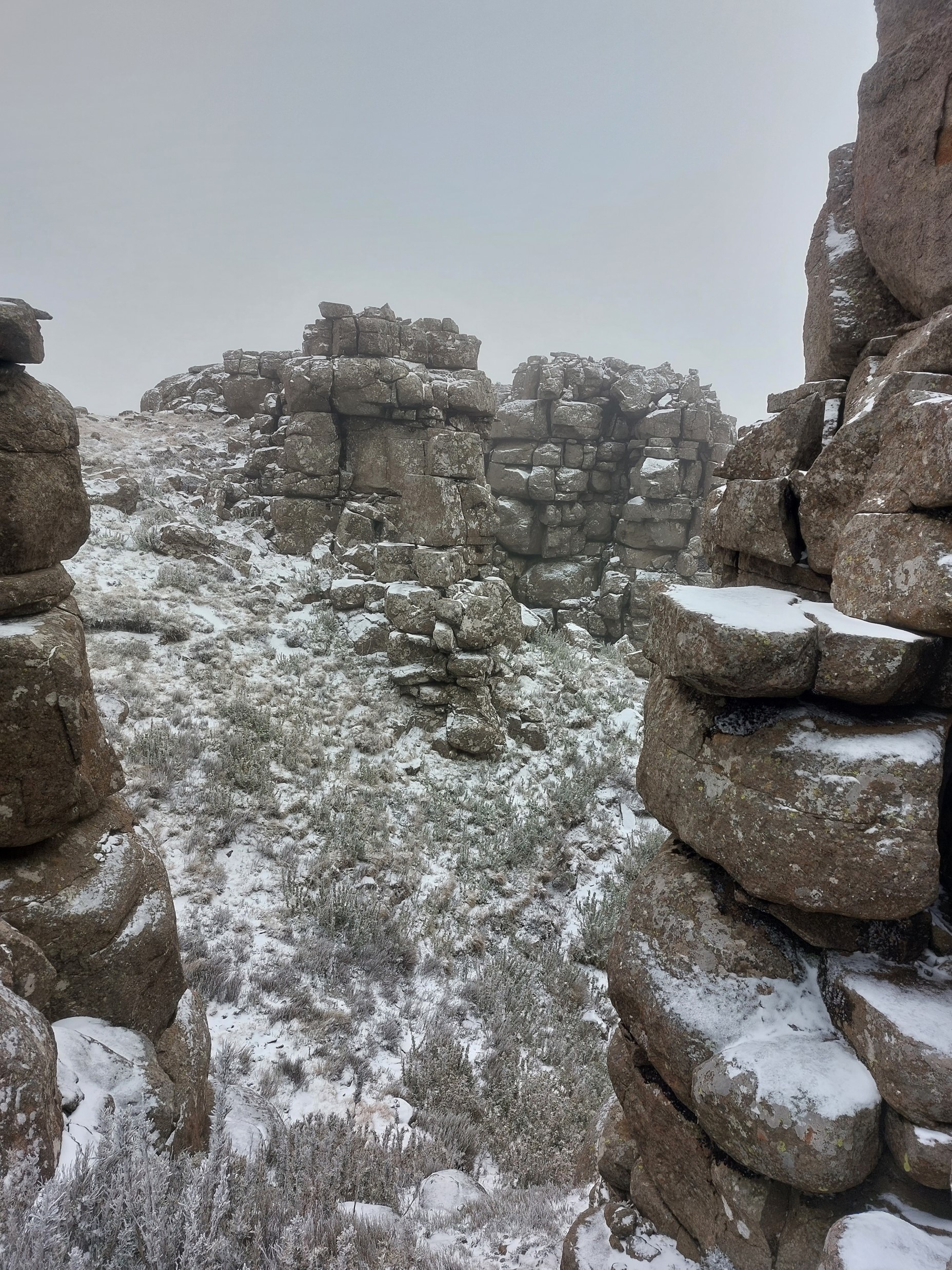
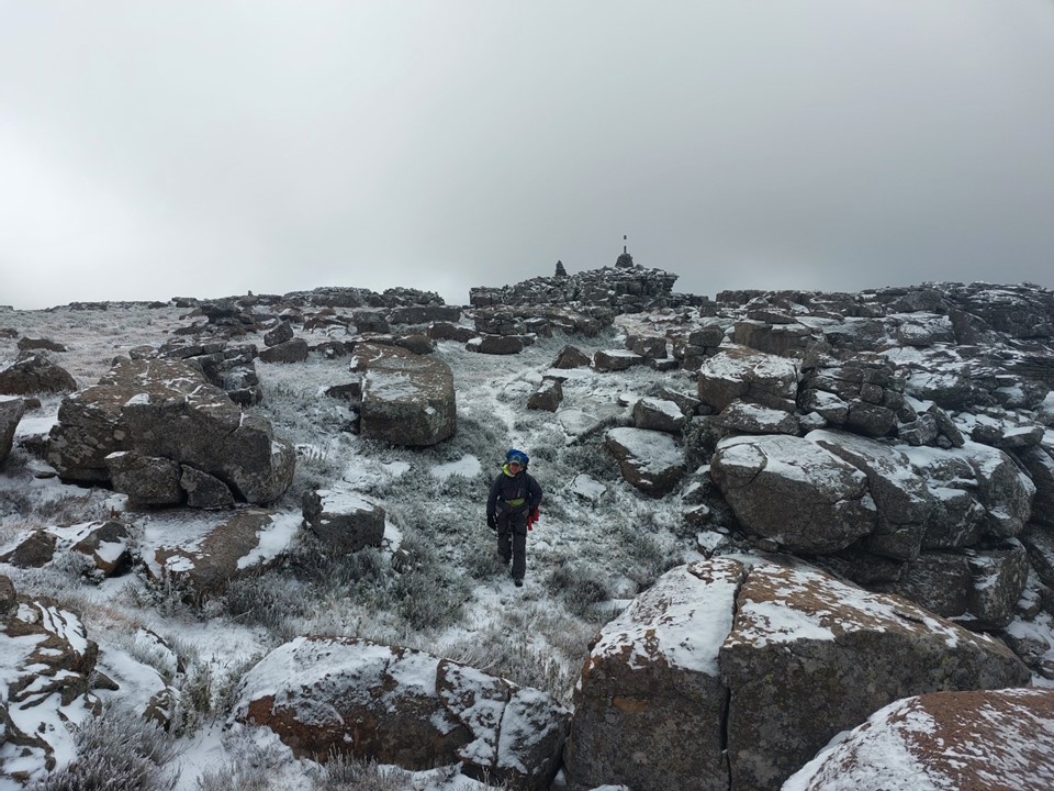
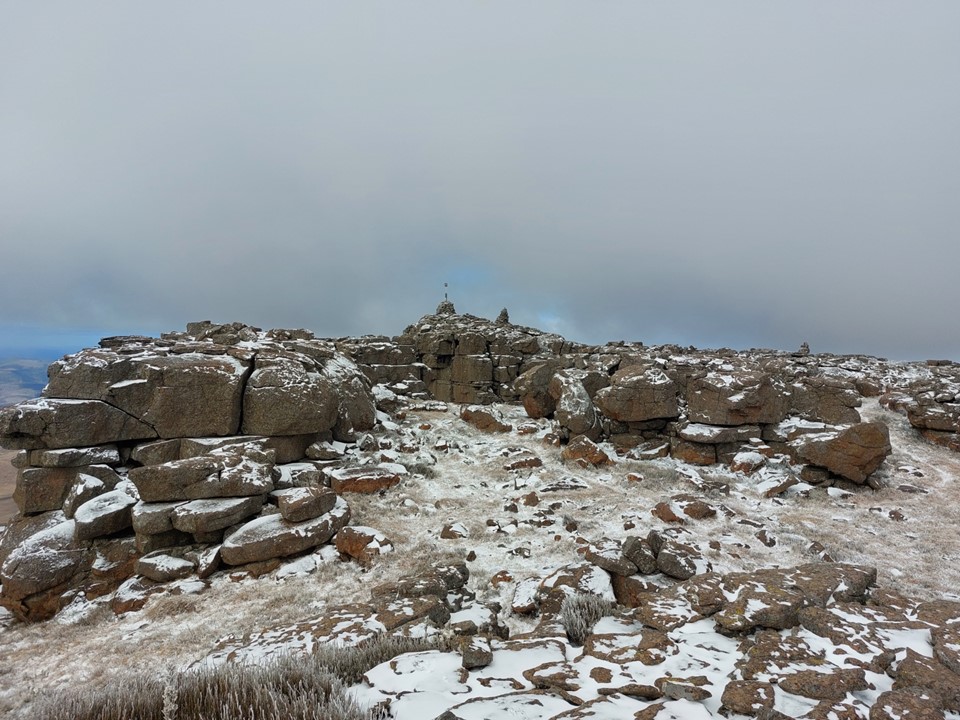
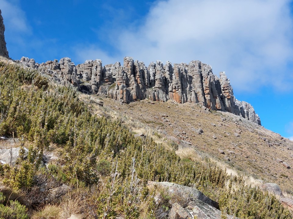
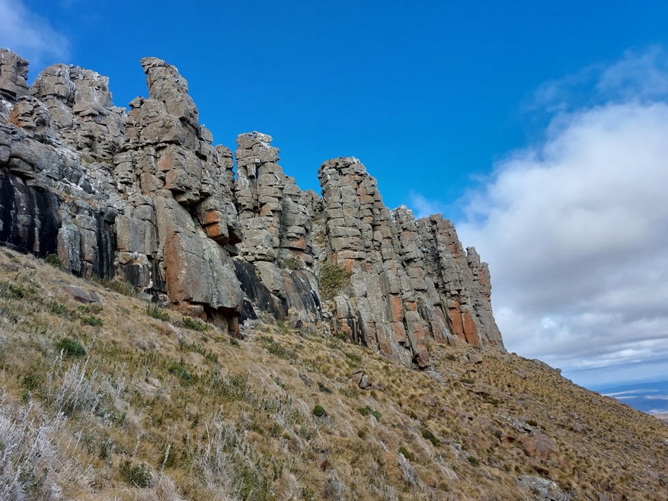
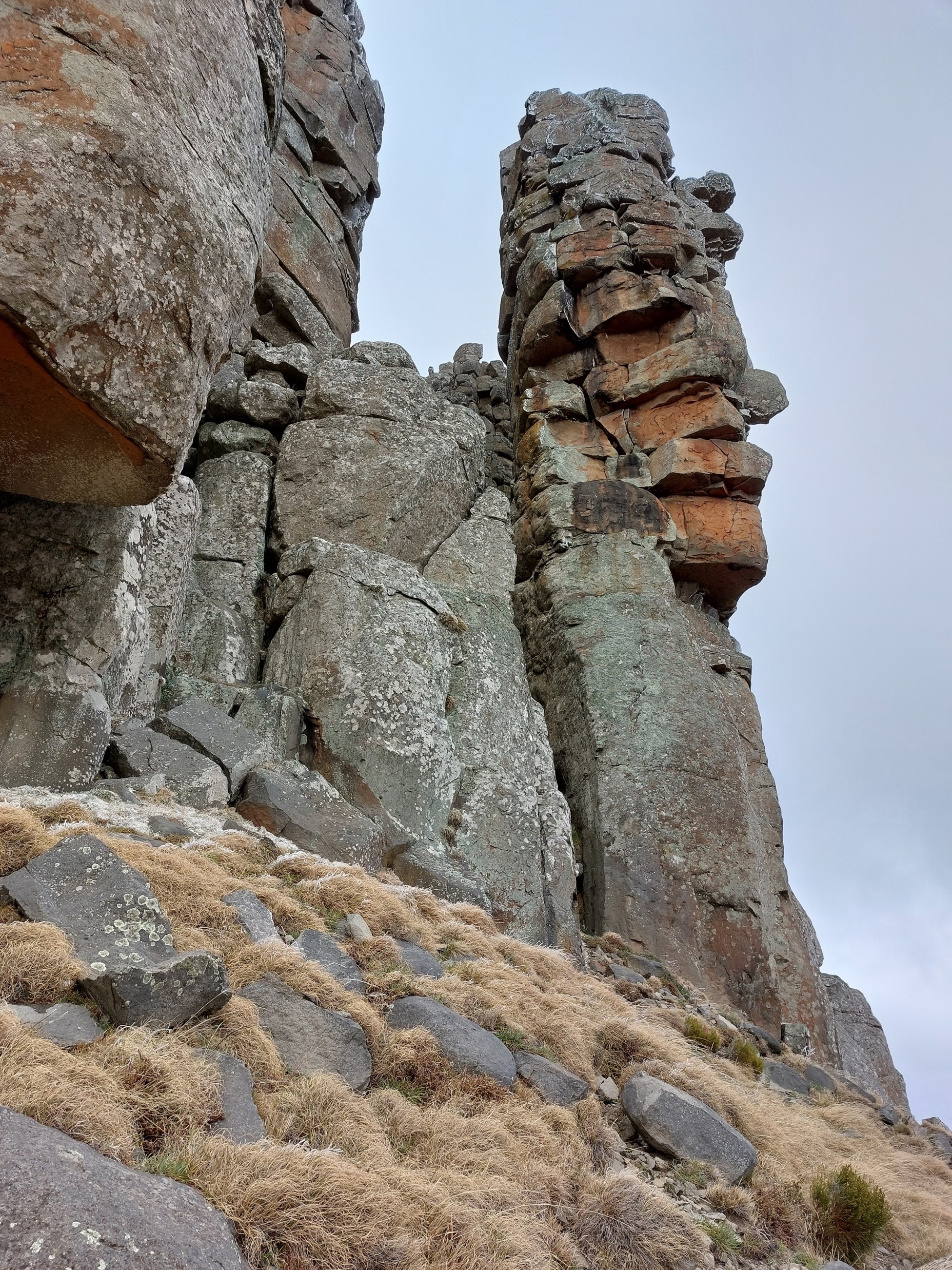
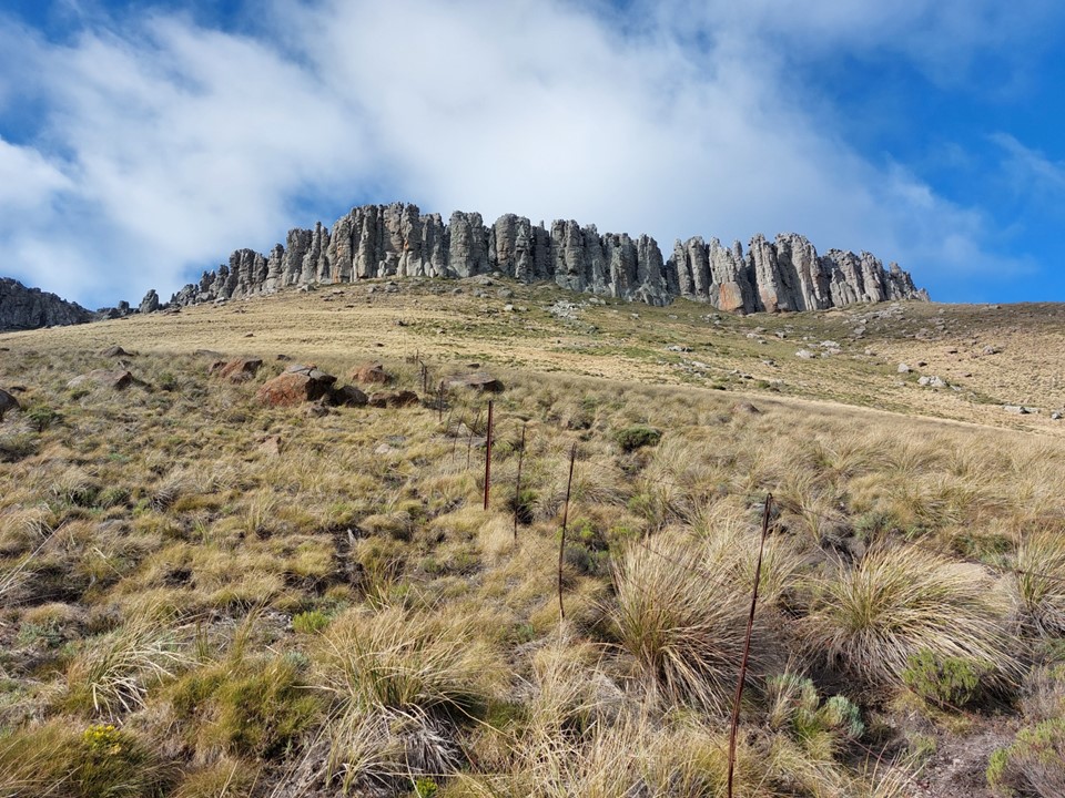
The summit is surrounded by other rock pillars. This is when my view of the mountain quickly began to change – rock pillars have always been one of my favourite types of features in the mountains – and the south side of the summit plateau is covered in them. I don’t know how many there are, but I’d be surprised if it was less than 30.

We made our way off the summit – with Lizelle belaying me through the crux, where I resembled a beached whale. Lizelle made it look easy once again.
The weather was improving, and as feeling started returning to my extremities, I was enjoying the summit a lot more.
Lizelle wanted to try some trad on one of the pillars, but soon after trying a potential route, decided to skip this due to the amount of ice on the rock. Probably a wise call, especially so far away from potential help if things go wrong.
Heading off the top, we soon bumped into the others.
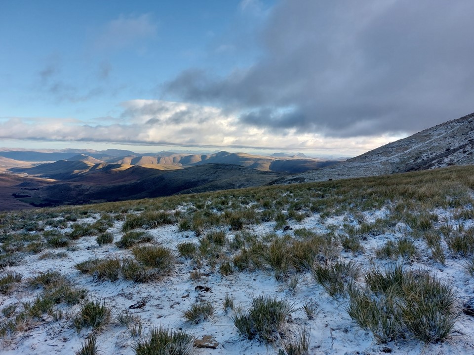
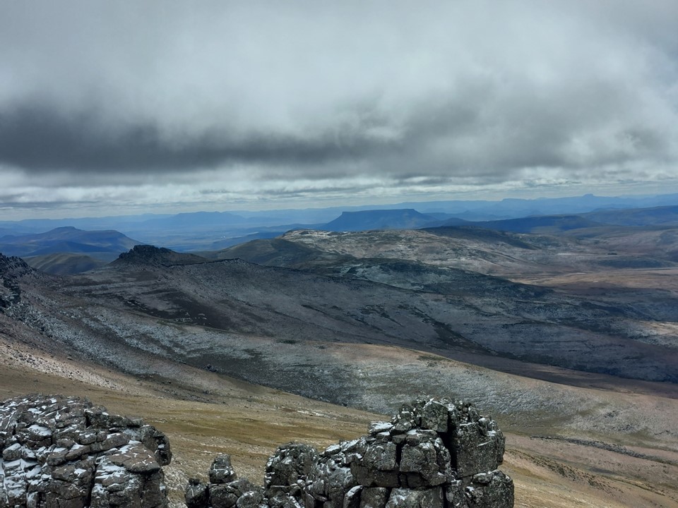
The sun was coming out as we dropped below the top. Amazing what a difference a bit of warmth makes!

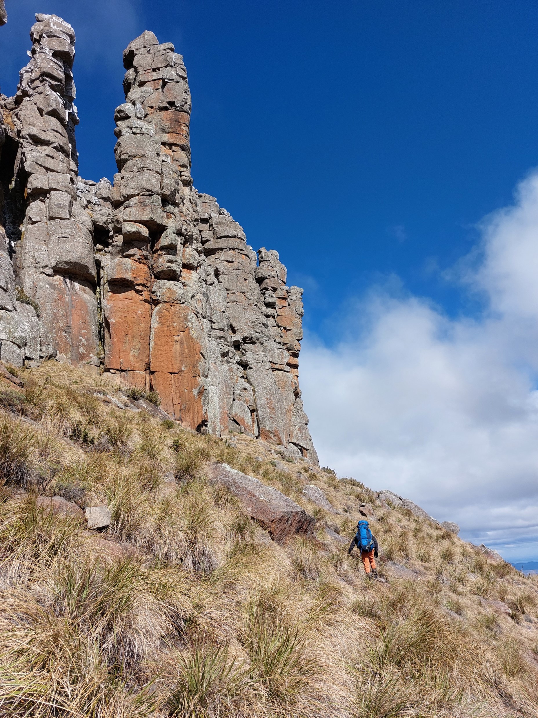
With the weather warming up, I decided to join Lizelle on her quest of finding new climbable routes on the pillars of the south side of the peak.

I opened my bottle to find around half the contents had become solid ice! On my 17 days in Nepal last year, this hadn’t happened once. Groot Winterberg indeed!
The northern half of the top is sandstone and doesn’t look particularly interesting for climbing, but the south side is basalt and looks very promising, albeit very difficult.
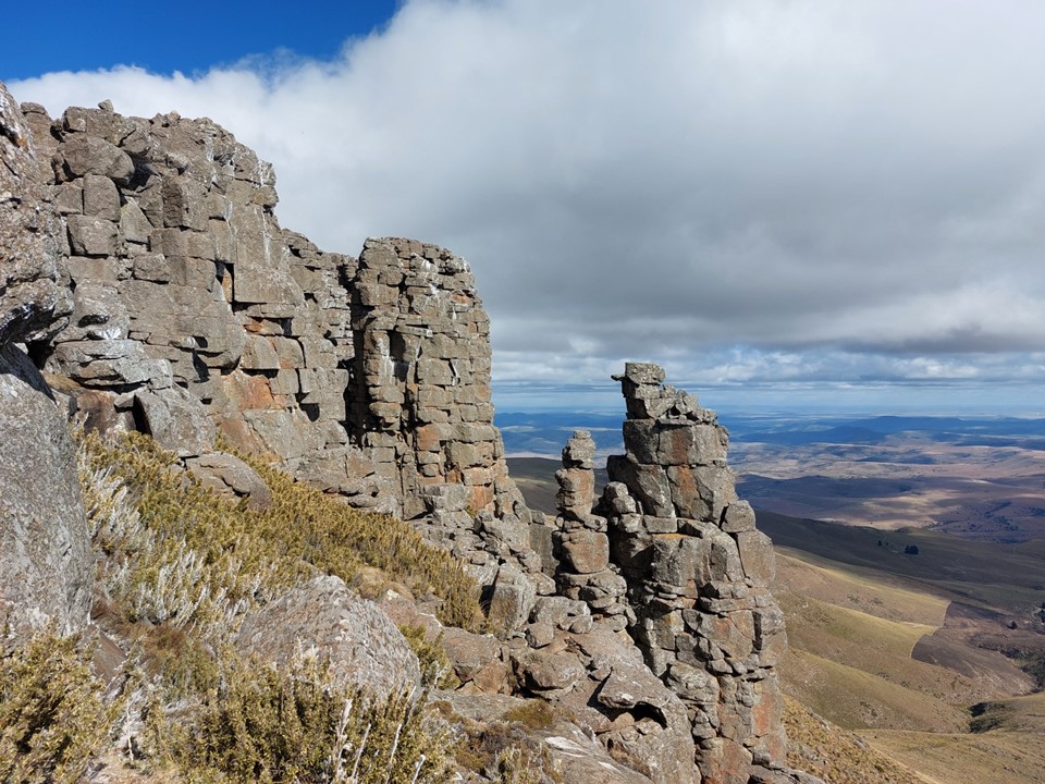
We found a spot where the cliff was narrow and it was easy to regain the summit plateau. This spot is easy to see from below as its the narrowest spot of the summit cliff. It was actually easier to ascend than the spot we used earlier, although reaching it would require a harder line up the grassy slopes.

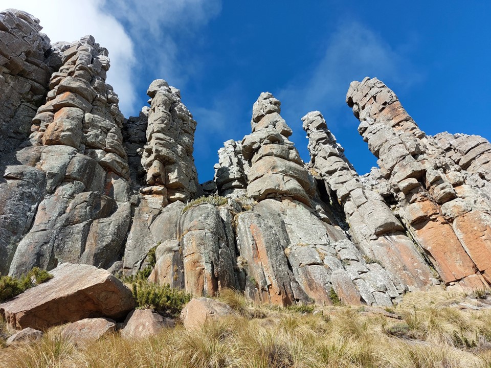
The rocky spires were incredibly impressive. At around 50m for the higher ones, they would make some epic climbs, albeit well out of my league with so many roofs.


It was getting a bit late and I decided to head down. Lizelle wanted to explore a bit further, so I made my way down on my own.

After a steep downhill next to a fence, and an unfortunate meeting between my jacket and a bit of wire, I found myself on a series of farm roads back to the old farmhouse.
The others saw me jogging down the hill along and thought something had happened. I confirmed all was fine. As it was getting dark, Lizelle returned safely.
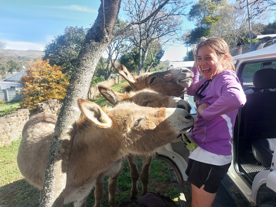
After cleaning up in the morning, we made our way back to Bedford for lunch. We proceeded from there to Grahamstown – including meeting some friendly donkeys – and then back to PE.
Gaye dropped me at the airport, and aside from my flight being 45 minutes late – all went well. Clive picked me up at the airport, and I was soon safely back home after a really enjoyable weekend with some wonderful people.
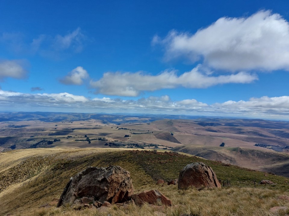
Its funny – I expected Groot Winterberg to be one of the least interesting peaks on the list, but between Finella Gorge, very cold summit conditions and the amazing rock formations – it was actually a really interesting peak. It has been one of the best attributes of the list so far – with 17 peaks now complete, there’s yet to be one that wasn’t worth the effort – whether the day was made by a dog following us up Sneeuberg, the field of flowers on the top of Mannetjiesberg, the perfectly clear day I had on Roodezanberg with views of peaks in every direction, it has been a great project. 7 peaks to go!
Special thanks to the PE MCSA Team for allowing me to join the hike, and especially to Richard for putting the hike together, I’m always impressed with how friendly members of the Section are towards strangers!
Regarding access to this mountain – it is on a farm, and obtaining access is not easy. If you would like to visit, watch out for meets on the MCSA Eastern Province Section website and chat to the meet leader.
