Machhapuchhare is an unclimbed 6993m mountain in the Annapurna Region of Nepal. It’s name means “Fish Tail Mountain” and it is sacred to the people of the region. It is also a mountain that has been on my to-visit list for many years. When I compiled my “5 most beautiful mountains” list, it featured in second place, behind Jirishanca in Peru. Naturally I need to do more research for my list, and as with all things mountain related – the fieldwork is the fun part!
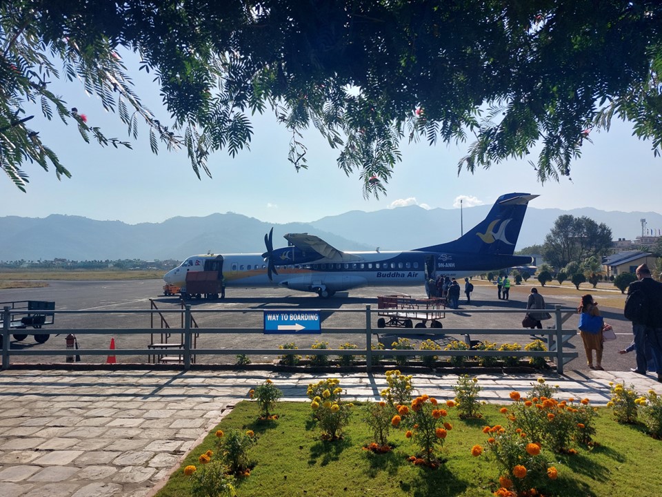
Landing back in Kathmandu after having just completed the Three Passes Circuit in the Everest Region, I knew I would be cutting it tight to attempt the Annapurna Sanctuary hike, also known as Annapurna Basecamp. Once I had my bag, I proceeded directly from arrivals to departures to see what flight I could get on to get to Pokhara. I stopped at the Yeti Airlines counter and proceeded to buy a ticket to fly to Pokhara on the 1PM flight. I had just short of three hours in Kathmandu – so I decided to catch a taxi to the tourism office in order to buy a TIMS Card as well as a permit for the Annapurna Region. The TIMS card can only be purchased in Kathmandu or Pokhara, but arriving with it already in place would mean I can head directly to the start of the hike upon arrival.
Obtaining the permit required a few colour ID photos, payment of some permit fees (NR5000 in total) and submitting a few forms – one of which is completed online. I always travel with 4 colour and 4 black and white ID photos as you do need them from time to time. It took about an hour to get the permit, nothing was well marked and the process was confusing – but I soon had the paperwork in my hands, as well as a topographic map of the route.
I then caught a taxi back to the airport, and found some food to eat. Finding anything proper was difficult, so I ended up with some biscuits, a chocolate and some water. I hadn’t eaten or had anything to drink since I left Lukla, and wasn’t feeling particularly great as a result.
Our flight was a bit behind schedule, but nothing too serious.
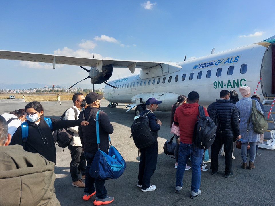
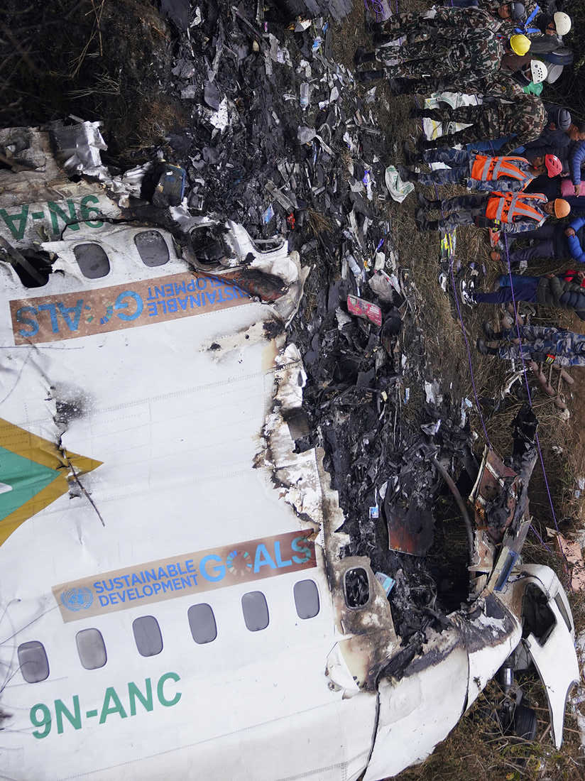
Slight digression – but roughly eight weeks after this flight Nepal suffered their worst aviation disaster in more than 30 years. It was a Yeti Airlines ATR72 coming in to land in Pokhara. When I found a picture of the crash sight, I saw that this had been the exact same aircraft I flew on just a few weeks earlier – registration number 9N-ANC. At the date of writing the cause of the crash is not entirely certain, but it appears to have been caused by a double engine failure. A lot of life boils down to simple luck – and while 8 weeks is a long time, every time I look at that photo of the wreckage, it is hard to believe that it is the same aircraft that had safely taken me from Kathmandu to Pokhara. Condolences to the friends and family of the deceased.
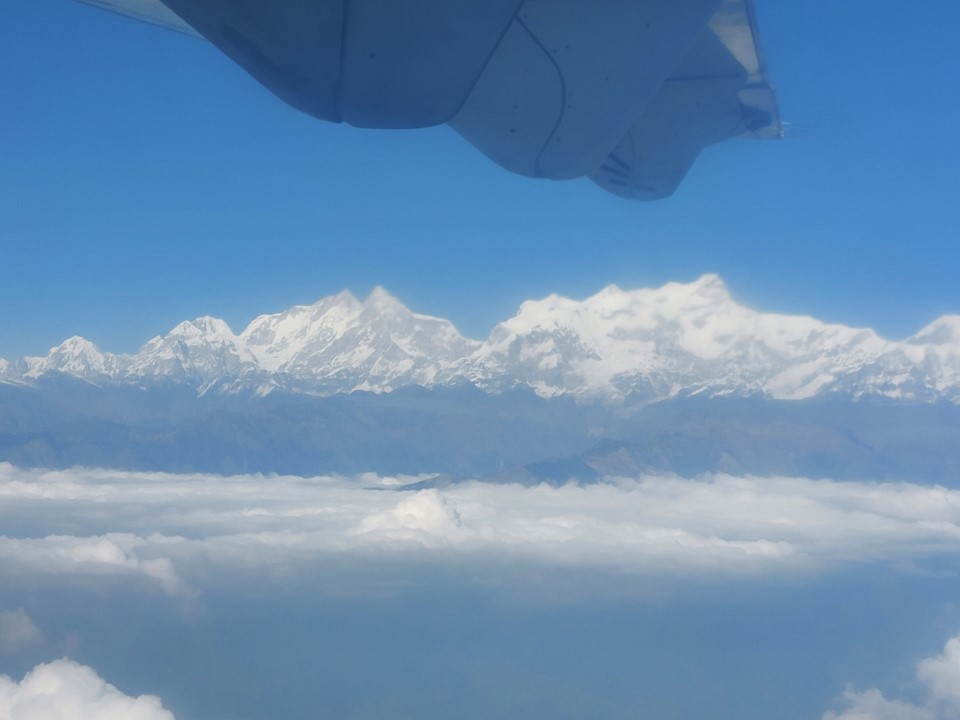
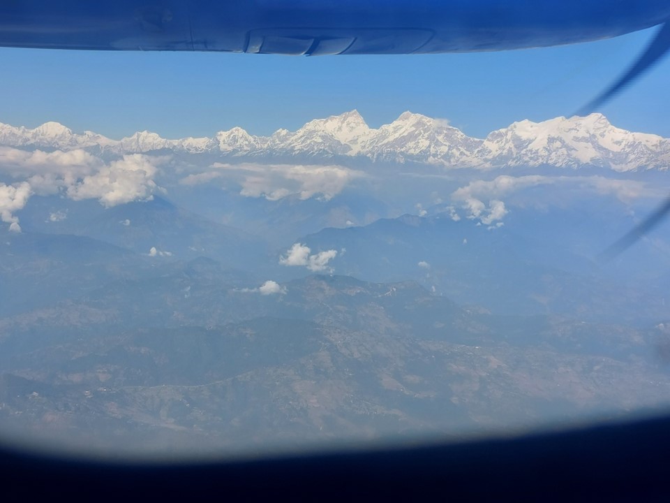
The flight to Pokhara went smoothly, I had a lovely view of Manaslu (eighth highest mountain on earth) as we came into land. I’m undecided as to whether or not seeing an 8000er from a flight counts as “seeing” it for the purposes of my “see all the 8000ers” goal. I think I’ll need to hike in the region just to be safe – as if I need an excuse to hike around a mountain!
As I got my bag and started walking to the taxi – I realised I actually have no clue where I’m going. Luckily Nepal seems to be a country full of very helpful people. The taxi driver told me he would take me to the place where I can get a jeep to the start. I forget the price, but an Uber in South Africa would have cost more for the same distance – so I was happy.
It was getting late in the afternoon. They would only have a jeep going out if it was full. As I was talking to the driver, two guys from Kathmandu arrived and also wanted to get a lift to the start. I really wish I had written down their names, but such is life. The driver had said if I paid the full NR7000, he would take me despite the jeep being empty. With these two arriving, he suggested I pay NR5000 (about R700 or $42) and they pay the NR1000 each they would have normally paid. The driver seemed to feel bad about the deal he was offering me – but considering it is a two hour ride on really bad roads, it seems like a fair deal. I did feel like I was getting ripped off a bit at the time, but in hindsight I have no clue why – if I didn’t take this option, I would have not been able to do the hike.
I quickly bought some snacks and water at the shop behind the jeep stop (which I ended up forgetting in the jeep), and soon we were off.
The road to Jhinu Danda is really bad. We kept getting caught behind a driver who somehow got stuck in the mud on an uphill – which takes skill (or lack thereof) seeing as one can simply roll back to find a spot where they have traction. Our driver was really good (the contact for the company is Antim Ghandruk, 974 252 2919). A significant portion of the road was bad quality dirt – sections of it could pass for a 4X4 obstacle course!
On the road I had a realisation – my maths had been off. I didn’t have three days to complete this hike, I only had two. I could finish on day three and try to get back to Kathmandu in a day, or even try to get from the end of the trail back to Kathmandu in a single day – but if all the flights were full or I couldn’t get a jeep, I would miss my flight home. Reading the map – I also found warnings about avalanches on the way into the final valley. I was seriously doubting what I was doing. Traditionally this hike is done in 7 days. Andrew did it in two days, but I usually take roughly double the time to complete routes compared to him.
I also wasn’t feeling well – it was getting late, and all I had eaten for the day was a small breakfast plus some chocolate and biscuits. A very rough ride on a dirt road when I had finished the Three Passes Circuit about 26 hours earlier and wasn’t feeling well – I was not in a great mood at all!
I sent a few whatsapps to friends and family – rereading them now I am actually impressed how much I toned them down, because I really wasn’t up for all this effort to reach this place in the middle of nowhere just to not get very far up a valley. I knew that there wasn’t a chance I was going to pull this off – what am I doing here?
We eventually arrived at the end of the road. I thanked the driver, and completely forgetting about my snacks, I grabbed my pack and started the walk to Jhinu Danda. The two guys from Kathmandu walked with me, they spoke very little English – so we didn’t talk much. Then again – I only know one word of their language, so they are doing far better than I am!
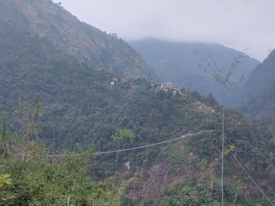
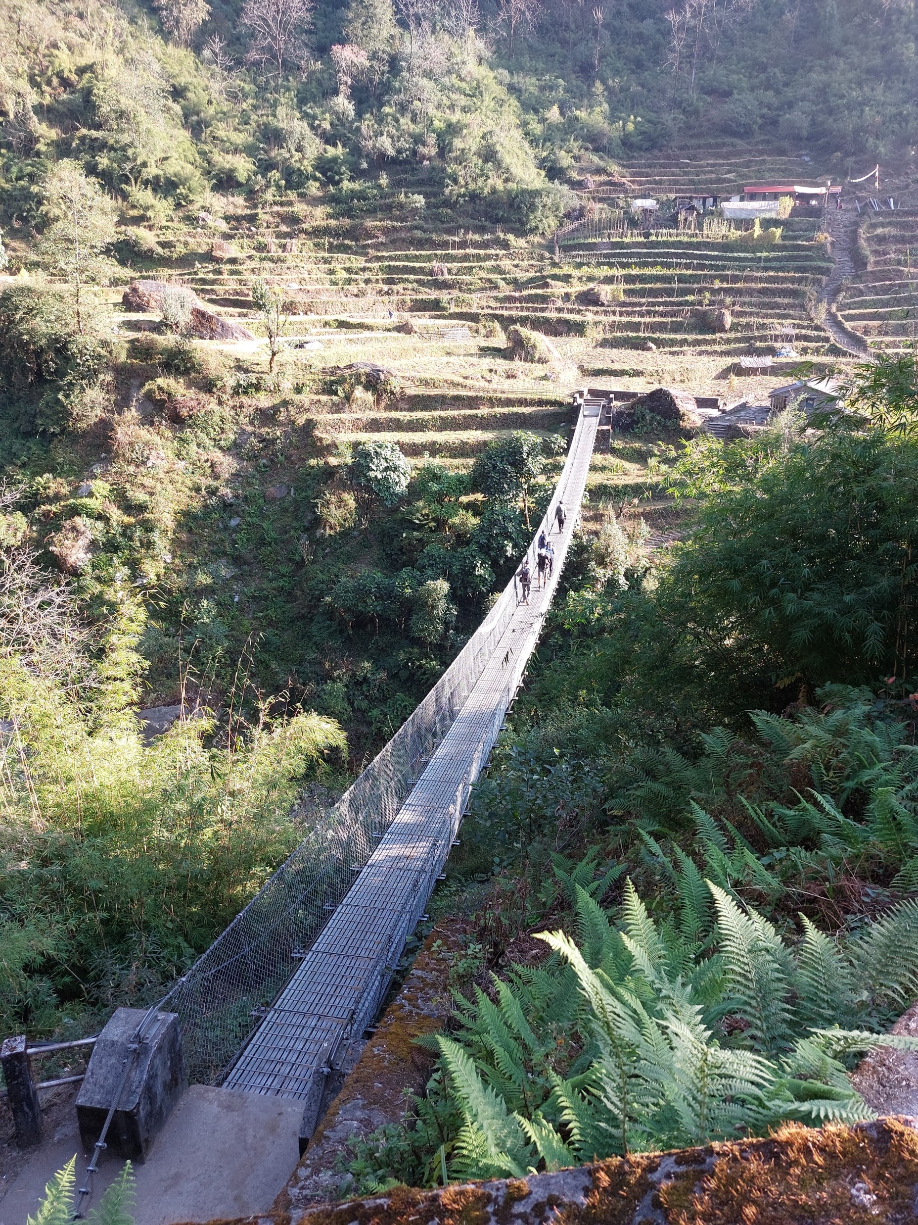
The bridge into the town is by far the longest one I did while in Nepal. It also had the largest drop of any of them – although by now I had done so many that it wasn’t too intimidating.
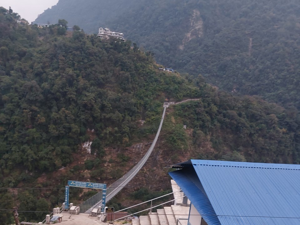
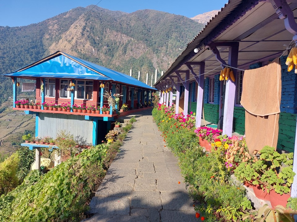
It was between sunset and last light when we arrived in the town. The guys suggested I stay at the tea house they were staying at – I wasn’t clear on the connection, but I think the owner was a relative of theirs. I am not sure if I got some form of special treatment, or if it was just that Nepalese people are generally great – but my room included a nice comfortable double bed, all for the exorbitant price of NR500 (about R80 or $5). I had supper and then bought snacks and water for the hike, by this point I had realised I left what I bought in the car – but food and accommodation was so cheap at this tea house that I was happy to give the owner a bit more business.
A large UK group had just finished the hike, so I chatted to their group leader about the route. He confirmed that avalanche risk isn’t this time of the year. He also said that doing it in two days is difficult, but with a maximum altitude of 4100m, which I was already acclimatised to, and seeing as I managed Three Passes in 12 days – he rated I could do it. Andrew and Marco also encouraged me to go for it – that’s the importance of having friends who encourage you to push when something is doable, or suggest caution when one’s plans are unwise.
I was fired up. I’m sick of excuses – I had come all this way, I back myself. After all, it’s only 56km round trip with 4.2km elevation gain and loss. Ok, that’s a lot of elevation, but I knew it was doable.
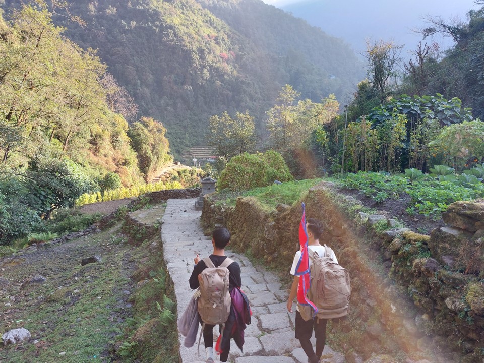
I took most of the equipment out of my pack – I knew I didn’t need a sleeping bag, a second down jacket, a change of clothes etc. I could buy snacks on the way too – time to go fast-and-light like the Ghaznavid of the mid to late 2010’s.
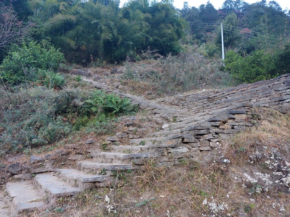
I had an early breakfast, and set off nice and early. The hike starts with a very steep staircase. By the time I hit 1km distance, I had already gained 235m in elevation. With 10 hours to go till sunset, it was going to be hard, but doable. I took a photo of my GPS and posted it as a whatsapp status with a caption “If this gradient is sustained, I’ll be on top of Annapurna in 28km!” I had been in Nepal long enough to know that there would be plenty of downhill on the route. Not to mention – when you start at 1750m and the high point is 4100m, it doesn’t take amazing maths skills to know that 4.2km elevation gain and loss means you will have plenty of up and down along the way.
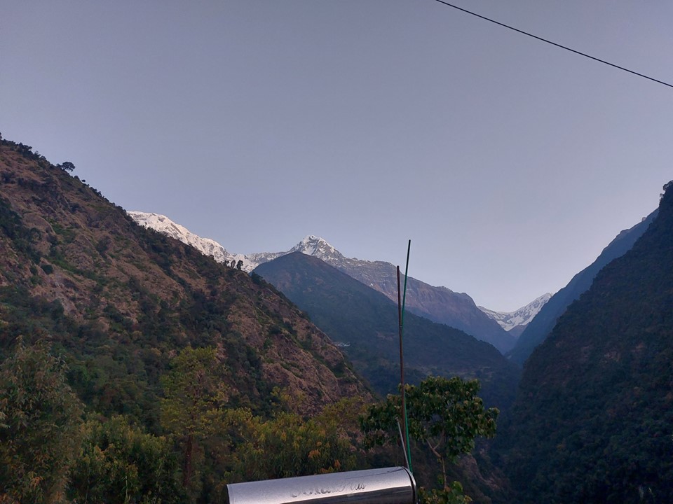
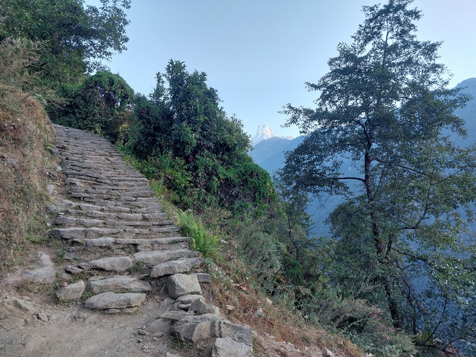
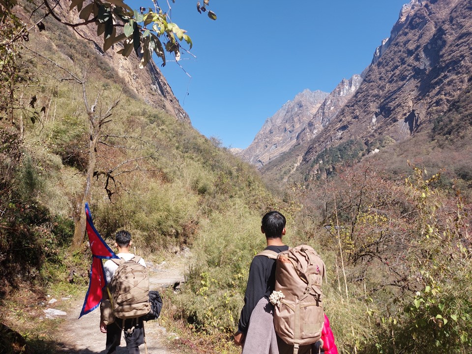
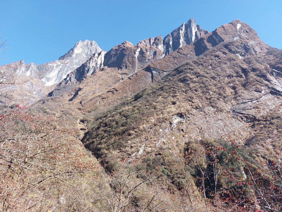
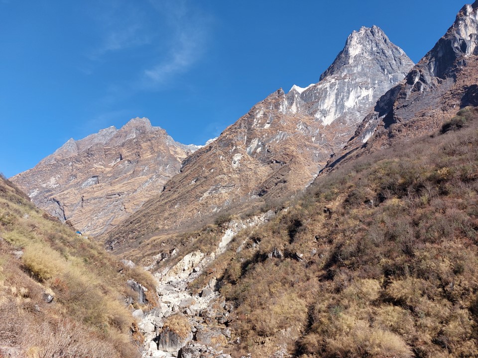
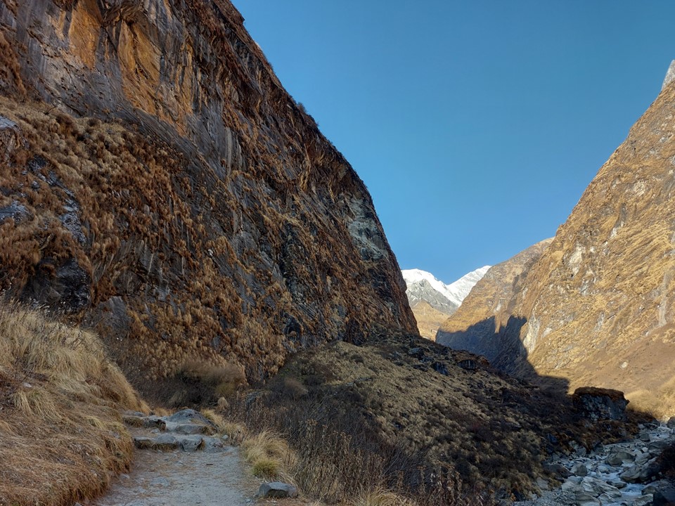
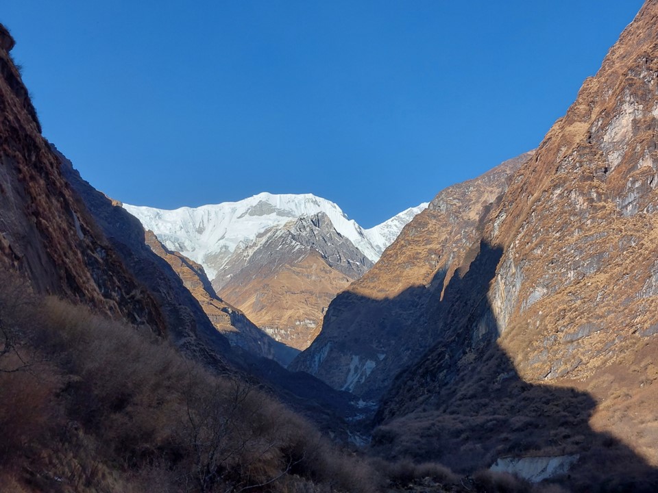
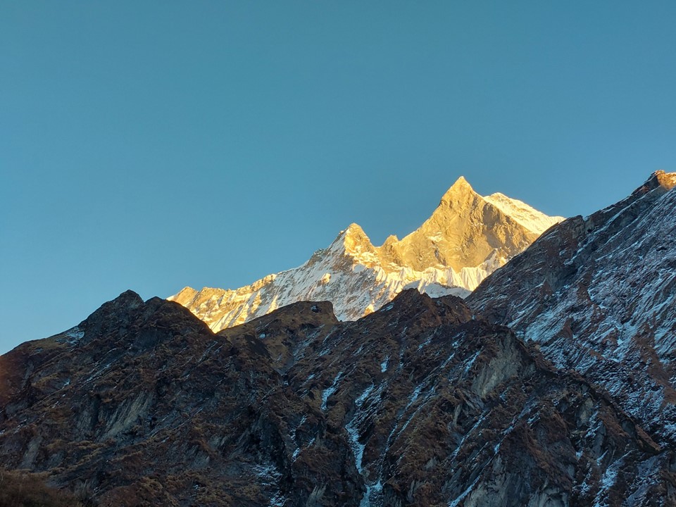
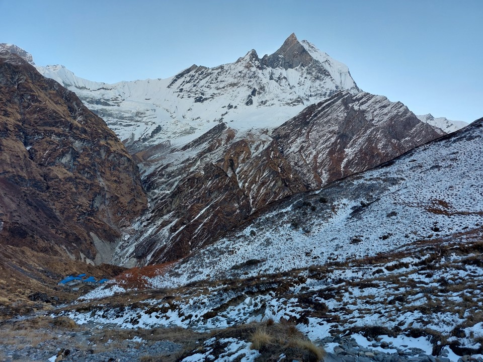
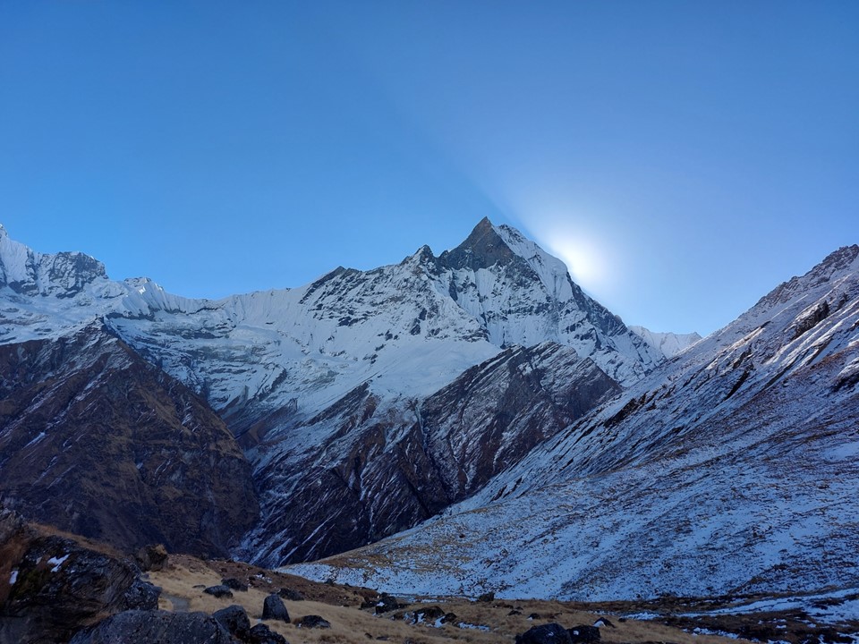
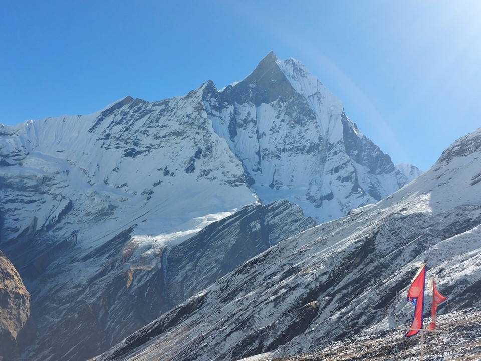
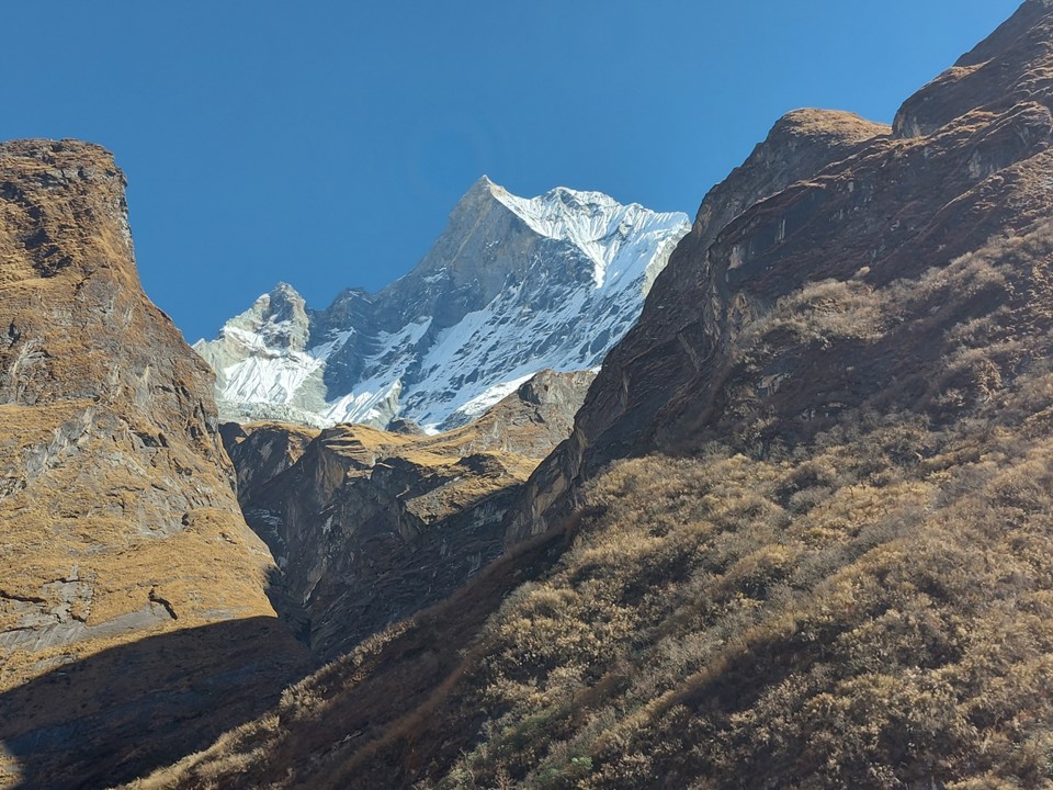
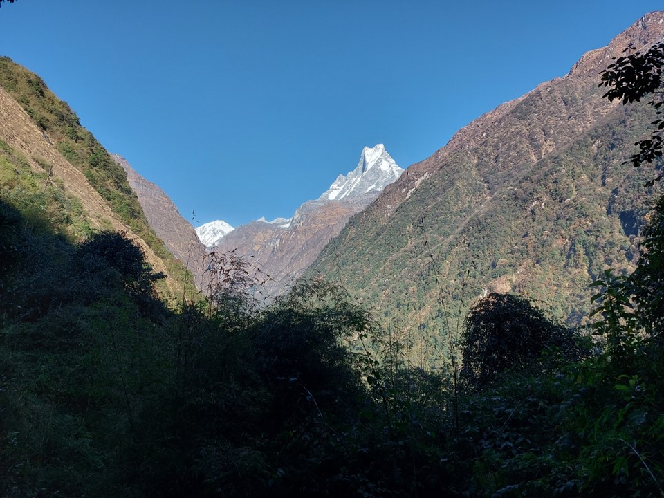
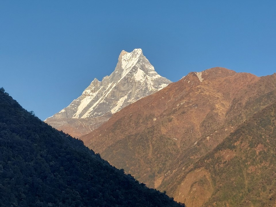
As I rounded a corner, I could see a summit in the distance – I knew exactly what it was, I have seen so many photos of the Fish Tail Mountain that I have no difficulty identifying it. Even with just the top being visible, it was enormous. At around 2000m compared it its summit just below 7000m, that’s a 5km height differential – which is similar to the differential between the view of Everest just past Namche, except that Machhapuchhare was considerably closer to me in this instance than Everest had been a few weeks earlier.
It was a very humid morning – I was happy I started so early. I could feel the heat already. Strangely this region has a bit of a KZN Valley of a Thousand Hills feel to it. The scale is much larger, but it felt familiar.
I eventually reached the first town along the way. There was an office where permits were checked before continuing on. My friends from the drive in caught up to me here, and soon disappeared into the distance.
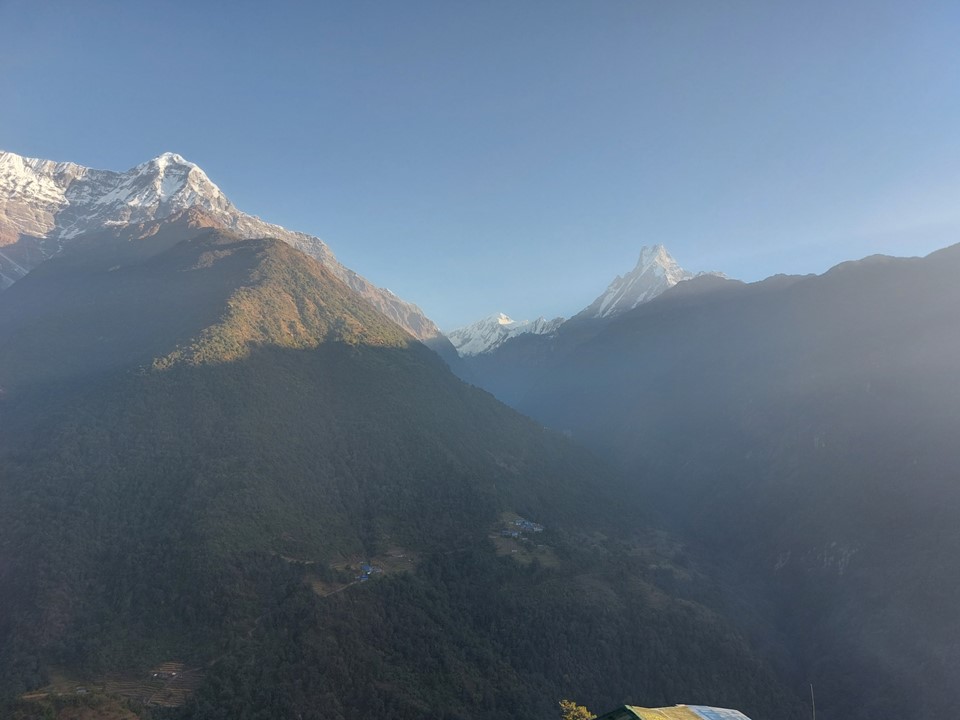
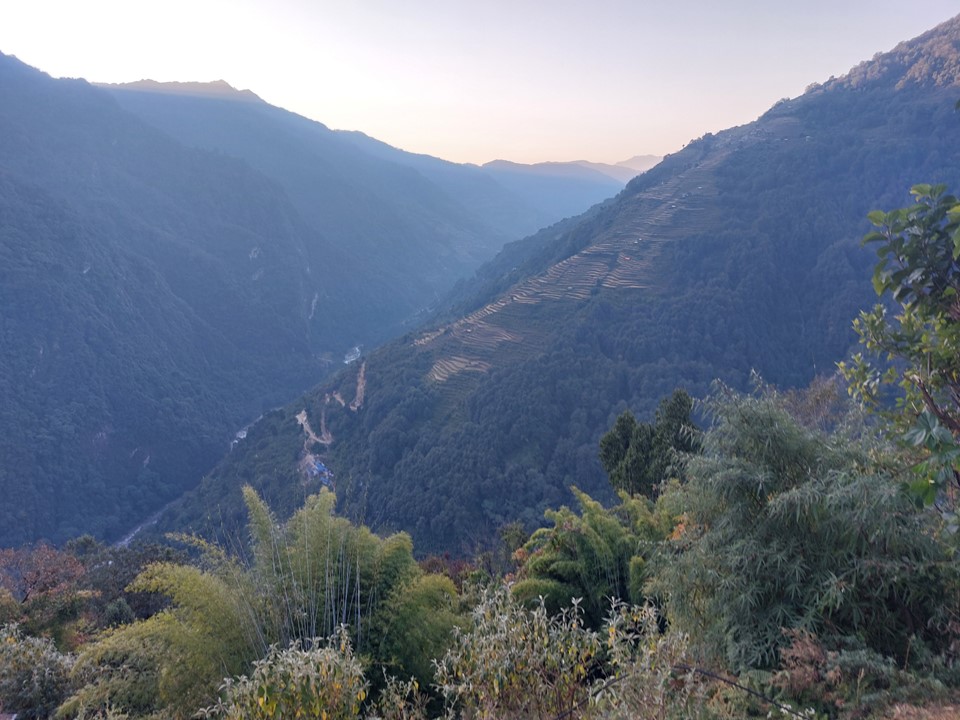
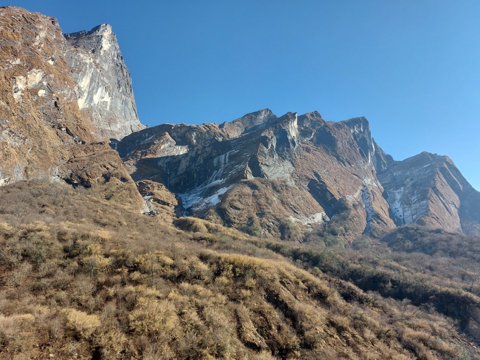
As expected, the trail began to drop from here. Machhapuchhare in the distance was a sight of note. I was sad that my camera with 40X optical zoom had stopped working on Chukhung Ri. It would have been perfect to try and capture this majestic peak – the best views are from this angle, and once I would be close enough to get a good shot with my phone, it would be a less dramatic angle.
While there were a fair number of people on this trail, it was far less crowded than the trail on the main tourist route to Everest Basecamp – one of the big upsides to the Three Passes Circuit was that over half the route is different from the main Everest Basecamp route, meaning you skip a lot of the more crowded sections. By contrast, I saw far less people on this route than, say, between Namche and Lukla.
Passing through the second town I smiled – this would be the first night for many groups, but it wasn’t even 10AM yet. A good start!
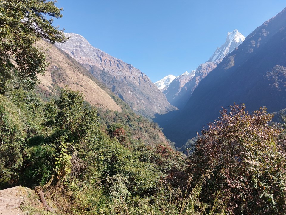
I periodically stopped to take in the view. While I had been surprised how small Ama Dablam actually is, Machhapuchhare was bigger than I expected.

I saw a porter walking with some snacks, which would have been on their way to one of the tea houses. I noticed he had a box of rusks in there – what are the odds!
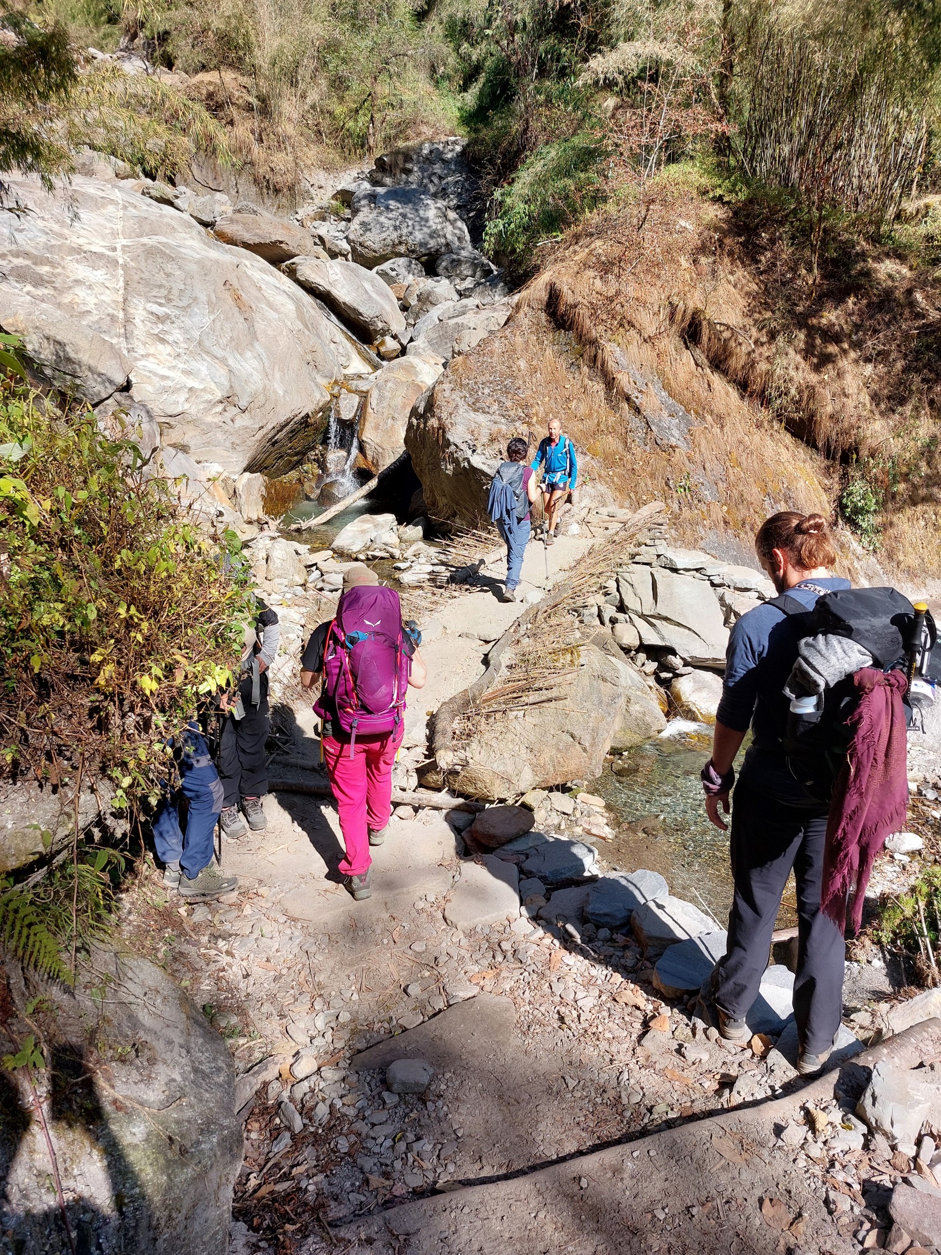
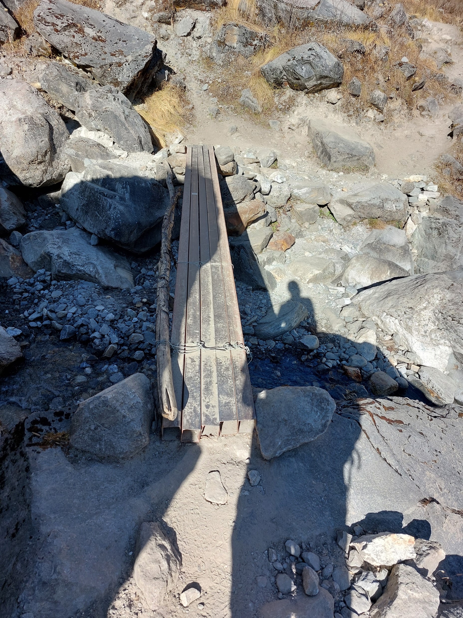
The bridges on this trail are far more rustic than the ones in the Everest Region. Some were logs, others were a mix of various items found nearby. They were entirely adequate, I actually prefer not damaging the local environment with a construction project when not required.
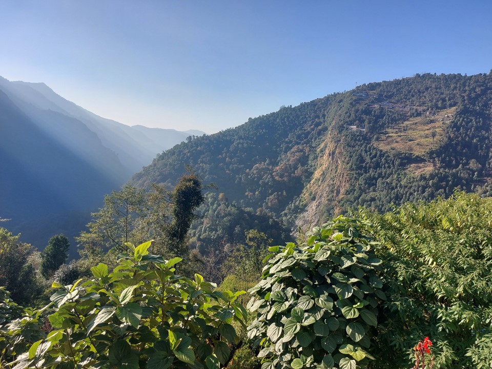
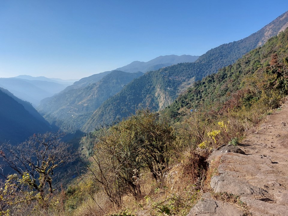
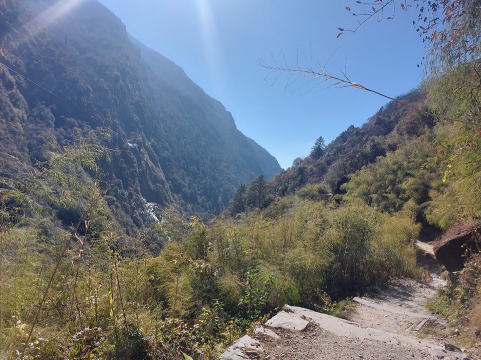
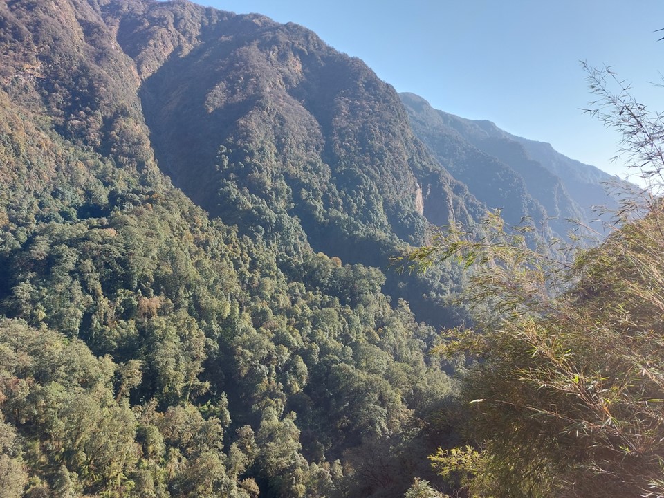
The trail spent a long time in a forest. Being a hot sunny day, this was nice. There were breaks along the way, so the view was still periodically there.

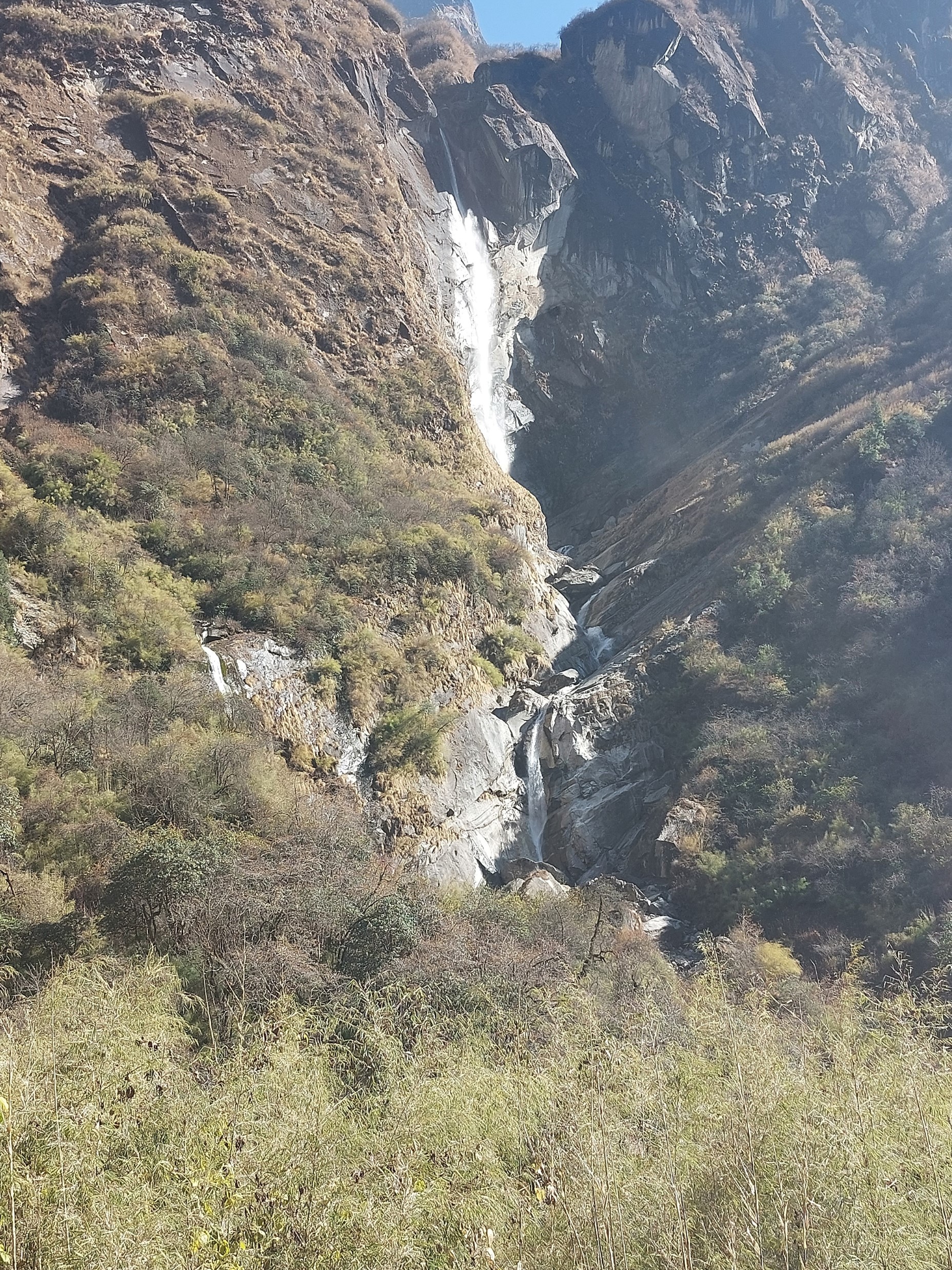
This trail has a very high number of waterfalls along the way. Not high ones, but they are everywhere. At one point there is a massive wall of waterfalls. Bearing in mind I was there during the dry season, I wonder what it would look like in monsoon season! I was far too close to capture it, it was at least 80m wide and probably about 50m high.
I soon caught up to my friends once again. They had stopped for lunch, which was the only reason I could catch up with them. They are very fit – although, in my defense, I had just done a 14km elevation gain and loss in 12 days with only one travel day off between hikes. Fatigue is definitely a thing!

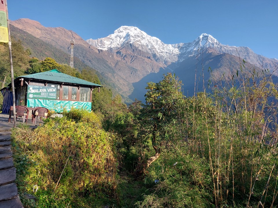
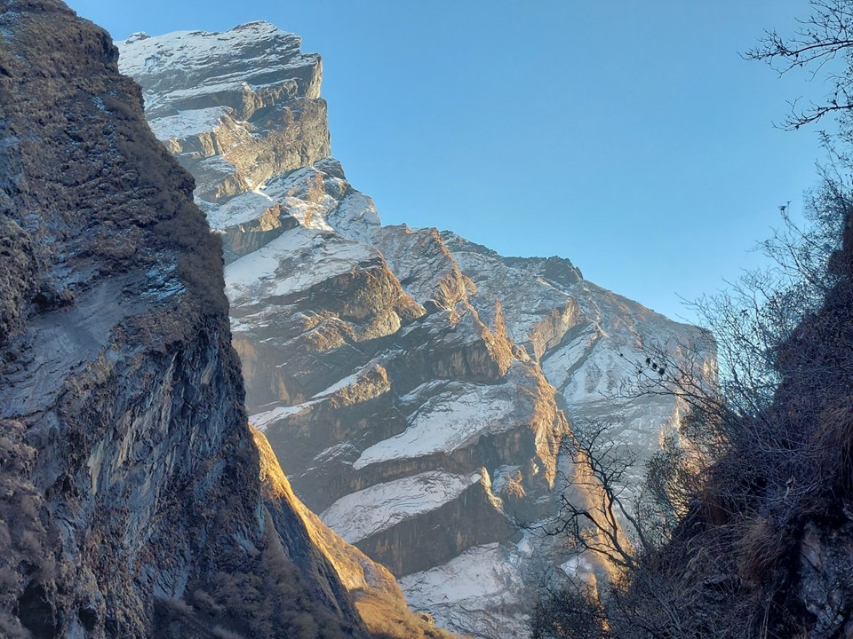
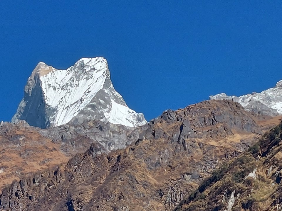
Soon Buddha Tower came into view. It is a rock formation on Machhapuchhare. It was one of the more interesting features in the area, especially when viewed from higher up.
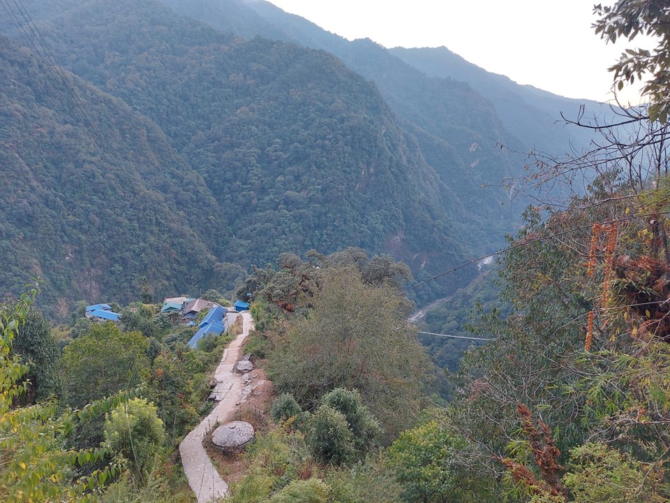
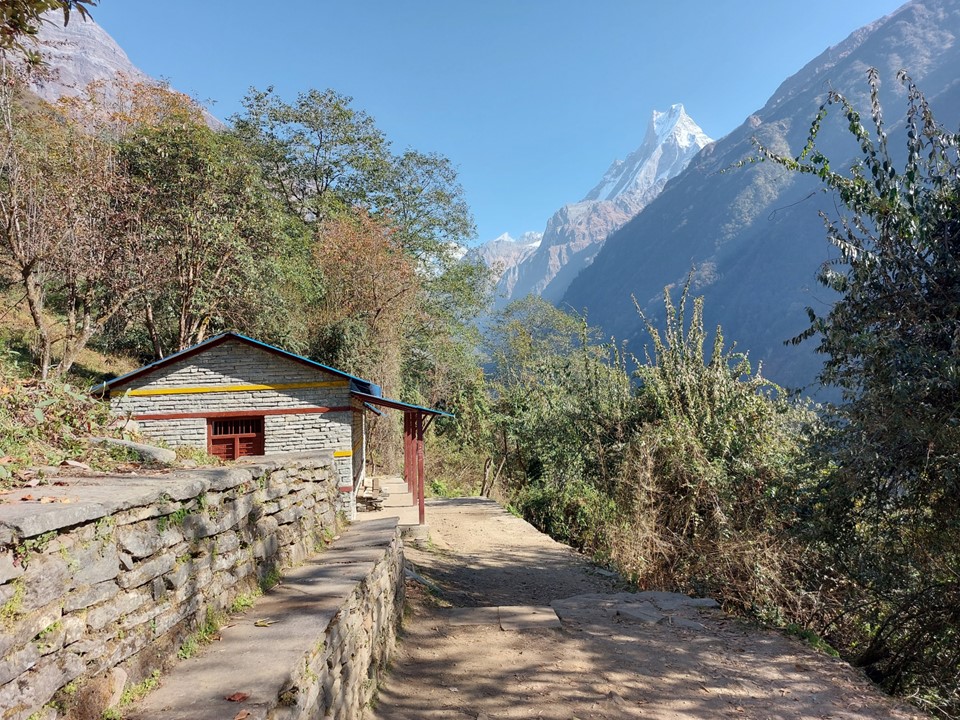
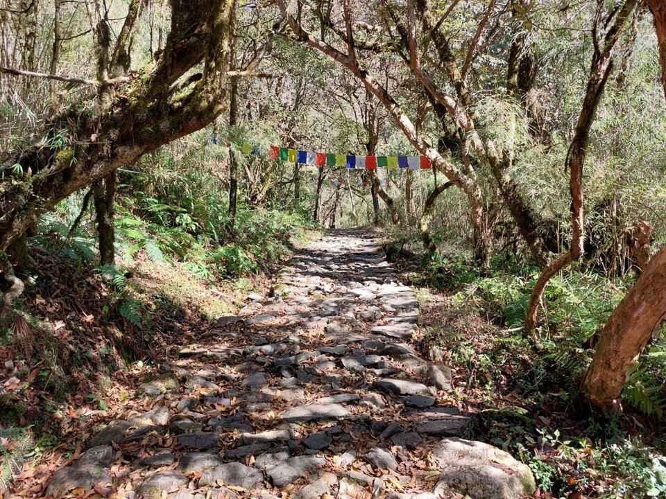
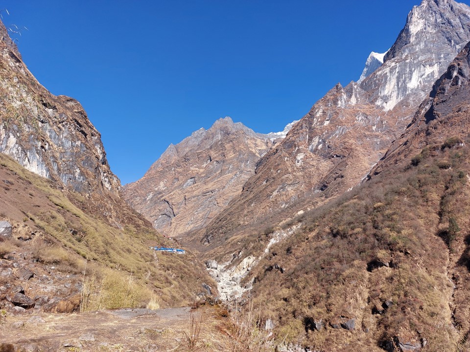
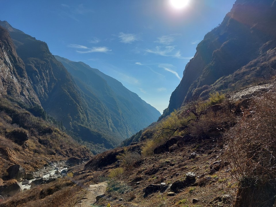
The trail eventually ends up at the level of the river. From here the route becomes less up and down and more simple up. The valley becomes very narrow. Every town you walk into has a sign stating that meat isn’t allowed. The region is considered a temple and thus there are strict rules. No tea house may compete – so all prices are identical once you enter the designated sanctuary as competition isn’t allowed.
I stopped in the town of Himalaya for a late lunch. I was feeling the fatigue of a long push.
As it turns out, eating a proper lunch was a terrible idea. After the meal I struggled to make progress. I eventually decided to sit for 20 minutes and see if I felt better. It wasn’t all bad – the view was great!
I passed Deurali, the last town before Machhapuchhare Basecamp. I decided I could keep going. Sunset was just under two hours away, and I just needed to keep putting one foot in front of the other and I’d get there. If I had considered that it was more than 500m elevation gain to get there, I might have called Jhinu Danda to Deurali in a day a win – but I decided to push forward.
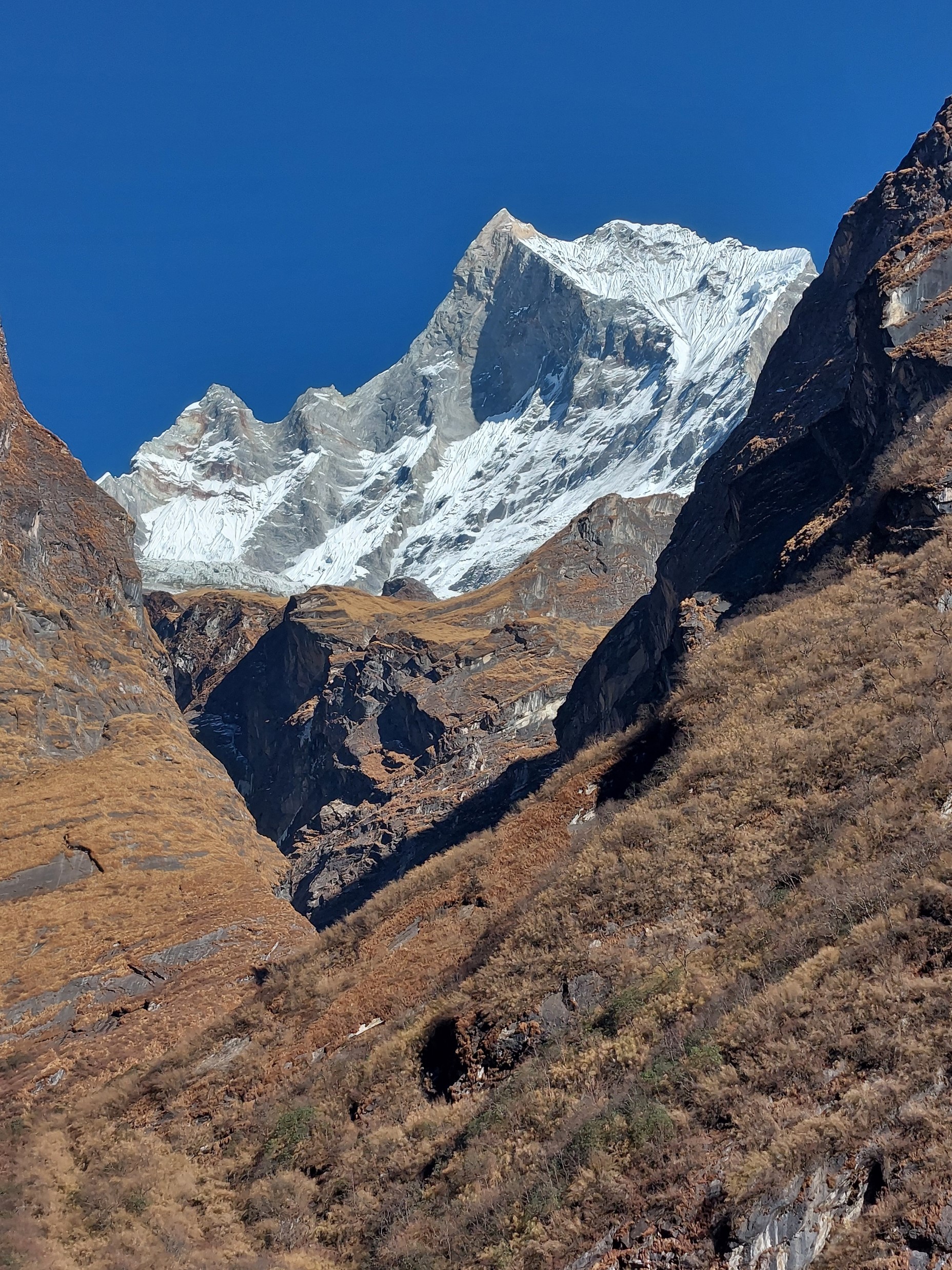
As I rounded the corner, Machhapuchhare came into view again. What a magnificent peak!
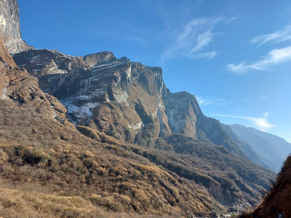
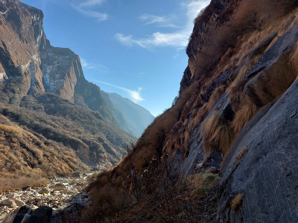
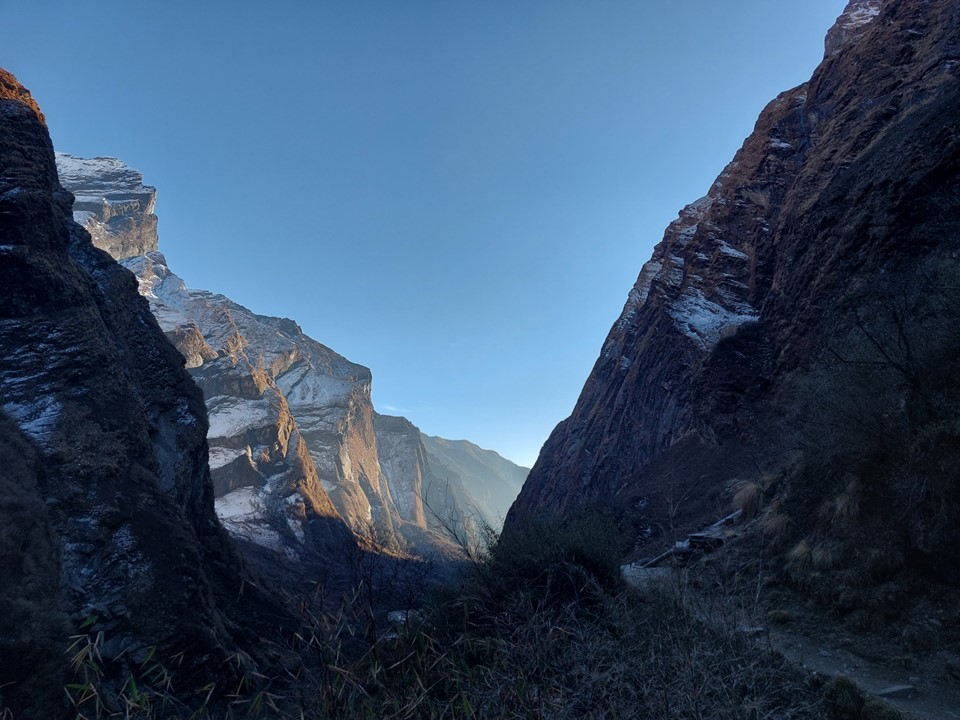
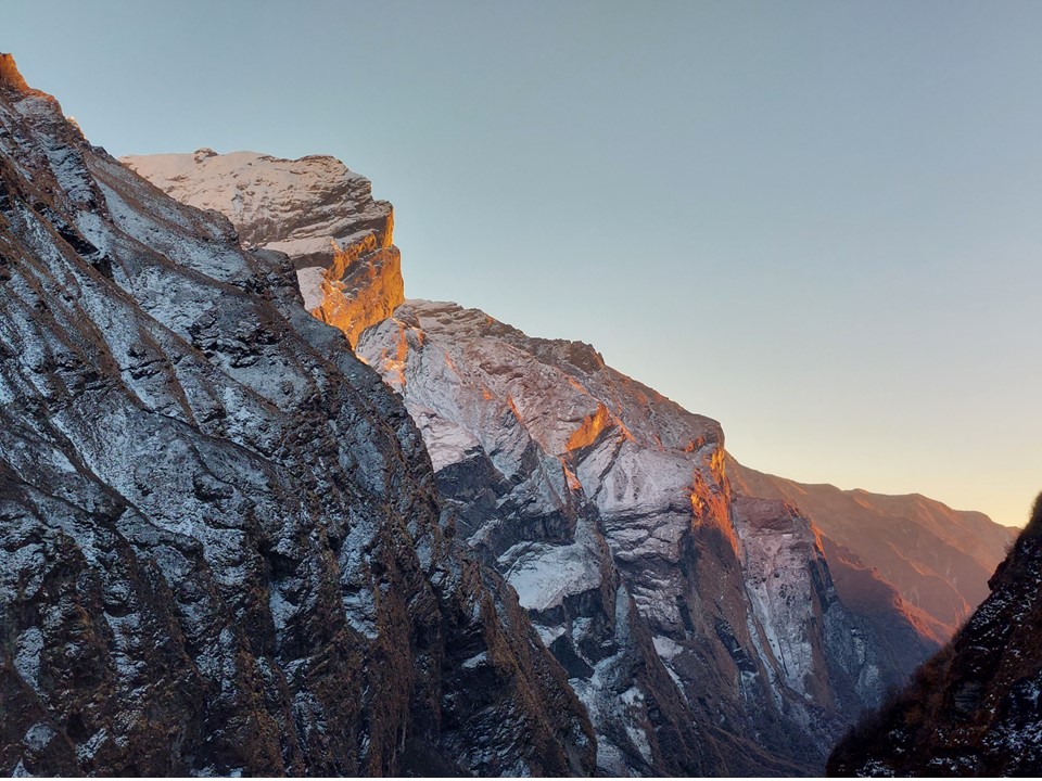
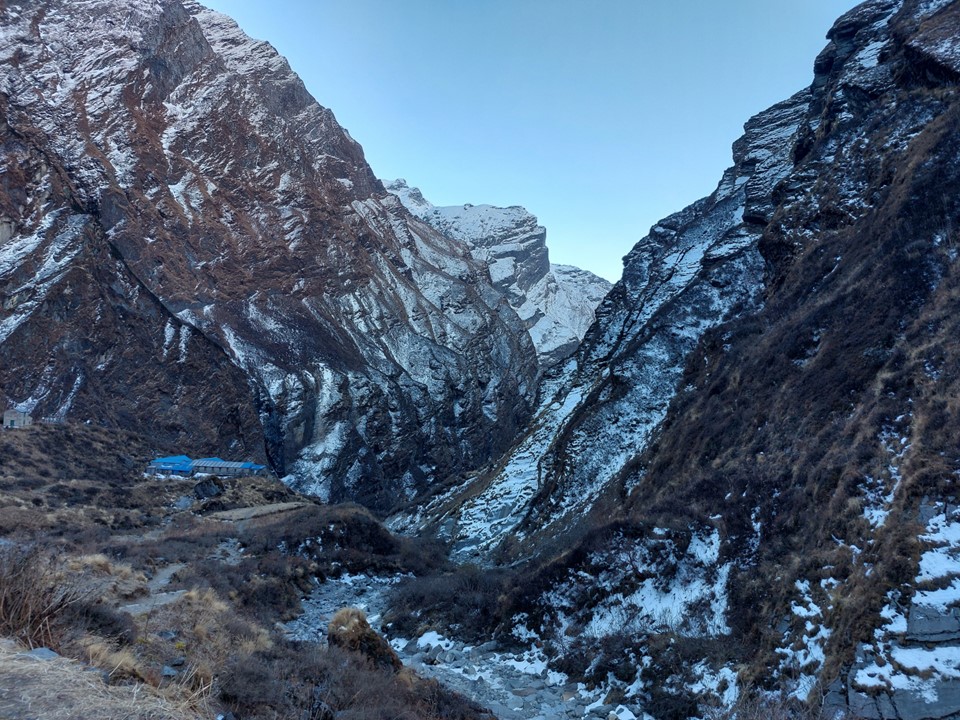
The valley becomes very narrow. This section before Machhapuchhare Basecamp is subject to avalanches when its snowing – the avalanche sweeps from the mountain above and drops off the cliffs. The trail is frequently closed as a result, although not usually during the dry season. There was barely any snow on this ridge at all, not that I could see that from below.
I imagine most other hikers had completed their day by this point – I didn’t see another hiker after Deurali.
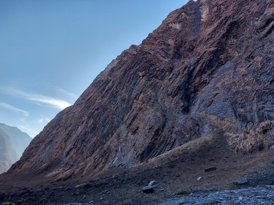
Walking below these monster cliffs, complete with clear signs of recent rock fall, I was aware that it wasn’t the safest spot around. But my energy levels were low and I could only move so fast to get through here.

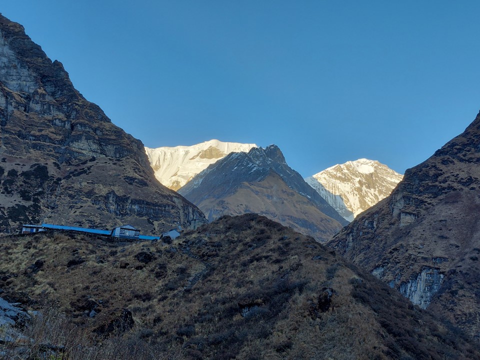
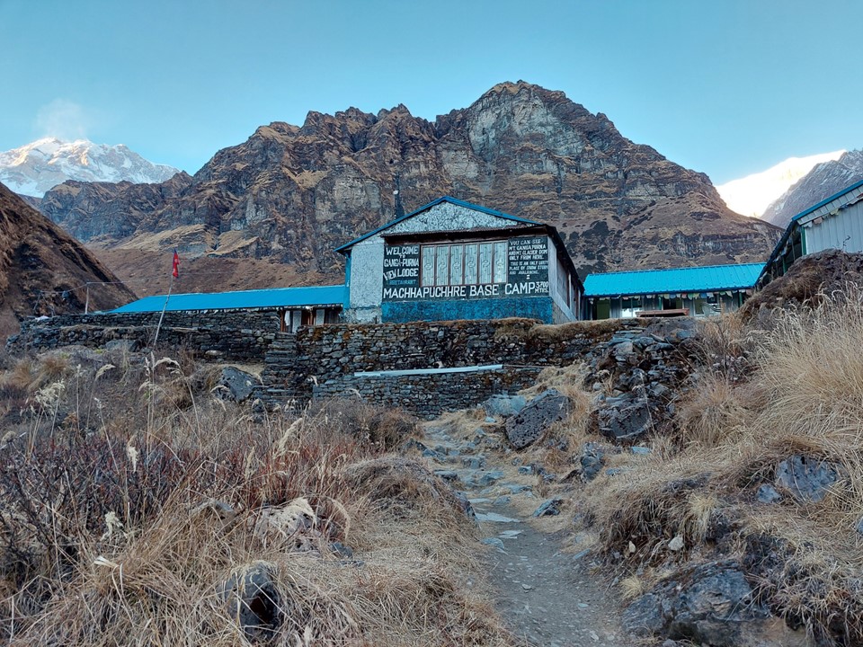
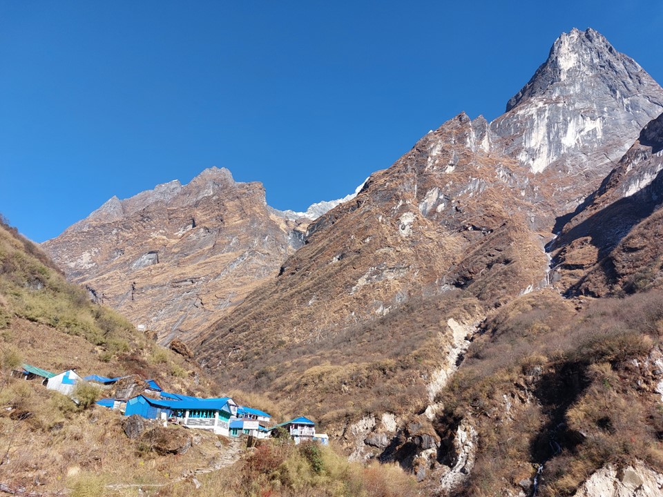
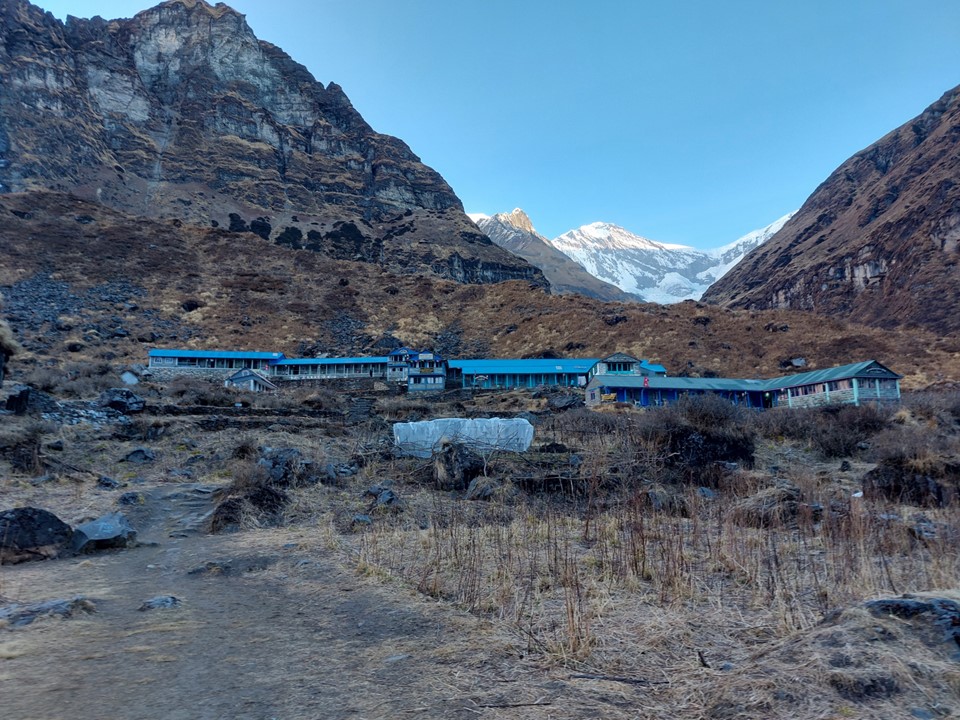
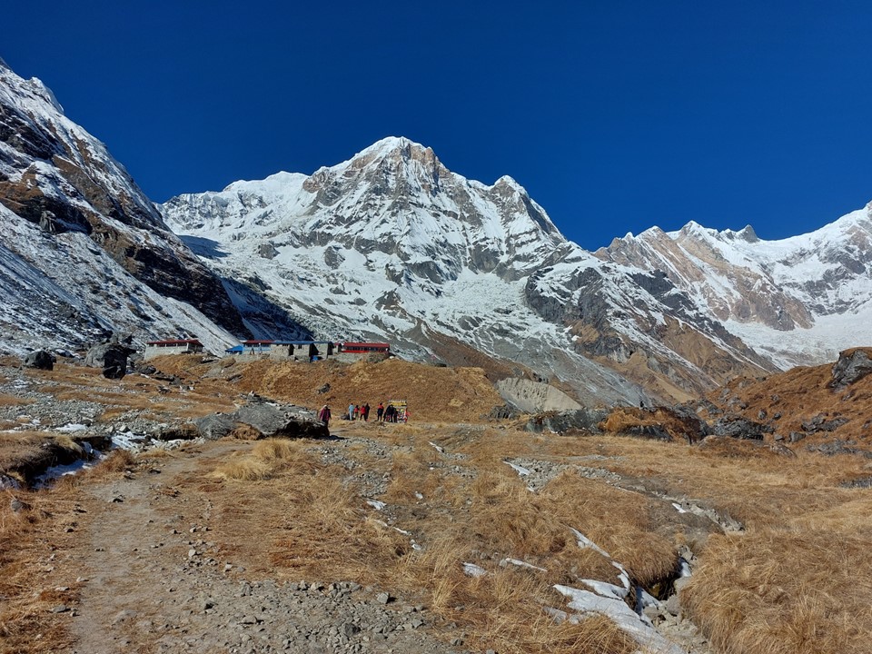
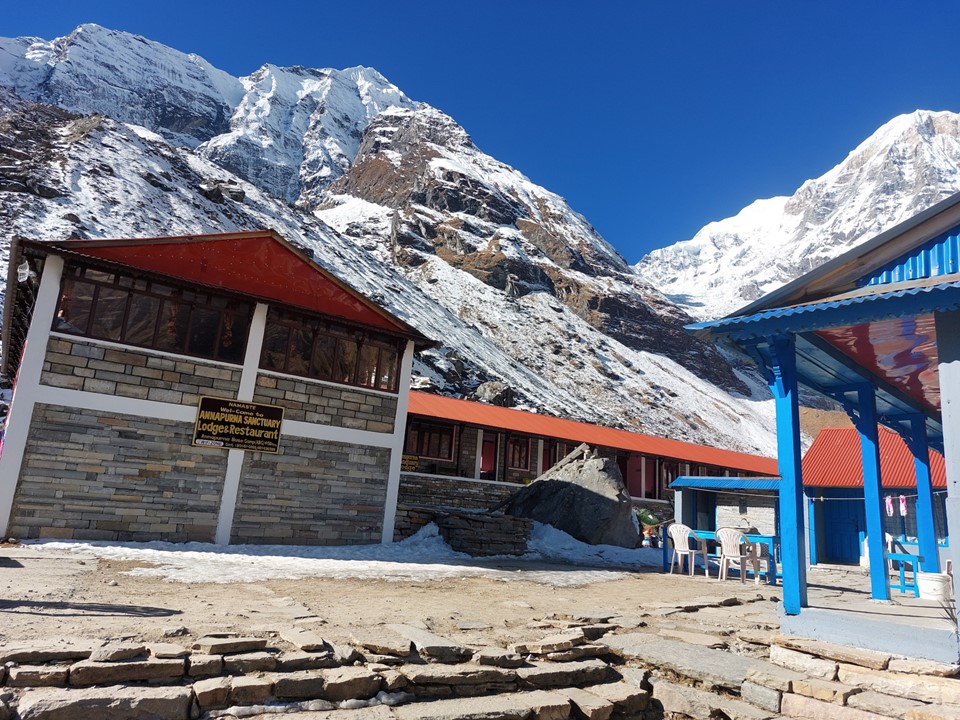
I reached Machhapuchhare Basecamp just before sunset. I went to the first tea house, and as it turns out I was the only person there. Two people arrived later that evening, but the place was mostly empty.
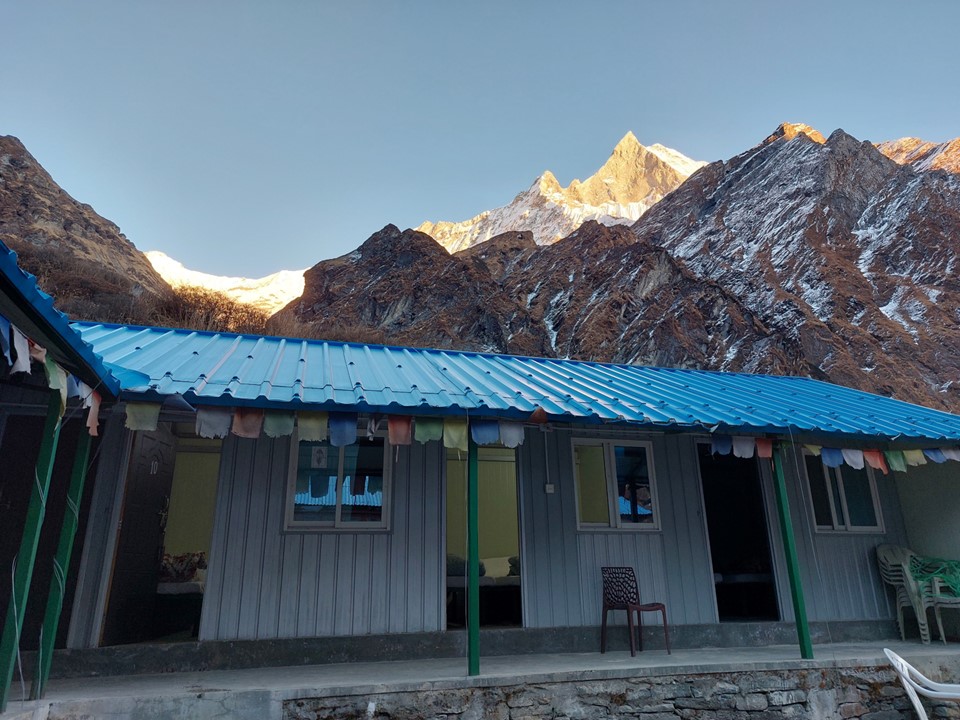
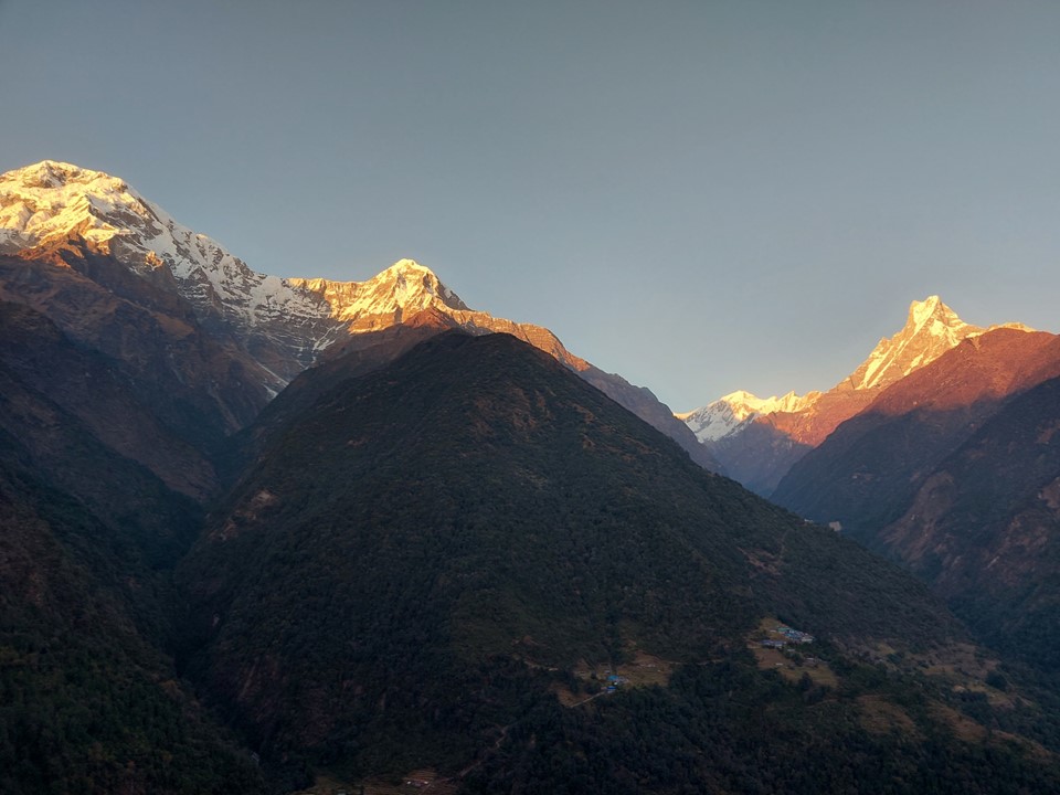
I watched the sunset while surrounded by these monstrous mountains – what an amazing location!
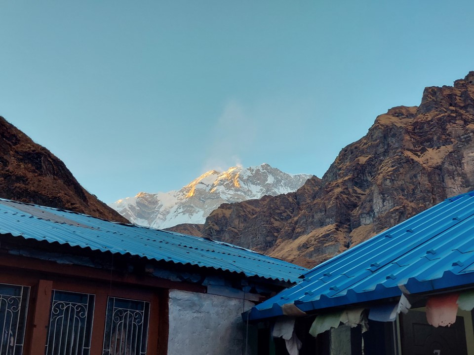
I was surprisingly cold. The Annapurna Region seems to be much colder than the Everest Region.
After a good supper, I was in bed under all the available blankets. Leaving my sleeping bag in Jhinu Danda was the right call – I didn’t need it.
I woke up not feeling particularly great. I was fine to keep going, but this would cost me some time. As the old saying goes “if you don’t make time to take a break, your body will decide on a time for you”.
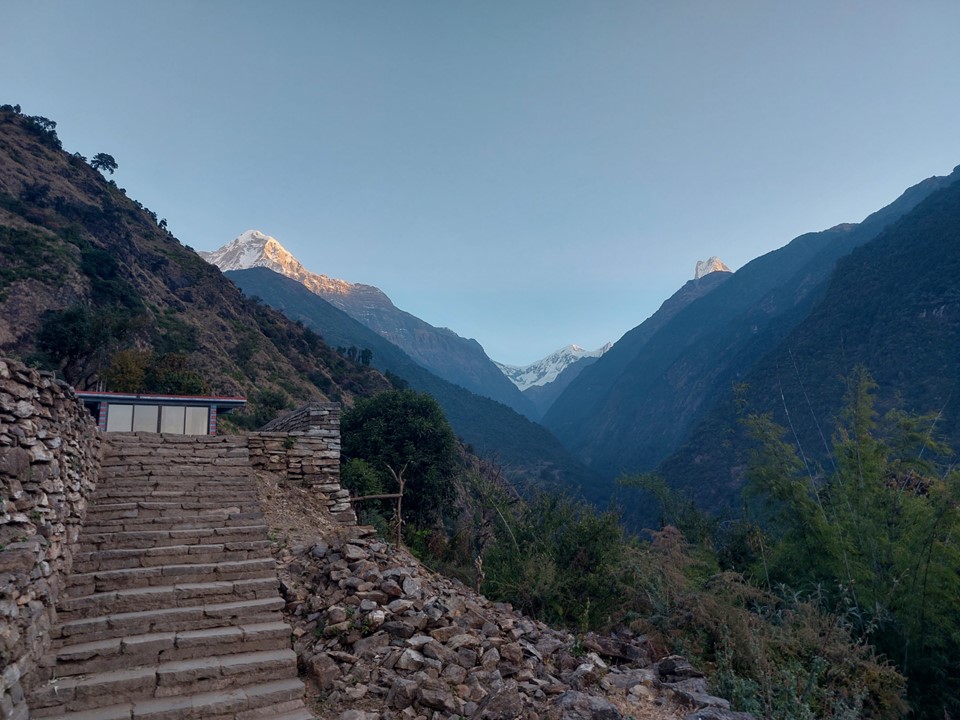
I left the tea house after sunrise, although the sun wouldn’t hit the valley for a while still.
The final slog to Annapurna Basecamp took some time. I stopped a lot to enjoy the view, but I could feel my energy levels were low.
When I eventually reached sunlight, I stopped and drank some water. I wasn’t feeling terrible, but I wasn’t feeling strong either.
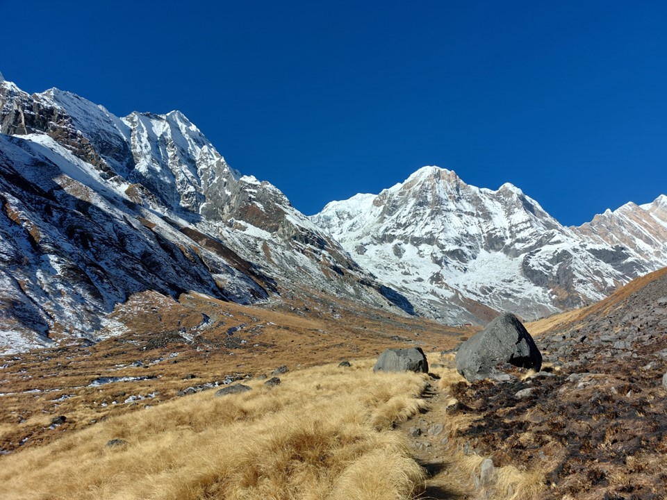
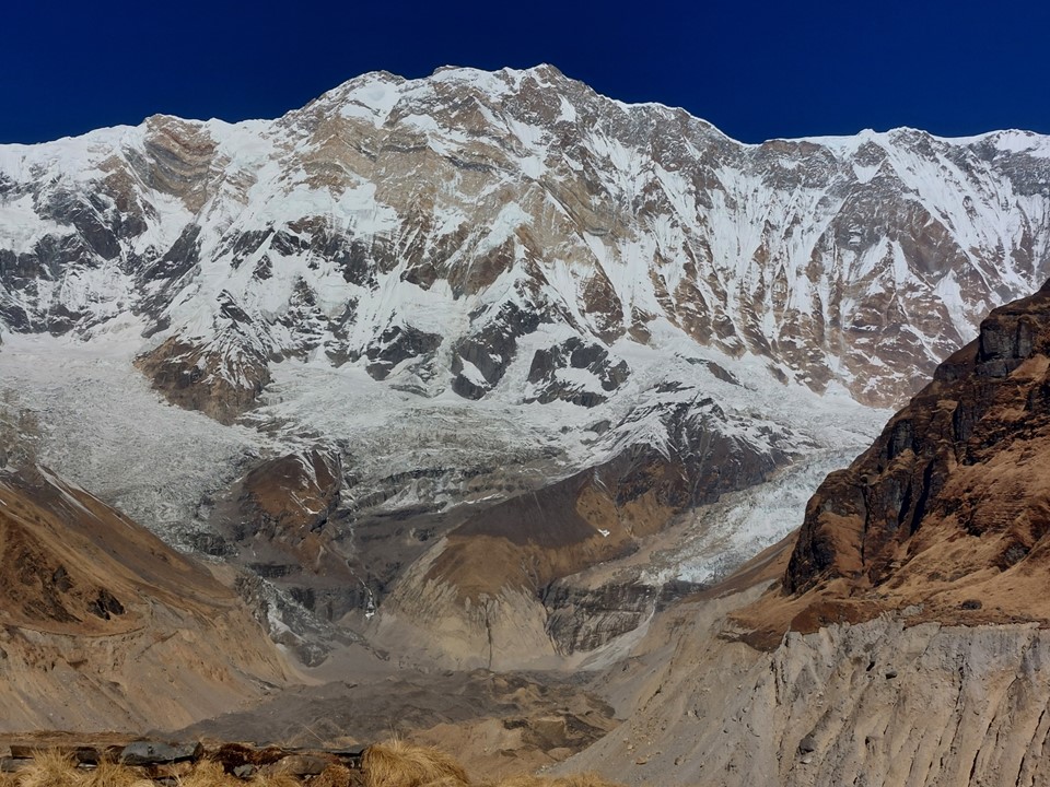
At 8091m, Annapurna is the 10th highest mountain on earth. It was also the first 8000m peak ever to be climbed, by a French team lead by Maurice Herzog in 1950. To date it has the worst overall death to summit ratio of any 8000er with roughly one fatality for every three summiters.
While Annapurna has been climbed from this side, the usual basecamp would be on the other side of the mountain. Very few climbers have ever climbed the mountain from this side. With a 4km high mountain face, it is one of the largest mountain faces on earth – as always, photos do it no justice.
Correction re the video above: a few parties have climbed Annapurna from this side.
I made my way up to the tea house and had some cheese toast and a cup of ginger tea. I knew getting down to Jhinu Danda before dark would be hard, but I also knew I could easily hike this trail in the dark, or even finish the last section in the morning – I wanted to enjoy this place while I was here.
With Annapurna on one side and Machhapuchhare on the other side, you are really surrounded by giants. What a special location!
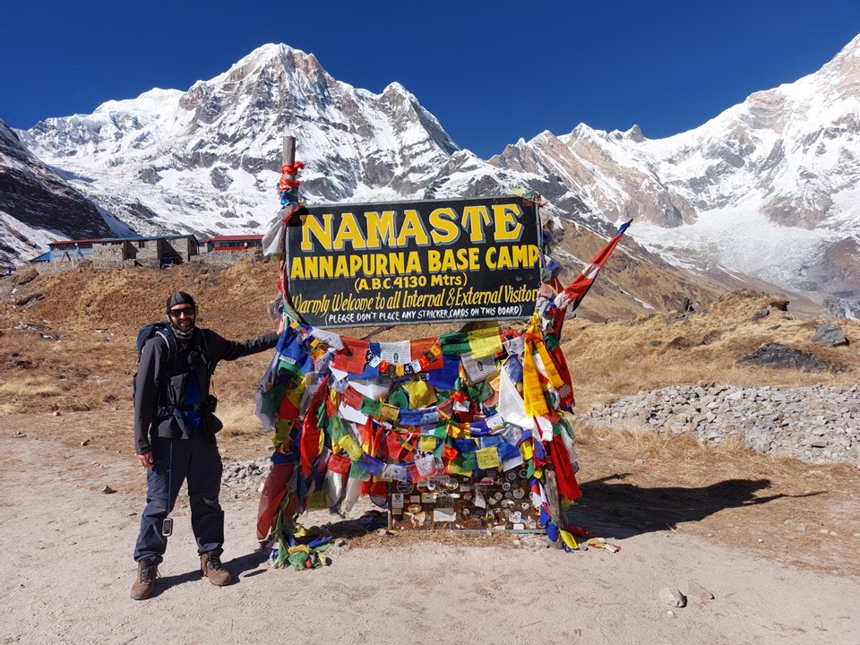
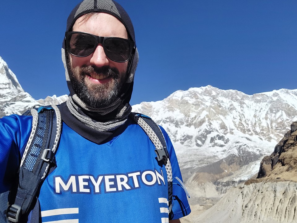
I got the obligatory photo with the sign before starting to head back down. It was already later than I had intended to leave, but staying there an extra hour is not a decision I regret at all.
I knew I needed to move, and I knew the views below Deurali aren’t particularly great until I get far enough down to start seeing Machhapuchhare again – it isn’t visible for a long stretch of the route. I rarely hike with headphones on as I enjoy the music of nature – the sound of rivers, birds, wind etc. But I wasn’t feeling great and I wanted to concentrate on one thing: getting down before dark. I had spent a lot of extra time in the most scenic part of the route, now to get through the less scenic part as quickly as possible! I put on a playlist of Epic Rap Battles of History, and I set off.
My strategy was simple: every second town I would get a snack – usually a chocolate or oreos, and every other town I would get a water. I had to finish these before I reached the next town where I would replace that item. I knew I would have a big uphill not far from the end, and I knew that the downhill half still included more than 1km in elevation gain.
Focusing on placing my feet well, and averaging 12 to 15 minutes per km, I kept making my way down the route.
After a very long stretch of making great pace without stopping, I found a spot where I could see Machhapuchhare and I decided to sit for 15 minutes and just stare at what is unquestionably one of the most amazing mountains on the planet. By this point I was fairly certain I would finish after dark, 15 minutes wouldn’t matter – but when will I next see this mountain?
As I got further away, I wish I was able to get some good high zoom shots of the mountain – but sadly my phone was all I had. It would be great to have an A0 canvas print of this mountain on my wall. I did notably get the sun rising over Machhapuchhare printed on an A2 canvas that is now hanging up at home.
The big hill near the end was substantial, but my diet of junk food was doing well with keeping my energy levels up. I knew I didn’t need to worry about how I would feel the next day – as I always say, its fine to collapse once you’ve crossed the finish line. In the mountains it is important to remember that the finish line is the end of the trail, not the summit.
Watching the sunset turn Machhapuchhare red was absolutely spectacular. Finishing in the dark is a win if it means I get to see that!
On the way up the hill I met a group of four, two from France and two from USA. I also caught up with my friends from Kathmandu on this final uphill. The four hikers had booked a jeep back to Pokhara for that night, and asked if we’d like to join them. The three of us who had come to the start in the same jeep agreed to go back out with this group.
We all made our way down to the tea house in Jhinu Danda. I was a bit sad about not staying the night seeing as the owner had looked after my gear for two days and now I wasn’t even staying there again. I bought some snacks and some water from him, and asked him what I owe him for looking after my things – as is very common in Nepal, he refused to let me pay anything extra.
With a much heavier pack than I had had for these two days, we crossed the bridge to find the jeep waiting for us. I was partly happy to do this drive back in the dark – driving in during the day had been nerve-wracking, a narrow muddy road barely wide enough for a car with a massive drop next to it – really not for the faint of heart!
Just to make my anxiety worse – there was a large rock around the size of a dining room table in the middle of the road. My memory may not be perfect, but I am fairly certain it wasn’t there two days earlier when we drove in!
Driving into Pokhara I realised two things – 1) I needed a flight back to Kathmadu for the next day, a Sunday, and Yeti Airlines only flight was already fully booked; and 2) I didn’t have somewhere to stay for the night. I asked the jeep driver to drop me somewhere I could stay for the night. The others all had accommodation sorted already.
I was dropped outside a mall, which seemed odd. I walked in and found that there was a hotel upstairs. My room cost $25 for the night – which felt expensive till I realised that’s only about R450, and when I saw that the room was enormous with a king-sized bed and a really nice shower, it was money well spent.
I couldn’t see much outside the room, being night time, but I could see I was right next to the lake that is a common spot to visit in Pokhara.
I jumped into the lift to get back down to the bottom to find some food. The lights went out and the lift promptly stopped – first time I’ve ever been in a lift that stopped working. I rang the alarm a bunch of times and had no phone signal. After about 5 minutes (which felt more like an hour), the light came back on and the lift got me back down to the bottom. I had some momos at the nearby restaurant and bought some clean clothes – seeing as I only had the clothes I had hiked in over the 15 days, plus a new shirt I bought in Lulka.
I managed to book a seat on the Buddha Air lunch time flight to Kathmandu before I went to bed. I also contacted BN back in Kathmandu and asked him to reserve a room for me at Samsara Hotel for my last night in Nepal. I had been worried about getting back in time for my flight home, but this meant I would have a full morning in Pokhara and more than 24 hours in Kathmandu – so there was plenty of time if something went wrong. This might sound like I was being overly cautious, but Nepal is notorious for delayed and cancelled flights, and jeeps between cities are very slow, so leaving too little time between flights is dangerous.
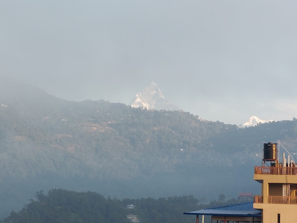
I woke up to a cloudy morning – but in the distance Machhapuchhare was sticking its head out above the nearby hill. I was happy to see the mountain again!
I went and got breakfast at the coffee shop over the road. I also went and bought a full change of clothes and a day pack for hand luggage. I then tried to find some gifts for friends in the town, although with little luck.
I really wasn’t feeling great – which is to be expected after 275km of hiking with 18km elevation gain and loss over 15 days. So even though the airport was only 2km away, mostly on flat ground, I caught a taxi.
The flight was about 2 hours late, but eventually I found myself in my typical window seat on the mountain side of the aircraft. The 25 minute flight to Kathmandu went off as expected with no issues. I caught a taxi to Samsara Hotel and checked into my room. I walked around town a bit, but I couldn’t find what I was looking for for gifts. I had a curry for supper and went to bed.
In the morning I wasn’t feeling any better. I actually wouldn’t feel better for more than two weeks afterwards. I hired a taxi to help me find yak wool – and while finding products made from yak wool is easy, finding the raw material is surprisingly hard. I eventually managed to find a shop who was willing to sell it to me. The taxi driver explained what I was looking for, and I soon had 3 balls of yak wool.
I also bought some local tea and coffee as gifts for friends back home. I then realised my pack was too small for all of this, and bought an expedition style bag – the type made to be attached to pack animals – and managed to fit it all into that, just.
BN took me for lunch, and after that he got the hotel shuttle to take me to the airport. Kathmandu Airport is very confusing for international departures. Somehow I waited in the waiting area for more than an hour yet I only got to the boarding gate as they were doing the final boarding call for my flight.
With a 10 hour overnight layover in Doha, I decided to go to the airport lounge, which was very crowded due to the ongoing FIFA World Cup. Usually Qatar Airways provides a hotel in such instances, but visa rules were different due to the world cup and this service was thus not available. It took more than 30 minutes to get into the airport lounge. Incidentally the ladies running the front desk were South Africans. Even finding a chair to sit on in the lounge was hard, and the beds were all taken. I got a shower after a 30 minute wait in that queue. After about a few hours I managed to get one of the beds. I didn’t get much sleep due to the noise and bright lights, but I was in the bed for about 6 hours, of which I probably slept for about 4 hours. I tried to find some breakfast, but there was nothing that early in the morning. I got a cup of coffee before making my way to the boarding gate. I timed it almost perfectly, arriving as the third group was boarding – I would be in the fourth and final group.
The flight was almost entirely full, yet both seats next to me were empty. I slept for a lot of the Doha to Jo’burg flight.
My mother and Archie were waiting in the airport, and soon we were making our way back. Arriving home after 19 days away is always great – I was exhausted, but that was unquestionably the most amazing and meaningful trip I have ever been on!
As for the question of which region I found more dramatic between the Annapurna Region and the Everest Region – there’s no contest really, the Everest Region is a far denser collection of massive mountains. While the east face of Annapurna might be similar in size to the south face of Lhotse – the south face of Lhotse feels far more dramatic. Machhapuchhare is without a doubt one of the most amazing mountains I have ever seen, and unquestionably the highlight of my visit to the Annapurna Region – but Tabuche and Cholaste were more dramatic. I am happy I did the Annapurna Sanctuary Trek, it was amazing and well worth the effort – but two days was enough for me to see the best of that particular valley. I may return to do a combined loop of Dhaulagiri Circuit, Annapurna Circuit and Manaslu Circuit – but it’s hard to say. Mardi Himal also has some appeal, just from a perspective of how close one gets to Machhapuchhare.
Don’t get me wrong – Annapurna Sanctuary is a truly special place, one of the most amazing places I have ever visited, but my time spent in the Everest Region was packed full of so many exceptional locations that its hard to match that level. Most people who visit Nepal fall in love with the country, and now I understand why. As the Nepal Tourism Board adverts say “one visit isn’t enough”!

Incredible trip, and write up! Gee that would haunt me forever, about that plane. A truly tragic thing to happen.