Leaving Labuche, I was really feeling the fatigue from so many days of hiking. It had been 8 long and difficult days, and I had been above 5000m daily for the last 5 days, and had been above 4600m for the entirety of the last 4 days. Setting out from Labuche on a cold sunny morning, I was in two minds – if I could finish this hike in 12 days, I would have just enough time to attempt to get to Pokhara and then have a go at Annapurna Basecamp. I had just enough time that there was an outside shot of this – but I knew it was a long shot as I needed to get from Lukla to Pokhara in a day and it would still be very tight. I found myself in two minds – either just relax and take the rest of the Three Passes Circuit a bit slower than planned and come back some other time, or keep pushing and give myself a chance. I knew Annapurna Basecamp was an unrealistic goal, especially with my current fatigue, and I wasn’t going to miss any part of this trek just to add on a quick side-quest. As I left Labuche, I had largely written this off as not going to happen.
As you leave Labuche, you start by descending the Khumbu Valley towards Thukla Pass. Contrary to what the name suggests, this isn’t a mountain pass, but rather a monument to those who have passed away on Everest.
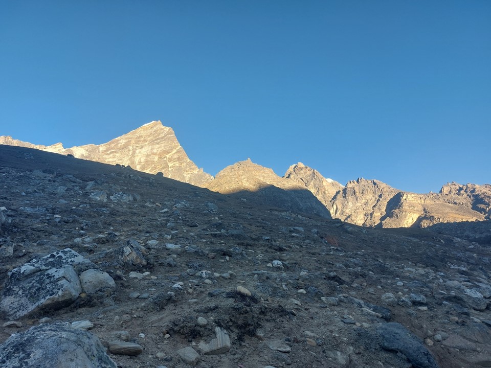
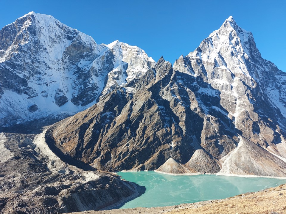
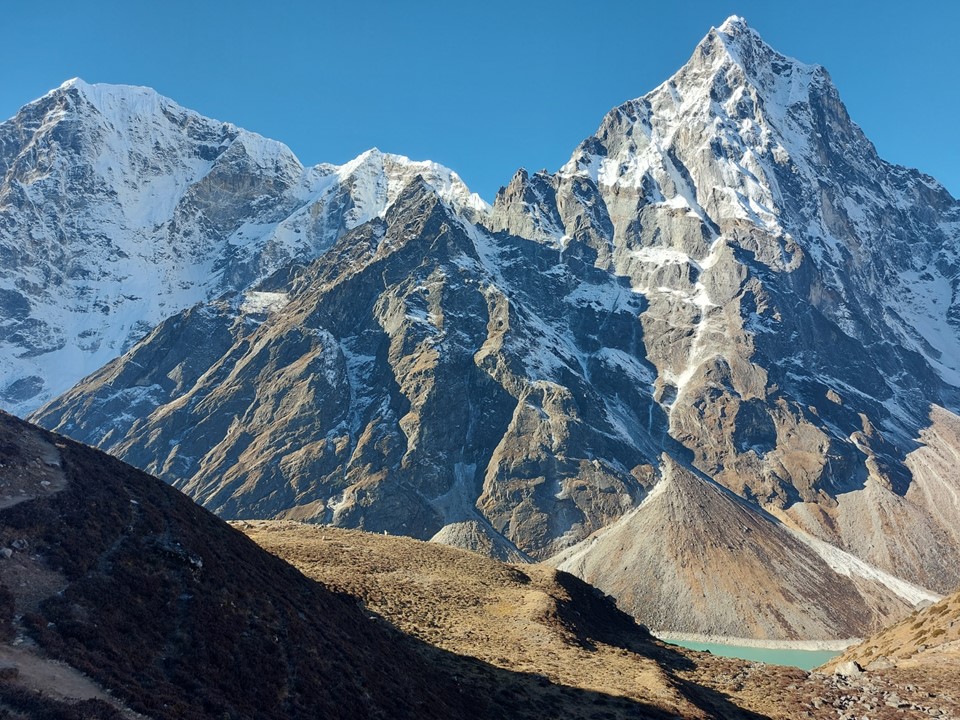
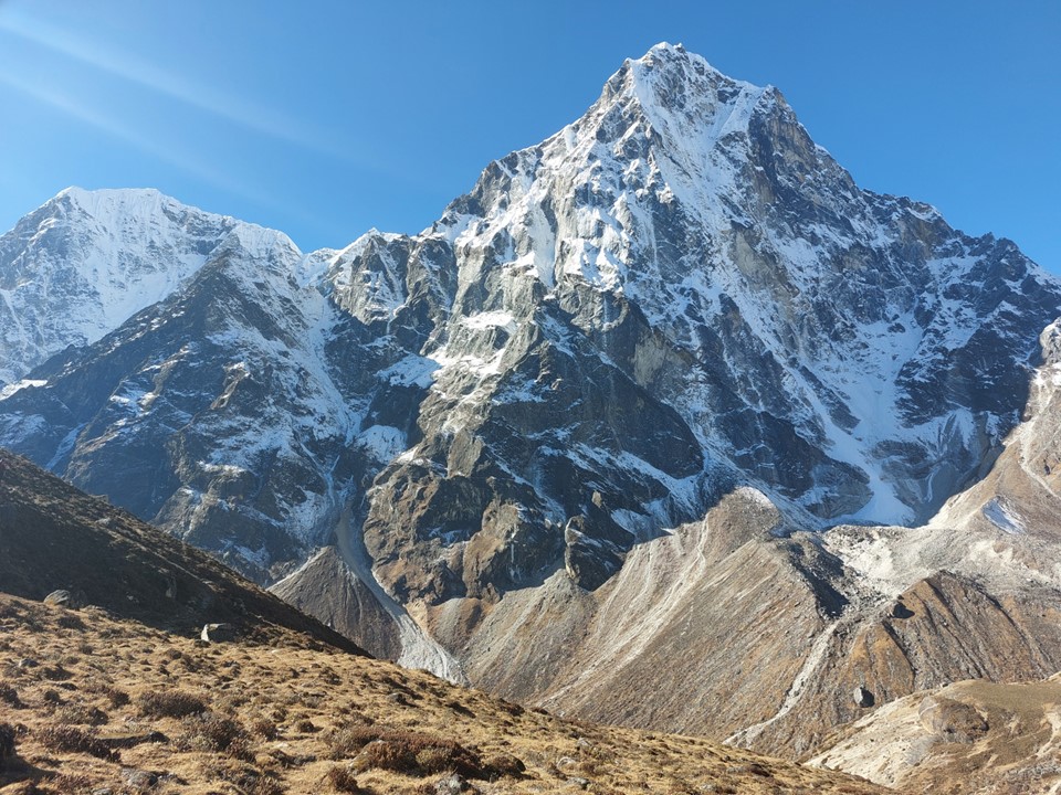
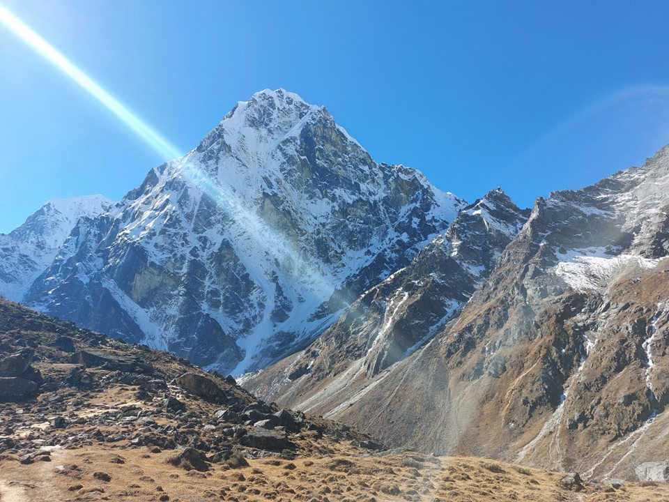
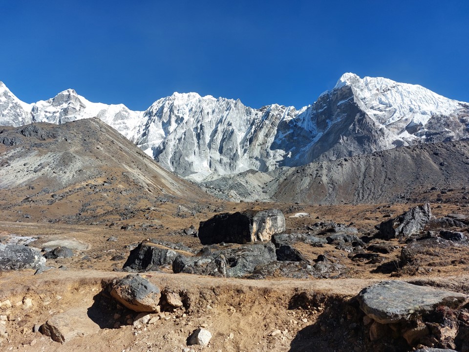
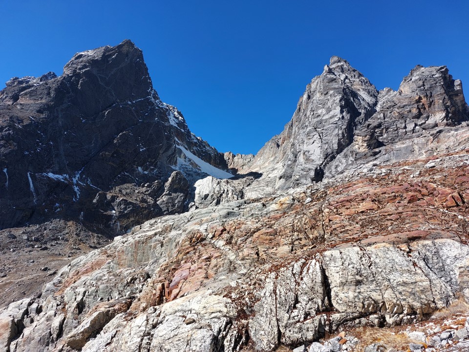
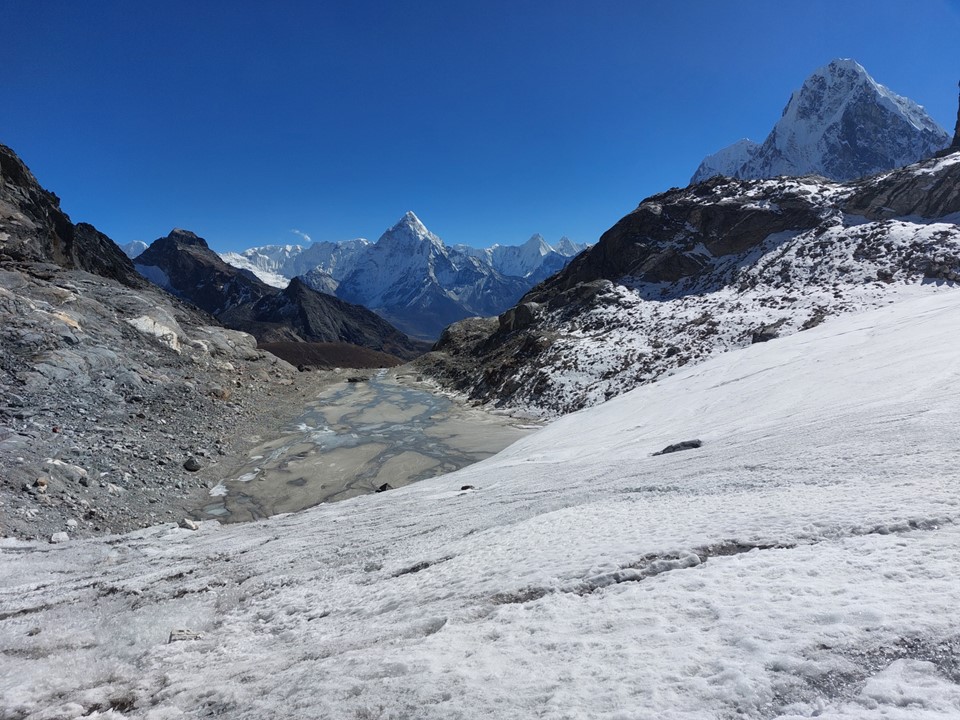
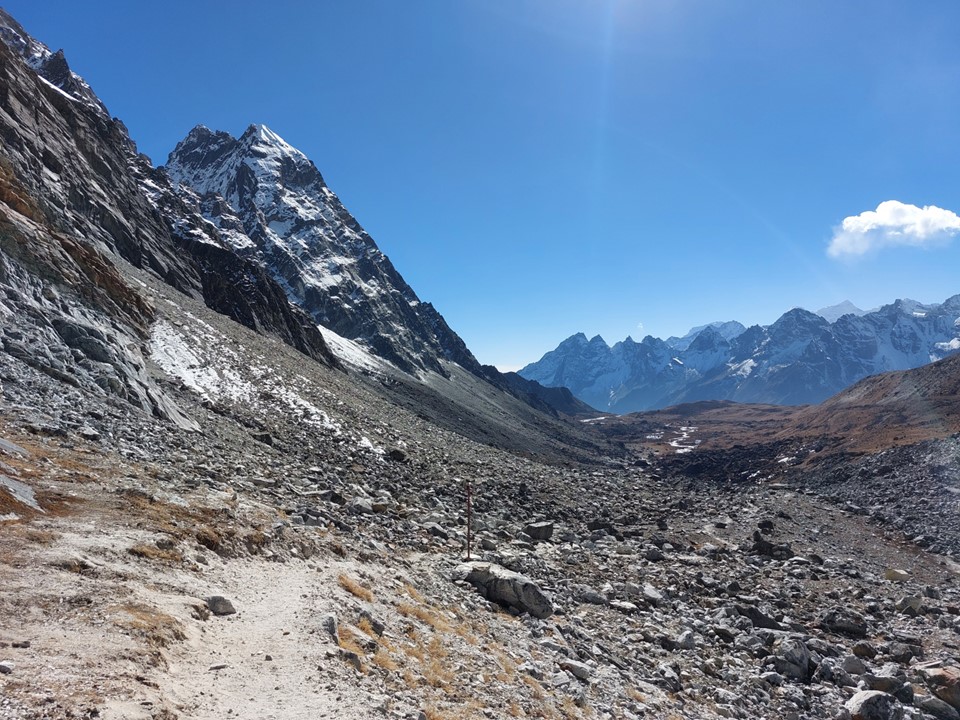
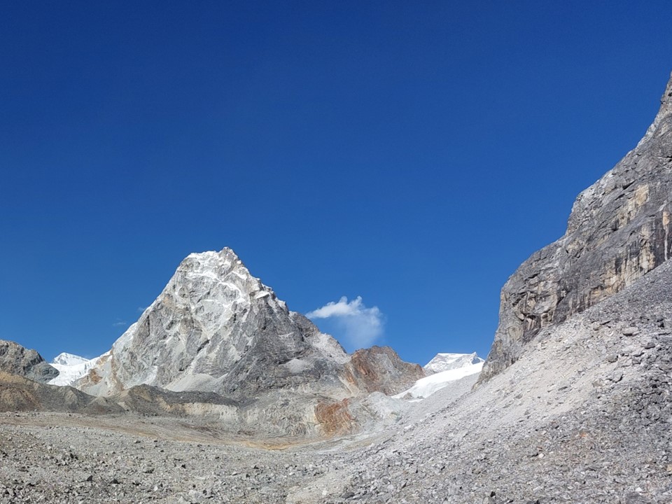
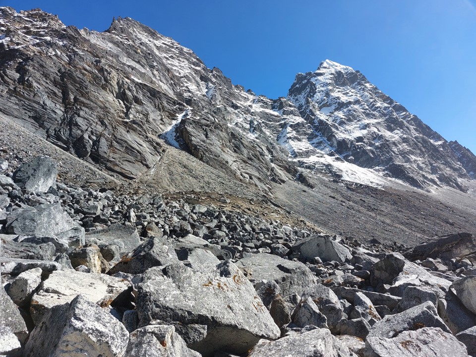
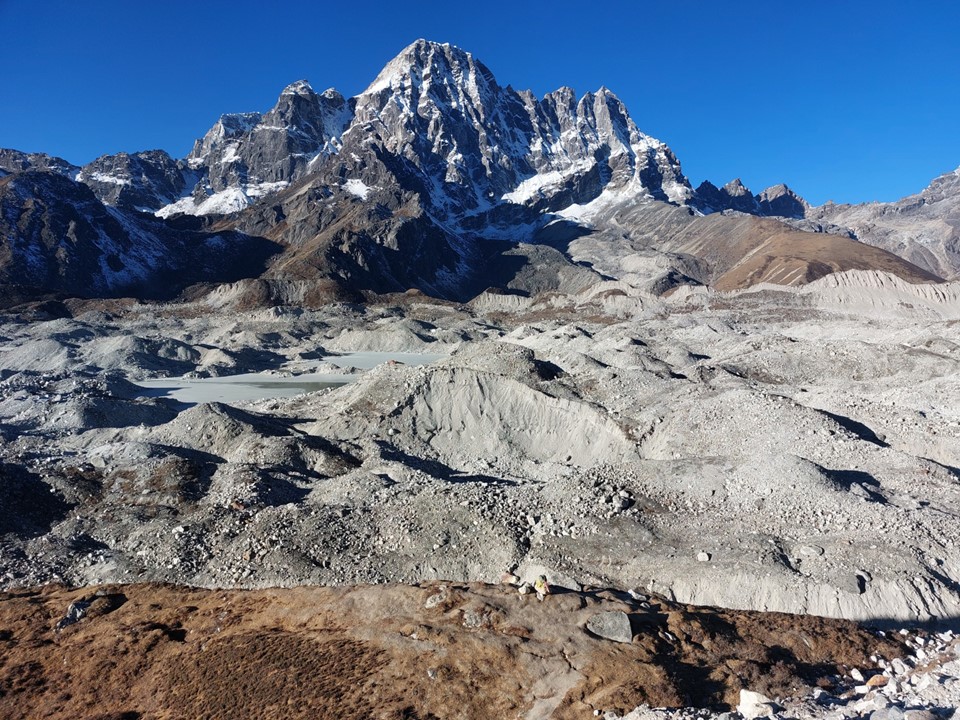
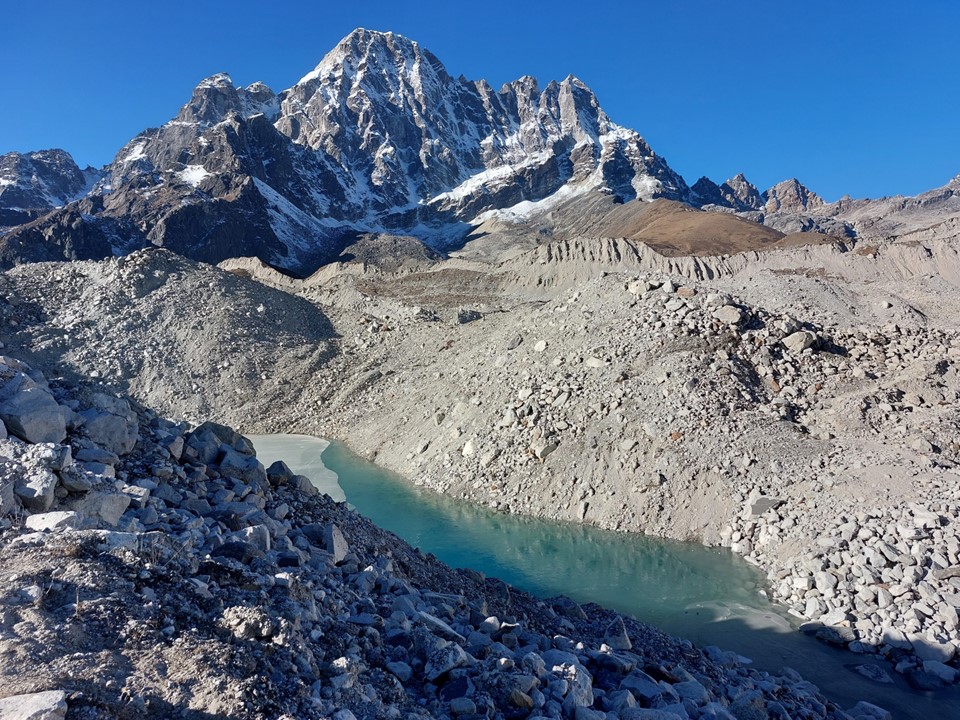
As I began to round the corner from the Khumbu Valley to the Chola Valley, Tabuche came into view once more. Alongside it was Cholaste. I kept stopping and looking at this view, which was progressively getting better. These 6000ers were so close that I could barely fit them into the frame with my phone camera!
As I got a full view of these peaks, I was already sold on this being the most beautiful sight I have ever seen, but as I rounded the corner further, it just kept getting better – until a frozen lake came into view to finish off the view of perfection. Massive steep walls of rock, ice and snow with a frozen lake at the base – words cannot describe this beauty, nor can a photo adequately capture it. When I first saw Elephant Peak from Cockade Pass in the Drakensberg in December 2014, that had been unquestionably the most spectacular sight I had ever seen. Looking at Tabuche and Cholaste from this viewpoint – I knew that the torch had been passed!
I was very aware of what this moment was – I don’t know if I will ever return to this spot, but if I do, there’s no guarantee I will ever get it in such perfect conditions. I sat and stared at the view, I took a few photos – knowing fully well I would be getting this printed on canvas (incidentally an A0 canvas print of it is hanging above my dining room table). I could easily have sat there all day just staring at it.
The late Ueli Steck climbed a route up the north face of Cholaste and said it was harder than the North Face of the Eiger. Standing there I could see what drew him to this massive peak. I traveled to Nepal as part of my “5 most beautiful peaks” objective, and yet it turns out that the mighty Ama Dablam is easily surpassed by these two peaks. I don’t have a favourite between them, but at the date of writing this, they are unquestionably the most beautiful mountains I have ever seen.
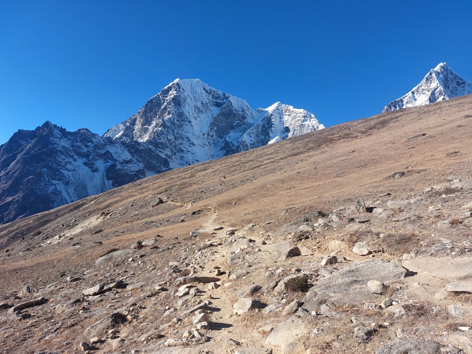
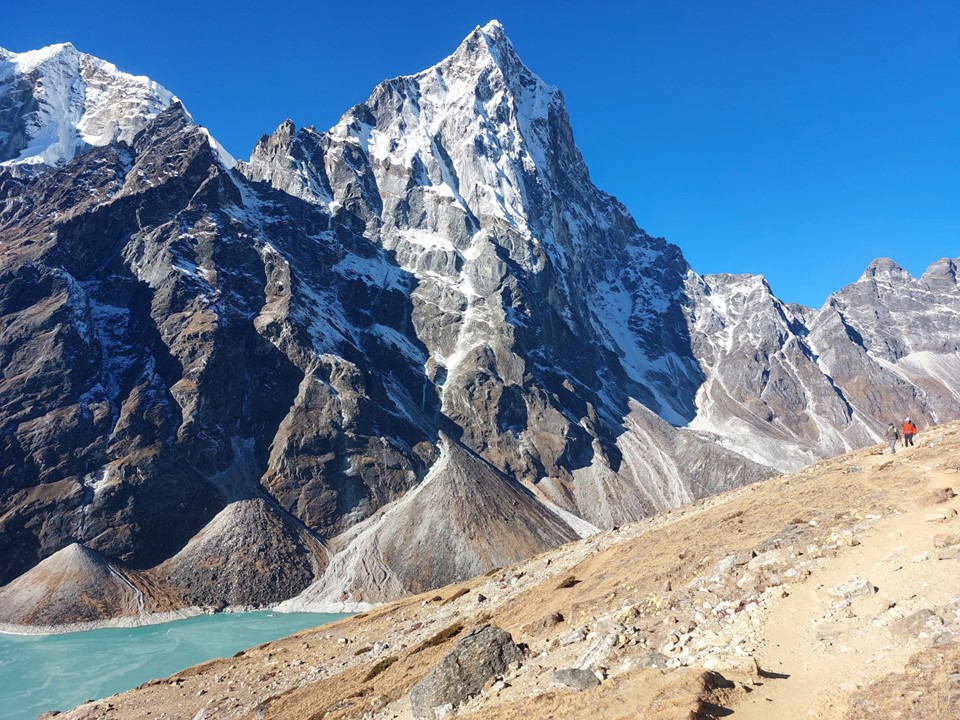
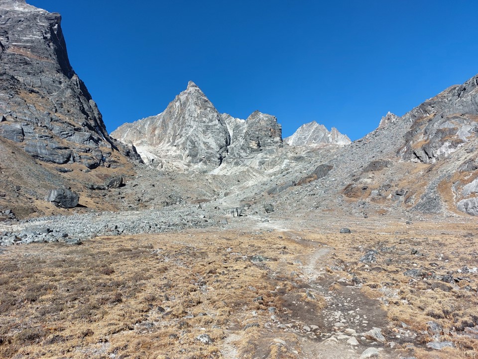
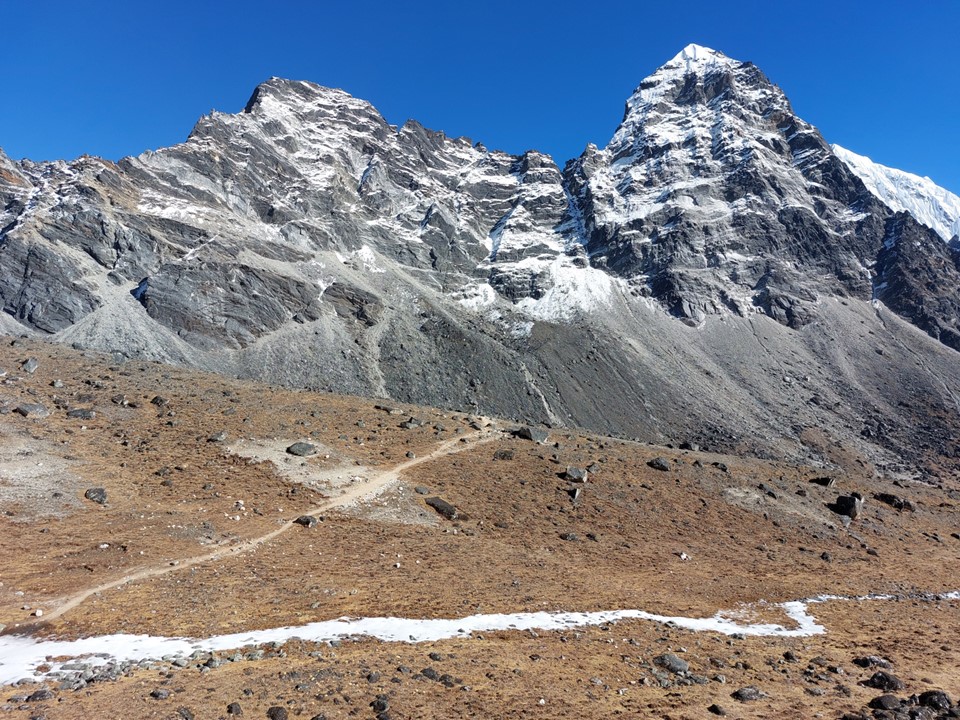
I continued up the valley towards Dzongla. My original plan included spending the previous night there, which wasn’t realistic, but also meant I would have missed this section with this lighting. Every few minutes I stopped – I will pretend it was just to enjoy the view, although admittedly it was also partly to catch my breathe. It is unclear to what extent my breathe had been taken away by the scenery vs the altitude.
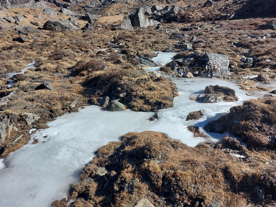
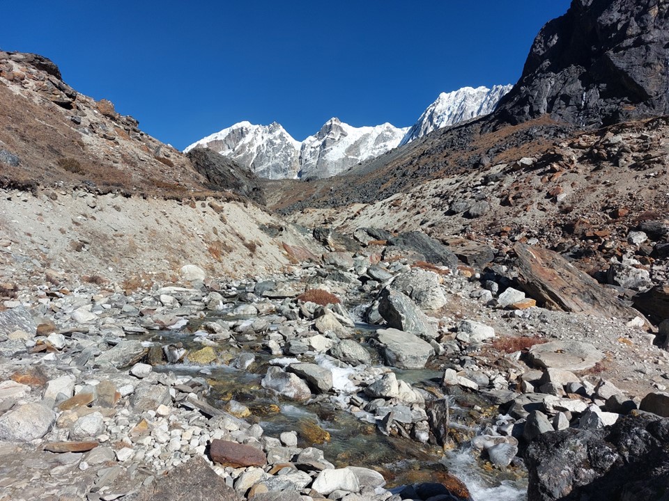
The river was frozen, but the water underneath was flowing. I stopped and filled my designated river-water bottle up and drank through my lifestraw. I started walking again to find someone had used the riverbed as a toilet about 5m above where I had just drunk – a good thing I was using my lifestraw! I don’t get why someone would use a riverbed on a trail – the standard protocol is at least 50m from water and the trail, not in the middle of the trail as it crosses a river! It’s also rare in the Everest Region to be far away from a tea house with a bathroom you can use, so this was entirely unnecessary.

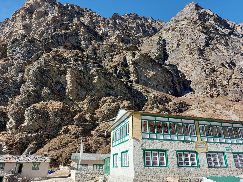
I arrived in Dzongla just before 10AM. I walked straight into a tea house and ordered a cup of tea. I was really feeling the hill, and the temptation to just call it a day and sit and stare at Cholaste. I asked the owner of the tea house about the pass, and he told me I must keep going, if I got from Labuche to Dzongla that quickly, I’ll easily get over the pass today. Considering that he would have made money off me staying there, I’m happy he pushed me to keep going. That’s one aspect I really enjoyed about the people of Nepal – I never got the feeling that they would give me advice just to make money off me.

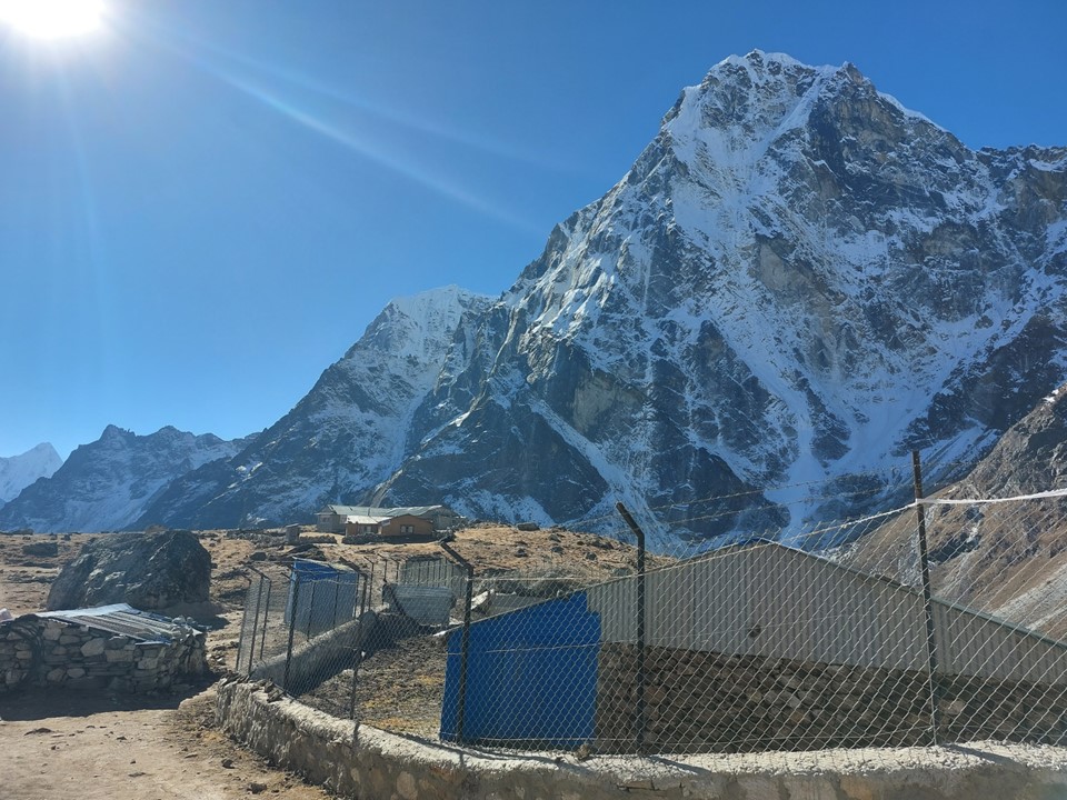
There was a high fence around something in the town. This was the largest fence I had seen, actually one of very few fences on the entire trek. I never asked what it related to, but I did find it interesting.
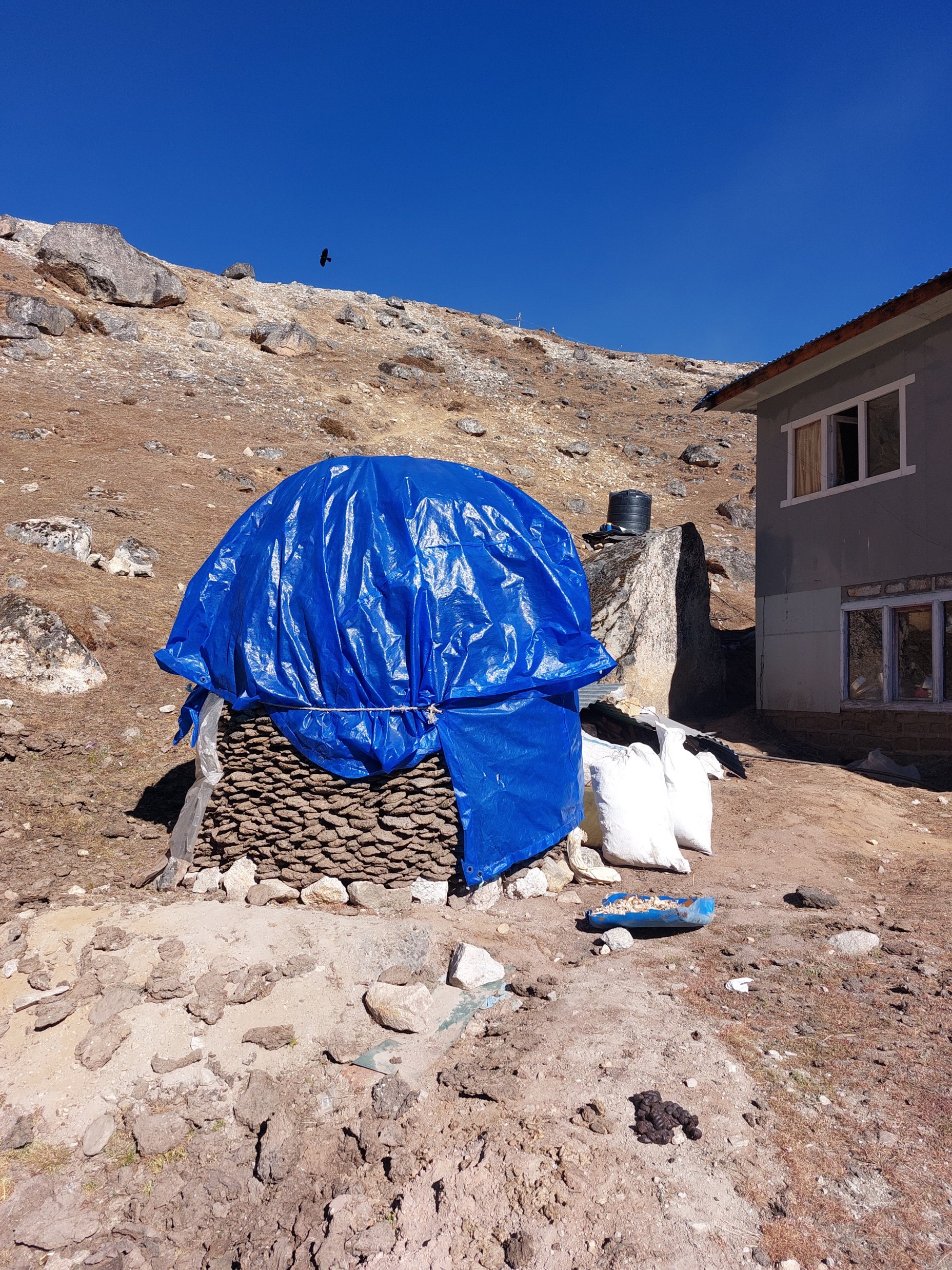
Firewood is hard to come by at higher elevations, so yak droppings are dried and burned for heat. There was a massive pile of them under a tarp on the way out of the town – which was a rather unusual sight!
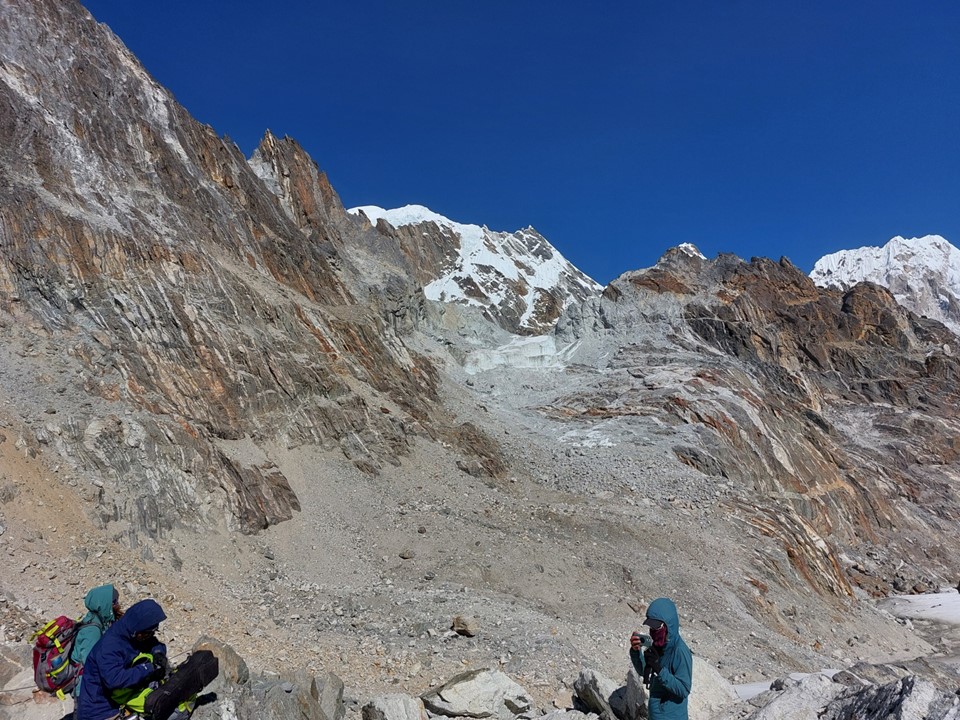
I saw a few people on the pass, although most were going in the opposite direction. There was a lot of excitement on the pass this morning – a local guide had given his micro-spikes to a client to use on the glacier crossing at the top of the pass. He had then taken a really nasty fall and dislocated his shoulder. I was a bit annoyed with how naive the person who told me this story was – she talked about how they would try to get him down to somewhere were a helicopter could collect him. Aside from the fact that an arm injury rarely requires a helicopter rescue on a hiking route, there is no way a local guide could afford one even if he did need one. The client’s travel insurance (if they had any) likely wouldn’t cover this, and I seriously doubt the client was about to pay for it. Nonetheless, I was very happy to have my micro-spikes with me, I had brought them for this pass – and the fact that a guide had been injured due to lack of them further reinforced how important they are. The guide passed me further along, and was moving along fairly fast, there is a clinic in the region, who hopefully were able to help remedy the situation.

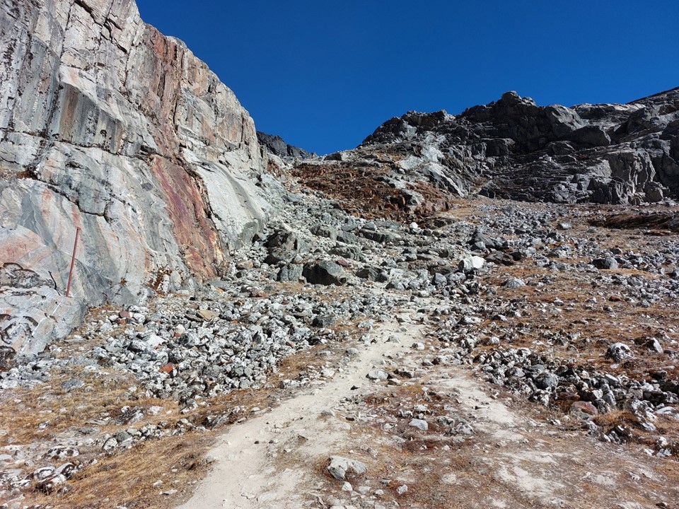
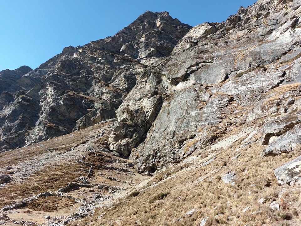
Considered the easiest of the three passes, Cho La most certainly isn’t short. As with all of them, the gradient wouldn’t have been an issue in thicker air, but at this elevation nothing is easy.

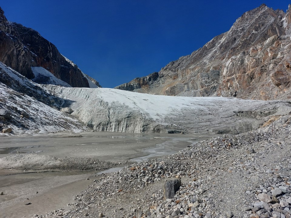
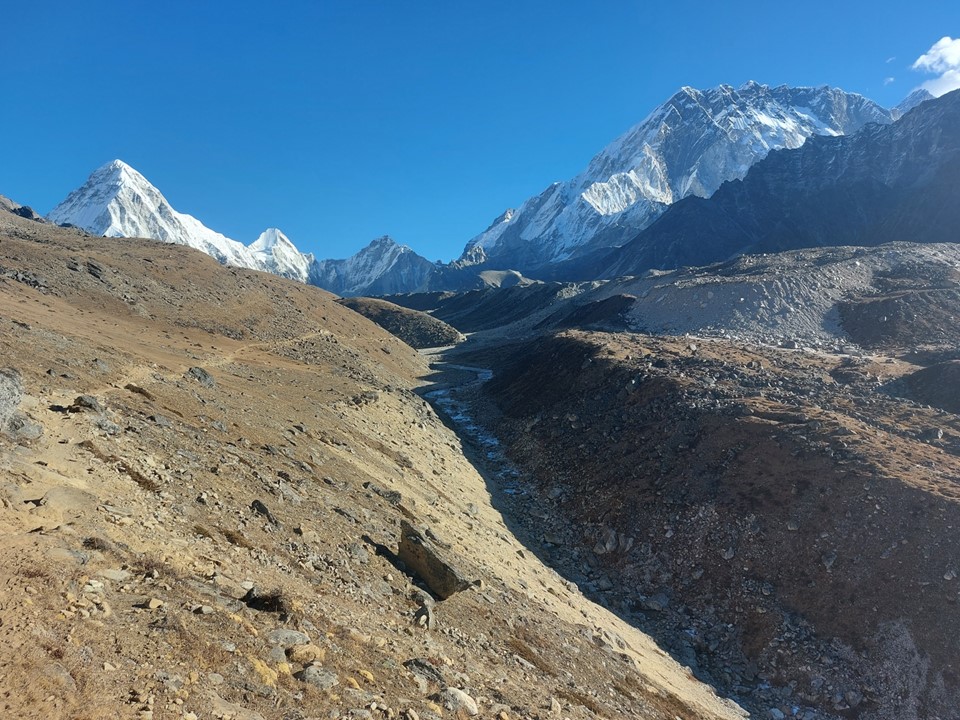
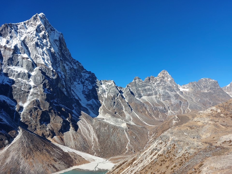
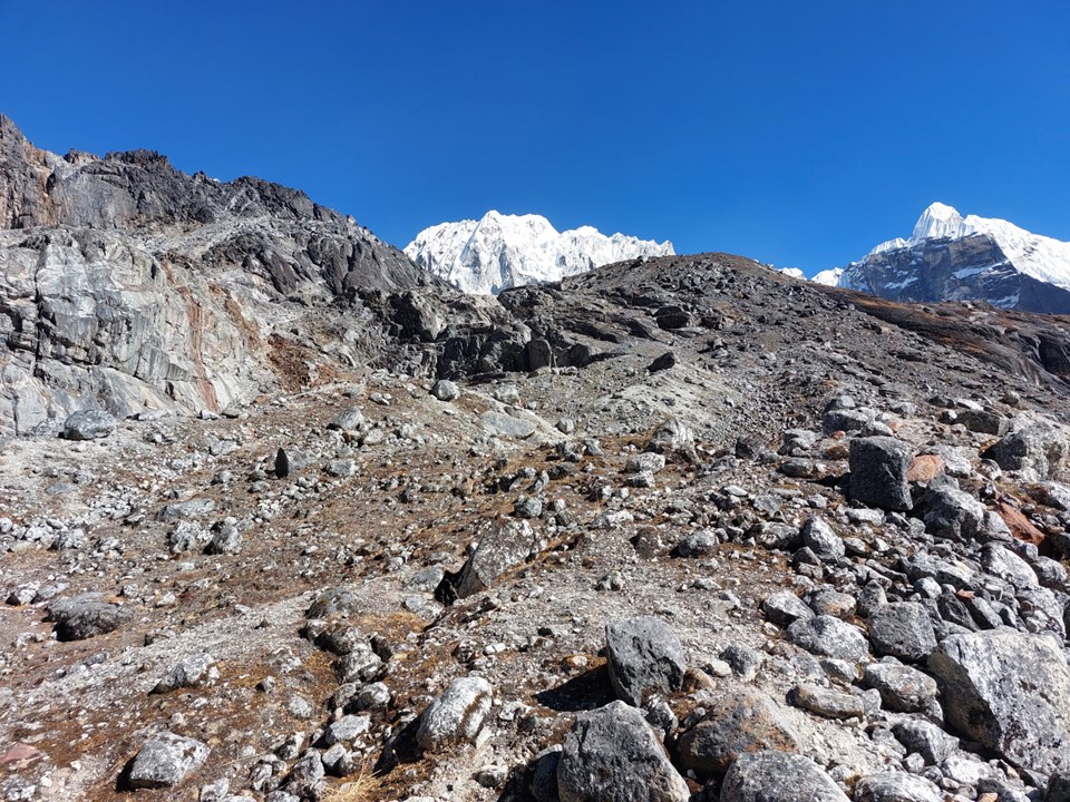
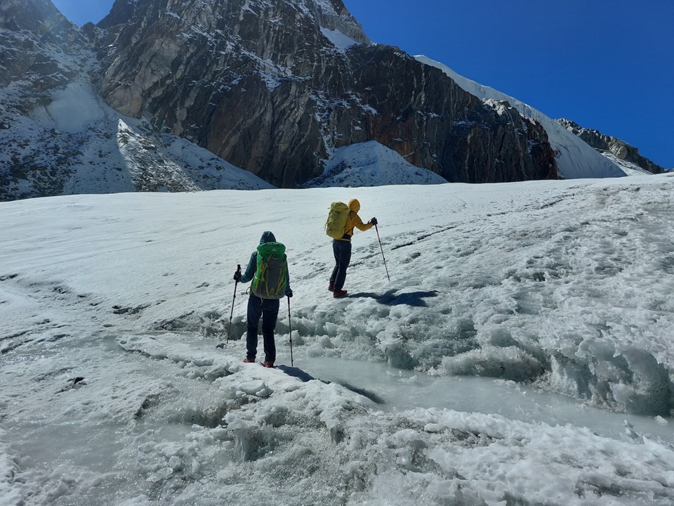
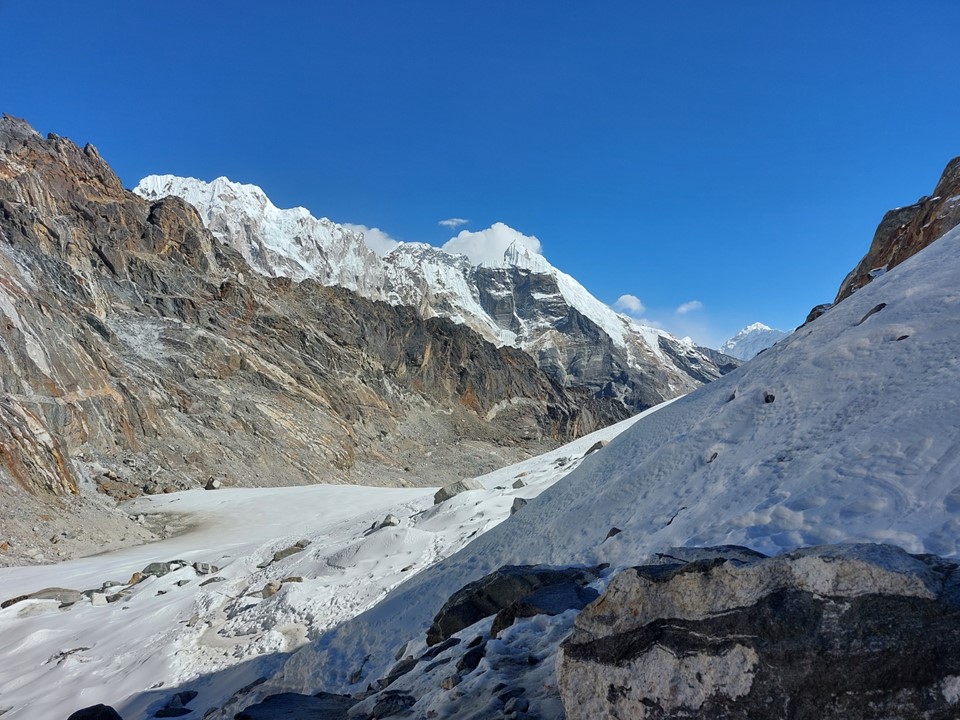
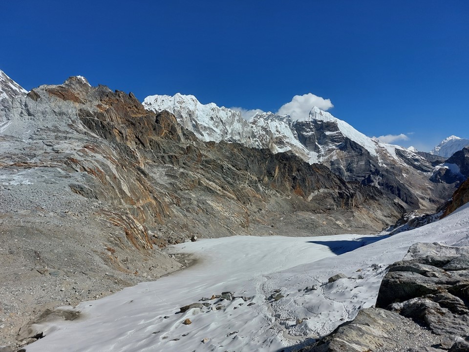
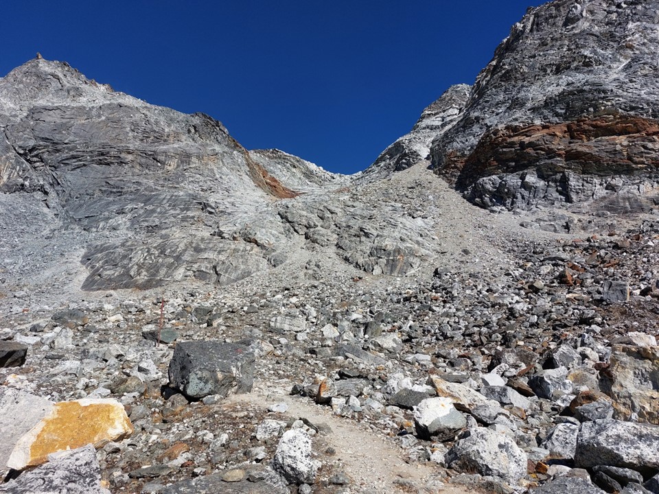
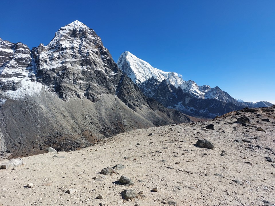
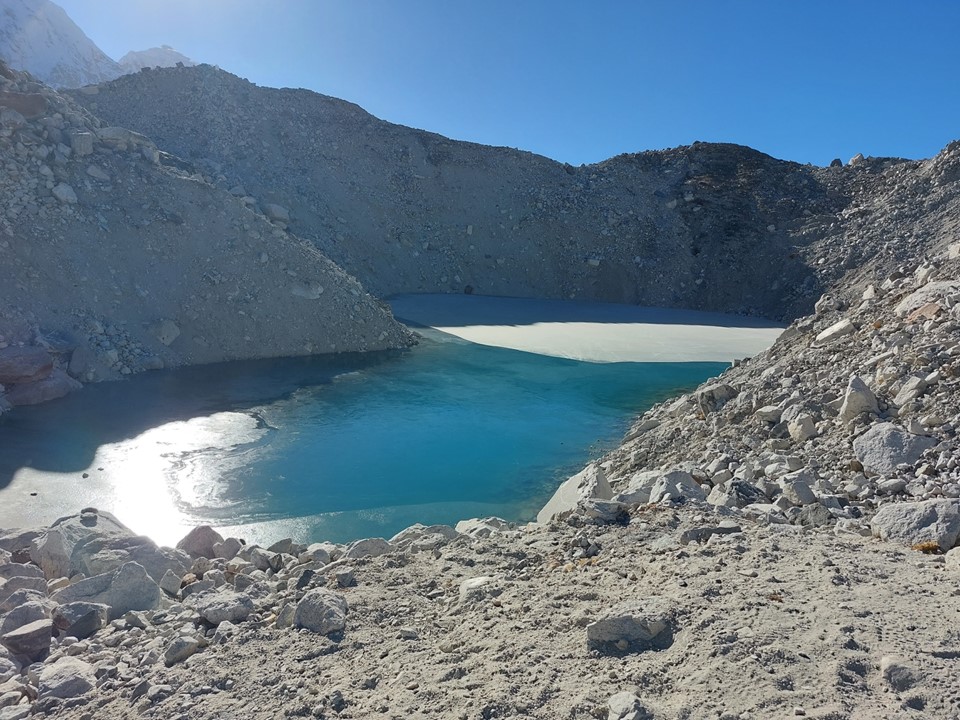
I eventually rounded a corner and the glacier I would be crossing came into view. It was considerably larger than I had expected.
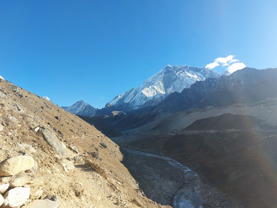
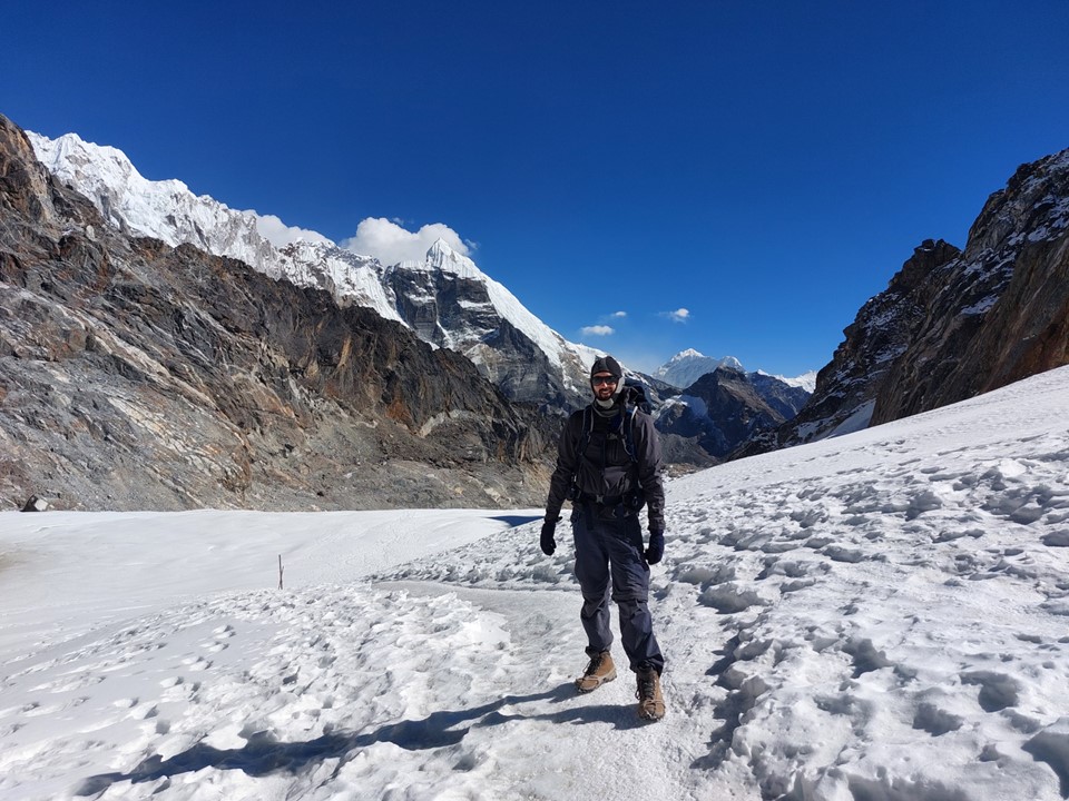
I got a good look at Ama Dablam, which would be disappearing once I was over this pass. I would still see Cholaste and Tabuche for a while, though.
Two Canadians for scale (right on the above photo) – I had a chat with this couple. This was my first proper ice glacier, so I was happy to be near people who knew what they were doing! They told me I was welcome to cross with them – an offer I gladly accepted.
I put on my microspikes and started walking across it. Walking on a massive sheet of ice is not particularly difficult with the correct equipment – but the problems with glaciers usually come from crevasses. Being a dry glacier (just ice, not covered in snow), a crevasse would be easily visible, so roping up to cross this glacier is unnecessary. Being crossed by many people already that day also meant that any likely problem would be more visible.
We made our way across as quickly as possible, you don’t want to stay on a glacier for too long if you don’t have to.
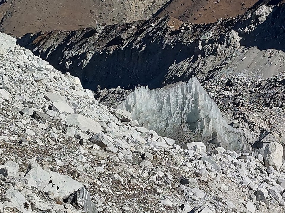
As we neared the end, there was a hanging serac off to the side, so I was happy to get away from the glacier and finish the final short section to the top of the pass. If a chunk of the serac did break off, I don’t think it would likely hit someone on the glacier, but I would rather not find out!
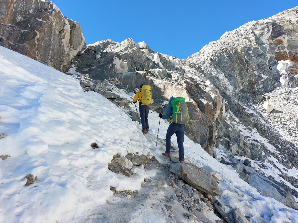
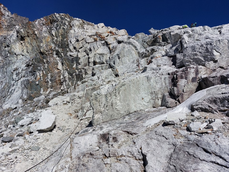
As we went back from ice to snow and then rock, I took my microspikes off – they had served their purpose perfectly.
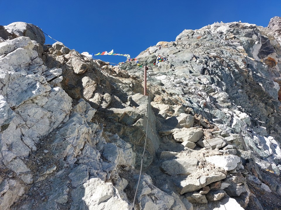
There was a wire handrail near the top, which I intentionally didn’t use – I’ve walked on more tricky ground many times before.

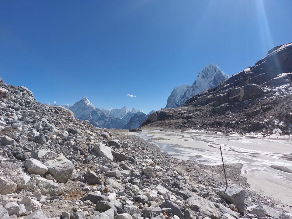
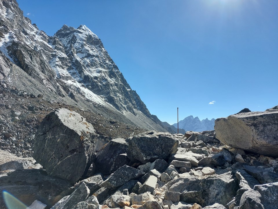
Crossing a pass provides your first view of the next valley. I was interested to see what the next phase of the adventure would look like!

The Canadians stopped for a break at the top of the pass. I thanked them and started down the pass. There was a rail on this side too, and seeing as I had my gloves on and the ground was loose, I decided to use this rail for a speed descent of the west side of the pass.
I did stop periodically for photos and to enjoy the view – and people can ask what is the point of racing down a loose rocky pass while holding onto a rain. The point is that its fun to run down a pass at 5400m!
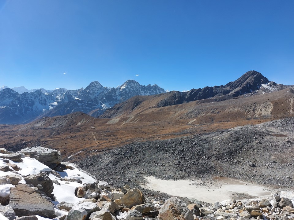
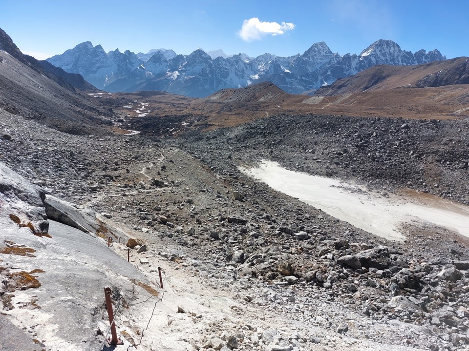
I was soon through the steep section and on to a much easier trail heading down the valley. I had been warned about the glacier between Cho La Pass and Gokyo, so I was keeping an eye on the time.

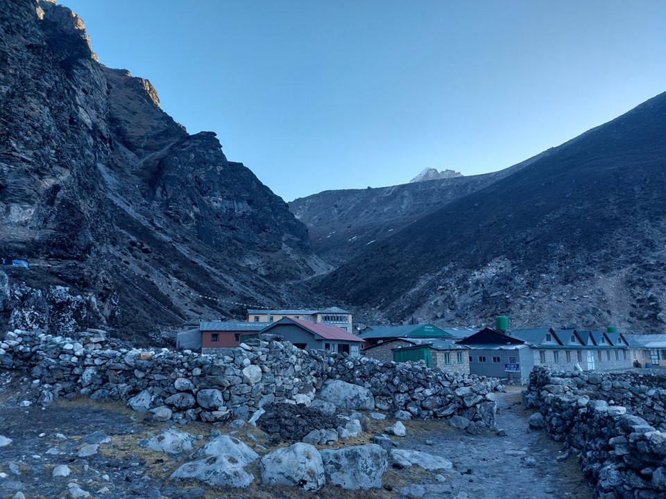
This downhill had been really pleasant – I was happy I took the advice at the tea house and kept going. But if I needed two hours to cross the glacier to Gokyo, I would be arriving as it got dark. There’s a small town on the opposite side of the valley called Dragnag. As I arrived in the town, I went to the first tea house, asked for a room and went in.
My room had an enormous window and the bed was in direct sunlight. I lay down in the sun and enjoyed the warmth. It was so warm that for the first time in around a week, I was able to walk around in shorts and a t-shirt! Then after about 15 minutes it was no longer as warm due to the sun setting behind the cliffs above the town, and I reverted to more suitable clothing – but that brief period of being lightly dressed had been wonderful!

Being in a narrow valley, the sun sets early in Dragnag. I hadn’t had signal since Kongma La a few days earlier, so when I discovered there was free wifi (you usually pay for wifi at a tea house, and there frequently isn’t wifi even if you are willing to pay for it) – I was happy to get a few messages off. As it turns out, both my family and my running club had been worried about my silence for a few days. I had warned that this was likely, but the fact that I had signal all the way to Chukhung probably meant they expected signal all the way through to the end.
I hadn’t showered in a few days, and the tea house had a hot shower – so I gladly used it. Incidentally, as is common in tea houses, the hot shower cost more than my room! Still my overall cost for the night, including tea, supper, breakfast, my room and the shower was around the usual price, which is considerably cheaper than a decent room almost anywhere in the world.

After breakfast I set off. The narrow valley was cold and shady early in the morning, as expected.
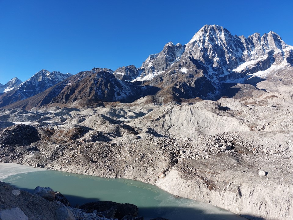
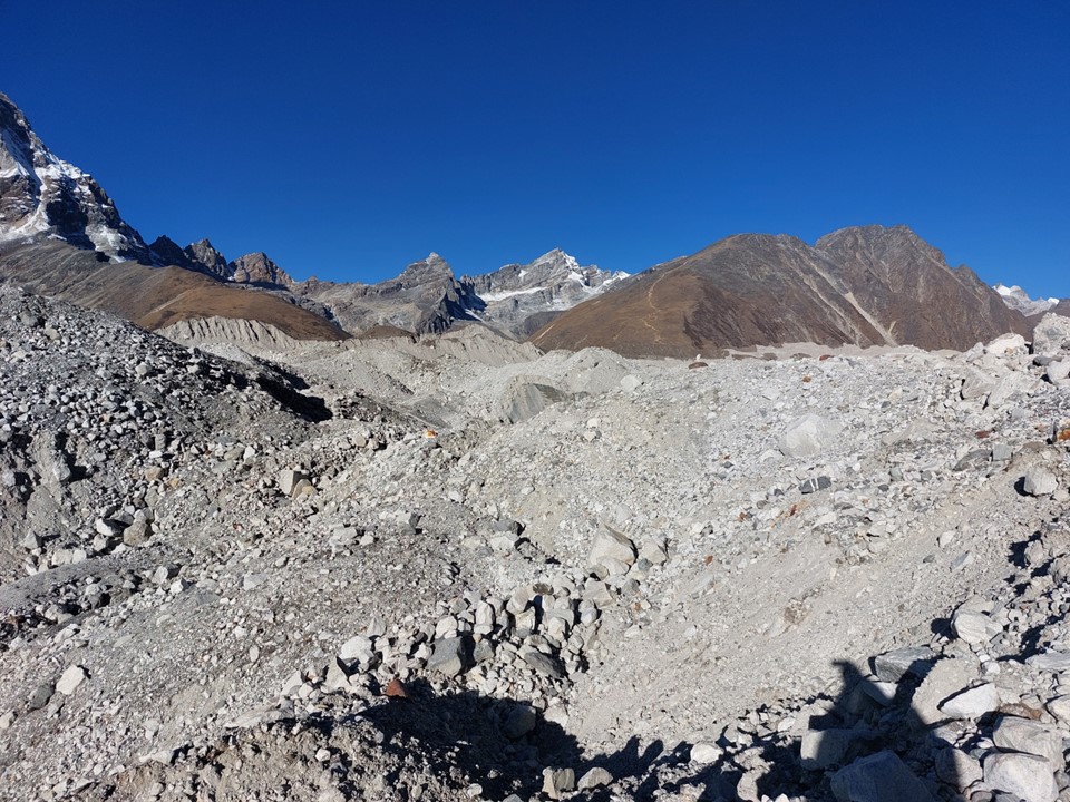
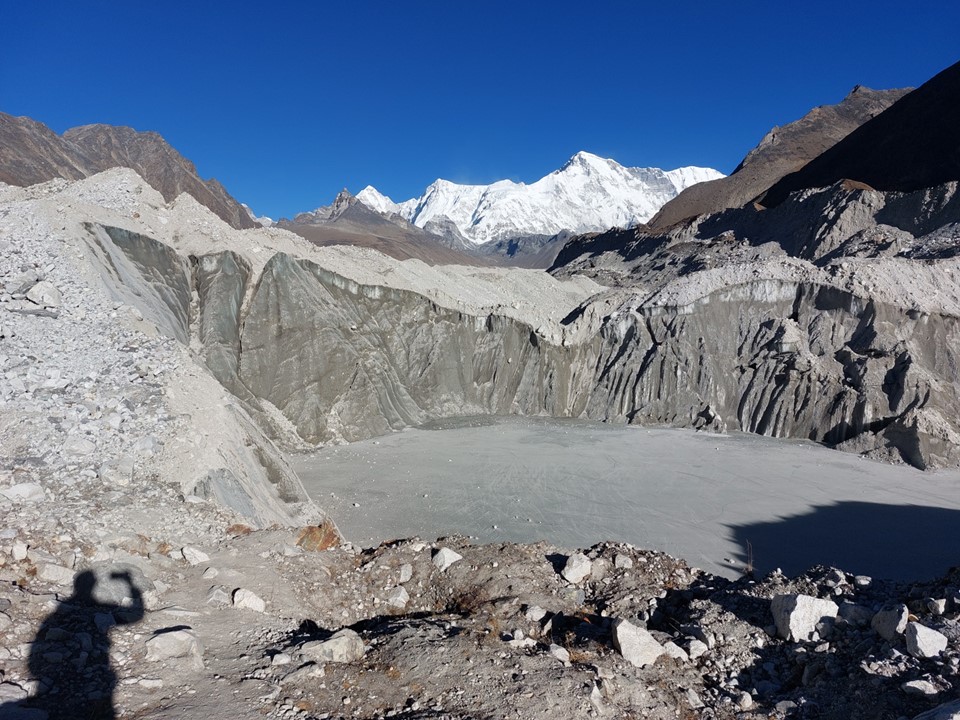
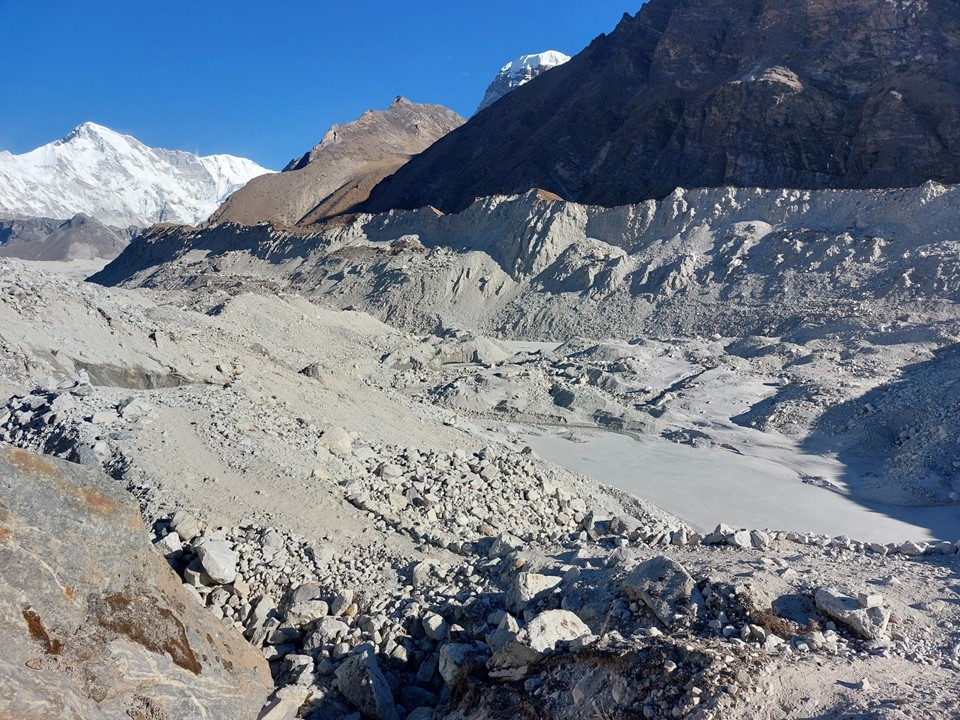
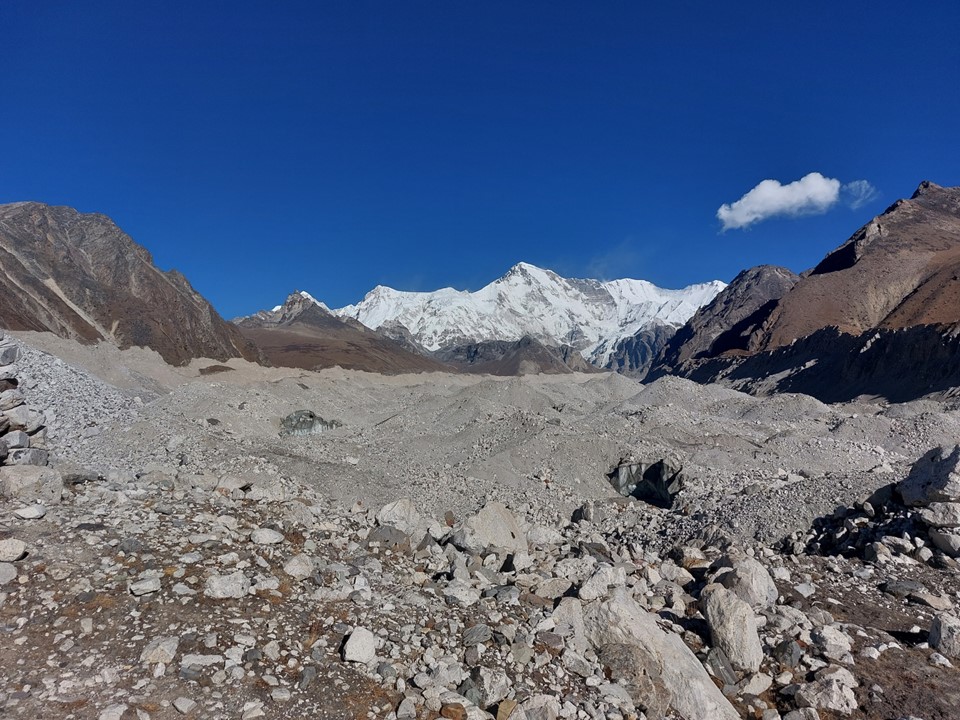
I soon rounded the corner to see the infamous Gokyo Glacier. As with the one before Labuche, I had to start by climbing to the top of a ridge and he descending onto the mass of rubble.
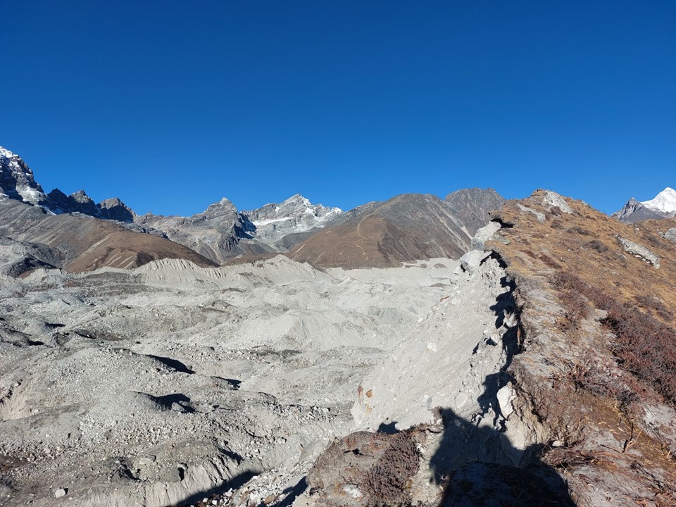
What followed was a chaotic trail that would climb and drop, zig-zagging in every direction. I could hear ice cracking and could see stones falling in every direction. The trail over this glacier follows the safest line possible, which isn’t very direct, but I never felt unsafe. Notably crossing a glacier at 8AM is not ideal – water that has frozen overnight is melting, rendering a lot of the ground less stable than at other times of the day.
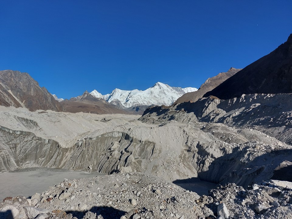
Looking up the valley, I could see Cho Oyu in the distance. It is the 6th highest mountain in the world, and statistically the safest of the 8000ers. It is rarely climbed from Nepal, and since Tibet has been closed to tourists for a few years now, it has received very few ascents in recent years. It has been described by some mountaineers and an enormous hill more than a mountain – which is probably a bit unfair for what is still an enormous mountain.
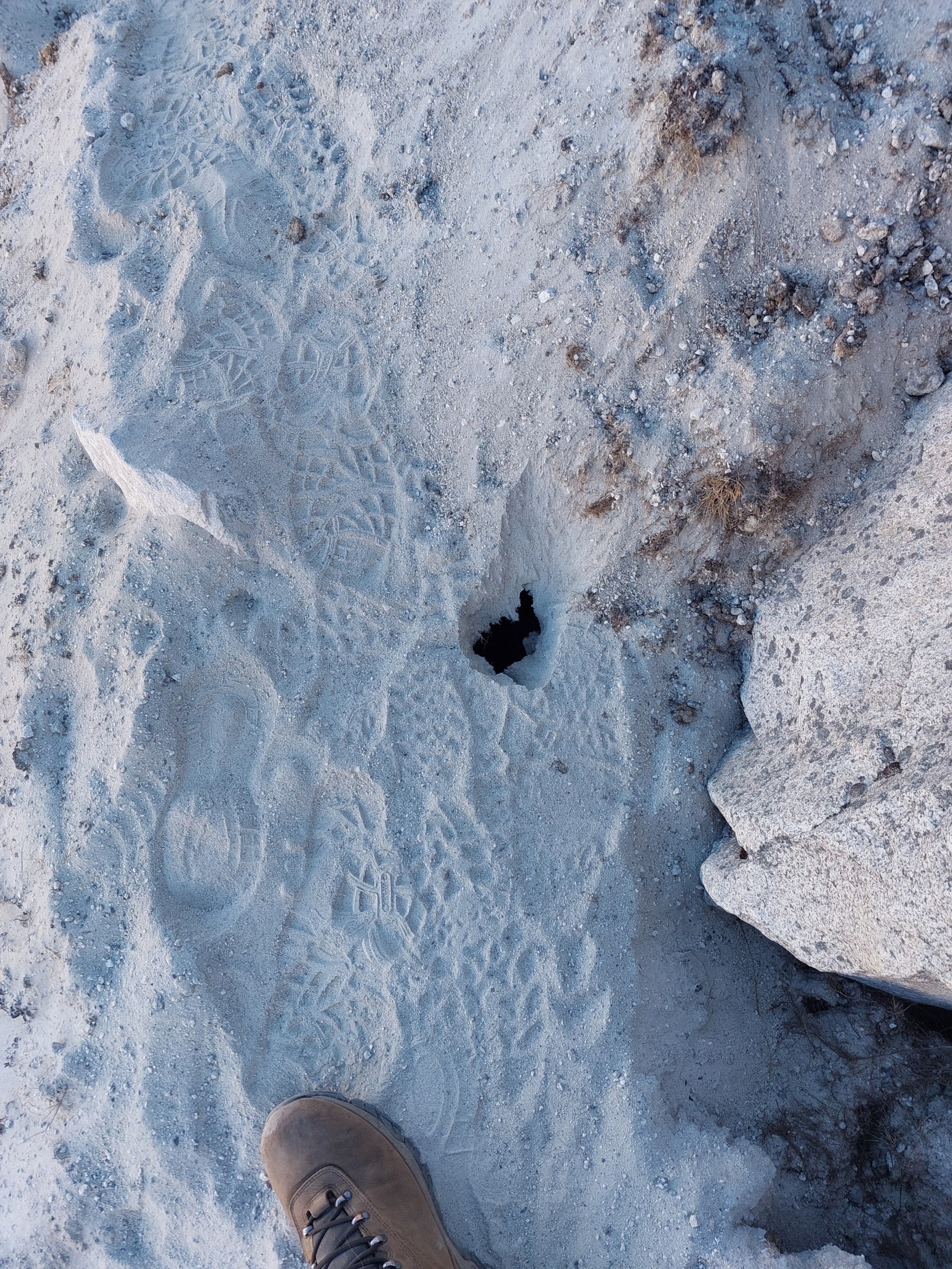
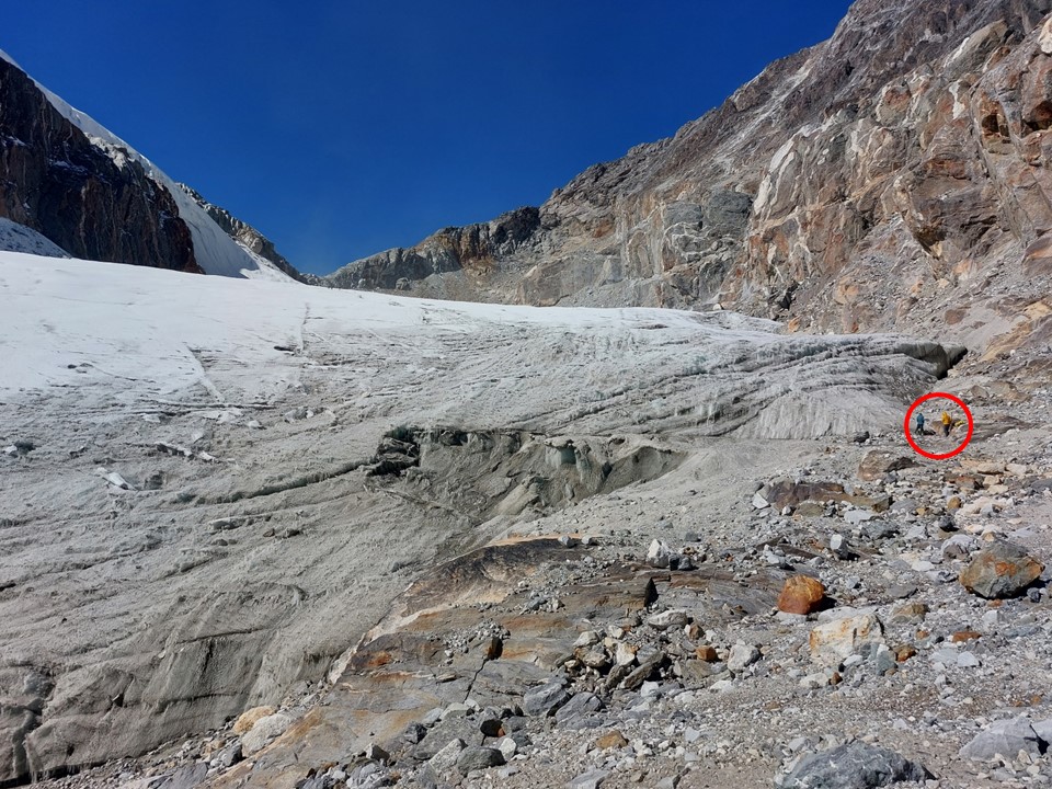
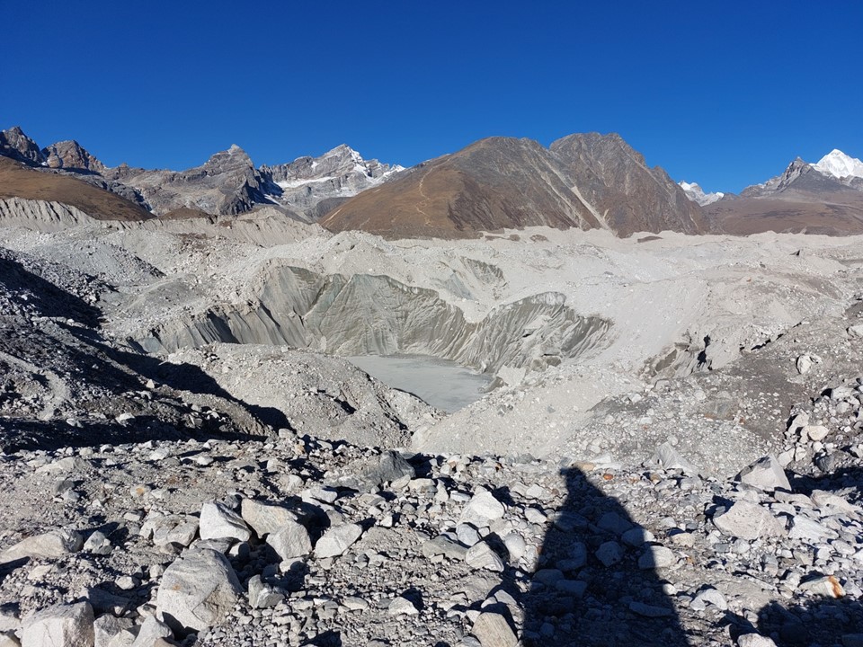
One notable aspect of a glacier is that it is a slow moving frozen river – so the ground on top can look fine while what is underneath is not fine. I encountered a small hole in the ground at one point – I am very curious what was going on below that, although I got away from it as quickly as possible as I didn’t want to be the one to find out!
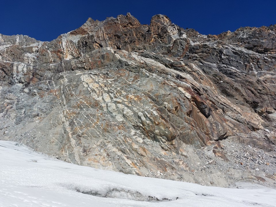
At one point there was a rock that had been painted as a route marker. This rock wasn’t even near the trail any more, but had fallen to the ground below. This served as a reminder of the importance of staying on the trail, nothing is stable here.
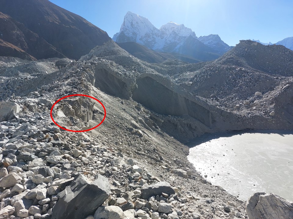
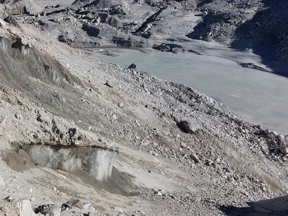
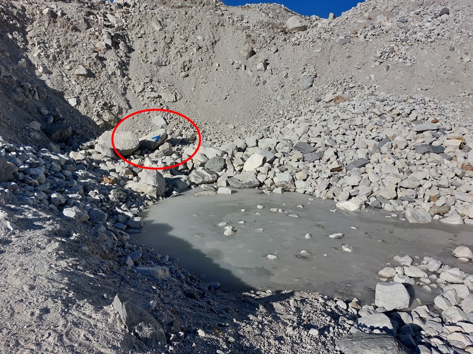
A bit further along I heard a sound, so I turned around to watch a rock 2m away from me detach from the ridge and fall down towards the frozen lake below. While 2m away is hardly a concern, it was still something for the ground right by where I was walking to just suddenly disappear into the rubble below. I have circled the spot where the rock detached in the photo above. You can see the trail to the left of it.

After more than two hours of walking across this ground, I was finally at the slope on the other side. Not crossing it the day before was the right call, I would have reached Gokyo after dark.
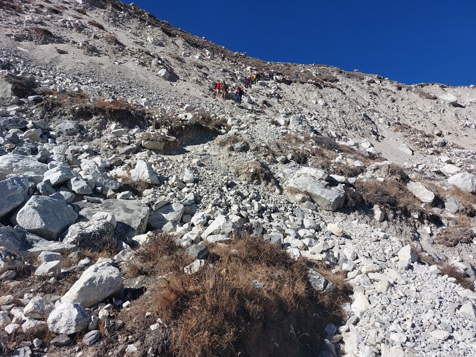
There was a large group of trekkers coming down the slope. I watched them dislodge rocks as they didn’t exercise sufficient care. I knew that I didn’t want to be below them while they dislodge more rocks, potentially onto the hikers coming up, so I waited before proceeding.
I waited for about 20 minutes as the team slowly proceeded down. A few people were stuck at the hardest section, and their guide didn’t seem to have any interest in doing anything about it, so I went up and showed them where to step to get down. I then proceeded to go up as quickly as possible – I could hear the people below talking about how quickly I ascended, which was rather funny. I could see the next group starting to come down, and I didn’t want to wait here forever. I took a variation line to the side for the top section since I didn’t feel like trying to get past the hikers on exposed loose ground.
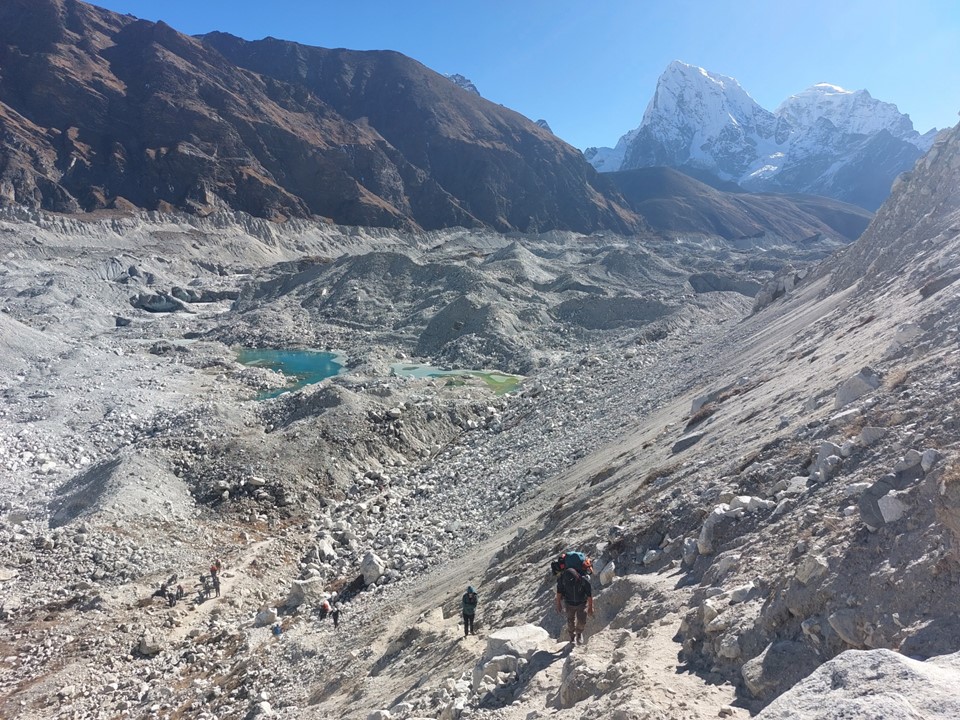
I was very happy to be off the glacier. I knew it was my last glacier for the trip, and it had been by far the hardest. It took me almost three hours to get from Dragnag to Gokyo – even though the distance is only 4.5km.

Gokyo is a small town on a lake. It is unquestionably the most beautiful town I have ever seen, and is no doubt one of the most beautiful towns on earth. To the north you have Cho Oyu (8188m), to the south you have Cholaste (6440m) and to the west across the lake you have Pharilapche (6017m). If you get on the ridge above the town, you can also see Everest to the east.
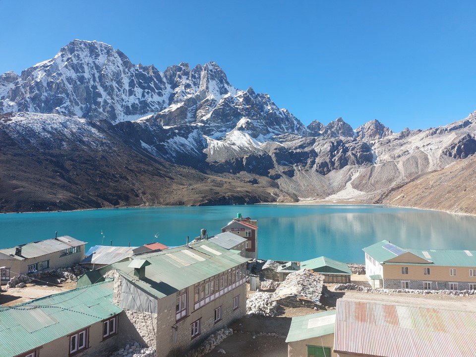
I found a tea house, booked a room and ordered a curry and some lemon tea. Sitting and looking out the window, I could have easily stayed there for a few weeks! I had to chuckle – like most tea houses in the region, my room only cost NR500 (about R80/$5).

Really enjoyed this one! I seriously need to go and walk around there. What a dream trip! Are you going to do an article at the end on all the gear you used on the trip?