After two nights in Pangboche, with my “rest day” hike to Ama Dablam Basecamp – I was happy to start moving up the valley again. The objective for the day was simple – hike to Dingboche and head up the hiking summit of Nangkartshang for some extra acclimatisation and some great views.
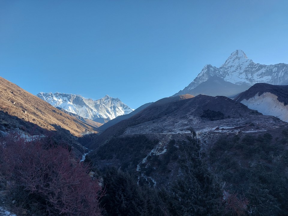
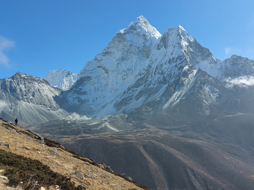
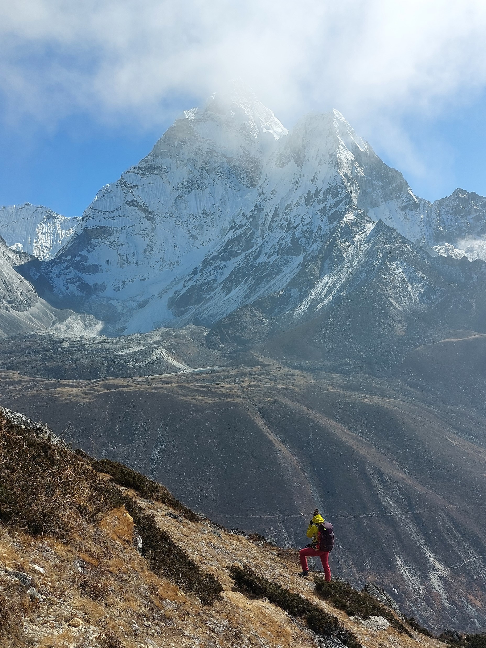
Walking out of the tea house with Lhotse and Ama Dablam in front of me is really strange. They just sit there minding their own business, as if they aren’t some of the craziest mountain faces on earth!
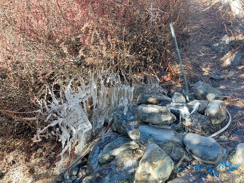
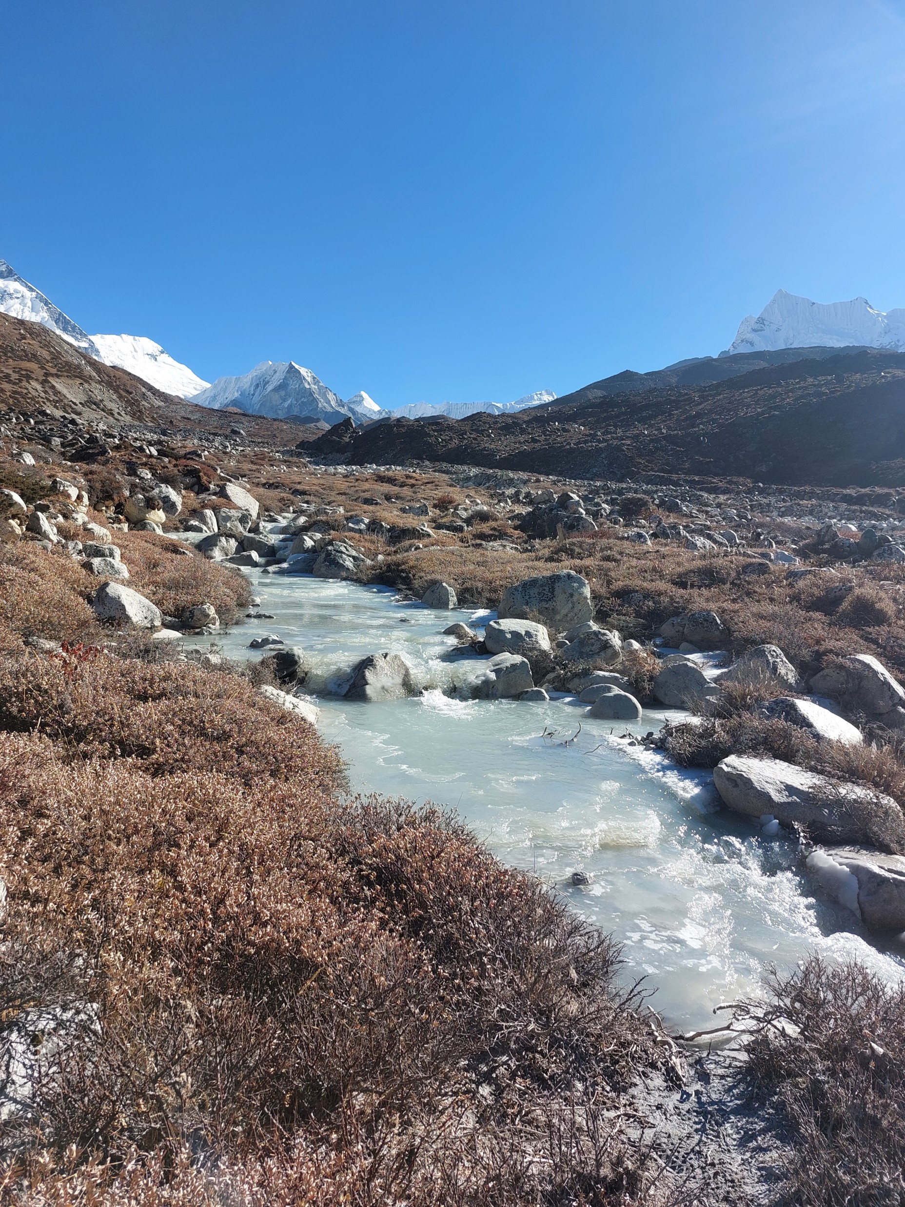
Conditions were definitely getting colder, ice was becoming a common sight. The days were still pleasantly warm, but the temperatures at night were getting colder – as one expects as elevation increases. I had been told how important a good sleeping bag is, yet mine had remained in my pack as the tea houses always provided blankets that were easily warm enough.
Watching the snow fly off Lhotse gave an idea how strong the winds were above 8000m. Meanwhile below 5000m there was not a breathe of wind. I had been told how good November weather usually is, but this was considerably better than I had expected.
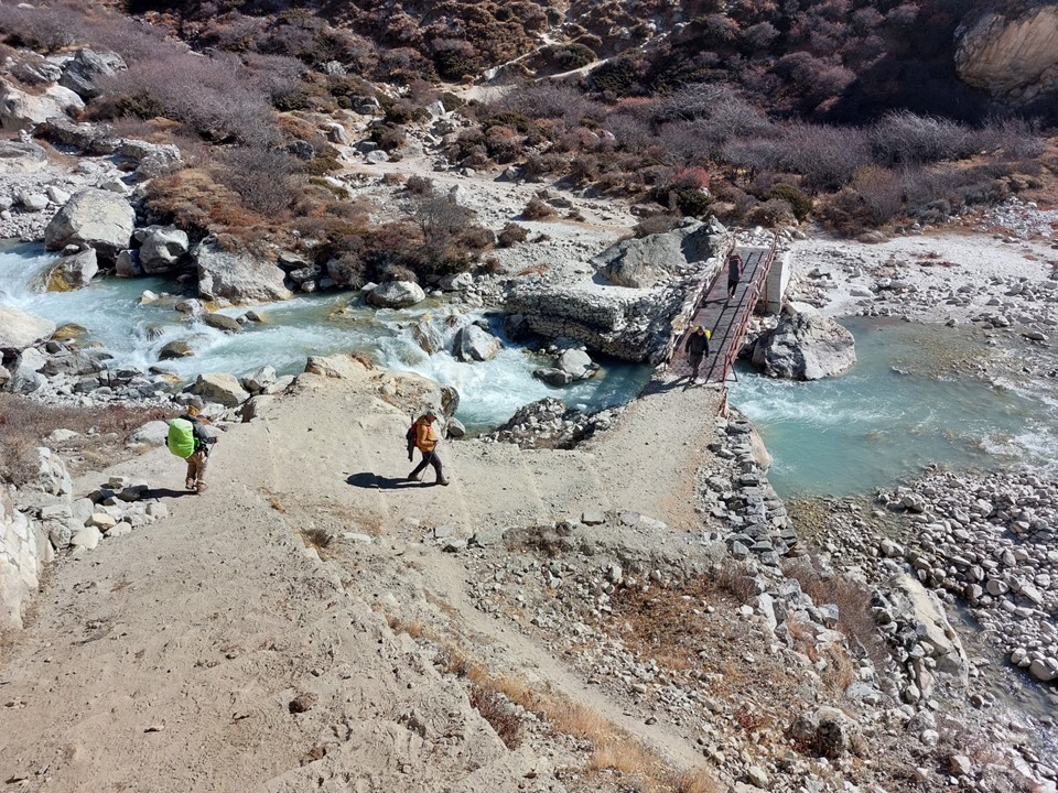
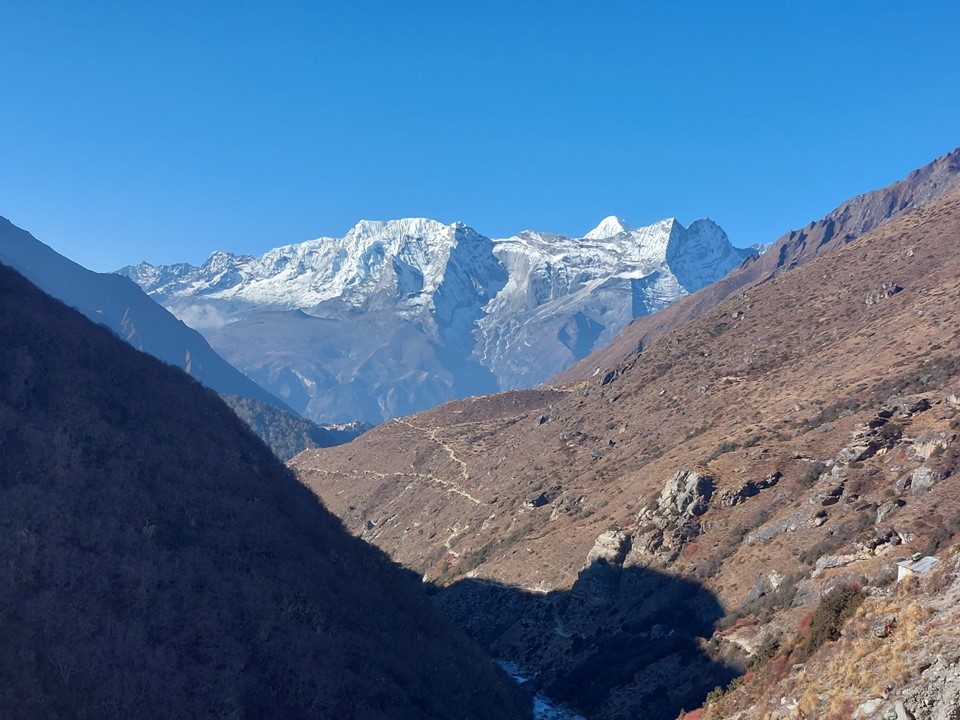
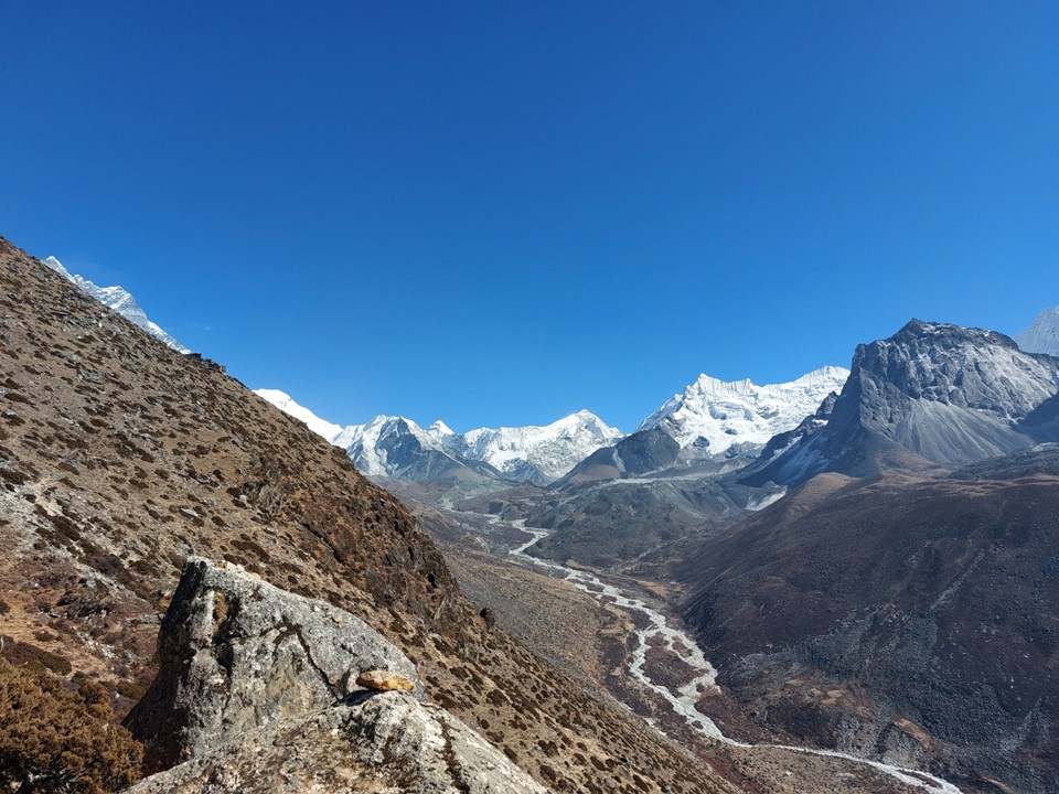
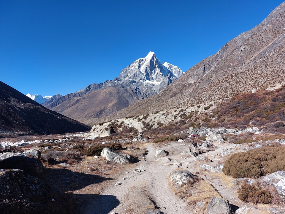
I soon reached a split – let to Labuche, right to Dingboche. This is where the Three Passes Circuit and the standard Everest Basecamp route split off. Some parties venture up to Chukhung to acclimatise, but most don’t. The Three Passes Circuit Trail drops down to the river and crosses just before you reach the town of Dingboche.
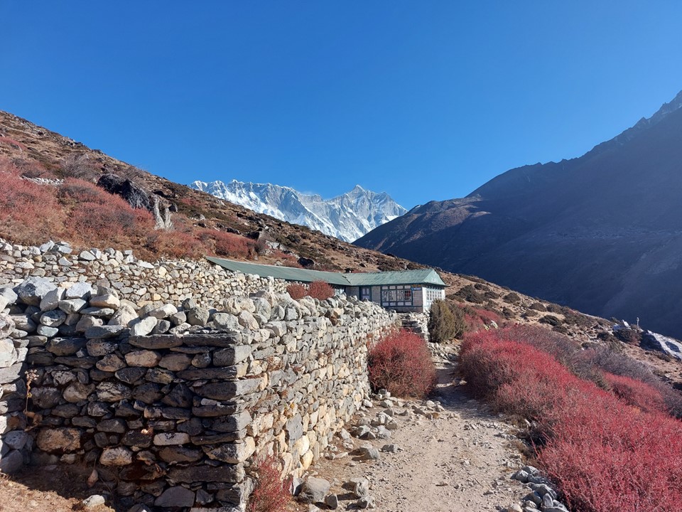
The lady who owns the tea house I had stayed at in Pengboche told me to go to a specific tea house in Dingboche – which is owned by her cousin. I arrived and told the owner that her cousin had sent me, which she seemed very happy about.
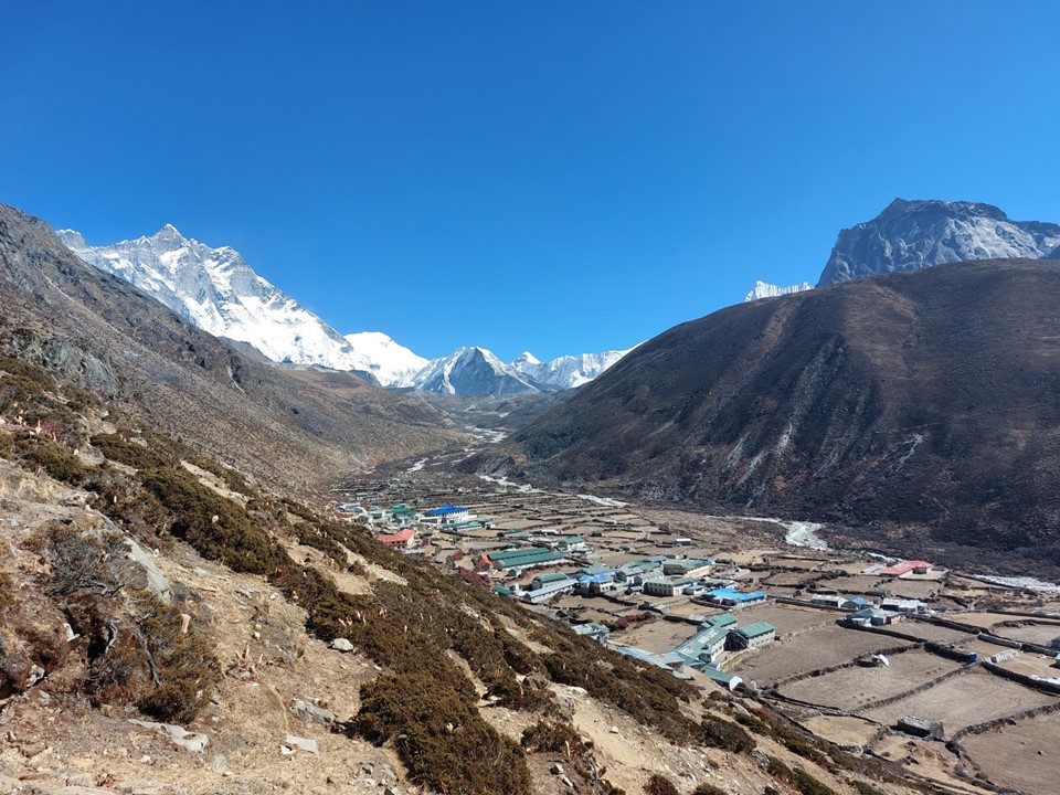
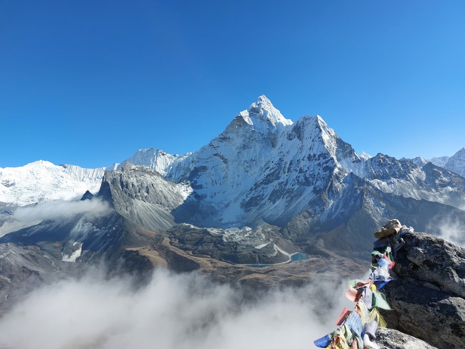
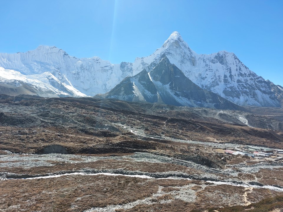
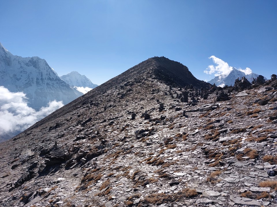
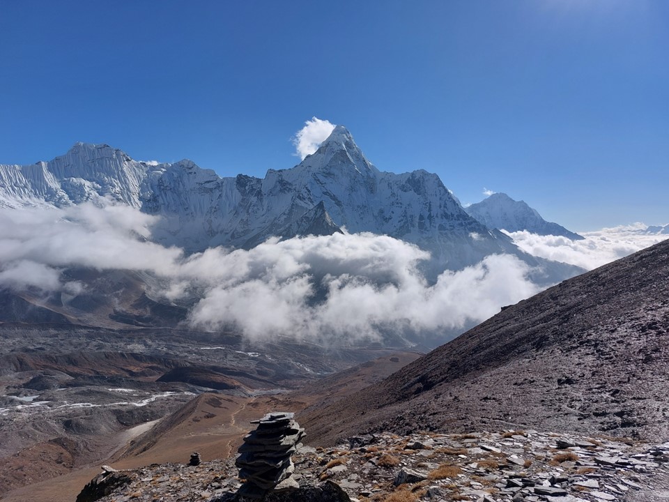
After putting my things down and taking a bit of a break, I began the ascent of Nangkartshang, a 5087m trekking peak above Dingboche. It looks easy from below, but much like anything else at this altitude, a gentle ascent is never trivial.
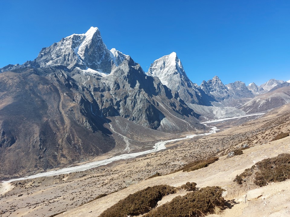
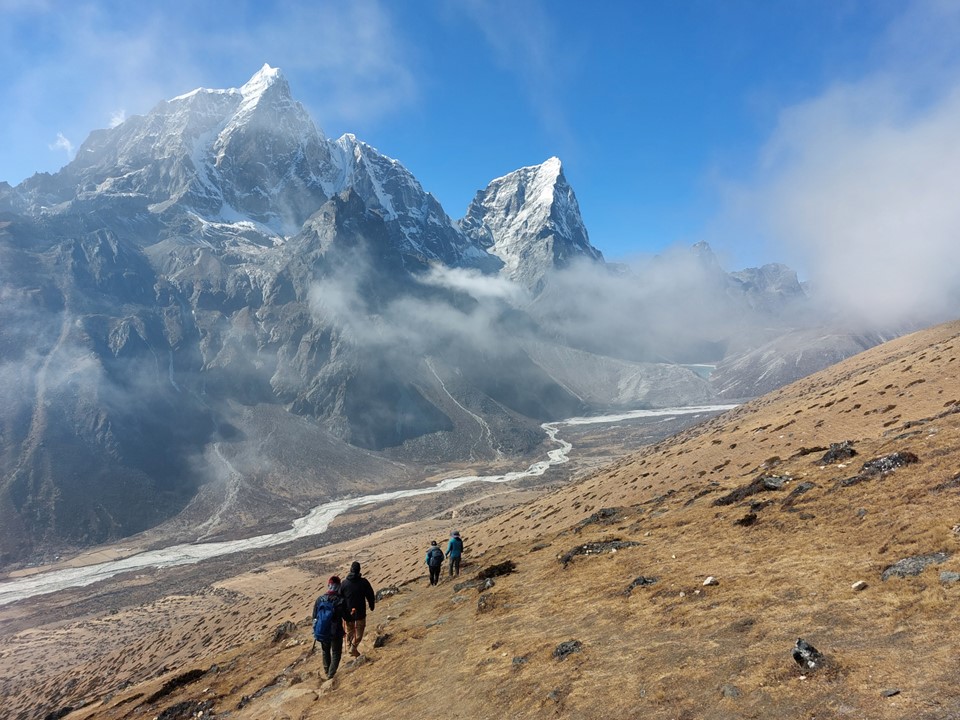
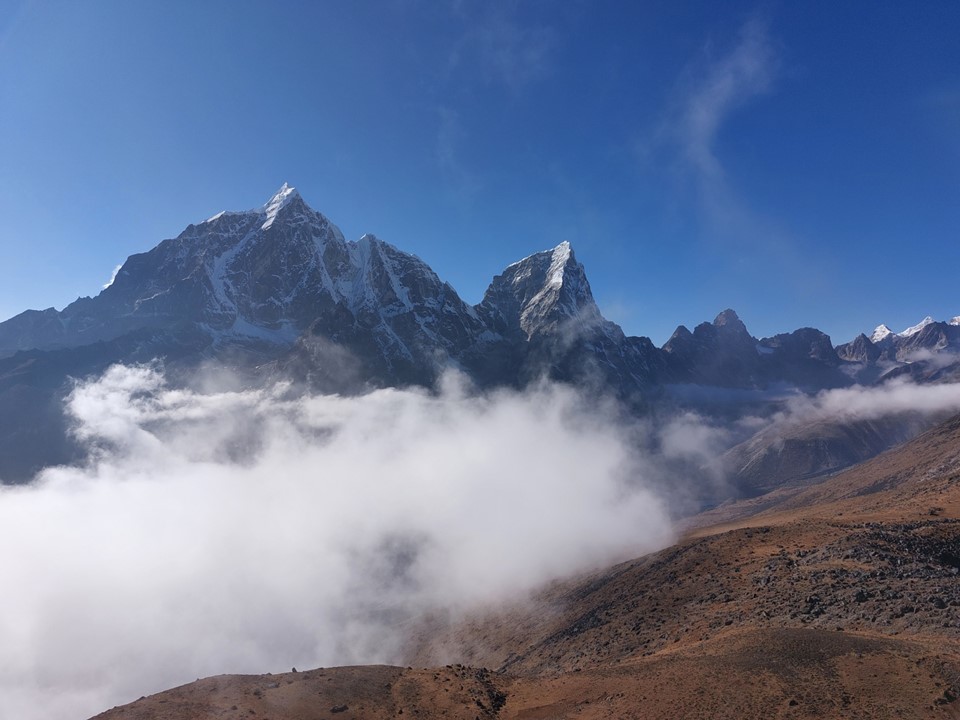
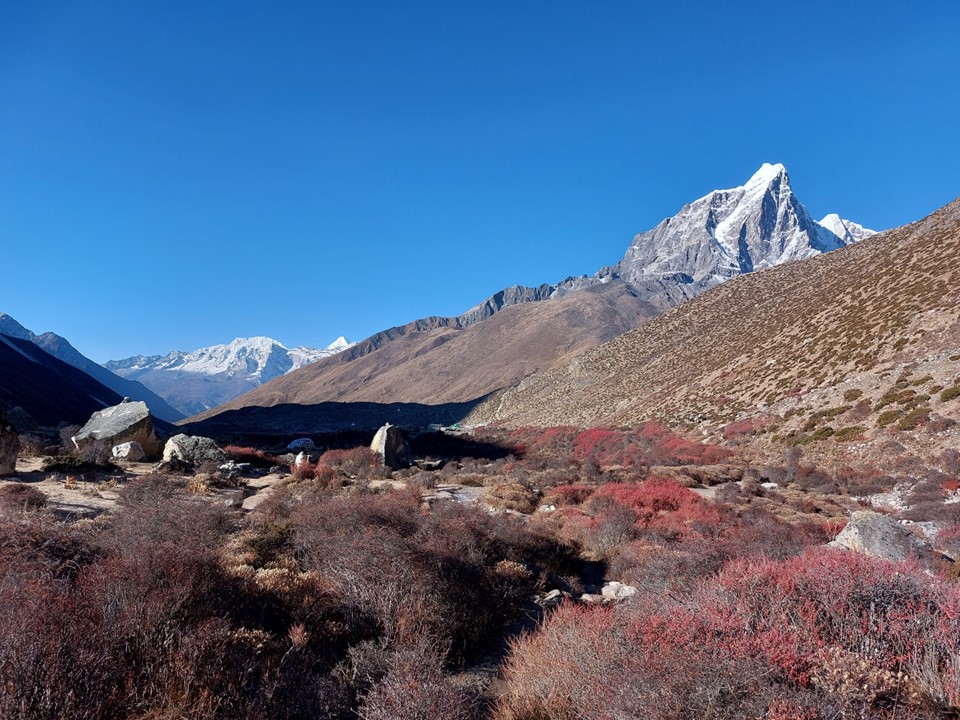
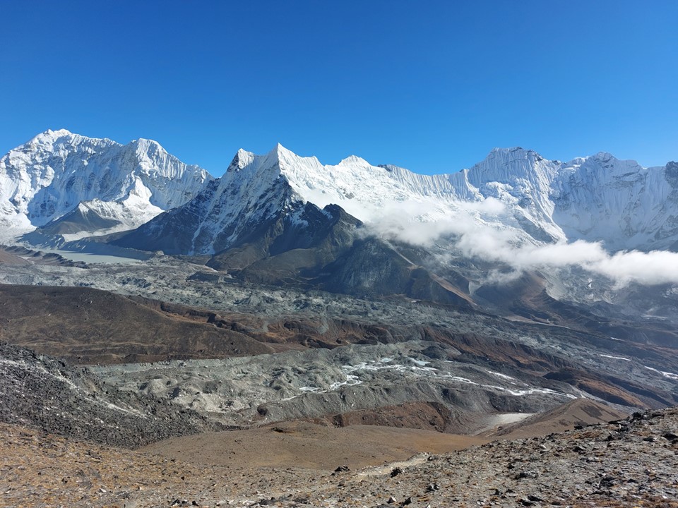
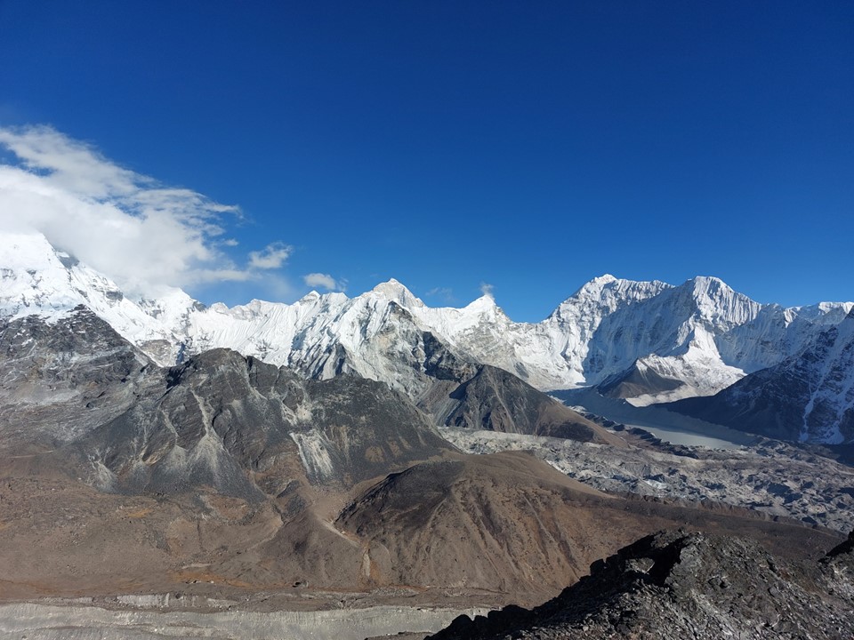
The views up the valley of Tabuche and Cholaste were very impressive. My initial thoughts on Tabuche had not been particularly great, but the peak was growing on me very quickly.
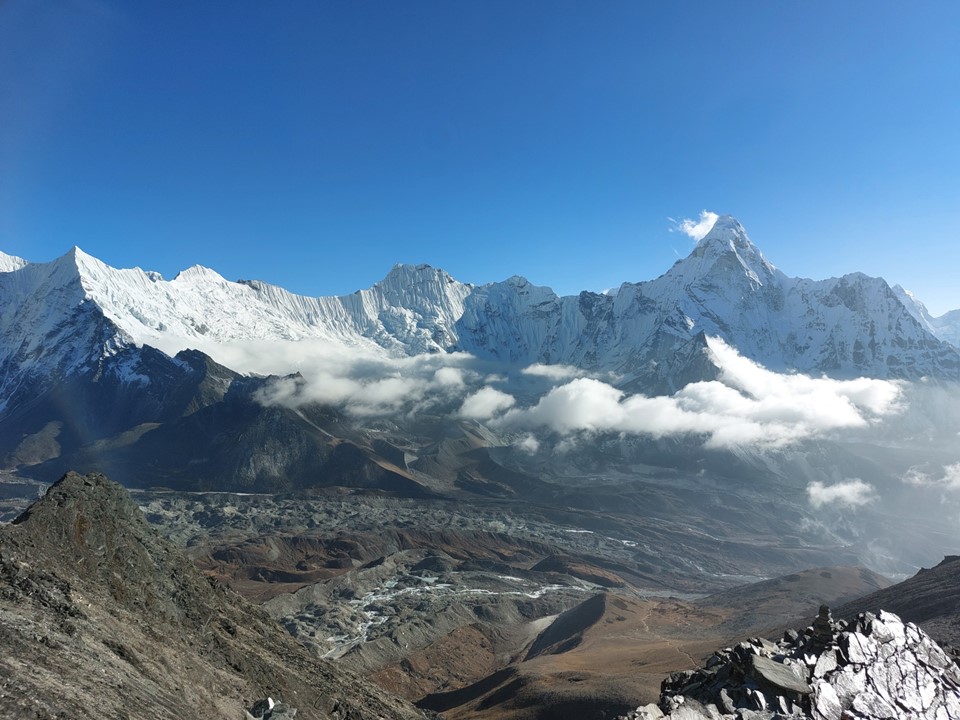
As I got higher, the views got better. As had been the case every day since I arrived, as the day went on, clouds came up the valley.
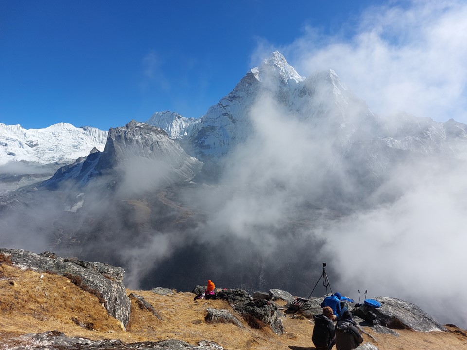
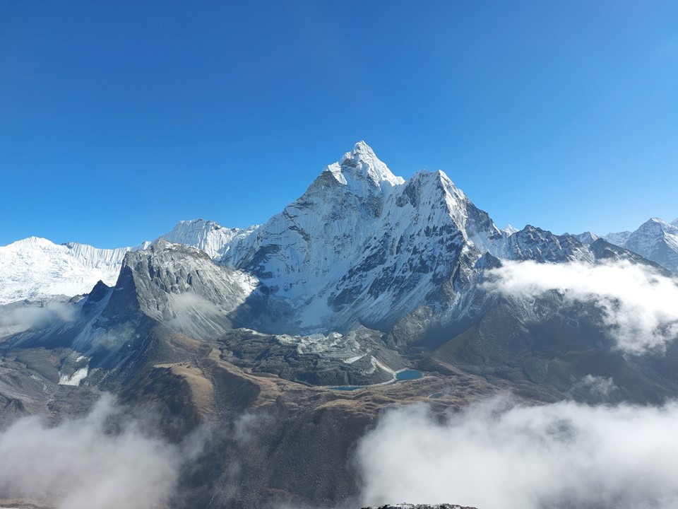
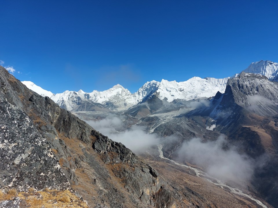
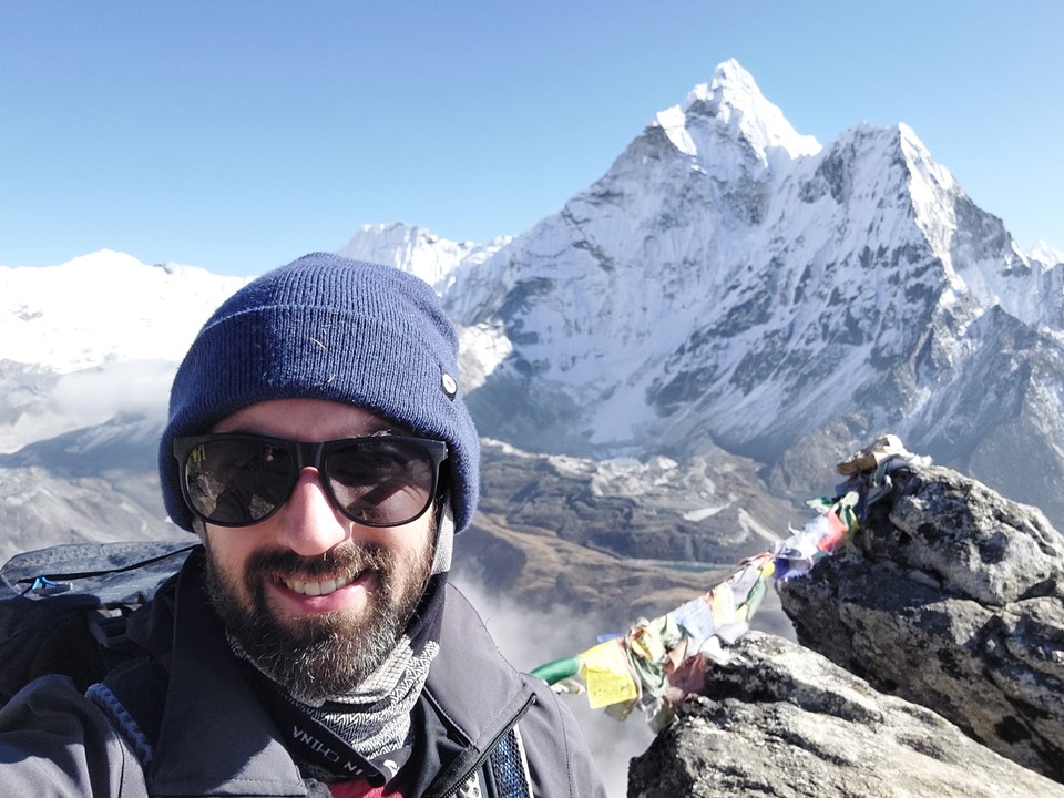
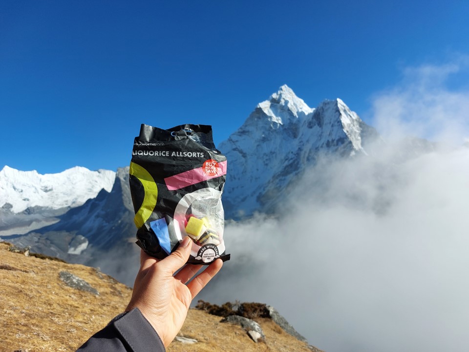
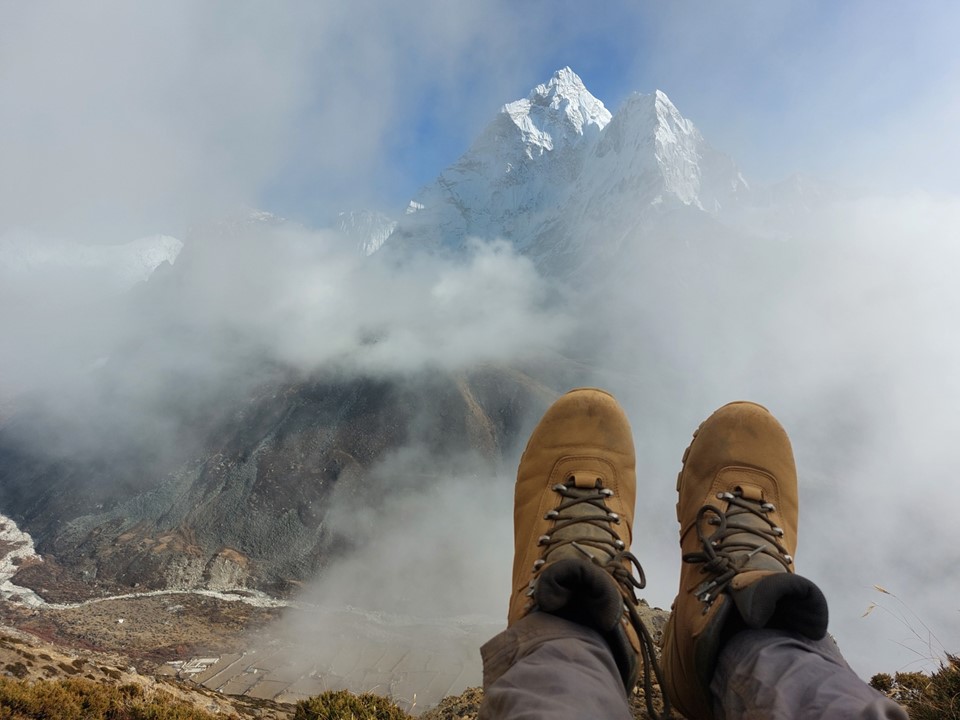
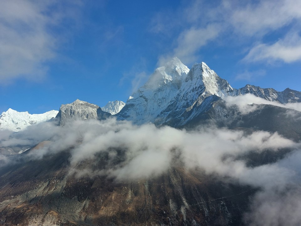
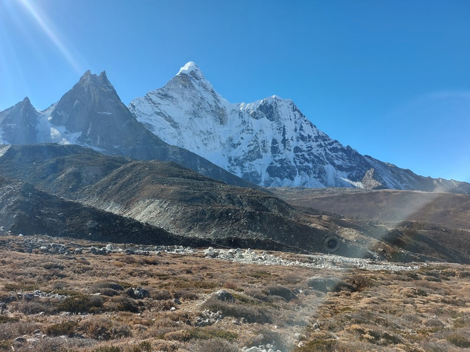
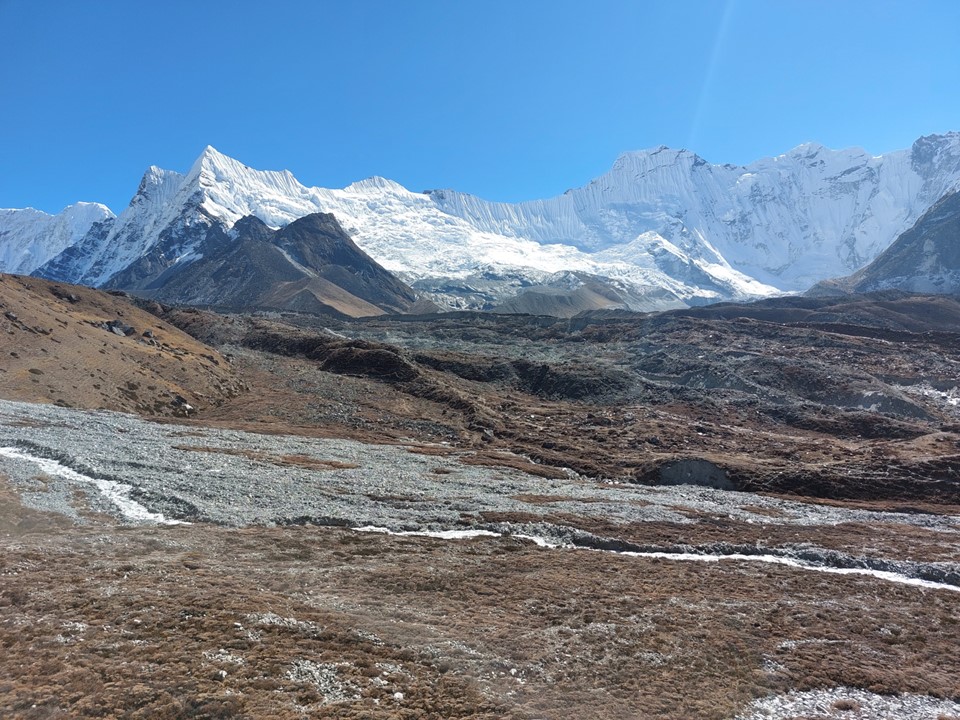
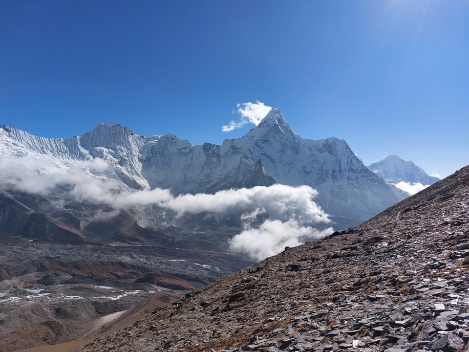
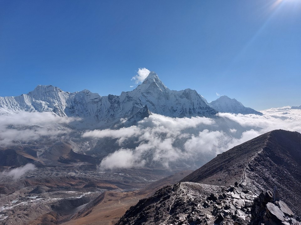
I eventually reached the hiking summit. The views were amazing – I was on an island in a sea of snow, ice and rock. The main climbing summit of Nangkartshang blocked the view towards Lhotse and Everest, but I could see Ama Dablam, Makalu, Tabuche, Cholaste and Cho Oyo.
I sat and stared at the view for a long time. I had brought my favourite hiking snack with me, Liquorice Allsorts, which I munched on while absorbing the exceptional scenery in every direction.
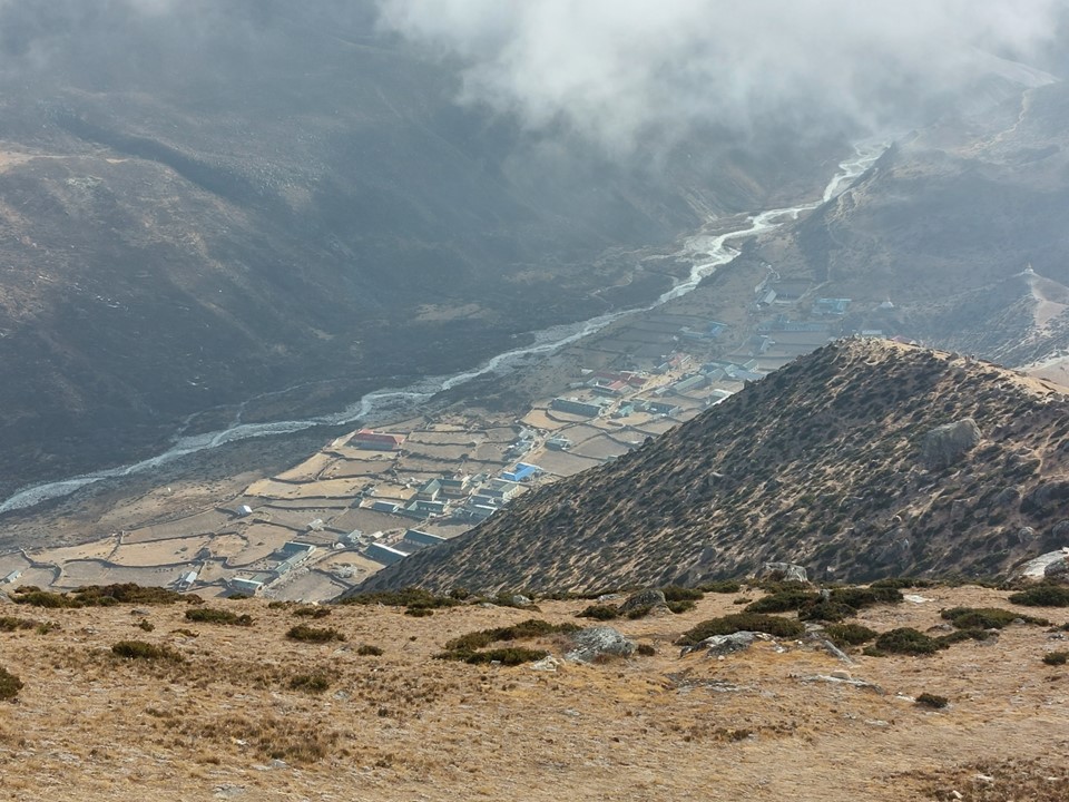
With more cloud wafting up the valley, I decided to head down and grab some supper in Dingboche. The ascent had gone very well, and having passed 5000m two days in a row meant I was now as acclimatised as I would likely need to be for the trip. I had felt fine both times, which was a really good sign.
My stats for the day were 14km with 1298m ascent and 960m descent.
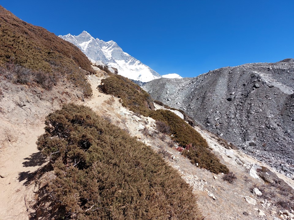
I woke up to yet another sunny day. The significantly smaller crowds as one heads up towards Chukhung were apparent. The majority of trekkers in the region won’t head up this valley.
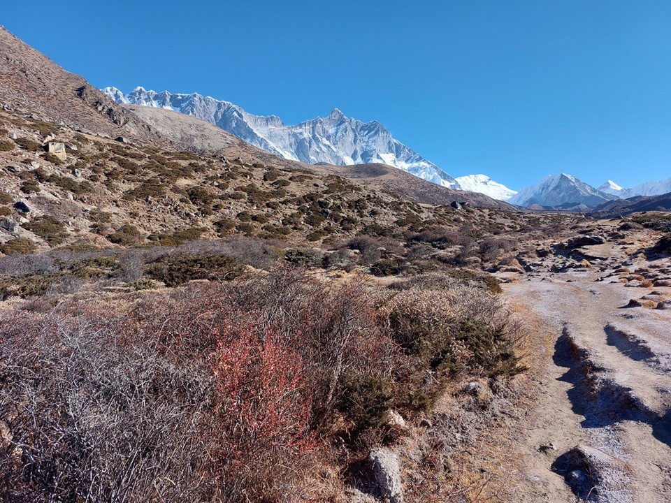
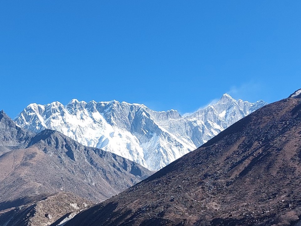
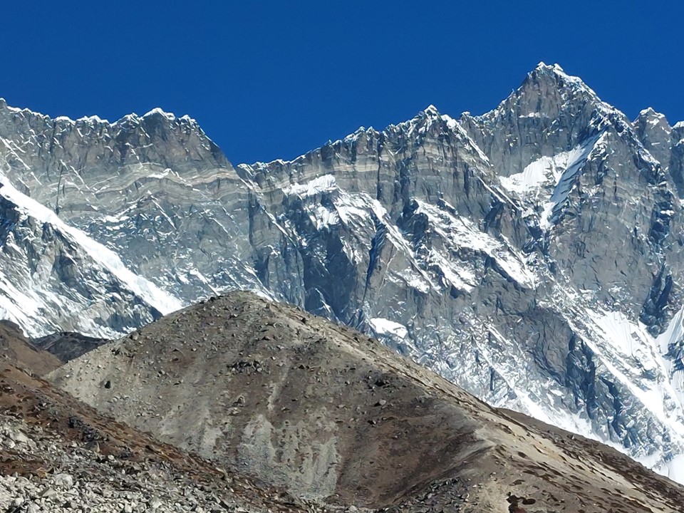
As Lhotse got closer, the scale of the world’s fourth highest mountain became more and more apparent. Lhotse is the only 8000er that isn’t also an ultra-prominence mountain (a mountain with 1500+m prominence), but with a 610m rise from the key saddle – which is the South Col of Everest, where Camp 4 on the standard Nepal side route is found – it still has in excess of the 7% required to qualify as a mountain. By contrast, Nuptse (7861m) only has 319m prominence off its parent peak (Lhotse), which is only 4%, rendering it a subsidiary summit and not a separate mountain.
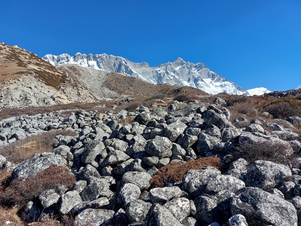
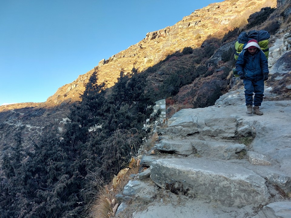
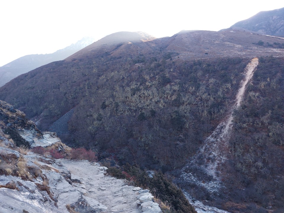
Another sign of how rarely hikers come this was was the fact that the trails were not nearly as clear as they had been further down the valley. In a number of spots it would be easy to lose the trail if you aren’t careful.
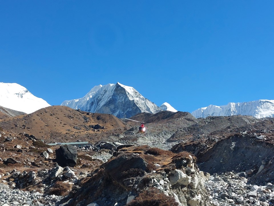
As I neared the town, a helicopter flew overhead. One aspect I really didn’t enjoy while on the main EBC route was how frequently helicopters flew fast, but it was strange to see one in a side valley.
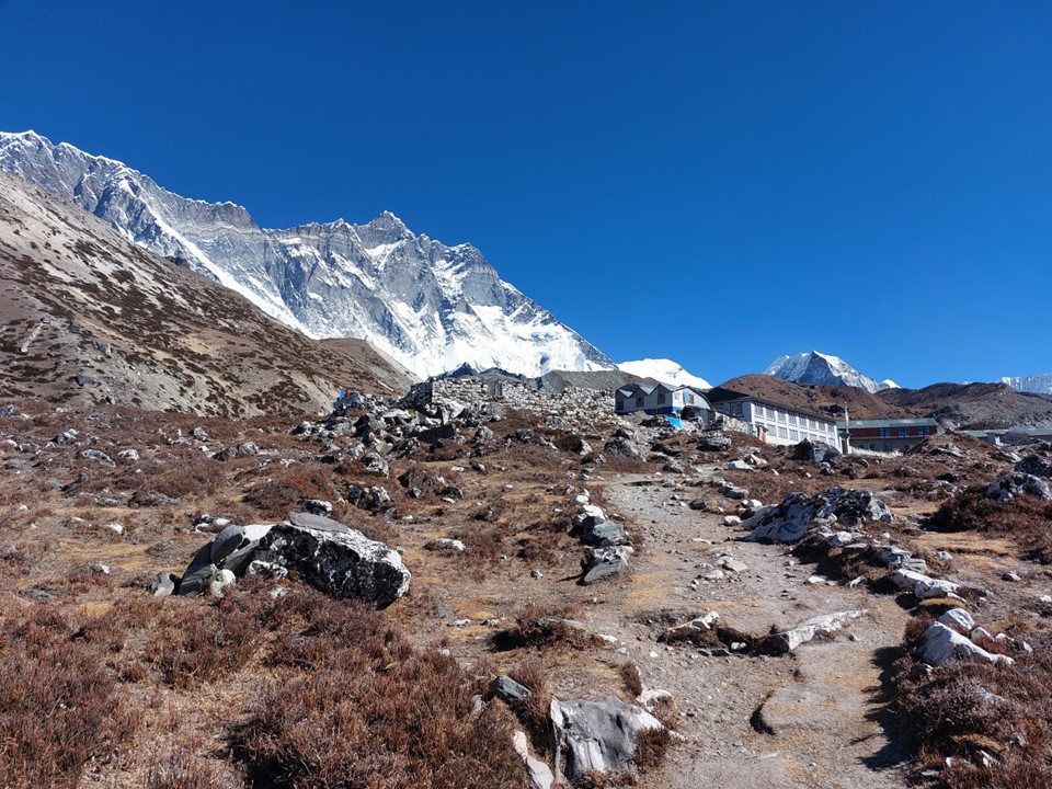
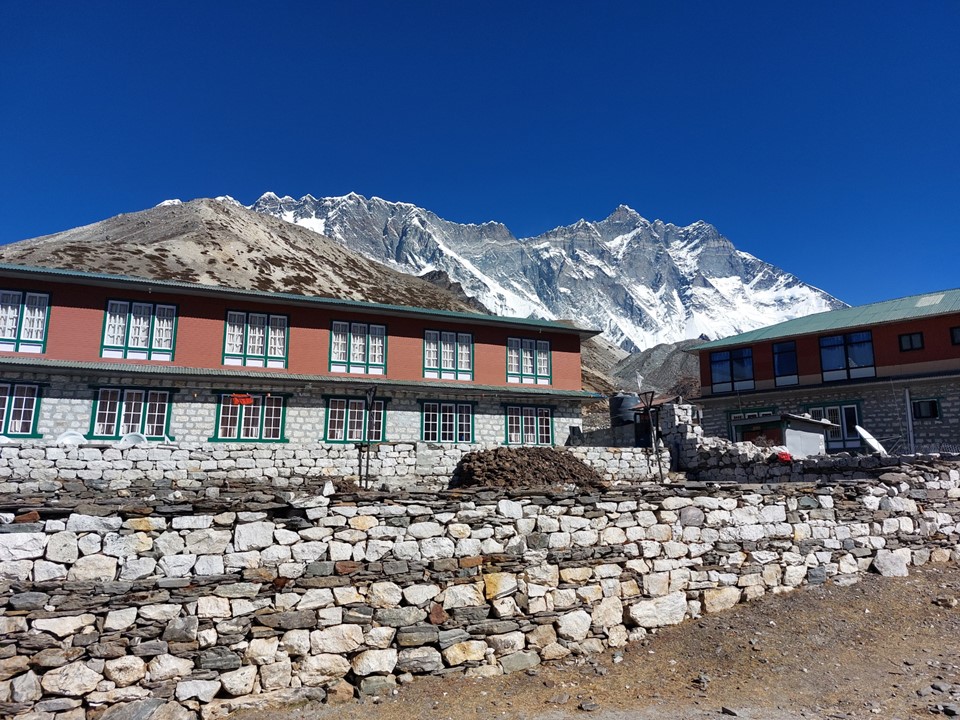
The town of Chukhung is very small. I went to the first tea house I saw and asked to see the room. The room looked great and it had western plumbing, so I asked how much a room was. The lady smiled and asked if I was going to eat there as well, and I told her I would, she said I could have the room for free. It’s crazy – I could see Ama Dablam out my window, if I walked outside I could see the south face of Lhotse – and my room was free. If it was an equivalent location in the Alps (well, if the Alps had such large mountain faces), such a well located room would easily cost hundreds, if not thousands, of euros.
I was tired and didn’t feel like slogging up a peak, but I also knew I would regret it if I didn’t – after all, this was one of the view points I was most interested in.
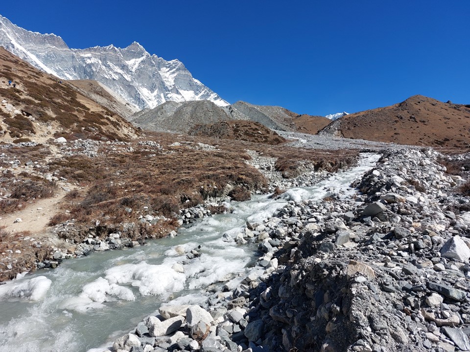
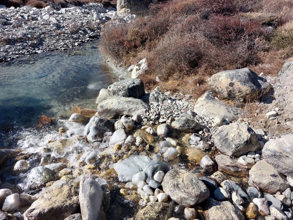
The river was iced up in places, but there was a small bridge, so crossing was easy enough. And thus the slog up Chukhung Ri began!
The trail was steep in places, but I just took it slowly, and frequently stopped to get photos and enjoy the view.
I had brought my bridge camera with 40X optical zoom along for the hike. I tried to get photos with it on the way up, but it kept giving me an error. I changed SD cards and batteries and it still wouldn’t work. I wondered if the problem was that it was too cold. At the date of writing this – the camera still doesn’t work. Rest in peace old camera – you served me well 😦 Naturally I had to still carry this heavy camera for the rest of the trip, which was admittedly a pain as it weighs about 1kg!
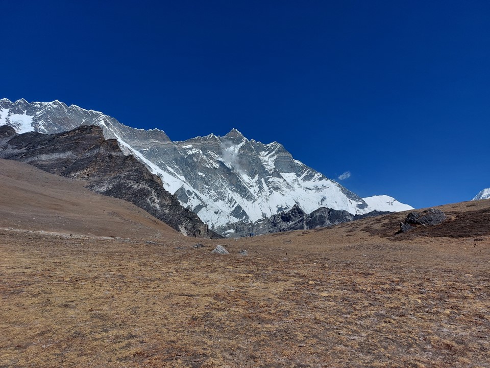
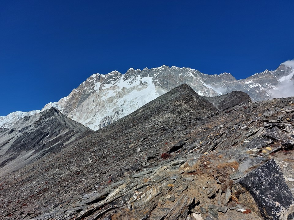
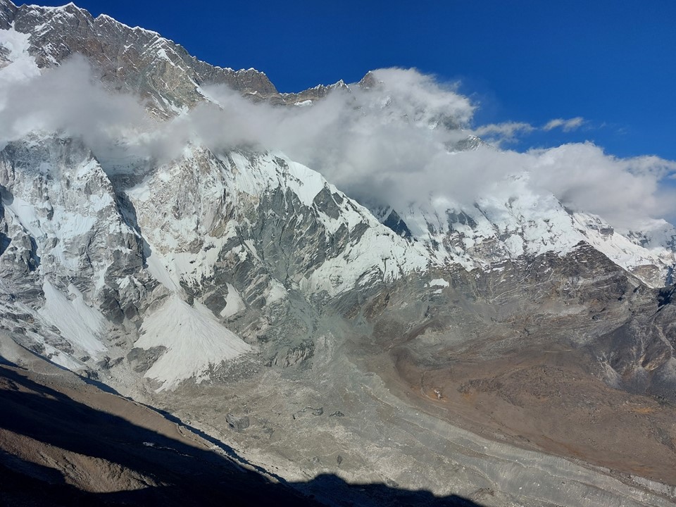
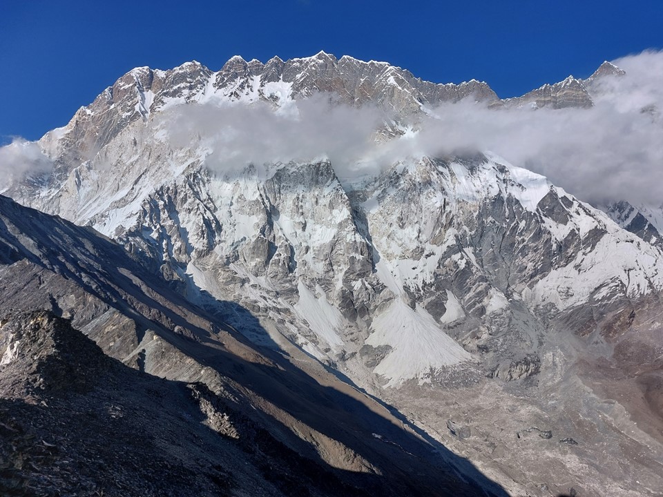
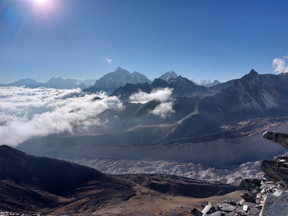
Around 5000m the route hits a wide plateau. I was really feeling this hill – maybe it was the 5 previous days catching up to me, maybe it was the altitude, or maybe I just need to train harder next time. Whatever it may be, I was happy to sit and stare at the monster that is Lhotse.
I had signal, so I posted a few photos and sent a few messages. There was something urgent to be resolved at work, so I dropped a message to some staff on how to resolve it. I then pulled out a chocolate and started eating it. I sent the following message to a friend while sitting there “Sitting at 5000m staring at Lhotse’s south face munching on a lunch bar. Then suddenly the surrealism of the situation hits me 🤣”
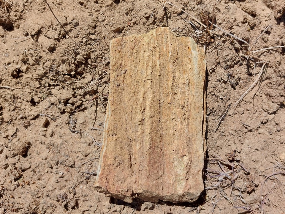
I saw an interest rock on the ground. At the time I thought it was petrified wood, although looking at the photo afterwards I don’t think it is. Before someone points out that there are no trees at the altitude – it is notable that sea shell fossils have been found higher than this – these mountains were formed by the Indian Plate and Eurasian Plate crashing into each other. These mountains weren’t always here. Nonetheless, probably just a random rock that I now have a photo of.
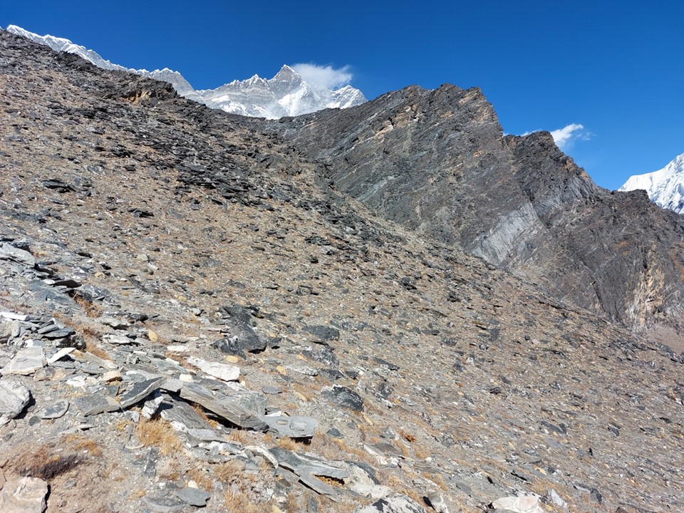
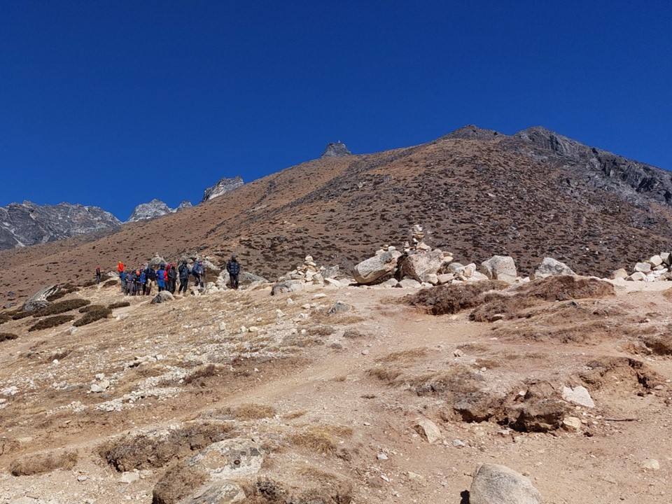
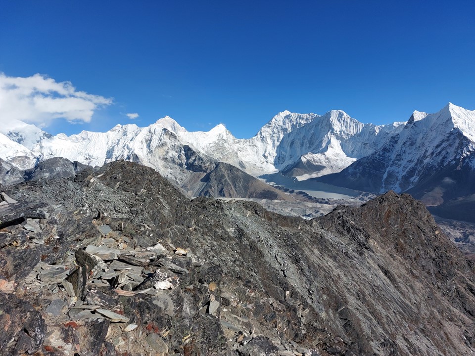
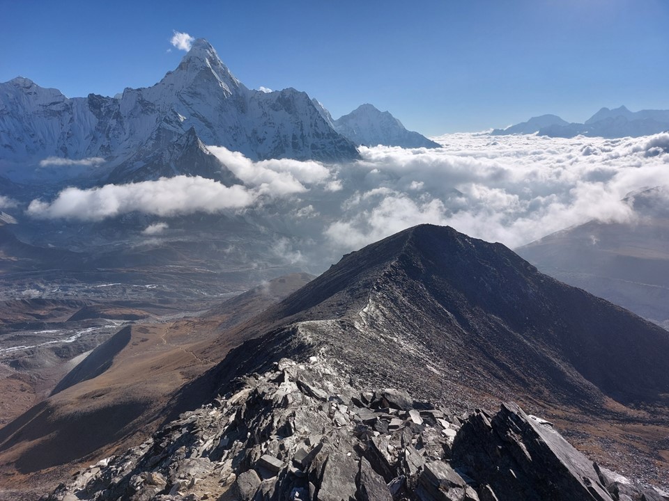
As I got higher, the ground got rockier and steeper. Many groups only go as high as the plateau at 5000m.
I soon reached the saddle between the main hiking peak and the lower but easier south hiking peak. Because of the exposed scrambling required to get to the higher peak, many teams go to the easier summit.
There were a few spots on the scramble where a fall could be fatal, and there was a lot of loose ground – so a fall was entirely possible. I made a point of stopping and assessing the situation before proceeding – there’s no summit worth dying for. I assessed it to be adequately safe and continued along. In hindsight I should have made a point of following the top of the ridge as much as possible as it was generally more stable.
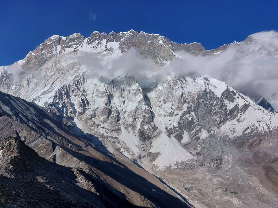
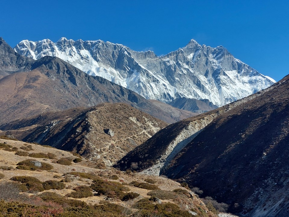
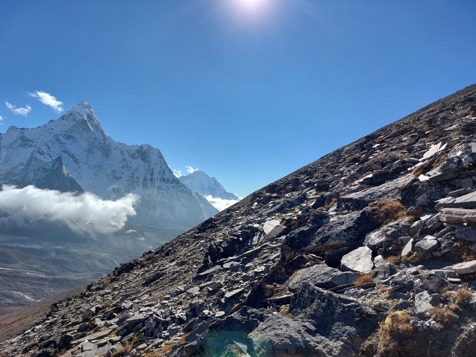
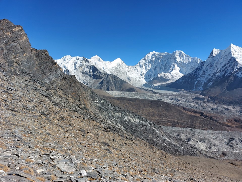
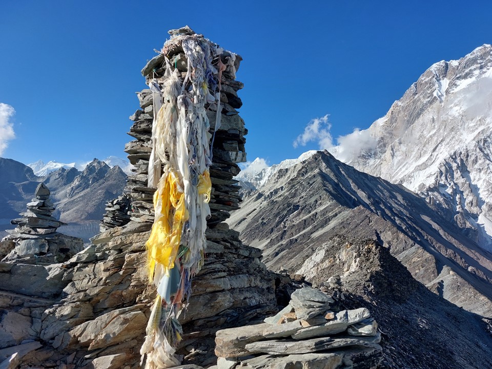
The summit itself was well worth the effort. I was at 5550m with a drop of almost 1000m in front of me and Lhotse almost 3000m above me. I had almost 4000m of mountain face right in front of me. For context of scale – no zoom or cropping was used on the above and below picture.
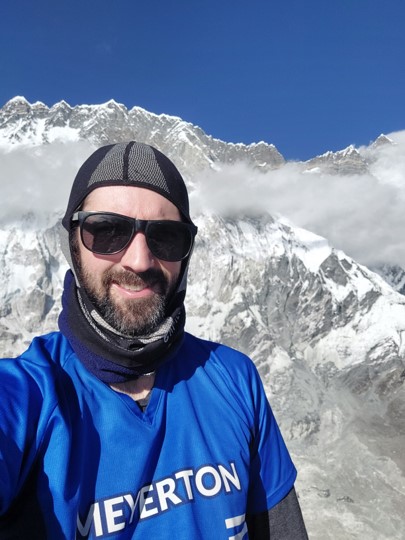
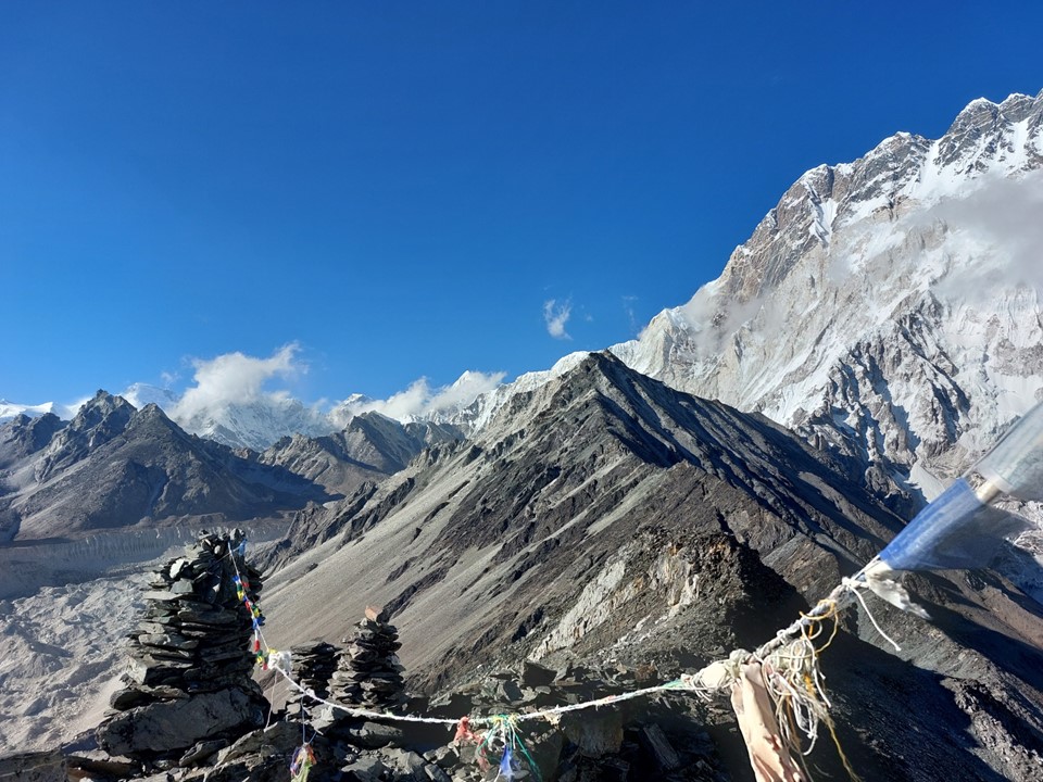
I had the summit to myself. I sat there for a while just trying to absorb what was in front of me. The scale and magnificence of these peaks is hard to take in.
I began my descent, making a point of taking it slowly and ensuring the ground was stable before committing to a step. After all – I was alone on a very exposed and loose slope.
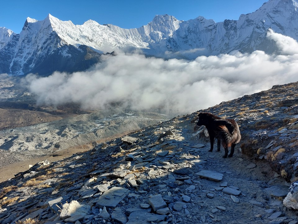
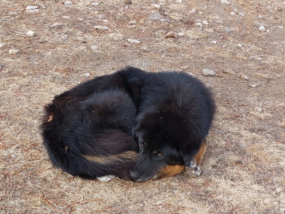
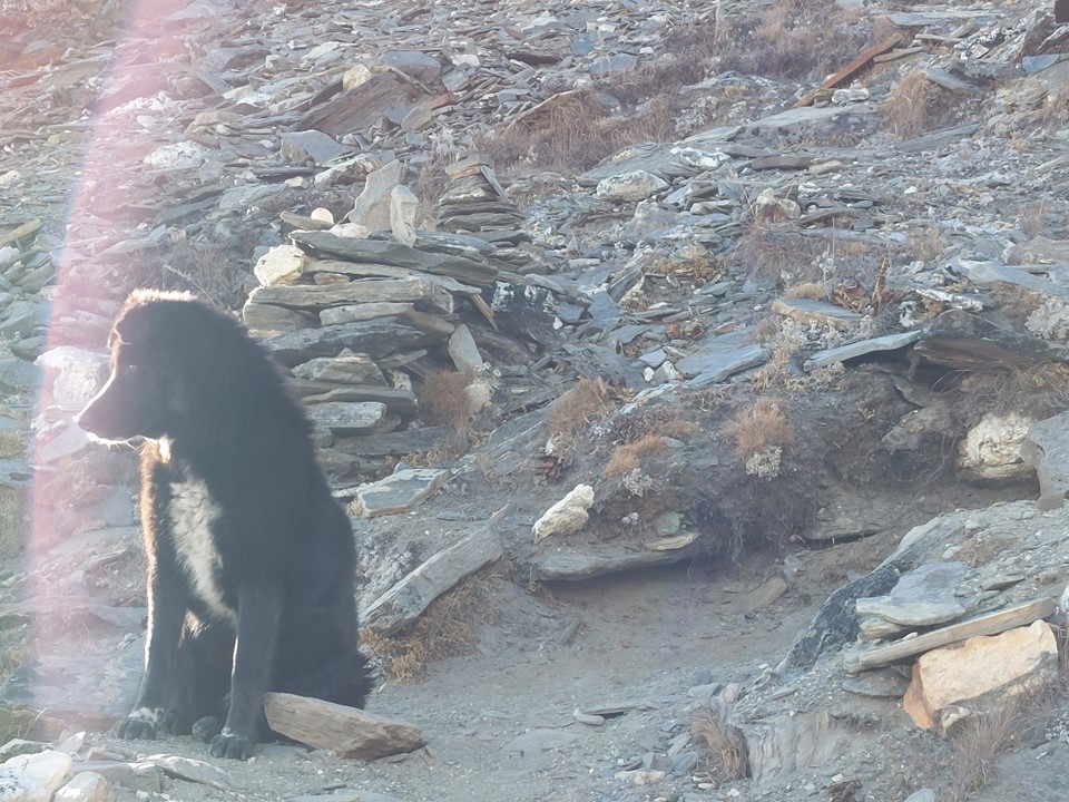
I soon encountered a group of two British people who had been working in the area and had just spent the day exploring the ridge. A dog had accompanied them on the way. Their route had included ascending the main Chukhung Peak (5833m) and traversing to Chukhung Ri. The scrambles required to follow the ridge are apparently rather treacherous, yet the dog had managed to follow them all day.
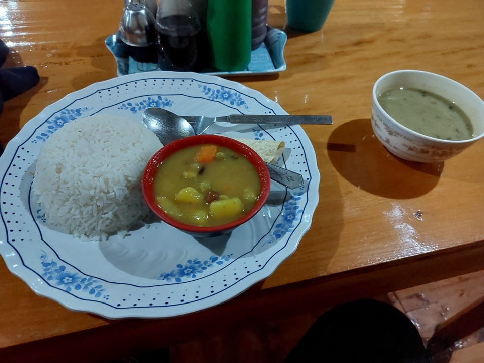
I eventually found myself back at the tea house, and had a lovely bowl of garlic soup and some dal bhat. Overall one of the best days of the trip!
Stats for the day were 13km distance with 1330m ascent and 884m descent.
