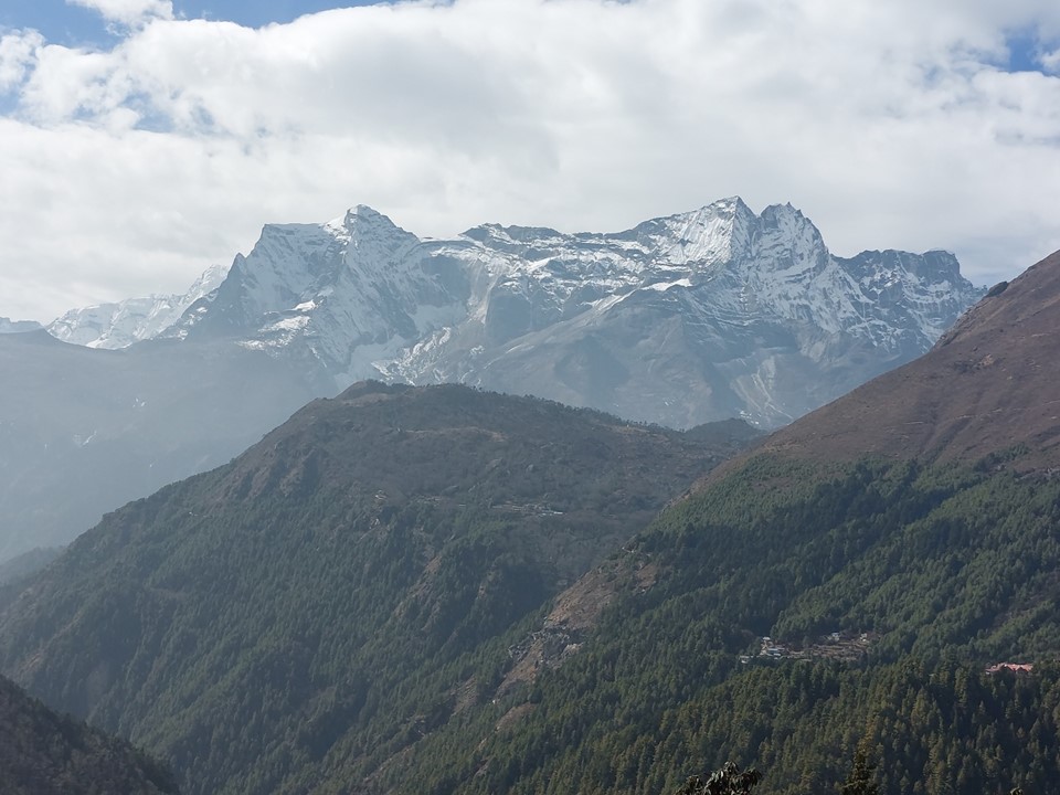
I woke up and took a look out my window. Kongde Ri was calmly waiting on the other side of the glass, across a deep valley. The scale of these mountains takes some getting used to! The usual first view of Everest had not provided a view the previous day, but I knew I would soon be reaching the second view of Everest and the first view of the mountain I was here to see more than any other – Ama Dablam, so this would be a big day!

Teams usually spend a rest day in Namche in order to acclimatise. Seeing as I had been up Baneiseng (3362m) in Lesotho about a week earlier, I knew I would likely be fine without a rest day.
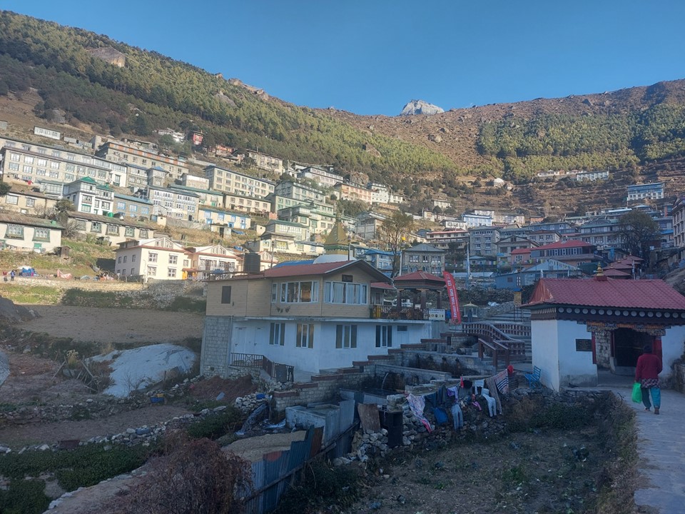
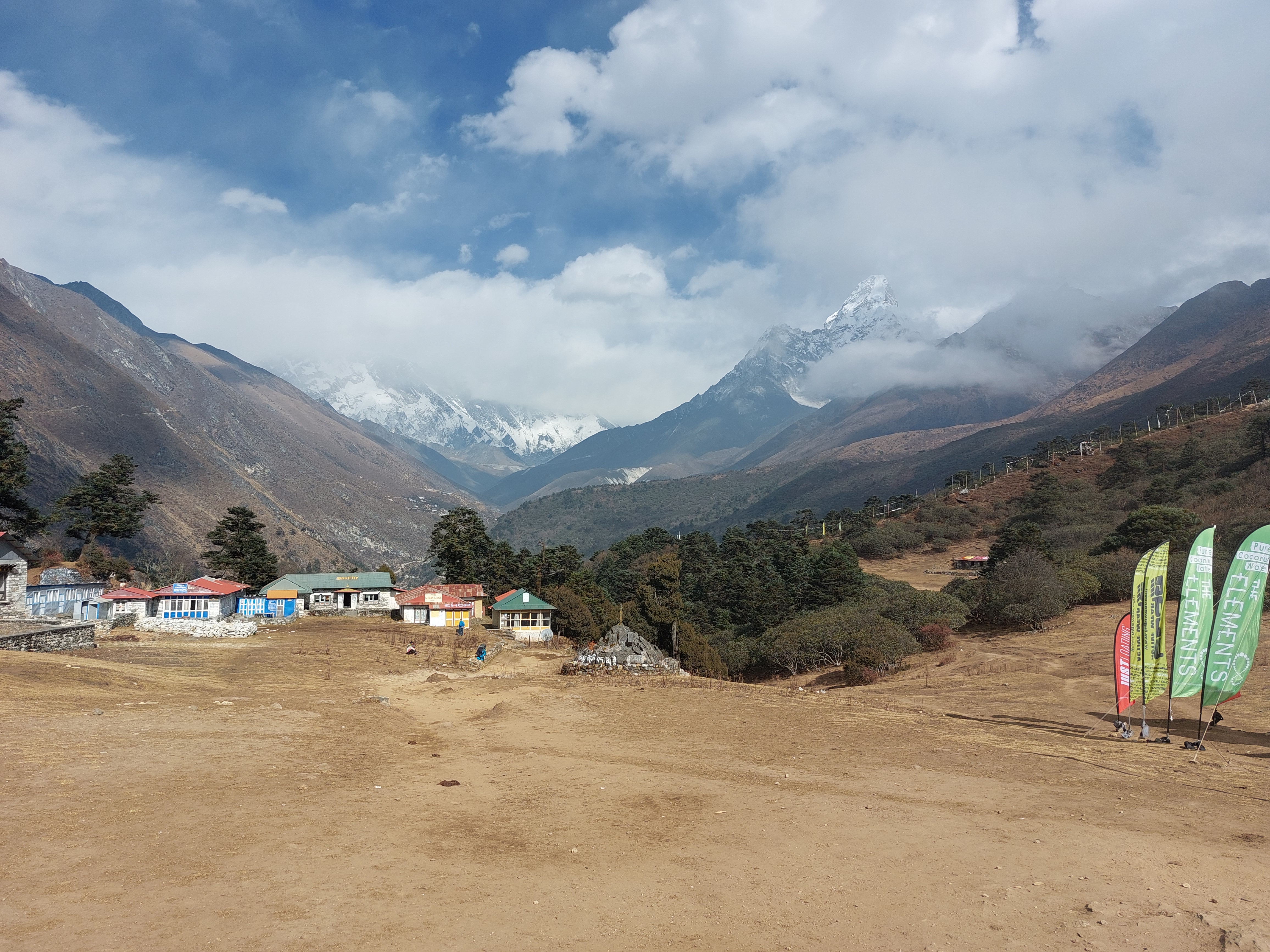
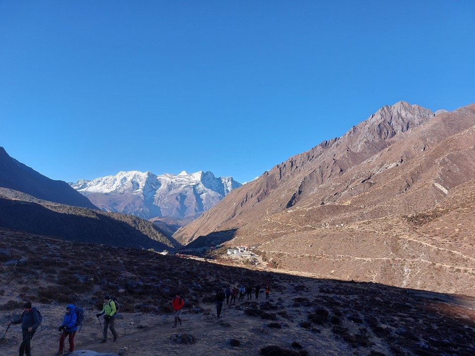
The Tea House I had spent the night in was technically just below the town, so walking around the corner I had my first proper view of Namche. It is crazy to see such a large town high up in the mountains. At around 3350m, the town is only around 100m lower than Mafadi, the highest point in South Africa!
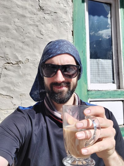
I didn’t need to buy anything in the town, although I did ensure my phone battery and power bank were both fully charged before leaving the tea house – Namche is the end of the power lines, so all phone charging above here would come at a cost. I walked through the town, considering stopping for coffee, but deciding it was too early in the day to justify that.
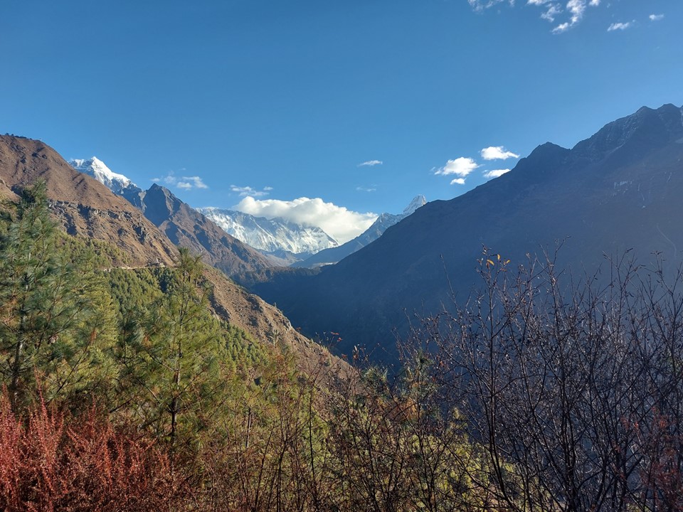
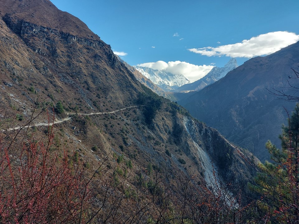
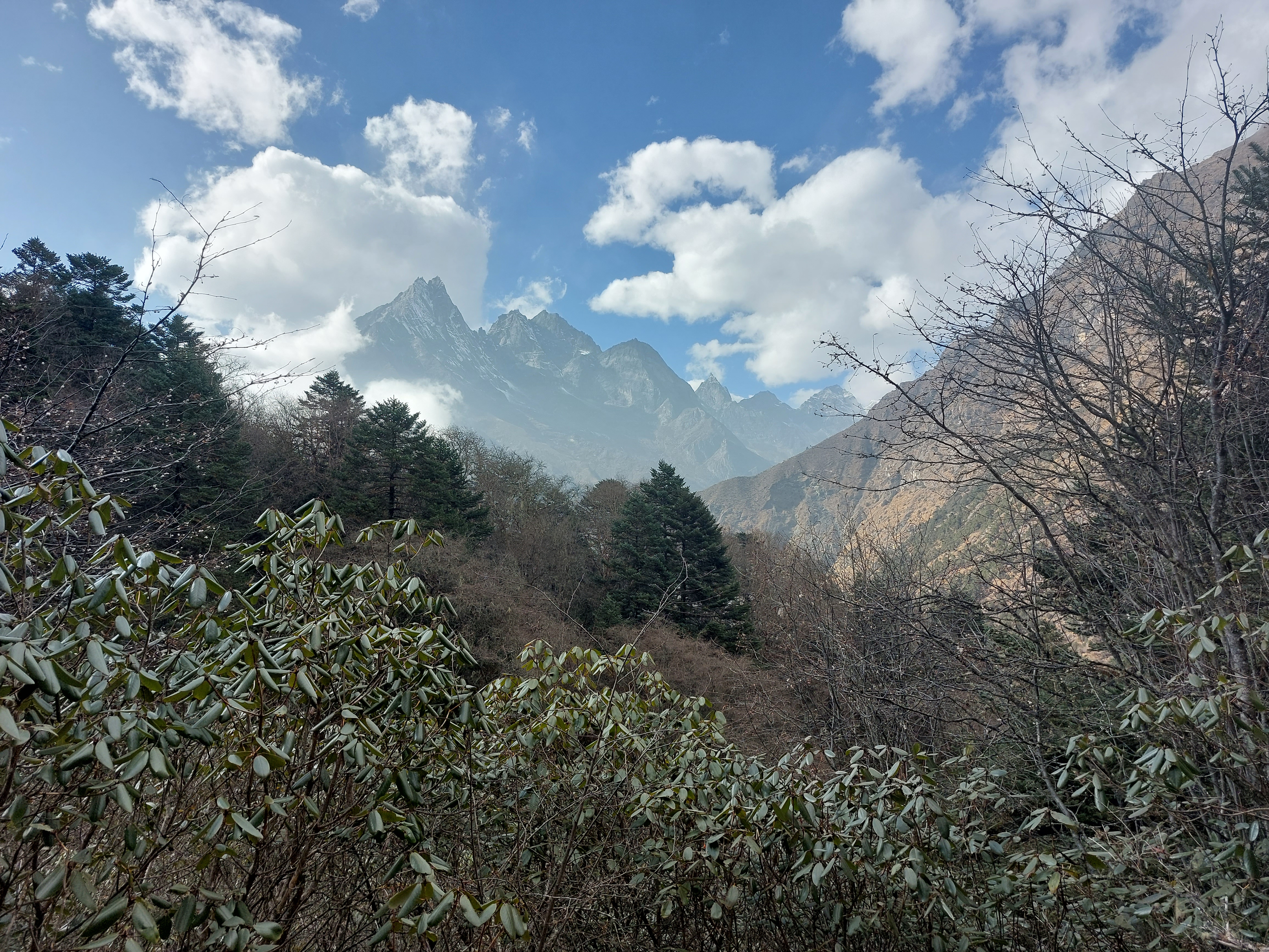
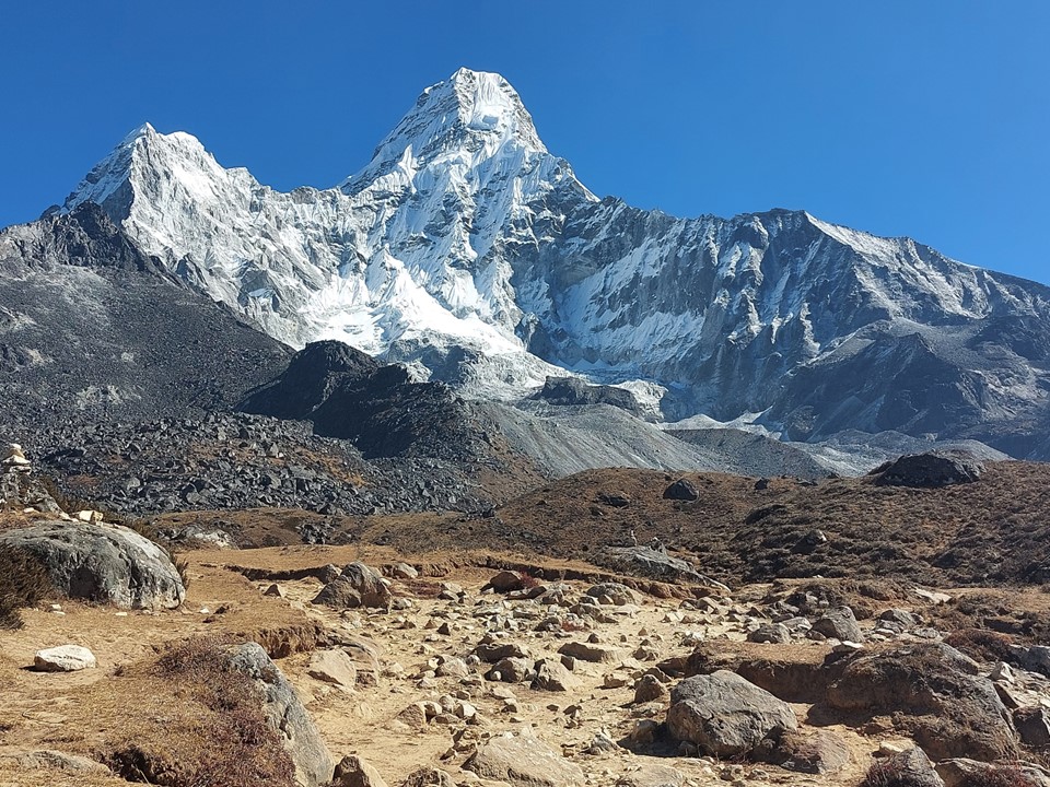
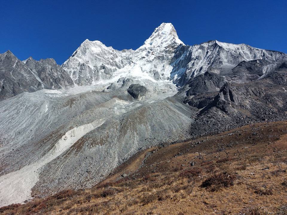
I soon rounded the corner known for the second view of Everest and first view of Ama Dablam. I took this section slowly, wanting to savour the first view of these iconic mountains. Then suddenly – there they were. Well, kind of. On an almost entirely cloudless day, Everest and Lhotse were hiding in the only significant cloud in sight. Go figure!
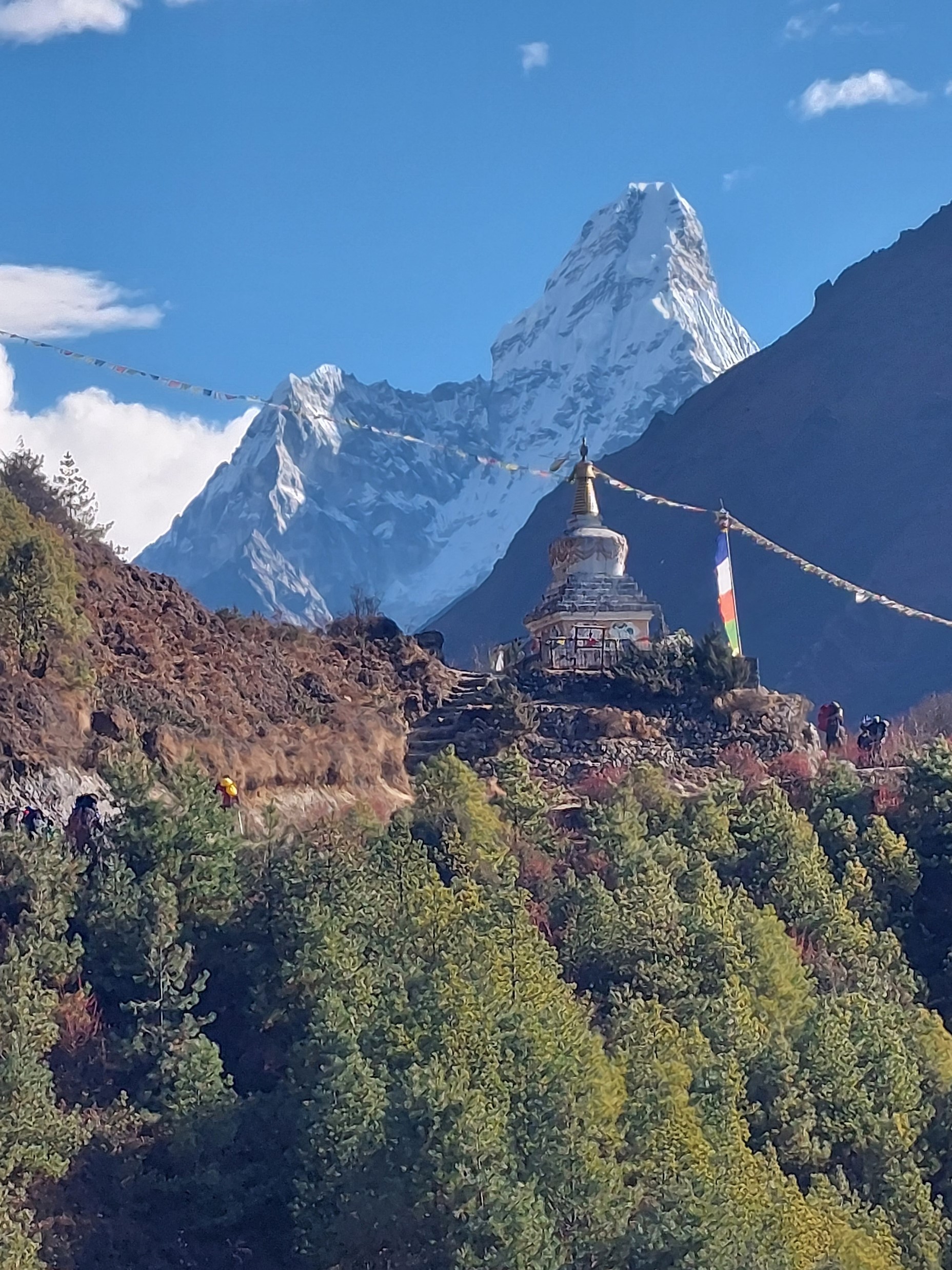
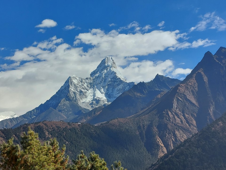
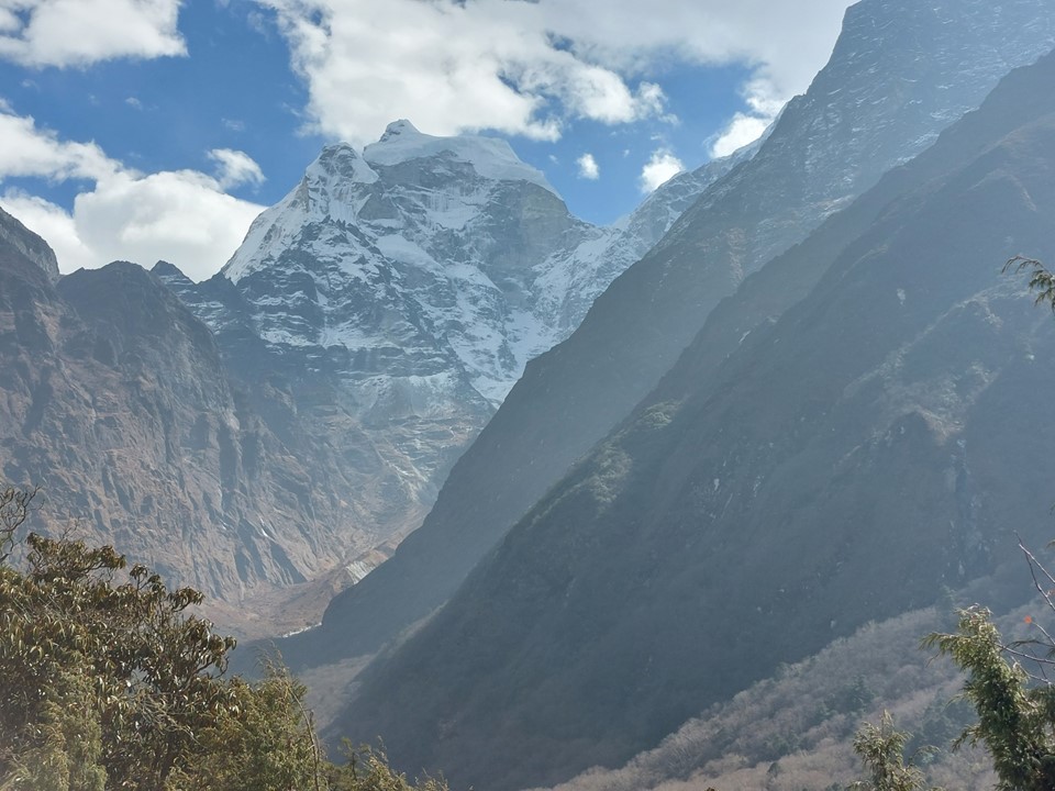
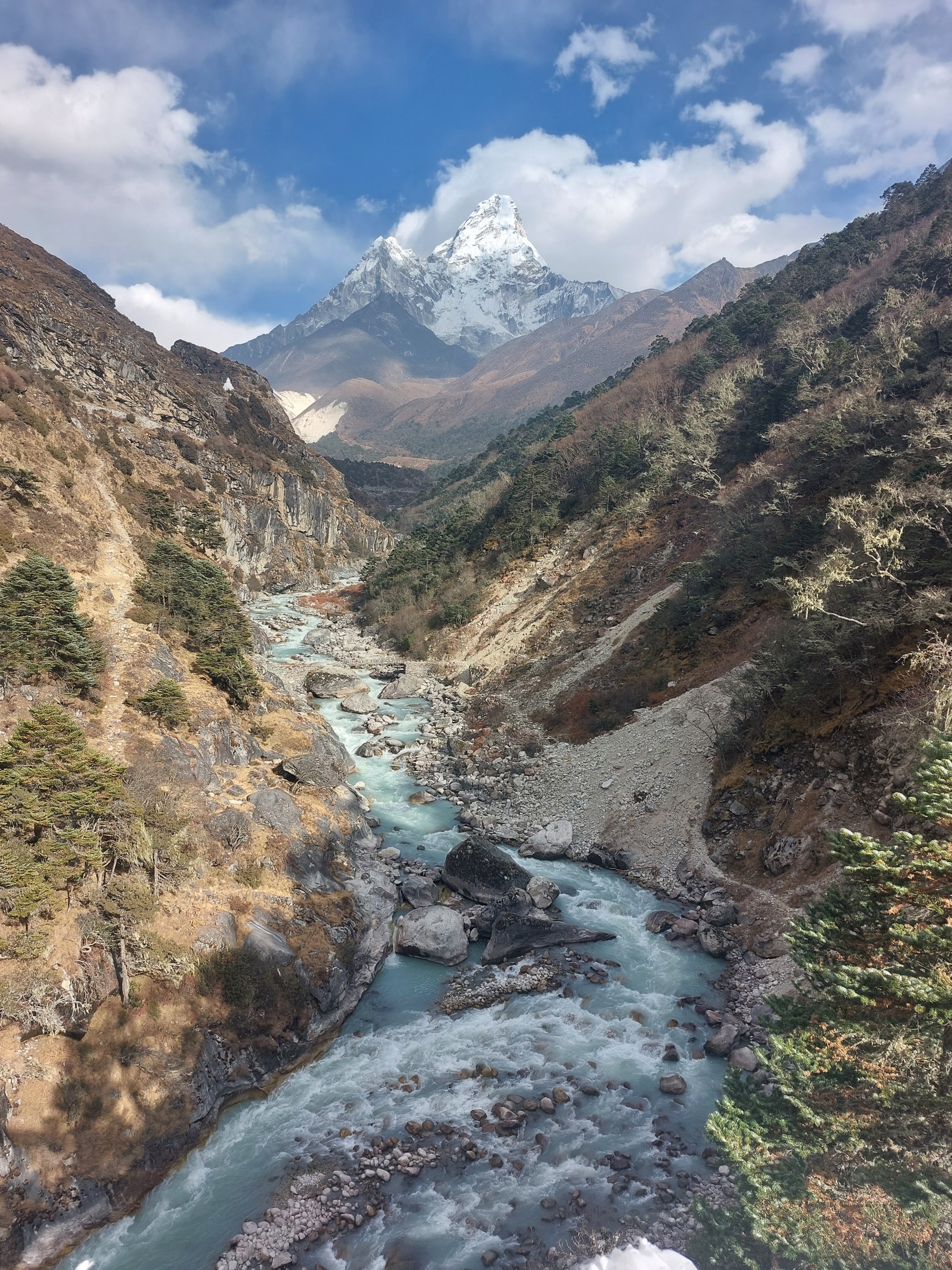
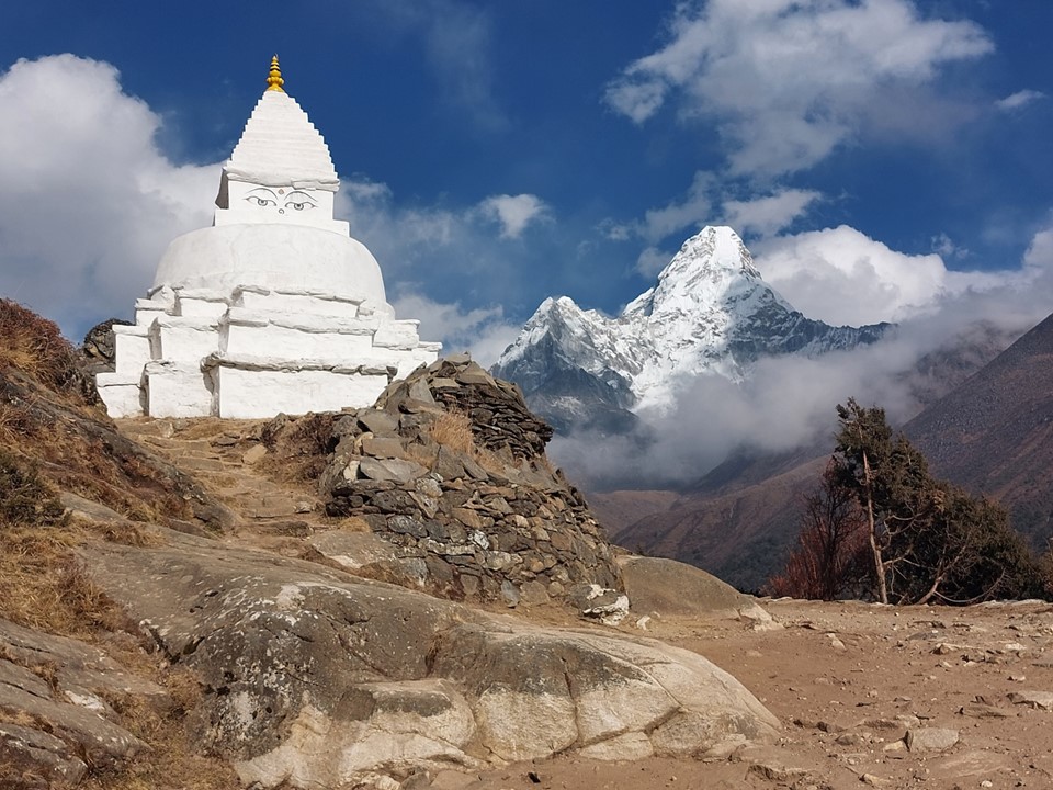
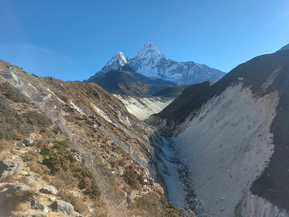
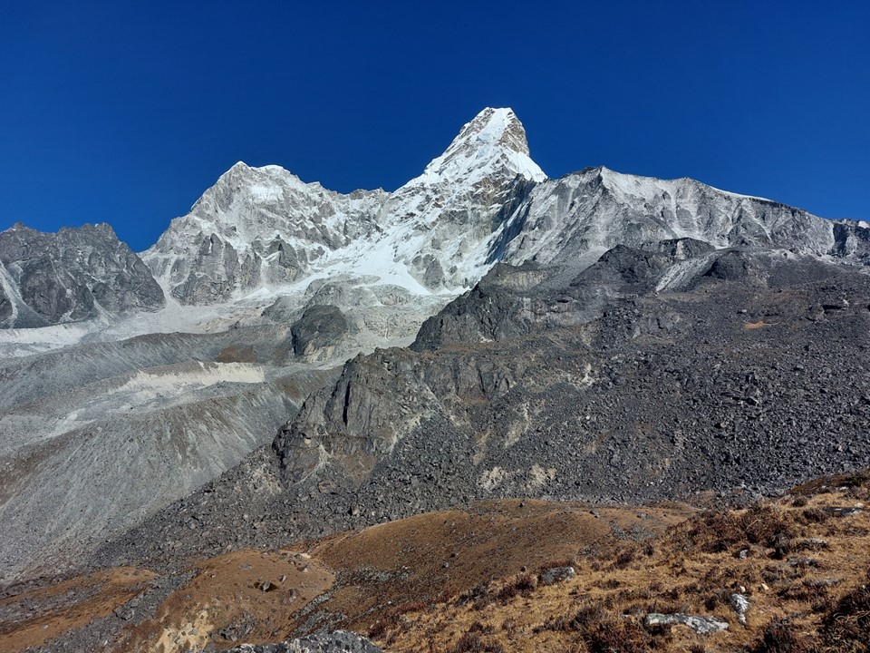
My first impression of Ama Dablam was rather unexpectedly “I thought it would be bigger than that”. I don’t know why I was expecting that, but I guess in my mind it had built it up to be this monstrously large peak. Nonetheless it is undeniably one of the most iconic mountains on earth. It is often called “the Matterhorn of the Himalaya”, although it would make more sense to call the Matterhorn “the Ama Dablam of the Alps”, seeing as one is significantly larger and higher than the other.
I stopped for some tea in Phunke Tenga. At some point my plans had included spending a night in this town, but the extra distance covered by vehicle on day one rendered this unnecessary. I knew the upcoming hill was a big one – Tengboche Monastery is famously on top of a big hill with exceptional views. Which meant two things: a difficult ascent; and some rewarding views!
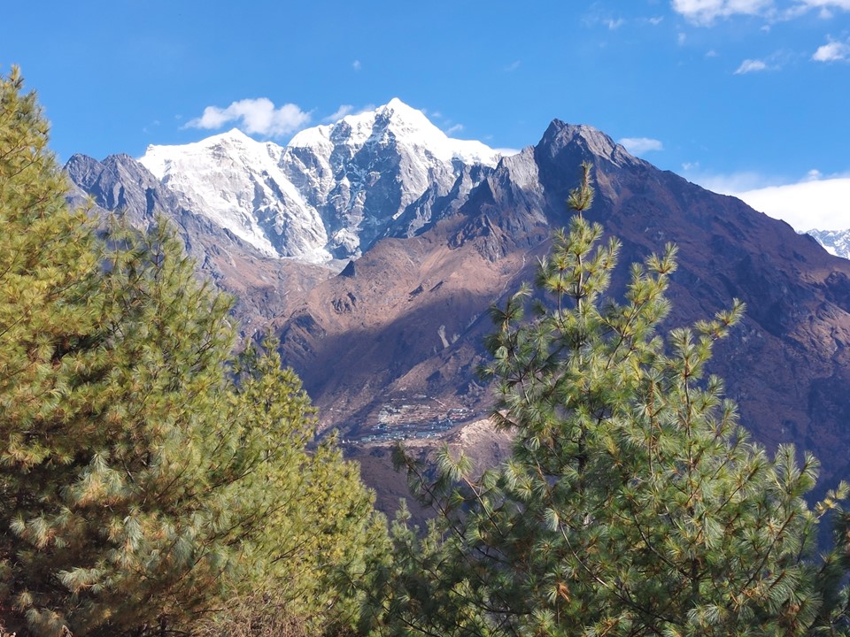
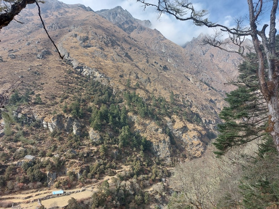
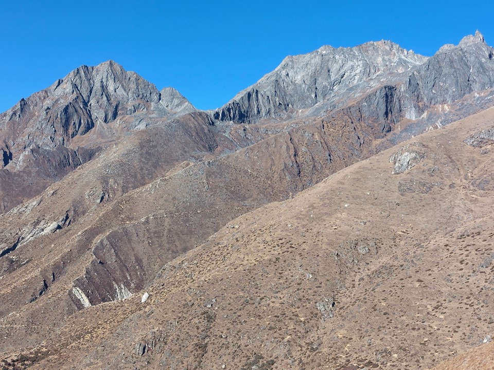
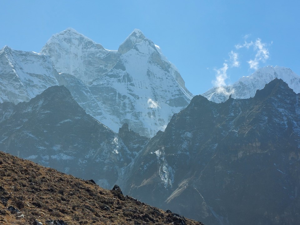
The mountains behind Tengboche are exceptionally impressive, actually some of the most spectacular peaks in the region. The ascent up the hill, however, was very long and slow.
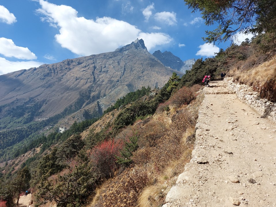
As I climbed the hill, I suddenly had a sharp stinging pain in my one calf. I was trying to figure out what happened, when I eventually pulled the leg of my pants up to see, a bee had got caught in my pants and had stung me. Having only been stung by a bee once in my life, despite frequently encountering bees, I had to laugh at the irony. Of all places to be stung by a bee – 3800m in elevation in Nepal would not have been a likely guess. I found a rock with a straight edge and removed the stinger, before continuing on.
As the temple came into view, I knew I was finally at Tengboche. The hill had been long and hard, but the views were well worth the effort.
I decided to stop for lunch at one of the tea houses in Tengboche – with a great view from my window. Most other parties would be calling it a day here, but I still had some way to go, including a big downhill followed by another big uphill. Pangboche was my target for the night, both towns are around 3950m, although not on the same side of the river.
After waiting 20 minutes and my meal still not having arrived, despite everyone who had ordered after me having received theirs, I went to inquire what had happened. Turns out the waiter had forgotten my order. I didn’t have more time to sit and wait, so after confirming that they hadn’t started preparing anything, I left, admittedly rather annoyed for the lost time with not even a cup of tea.

There were flags for the trail race that was going through the area at the time. This would be the last time I saw the trail race as my route and theirs would no longer be in sync after this day due to my side-quest to Ama Dablam Basecamp.

On the way down the hill, a runner would ask me which one was Everest. I told them it was the one in the clouds there – it had been hidden all day. I was looking forward to seeing it for the first time.
I was starting to notice more ice on the ground. You know you are making progress when you start seeing this!

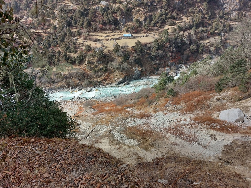

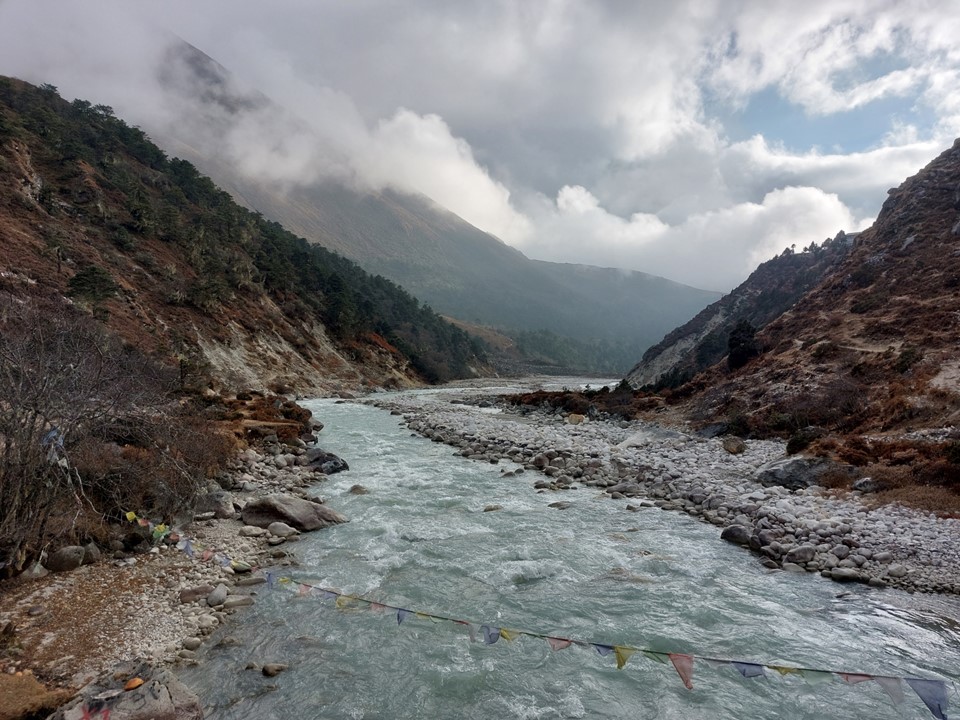
The drop down to the river was a bit annoying – but at least I had known it was coming
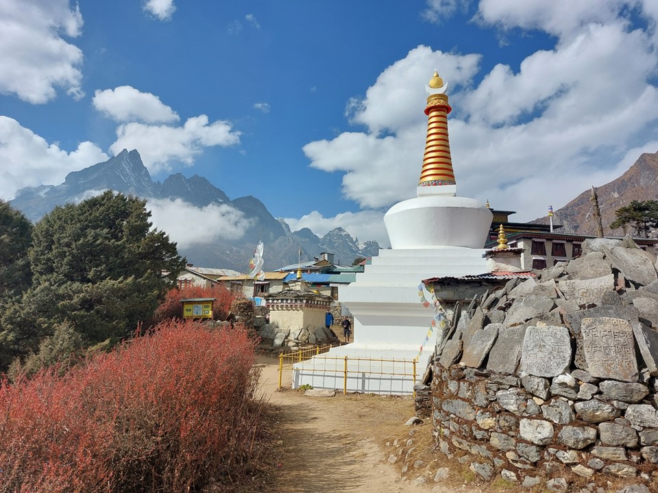
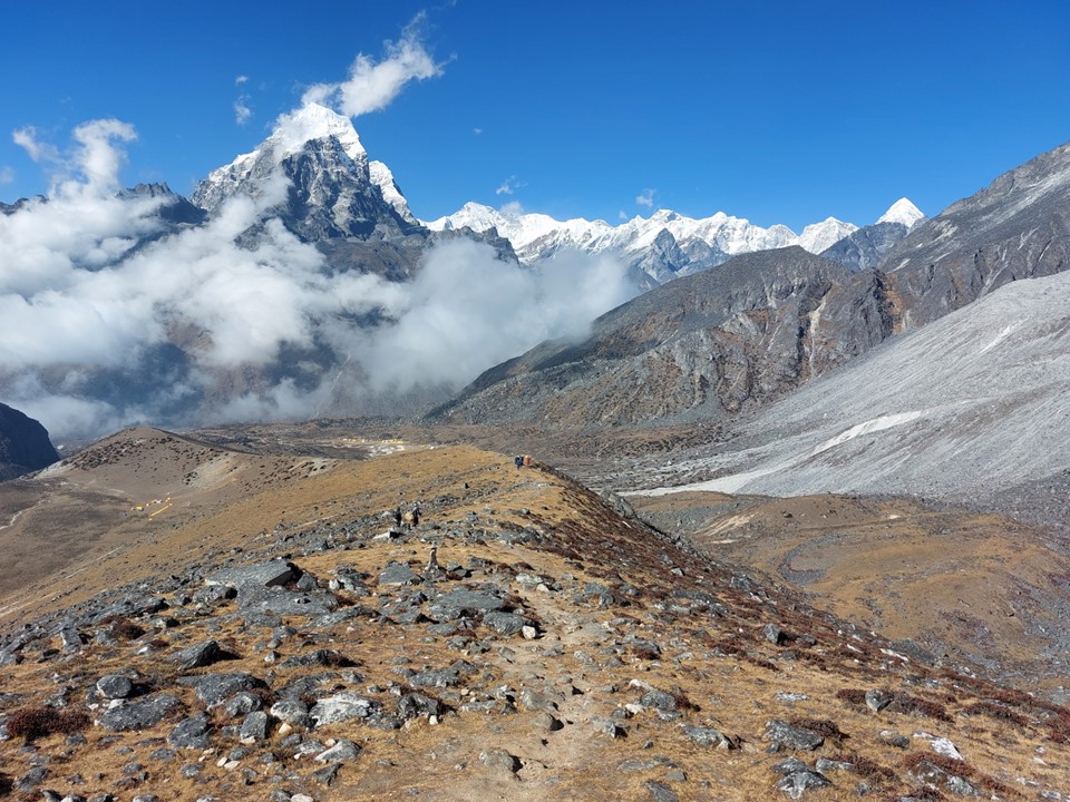
I reached Pangboche around 4PM. I was happy to be finishing well before dark this time. Total distance for the day was only 17km, but with 1245m ascent and 661m descent. Pangboche had been chosen for two reasons: being about 600m higher than Namche was perfect for my acclimatisation schedule, but more importantly, it was where the turnoff to Ama Dablam Basecamp is found.

The town itself is really beautiful. Between 6000ers, one would expect this!
The first tea house I stopped at was full – this would be the only time on the entire trip where this was the case. The second one I went to was almost entirely empty. This was the first tea house I had stayed at that had a hot shower available – so I decided to pay the extra NR600 (more than the NR500 one pays for the room) and make use of this. My room had a view of Ama Dablam out the window, and I had my own western toilet and basin attached to my room – I really liked this tea house!
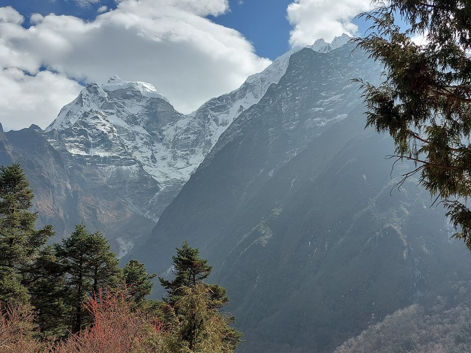
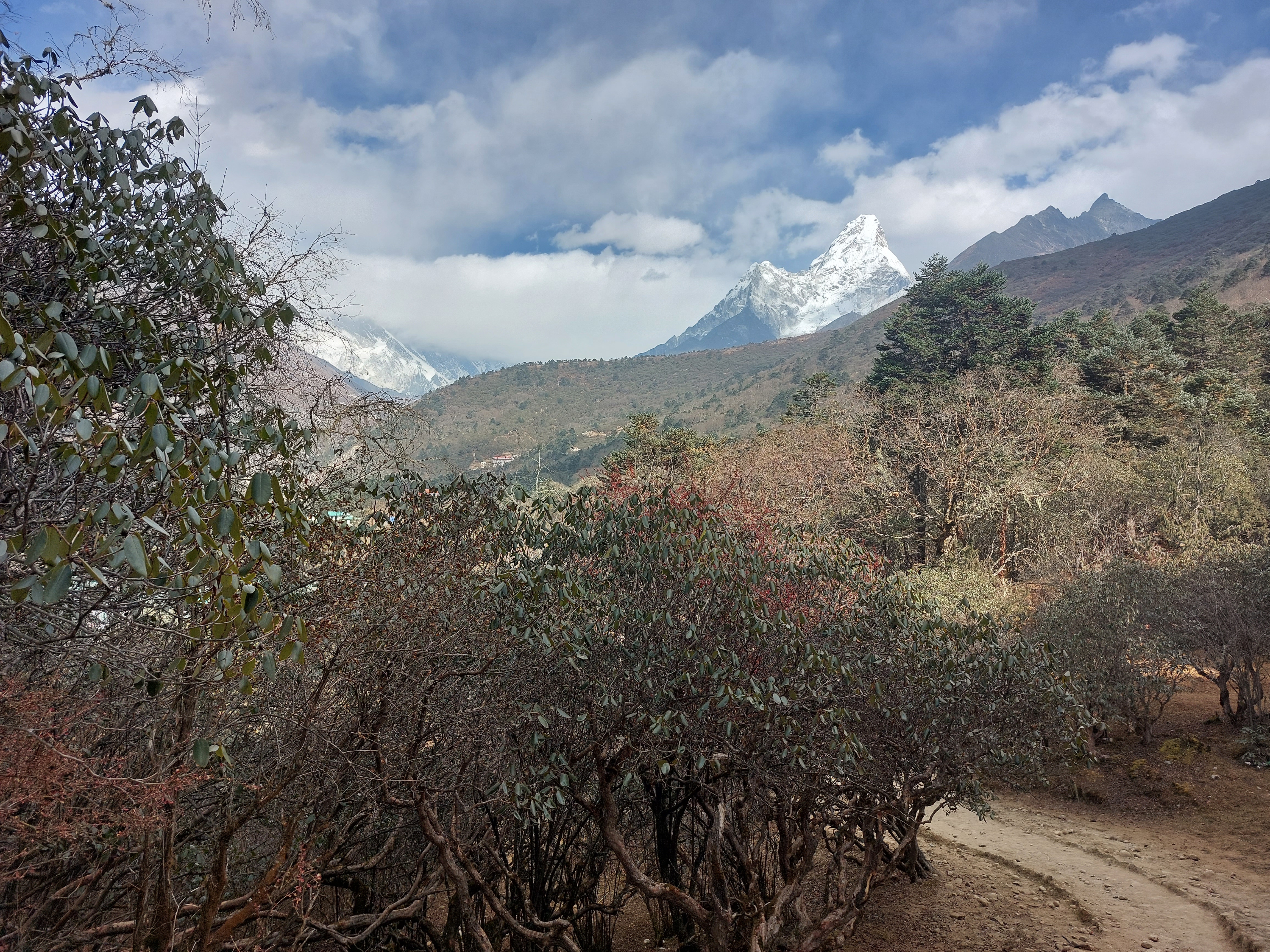
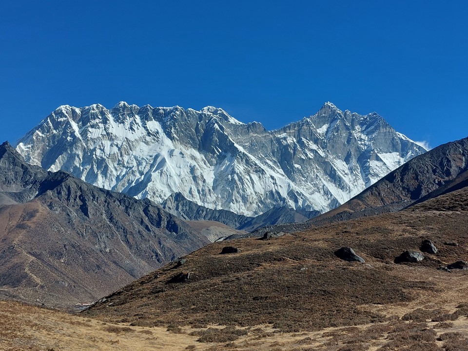
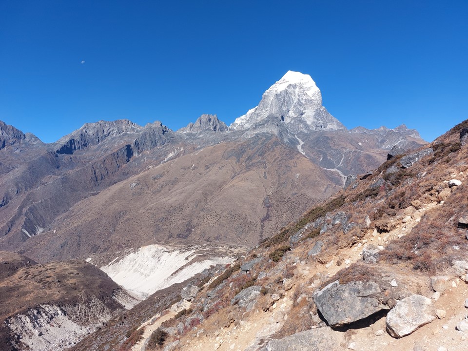
Early the next morning I set off for Ama Dablam Basecamp. The cloud had cleared and Lhotse, the fourth highest mountain on earth, was right there in all its glory. A certain 8849m mountain was just sticking its head over the top as well – it was great to finally see the Big-E, albeit not the most impressive view of it!
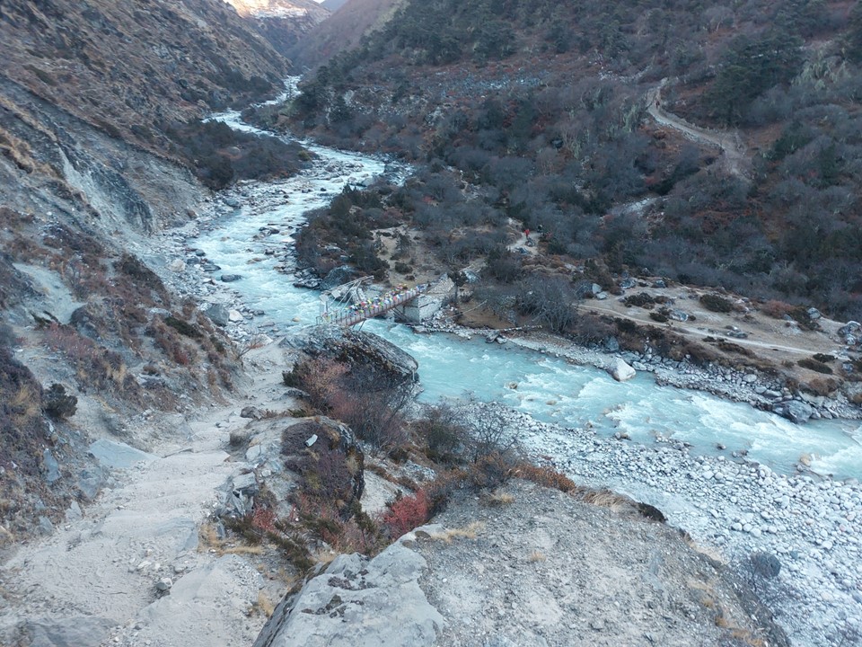
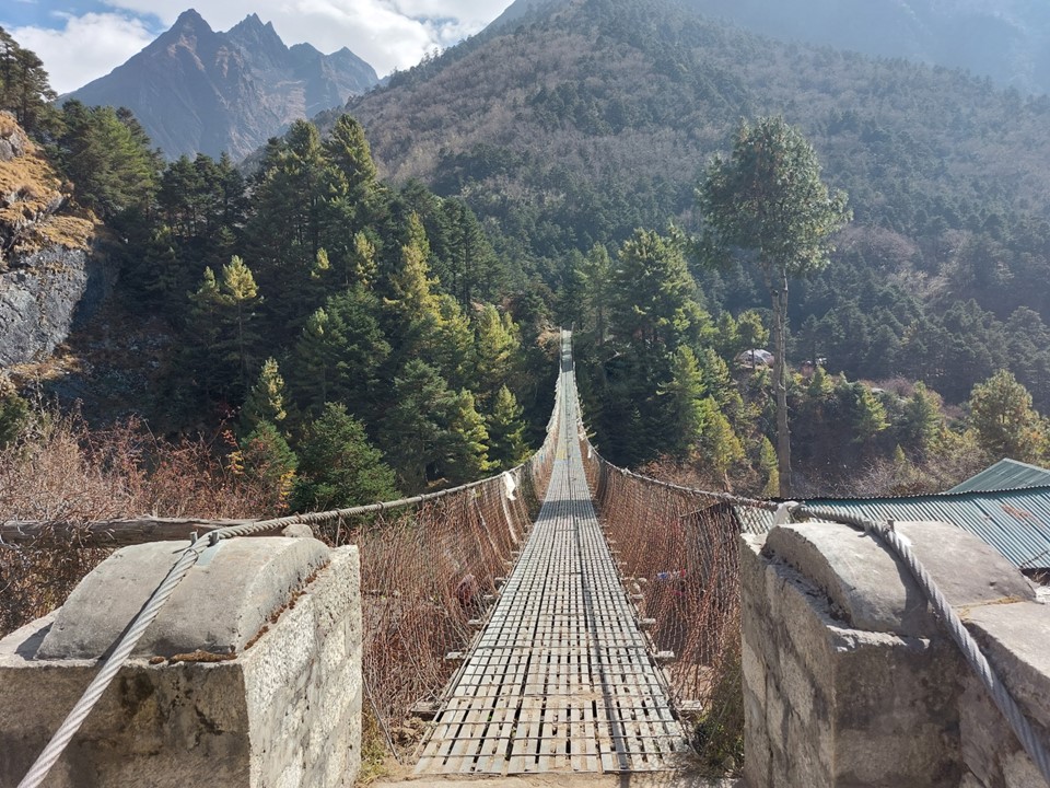
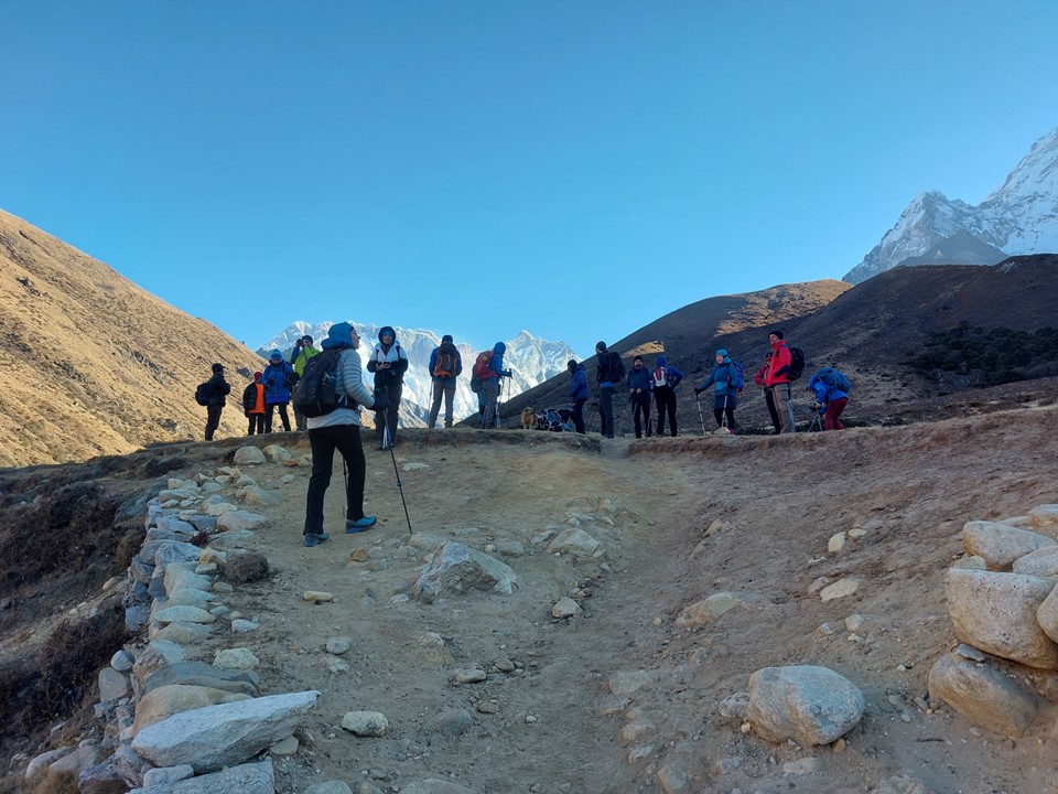
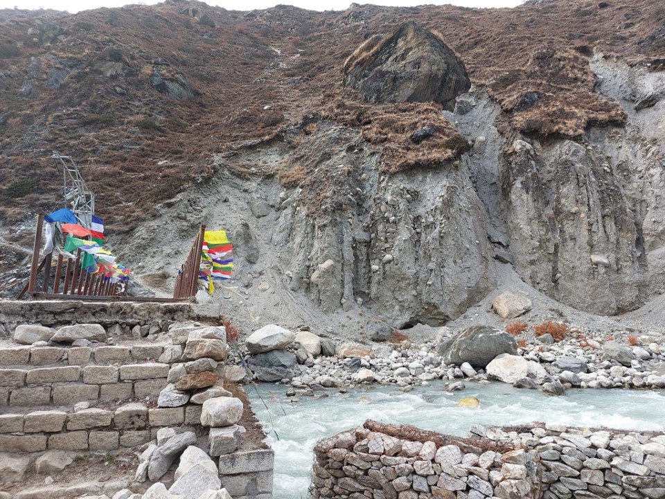
After initially missing the unmarked turnoff, I walked back and found the way past the houses at the far end of the town and dropped to the bridge over the river. I didn’t expect many people to be doing this side quest, but being the Everest Region, wasn’t surprised to see others. A group of 20 Poles was also doing this hike, which meant I would have others around – which is always nice.
One might ask why did I want to do this – and there are a few reasons: for one, Ama Dablam is one of my favourite mountains, and getting as close as possible to it sounded like a great idea. But there was also the value in using it as an acclimatisation day. Seeing as I would be staying in Pangboche again that night, my pack was very light, so I saw it as a kind of a rest day as well. As was noted by many of my primary school teachers – sitting still isn’t something I’m very good at!
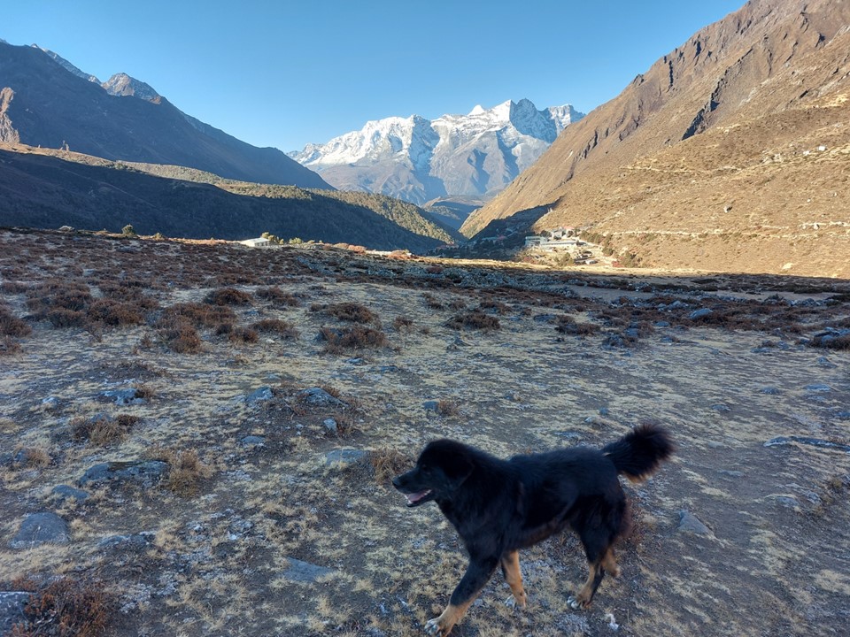
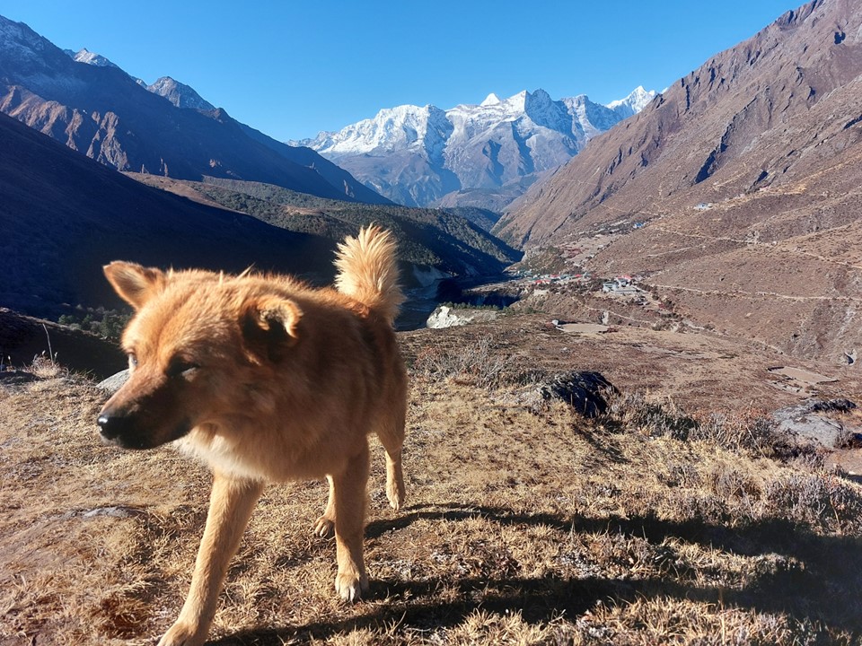
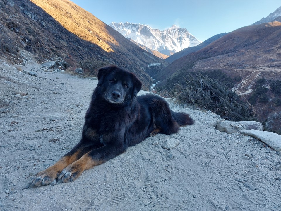
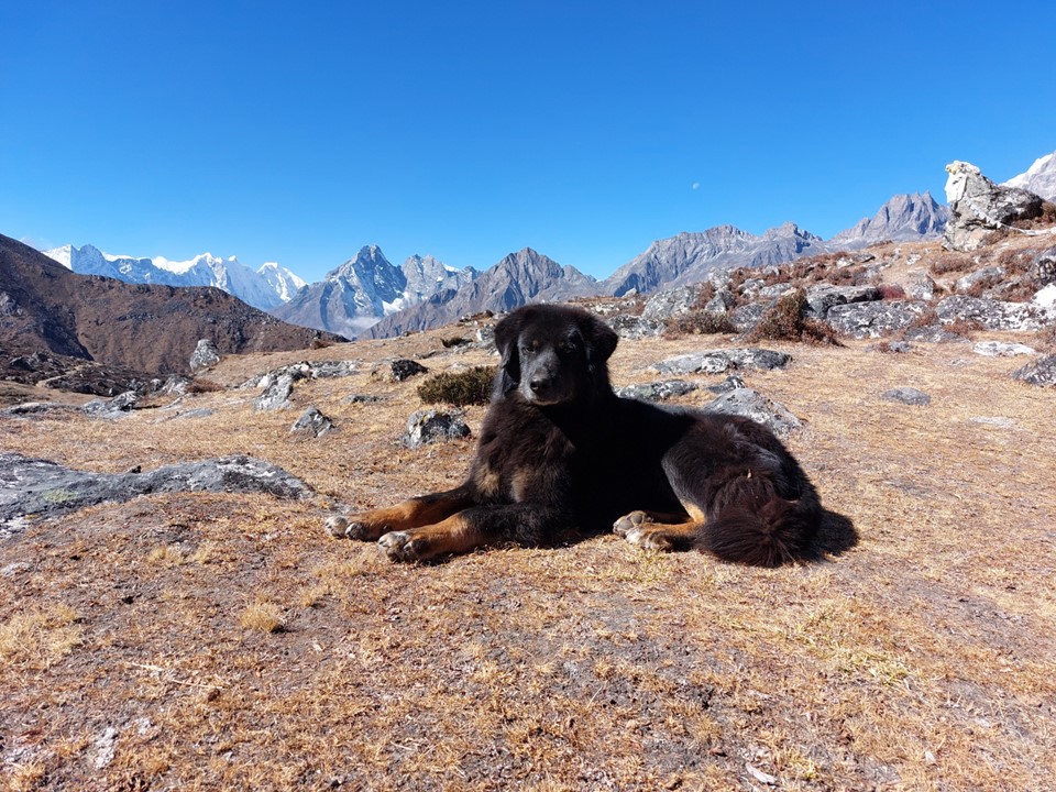
A few trail dogs were following us as we climbed the steep ridge up to basecamp. I decided to stay reasonably close to the Polish team – mostly because they were going at a pace that I found comfortable, but also as a bit of a safety net if something should go wrong.
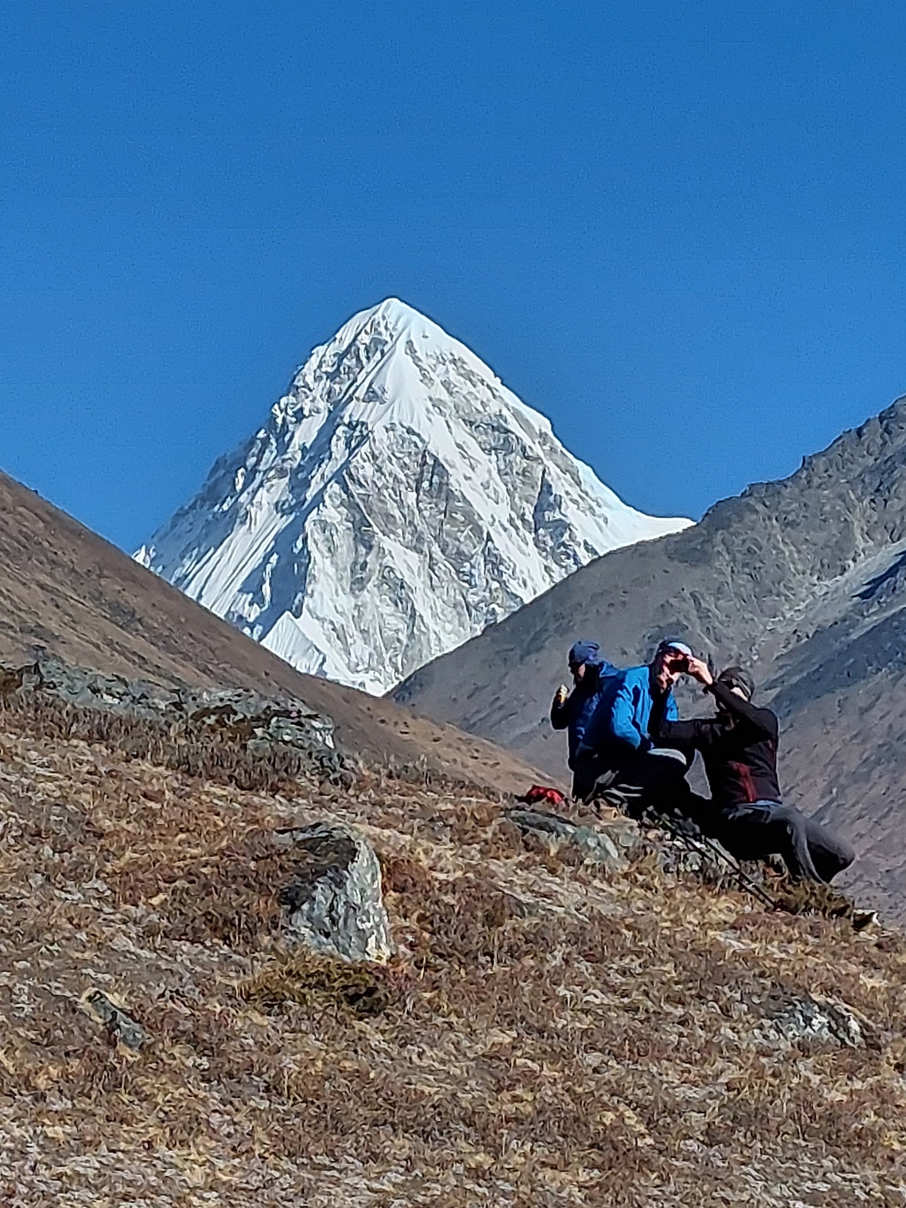
Soon a large conical peak became visible in the distance. I was initially uncertain what it was, till the Polish guide said it was Pumo Ri. When he said the name, I had to chuckle – its a peak I have read about many times, I really should have known! It is commonly mistaken for Everest (despite looking completely different) as it is one of the most impressive peaks in the region. The name means “daughter mountain”, presumably referencing Everest being the mother. It is a mountain I would love to climb some day.

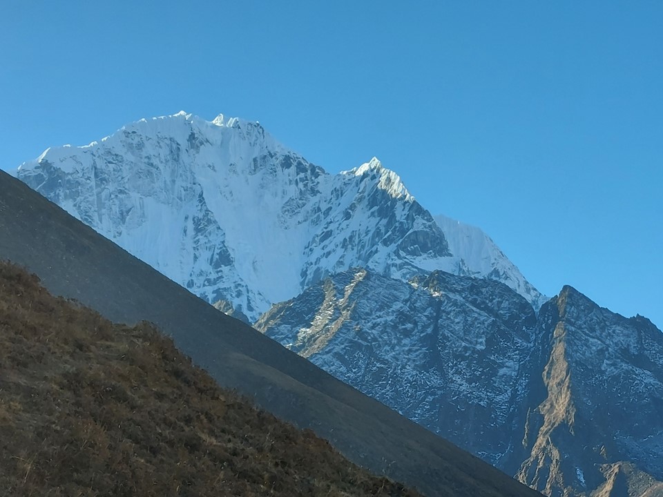
While the views from this region are exceptional – the one peak with its least flattering angle is the sacred mountain Tabuche.

Walking through basecamp I was surprised how many tents I saw. As it turns out, while most ascents of Ama Dablam happen during the spring season, a reasonable number of ascents happen in October and November when the weather is most stable, albeit colder and drier.
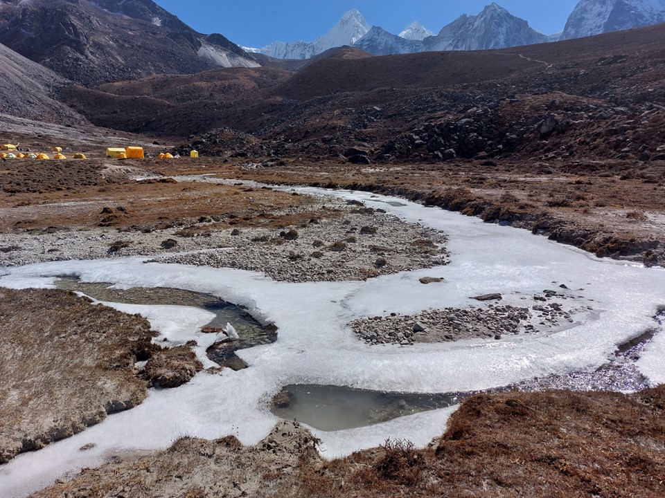
I found a hole in the ice and filled my water bottle. Water in this region is often contaminated, so using tablets or a filter is necessary. I had brought a life straw for this reason, this being one of the few times I was able to use it.
I sat with the Polish team and enjoyed the lunch I had brought. Their leader told me they were planning to continue up the ridge to the summit at 5000m between basecamp and ABC. I thought a permit was required to go past basecamp, but apparently you can actually go as far as the start of the fixed ropes before you need one. Don’t quote me on this one – I was never able to verify whether or not this was actually the case.
I saw some spots near the top of the mountain, so I pulled out my bridge camera and took a 40x optical zoom shot to see what was visible. As it turns out, there were two climbers on the final approach to the summit.

The climb up the ridge wasn’t steep, but as you get higher, the air gets thinner making usually easy tasks much harder – and I wasn’t yet acclimatised to this elevation. So I took it easy, ready to turn around if I wasn’t feeling great.
Whenever I stopped, I would take another photo of the climbers and see how they were doing. I knew I had all day, and the more time I spent at higher altitude, the better for the rest of the trip. The usual rule of acclimatisation is that you want to avoid going more than 1km higher than you have been in the last two weeks excluding yesterday. My highest elevation in the preceding two weeks without yesterday was 3362m, so going to 5001m was something I needed to be careful about, but I actually felt completely fine.


As they say in Tanzania – pole pole. I moved at a pace comparable to a snail in peanut butter, and stopped regularly. I knew I could get down to Pangboche reasonably quickly, so I was in no rush. Also – how many times in my life will I get this view, I was in no rush to leave.
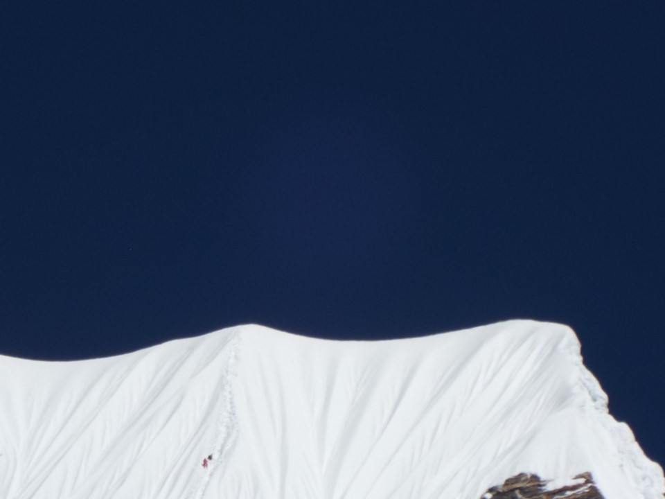
The climbers were nearing the summit of Ama Dablam. Sadly I never managed to get a photo of them on the summit.
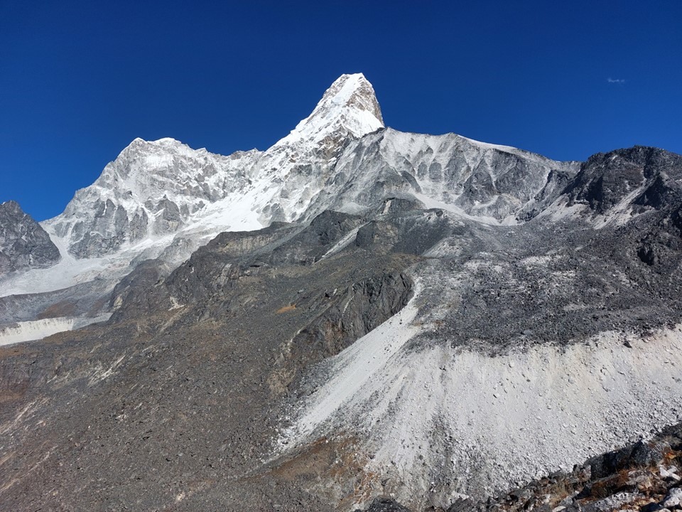
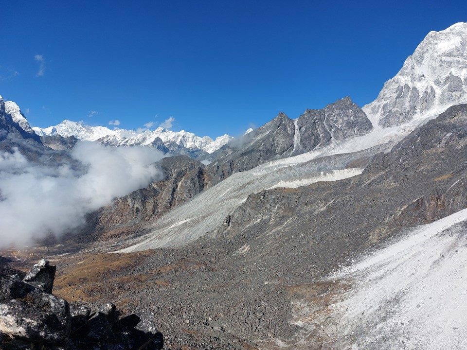
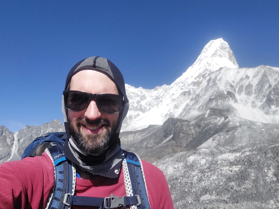
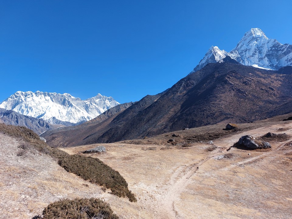
I eventually reached the top of the ridge before it drops again towards Advanced Basecamp. I could see Cho Oyu (6th highest mountain on earth) in the distance, the ridges visible from there were spectacular, and there was Ama Dablam right in front of me. I easily could have sat here for hours. But I knew daylight wouldn’t last forever, and I would eventually have to descend.
For the first time on the trip, I put my phone on selfie mode and recorded myself attempting a rap. I used the Epic Rap Battles of History rap in their Alexander the Great video. As many people have pointed out in the past – I am not particularly good at rapping, so one might ask why I did this. The answer is that slurred speech and memory issues are the most common early signs of altitude sickness. As I was on my own, there was no one else around to inform me if I had these issues – by recording this, I was able to watch the video back an confirm that I was in fact fine.
I set off down the mountain reasonably fast. Clouds were coming in, so the views were not going to be there anyway. As I got lower, I could feel the air getting thicker, or perhaps downhill is just much easier giving one this illusion.


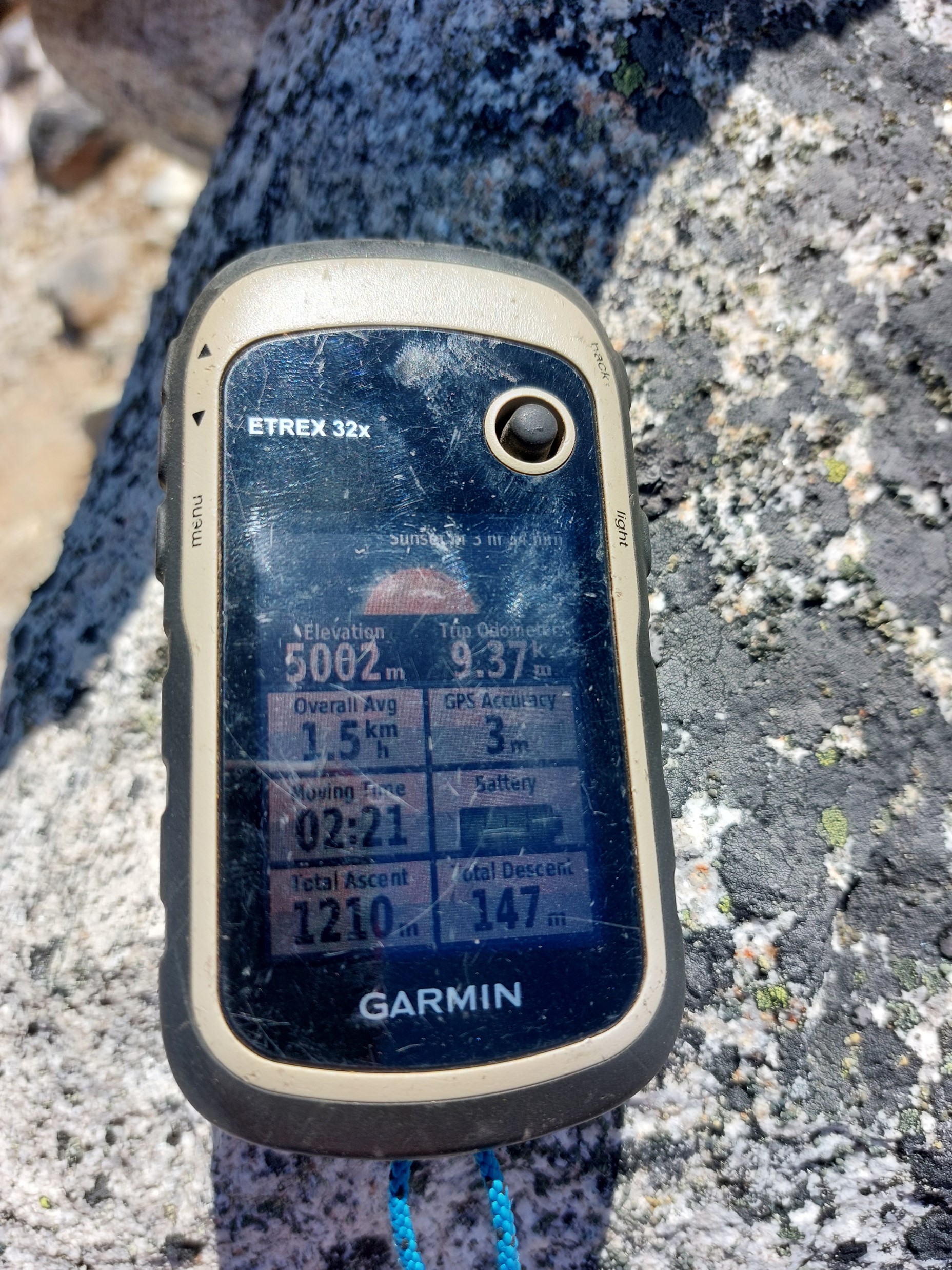
I got down to Pangboche reasonably easily. My “rest day” had been 17km with 1200m elevation gain and loss – but having reached 5000m for the first time on the trip without any problems, I felt really good about how this was going. This had only been my second time above 5000m.
That evening I met Pasang Sherpa, a local guide with a few Everest and Ama Dablam ascents under his belt. He showed me a few videos of him getting hikers up various 6000ers around the country. While my plan at the time didn’t include coming back to this region, I thought it was handy to get his number just in case. A few people from my running club joked that I would have to come back to climb Ama Dablam, which I dismissed at the time. No comment on recent messages between myself and Pasang about climbing Ama Dablam some time in the next few years…
