At any given point in time, I will have a large number of ongoing mountain projects. A few years ago I came up with a list of five mountains that I need to see in person, I usually call it my top contenders for the most beautiful mountains on earth – although it might be more accurately described as five mountain regions I want to visit. The list is as follows:
1) Jirishanca, 6125m, Cordillera Huayhuash, Peru.
2) Machhapuchhare, 6993m, Annapurna Region, Nepal.
3) K2, 8611m, Karakoram, Pakistan.
4) Ama Dablam, 6812m, Everest Region, Nepal.
5) Artesonraju, 6025m, Cordillera Blanca, Peru.
After talking about visiting these regions for years, and having a partly planned trip to Peru for 2018 that never ended up happening – I eventually decided to put in some leave for November 2022 and went online to buy tickets to fly to Nepal. The plan was simple: head to the Annapurna Region, do Annapurna Basecamp and then the Annapurna Circuit.
I came up with a rough plan, found GPS tracks online, talked to friends who had hiked there, joined Facebook groups were people share information on the trek etc. I soon realised that this once wild trek is now mostly a jeep track. Hiking on roads has never been something I am a huge fan of, and was disappointed to learn this – I decided to change plans to the Three Passes Circuit in the Everest Region.
Everest Basecamp itself has always been a hypothetical goal for me – one where the area around the basecamp was somewhere I would have to visit someday, but the basecamp itself is arbitrary and not something I am actually that interested in. The plan was always to do this via the Three Passes Circuit – a harder variation of the route where the route from Namche onwards is a loop rather than ascending and descending the same valley. It is traditionally completed in around 22 days, with extra days added if one intends to add any peaks along the way.
Luckily – when planning to do a popular route there are hundreds of blogs online one can read, in addition to Facebook groups where people share their recent experiences. I also happen to have a few friends who have done this route before. Andrew completed it in 3 days, which is insanely fast – and most importantly told me that a faster loop was possible. I would only have 17 days available, and these included travel days. And I didn’t just want to do the circuit, I wanted to head to both Ama Dablam Basecamp and Everest Basecamp, as well as ascend Nangkartshang, Chuckhung Ri, Kala Patthar and Gokyo Ri. I also was hoping to finish in 12 days so that I could catch a flight to Pokhara and do a quick hike up to Annapurna Basecamp – I know, not a very realistic goal, but worth trying anyway!
One complication that quickly became apparent was that flights to Lukla were no longer departing from Kathmandu, but now Ramechhap. This meant a 6 hour jeep ride before you even jump on a flight. In addition to the fact that flights can’t be booked online and scheduling depends on weather – I knew it was entirely possible that I’d lose my first day in the country to getting to Ramechhap and then lose further days waiting for the weather to clear for a flight to Lukla. So I decided to back myself over factors I couldn’t control, and instead decided that I would hike from Phaplu. This adds two days of hiking, but at least I could continue in bad weather. It did render the prospects of heading to the Annapurna Region unrealistic, though – I knew it was even possible that I may miss the final pass on the circuit if I was running low on time, as bad weather could mean no flights out of Lukla for a few days.
The weekend before flying out, I went to Afriski and spent some time above 3300m so that I would arrive at least partly acclimatised. This would mean I could head to Namche as quickly as possible as I was already acclimatised to this altitude.
In the few days between my Afriski trip and leaving for Nepal – things got off to a bad start as I ended up with food poisoning on the Monday night. (unlikely to relate to the Afriski trip as I only ate tinned food their due to their restaurant being closed). On Tuesday I was very sick and ended up going home from work early – I had work that had to be finished before I flew out, and my flight was on Wednesday evening, so this was bad for numerous reasons. After having almost nothing to eat on Tuesday, I was feeling much better on Wednesday morning. I managed to get my work finalised and then made my way across to my mother who would be taking me to the airport. The meal I had with her was the first food I’d had in more than a day, never ideal when one is on their way to attempt a long difficult trek! Fortunately I was feeling much better, although still no 100%
Flying Qatar Airways, I don’t have much to say about the flights – the airline is rated as the best in the world, and their service was great, although equally as good as Air Kenya or Air Mauritius, which I had also flown within the last year. Doha Airport was preparing for the Fifa World Cup, so the usual visa free entry for South Africans was suspended – although with a 3 hour layover, I realistically wouldn’t be leaving the airport anyway. Thus Qatar joins the list of countries that I have landed at but never left the airport and thus don’t count as countries I have been to.
Arriving in Nepal – there were some sights from the air of really impressive mountains, although it was hard to tell exactly what I was looking at. Kathmandu Airport was chaotic, but I had completed the visa form online and simply walked to the desk, got my visa, and soon was at baggage collection.
It was crucial that I could hike as early as possible, so my checked luggage was only items I couldn’t have in hand luggage – such as my micro-spikes. Everything else was in my hand luggage. Ironically my checked luggage was 5kg while my hand luggage was 7kg. Worst case scenario, I could replace everything in my checked luggage if the bag never arrived. After waiting more than an hour at the carousel (downside of a large aircraft and a disorganised airport), my bag eventually arrived.
I got a SIM card and drew some local cash before getting a taxi to Samsara Hotel. The ride to the hotel took more than an hour in the chaotic traffic that is Kathmandu’s roads. BN, the owner of the hotel, is a friend of Andrew’s and was the individual who helped him with his admin and logistics when he completed the Great Himalayan Traverse. When I arrived at the hotel, he had already booked my bus ticket to Phaplu to depart early the next morning, and he explained a few things I needed to be aware of.
I walked around Thamel (the tourist region of Kathmandu where Samsara Hotel is located), but didn’t buy anything aside from some water and snacks.
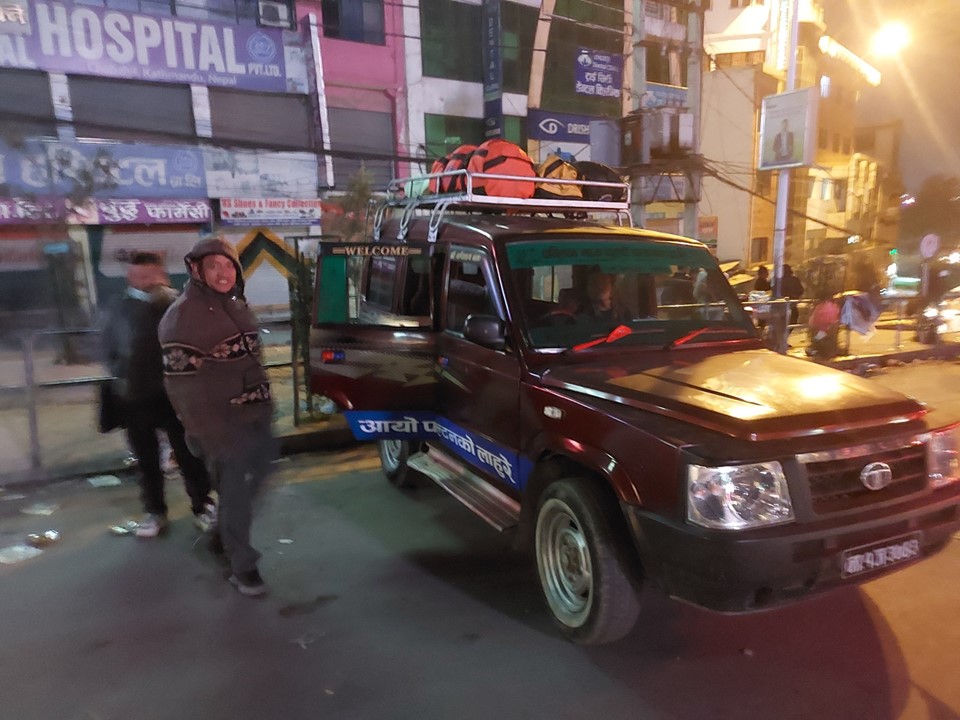
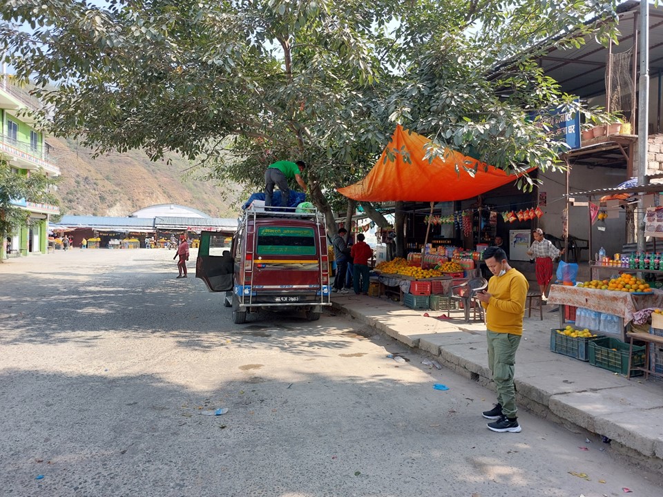
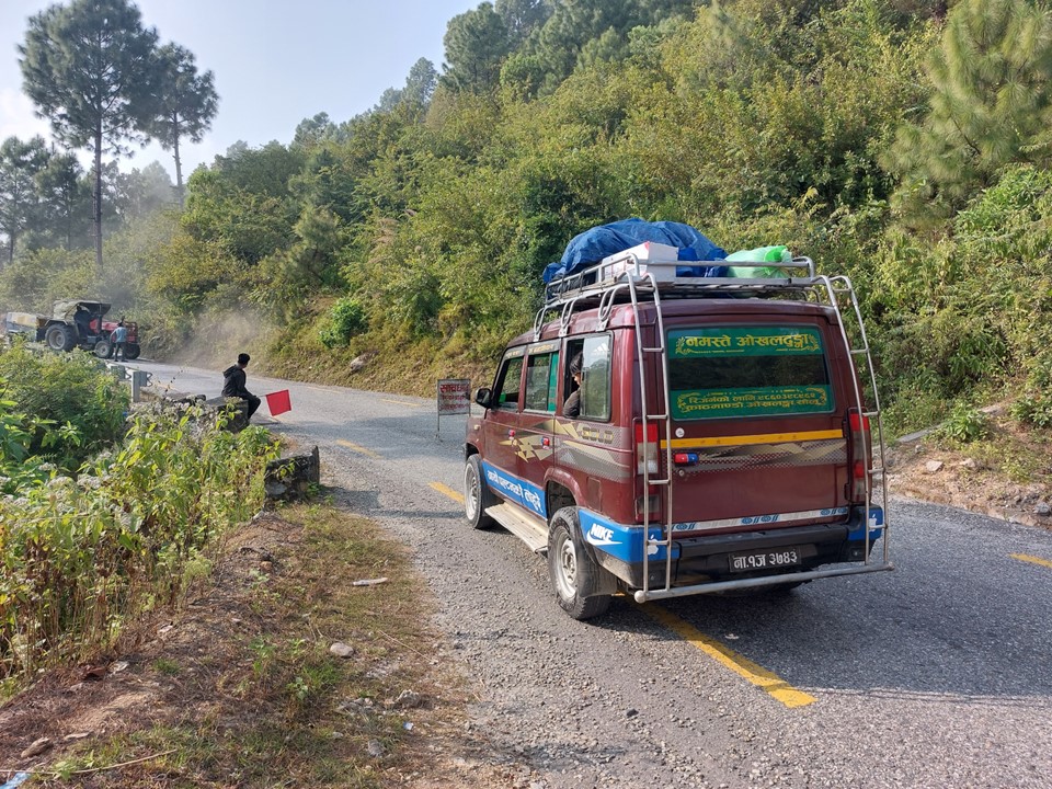
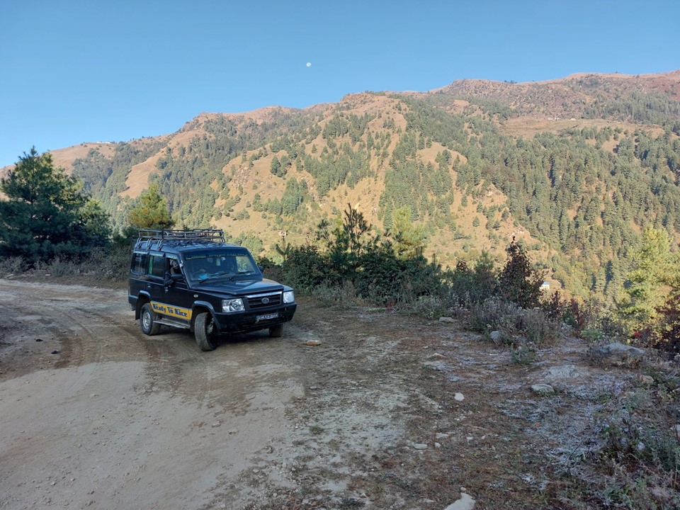
At 4:30am I was up and waiting in reception. They had a packed breakfast for me. I was supposed to be picked up by the jeep that would be heading to Phaplu at this time. After more than an hour of waiting, a motorbike came to pick me up. It was about a 20 minute drive through the city before we were at the jeep, where we would wait for close to an hour more before getting started. We then spent the next hour or so driving around Kathmandu to pick up the other passengers. To those who say the jeeps are better than the bus – I am really not convinced!
By 9:30 we were finally out of the city, which meant it was time to stop for breakfast at a place next to the road. I knew that getting from Kathmandu to Phaplu usually takes about 12 hours, and is only about 270km, and I was starting to figure out why!
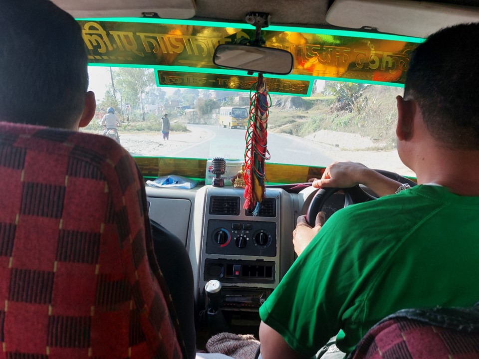
No one in the vehicle spoke much English, so it was hard to communicate. The only Nepalese word I know is “Namaste”, which means hello.
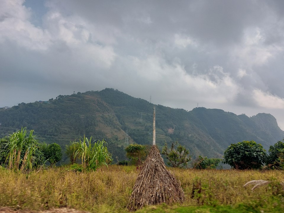
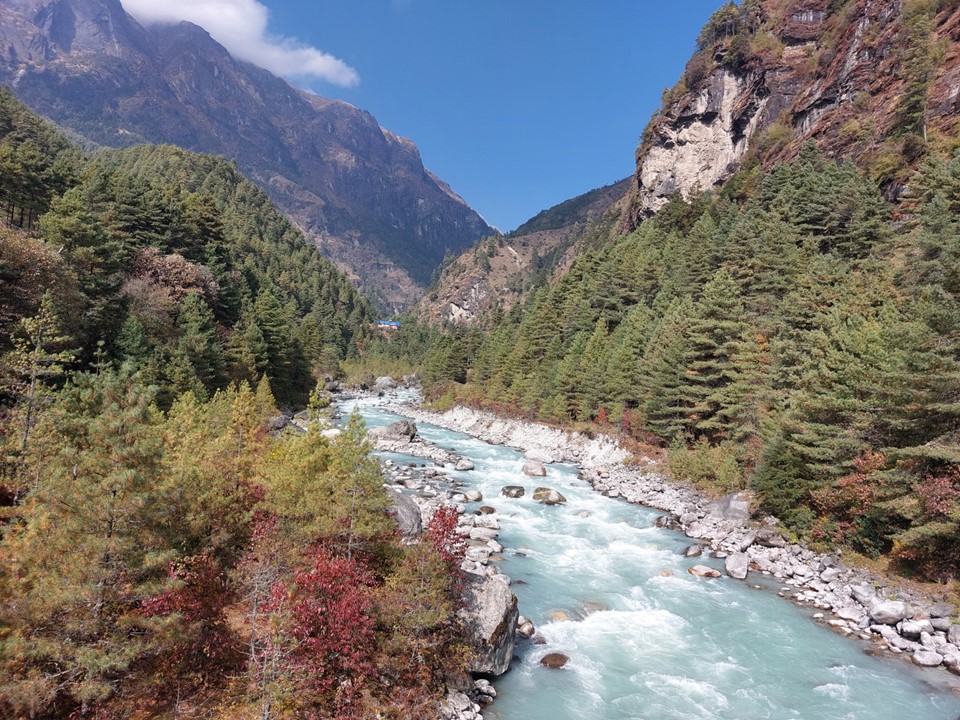
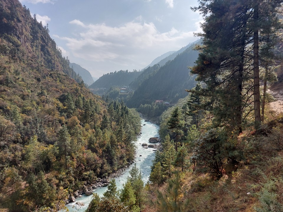
A significant portion of this drive is along the Sunkoshi River. I was interested at how big the river is – seeing as it was the dry season. A significant portion of Nepal’s water is from melted glaciers, so the rivers tend to be a turquoise colour.
I was right in the middle of the jeep. There was a mother to my right whose daughter (probably about 2 years old) threw up five or so times over the duration of the drive. Credit to the mother for managing to catch it in a bag every time, with none of it ending up on me – but I was aware that my clothes getting dirty on the way to the start of the trek would be less than ideal, especially since I had only one change of clothes for 17 days! One complication of not making use of porters and guides is that you are very limited in what you can carry – but it gives you a lot of flexibility in terms of your schedule.

We stopped for lunch at a tea house on the Sunkoshi River. This was my first time trying Dal Bhat, and was probably the worst Dal Bhat I had on the trip. Dal Bhat is a a meal of lentil soup and rice with veggies. You are given unlimited refills of rice and lentil soup, and as I would learn much later (and wish I knew at the start), not finishing all your rice is very rude.
We eventually left the Sunkoshi River to head up the valley towards Phaplu. With road works along the way, we spent 45 minutes parked at a stop go, so progress remained slow.
Nepal roads are notoriously bad – this is in no small parts due to the annual landslides that happen during the monsoon season. While a lot of the roads are tarred, they all include sections that have been washed away and are now really bad dirt roads or even basically off-road. This combined with the steep mountainous terrain where a road may be tarred, but driving faster than 40km/h is not possible, makes travel of any distance very slow. The rough and windy roads would also be an issue for anyone with motion sickness. They can also be unnerving at times, as you frequently have a massive drop next to the road, and the roads are not always wide enough for two vehicles to pass each other. Long story short: the part of Nepal I really didn’t enjoy was jeep rides!
By the time we were past the roadworks, I was very much over this drive – it had been long and slow, and it would soon be getting dark.
We reached Basanta Bazar and the jeep stopped and I was told to get out, I assumed to get something to eat. Then suddenly the jeep drove off. I was very confused – my bag was on top of the jeep, so all I had was what was in my pocket (which fortunately included my passport and wallet). The downside of being in a country where you don’t speak the language is that you really don’t know what’s happening. I decided that there’s no point in stressing – the driver would probably be back soon. And after about 20 minutes he was back and I was now one of only two people in the jeep (aside from the driver). The others were going to another town up a different road, and the driver decided it would be easier to drive with a lighter vehicle – understandable, although I wish that had been communicated to me. In hindsight, 20 minutes less in that jeep was definitely preferable!
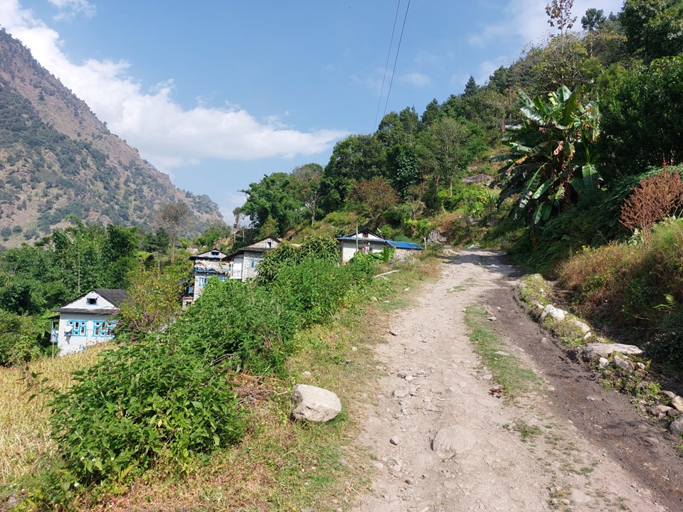
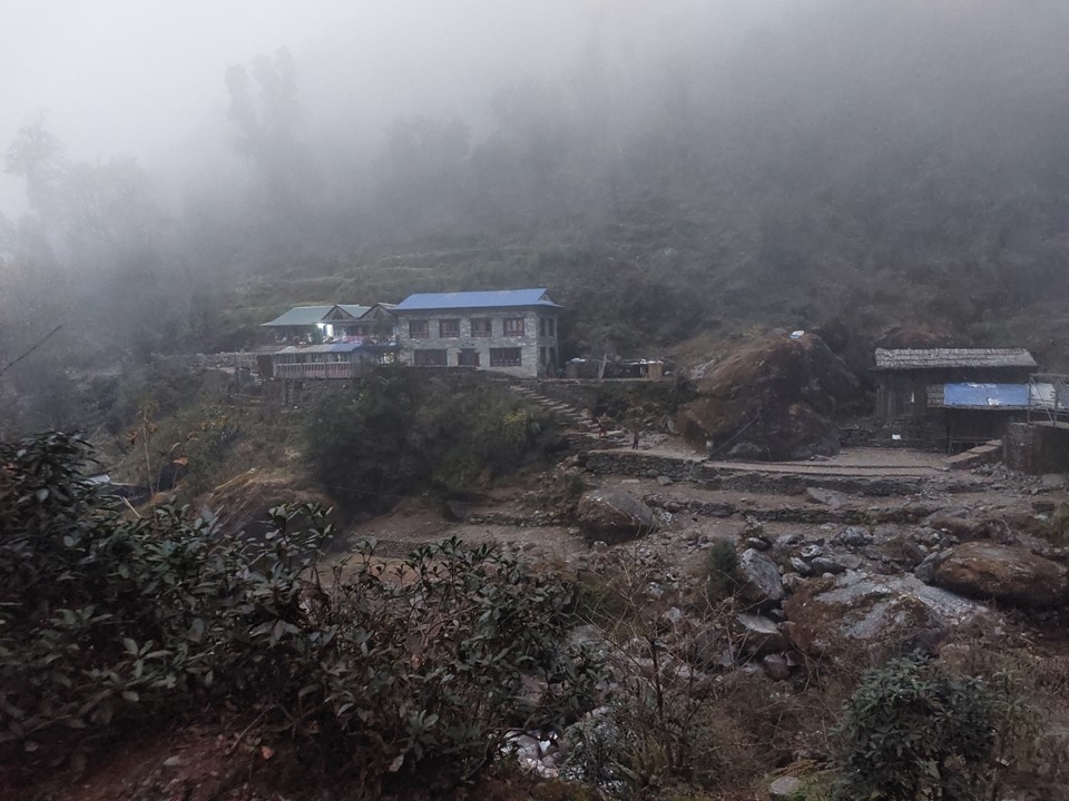
We arrived in Phaplu after 7PM. The other person in the jeep was also coming to Phaplu, so he took me to the tea house he recommended and I stayed there for the night. The people were very friendly and my room was great. The basic rule of tea houses is that the accommodation is a side business – they primarily want you to eat there. To stay in one tea house and eat in a different one is very rude (this I fortunately knew beforehand).
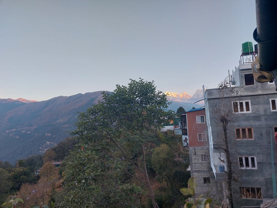
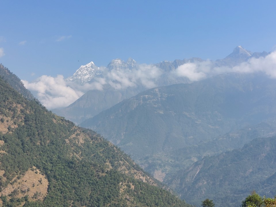
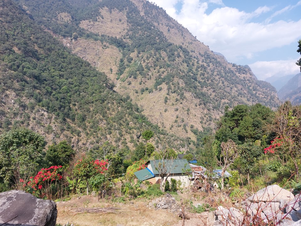
The next morning I could see a really impressive mountain in the distance. I looked at my map and noted it was Numbur, 6958m, making it the highest mountain I had ever seen to that point. It’s funny – it is 3m lower than Aconcagua, meaning it is higher than the highest point of five of the continents, and only 3m lower than the highest point in South America – but in Nepal it isn’t even in the top 20 highest mountains in the country!
I arranged for a 6:30 breakfast. I had thought Phaplu was the end of the road, but the road clearly continues on, so I wanted to see if I could get another jeep further up the road. As much as I had not enjoyed the jeep ride the day before, I knew my odds of a successful trip improved the faster I got to Namche. Within two minutes of walking out of the door, I was on a jeep to Phera – which was worth about an hour walking time saved.

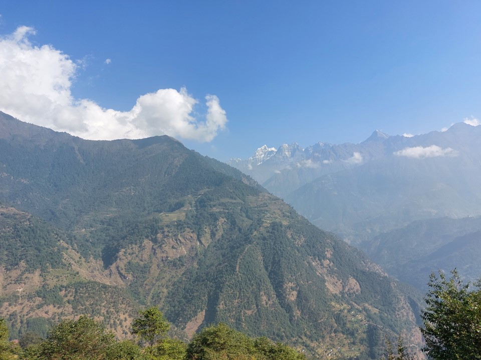
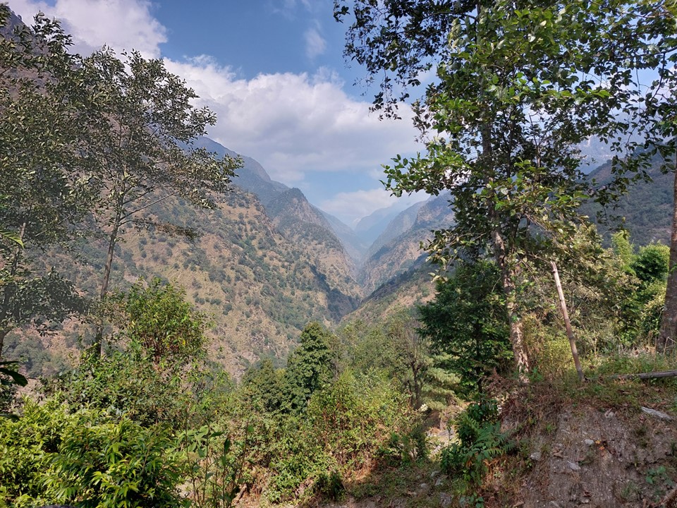
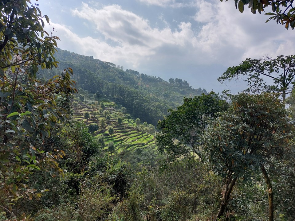
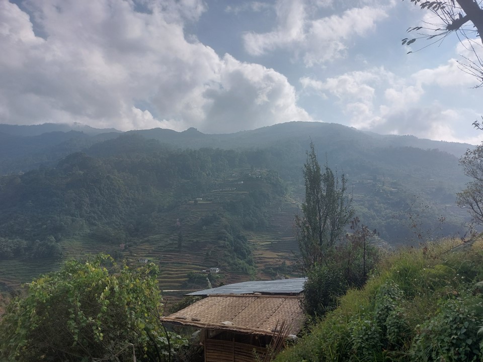
As I started to walk from Phera, I noted that I was still clearly on a road that went long past here. The views of the big peaks in the distance were great, although by no means the most amazing scenery I had seen. From this far back, while these mountains were bigger than the Drakensberg, they were nowhere near as dramatic. I suspected this would change as I got closer to the big peaks.
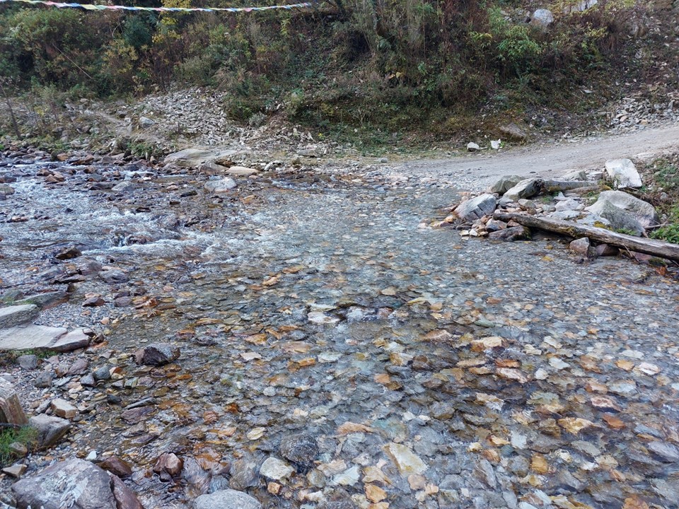
I had to cross a shallow stream. Being a road, it was just deep enough that if I walked through it I would have soaked hiking boots – and as a result it also happened to be relatively wide. With some careful line selection I managed to get across with dry shoes. It was a cold morning, so the prospect of wet feet didn’t sound appealing!
After just short of 1km of walking on this road, a car drove past. I asked if I could get a ride, and they agreed to take me. The front was full, so I jumped in the back. While I had not enjoyed the jeep rides of the day before, I knew this would be worth hours of time saved and would give me more time in the mountains.
We stopped at a tea house on the way down the valley once we had crossed the pass, and had some tea and biscuits. The drive itself was about 40km, and cut roughly 20km of walking off for the day. They eventually dropped me at a clinic in Phuleli. I was very grateful to them, and they refused payment for the ride.
The goal for the day had been Kharikhola, which would have been about 30km with a lot of elevation gain and loss – not an easy day by any means! It was around 11AM now, and Kharikhola was only 6km away, so the goal became Kharikhola for lunch.
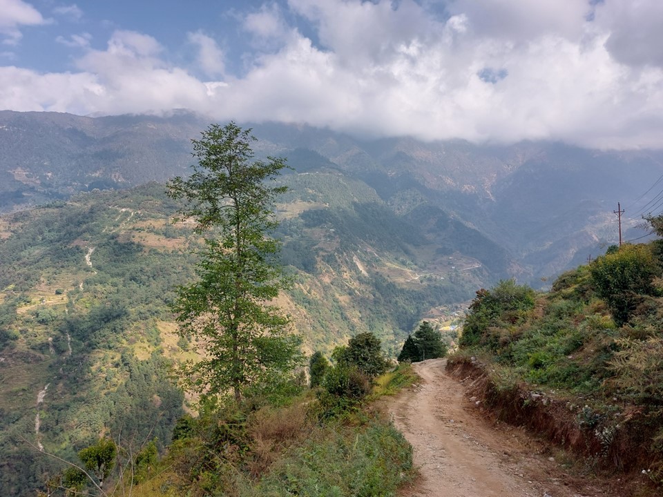
There is a network of roads and trails through this region. The trails are more direct, but frequently cross the roads. Finding where the trail leaves the road on the opposite side isn’t always easy. As it turns out, there was a multiday staged trail race through the region at the time, so upon hitting the road just before crossing the Dhudh Kosi River, I actually passed the water table for the runners. It was funny – I would see these tables daily between the start and Tengboche, as the daily sections on the race were similar to my daily itinerary.

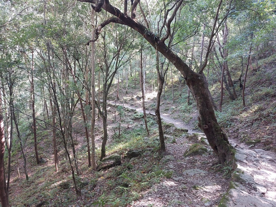
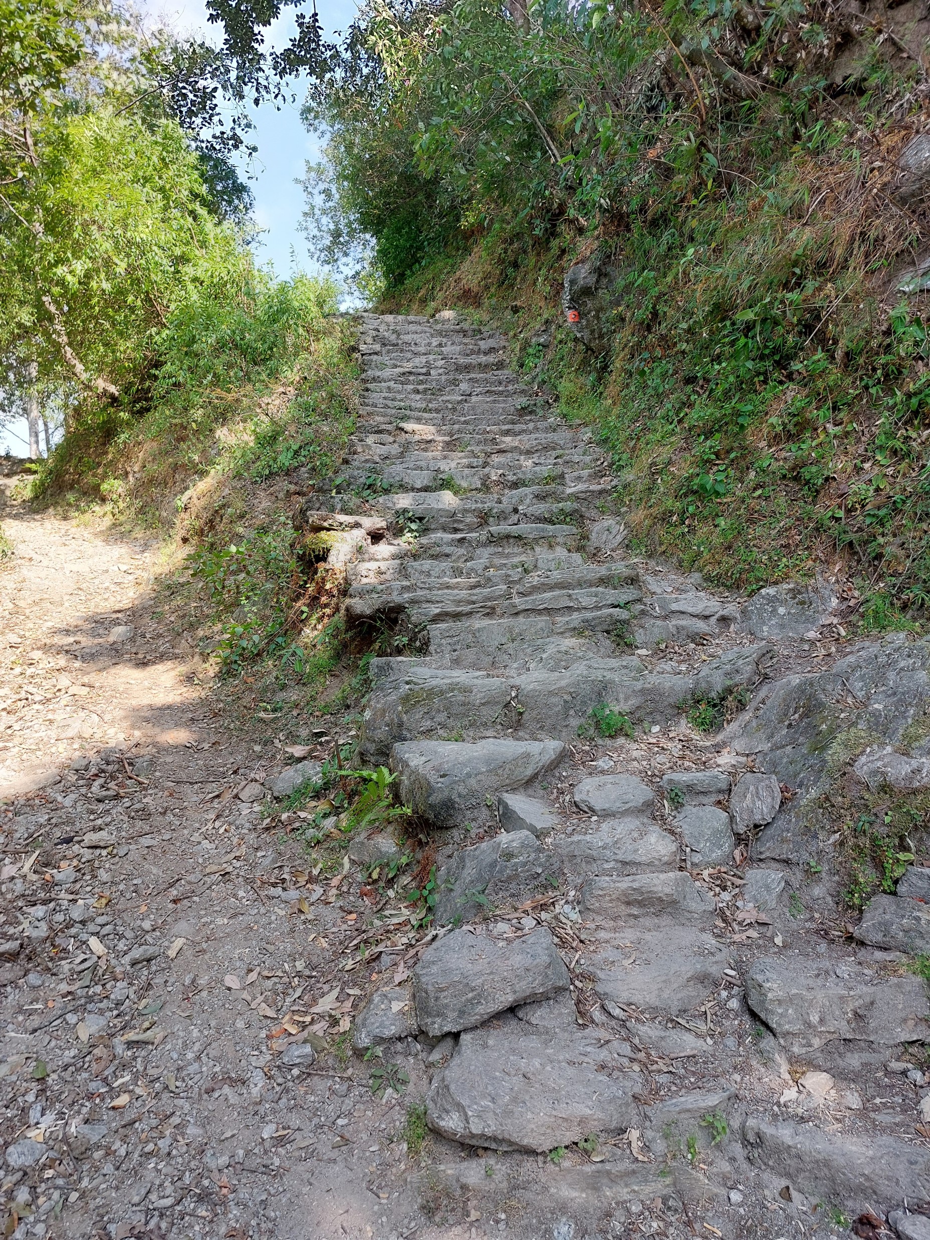
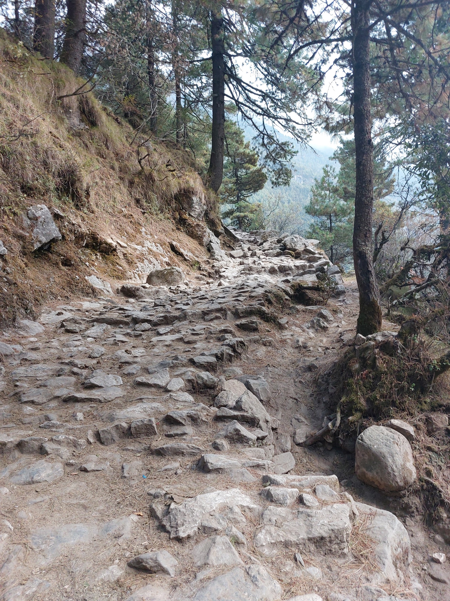
The upside of the race was that my route was well marked. Hikers rarely visit anything downstream of Lukla, so the trails around here are nowhere near as well maintained and are rarely marked. I did have a GPS track of the route, although unless a split is left or right, that is rarely helpful at the time of the split, and more an indicator that you took the wrong split once you have covered a bit of distance the wrong way. Notably GPS devices don’t cope well in deep valleys as they can’t see enough satellites, so you rarely get an accuracy reading of less than 15m – combined with the likelihood that the person whose track I am using had the same problem, and that these routes are often redirected due to recent landslides, meaning that you have to take the GPS tracks with a pinch of salt.
The ascent from the river to Kharikhola was not trivial – I had crossed the river at 1500m elevation, the lowest altitude of the entire hike, and the town was around 2000m. It was the middle of the day and it was very hot – so this ascent was draining. Mosquitoes flying around did not help either!

I had encountered a problem with the ATM’s in Kathmandu, I could only draw a certain amount of cash in a day (presumably a limit from my bank’s side), and had only seen ATMs that first day and nothing since. I knew Kharikhola had an ATM, but on reaching it I found it was closed as it was a Saturday. I ran the numbers and knew without drawing more cash I would not be able to complete the trip – so I suddenly became very aware of not spending money unless I absolutely had to. I had some USD cash (sufficient for what I required), but I quickly learned than no one in the region accepts foreign cash.
On my way out of Kharikhola I encountered a jeep that could take me to the end of the road just before Paiya for NR1000 (about R140, or $8), but with my uncertainty regarding cash – I decided to keep walking. In hindsight, if I hadn’t been able to get cash on the route, I would have run out of cash around day 9 – although at the time I had figured out a budget that would hypothetically get me through the trip on what I had. Unfortunately this plan didn’t factor in how much more expensive food is higher up the valley.
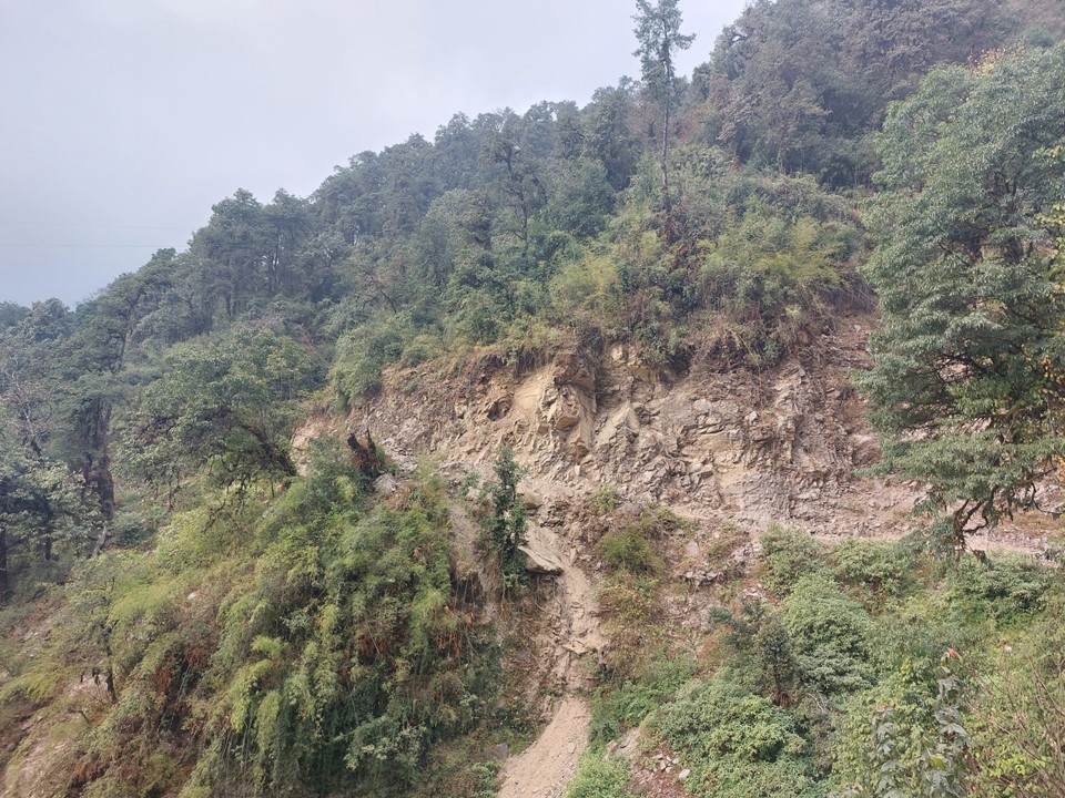
One aspect of hiking in Nepal is the amount of erosion one sees. It is well documented that landslides are a regular occurrence here – but it is one thing to read this in a book, and another to consistently see banks that have recently collapsed. It is also a bit unnerving to walk under banks like this that have collapsed. A hiker was killed in the Everest Region in October 2022 in a landslide, not to mention that many locals die to this each year.

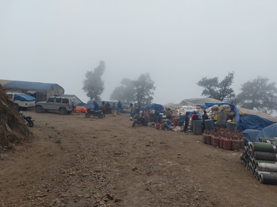
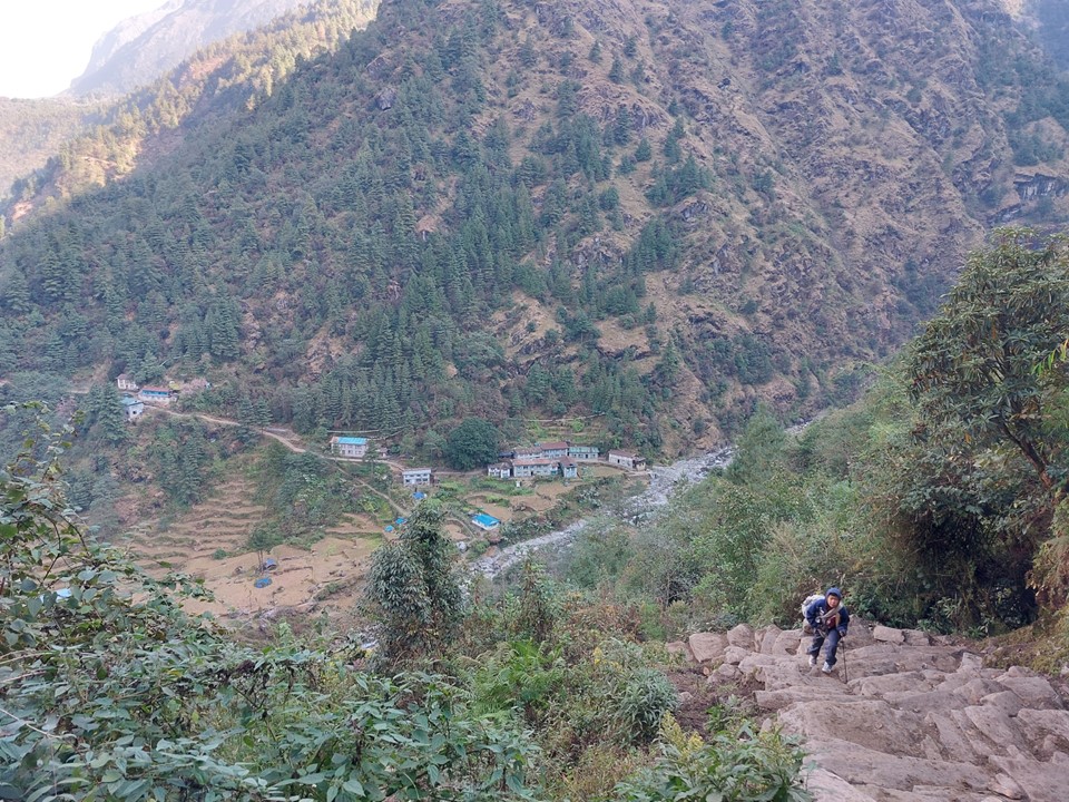
I eventually reached the end of the road. It looked like a market, with empty gas bottles coming down and full ones going up. While some food is grown on the route, most is carried in, and this is where it is brought before it is loaded on pack animals to resupply the towns of the Solu-Khumbu Region, or The Everest Region, as its known to tourists.

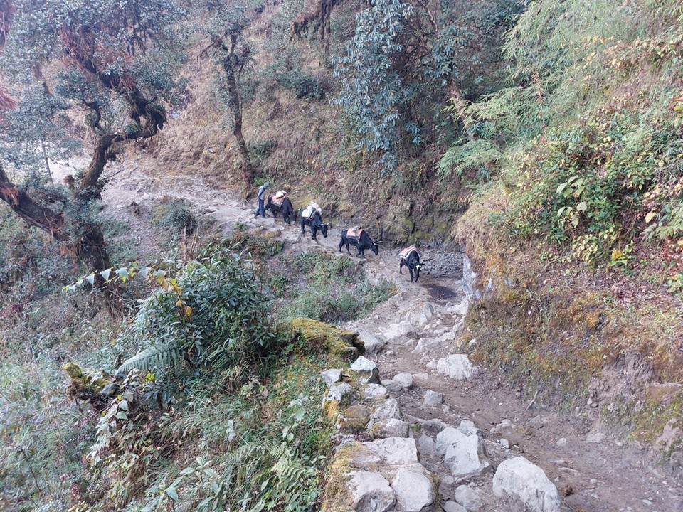
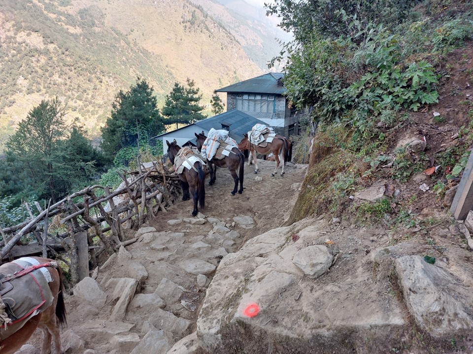
There is a warning that this section from the dropoff point to Paiya is very slippery – and as it turns out the reason for this is that its covered in animal droppings. I very quickly found myself caught behind a train of mules, and would be stuck behind this for over an hour.
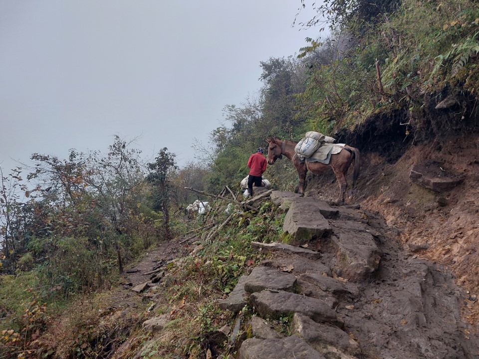
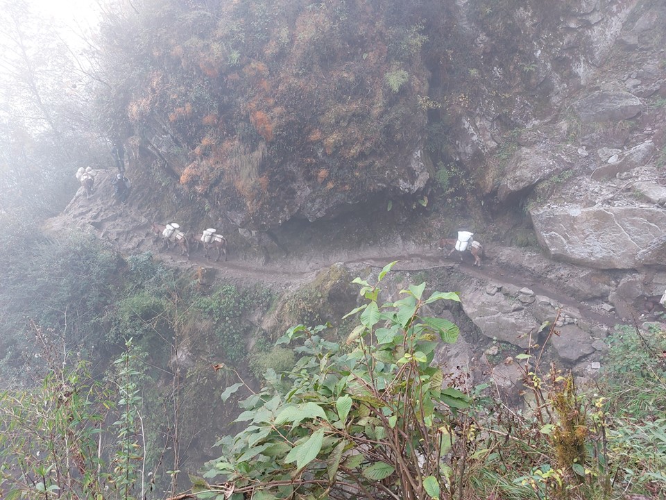
At times there would be massive drops next to the trail, and the trail would be very narrow – so walking past the animals was not easy. While I would generally be walking faster than them, it had been a long day and I was tired, so I couldn’t just run past them.

At one point the person handling the animals was walking past a mule and the mule pushed him off the ledge. In a surreal moment I watched this personal grab a tree while falling, haul himself back up and give the mule a few hits to keep going – as if nothing had happened. There was a rather substantial drop off next to the trail at the time – if he hadn’t grabbed the tree so quickly, he very likely could have died, or at least been badly injured. I imagine this has happened to him before and he probably is very selective in when he walks past the animals – but this reinforced further why I had not made an effort to get past the animals.
A local coming the other way asked me where I was spending the night – I said Paiya. He looked at me and said it was too far, I must go back. There wasn’t much daylight left, so I took his point and realised I needed to get past the mules. On a steep uphill section, I decided to find whatever energy I had left and power up, naturally staying between the mountain and the animals so I would not be pushed off, and eventually was out of breathe, but at least I was now in front of the mules.
There is a small waterfall about 500m before Paiya, and there was a tea house next to it – so I decided to stay there for the night. At NR200 for the night (R30/$1.50), it was the cheapest tea house I would stayed in on the trek (well, aside from the one in Chuckhung that allowed me to stay there for free).
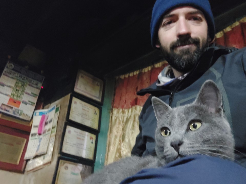
The son of the owner had lived abroad asked me if he could practice his English with me. He told me about the history of the region, local politics etc. Very interesting.

It had been cloudy all afternoon, so when I left early on the cold morning, I was happy to get an update of the local scenery.
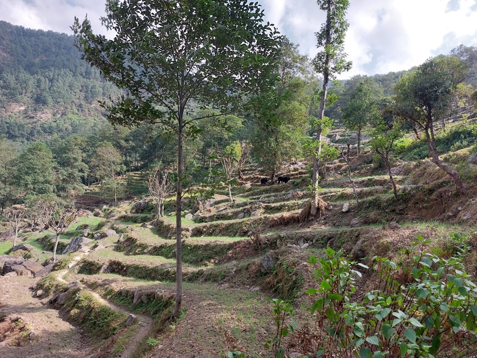
I was now properly in the mountains – there are no more roads, although there are power lines, so electricity is still available.
The upside of an early start is getting above the lower ground before its too hot. This would be the last day in a while where the heat of the day would be a problem, though!
The route from Paiya is best described as a lot of up and down – you climb 500m and then drop steeply down to a river shortly thereafter. By this point I had already decided that I would not be hiking back out this way unless I absolutely had to. I would rather catch the Lukla flight. For those considering this option – the hiking before Lukla is nowhere near as scenic and is on poorly maintained trails. Unless you are trying to reduce costs or have a lot of time, it is best avoided.
I soon found that the aircraft coming in were basically overhead, and thus knew I would be passing under Lukla soon. Lukla is placed high on the mountain, so approaching from Paiya you don’t actually go through the town.
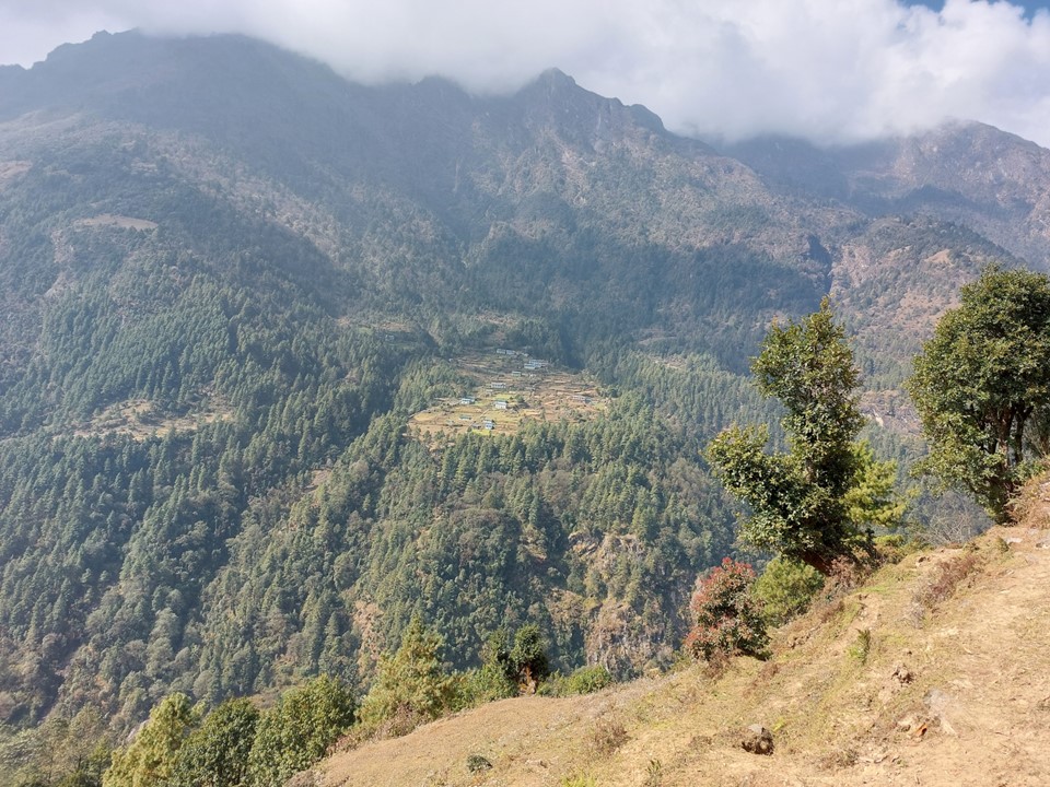

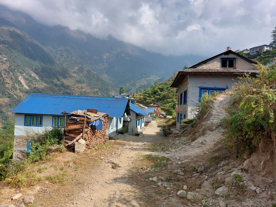
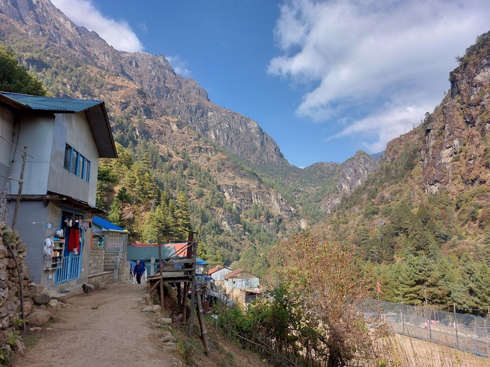
Once you pass Lukla a few things change – the trail quality improves dramatically, but the number of tourists also increases dramatically. There are suddenly tea houses every 500m as well. The scenery also improves dramatically – I was finally looking at the peaks and thinking “this is what I came here to see”.

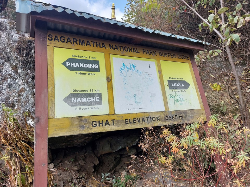
In the town of Toktok you buy your municipal permit, which is a card with your personal detail stored on it. This is basically used to track where you were last seen, so if you go missing it is easier to search for you. It also serves as an identifier if you should pass away for whatever reason, as they can simply scan the permit that is on the body and retrieve data such as your emergency contact back home.
In one of the small towns between Lukla and Namche I managed to find an ATM, and drawing more cash, I knew I would now be fine for cash for the rest of the trek. It can be really unnerving when you are in a foreign country and have no means of getting more cash, so this was a huge relief.
At Monjo you finally reach the gate of the park. This is where you pay your second permit fee. The permits are NR5000 (R700/$40) in total as at November 2022. Entering the park is another dramatic change – the number of tea houses decrease and the scenery starts to really pick up!


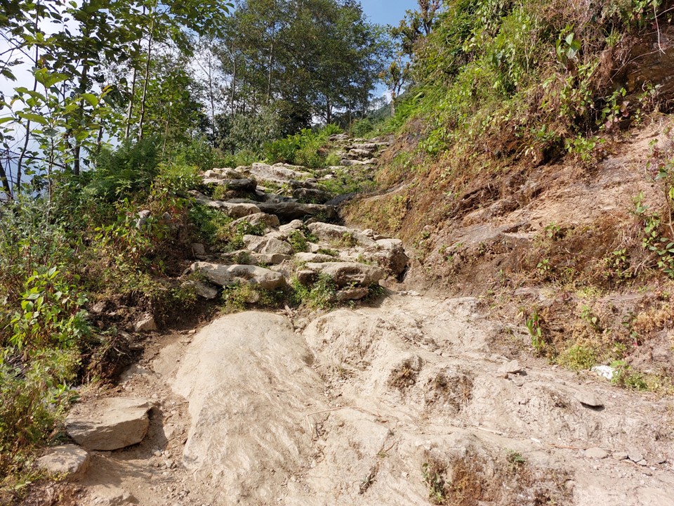
My original plan, back when I was going to fly into Lukla, included doing Lukla to Namche in a day. Many people had told me this was unrealistic. Attempting to do Paiya to Namche in a day would be even more heavy, especially with the big hill one has to ascend to reach Namche (roughly 700m elevation gain). However I had misread the map, assuming I could stay in Larja Dobhan – only to reach it and realise it was a temple that was marked on the map, and there was no accommodation there. So, once again knowing that arrival after dark was possible if I didn’t pick up my pace, I began the ascent to Namche.
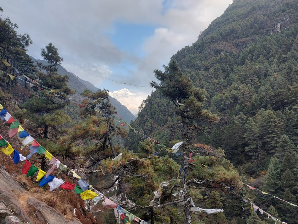
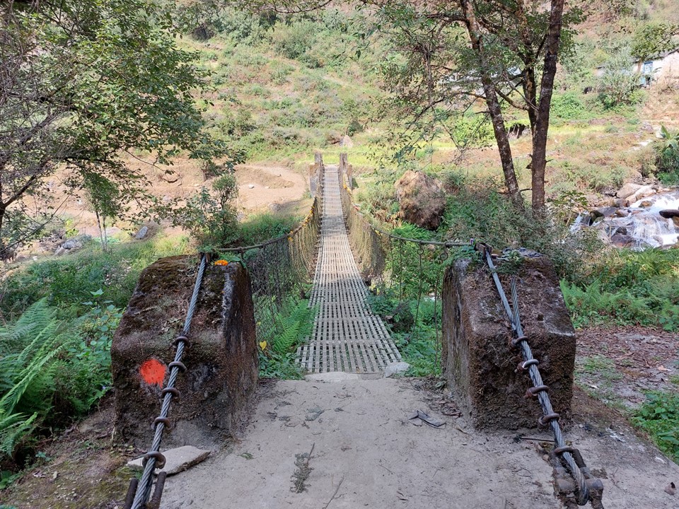
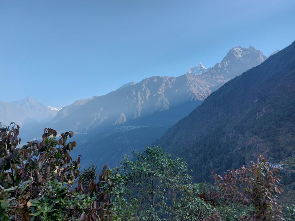
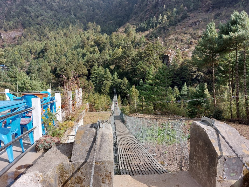
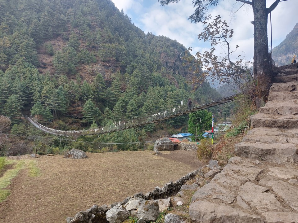
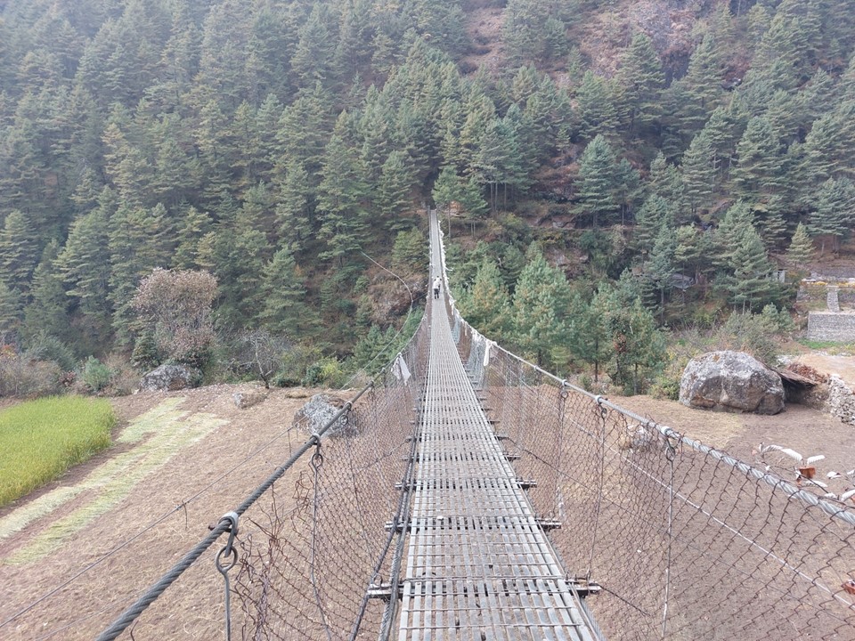
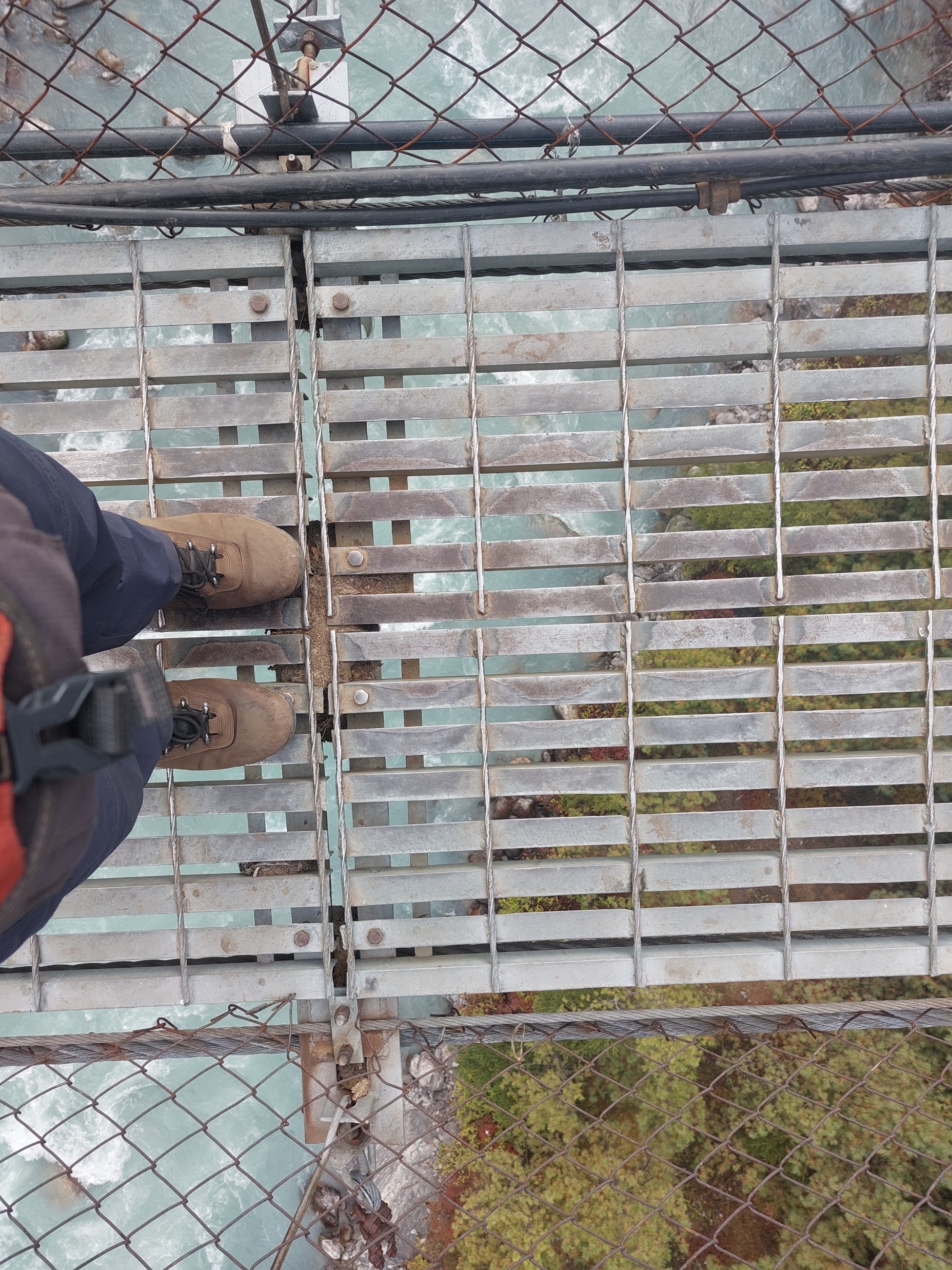
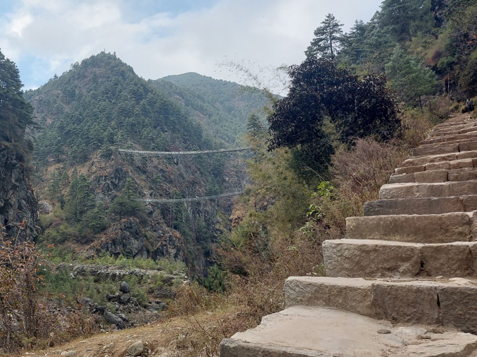
About halfway up the hill, one has to cross one of the most daunting bridges on the trek – the famous Larja Bridge, which is 136m long above a 70m drop. This would usually be the first view of Everest, but with the cloud about, I didn’t expect to see anything. On looking up I would see a peak sticking out through the cloud – which I would later learn is Tabuche, a sacred mountain. Little did I know that this peak that I had never heard of would become one of my favourites over the next few days!

The hill up to Namche is an absolute killer. I get why people don’t attempt to do Lukla to Namche in a day – ending a long day with this ascent is no joke! I started reasonably strong, but by the time I hit 3000m elevation, I was stopping every 50m elevation gained. I had some sweets with me for exactly this purpose, which gave me just enough energy to power up the hill.
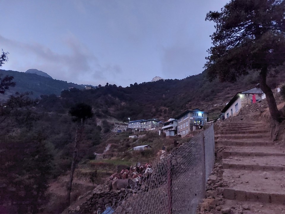
I reached Namche as it was getting dark, so I stayed at the first tea house as you enter the town. I had somehow managed to get from Phaplu to Namche in two days – albeit with the first 20km being cut off by jeep. I was very happy to be here – Namche is one of the most iconic mountain towns, a place I had read about for many years.
There was one other person staying at the tea house, Namgyal Sherpa, who has climbed Everest, K2 and Ama Dablam multiple times. Always great to meet a legend like that!

Overall it had been a near perfect start to the trip – but the meat of the trip was about to begin!
Stats for the first two days:
Day 1: Phuleli to Paiya, 17km with 1584m elevation gain and 673m elevation loss.
Day 2: Paiya to Namche, 30km with 1863m elevation gain and 1243m elevation loss
