One of my ongoing projects is to attempt to climb all 24 mountains in South Africa with at least 1000m topographic prominence. The list contains 18 Western Cape peaks, 3 Eastern Cape Peaks and 3 Limpopo peaks. The closest peak to my house is the high point at Marakele National Park. The official Government Survey Maps don’t have a name for it, so I refer to it as Marakele.
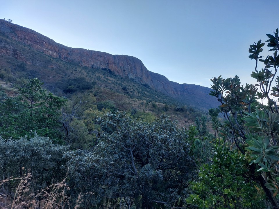
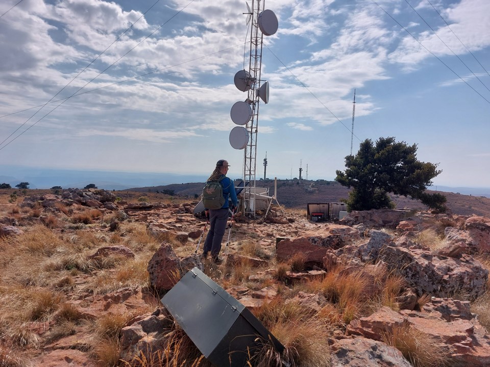
Figuring how to access this mountain was an interesting process. The summit is on the border of Marakele National Park. As it turns out, the Mountain Club of SA (of which I am a member) owns land in the area as well. On the north side one can drive to the Lenong Viewpoint in the nature reserve, but driving most of the way up a mountain feels like cheating, or at least doesn’t earn one much of a sense of achievement. If accessed from MCSA land, there is a mountain pass with a bit of climbing called Groothoek Gully. This combined with the bush camp at the bottom of the mountain made this approach the obvious one.
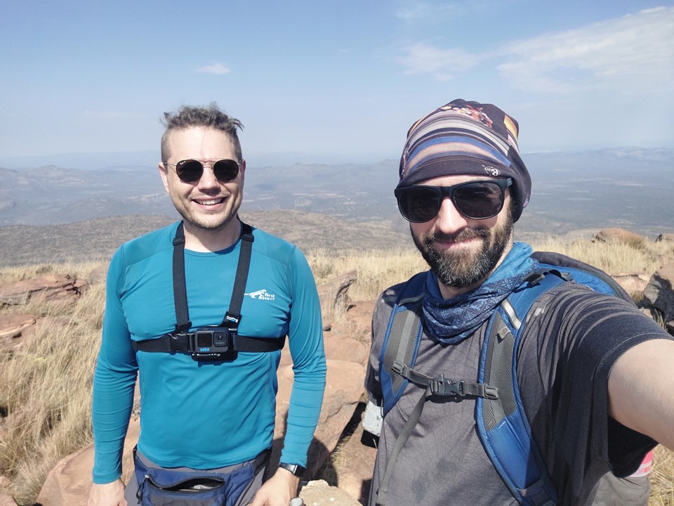
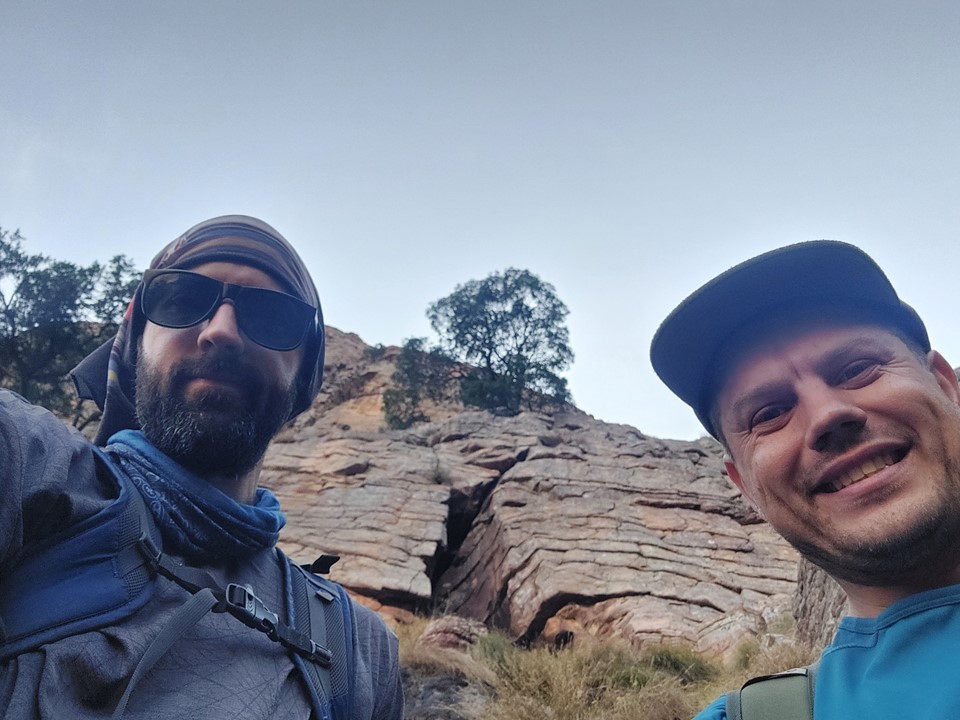
When Rudi told me he’d be up in Jo’burg for a few days for work, I suggested we team up and head to the MCSA Kransberg property and attempt this peak. I had just done Makoaneng the weekend before – if I could summit Makoaneng and Marakele on consecutive weekends, that would be two peaks of great significance for me over a very short duration.
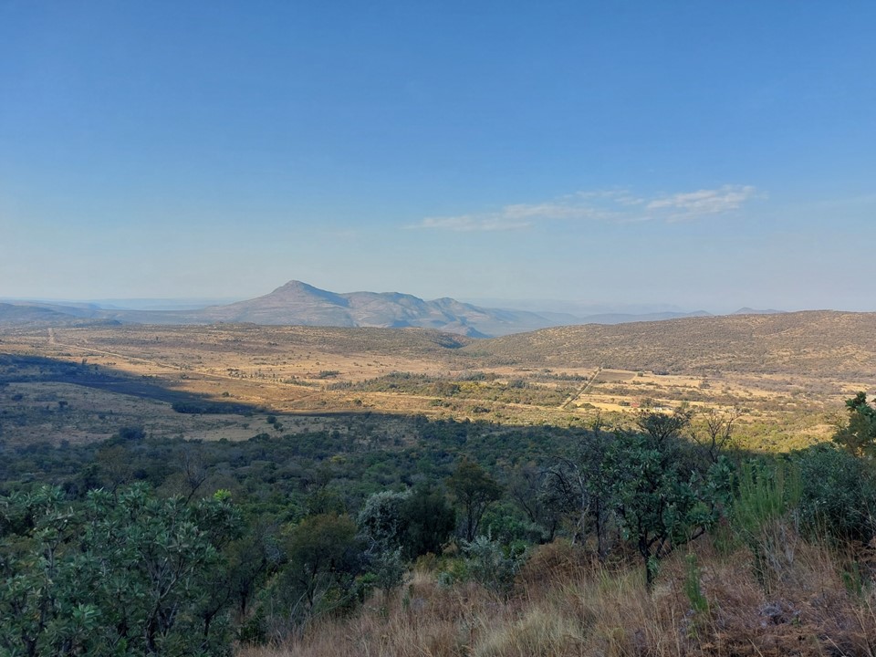
Also notably – in 2004 when I participated in a wargames tournament in Potchefstroom, I had visited 8 out of 9 of South Africa’s provinces – but Limpopo eluded me. Driving into South Africa’s most northern province to climb this mountain meant I had finally ticked off the last one, and it had only taken an additional 18 years! Incidentally I have been in all 9 provinces between December 2021 and July 2022 – and have hiked in all but Mpumalanga and Free State during that period. At the date of writing this, Mpumalanga remains the only province in the country in which I have never done any hiking. To complete the highest point in each province, I just require Limpopo, Mpumalanga and North West. Digressions aside!

We had been told that the road to the camp was doable with a high clearance vehicle. My previous car, a Corolla, frequently crashed into small speedbumps on well maintained roads and was thus unquestionably unable to drive here. My new car has considerably better clearance – but on seeing the road I would have to drive up to get to the campsite, I realised this car wouldn’t do it either.
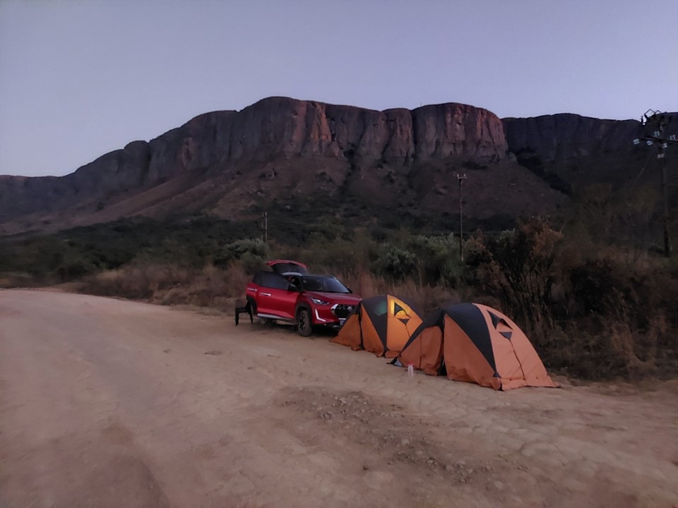
So instead we camped by the side of the road. Being in the middle of nowhere, we didn’t assume we’d have any problems. We did have a number of animals eying us out, we could only see their eyes so identification wasn’t really possible, though. It is notable that there are lions in this region (although we definitely didn’t see those), and we were aware that all the game fences on the opposite side of the road were aimed at keeping animals on our side of the fence. Nonetheless, the worst aspect of this night was how hard the dirt road actually was – a tent peg wouldn’t go into the ground, and it was like sleeping on concrete even with an air mattress.
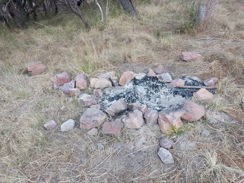
We set off just after sunrise. Even in winter Limpopo days can be very hot. We started by walking up the road to find the MCSA campsite. “Campsite” was an overstatement – moderately flat ground with a marked fireplace is more accurate, although we did know this beforehand.
We reached the campsite fairly easily, although it was further than expected. It clearly doesn’t get much use as the road to it included multiple large bushes – my car didn’t stand a chance of getting there.

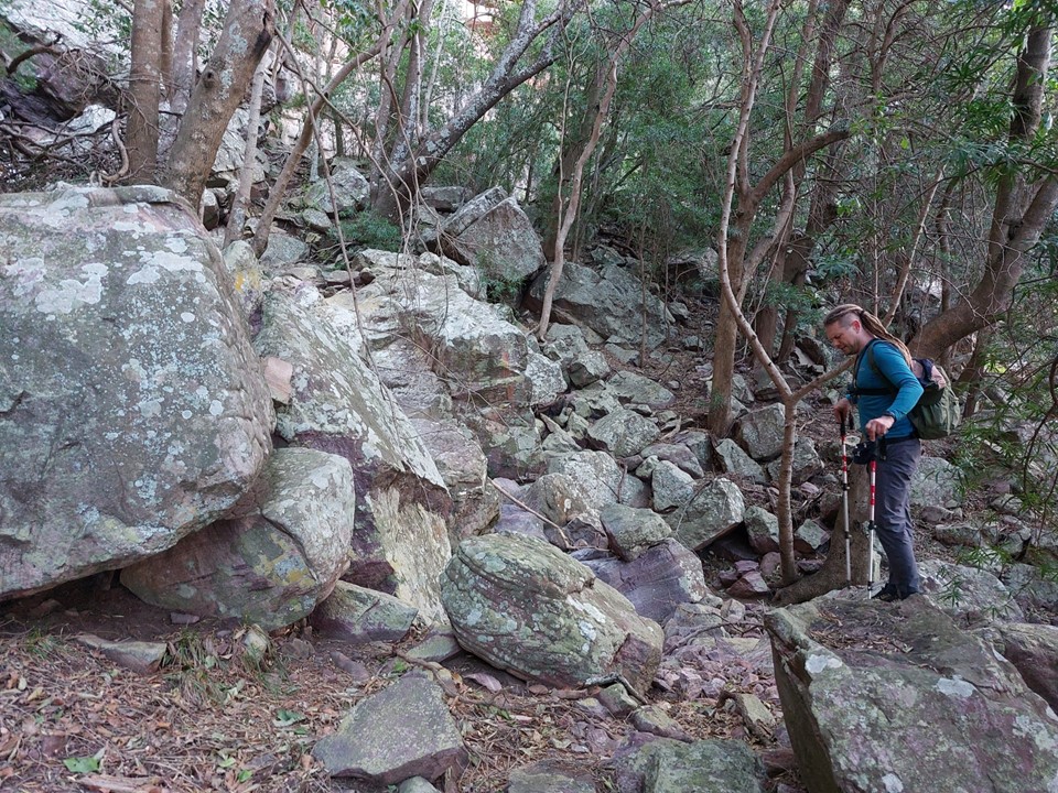
From there we followed the directions to get through the thick overgrowth, which initially went very well – but without a proper trail, progress was slow.

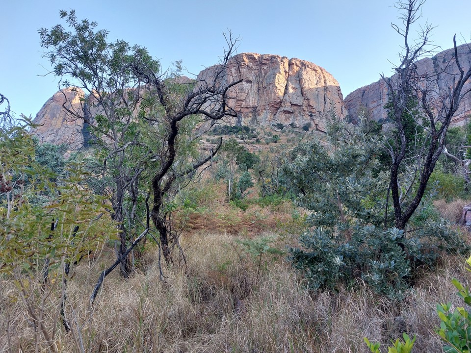
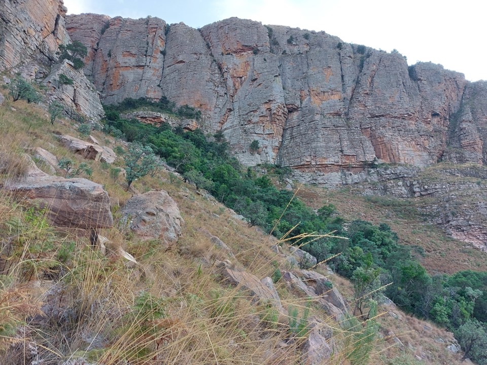
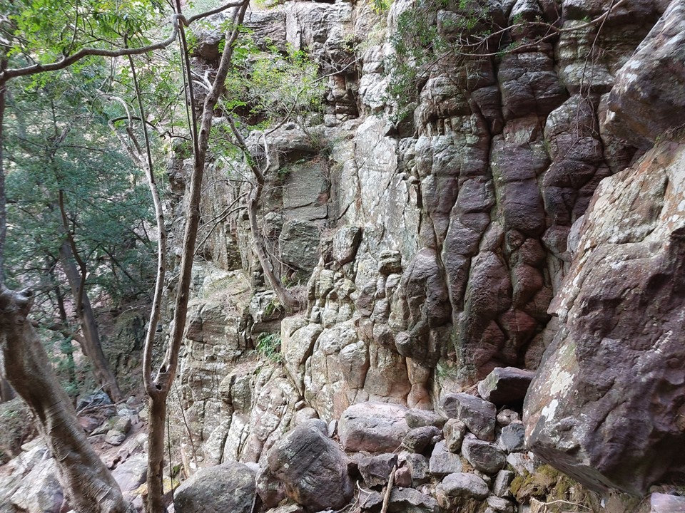
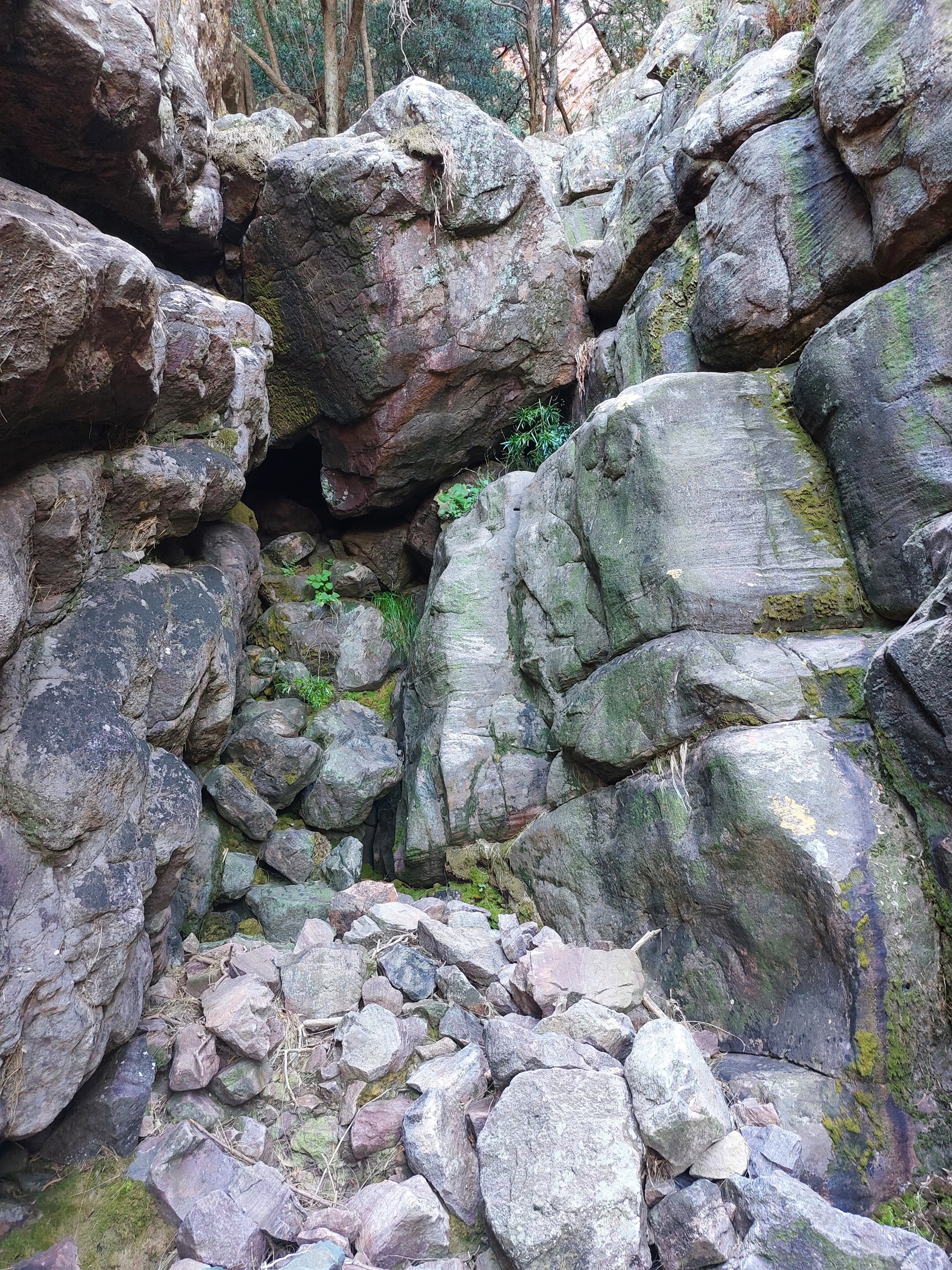
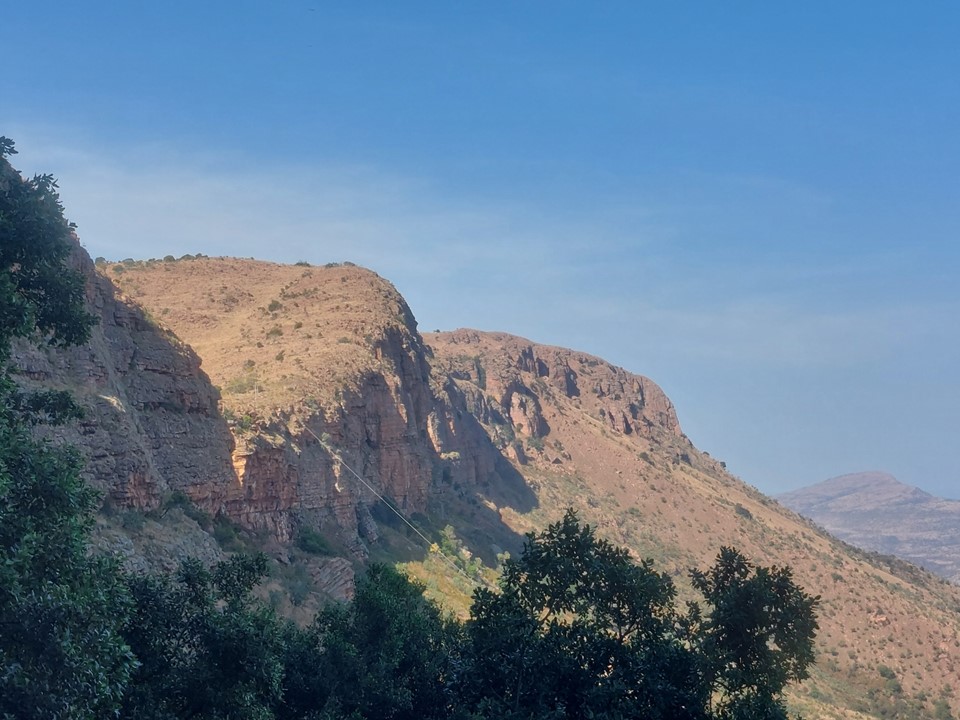
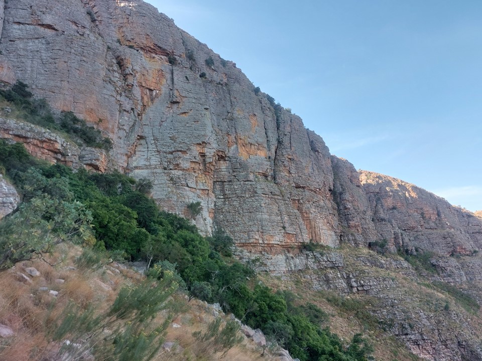
The cliffs are really impressive. I wouldn’t mind returning to the venue (in someone else’s car ideally) and trying out a few of the easier multi-pitch routes. We did have climbing gear in the car, but after sleeping on the road for the night, our plan was to head home on Saturday afternoon to avoid sleeping on a road a second night.
As we got further, the overgrowth got worse. Progress was very slow, and the day was already starting to get hot. I didn’t get many photos of the overgrowth, unfortunately.
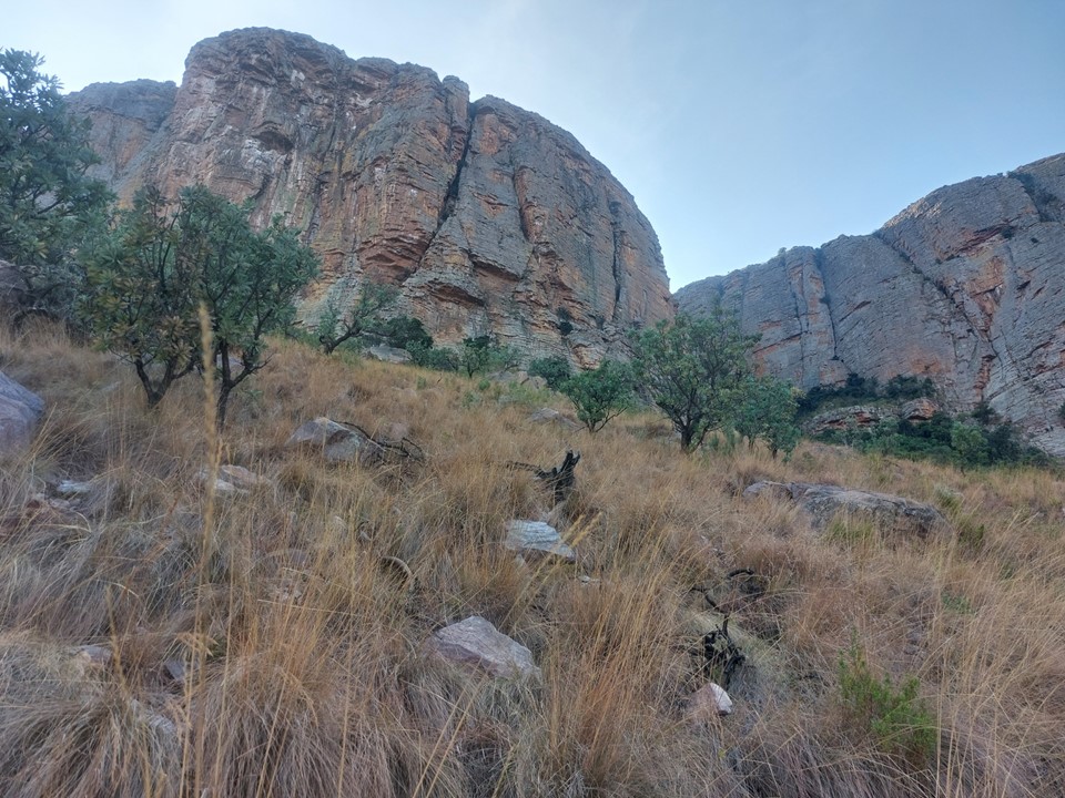
Eventually the route emerges from the overgrowth to reach a steep grassy slope with loose gravel underneath. Progress up this was still slow, but at least we were gaining altitude now.
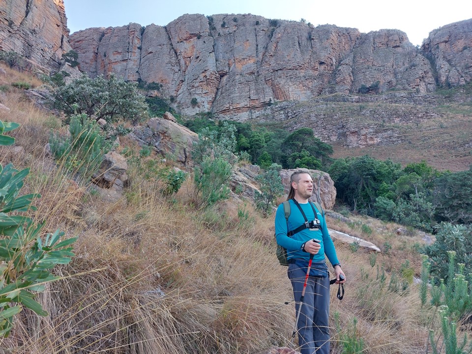
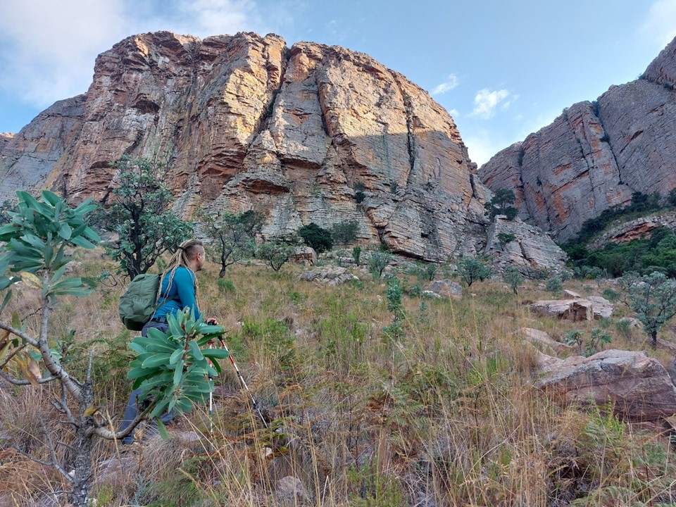
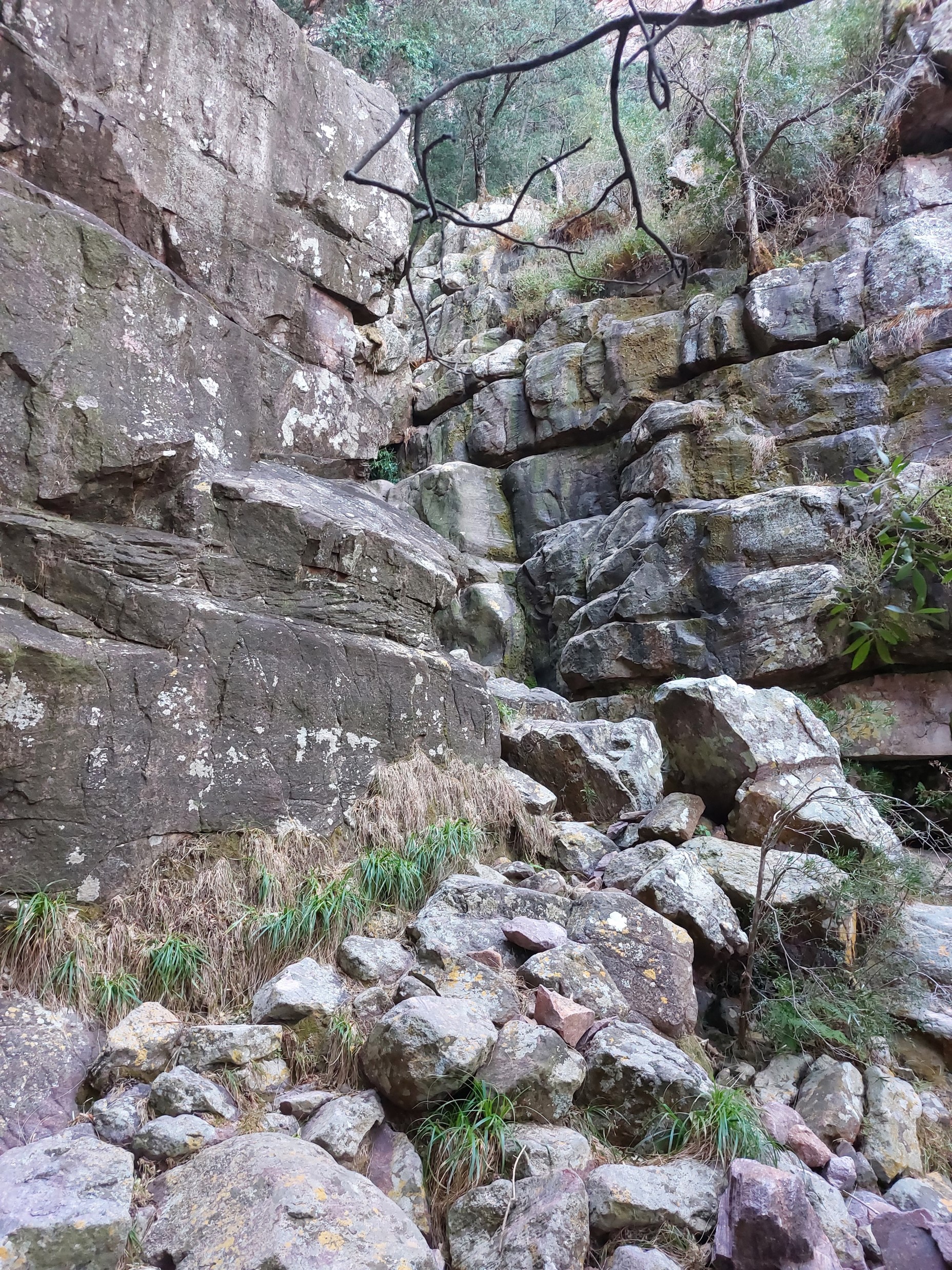
The cliffs are really imposing as you get closer – it is a spectacular venue.

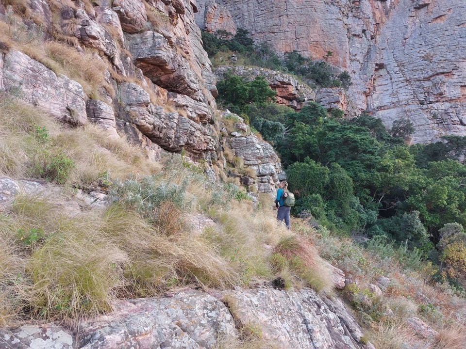
We eventually started traversing under the cliffs to access the gully.
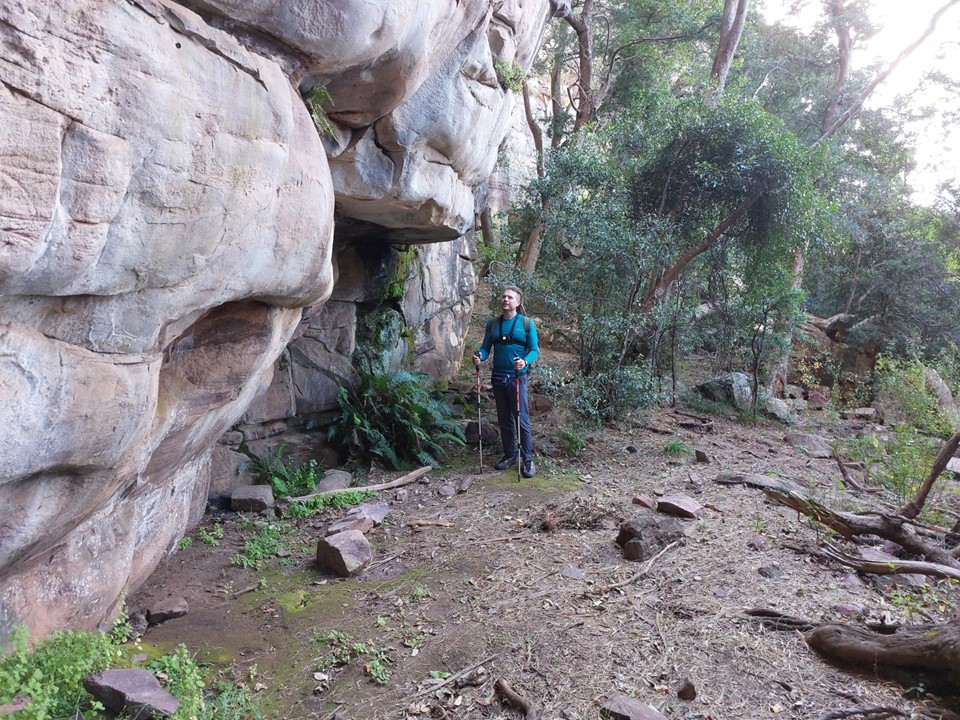
The route description mentioned a cave at the bottom of the cliffs with a spot to collect water. This spot looked great – a long weekend at this cave with some climbing and relaxing in the mountains would actually be great!
We knew the route was graded a D (around 8 on the old SA trad grades, or around 5.3 on YDS). The problem with these older graded routes is that D could mean trivial scrambling or super exposed long scrambles where a rope would be useful. The supposed D pitch on Sentinel Standard Route in the Drakensberg is 20m long with only one gear placement and felt a lot harder than the grade suggests. My point being – I have learned not to assume a D will be trivial.
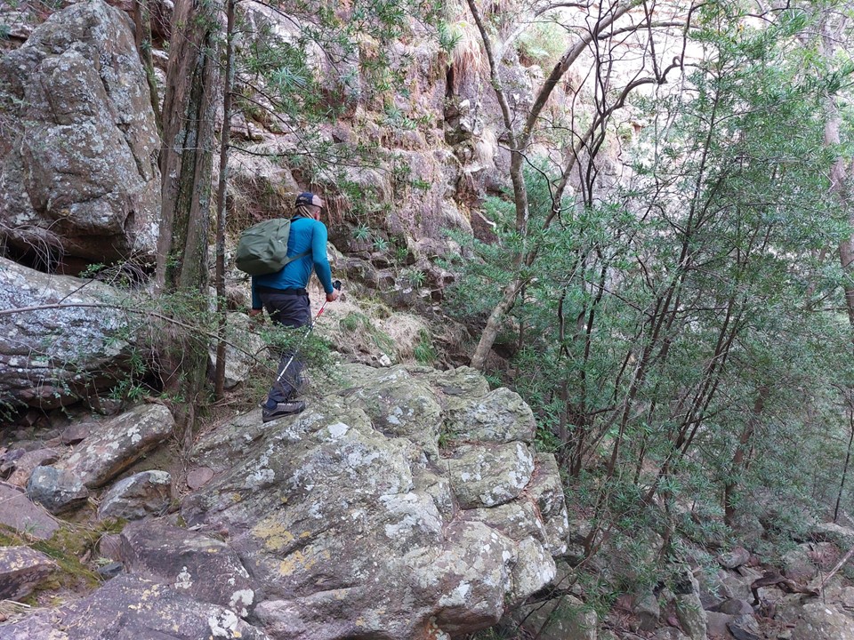
Nonetheless, the early scrambles were in fact trivial. You could hurt yourself if you pick the wrong line or slip – but if you are careful it isn’t an issue. The crux, however, was not trivial.
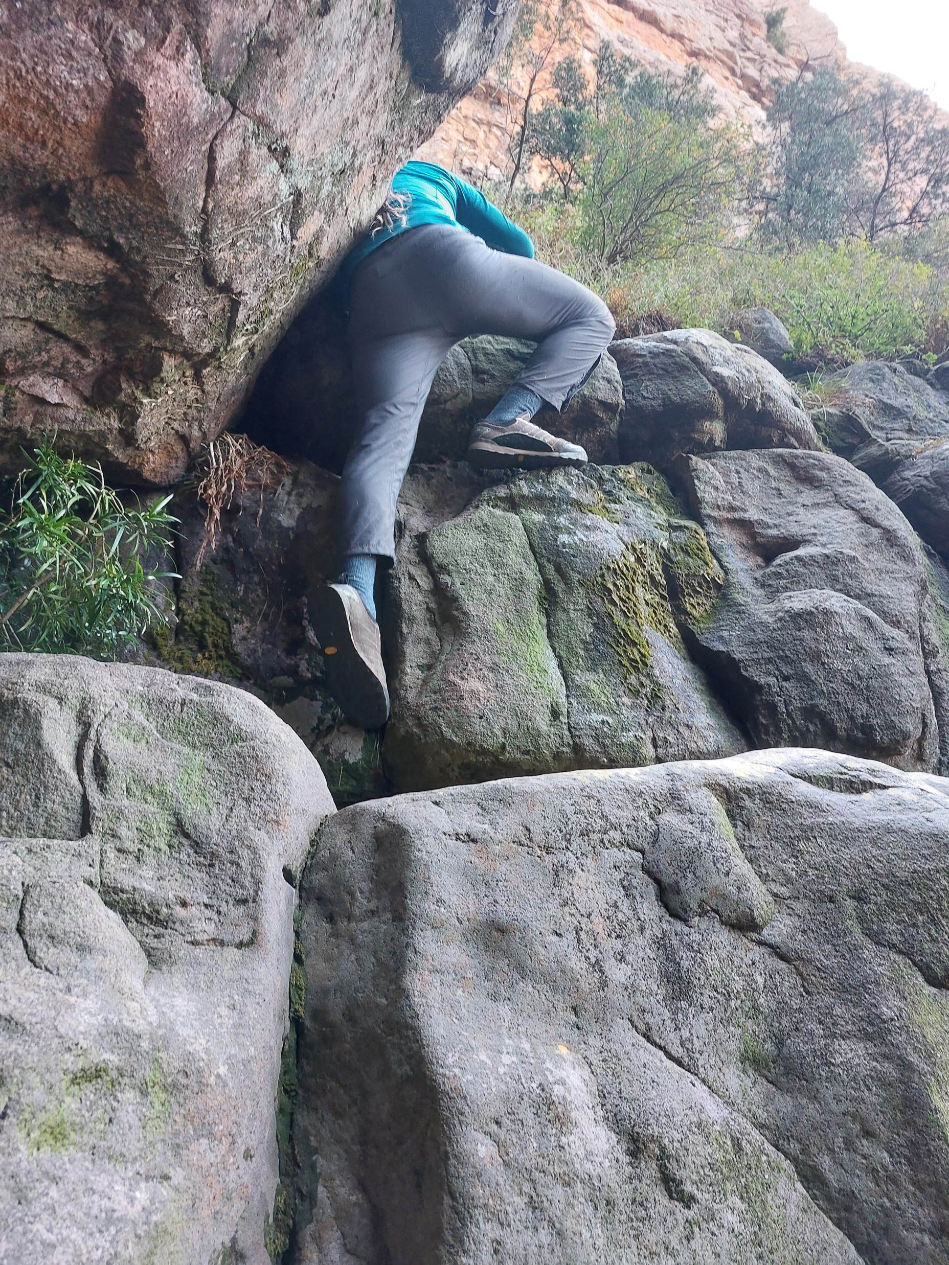
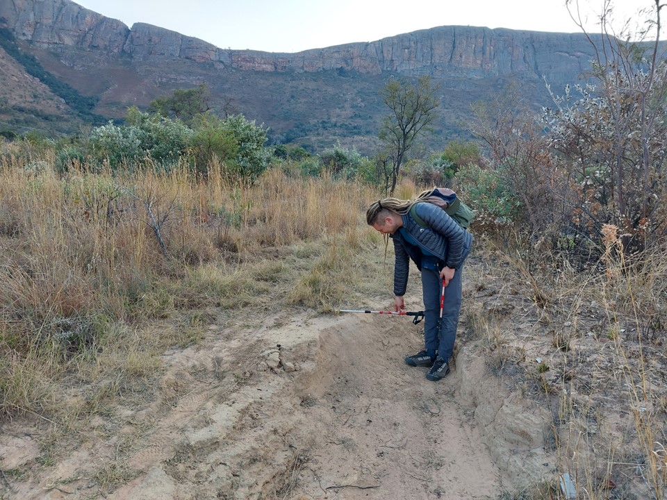
The above photo of the crux doesn’t really capture what its like. The sequence is about 5m high, with the bottom 3m being really easy. The final move requires a fairly big step up on off-balance moves with a boulder above in the exact wrong place to ensure your balance is off and no useful hand placements. It is just high enough that a fall could end badly, and just awkward enough that a fall could happen. We hauled packs up this section to make it a bit easier.
The rest of the gully was steep and required considerable effort – but was not bad at all.
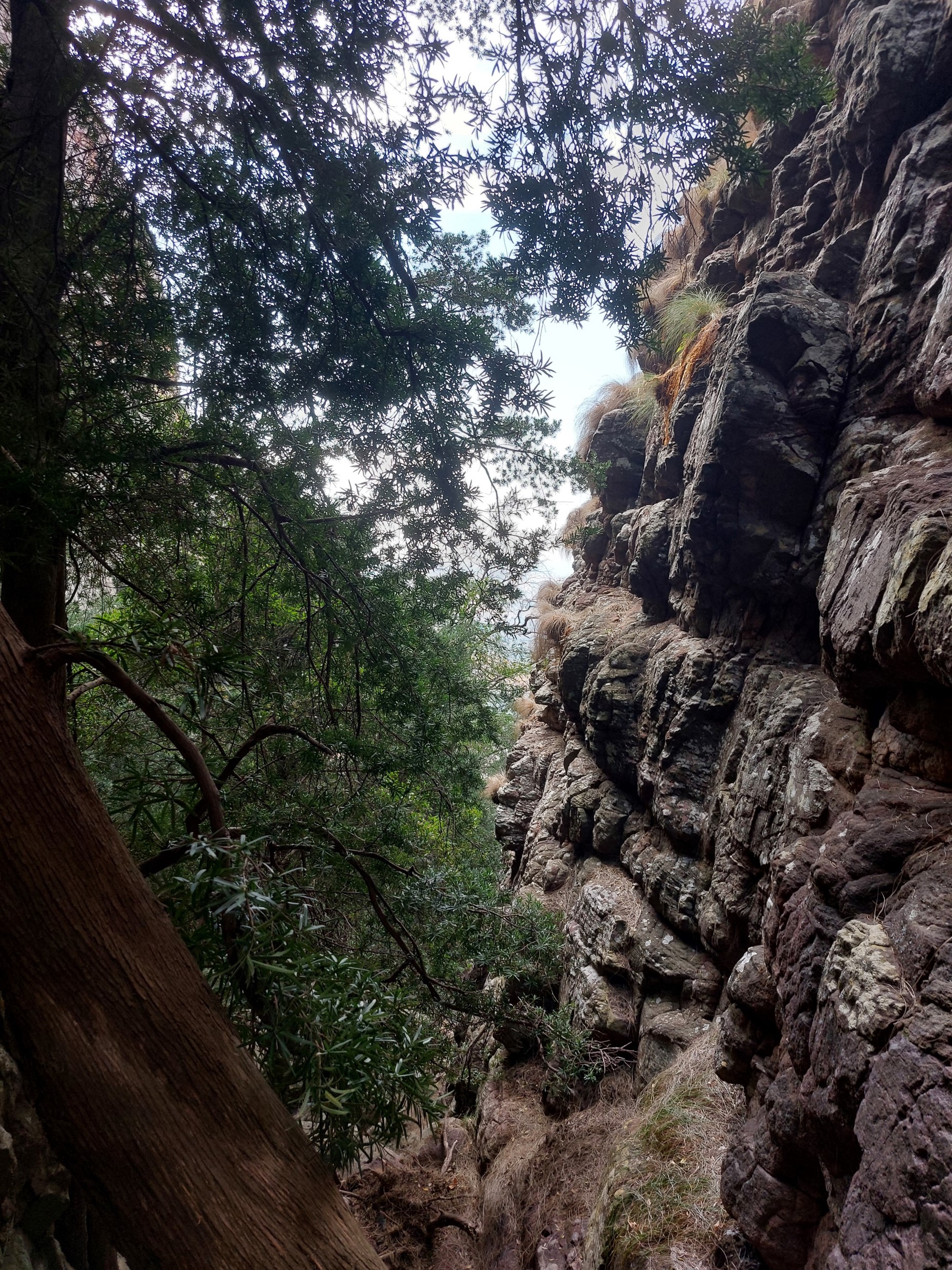
We soon found an escape from the gully to get onto a grass slope. The views of the cliffs from above were amazing!
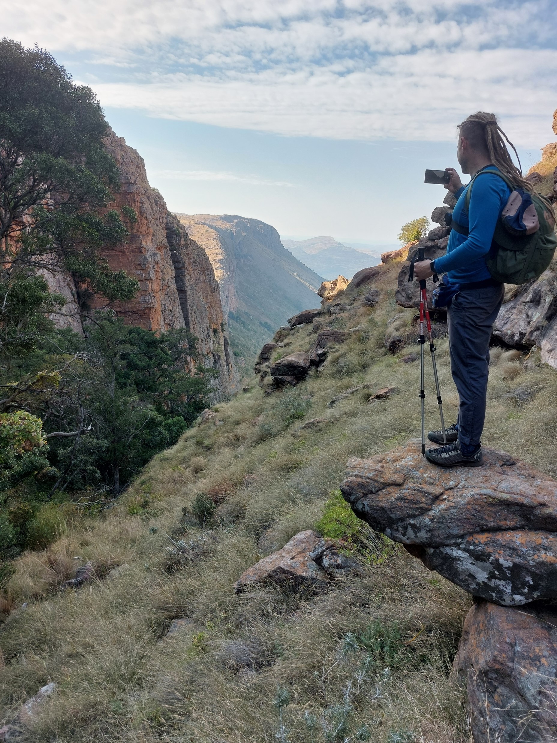
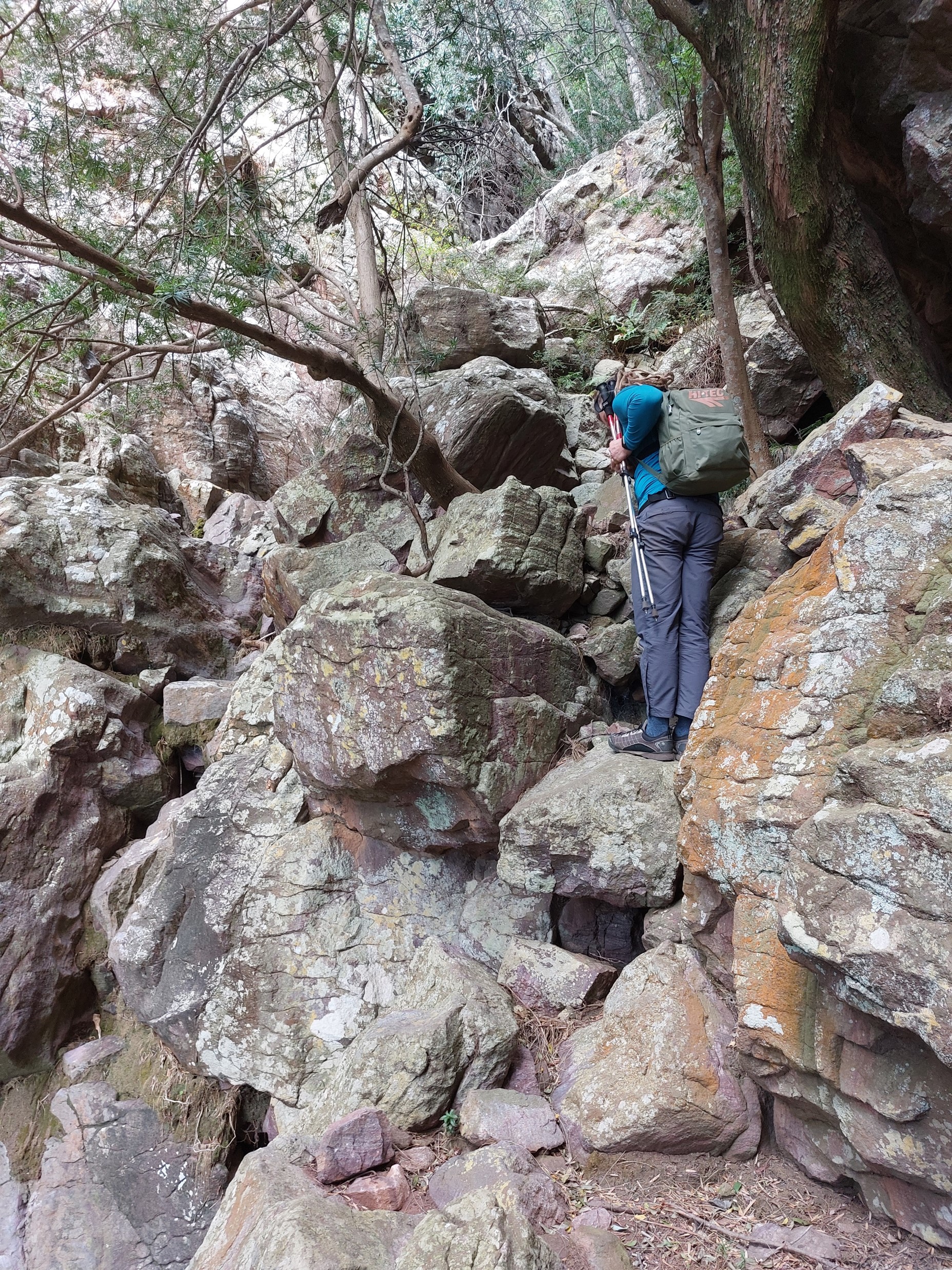
There’s an old saying in mountain circles: it’s always higher, further and harder than it looks. This next section would teach us a lesson in this, admittedly a lesson I have been taught many times! No trail on rocky uneven ground is never easy.


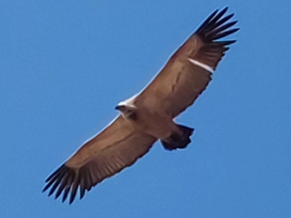
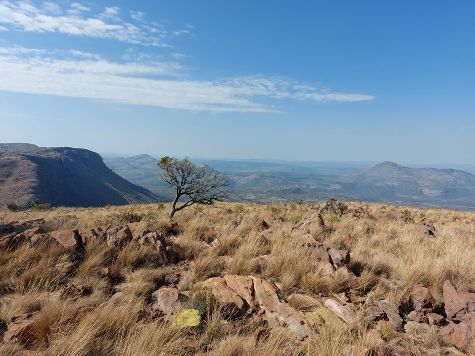
With roughly 30 vultures circling overhead to encourage us, we eventually reached the summit just before midday. The supposedly trivial peak had not been so trivial after all! Nonetheless – that’s peak 14 out of 24 done.
The top section of the descent was harder than the ascent – as is often the case. Steep grass can be troublesome at times, especially when near big drops. We found the spot we had exited the gully, and used it to reenter, which got us to much easier rocky ground.
When we reached the crux, I was happy to be carrying a light rope. I rigged an abseil and we used this to get past this section. The photo above illustrates what I referred to earlier regarding the crux – while the move itself isn’t too bad, the consequence of incorrect execution could be severe.
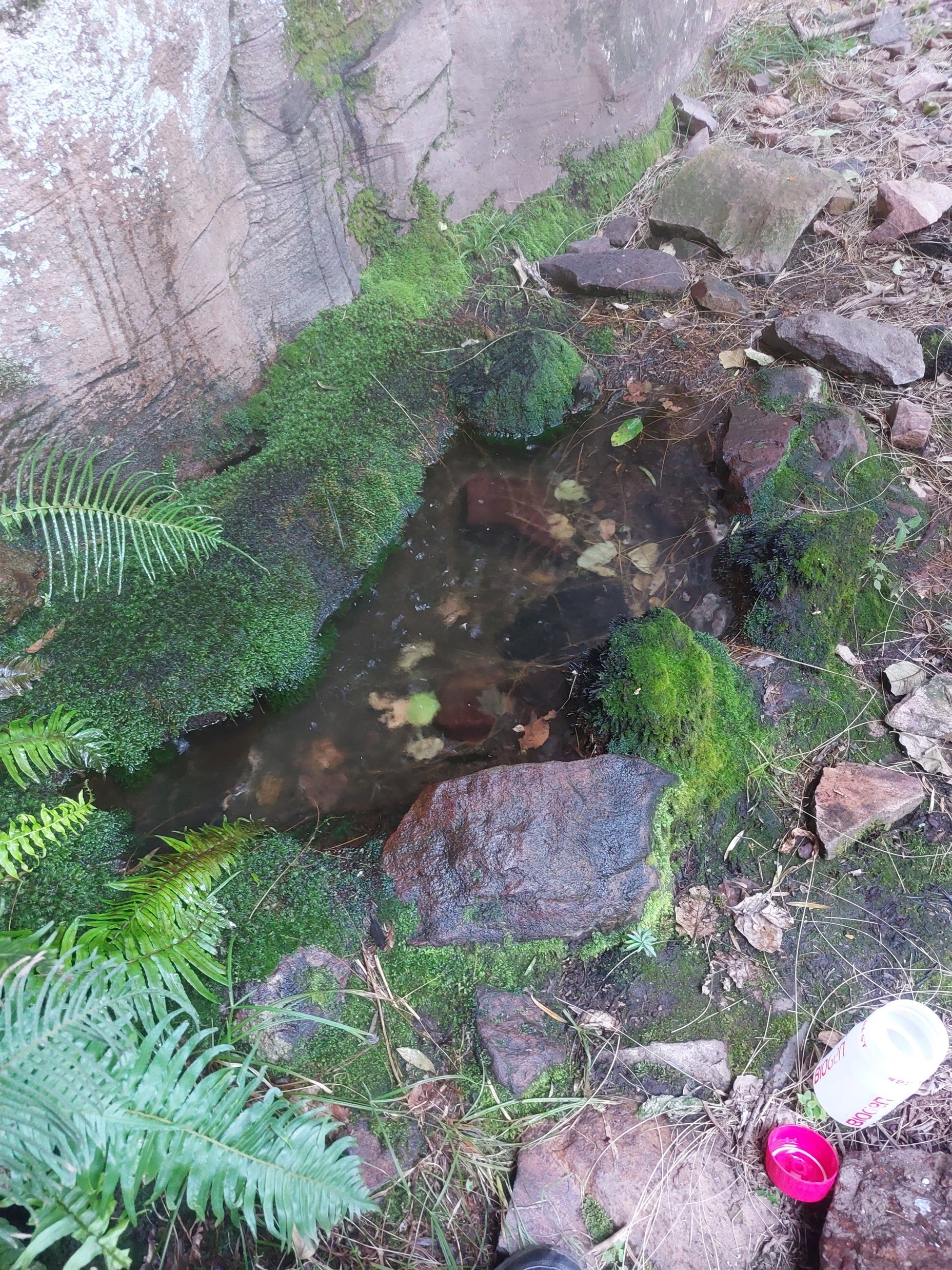
We filled up our bottles from the drip-pool by the cave before leaving the gully.
The initial descent down the steep grass/gravel slope wasn’t too bad. It was slow, but far faster than the ascent – as one would expect.

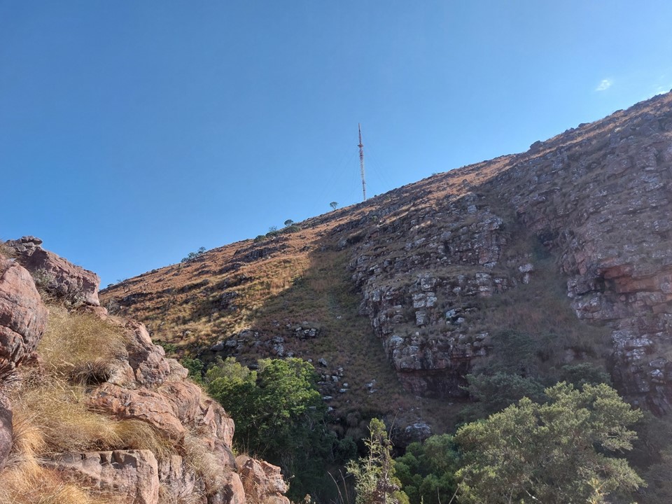
Then we hit the never ending overgrowth! I don’t know how long we spent pushing through this final section, but it was more than an hour. We eventually reached the section under the power lines and decided to just follow that line instead of trying to hit the campsite. The upside of this was that we popped out right next to the car and was not as bad as the alternative. It had taken us 9 hours to complete the 12km hike – which included 1200m of elevation gain and loss, which gives an indication of the difficulty of the route.
Overall a great hike. It was nice to be on ground that is so rarely used, yet simultaneously a good trail would have been great! If I go back, I wouldn’t mind starting from Lenong Viewpoint and descending Groothoek Gully to the cave, rather than trying to get climbing gear up to the bottom of the gully. Nonetheless – with a decent number of long easy climbs, it is a venue I would like to return to. The Waterberg is definitely a great place to visit!
