Much like most of my writeups, this one starts with me studying a map late on a Saturday night in October 2015. I had been looking at a list of peaks above 3400m in Lesotho – with nothing above 3300m on the Middle and Western Ridges, these peaks are generally shown on the Geoseries Hiking Maps – but a map of Lesotho I found online showed a peak called Makoaneng marked at 3416m on the Leqooa Ridge fairly deep into Lesotho, far enough to not reflect on the Geoseries Maps. After a quick look on Google Earth, I found the summit, which Google Earth also had as being above 3400m.
If a mountain is defined as a summit with at least 7% prominence relative to height, or if a hard cut-off of 200m prominence is used – Makoaneng is the 4th highest mountain in Southern Africa. There are a number of height readings for it, ranging from 3416m to 3425m. Prominence is approximately 356m.
The peak remained on my mind for years, and I knew I would inevitably have to climb it at some point. In 2018 Mike and I set off for Bushmans Nek on a Friday afternoon, but with a deep puddle across the road, we turned around and went to Garden Castle instead. We ended up starting later than planned on Saturday morning, and hiking up Rhino with a Canadian named Zuzka instead. While our intention going in was Makoaneng, by the time we left the car park we already knew the peak was off the table – although we did climb Tsepeng (3431m) that weekend, which was my second time on the highest point of the Leqooa Ridge.
Fast forward to July 2022 – Dave and I both found ourselves with a free weekend at the same time, and thus I found myself at Bushmans Nek. The plan was simple: Friday afternoon start up Thamathu Pass, getting as far into Lesotho as possible. Saturday try and follow the trails we could see on Google earth to get to the valley below the peak, this would include climbing to 2700m, dropping back down to 2400m and then climbing to 3416m, before having to reverse the route back towards the top of Thamathu Pass. Sunday would be a simple hike back out via Thamathu Pass, followed by the long drive back home.
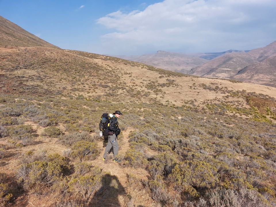
One aspect we were very aware of going in was that we were heading into unknown territory, we didn’t even know what the peak looked like. We picked a line and drew a GPS track off Google Earth, but what one finds on the ground rarely matches exactly what one was expecting. On the other hand, a team of two individuals with plenty of Drakensberg experience can usually find a solution to problems as they arise.
The trip was off to a bit of a late start with us only leaving Bushman’s Nek at 3:30PM. It was also a bit ominous with a number of Ezemvelo employees walking down the route with firefighting equipment!

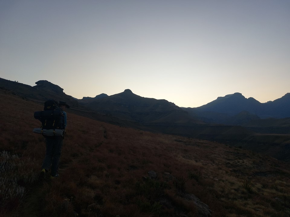
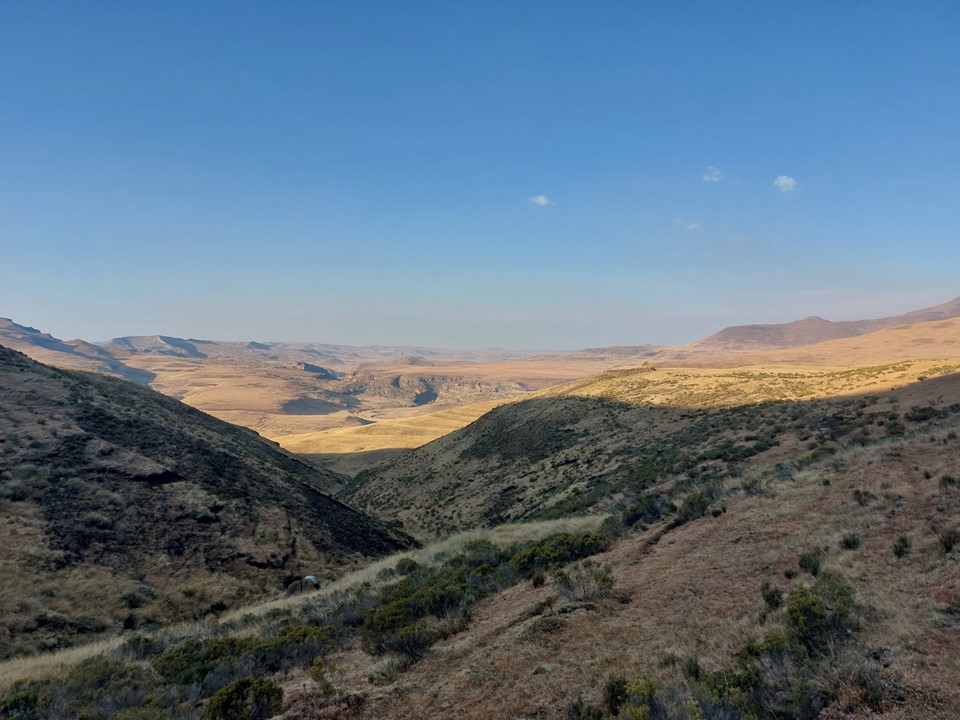
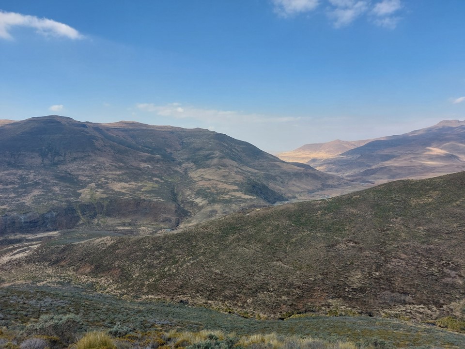
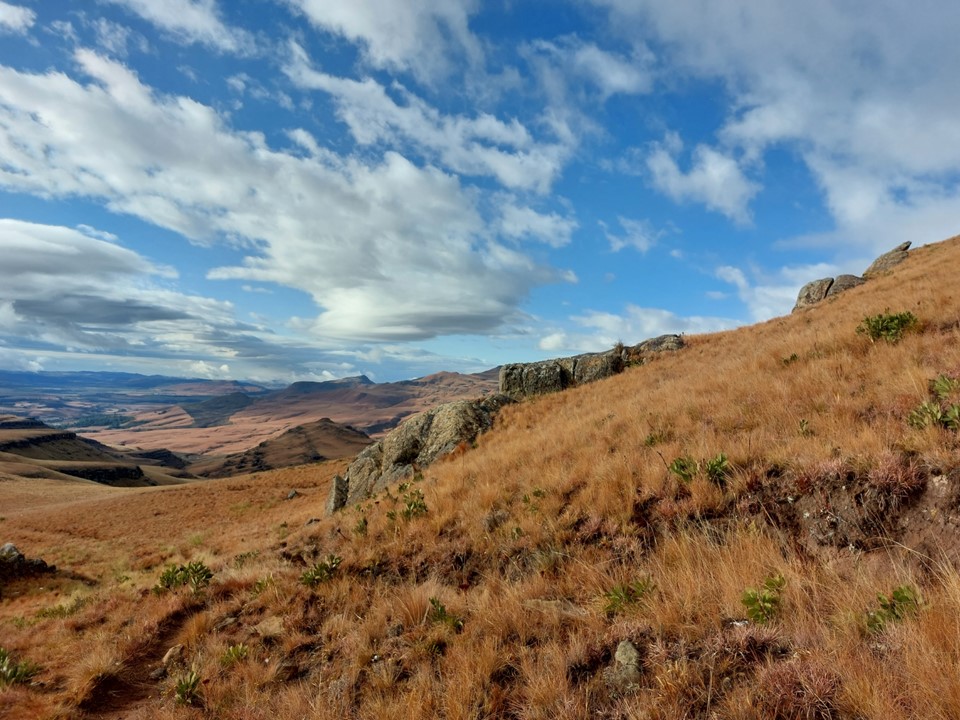
We made relatively fast progress up Thamathu Pass. To be fair, it is a very easy route, which was in no small part why it was the logical choice for this hike. One could make a case for doing it from Garden Castle, which would be similar in distance, but would either include a long time on top of the Leqooa Ridge or a lot more vertical.
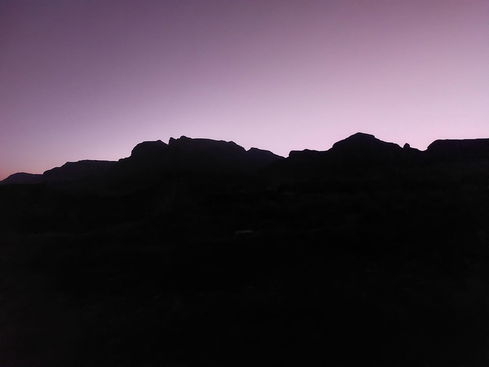
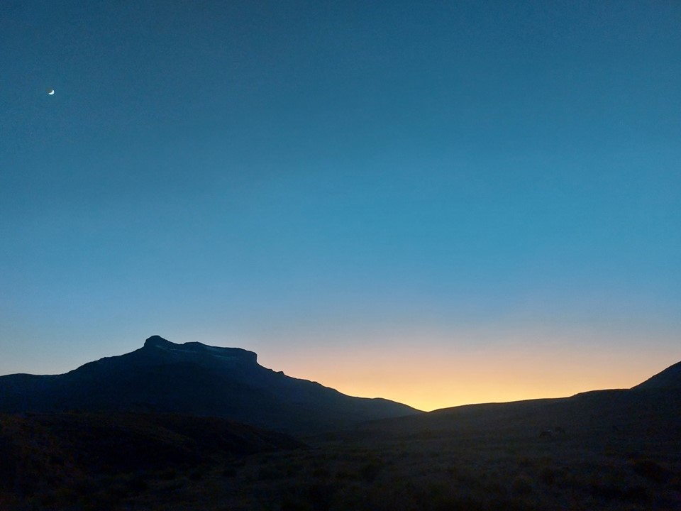
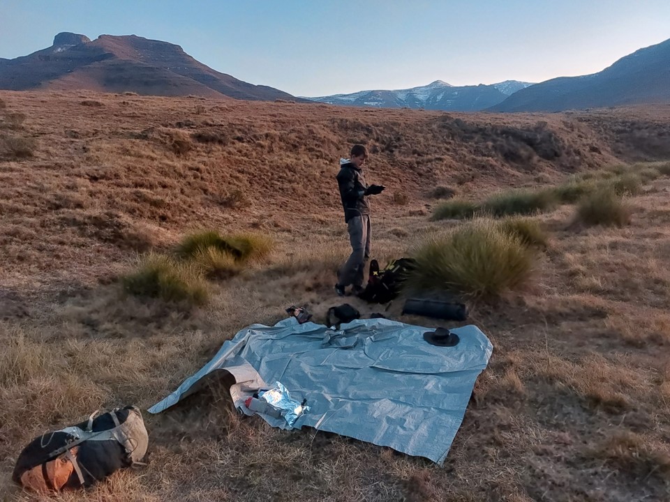
The sun went down between Thamathu Cave and the top, and we were under headlamp thereafter. With a GPS track following Lesotho paths, navigating unknown ground in the dark didn’t prove too difficult. We managed to get around 4km into Lesotho before we hit the turnoff from one trail to another. We found a flat spot near water but off the trail and pitched the tent there.
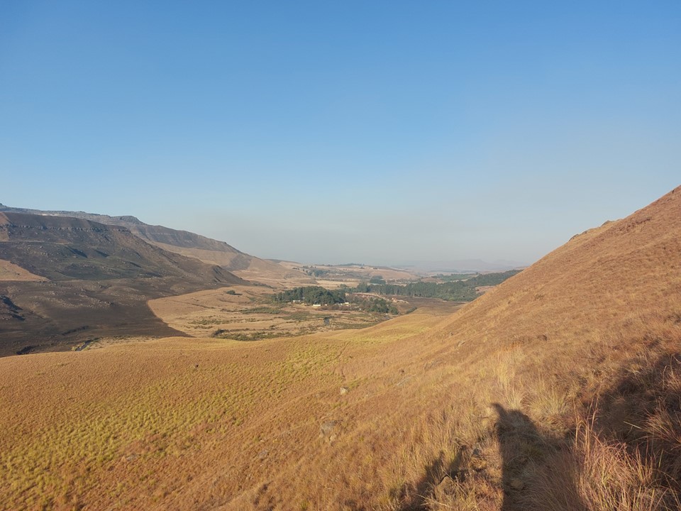
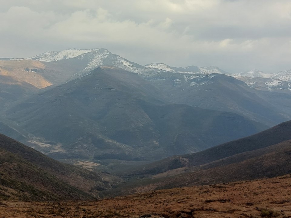
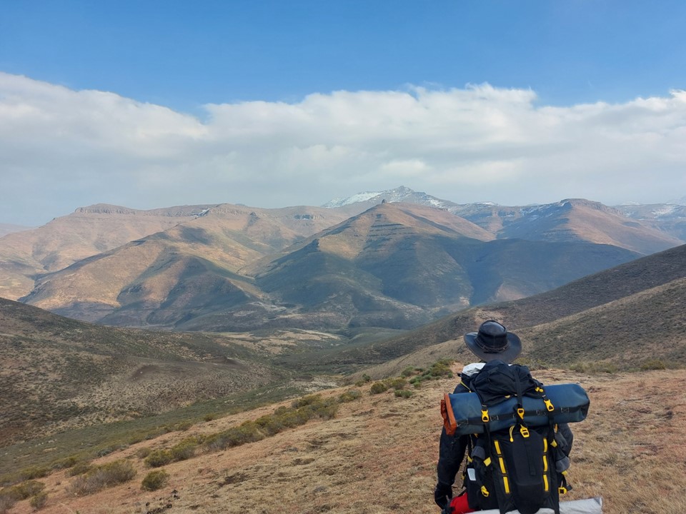
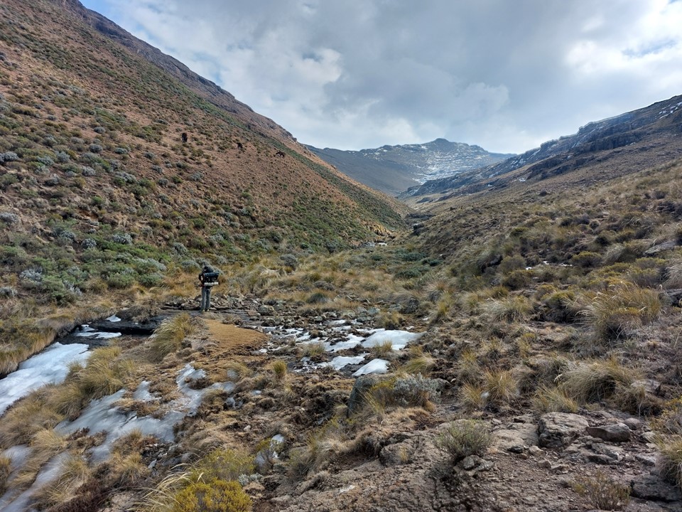
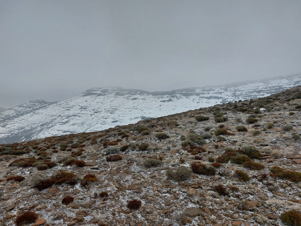
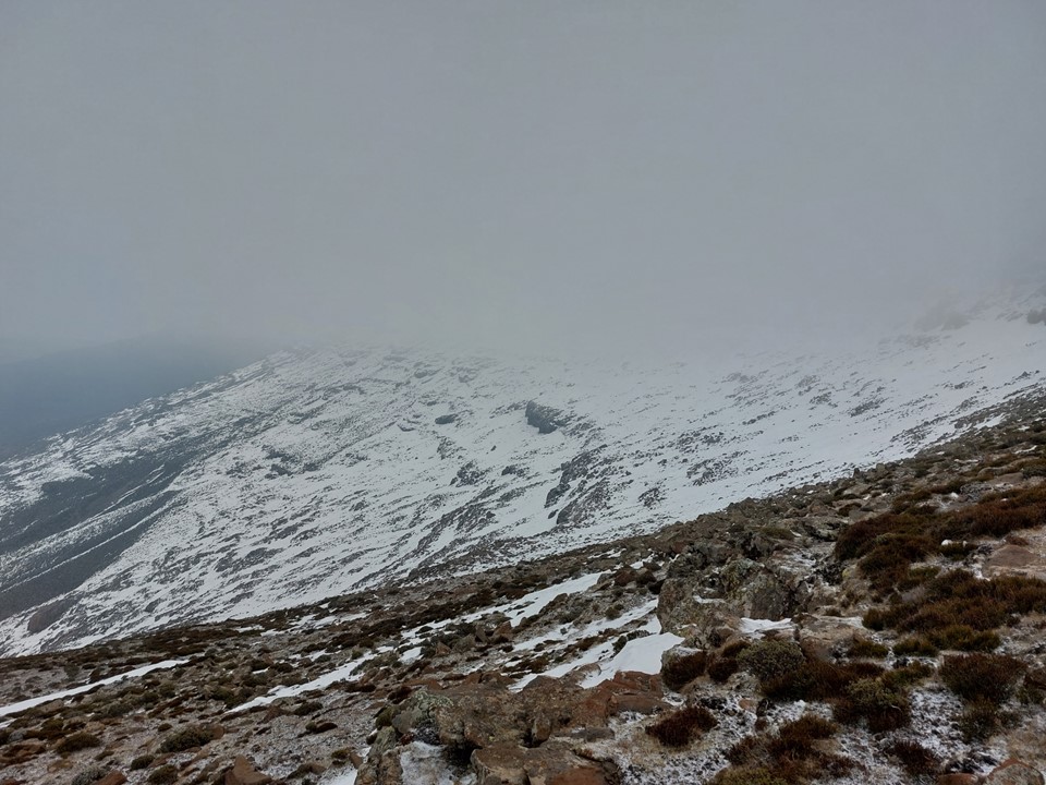
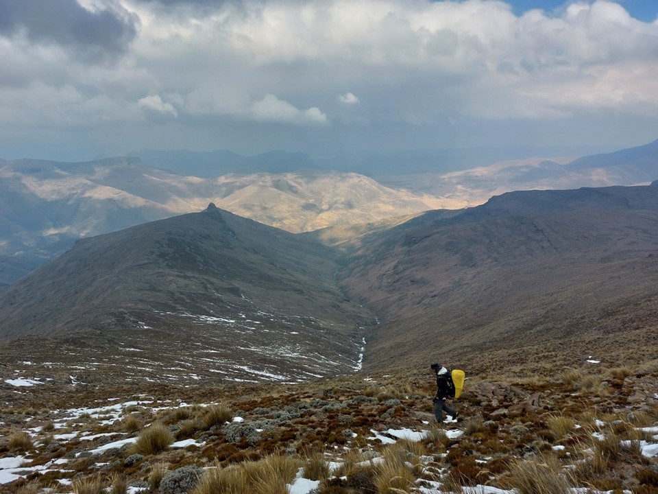
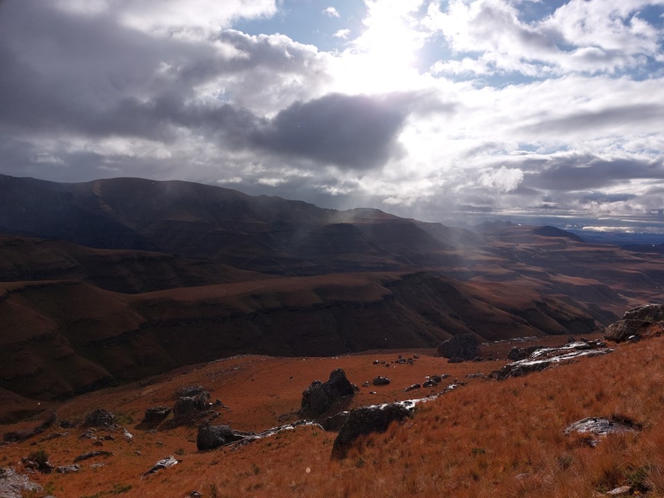
We decided not to start before dark for two reasons – one being that it was new ground to both of us and we wanted to see it. The other being that we finished late and a good night sleep makes a difficult day considerably easier. There was a lot of snow left from the recent snowfalls, and being at 2400m in a valley with peaks rising up to 3300m nearby, the views were great!
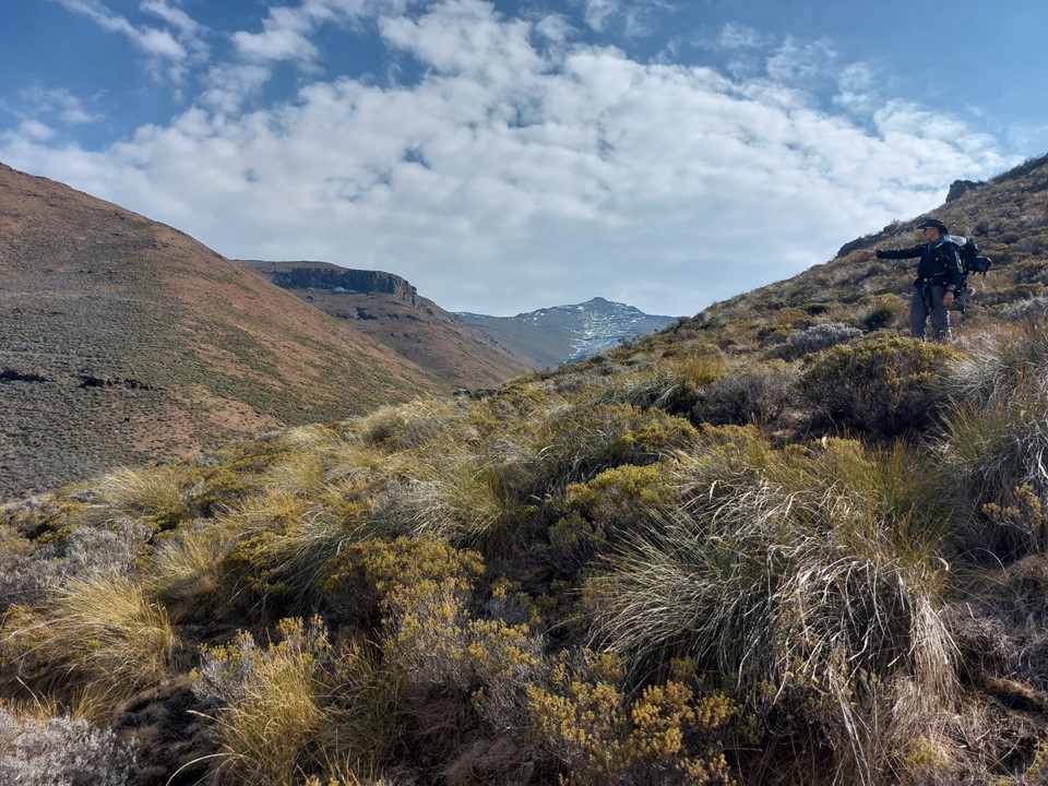
We made our way to the north side of the river and picked up the trail we had planned to follow. It was clearly visible on Google Earth, and finding it wasn’t a problem.
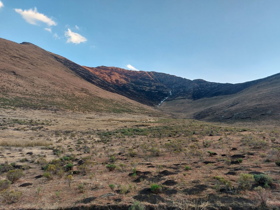


We followed this trail for a while before eventually hitting the side valley up the ridge we would be attempting to cross. We found remnants of a trail, but were mostly off trail till just below the saddle. As it turns out, there was a very good trail down from the saddle! At least we know for next time!
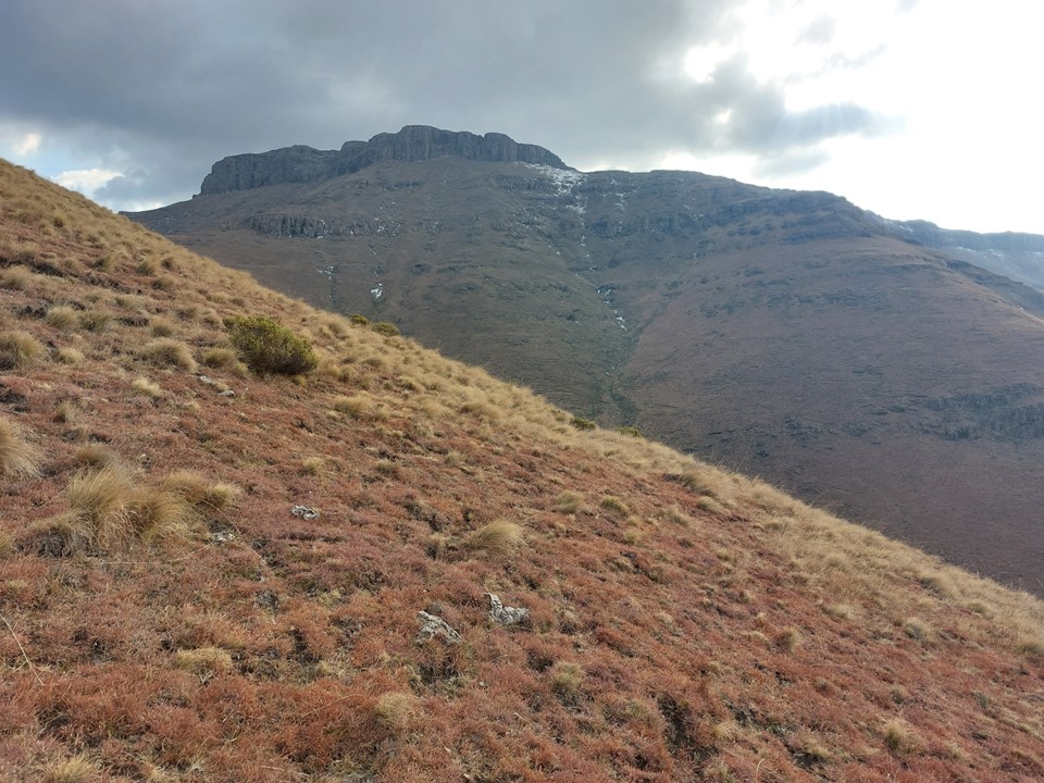
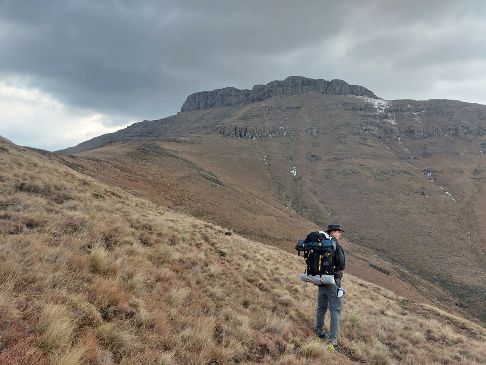
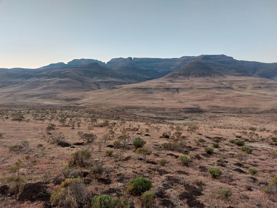
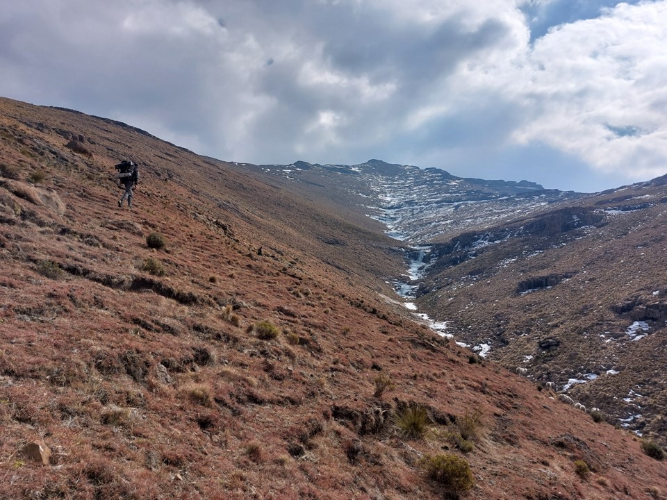
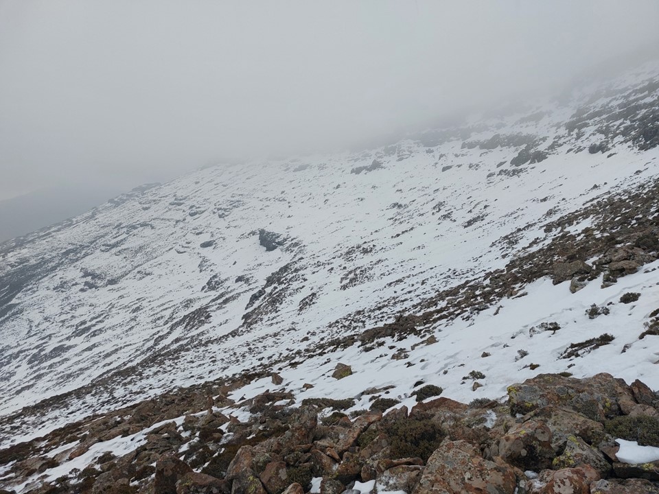
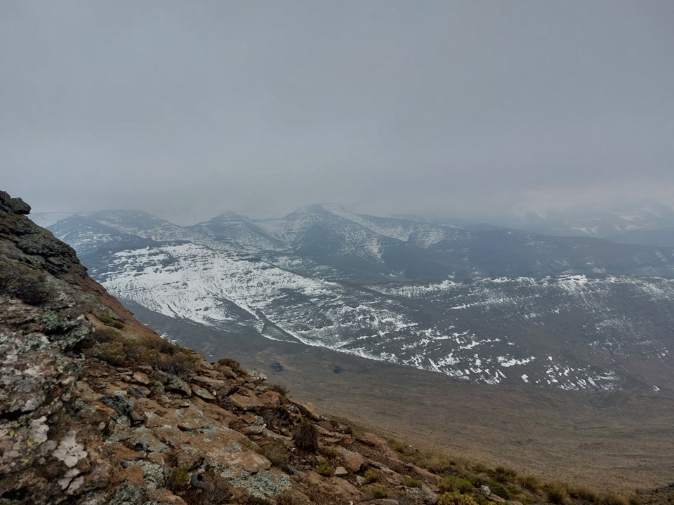
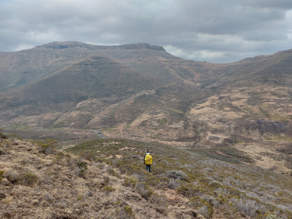
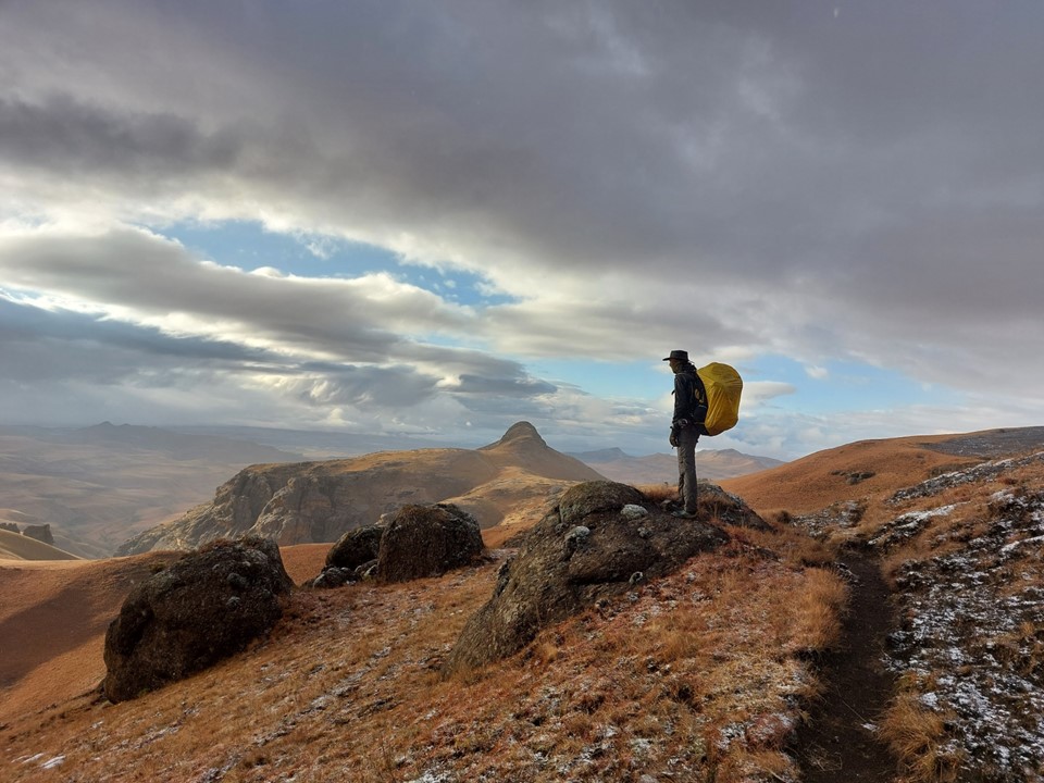
Reaching the saddle was a bit like getting slapped in the face! Makoaneng was straight in front of us, and it was enormous. The snow on the ridge provided some amazing views, but we could also see that this ascent would not be trivial.
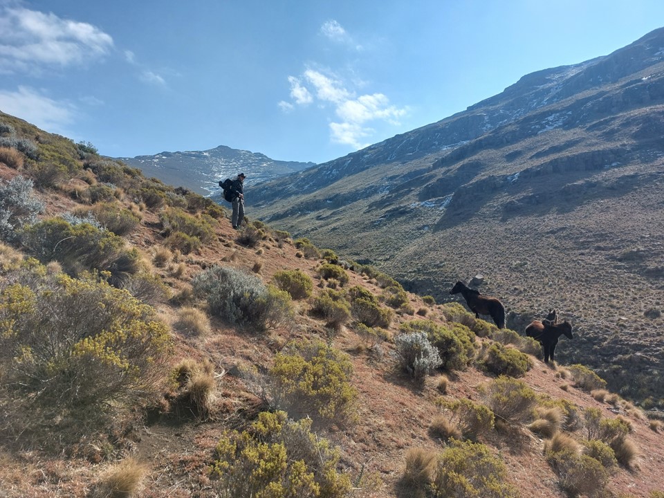
We found a good trail down into the valley. There were a few kraals down this valley, which explained the really good trail. I was not looking forward to the fact that we would have to cross this saddle again later in the day.
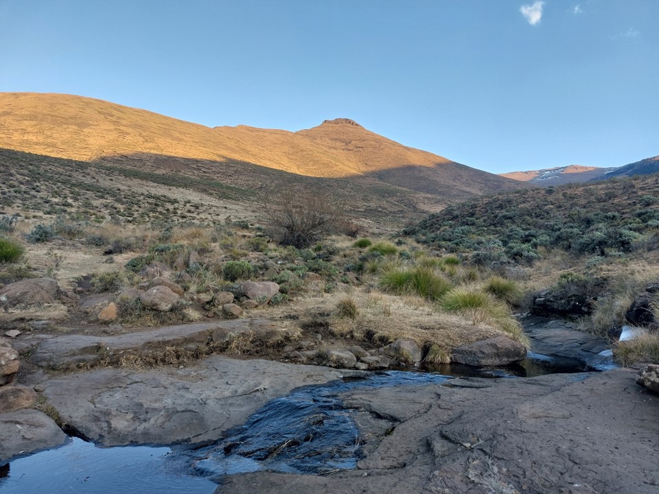
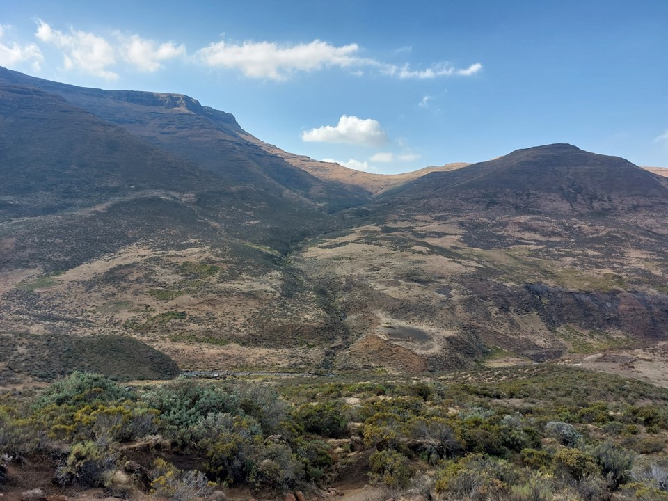
The river is crossed at 2400m, so we knew the next section would be just over 1000m of elevation gain.

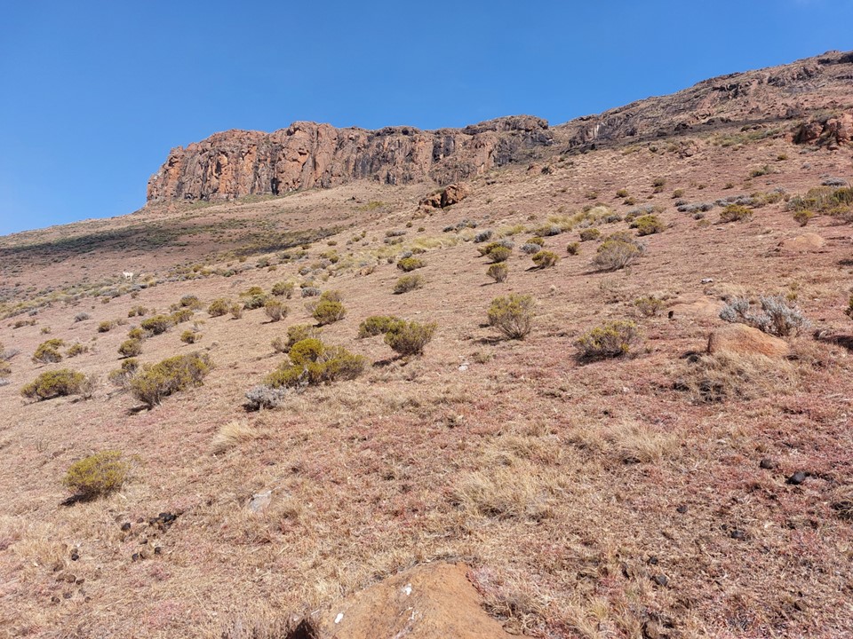
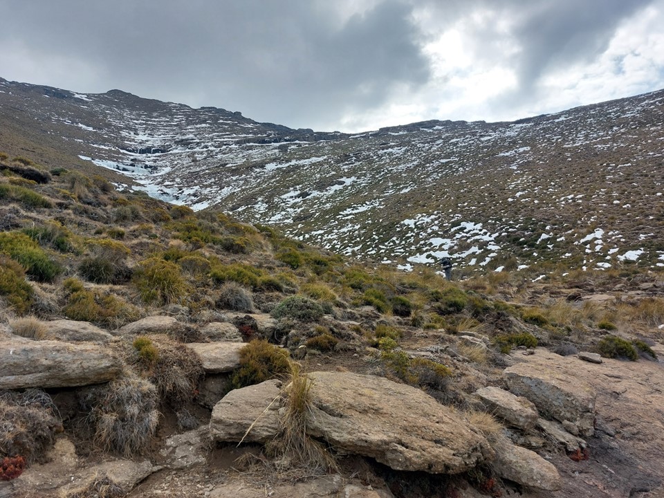
The lower section included a trail past a kraal, followed by a very eroded trail up the lower slopes. The trail soon died, and we found ourselves walking through overgrowth trying to hit the river that flows down the east slopes of the peak.


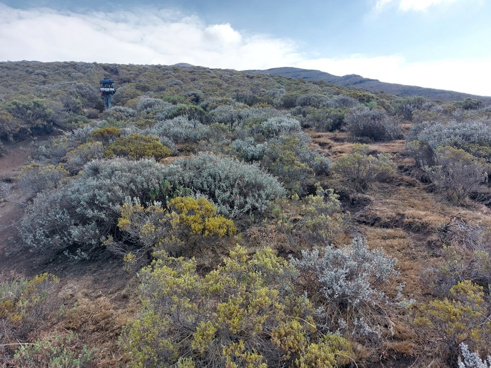
We found short sections of trails in places, and there were a few animals on the way up, but we mostly had the mountain to ourselves. Clouds looked ominous, but we had all our gear with us and thus knew we would likely be fine if anything went wrong. Then again, mountain rescue won’t collect you that far into Lesotho, so we knew we had to be extra careful.
As we continued up the gully, we saw more ice and snow. Between the cold wind and the fact that ascending steep slopes like this is very draining, I was struggling a bit.


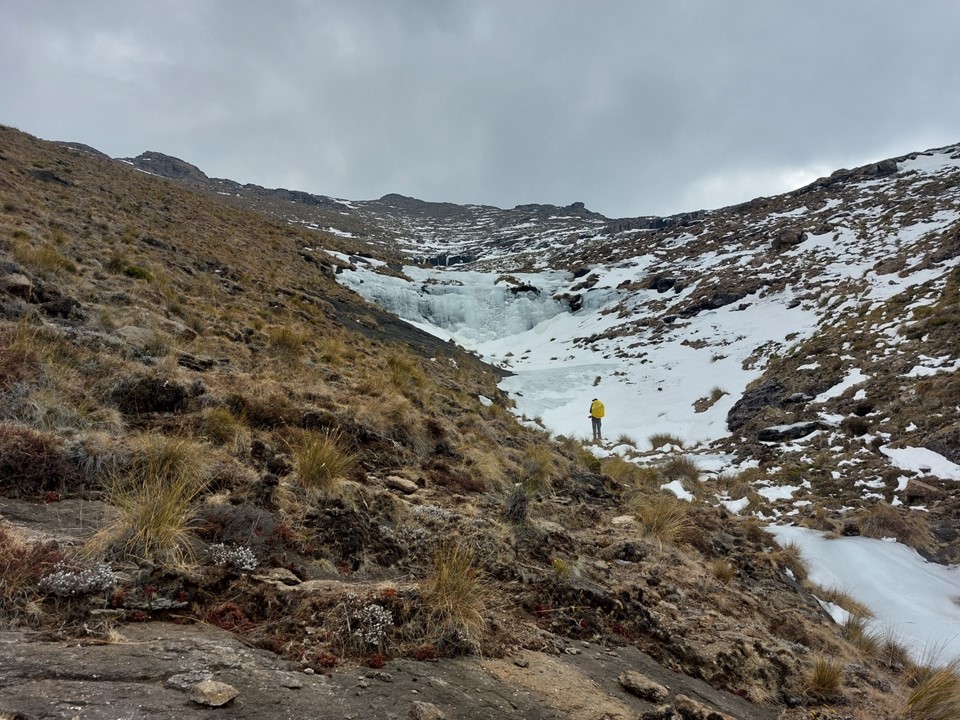
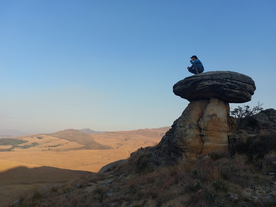
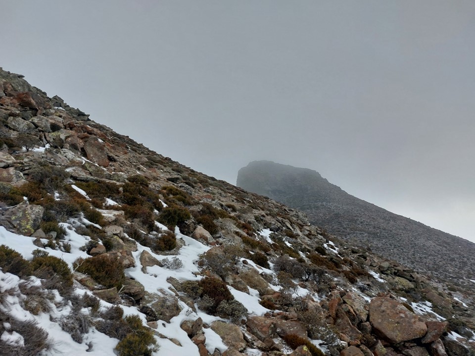
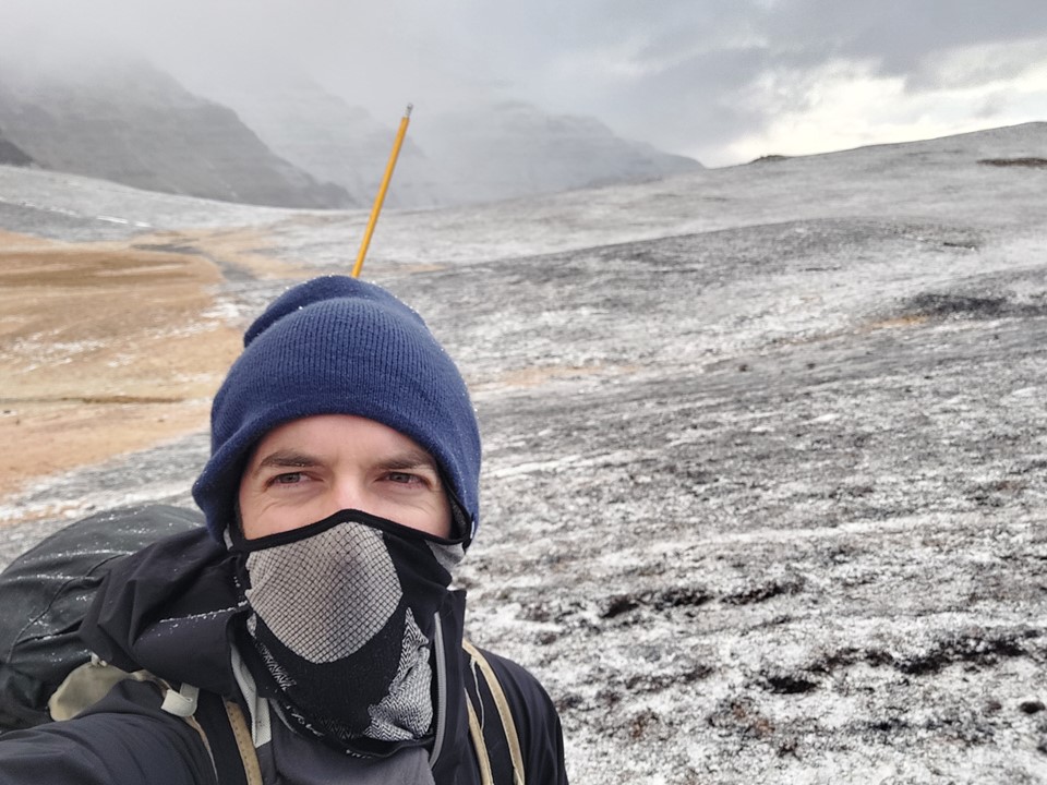
We eventually reached the shoulder below the summit. I knew the peak in front of us was a false top, and was interested to see a cairn at the point where I planned to traverse. Odds are this is a marker to mark the end of one individual’s land – I doubt hikers visit this peak very often.

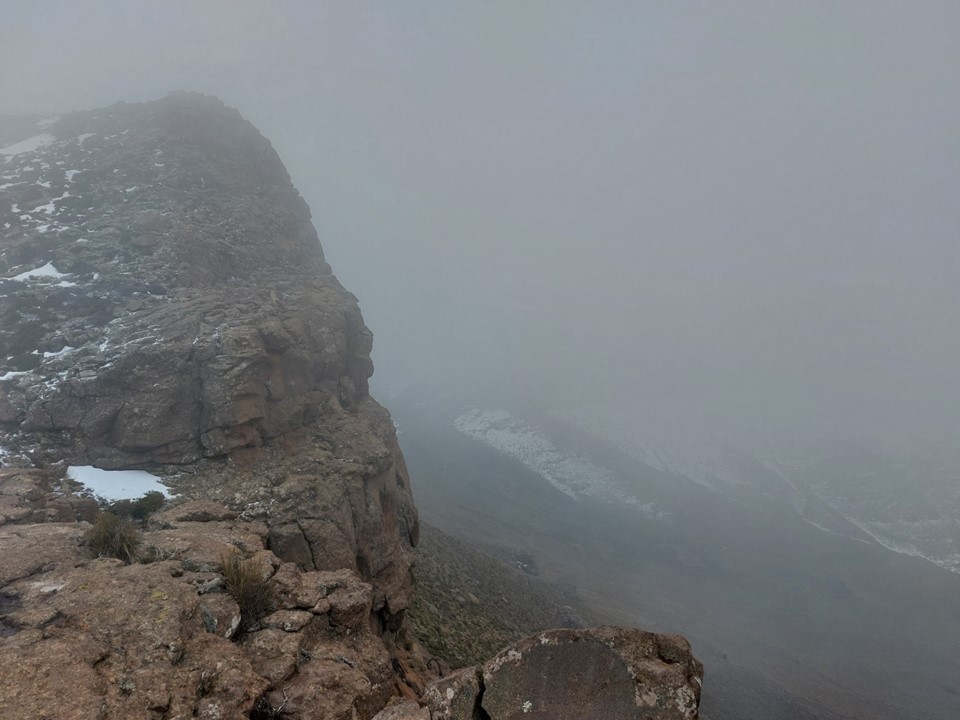
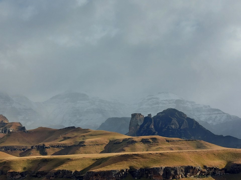
As we rounded the corner, the view of the top covered in snow was really impressive! Cloud was coming in, and it had started snowing.
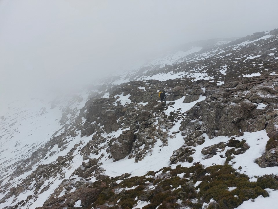
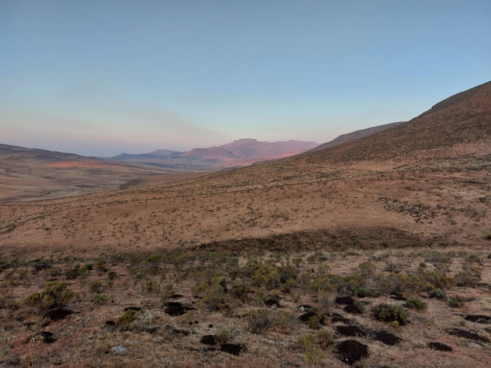
Snow and loose rock on a steep slope is never easy ground – so the final section to the top was harder than expected. We had a small gap in clouds when we hit the saddle between the false top and the main summit – which gave us a feeling of how high we were. Unlike most Drakensberg peaks, this one is on a reasonably narrow ridge, meaning the views in clear weather should be exceptional. The summit also isn’t that far from the Senqu (Orange River), although that wasn’t visible in these conditions.
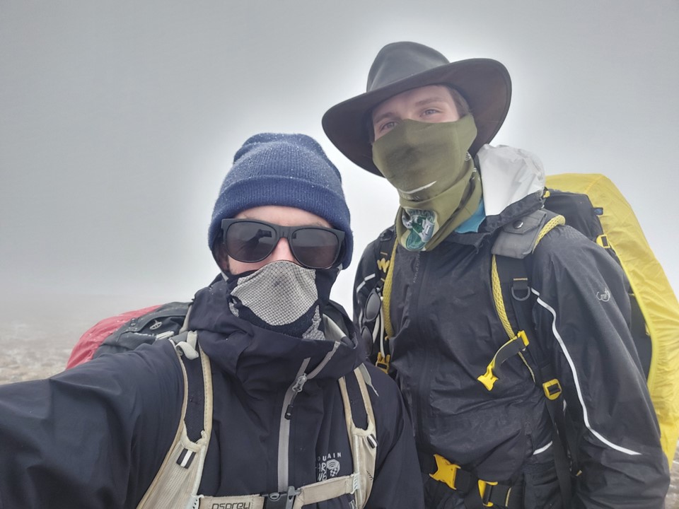
We got a few photos on the summit, but with snow falling and cold conditions, we had no interest in enjoying the view for very long. Not that we could see much in the mist.

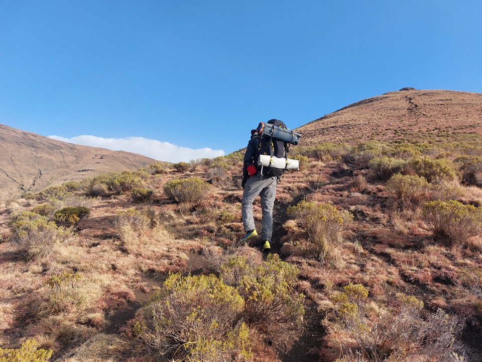
We started to make our way back down the gully we had ascended. It was already around 2PM and the ascent had been much harder than expected, or perhaps I was not as fit as I had hoped. In my defense, I was carrying a full winter pack with half a tent – and had just lugged all of that to the summit of the 4th highest mountain in Southern Africa!

The descent down to the river went smoothly enough, but the ascent from 2400m to 2750m to cross the saddle would not be trivial.


We met a friendly shepherd at the kraal by the river, who asked to get some selfies with us – which is roughly the opposite of what I am used to!
The ascent up to the saddle proved slow, mostly because I was exhausted. We eventually crossed the ridge around 4PM. Being mid-winter, it would be getting dark soon, so we knew we would be in for a headlamp finish.
The reasonably flat and easy trail from the morning felt a lot harder in the afternoon. Perhaps it was because it was a gentle uphill, perhaps it was my pack, perhaps it was fatigue from a long day – probably all of the above.
As it became darker, it began to rain, and continued to rain on and off for the rest of the evening. We made slow progress back up the valley, and those roughly 8km seemed to never end. Eventually we found the exact spot where we had camped the night before, and decided to call it a night. I believe it was around 8PM, although I don’t recall the exact time.
It rained all night, and we woke up in the morning to find that a bit of water had made its way into the tent via a small hole in the floor of the tent. I guess my 10 year old tent might need to be replaced some time soon.
There was an icy wind outside and some fresh snow was visible on the ground.
We packed up and put the tent away – one of the pole connections was frozen in place and could not be dismantled, so I had to start the day with a pole sticking out of the top of my pack.

The hour that followed was extremely cold. We were both adequately equipped for this, but it is still difficult to move quickly in cold windy weather.


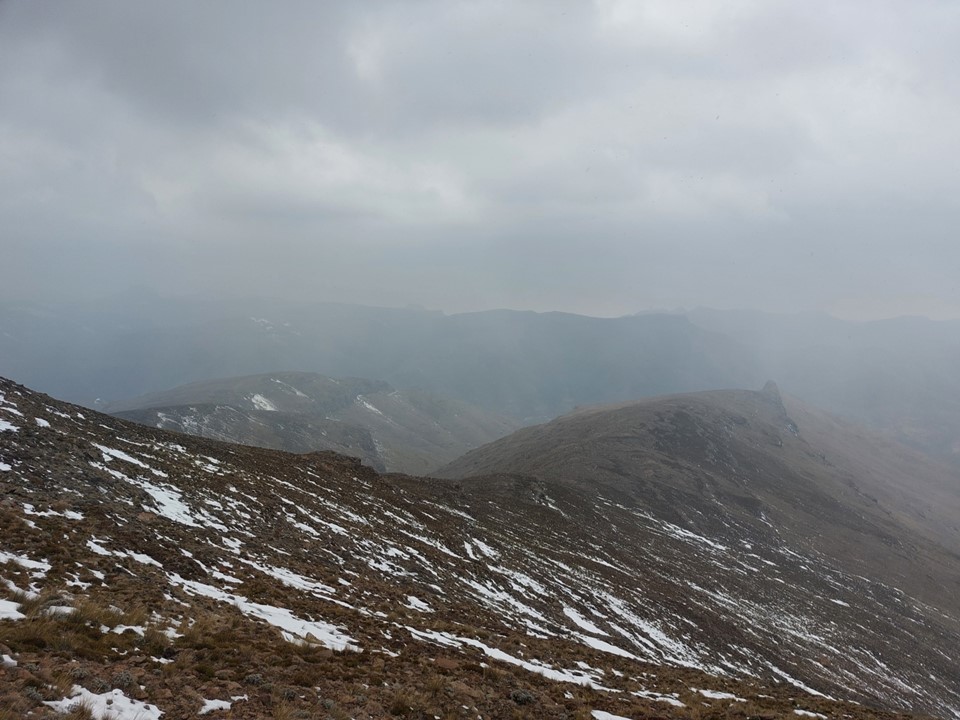
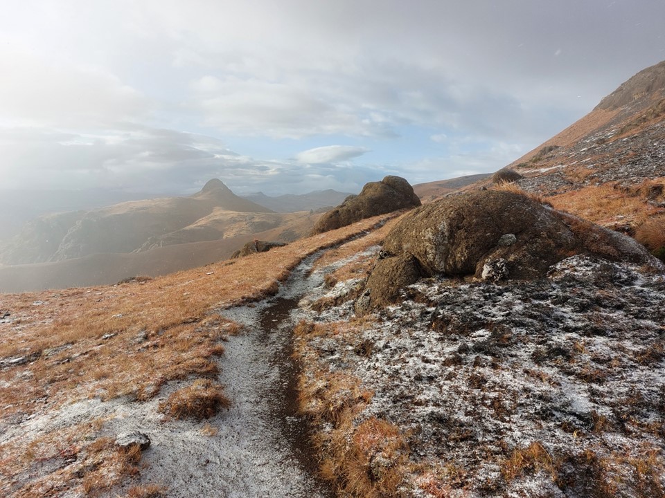
As we neared the top of Thamathu Pass, there was considerably more snow on the ground – not enough to cause problems beyond a bit of slipping, but enough to look great in photos.
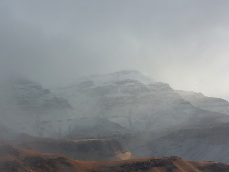
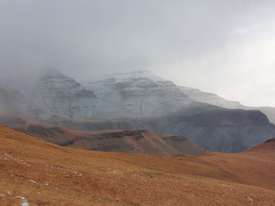
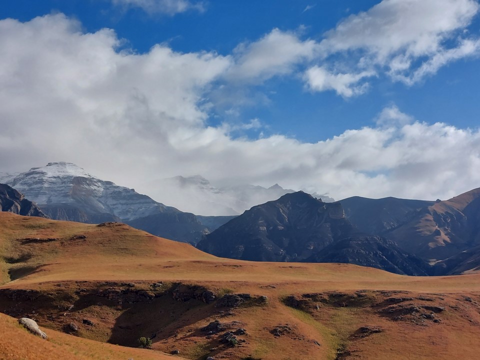
There was considerably snow on the peaks on either side of us – it was a great sight to see!
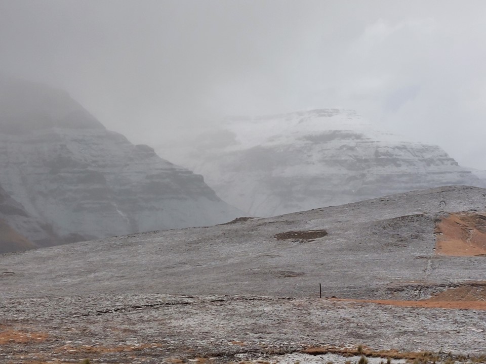
As we started down the pass, it was clear that considerably more snow fell on this side of the watershed.
We found small snow patches as far down as 2200m, which is not very common.

We made good pace, getting back to the car before 11AM.
Overall a great hike. Of the higher peaks in the Drakensberg, Makoaneng is definitely one of the most dramatic and was well worth the effort. Around the summit we had been saying about how it is possible that no hiker will stand on this summit for many years – although at the time of writing this we are already discussing plans to go back and explore the peaks around the area, and hopefully get a view from this particular summit in clear weather!
