While generally not considered a hiking destination, Mauritius actually has a reasonable number of established hiking routes. The weather tends to be hot, and routes don’t have usable water – but with most hikes being reasonably short, this isn’t an issue if you are prepared. While tourists are rarely found on hiking routes, every hike I’ve done in Mauritius on a weekend I have seen many locals on the route as well – so clearly the country has a strong hiking community.
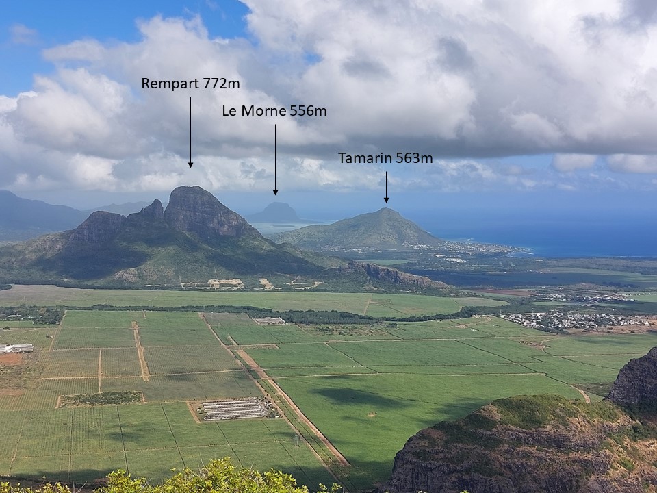
What constitutes a mountain is subjective, with definitions ranging wildly. My personal definition is a summit with at least 200m topographic prominence (or 7% if it is higher than 2857m) and a minimum height of 500m. By this definition Mauritius has approximately 18 different mountains. On my visit in 2018 I got up Black River Mountain (828m, highest point on the island) and Le Pouce (812m, third highest summit on the island). I also turned around 40m below the summit of Pieter Both (820m, second highest) and only went as high as the second summit of Le Morne (556m for the main summit, 490m for the second summit), as the main summit is closed to the public.
Pieter Both and Rempart (772m, 4th highest – which I attempted but couldn’t gain access to in 2018) are both peaks I had considered climbing on a second visit to Mauritius. While I am capable of climbing Pieter Both and have sufficient gear to do so, I would need a suitable belayer to attempt this and didn’t want to hire a guide. I have figured out how to access Rempart since 2018, but a climbed died while attempting the peak last year and therefore I opted to skip both. Instead with my day allocated to hiking, I decided to attempt to summit three different mountains – Trois Mamelles, Corps de Garde and Tamarin.
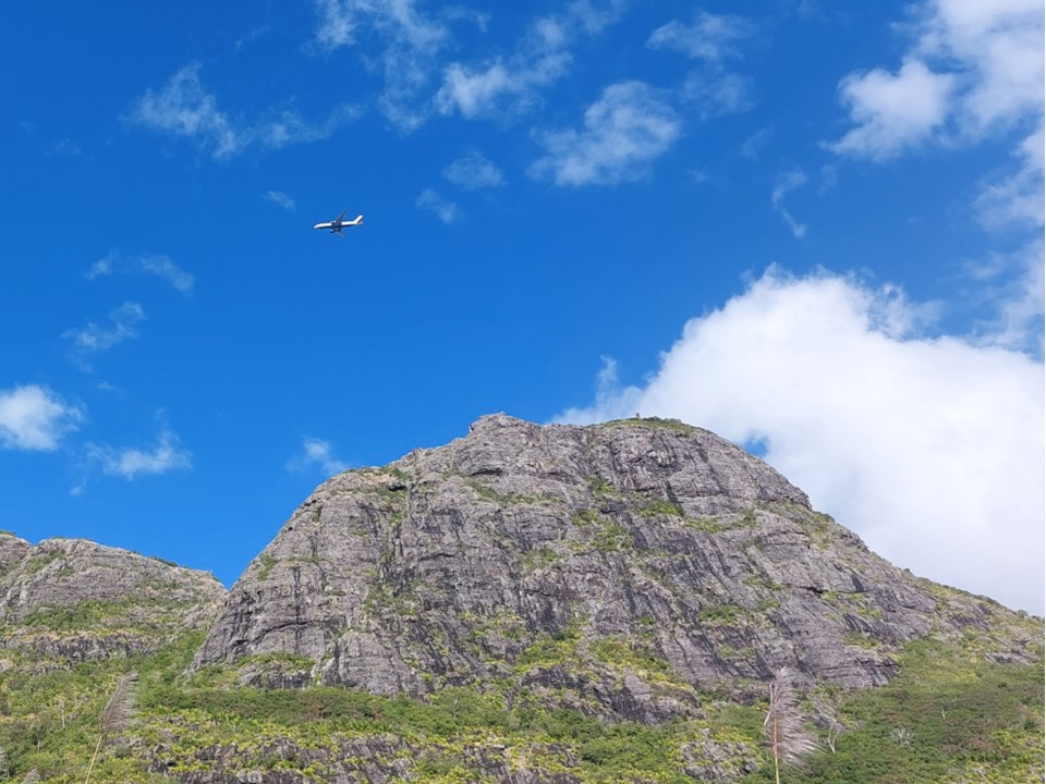
I had previously not considered Trois Mamelles (French for three sisters) to be a mountain due to lack of prominence, but with subsequent research had found that most quoted heights online were dramatically understated.
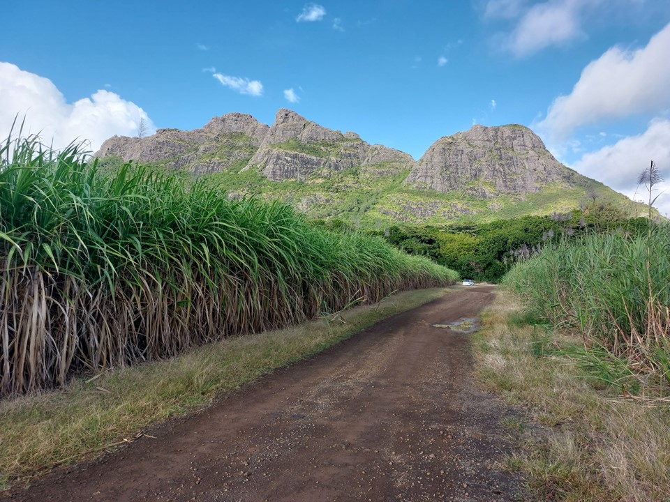
The hike starts with parking in a sugar cane field. If there hadn’t been so many other cars there, I would have assumed I couldn’t park there.
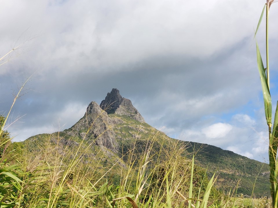
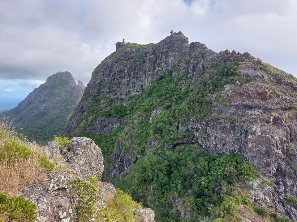
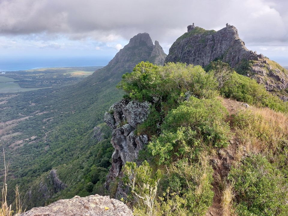
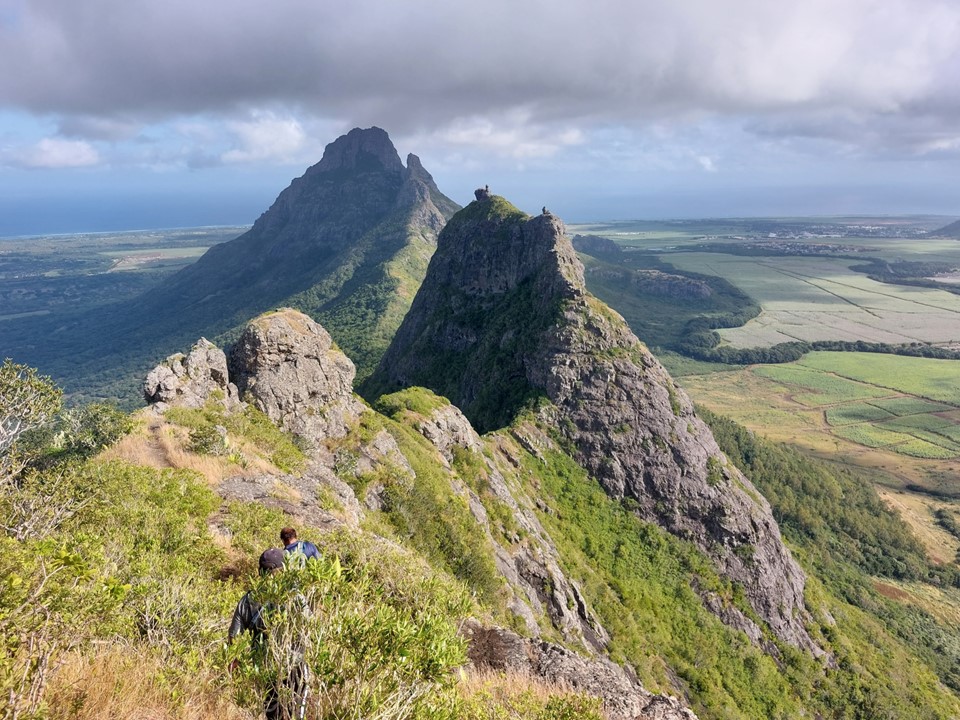
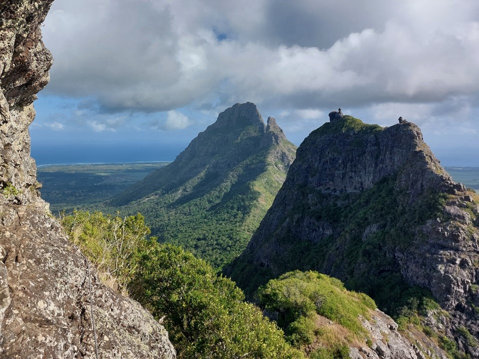
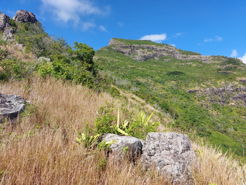
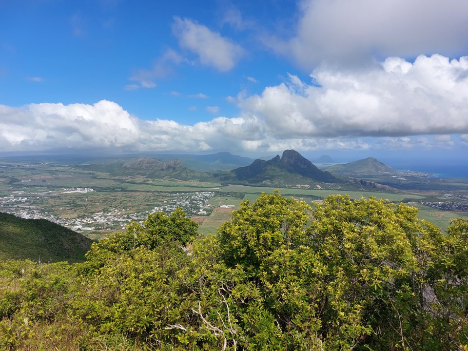
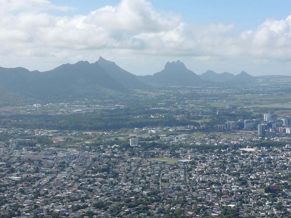
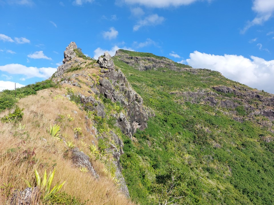
Rempart and Trois Mamelles are on the same ridge, and the views of Rempart from below are always amazing. It has been known as Mauritius’ Matterhorn. although it looks more like the Outer Mnweni Needle to me.
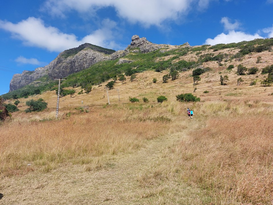
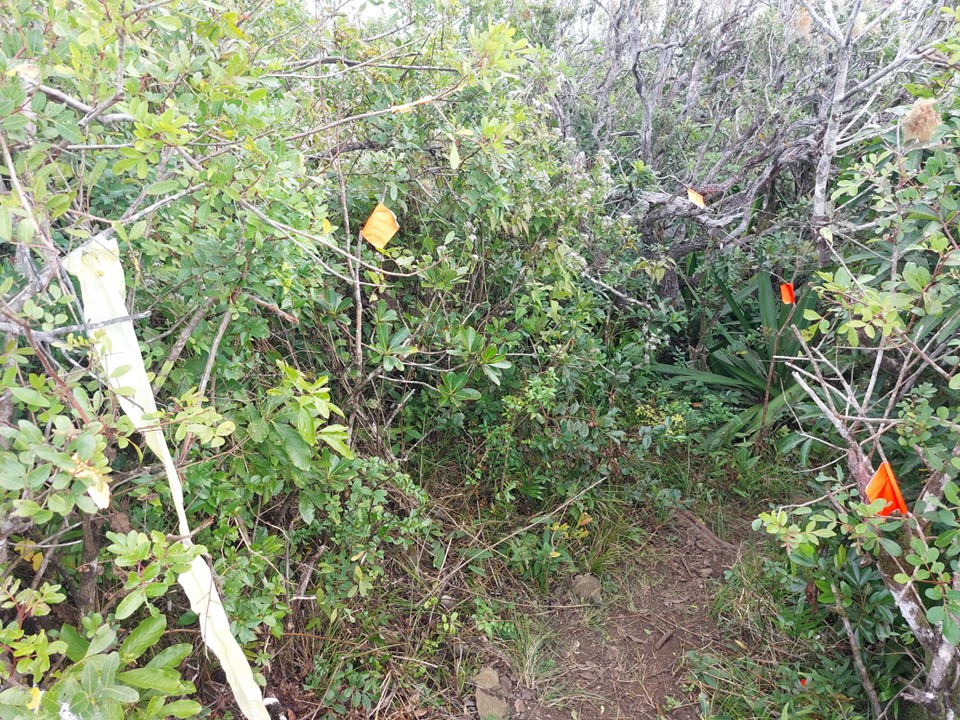
After walking through the fields for a bit, one needs to find the trail head into a forest. It is not marked, but I had found a GPS track online which meant I found the turnoff easily.
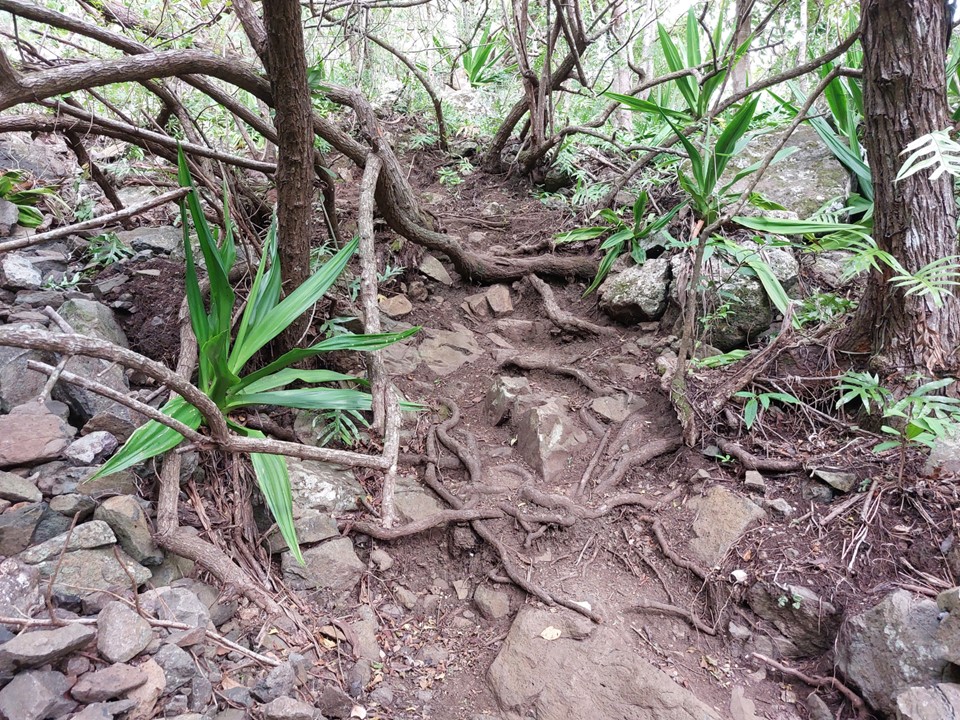
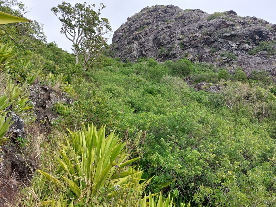
Following the trail through the forest wasn’t hard, but the ground was steep and it was getting hot.
You soon emerge from the trees at a saddle. The ground was very loose, which made progress a bit slow – but nothing too serious (yet).
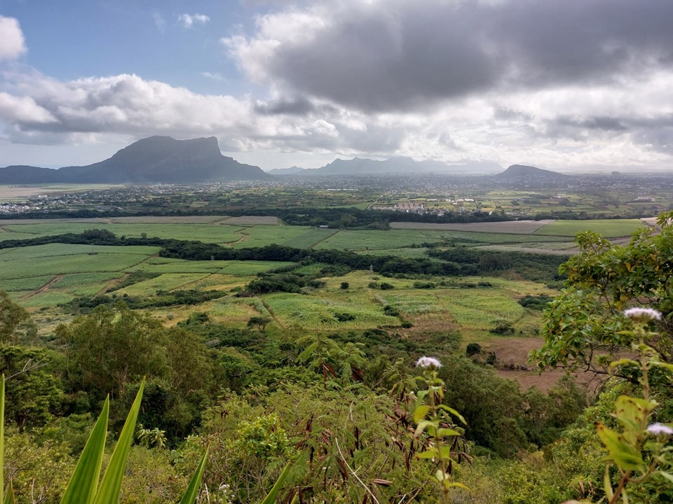
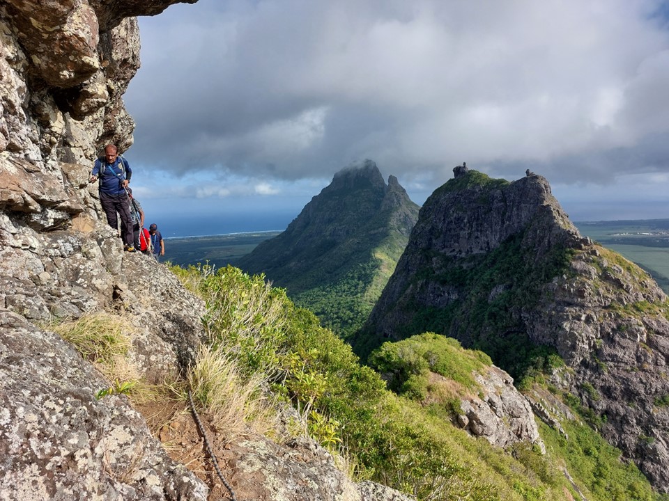
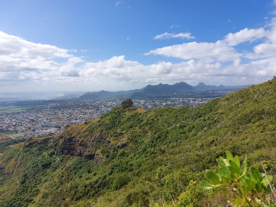
From the saddle one is afforded exceptional views both north and south.

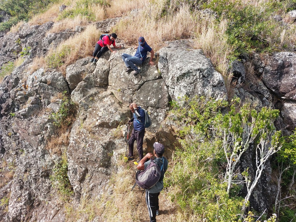
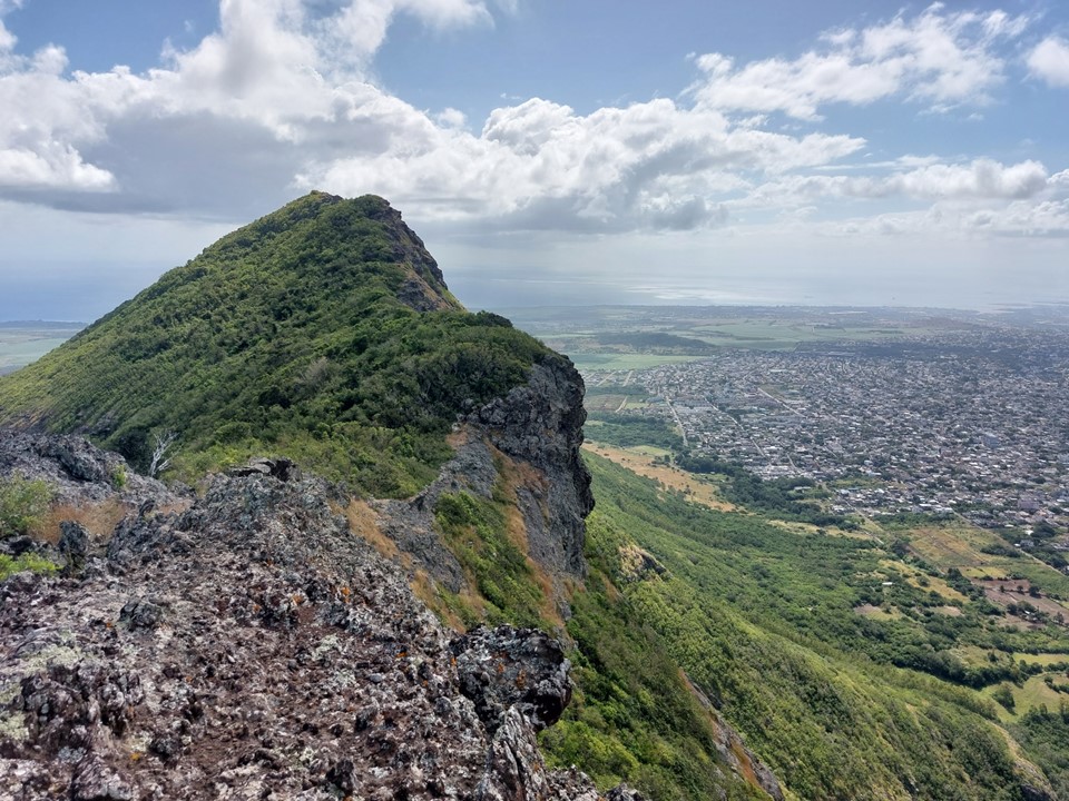
The middle summit is the highest and easiest. The trail zig-zags from the saddle. With the ridge being very narrow, there is fall potential on both sides – so the slippery ground wasn’t helping! This is one of the few occasions where I wish I had trekking poles with me.
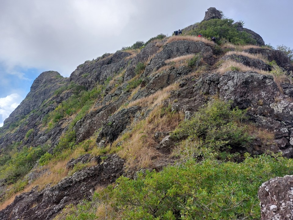
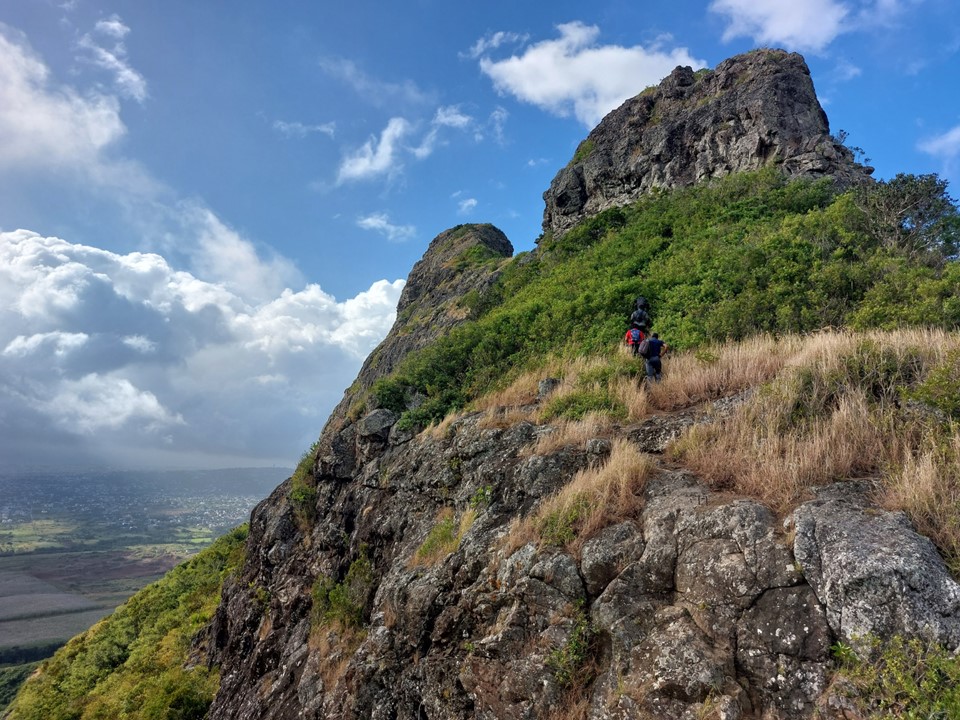
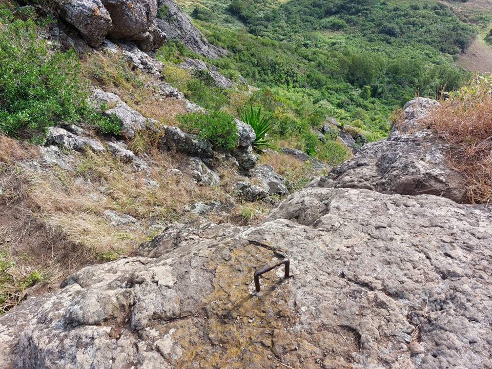
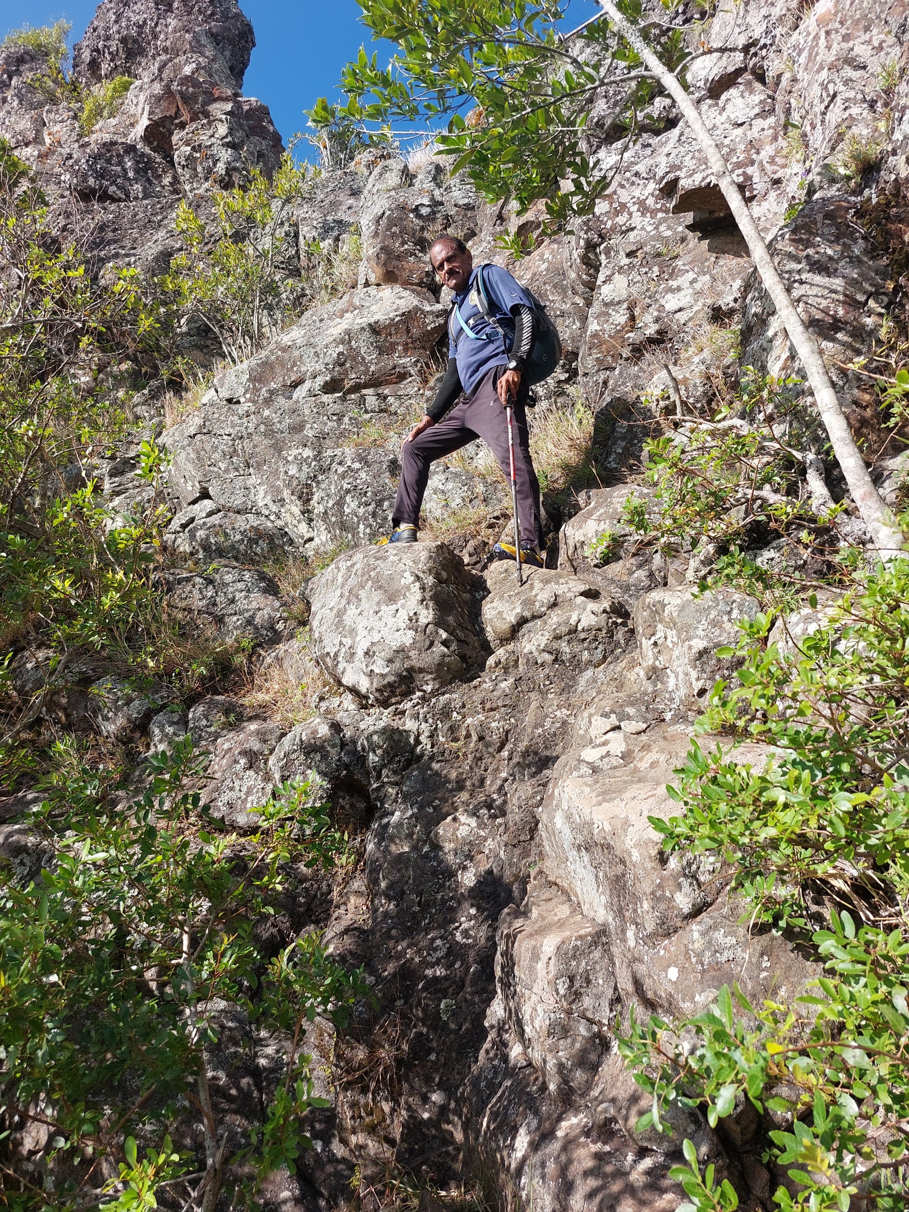
I soon reached the short cliff section. Only around 3m high, and with a very rusted staple at the top to hold onto. A group was just in front of me, I had been catching up to them for a while. When hiking solo, it is always nice to have others around – at least if something goes wrong there will be someone to help.
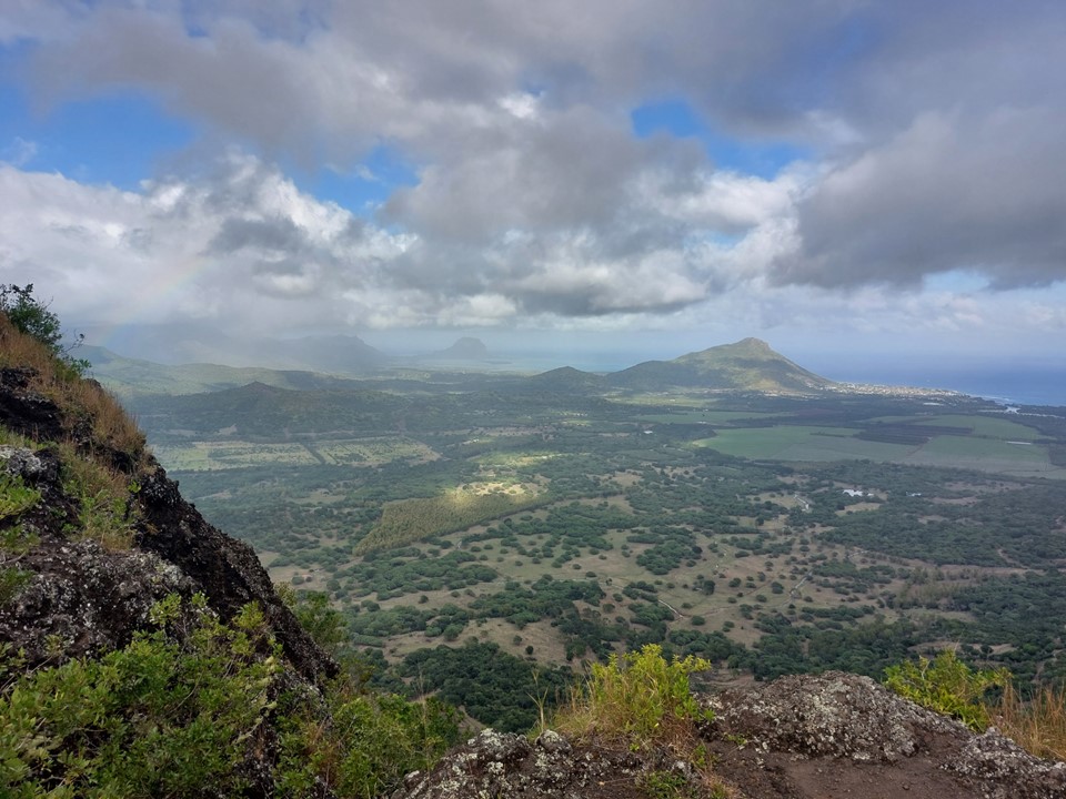
As I got higher, the views continued to get better.
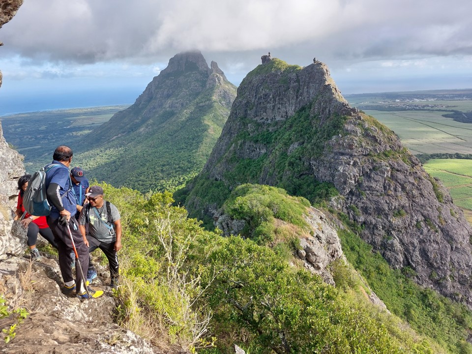
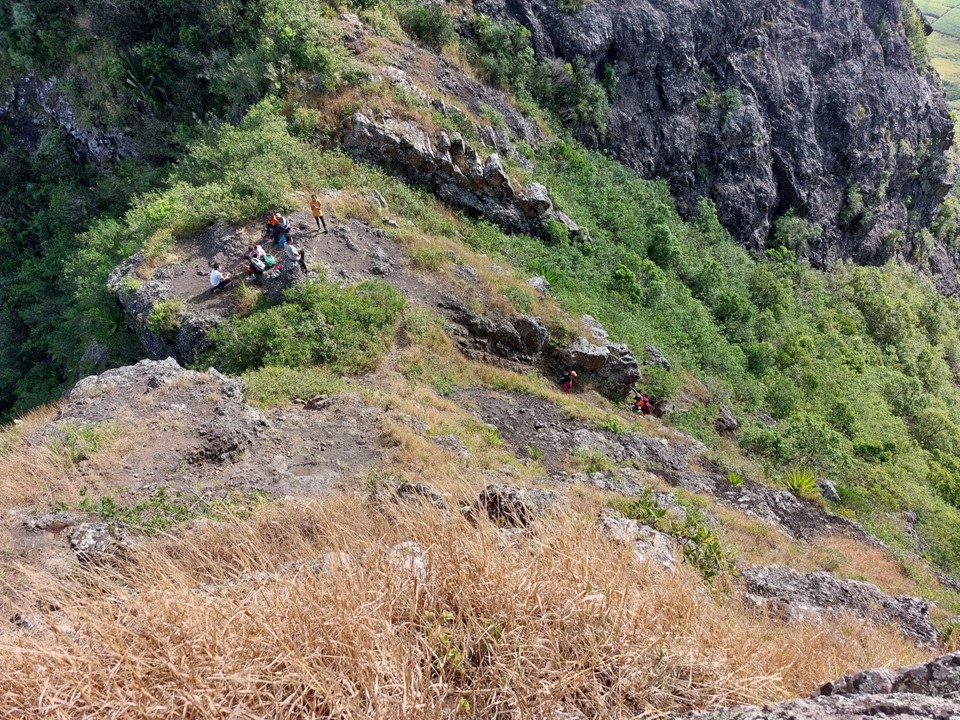
Soon I reached the real crux of the climb – a ledge one has to traverse with a fall of consequence below. While not technically difficult, it is very intimidating. The other team had brought a rope, but hadn’t intended on attaching it to anything – rendering it useless. They asked me to carry the rope across the traverse for them, which I did, although I was not happy to be helping in creating the illusion of safety without actually being safe.
They all made it across safely, so no stress.
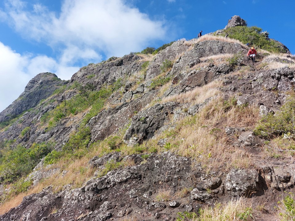
The final ascent included an easy scramble up rock next to a fall of consequence. This hike can best be summed up as “if you are careful, you probably won’t fall. But if you fall, it will be bad”.
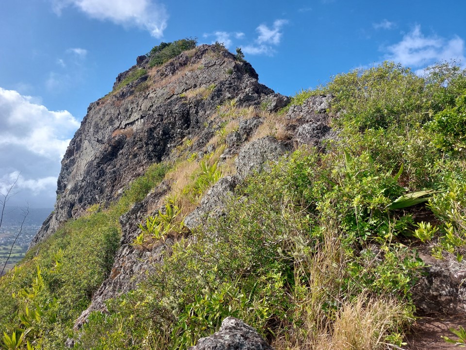
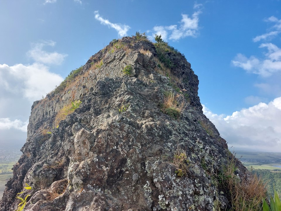
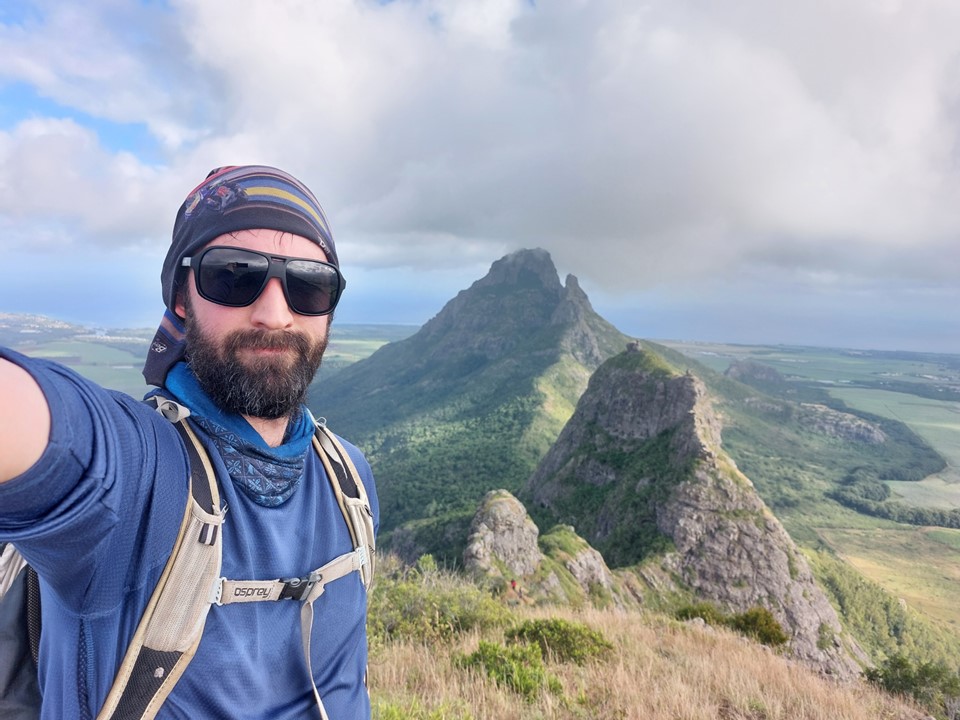
I reached the summit, with the others getting up just after me. Usually on a summit one questions whether or not the surrounding peaks are higher – although in this instance I had no doubt that the middle peak was in fact the highest of the three. Rempart in the distance was obviously higher, but it is the 4th highest peak on the island.
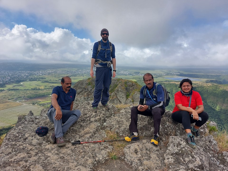
The others soon joined me on top.
The summit is only halfway and 70% of accidents happen on the way down, so I made sure I didn’t try to rush the descent.
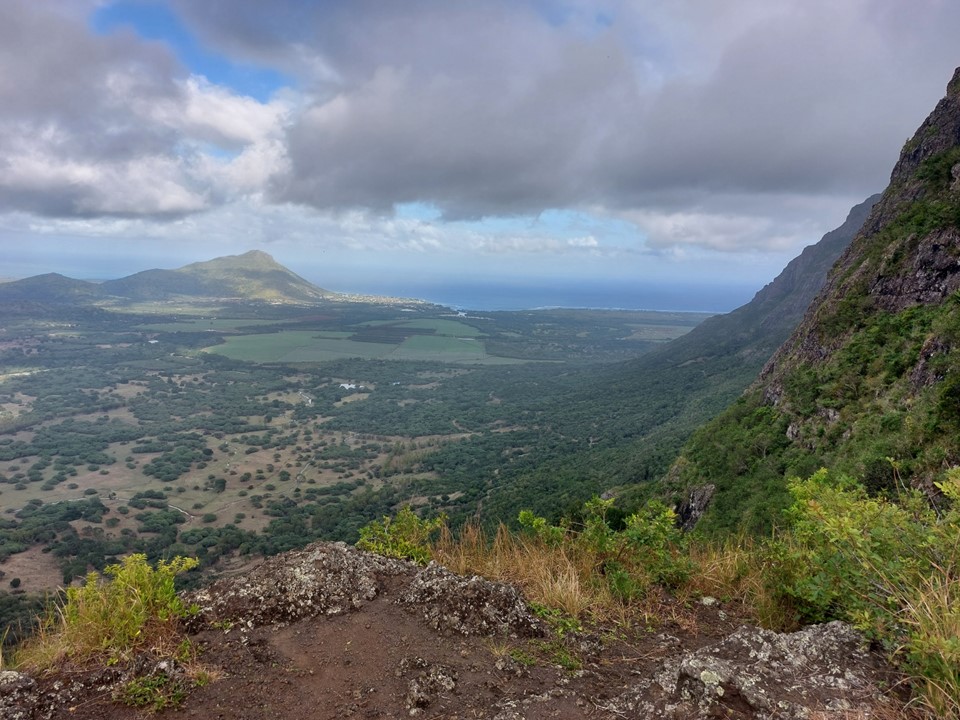
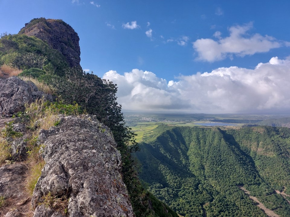
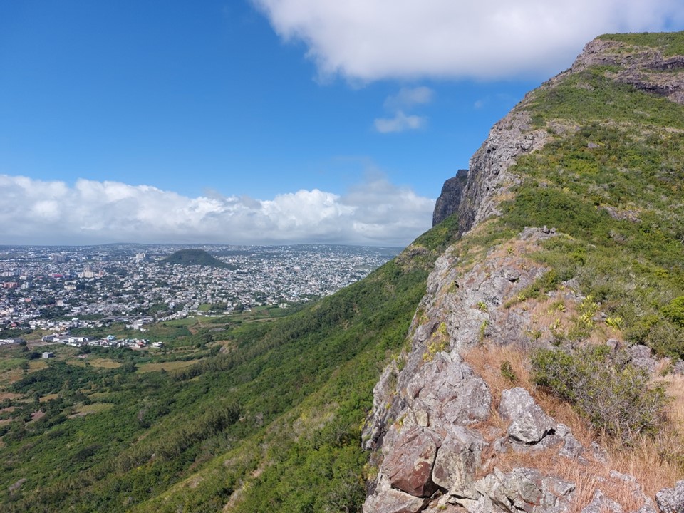
The view from the traverse is definitely one of the best views I’ve encountered – with the Indian Ocean in the distance, and Rempart and the West Sister right there.
The staple was reasonably committing to descend, but I was down soon enough.
The rest of the descent went off without issue.

From there I got back to my car, ate some food and switched my empty water bottles for full ones. The heat in Mauritius is not trivial, so it is a good idea to carry more than you think you’ll need.
The drive to the start of the second peak took much longer than expected. As usual, Mauritius roads are narrow and often barely wide enough for one car despite being multi-directional. The car park for Corps de Garde (720m, 5th highest) was crowded and I took the last available spot.
This peak hadn’t really interested me last time, I knew it was one of the higher peaks, but it looked too bulky to have a good view. Many reviews online had rated it highly, but I have seen similar reviews for various arbitrary peaks before. What surprised me was the man leading the group I had summitted Trois Mamelles with said Corps de Garde had a better view – and he had climbed both multiple times.
Nonetheless, I had decided to climb it before I even got on the flight, and now I was at the bottom ready to start the ascent.
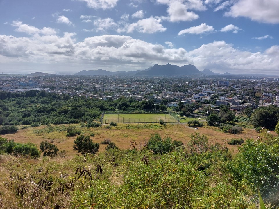
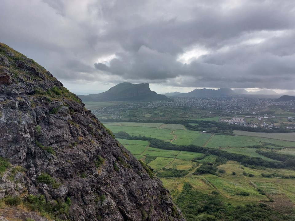
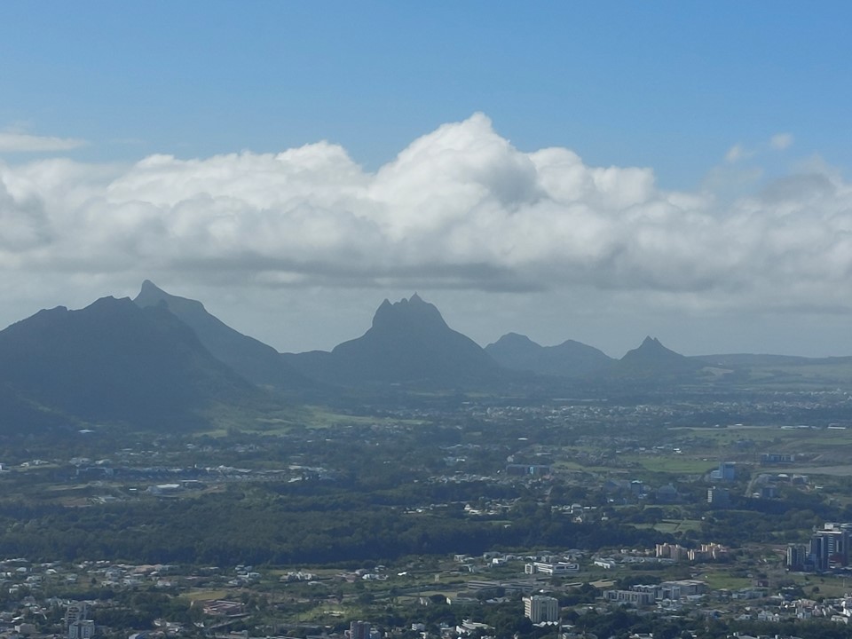
The route climbs steeply to the ridgeline. You quickly get a view towards the peaks by Port Louis: Pieter Both and Le Pouce specifically.
It was a really hot day and I was feeling it, so when I found a shady spot in some overgrowth, I decided to stop and catch my breathe. I also had something to eat. If I had known there was a great viewpoint a bit further up that was also in the shade, I would have stopped there, but such is life!
The lower section was what I was expecting – decent views and reasonable scenery, but nothing special by Mauritius standards.
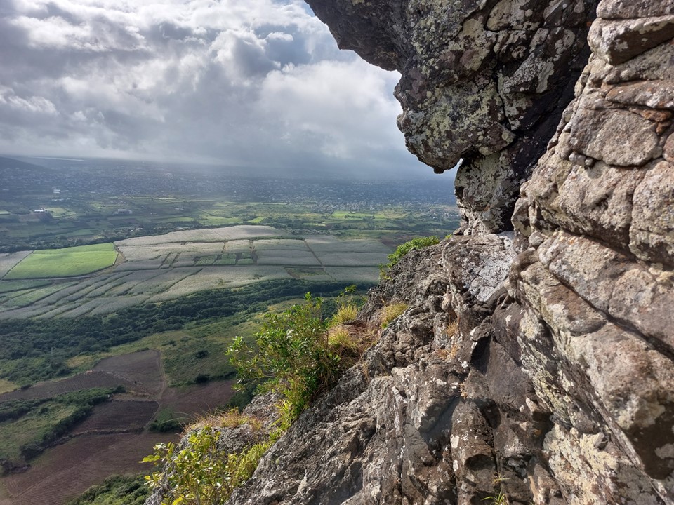
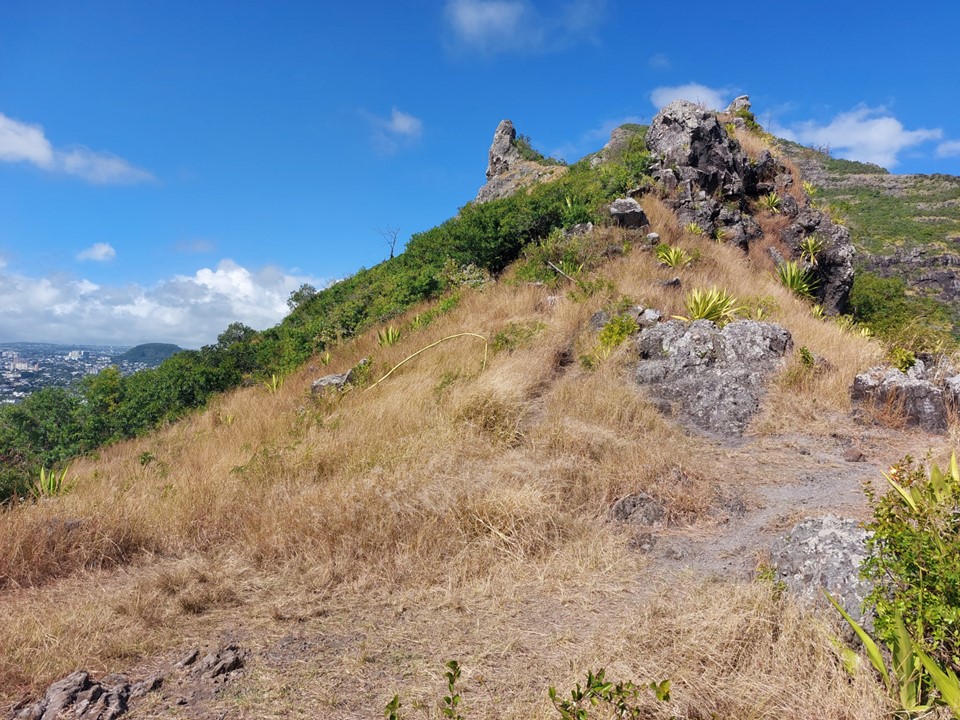
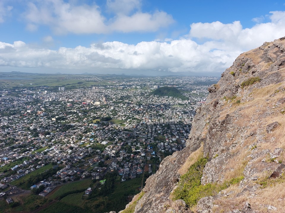
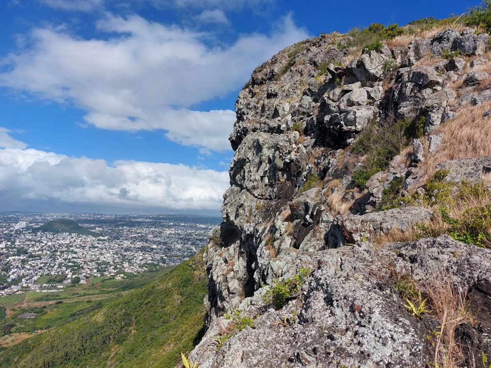
Then the peak decided to start showing off. Being encircled by a large cliff, the higher sections of the peak are actually rather dramatic. It also does include some exposed scrambling.

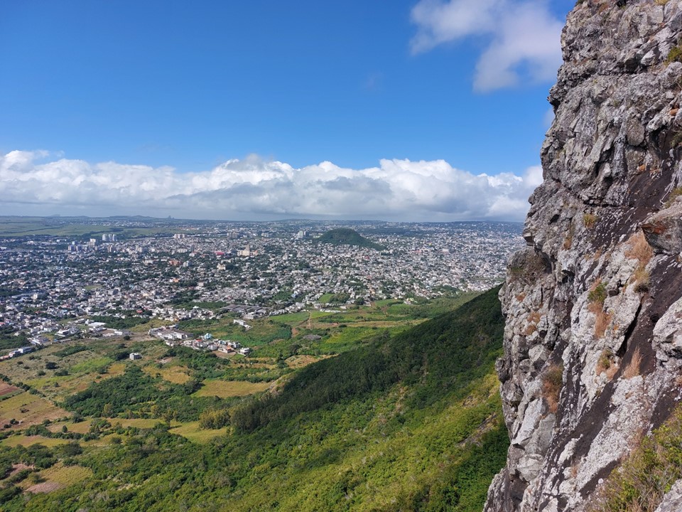
The views near the summit are actually well worth the effort. Don’t get me wrong – Le Morne, Le Pouce and Trois Mamelles are all more scenic – but don’t discount this one, it is definitely worth doing.

There was a 20m or so scramble near the summit. While it was mostly very easy moves on solid grippy basalt (I’m used to brittle basalt in the Drakensberg, so solid basalt is amazing), there is definite fall potential if one is not careful.

Having tagged the summit, that’s 3 out of the top 5 highest peaks on the island done. Pieter Both and Rempart would be required to finish the top 5. As to whether or not I’ll ever return to finish the list, its hard to say – I didn’t think I would return to do the ones I’ve done.
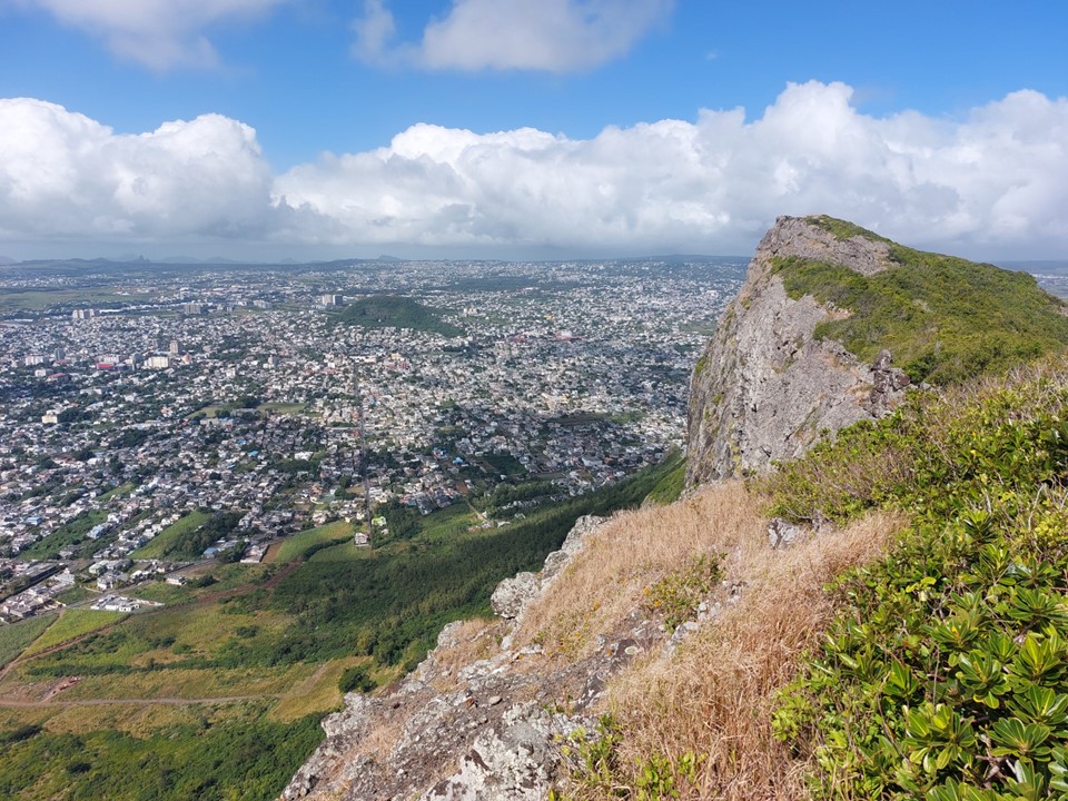
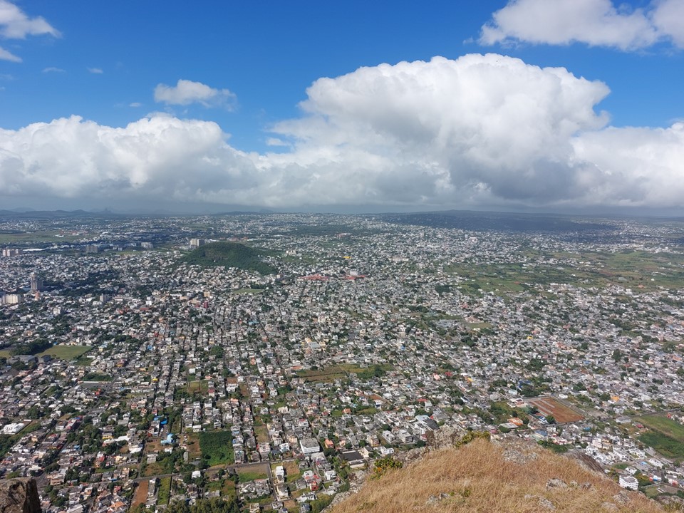
Both online and in person I had been told that the best views aren’t from the summit, but from the far side of the peak. The top is roughly 1km long, but not very wide. There is a trail across the top, though.
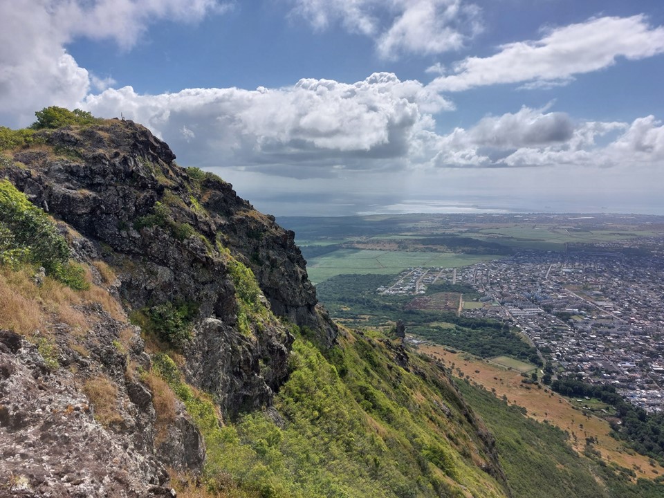
I always enjoy walking near cliffs. The views of the island were amazing. I have to admit that Mauritius is one of my favourite places to visit – between the amazing views, amazing people and amazing food, it is genuinely a wonderful country to visit.
I eventually found myself at the far end of the peak. Standing above roughly 300m of cliff, with Quatre Bornes directly below me, the walk along the top was definitely worth the effort.
The traverse back to the summit went reasonably well. I saw a trail marked with bright markers and thought it might be an alternative trail back down, worth exploring at least.
After dropping a fair distance, I noted that I was getting further from where I was trying to go, and thus decided to backtrack up the mountain. Later on the descent a local would tell me that the route I was on goes down to a farm and is part of an annual trail run.
I had to backtrack right up to the summit – and with how much time this detour had cost, I would not have the time to attempt Tamarin Peak that day. But it had been a good day, and exploring a region I will likely never visit again is never time wasted.
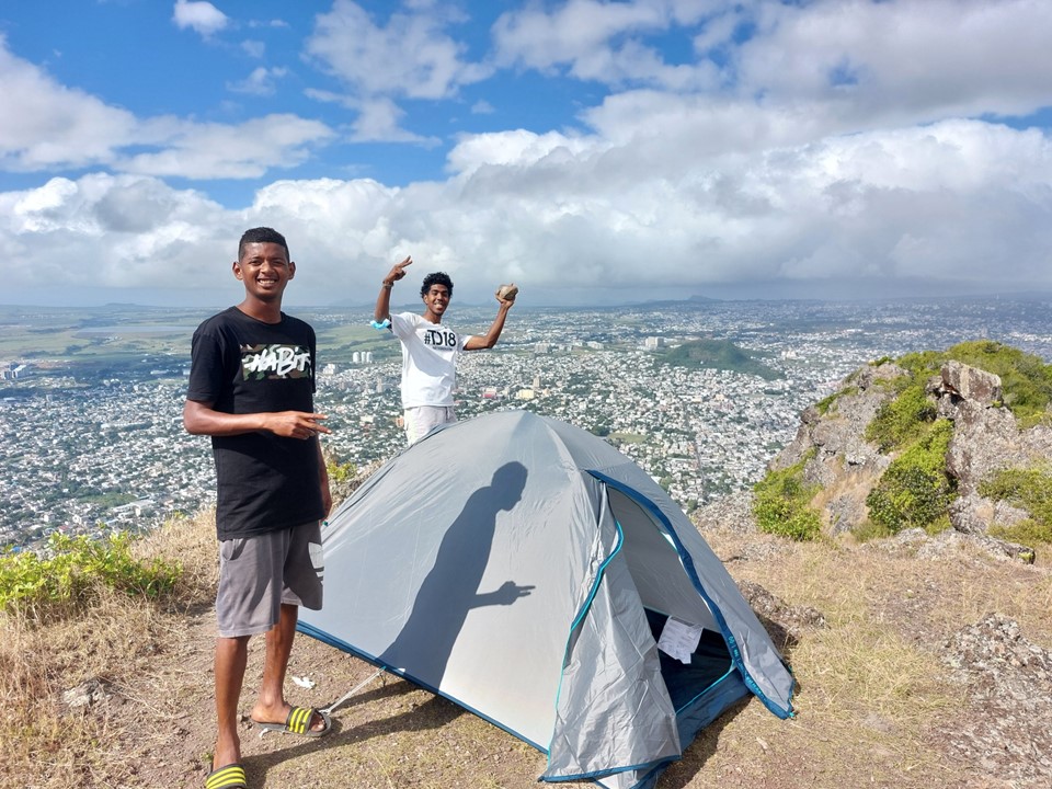
On reaching the summit I found two locals who had pitched a tent and were spending the night on top. They didn’t speak much English and I barely speak French, so we didn’t have much of a conversation.
On the way down – on the proper route this time – I bumped into a local who was hiking with his fiance. He told me about his upcoming plan to climb a 7000er in the Himalaya. He has hiked in the Drakensberg, summited Kilimanjaro and many other mountains, actually a very interesting individual to talk to.
The rest of the ascent went without issue. I found the car park mostly empty by the time I got back to my car. I proceeded to try and find an ice cream, a task that was surprisingly difficult on this occasion. I did eventually find one, though.
While I didn’t get all three peaks – admittedly I am not too worried about Tamarin, there are other hikes I’d do first if I’m ever back in Mauritius. It was a great day out. Classification of Mauritian peaks as hills or mountains is immaterial, they are definitely worth the effort and are never as easy as one might anticipate.
